Home › Arkansas › Public land › Muddy Creek WMA
WMA · public hunting
Muddy Creek WMA for Hunters, 2026-27
Wildlife management area in Montgomery County and 2 more counties with 146,206 acres (WMA zone 460).
Photo: Fredlyfish4 (CC BY-SA 4.0)
Getting to Muddy Creek WMA
The guidebook entry for Muddy Creek WMA
WMA zone 460 has its own dates in the guidebook, and they are laid out here for Muddy Creek WMA. WMA waterfowl rules, greentree reservoir draws and rest areas sit in the Waterfowl Guidebook and are not parsed here. Off the boundary, the private land zone rules further down take over. Closed seasons on this WMA: alligator.
| Season | Dates | Needs | Note |
|---|---|---|---|
| Deer archery | Aug 29–31 Sep 26–Feb 28 | License | One antlered buck |
| Deer alt firearms | Oct 17–25 | License | – |
| Deer gun | Nov 14–Dec 6 Dec 26–28 | License | – |
| Deer gun youth | Nov 7–8 Jan 2–3 | License | – |
| Bear archery | Sep 9–Nov 30 | License | – |
| Bear alt firearms | Oct 17–25 | License | – |
| Bear gun | Nov 14–30 | License | – |
| Bear gun youth | Nov 7–8 | License | – |
| Turkey youth | Apr 10–11 | License | One turkey |
| Turkey | Apr 19–May 9 | License | One turkey |
Muddy Creek WMA bag, by method
| Up to | Of these | Using |
|---|---|---|
| two | antlered bucks | archery alternative firearms modern gun |
| two | antlerless deer | archery |
| one | antlerless deer | alternative firearms the first two days of modern gun |
- During youth hunt, youths may take two deer, one antlered buck (no antler restrictions) and one antlerless deer
Button bucks count as antlerless deer under the AGFC definition.
Guidebook p. 94 of the 2026-27 Arkansas Hunting Guidebook (WMA-specific regulations; Arkansas Game and Fish Commission); waterfowl: 2026-27 Waterfowl Hunting Guidebook. Checked November 9, 2026.
Nearby
Places to hunt and shoot around Muddy Creek WMA
Muddy Creek WMA by the numbers
Start with the basics: Muddy Creek WMA is an AGFC wildlife management area. Acreage: 146,206, taken from the 2026-27 guidebook, across Montgomery County and 2 other counties. Wildlife staff for the area work from AGFC Region 5 (Fort Smith). Title or co-management rests with U.S. Forest Service, according to the guidebook entry.

Golden and orange fall leaves in a hardwood forest in the Ouachita National ForestPhoto: Tammo2011 (CC BY-SA 4.0)
From lands.json records (Guidebook · Source 2 · Source 3 · Source 4); acres: 2026-27 AGFC Hunting Guidebook WMA entry ("146,206 acres"). Checked November 9, 2026.
Applying to hunt Muddy Creek WMA
Game of the permit hunts on Muddy Creek WMA.
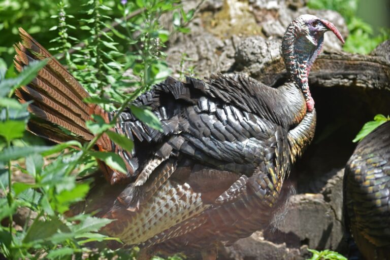
Wild turkey gobbler strutting with tail fannedPhoto: U.S. Fish and Wildlife Service – Midwest Region (Public domain)
For Muddy Creek WMA, the parse shows no permit hunts; the guidebook page is the real test.
guidebook entry; draw rules. Checked November 9, 2026.
Muddy Creek WMA on the zone maps
Game Check uses 460 on Muddy Creek WMA; private land around it belongs to Deer Zone 11. Nonresidents need the $100 Nonresident Hunting Dog Owner Permit and may run dogs only in the last nine days of the regular modern gun season.
| Private zone | Modern gun | Alt guns | Dogs | Antler rule | Bag |
|---|---|---|---|---|---|
| Zone 11 | Nov 14–Dec 6 Dec 26–28 | Oct 17–25 Dec 12–14 | Nov 14–Dec 6 | 3 points one side CWD zone: any buck | 4 (2 antlered) |
- CWD Management Zone rules apply on Muddy Creek WMA: no antler restrictions, carcass movement by tier, feeding limits (Scott is Tier 2 and Yell is Tier 2).
- Bear hunting falls under Bear Zone 2, where seasons close early once the quota is filled.
- The turkey zone layer and AGFC map place it in Turkey Zone 1.
- Night alligator permits apply in Alligator Management Zone 2.
Zones from the guidebook deer zone pages, the AGFC zone layers and the CWD zone list; turkey zones from AGFC’s zone map. Checked November 9, 2026.
Muddy Creek WMA and nearby hunting ground
Cedar Creek WMA lies 9 miles west of Muddy Creek WMA, the nearest alternative. Among the six neighbours: 4 ranger districts, 1 wildlife management area and 1 lake project.
| Place | Type | Acres | County | Straight line | Which way |
|---|---|---|---|---|---|
| Cedar Creek WMA | WMA | 103 | Scott | 9 miles | west |
| Cold Springs RD | Ranger district | 155,480 | Scott | 16 miles | northwest |
| Womble RD | Ranger district | 159,621 | Montgomery | 22 miles | southeast |
| Fourche RD | Ranger district | 144,695 | Yell | 22 miles | northeast |
| Jessieville RD | Ranger district | 139,486 | Garland | 23 miles | east |
| Lake Ouachita (Corps) | Corps lake | – | Garland | 23 miles | southeast |
Point: AGFC WMA boundary layer (GIS/wmas_website_link) (polygon centroid). Straight-line distances. Arkansas public land map.
Harvest around Muddy Creek WMA
1,723 deer went through Game Check in Montgomery County during 2025-26, rank 55. Figures cover the whole county, not just this tract. AGFC counted 59 gobblers on Muddy Creek WMA in 2025, rank 6 for public land.
| County | Latest | Previous | Rank of 75 |
|---|---|---|---|
| Montgomery | 1,723 | 1,993 | 55 |
| Scott | 2,036 | 1,920 | 49 |
| Yell | 3,066 | 4,055 | 23 |
| Spring | Rank | Turkeys |
|---|---|---|
| 2023 | 6 | 49 |
| 2024 | 5 | 42 |
| 2025 | 6 | 59 |
deer report 2025-26; turkey report 2025 (checked deer by county (AGFC deer reports, Table 6)). Checked November 9, 2026.
Connected public land for Muddy Creek WMA
Overlapping records: Oden RD and Ouachita National Forest; where a WMA overlays federal land, the WMA entry sets the seasons.
Towns that make a good base for Muddy Creek WMA
Pencil Bluff is the closest town with a page here, 9 miles from Muddy Creek WMA. Mount Ida is the largest of the five, with 1,020 people in 2024. Pencil Bluff, Mount Ida and Boles count Muddy Creek WMA as nearby public land. The nearest AGFC building is in Hot Springs, 44 miles away. Business listings come from directories and are not individually verified, so call ahead.
| Town | County | Pop. 2024 | Miles off | Bearing |
|---|---|---|---|---|
| Pencil Bluff | Montgomery | – | 9 miles | south |
| Mount Ida | Montgomery | 1,020 | 15 miles | south |
| Boles | Scott | – | 19 miles | west |
| Norman | Montgomery | 305 | 20 miles | south |
| Rover | Yell | – | 22 miles | northeast |
Towns from places.json (Census 2024 estimates); AGFC buildings from the AGFC offices page and AGFC layers; businesses from services.json directory listings; straight-line miles. Checked November 9, 2026.
Legal light, worked out for Muddy Creek WMA
Arkansas hunting hours run from half an hour before sunrise to half an hour after sunset, and the times below are figured for Muddy Creek WMA itself.
| When | Opener or event | First light | Last light | Most game | Migratory | Method |
|---|---|---|---|---|---|---|
| Aug 29, 2026 | Early buck archery | 6:45 a.m. | 7:47 p.m. | 6:15 a.m. to 8:17 p.m. | 6:15 a.m. to 7:47 p.m. | NOAA formula |
| Sep 26, 2026 | Archery deer opens | 7:05 a.m. | 7:08 p.m. | 6:35 a.m. to 7:38 p.m. | 6:35 a.m. to 7:08 p.m. | NOAA formula |
| Oct 17, 2026 | Zone 11 alt-firearms | 7:25 a.m. | 6:40 p.m. | 6:55 a.m. to 7:10 p.m. | 6:55 a.m. to 6:40 p.m. | AGFC table |
| Nov 7, 2026 | Youth gun weekend | 6:44 a.m. | 5:18 p.m. | 6:14 a.m. to 5:48 p.m. | 6:14 a.m. to 5:18 p.m. | AGFC table |
| Nov 14, 2026 | Zone 11 gun opener | 6:51 a.m. | 5:13 p.m. | 6:21 a.m. to 5:43 p.m. | 6:21 a.m. to 5:13 p.m. | AGFC table |
| Nov 21, 2026 | Duck season opens | 6:58 a.m. | 5:09 p.m. | 6:28 a.m. to 5:39 p.m. | 6:28 a.m. to 5:09 p.m. | AGFC table |
| Dec 6, 2026 | Zone 11 gun closes | 7:11 a.m. | 5:06 p.m. | 6:41 a.m. to 5:36 p.m. | 6:41 a.m. to 5:06 p.m. | AGFC table |
| Dec 21, 2026 | Shortest day | 7:21 a.m. | 5:11 p.m. | 6:51 a.m. to 5:41 p.m. | 6:51 a.m. to 5:11 p.m. | AGFC table |
| Apr 19, 2027 | Turkey Zone 1 opens | 6:41 a.m. | 7:53 p.m. | 6:11 a.m. to 8:23 p.m. | 6:11 a.m. to 7:53 p.m. | AGFC table |
Hours rules from the 2026-27 Arkansas Hunting Guidebook; sunrise and sunset from the AGFC Little Rock table with AGFC’s nine-mile correction, or the NOAA solar formula on Central Time where the table has no entry; checked November 9, 2026. Legal hours across Arkansas.
Muddy Creek WMA: closest ranges for a zero check
Nearest range to Muddy Creek WMA: Reed Mountain Shooting Range at 18 miles.
From the AGFC Shooting and Archery Ranges page, the AGFC range layer, club sites and directory listings, checked November 9, 2026.

Clear blue lake with pine-covered shores in the Ouachita National ForestPhoto: Oemar (CC BY 2.0)
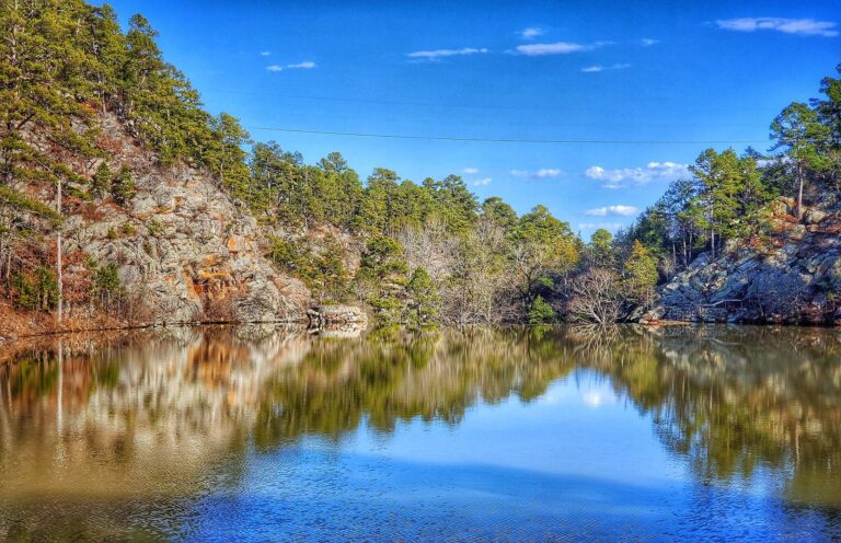
Lake Sylvia reflecting pines and rock bluffs under a blue sky, Ouachita National ForestPhoto: ChattOconeeNF (Public Domain Mark 1.0)
Muddy Creek WMA questions with sourced answers
Can I trust the Muddy Creek WMA dates here?
Guidebook entries, zone layers and agency pages, all linked, checked November 9, 2026.
Is Muddy Creek WMA AGFC land, federal land or leased?
Arkansas Game and Fish Commission manages it (AGFC Region 5 (Fort Smith)).
Is Muddy Creek WMA its own deer zone in the guidebook?
460 is the number printed in the guidebook entry.
What license do I need on Muddy Creek WMA?
License for open seasons, permit for permit hunts; the WMA/Lake Conservation Permit is for users without a hunting or fishing license.
Are antler restrictions lifted on Muddy Creek WMA because of CWD?
It is inside the zone: tier carcass rules apply and only low-risk parts leave the zone.
Does Muddy Creek WMA follow the zone gun dates or its own?
Nov 14–Dec 6 and Dec 26–28, from the guidebook entry.
Which 2027 turkey zone covers Muddy Creek WMA?
The entry prints Apr 19–May 9; its zone is Turkey Zone 1, from AGFC's zone map.
What does the bear quota mean for hunters on Muddy Creek WMA?
It sits in Bear Zone 2, open until the quota is reached.
Is Muddy Creek WMA a big tract or a small one?
Montgomery County and 2 other counties; 146,206 acres by the 2026-27 guidebook.
Do I need to apply for any Muddy Creek WMA hunts?
None parsed, though the guidebook is the authority.
When is hunter orange mandatory on Muddy Creek WMA?
Orange, chartreuse or blaze camouflage, 400 square inches plus headwear, during firearm big game seasons; pop-up blinds on WMAs need 144 square inches.
Where is the nearest AGFC building to Muddy Creek WMA?
Pencil Bluff (9 miles). For AGFC staff, Hot Springs is 44 miles off.
How do AGFC legal hours work out on Muddy Creek WMA?
Deer, turkey and small game go by the general window, which on November 14, 2026 runs from 6:21 a.m. through 5:43 p.m. at this point.
Double-check list for Muddy Creek WMA hunters
Check deer, turkey and bear through Game Check within 12 hours, using the zone number that applies on Muddy Creek WMA.
Sources: source 1 · source 2 · source 3 · source 4; seasons from the 2026-27 Arkansas Hunting Guidebook and the 2026-27 Waterfowl Hunting Guidebook. Checked November 9, 2026.
Other photos on this page: Tammo2011 (CC BY-SA 4.0); U.S. Fish and Wildlife Service – Midwest Region (Public domain).