Home › California › Public land › National forests › Stanislaus NF
California national forest
Stanislaus National Forest Field Guide for Hunters
National forest in Tuolumne County and 3 more counties, 899,804 acres, managed by the US Forest Service.
Home › California › Public land › National forests › Stanislaus NF
California national forest
National forest in Tuolumne County and 3 more counties, 899,804 acres, managed by the US Forest Service.
Photo: Kevin Dooley (CC BY 2.0)
Parking, trailhead and gate locations come from OpenStreetMap contributors. Roads into public land can be gated or seasonal; check with the managing agency before you go.
Stanislaus National Forest is a national forest across 4 counties including Tuolumne County, Calaveras County and Alpine County, managed by the US Forest Service. Records put the size near 899,804 acres. CDFW seasons govern what can be taken, and the Forest Service governs how you use the forest.
Sources: Forest Service page · Forest Service page 2 · Forest Service page 3. Checked November 15, 2026.
Nearby
On the dated 2014 CDFW zone layer, 2 deer zones overlap the Stanislaus National Forest polygon, so treat the shares as estimates.
| Zone | Approx. share | Tag class | Opening window |
|---|---|---|---|
| Zone D-6 | 78% | Unrestricted | Sep 19–Nov 1 |
| Zone D-5 | 21% | Unrestricted | Sep 26–Nov 1 |
Zone overlaps from the CDFW deer zone layer (2014) and waterfowl zone layer; zone sheets at CDFW deer zones; season dates from the 2026-27 booklet. Checked November 15, 2026. Deer zone and waterfowl zone overlaps on land records come from the CDFW deer zone layer dated 2014 and the waterfowl zone layer, so treat them as approximate.
Getting into Stanislaus National Forest takes a state license and the forest rules in the quote below.
The CDFW fee page checked November 15, 2026 puts a resident license at $64.54 and a nonresident license at $225.46 for July 1, 2026 – June 30, 2027.
The Stanislaus National Forest provides opportunities to hunt and engage in shooting sports activities in a safe and environmentally sound manner that promote marksmanship, public safety, hunter education, competition and lawful hunting. Our national forests offer many types of hunting opportunities for hunters of all ages and experience levels. Each year visitors enjoy hunting high in the mountains in thick lodge pine stands, in open grassland canyon benches and in sagebrush valleys. Hunting activities are regulated by the corresponding state's forest service office.
Sources: Forest Service page; license fees from the CDFW fee page. Checked November 15, 2026.
District pages cover the ground within Stanislaus National Forest, starting with the table below.
| Ranger district | CA acres | County |
|---|---|---|
| Mi-Wok Ranger District | 208,643 | Tuolumne |
| Calaveras Ranger District | 328,983 | Calaveras, Tuolumne |
| Summit Ranger District | 309,856 | Tuolumne, Alpine |
| Groveland Ranger District | 241,778 | Tuolumne, Mariposa |
District list from the Forest Service hunting page and the Forest Service ranger district layer. Checked November 15, 2026.
Coordinates for Stanislaus National Forest come from the Forest Service boundary layer, generalized, so check the official map before driving out. Towns within reach, nearest first: Cold Springs (Tuolumne) (2 miles west), Strawberry (Tuolumne) (2 miles north) and Sierra Village (10 miles southwest). Bay Delta Region (Region 3) Stockton Office is the CDFW office nearest the point, around 69 miles away.
Sources: Forest Service page · Forest Service page 2 · Forest Service page 3; point from the Forest Service boundary layer; offices from the CDFW regions page. Checked November 15, 2026.
Every county that touches Stanislaus National Forest appears below with its CDFW region and chronic wasting disease status. Zones cover portions of a county, so the zone count only shows how many sheets name it.
| County | Share | Region | Zones | CWD status |
|---|---|---|---|---|
| Tuolumne County | 66% | Central | 2 zones | None reported |
| Calaveras County | 13% | North Central | 1 zone | None reported |
| Alpine County | 12% | North Central | 3 zones | None reported |
| Mariposa County | 9% | Central | 2 zones | Testing zone |
Zones D7 are in the CWD management zone and touch Mariposa; the sample must come in within 10 days (source, November 15, 2026).
Where CDFW printed a county row, bear take for 2024 and pig take for 2024-25 are shown for the Stanislaus National Forest counties.
| County | Bear take 2024 | Pig take 2024-25 |
|---|---|---|
| Tuolumne County | 30 | 6 |
| Calaveras County | 19 | – |
| Alpine County | 19 | – |
| Mariposa County | 6 | 13 |
Bear take from the CDFW black bear hunter take report; pig take from the CDFW wild pig report. Checked November 15, 2026.
County and CWD data from CDFW and the 2026-27 mammal booklet; county shares from Forest Service page · Forest Service page 2. Checked November 15, 2026.
Hours for coyote and other nongame mammals are not tied to light on public land, so this Stanislaus National Forest table covers deer and migratory birds only.
| Day | Why it matters | Sun up | Sun down | Big game window | Migratory window |
|---|---|---|---|---|---|
| Aug 15, 2026 | Deer archery opens | 6:14 a.m. | 7:56 p.m. | 5:44 a.m. to 8:26 p.m. | 5:44 a.m. to 7:56 p.m. |
| Sep 1, 2026 | Dove opens | 6:29 a.m. | 7:32 p.m. | 5:59 a.m. to 8:02 p.m. | 5:59 a.m. to 7:32 p.m. |
| Sep 19, 2026 | Deer general opens | 6:44 a.m. | 7:04 p.m. | 6:14 a.m. to 7:34 p.m. | 6:14 a.m. to 7:04 p.m. |
| Oct 17, 2026 | Chukar opens | 7:09 a.m. | 6:21 p.m. | 6:39 a.m. to 6:51 p.m. | 6:39 a.m. to 6:21 p.m. |
| Nov 14, 2026 | Fall turkey opens and pheasant opens | 6:39 a.m. | 4:50 p.m. | 6:09 a.m. to 5:20 p.m. | 6:09 a.m. to 4:50 p.m. |
| Nov 21, 2026 | Free hunting day | 6:47 a.m. | 4:45 p.m. | 6:17 a.m. to 5:15 p.m. | 6:17 a.m. to 4:45 p.m. |
| Dec 21, 2026 | Year's shortest day | 7:13 a.m. | 4:43 p.m. | 6:43 a.m. to 5:13 p.m. | 6:43 a.m. to 4:43 p.m. |
| Mar 27, 2027 | Spring turkey opens | 6:55 a.m. | 7:18 p.m. | 6:25 a.m. to 7:48 p.m. | 6:25 a.m. to 7:18 p.m. |
| Apr 10, 2027 | Free hunting day | 6:33 a.m. | 7:30 p.m. | 6:03 a.m. to 8:00 p.m. | 6:03 a.m. to 7:30 p.m. |
Hours rules from the 2026-27 CDFW mammal hunting booklet and the waterfowl and upland game booklet (California Department of Fish and Wildlife); sunrise and sunset worked out for this location with the NOAA solar formula on Pacific Time; checked November 15, 2026. Legal hours for every county.
Elk, pronghorn and bighorn hunts are drawn and sit on hunt maps with no county list, so they are not in the Tuolumne County table.
| Quarry | Weapon and window | Paper needed | Applies to | Start | Stop | Now |
|---|---|---|---|---|---|---|
| Deer | Archery | Deer tag | Zone D6 | Aug 15, 2026 | Sep 6, 2026 | |
| Deer | Archery | Deer tag | Zones D3 to D5 | Aug 15, 2026 | Sep 6, 2026 | |
| Deer | General | Deer tag | Zone D6 | Sep 19, 2026 | Nov 1, 2026 | |
| Deer | General | Deer tag | Zones D3 to D5 | Sep 26, 2026 | Nov 1, 2026 | |
| Black bear | Archery | Bear tag | All bear hunt areas | Aug 15, 2026 | Sep 6, 2026 | |
| Black bear | General | Bear tag | Deer zones X1 through X7b | Oct 10, 2026 | Dec 27, 2026 | |
| Wild pig | General | Pig validation | Statewide | Jul 1, 2026 | Jun 30, 2027 | |
| Wild turkey | Fall | Upland validation | Statewide | Nov 14, 2026 | Dec 13, 2026 | |
| Wild turkey | Spring additional junior | Upland validation | Statewide | Mar 20, 2027 | Mar 21, 2027 | |
| Wild turkey | Spring | Upland validation | Statewide | Mar 27, 2027 | May 2, 2027 | |
| Wild turkey | Spring additional junior | Upland validation | Statewide | May 3, 2027 | May 16, 2027 | |
| Wild turkey | Spring archery | Upland validation | Statewide | May 3, 2027 | May 16, 2027 | |
| Tree squirrel | Archery, falconry | Hunting license | Counties in T14 CCR 307 | Aug 1, 2026 | Sep 11, 2026 | |
| Tree squirrel | General | Hunting license | Tree squirrel general season | Sep 12, 2026 | Jan 31, 2027 | |
| Rabbit and hare | General | Hunting license | Statewide | Jul 1, 2026 | Jan 31, 2027 | |
| Rabbit and hare | Falconry | Hunting license | Statewide | Feb 1, 2027 | Mar 21, 2027 | |
| Jackrabbit | General | Hunting license | Statewide | Jul 1, 2026 | Jun 30, 2027 | |
| Pheasant | Falconry | Upland validation | Statewide | Aug 15, 2026 | Feb 28, 2027 | |
| Pheasant | Archery | Upland validation | Statewide | Oct 10, 2026 | Nov 1, 2026 | |
| Pheasant | General | Upland validation | Statewide | Nov 14, 2026 | Dec 27, 2026 | |
| Pheasant | Archery | Upland validation | Statewide | Dec 28, 2026 | Jan 24, 2027 | |
| Chukar | Archery | Upland validation | Statewide | Aug 15, 2026 | Sep 4, 2026 | |
| Chukar | Falconry | Upland validation | Statewide | Aug 15, 2026 | Feb 28, 2027 | |
| Chukar | General | Upland validation | Statewide | Oct 17, 2026 | Jan 31, 2027 | |
| Dove | General | Upland validation | Statewide | Sep 1, 2026 | Sep 15, 2026 | |
| Dove | General | Upland validation | Statewide | Nov 14, 2026 | Dec 28, 2026 | |
| Spotted dove | General | Upland validation | Statewide | Sep 1, 2026 | Sep 15, 2026 | |
| Spotted dove | General | Upland validation | Statewide | Nov 14, 2026 | Dec 28, 2026 | |
| Collared dove | General | Upland validation | Statewide | Jul 1, 2026 | Jun 30, 2027 | |
| Snipe | General | Upland validation | Statewide | Oct 17, 2026 | Jan 31, 2027 | |
| Nongame mammals | General | Hunting license | Statewide | Jul 1, 2026 | Jun 30, 2027 |
From the 2026-27 CDFW mammal hunting booklet and the waterfowl, upland game and lands booklet (California Department of Fish and Wildlife), checked November 15, 2026.
Towns nearest the Stanislaus National Forest point are listed with distances, and the town pages carry stores and offices.
| Town | County | Away | Bearing |
|---|---|---|---|
| Cold Springs (Tuolumne) | Tuolumne County | 2 miles | west |
| Strawberry (Tuolumne) | Tuolumne County | 2 miles | north |
| Sierra Village | Tuolumne County | 10 miles | southwest |
| Bear Valley (Alpine) | Alpine County | 21 miles | north |
| Sonora | Tuolumne County | 24 miles | southwest |
Closest outfitters, shops and processors to Stanislaus National Forest.
Business listings from public directories and the hunting services guide; distances are straight lines. Checked November 15, 2026.
Looking northeast from the Stanislaus National Forest point, the first neighbour is Pickel Meadow WA at 29 miles. The nearest 6 are made up of 3 ranger district, 1 wildlife area and 1 national forest. The table measures straight across country from the Stanislaus National Forest point, ignoring rivers, ridges and gates.
| Place | Type | Acres | County | Straight line | Which way |
|---|---|---|---|---|---|
| Pickel Meadow WA | Wildlife area | 991 | Mono | 29 miles | northeast |
| Amador RD | Ranger district | 196,002 | Amador | 30 miles | north |
| Humboldt-Toiyabe NF | National forest | 646,422 | Mono | 34 miles | northeast |
| BLM Mother Lode FO | BLM office | 230,000 | Tuolumne | 34 miles | west |
| Carson RD | Ranger district | 290,342 | Alpine | 35 miles | north |
| Bridgeport RD | Ranger district | 402,123 | Mono | 35 miles | east |
Point from the Forest Service boundary layer; straight-line distances. Statewide public land map.
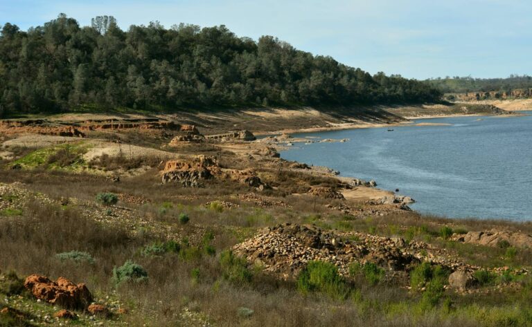
Camanche Reservoir, February 2016, Calaveras CountyPhoto: Eric Sonstroem (CC BY 2.0)

Dawn on Mount ShastaPhoto: Jonathan Fox (CC BY-SA 2.0)

Common murres nest at Farallon Islands National Wildlife RefugePhoto: USFWS Pacific Southwest Region (Public Domain Mark 1.0)
Stanislaus National Forest sits across 4 counties including Tuolumne County, Calaveras County and Alpine County, with Cold Springs (Tuolumne) and Strawberry (Tuolumne) closest.
Pay $64.54 (resident) or $225.46 (nonresident) for the license, add a deer, bear or bird validation as needed, and carry both (CDFW fee page, checked November 15, 2026).
Nonlead is mandatory. Section 250.1 of Title 14 requires it for any wildlife taken with a firearm, in force since July 1, 2019 (source, checked November 15, 2026).
Season markers: deer archery opens Aug 15, 2026, dove opens Sep 1, 2026 and deer general opens Sep 19, 2026 (mammal booklet, checked November 15, 2026). The seasons guide has the full list.
State hours: half an hour before sunrise to half an hour after sunset for big game, sunset for migratory birds. On December 1, 2026 the worked-out deer hours at the Stanislaus National Forest point are 6:27 a.m. to 5:11 p.m. and the bird hours 6:27 a.m. to 4:41 p.m. (booklet, checked November 15, 2026).
Hunting is permitted during the seasons CDFW designates, and the Forest Service posts its own conduct rules (Forest Service hunting page, checked November 15, 2026).
No area-specific restriction is on file. Confirm current closures with the manager (source, checked November 15, 2026).
Supplies come from Cold Springs (Tuolumne) and Strawberry (Tuolumne). Businesses on file: Ebbetts Pass Sporting Goods and Borchard Taxidermy. See also the hunting services guide.
No special hunt is scheduled here on the 2026 list (CDFW, November 15, 2026); other drawings are on our drawing page.
Expect Zone D-6 and Zone D-5: those are the zones the generalized 2014 layer overlaps at Stanislaus National Forest (CDFW, November 15, 2026).
Neither topic is addressed in the booklets (CDFW, checked November 15, 2026), so confirm any local requirement at Stanislaus National Forest with its manager.
Do not bait: CDFW states wildlife cannot be baited in California (source, checked November 15, 2026).
It covers approximately 899,804 acres, per the managing agency checked November 15, 2026.
The managing agency is the US Forest Service; see the official page (read November 15, 2026).
Boundaries, permits and closures at Stanislaus National Forest shift through the year; the agency and the signs on the ground have the last word.
Sources: Forest Service page · Forest Service page · Forest Service page; statewide seasons from the 2026-27 CDFW mammal hunting booklet. Checked November 15, 2026.