Home › Ohio › Public land › Shade River State Forest
State forest in Meigs County, Ohio
Shade River State Forest hunting, rules and county limits
A 2,859-acre Ohio state forest in Meigs County.
Photo: daveynin (CC BY 2.0)
Getting to Shade River State Forest
Parking, trailheads and gates near Shade River State Forest
- Parking areaParking · 2.3 mi from the centreDirections
- Boat rampBoat ramp · 2.3 mi from the centreDirections
- Parking areaParking · 2.4 mi from the centreDirections
- Parking areaParking · 2.4 mi from the centreDirections
- Parking areaParking · 2.7 mi from the centreDirections
- Parking areaParking · 2.8 mi from the centreDirections
- Parking areaParking · 2.8 mi from the centreDirections
- Parking areaParking · 4.1 mi from the centreDirections
- Parking areaParking · 4.2 mi from the centreDirections
- Parking areaParking · 4.2 mi from the centreDirections
- Parking areaParking · 4.2 mi from the centreDirections
- Parking areaParking · 4.3 mi from the centreDirections
Parking, trailhead and gate locations come from OpenStreetMap contributors. Roads into public land can be gated or seasonal; check with the managing agency before you go.
Getting to know the Shade River State Forest ground
At 2,859 acres, Shade River State Forest is a state forest in Meigs County; the ODNR Division of Forestry looks after it. The Division of Wildlife handles it from its Athens office (District 4, Southeast Ohio). Other uses listed: fishing and hiking. The hunting layer shows the parcels as owned outright by the state. The administrative code lists it under 1501:31-15-04(A)(3), written "Shade river".
From the ODNR property page:
“Nestled in the rolling hills of southeastern Ohio, the 2,859-acre Shade River State Forest encompasses mostly wooded country.”
Pick your number: 2,859 acres at the low end, 3,043 at the high end, by source.
| Source | Acres |
|---|---|
| State Forest Guide | 2,859 |
| Hunting-status layer | 3,043 |
| GIS parcel area | 2,980 |
From the ODNR property page, ODNR hunting-status layer, OAC; retrieved 2026-11-05, checked November 6, 2026.
Nearby
Places to hunt and shoot around Shade River State Forest
Shade River State Forest hunting rules, line by line
ODNR marks every parcel of Shade River State Forest open to hunting.
- Leave the corn at home: no bait on public land.
- Two antlerless deer at most from all public hunting areas in a license year.
- Most forest land is open unless signs or maps say otherwise.
- Keep shots off forest roads and driveways.
- Hunters may stay past the 11 p.m. closing.
From the agency page, public hunting area rules, OAC 1501:3-6-03; checked November 6, 2026.
Hunting calendar matched to Shade River State Forest
The property page is silent on species, so the rows below are the usual statewide seasons. The spring turkey dates are from 2026, since ODNR had not published 2027.
| Quarry | Season | Start | End | Limit |
|---|---|---|---|---|
| Deer | Archery | Sep 26, 2026 | Feb 7, 2027 | County limit |
| Deer | Youth gun | Nov 21, 2026 | Nov 22, 2026 | County limit |
| Deer | Gun | Nov 30, 2026 | Dec 6, 2026 | County limit |
| Deer | Bonus gun | Dec 19, 2026 | Dec 20, 2026 | County limit |
| Deer | Muzzleloader | Jan 2, 2027 | Jan 5, 2027 | County limit |
| Wild turkey | Fall | Oct 1, 2026 | Oct 25, 2026 | 1 turkey |
| Squirrels | Regular | Sep 1, 2026 | Jan 31, 2027 | 6 daily |
| Cottontail | Regular | Nov 6, 2026 | Feb 28, 2027 | 4 daily |
| Pheasant | Regular | Nov 6, 2026 | Jan 10, 2027 | 2 roosters daily |
| Cottontail | Youth small game weekend | Oct 24, 2026 | Oct 25, 2026 | 4 daily |
| Cottontail | Youth small game weekend | Oct 31, 2026 | Nov 1, 2026 | 4 daily |
| Pheasant | Youth small game weekend | Oct 24, 2026 | Oct 25, 2026 | 2 roosters daily |
| Pheasant | Youth small game weekend | Oct 31, 2026 | Nov 1, 2026 | 2 roosters daily |
| Raccoon | Hunting | Nov 10, 2026 | Jan 31, 2027 | No limit |
| Raccoon | Trapping | Nov 10, 2026 | Jan 31, 2027 | No limit |
Dates and limits from the 2026-27 hunting seasons list and the 2026-27 Ohio Hunting and Trapping Regulations; species from the record (No species named by ODNR for this area); checked November 6, 2026.
County limits that apply on Shade River State Forest
Deer bag in Meigs County: 2, with a single antlered deer allowed across Ohio. The 2025-26 deer total for Meigs County was 1,060, by ODNR's final report. The 2026-27 count stood at 361 on November 3, 2026.
| County | Limit | DSA | Zone | Spring | Fall turkey | 2025-26 deer |
|---|---|---|---|---|---|---|
| Meigs County | 2 deer | No | C | South | Open | 1,060 |
From the deer bag limit map, DSA, waterfowl zones, turkey zones, 2025-26 deer harvest report, harvest to date (ODNR Division of Wildlife); checked November 6, 2026.
Public hunting land within reach of Shade River State Forest
Drive 2 miles southeast and the next public tract is Forked Run State Park. Around it on the map: 4 public access areas and 2 state parks. Within 15 miles but not open to hunters: Woodland Fernleaf False Foxglove State Nature Preserve (nature preserve), Desonier State Nature Preserve (nature preserve) and Ladd Natural Bridge State Nature Preserve (nature preserve).
| Public land | Kind | Acres | County | Distance | Direction |
|---|---|---|---|---|---|
| Forked Run State Park | State park | 791 | Meigs | 2 miles | southeast |
| Ohio River Forked Run SP | State park | 15 | Meigs | 3 miles | south |
| Ohio River Access – Forked Run WA | Access area | 34 | Meigs | 3 miles | south |
| Ohio River Access – Shade River WA | Access area | 29 | Meigs | 4 miles | south |
| Ohio River Lock & Dam 21 WA | Access area | 15 | Meigs | 7 miles | south |
| Ohio River Access – Old Town Creek WA | Access area | 33 | Meigs | 12 miles | south |
Point: ODNR DNR_Lands_Hunting_Status layer, 1 parcel (polygon centroid of the largest part). Straight-line distances. Closed places from the lands.json closed list. Checked November 6, 2026. Statewide public land map.
Shade River State Forest maps, address and officers
For permits and questions try the Wildlife District Four office, 740-589-9930. The Meigs County wildlife officer is Chris Gilkey, (614) 563-4492. Anonymous tip line: 1-800-POACHER. Printed on the map: and fishermen may be present during other hours. Printed on the map: roads or trails will be obstructed.
- Area map PDF · legend: parking, camping, pond, lake
- Shade River State Forest Map [Archived PDF]
- Map pin
Address and phone from the agency page and the ODNR Property Details layer; district offices from the ODNR Districts layer; officers from the officer list; point from ODNR DNR_Lands_Hunting_Status layer, 1 parcel (polygon centroid of the largest part); checked November 6, 2026.
Shade River State Forest: towns, shops and the nearest ODNR office
From the point, Tuppers Plains sits 5 miles away. Athens, 22 miles out, is larger: 24,824 people in 2024. For face-to-face help, the Athens ODNR office lies 22 miles away as the crow flies.
| Place | County | Population | Distance | Direction |
|---|---|---|---|---|
| Tuppers Plains | Meigs | – | 5 miles | northwest |
| Pomeroy | Meigs | 1,505 | 14 miles | southwest |
| Rutland | Meigs | 412 | 19 miles | west |
| Athens | Athens | 24,824 | 22 miles | northwest |
| Chesterhill | Morgan | 267 | 26 miles | north |
Towns from places.json (Census 2024 estimates); ODNR offices and businesses from services.json listings; straight-line miles. Checked November 6, 2026.
Gun-week light and other opener times on Shade River State Forest
ODNR prints no sunrise table and points hunters to its app, the NOAA calculator and the Naval Observatory; the times for Shade River State Forest below are worked out with the NOAA solar formula for its own location.
| Date | Opener | Sunrise | Sunset | Big game | Duck window | Pheasant window |
|---|---|---|---|---|---|---|
| Sep 26, 2026 | Archery deer opens | 7:17 a.m. | 7:20 p.m. | 6:47 a.m. to 7:50 p.m. | 6:47 a.m. to 7:20 p.m. | 7:17 a.m. to 7:20 p.m. |
| Oct 1, 2026 | Fall turkey | 7:22 a.m. | 7:12 p.m. | 6:52 a.m. to 7:42 p.m. | 6:52 a.m. to 7:12 p.m. | 7:22 a.m. to 7:12 p.m. |
| Nov 6, 2026 | Rabbit and pheasant | 6:59 a.m. | 5:22 p.m. | 6:29 a.m. to 5:52 p.m. | 6:29 a.m. to 5:22 p.m. | 6:59 a.m. to 5:22 p.m. |
| Nov 30, 2026 | Deer gun week | 7:26 a.m. | 5:06 p.m. | 6:56 a.m. to 5:36 p.m. | 6:56 a.m. to 5:06 p.m. | 7:26 a.m. to 5:06 p.m. |
| Dec 12, 2026 | Second duck split | 7:37 a.m. | 5:05 p.m. | 7:07 a.m. to 5:35 p.m. | 7:07 a.m. to 5:05 p.m. | 7:37 a.m. to 5:05 p.m. |
| Dec 21, 2026 | Shortest day | 7:43 a.m. | 5:07 p.m. | 7:13 a.m. to 5:37 p.m. | 7:13 a.m. to 5:07 p.m. | 7:43 a.m. to 5:07 p.m. |
| Jan 2, 2027 | Muzzleloader | 7:46 a.m. | 5:15 p.m. | 7:16 a.m. to 5:45 p.m. | 7:16 a.m. to 5:15 p.m. | 7:46 a.m. to 5:15 p.m. |
Hours rules from the 2026-27 Ohio Hunting and Trapping Regulations; sunrise and sunset worked out for this location with the NOAA solar formula (Eastern Time); checked November 6, 2026. Legal hours for every county.
Field and woods views near Shade River State Forest
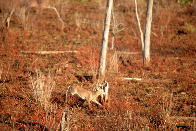


Zeroing a slug gun on the way to Shade River State Forest
Shade River State Forest hunters reach Veto Lake Wildlife Area Shooting Range, the nearest ODNR-listed range, after about 17 miles. Next to it: the nearest club ranges, all inside 30 miles.
From ODNR’s public range list and range pages, ranges’ own pages and directory listings, checked November 6, 2026.
Shade River State Forest: what Buckeye hunters keep asking
Is any hunting at Shade River State Forest by permit only?
No; the 2026 lottery list does not include it.
Which zone sets the waterfowl calendar at Shade River State Forest?
Zone C. Splits: Oct 17 to Oct 25, 2026; Dec 12, 2026 to Jan 31, 2027.
Can I camp at Shade River State Forest?
Designated forest camps only.
Can I leave a tree stand or use bait on Shade River State Forest?
No bait, and stands must be portable.
Must I wear orange while hunting Shade River State Forest in winter?
During the youth gun, gun, bonus gun, DSA early gun and muzzleloader seasons, every hunter except waterfowl hunters wears a hunter orange vest, coat, jacket or coveralls.
When does legal deer light start on Shade River State Forest?
6:56 a.m. to 5:36 p.m. on November 30, 2026.
Which phone line answers questions on Shade River State Forest?
Phone (740) 596-5781.
Nearest town for supplies near Shade River State Forest?
About 5 miles from Tuppers Plains.
Is every part of Shade River State Forest open to hunting?
The whole area is open.
Game check rules after a kill on Shade River State Forest?
Report deer and turkeys by noon the day after the kill, online, by phone or in the HuntFish OH app.
Can Shade River State Forest be hunted all seven days?
No statewide Sunday limit applies.
Is any special pass needed to hunt Shade River State Forest?
An Ohio hunting license ($19 resident, $180.96 nonresident) plus the permit for your game: deer or turkey permit, fur taker permit, or HIP and stamps for waterfowl.
How big is the Shade River State Forest property in acres?
About 2,859 acres by the main source; other layers are in the acreage table. Different layers give slightly different totals.
Last checks before loading up for Shade River State Forest
Gravel lanes and parking lots can flood or close in wet weather; check access to Shade River State Forest before the drive.
Sources: source 1 · source 2 · source 3 · source 4 · source 5; seasons from the 2026-27 Ohio Hunting and Trapping Regulations. Checked November 6, 2026.
Other photos on this page: NPS Photo (Public domain); Clay Heaton (CC BY-SA 3.0); U.S. Fish and Wildlife Service (Public Domain Mark 1.0).