Home › Arkansas › Public land › DeGray Lake WMA
Arkansas wildlife management area
Hunting DeGray Lake WMA
Wildlife management area in Clark County and Hot Spring County, 14,000 acres, WMA zone 173.
Photo: Armyman (CC BY 2.0)
Getting to DeGray Lake WMA
Parking, trailheads and gates near DeGray Lake WMA
- Lenox Marbus Boat RampBoat ramp · 1.7 mi from the centreDirections
- Boat rampBoat ramp · 2.2 mi from the centreDirections
- Parking areaParking · 2.2 mi from the centreDirections
- Parking areaParking · 3.4 mi from the centreDirections
- Parking areaParking · 3.4 mi from the centreDirections
- Boat rampBoat ramp · 3.7 mi from the centreDirections
Parking, trailhead and gate locations come from OpenStreetMap contributors. Roads into public land can be gated or seasonal; check with the managing agency before you go.
DeGray Lake WMA basics for 2026-27
DeGray Lake WMA is an AGFC wildlife management area, listed here for the 2026-27 season. Expect about 14,000 acres by the 2026-27 guidebook, inside Clark County and Hot Spring County. Questions about local conditions go to AGFC Region 4 (Perrytown). Ownership in the guidebook: Corps of Engineers.

Clear shallow water and a sandy point on DeGray LakePhoto: Samuel Hozan (CC0 1.0)
From lands.json records (Guidebook · Source 2 · Source 3 · Source 4); acres: 2026-27 AGFC Hunting Guidebook WMA entry ("14,000 acres"); the AGFC boundary layer polygon is 30,950 GIS acres and includes lake water. Checked November 9, 2026.
Nearby
Places to hunt and shoot around DeGray Lake WMA
DeGray Lake WMA seasons from the guidebook
Everything in this table is the guidebook entry for DeGray Lake WMA (WMA zone 173), cut into short cells. Check the Waterfowl Guidebook before any duck hunt here; its WMA pages were not parsed. Statewide private land dates do not apply on the WMA when its own entry differs. AGFC marks alligator as closed here.
| Season | Open days | Entry | Comment |
|---|---|---|---|
| Deer archery | Aug 29–31 Sep 26–Feb 28 | License | One antlered buck |
| Deer alt firearms | Oct 17–25 | License | – |
| Deer gun | Nov 14–Dec 20 Dec 26–28 | License | dogs allowed) and (no dogs |
| Deer gun youth | – | Permit | As set by the Corps of Engineers (no dogs) |
| Deer gun youth | Nov 7–8 Jan 2–3 | License | Any buck |
| Bear archery | Sep 9–Nov 30 | License | – |
| Bear alt firearms | Oct 17–25 | License | – |
| Bear gun | Nov 14–30 | License | – |
| Bear gun youth | Nov 7–8 | License | – |
| Turkey youth | Apr 10–11 | License | One turkey |
| Turkey | Apr 12–May 2 | License | One turkey |
How many deer on DeGray Lake WMA
| Number | Deer type | Weapons |
|---|---|---|
| two | antlered bucks | archery alternative firearms modern gun |
| three | antlerless deer | archery |
| two | antlerless deer | alternative firearms modern gun |
- Nonresidents hunting with dogs are limited to one deer during the last nine days of the regular modern gun season
Every WMA deer also counts against the six-deer statewide season limit.
DeGray Lake WMA special rules
- All killing devices prohibited in Lower DeGray Lake WRA except for youth permit hunters; contact the Corps of Engineers, 870-246-5501.
- Archery equipment legal for bowfishing.
- During permit hunt, WMA remains open to nonpermitted seasons and public access.
Guidebook p. 76 of the 2026-27 Arkansas Hunting Guidebook (WMA-specific regulations; Arkansas Game and Fish Commission); waterfowl: 2026-27 Waterfowl Hunting Guidebook. Checked November 9, 2026.
DeGray Lake WMA deer, bear and turkey zones
Inside the boundary, zone 173 governs; outside it, Deer Zone 13 sets the dates. Dog hunting by nonresidents takes a $100 permit and fits only the last nine days of modern gun.
| Deer zone | Gun dates | Alternative firearms | Dog hunting | Antlers | Limit |
|---|---|---|---|---|---|
| Zone 13 | Nov 14–Dec 20 Dec 26–28 | Oct 17–25 | Nov 14–Dec 20 | 3 points one side CWD zone: any buck | 4 (2 antlered) |
- For CWD purposes, DeGray Lake WMA sits outside the management zone.
- Bear Zone 2 applies to bear hunters on DeGray Lake WMA.
- Turkey zones for DeGray Lake WMA: Turkey Zones 1 and 2, read from AGFC's zone map.
- For alligator, the county falls in Alligator Management Zone 2.
Zones from the guidebook deer zone pages, the AGFC zone layers and the CWD zone list; turkey zones from AGFC’s zone map. Checked November 9, 2026.
Draw dates and permit hunts on DeGray Lake WMA
What permit holders on DeGray Lake WMA are after.
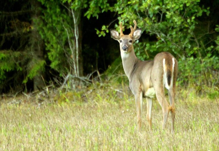
Young white-tailed buck standing in a grassy field at the edge of the woodsPhoto: yrjö jyske (CC BY 2.0)
The guidebook parse finds 1 permit hunt on DeGray Lake WMA: 1 deer. Plan around permit dates: the WMA is reserved for permit holders then, apart from waterfowl.
| Animal | Hunt | Dates | Count | Ref |
|---|---|---|---|---|
| Deer | Deer gun youth | As set by the Corps of Engineers (no dogs) | – | Guidebook p. 76 |
When to apply for DeGray Lake WMA hunts
| Game | Apply | Drawing |
|---|---|---|
| Deer | June 1-July 1, 2026 | – |
guidebook entry; draw rules. Checked November 9, 2026.
County harvest for DeGray Lake WMA
The 2025-26 deer report credits Clark County with 5,406 deer, 9 percent fewer than 2024-25. These are county totals from AGFC Game Check, so they include private land as well as public ground.
| County | 2025-26 | 2024-25 | Rank |
|---|---|---|---|
| Clark | 5,406 | 5,965 | 2 |
| Hot Spring | 3,695 | 3,834 | 14 |
deer report 2025-26 (checked deer by county (AGFC deer reports, Table 6)). Checked November 9, 2026.
Closed ground near DeGray Lake WMA
DeGray is 3 miles away and closed to hunting; do not cross into it from DeGray Lake WMA. Code 05.11 closes Arkansas parks to hunting, with the two WMA exceptions.
| Name | Closed by | Away | County |
|---|---|---|---|
| DeGray | State park (Code 05.11) | 3 miles | Clark, Hot Spring |
| Electric Island WMA | WMA closed to hunting | 15 miles | Garland |
| Lake Catherine | State park (Code 05.11) | 20 miles | Hot Spring, Garland |
| Hot Springs NP | Park Service unit | 22 miles | Garland |
| Lake Ouachita | State park (Code 05.11) | 25 miles | Garland |
AGFC Code 05.11; closed places from lands.json (PAD-US 4.1, NPS, FWS). Straight-line miles. Checked November 9, 2026.
Land that overlaps DeGray Lake WMA
DeGray Lake WMA overlaps DeGray Lake (Corps); acreages should not be added together.
How DeGray Lake WMA lines up with nearby WMAs and refuges
Jack Mountain WMA, 8 miles northeast, is the next pin over. By type, the nearest six are 2 leased land WMAs, 1 natural area WMA and 1 ranger district.
| Nearby | Type | Acres | County | Miles | Heading |
|---|---|---|---|---|---|
| Jack Mountain WMA | Leased land WMA | 18,474 | Garland | 8 miles | northeast |
| Terre Noire | Natural area WMA | 493 | Clark | 13 miles | south |
| Womble RD | Ranger district | 159,621 | Montgomery | 24 miles | northwest |
| Big Timber WMA | Leased land WMA | 40,585 | Clark | 26 miles | south |
| Lake Ouachita (Corps) | Corps lake | – | Garland | 26 miles | north |
| Hot Springs State Forest | WMA | 3,273 | Garland | 27 miles | northeast |
Point: AGFC WMA boundary layer (GIS/wmas_website_link) (polygon centroid of the largest part). Straight-line distances. Arkansas public land map.
When the clock says go at DeGray Lake WMA
Deer, bear, elk, turkey and small game follow the general window; the migratory bird column applies to ducks, geese, doves, woodcock and snipe near DeGray Lake WMA.
| Day | Why it matters | Sun up | Sun down | Deer and turkey | Ducks and doves | Basis |
|---|---|---|---|---|---|---|
| Aug 29, 2026 | Early buck archery | 6:43 a.m. | 7:45 p.m. | 6:13 a.m. to 8:15 p.m. | 6:13 a.m. to 7:45 p.m. | NOAA formula |
| Sep 26, 2026 | Archery deer opens | 7:03 a.m. | 7:06 p.m. | 6:33 a.m. to 7:36 p.m. | 6:33 a.m. to 7:06 p.m. | NOAA formula |
| Oct 17, 2026 | Zone 12 alt-firearms | 7:21 a.m. | 6:36 p.m. | 6:51 a.m. to 7:06 p.m. | 6:51 a.m. to 6:36 p.m. | AGFC table |
| Nov 7, 2026 | Youth gun weekend | 6:40 a.m. | 5:14 p.m. | 6:10 a.m. to 5:44 p.m. | 6:10 a.m. to 5:14 p.m. | AGFC table |
| Nov 14, 2026 | Zone 12 gun opener | 6:47 a.m. | 5:09 p.m. | 6:17 a.m. to 5:39 p.m. | 6:17 a.m. to 5:09 p.m. | AGFC table |
| Nov 21, 2026 | Duck season opens | 6:54 a.m. | 5:05 p.m. | 6:24 a.m. to 5:35 p.m. | 6:24 a.m. to 5:05 p.m. | AGFC table |
| Dec 20, 2026 | Zone 12 gun closes | 7:17 a.m. | 5:06 p.m. | 6:47 a.m. to 5:36 p.m. | 6:47 a.m. to 5:06 p.m. | AGFC table |
| Dec 21, 2026 | Shortest day | 7:17 a.m. | 5:07 p.m. | 6:47 a.m. to 5:37 p.m. | 6:47 a.m. to 5:07 p.m. | AGFC table |
| Apr 12, 2027 | Turkey Zone 2 opens | 6:46 a.m. | 7:43 p.m. | 6:16 a.m. to 8:13 p.m. | 6:16 a.m. to 7:43 p.m. | AGFC table |
Hours rules from the 2026-27 Arkansas Hunting Guidebook; sunrise and sunset from the AGFC Little Rock table with AGFC’s nine-mile correction, or the NOAA solar formula on Central Time where the table has no entry; checked November 9, 2026. Legal hours across Arkansas.
Restocking runs from DeGray Lake WMA
For gas and groceries, Bismarck is 5 miles off. The Census 2024 estimate puts Hot Springs at 37,971, the largest nearby. Ten-mile neighbours of DeGray Lake WMA: Bismarck, Caddo Valley, Arkadelphia and Amity. Hot Springs has the closest AGFC office or center, 14 miles out. Confirm that a business is open by phone before you go.
| Town | County | 2024 population | Away | Which way |
|---|---|---|---|---|
| Bismarck | Hot Spring | – | 5 miles | north |
| Caddo Valley | Clark | 590 | 9 miles | southeast |
| Arkadelphia | Clark | 9,894 | 12 miles | southeast |
| Amity | Clark | 677 | 15 miles | west |
| Hot Springs | Garland | 37,971 | 19 miles | northeast |
Towns from places.json (Census 2024 estimates); AGFC buildings from the AGFC offices page and AGFC layers; businesses from services.json directory listings; straight-line miles. Checked November 9, 2026.
DeGray Lake WMA: practice before the trip
The range map puts The Gun Cave Range 19 miles from DeGray Lake WMA.
From the AGFC Shooting and Archery Ranges page, the AGFC range layer, club sites and directory listings, checked November 9, 2026.

Still water of Valley Creek under arching spring trees on the DeGray Lake WMAPhoto: risingthermals (CC BY-SA 2.0)

Clear blue water and a low wooded shore on DeGray LakePhoto: Samuel Hozan (CC0 1.0)
DeGray Lake WMA hunting questions
What do I carry to hunt DeGray Lake WMA?
Your Arkansas hunting license, plus a drawn permit for any permit-required hunt.
What sources back this DeGray Lake WMA page?
AGFC and federal agency sources, read for the 2026-27 season and checked November 9, 2026.
When can I hunt deer with a rifle on DeGray Lake WMA?
Nov 14–Dec 20 and Dec 26–28; dates come from the guidebook entry.
How does zoning work on DeGray Lake WMA?
Use 173, the guidebook zone for DeGray Lake WMA, not the private land zone number.
Can a black bear be taken legally on DeGray Lake WMA this fall?
Bear season applies through Bear Zone 2 with dates from the entry.
Which CWD tier applies to deer from DeGray Lake WMA?
No, it is outside the 32-county CWD Management Zone for this season.
Is there a draw for DeGray Lake WMA?
Yes: 1 in the parsed list, all requiring a drawn permit.
Is DeGray Lake WMA turkey ground in spring 2027?
It sits in Turkey Zones 1 and 2 (from AGFC's zone map), with WMA dates Apr 12–May 2.
Which Arkansas town works as a base camp for DeGray Lake WMA?
Bismarck is closest, roughly 5 miles. An AGFC office or nature center sits in Hot Springs, 14 miles away.
How many acres does DeGray Lake WMA cover, by which source?
14,000 acres (2026-27 guidebook), in Clark County and Hot Spring County.
What are the opening-day shooting hours on DeGray Lake WMA?
Opening day of modern gun, November 14, 2026, gives legal light here from 6:17 a.m. until 5:39 p.m.
Is blaze pink legal on DeGray Lake WMA in Arkansas?
Yes, whenever firearm deer, bear or elk seasons are open: 400 square inches above the waist and a hat in orange, chartreuse or blaze camo.
Which AGFC district looks after DeGray Lake WMA?
Arkansas Game and Fish Commission, with Corps of Engineers as landowner or partner; AGFC work in the area runs through AGFC Region 4 (Perrytown).
Before the alarm goes off for DeGray Lake WMA
Rules, closures and permit dates for DeGray Lake WMA can change during the season; posted signs and the managing agency outrank this page.
Sources: source 1 · source 2 · source 3 · source 4; seasons from the 2026-27 Arkansas Hunting Guidebook and the 2026-27 Waterfowl Hunting Guidebook. Checked November 9, 2026.
Other photos on this page: Samuel Hozan (CC0 1.0); yrjö jyske (CC BY 2.0).