Home › Missouri › Public land › Cedar Gap Conservation Area
Conservation area · 2026-27
Cedar Gap Conservation Area hunting guide
What MDC publishes about this conservation area in Wright County, in one page.
Photo: David Nichols (CC BY-SA 2.0)
Getting to Cedar Gap Conservation Area
Parking, trailheads and gates near Cedar Gap Conservation Area
- Parking areaParking · 3.1 mi from the centreDirections
- Parking areaParking · 3.2 mi from the centreDirections
- Parking areaParking · 3.2 mi from the centreDirections
- Parking areaParking · 3.3 mi from the centreDirections
Parking, trailhead and gate locations come from OpenStreetMap contributors. Roads into public land can be gated or seasonal; check with the managing agency before you go.
Cedar Gap Conservation Area: acres, manager and game
The record gives Cedar Gap Conservation Area 431 acres in Wright County. Of 3 conservation areas in Wright County, Cedar Gap Conservation Area is number 2 by acreage. It belongs to the Bryant Creek management district, MDC Ozark Region.
Other uses MDC lists for Cedar Gap Conservation Area: trails (hiking).
From the MDC area description: Cedar Gap CA came into existence in 1999 thanks in large part to the dedication and commitment of a small group of private citizens from Springfield and the local community of Cedar Gap. The Cedar Gap Plateau is recognized as the second highest point in the State of Missouri. From this large plateau, three large watersheds begin: Gasconade River, Finley River, and Bryant Creek. At Cedar Gap CA, visitors can explore the headwaters of Bryant Creek, view limestone glades, and explore the oak/hickory forest. A gravel-surfaced trail leads from the parking lot to a valley overlook. This three-eighths mile trail can accommodate most hikers with some effort. For a more rugged hike, visitors can continue beyond the overlook and hike the 1.6 mile loop trail. While hiking or exploring, visitors will notice the remnants of a limestone quarry and limestone glades. Management practices on the glades are conducted periodically to stimulate native plants and flowers, and to improve wildlife habitat. During most of the year, Bryant Creek is a peaceful bubbling brook.
Game species: Deer, Black bear, Turkey, Squirrel.
From the agency record (Missouri Department of Conservation); checked October 29, 2026.
Nearby
Places to hunt and shoot around Cedar Gap Conservation Area
Neighbors of Cedar Gap Conservation Area on the map
Count on Odin Access as the first fallback, 12 mi north of Cedar Gap Conservation Area.
| Public land | Type | Acres | County | Distance | Direction |
|---|---|---|---|---|---|
| Odin Access | Public access area | 124 | Wright | 12 mi | north |
| Vera Cruz Access | Public access area | 80 | Douglas | 16 mi | southeast |
| Camp Branch Access | Public access area | 28 | Wright | 16 mi | northeast |
| Rippee CA | Conservation area | 419 | Douglas | 19 mi | southeast |
| Compton Hollow CA | Conservation area | 831 | Webster | 20 mi | northwest |
| Buzzard Bluff Access | Public access area | 89 | Wright | 23 mi | northeast |
| Shannon Ranch CA | Conservation area | 1,565 | Douglas | 23 mi | southeast |
| Niangua CA | Conservation area | 865 | Webster | 25 mi | northwest |
Points: MDC Conservation Area Centroids layer (https://gisblue.mdc.mo.gov/arcgis/rest/services/Discover_Nature/MDC_Administrative_Areas/FeatureServer/4). Straight-line distances. Statewide public land map.
Cedar Gap Conservation Area hunting methods
Cedar Gap Conservation Area follows statewide seasons with the area limits shown here.
| Game | Methods | Note |
|---|---|---|
| White-tailed Deer | Archery and firearms | Allowed |
| Wild Turkey | Archery and firearms | – |
| Black Bear | Archery and firearms | Zone permit |
| Gray Squirrel | Statewide methods | – |
MDC allows archery and firearms for deer on Cedar Gap Conservation Area; antlerless permits may be used. Turkey hunters may use archery and firearms here. Bear hunting is listed on Cedar Gap Conservation Area (archery and firearms) for permit holders in the right management zone. Cedar Gap Conservation Area shows code A in the booklet, antlerless permits allowed. The deer hunting quick view is the list that counts for MDC areas, and Cedar Gap Conservation Area appears on it.
Sources: area page, area regulations, deer quick view; booklet table: 2026 Fall Deer and Turkey booklet, pp. 42-55. Checked October 29, 2026.
Calendar of hunts for Cedar Gap Conservation Area
Cedar Gap Conservation Area gets 14 dated rows once the Wright County calendar is trimmed to its game list.
| Game | Segment | Where | Starts | Ends | Status |
|---|---|---|---|---|---|
| White-tailed deer | Archery, first part | Statewide | Sep 15, 2026 | Nov 13, 2026 | |
| White-tailed deer | Firearms, early antlerless | Antlerless county | Oct 9, 2026 | Oct 11, 2026 | |
| White-tailed deer | Firearms, early youth | Statewide | Oct 24, 2026 | Oct 25, 2026 | |
| White-tailed deer | Firearms, November | Statewide | Nov 14, 2026 | Nov 24, 2026 | |
| White-tailed deer | Archery, second part | Statewide | Nov 25, 2026 | Jan 15, 2027 | |
| White-tailed deer | Firearms, late youth | Statewide | Nov 27, 2026 | Nov 29, 2026 | |
| White-tailed deer | Firearms, late antlerless | Antlerless county | Dec 5, 2026 | Dec 13, 2026 | |
| White-tailed deer | Firearms, alternative methods | Statewide | Dec 26, 2026 | Jan 5, 2027 | |
| Black bear | Bear, zone 1 | Bear zone 1 | Oct 17, 2026 | Oct 30, 2026 | |
| Black bear | Bear, zone 3 | Bear zone 3 | Oct 17, 2026 | Oct 30, 2026 | |
| Wild turkey | Fall archery | Statewide | Sep 15, 2026 | Nov 13, 2026 | |
| Wild turkey | Fall firearms | Open county | Oct 1, 2026 | Oct 31, 2026 | |
| Wild turkey | Fall archery, part 2 | Statewide | Nov 25, 2026 | Jan 15, 2027 | |
| Squirrels | Squirrel season | Statewide | May 23, 2026 | Feb 15, 2027 |
Rabbits may be hunted sunrise to sunset; trapping seasons are on the species pages.
From the 2026 Fall Deer and Turkey booklet, the 2026-2027 waterfowl digest and the 2026 hunting and trapping summary (Missouri Department of Conservation); checked October 29, 2026. All Missouri seasons.
Which county rules govern Cedar Gap Conservation Area
| Rule | Wright County |
|---|---|
| Firearms antlerless limit | 4 deer |
| Antlerless portions | Open |
| CWD sampling Nov. 14-15 | No |
| Feed and mineral ban | No |
| Share the Harvest CWD test | No |
| Fall firearms turkey | Open |
| Dogs, November portion | No rule |
| Elk county | No |
| Bear zone | Zone 3, Zone 1 |
| Duck zone | South |
Missouri sets deer rules county by county, so Cedar Gap Conservation Area follows Wright County: up to 4 antlerless deer on firearms permits. Wright County opens for both antlerless portions this year. Bear Management Zone 3 covers Wright County: 250 permits and a 8-bear quota for Oct. 17-30. MDC retired the CWD portion, its management zone and the antler-point restriction for 2026.
2026 Fall Deer and Turkey booklet county rules, MDC CWD rules and 2026 bear digest; checked October 29, 2026.
Cedar Gap Conservation Area town and service list
Ava lies closest, about 9.7 mi as the crow flies. Marshfield counts 7,935 residents, more than any other town listed. How MDC says to drive in: From Mansfield, take Highway 60 west 4 miles, then Route O south 0.75 mile to the end of the pavement, continue on gravel road 0.25 mile to parking lot. Need MDC staff? Springfield Conservation Nature Center in Springfield is 31 mi out.
| Nearest towns | County | Population | Miles | Heading |
|---|---|---|---|---|
| Ava | Douglas | 3,184 | 9.7 mi | south |
| Hartville | Wright | 626 | 14 mi | northeast |
| Norwood | Wright | 613 | 14 mi | east |
| Marshfield | Webster | 7,935 | 21 mi | northwest |
| Grovespring | Wright | – | 22 mi | north |
Towns from places.json (Census 2024); offices and businesses from services.json (MDC offices and business listings, chain stores and permit vendors left out); straight-line miles. Checked October 29, 2026.
Cedar Gap Conservation Area: deer, turkey and CWD by year
County figures, the smallest unit MDC publishes.
The county total for 2025 was 3,625 deer (1,753 antlered bucks), the closest MDC figure for Cedar Gap Conservation Area. 18 public-land birds out of 461 in spring 2026, Wright County. 0 positive deers in Wright County in the sample years shown.
| Permit year | Antlered bucks | Button bucks | Does | Total |
|---|---|---|---|---|
| 2025 | 1,753 | 331 | 1,541 | 3,625 |
| 2024 | 1,449 | 286 | 1,344 | 3,079 |
| 2023 | 1,791 | 347 | 1,788 | 3,926 |
| 2022 | 1,497 | 324 | 1,421 | 3,242 |
| 2021 | 1,783 | 357 | 1,483 | 3,623 |
| 2020 | 1,642 | 293 | 1,281 | 3,216 |
| Year | Spring harvest | Public land share | Youth weekend | Fall firearms | Fall archery |
|---|---|---|---|---|---|
| 2026 | 461 | 18 | 86 | – | – |
| 2025 | 519 | 24 | 51 | 13 | 14 |
| 2024 | 489 | 15 | 64 | 16 | 8 |
| 2023 | 492 | 35 | 43 | 10 | 22 |
| 2022 | 369 | – | 35 | 23 | 22 |
| 2021 | 412 | – | 51 | 17 | 26 |
| Season | Tested | Positives |
|---|---|---|
| 2026 | 8 | 0 |
| 2025 | 67 | 0 |
| 2024 | 105 | 0 |
| 2023 | 93 | 0 |
| 2022 | 93 | 0 |
| 2021 | 131 | 0 |
MDC 2025 deer harvest summary, MDC turkey harvest summaries and MDC CWD dashboard; earlier years from the yearly reports. Checked October 29, 2026.
First and last shooting light in Cedar Gap Conservation Area
The times below start from the MDC Jefferson City table and add 2 minutes for Cedar Gap Conservation Area, as the booklet directs.
| Date | Season point | Sunrise | Sunset | Deer, bear, elk | Ducks, doves, geese |
|---|---|---|---|---|---|
| Sep 1, 2026 | Dove opener | 6:39 a.m. | 7:40 p.m. | 6:09 a.m. to 8:10 p.m. | 6:09 a.m. to 7:40 p.m. |
| Sep 15, 2026 | Archery opener | 6:51 a.m. | 7:18 p.m. | 6:21 a.m. to 7:48 p.m. | 6:21 a.m. to 7:18 p.m. |
| Oct 1, 2026 | Fall firearms turkey | 7:06 a.m. | 6:52 p.m. | 6:36 a.m. to 7:22 p.m. | 6:36 a.m. to 6:52 p.m. |
| Nov 7, 2026 | Middle Zone ducks | 6:43 a.m. | 5:03 p.m. | 6:13 a.m. to 5:33 p.m. | 6:13 a.m. to 5:03 p.m. |
| Nov 14, 2026 | November firearms opener | 6:51 a.m. | 4:57 p.m. | 6:21 a.m. to 5:27 p.m. | 6:21 a.m. to 4:57 p.m. |
| Dec 26, 2026 | Alternative methods | 7:26 a.m. | 4:55 p.m. | 6:56 a.m. to 5:25 p.m. | 6:56 a.m. to 4:55 p.m. |
| Jan 15, 2027 | Archery close | 7:26 a.m. | 5:13 p.m. | 6:56 a.m. to 5:43 p.m. | 6:56 a.m. to 5:13 p.m. |
Hours rule and the Jefferson City sunrise and sunset table from the MDC Migratory Bird and Waterfowl Digest (same table in the Fall Deer and Turkey booklet), adjusted 1 minute per 13.5 miles east or west as MDC directs; checked October 29, 2026. Legal hours for every county.
Missouri scenes for Cedar Gap Conservation Area


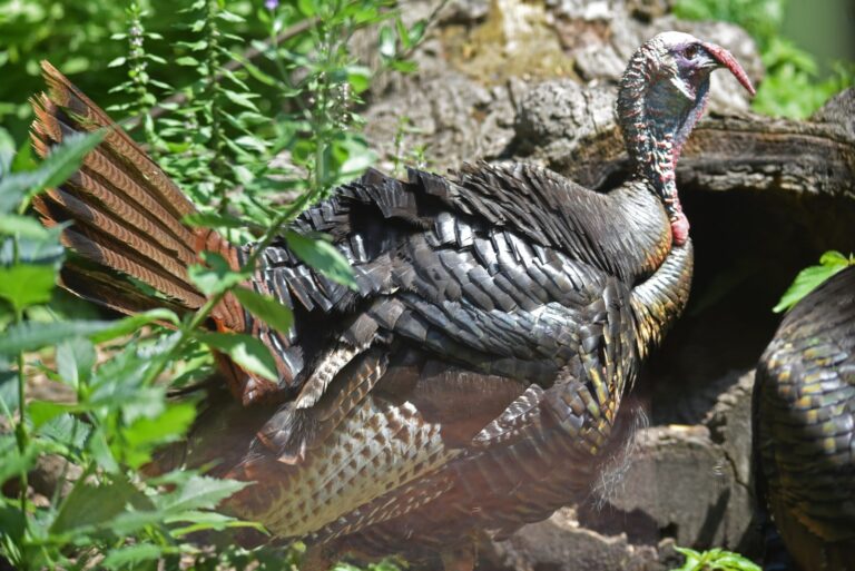
Public lanes and clubs for Cedar Gap Conservation Area hunters
From Cedar Gap Conservation Area, Grundy Memorial Wildlife Area Archery Range is the nearest MDC or other public range (14 miles). Nearby gun clubs fill the other cards.
From MDC area pages and the MDC Shooting Ranges layer, the operators’ pages and directory listings, checked October 29, 2026.
Cedar Gap Conservation Area questions with sourced answers
Is Cedar Gap Conservation Area open for hunting this season?
Yes. MDC lists deer, black bear, turkey and squirrel on Cedar Gap Conservation Area, and it is on the deer list.
Is Cedar Gap Conservation Area archery only for deer?
Plan on archery and firearms. Antlerless permits are allowed.
What is the antlerless limit for Cedar Gap Conservation Area?
Wright County sets a firearms antlerless fill limit of 4, and its antlerless portions are open.
Does the feed ban cover Cedar Gap Conservation Area?
For Wright County, sampling is not required and the feed ban does not apply.
What turkey rules apply on Cedar Gap Conservation Area?
Turkey methods: archery and firearms. Fall firearms turkey (Oct. 1-31) is open in Wright County.
Which bear permits work at Cedar Gap Conservation Area?
The county is BMZ 3; bear is listed for the area.
How long is the legal day at Cedar Gap Conservation Area in mid-November?
From 6:22 a.m. until 5:28 p.m. on Nov. 14, by the MDC table with the longitude correction.
Closest public alternatives to Cedar Gap Conservation Area?
The three nearest: Odin Access (12 mi), Vera Cruz Access (16 mi) and Camp Branch Access (16 mi).
Where do I buy gas near Cedar Gap Conservation Area?
About 9.7 mi to Ava.
How large an area is Cedar Gap Conservation Area?
Roughly 431 acres, looked after by Missouri Department of Conservation.
Cedar Gap Conservation Area hours and camping?
Area hours: 4 a.m. to 10 p.m.. Camping is not listed.
What paperwork covers a hunt at Cedar Gap Conservation Area?
Buy the matching Missouri permit (Missouri calls them permits); waterfowl also need the federal duck stamp.
Leaving for Cedar Gap Conservation Area?
Missouri sells permits, not licenses: buy the right one before you hunt Cedar Gap Conservation Area, and wear hunter orange in the firearms portions.
Sources: source · source · source · source; regulations from the 2026 Fall Deer and Turkey booklet. Checked October 29, 2026.
Other photos on this page: David Nichols (CC BY-SA 2.0); David Nichols (CC BY-SA 2.0); U.S. Fish and Wildlife Service – Midwest Region (Public domain).