Home › Missouri › Public land › Crooked Creek Conservation Area
Conservation area · Missouri 2026-27
Crooked Creek Conservation Area hunting
Seasons, methods and access for this conservation area in Crawford County.
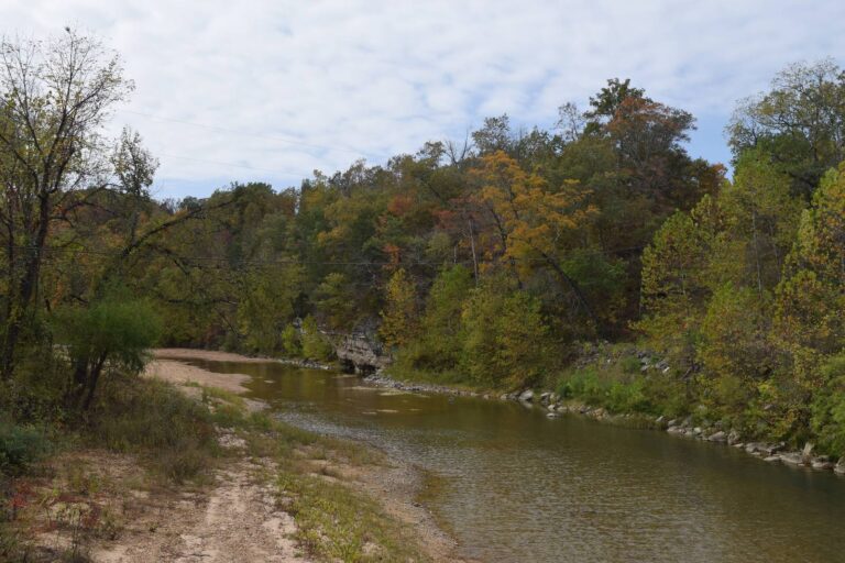
Photo: Carl Belken (CC BY-SA 3.0)
Getting to Crooked Creek Conservation Area
Crooked Creek Conservation Area profile
Crawford County is home to the 337 acres of Crooked Creek Conservation Area. In acreage it places 5th among 6 conservation areas in Crawford County. Management sits with MDC: Meramec district, St. Louis Region.
When hunting is slow, Crooked Creek Conservation Area offers trails (hiking) and trapping (special use permit), per MDC.
In the agency's words: This 337-acre conservation area in the middle of beautiful Crawford County, offers a sample of Ozark country that's not too far away from St. Louis. It' also the remnant of a celestial calamity. The area lies on an outcrop that's actually the rim of an impact crater created by a meteor strike thousands of years ago. A short, linear trail affords hikers an out-and-back trek to experience hills forested by oak-hickory and shortleaf pine.
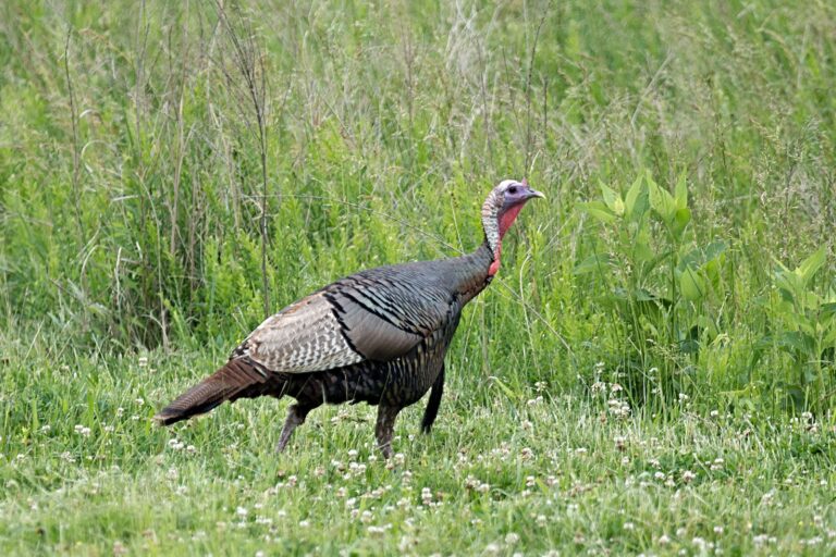
Species on the record: Deer, Black bear, Turkey, Squirrel.
From the agency record (Missouri Department of Conservation); checked October 29, 2026.
Nearby
Places to hunt and shoot around Crooked Creek Conservation Area
Crooked Creek Conservation Area methods and area rules
Methods for Crooked Creek Conservation Area come from the MDC area page and the deer quick view.
| Quarry | Methods | Permits |
|---|---|---|
| White-tailed Deer | Archery and firearms | Allowed |
| Wild Turkey | Archery and firearms | – |
| Black Bear | Archery and firearms | Zone permit |
| Gray Squirrel | Statewide methods | – |
Plan on archery and firearms for deer at Crooked Creek Conservation Area; antlerless permits may be used. For turkey, MDC allows archery and firearms on Crooked Creek Conservation Area. A bear permit holder may hunt Crooked Creek Conservation Area with archery and firearms. Antlerless code A applies to Crooked Creek Conservation Area, so antlerless permits allowed. MDC limits deer hunting on its areas to the listed ones, and Crooked Creek Conservation Area is listed.
Sources: area page, area regulations, deer quick view; booklet table: 2026 Fall Deer and Turkey booklet, pp. 42-55. Checked October 29, 2026.
Crawford County rules on Crooked Creek Conservation Area
| County rule | Crawford County |
|---|---|
| Firearms antlerless limit | 4 deer |
| Antlerless portions | Open |
| CWD sampling Nov. 14-15 | No |
| Feed and mineral ban | Yes |
| Share the Harvest CWD test | Required |
| Fall firearms turkey | Open |
| Dogs, November portion | No rule |
| Elk county | No |
| Bear zone | Zone 2, Zone 3 |
| Duck zone | Middle |
For deer, Crawford County sets the rules on Crooked Creek Conservation Area: firearms antlerless limit 4. Antlerless portions: open in October and December for Crawford County. Leave the feeders home: Crawford County bans feed and minerals all year. Bear hunters drawn for Zone 2 may hunt Crawford County (750 permits, 22 bears). No CWD portion, no CWD Management Zone and no antler-point restriction this season.
2026 Fall Deer and Turkey booklet county rules, MDC CWD rules and 2026 bear digest; checked October 29, 2026.
Open dates on Crooked Creek Conservation Area
Open-now status is in the last column; 14 rows apply to Crooked Creek Conservation Area.
| Quarry | Season | Where | Opening | Closing | Status |
|---|---|---|---|---|---|
| White-tailed deer | Archery, first part | Statewide | Sep 15, 2026 | Nov 13, 2026 | |
| White-tailed deer | Firearms, early antlerless | Antlerless county | Oct 9, 2026 | Oct 11, 2026 | |
| White-tailed deer | Firearms, early youth | Statewide | Oct 24, 2026 | Oct 25, 2026 | |
| White-tailed deer | Firearms, November | Statewide | Nov 14, 2026 | Nov 24, 2026 | |
| White-tailed deer | Archery, second part | Statewide | Nov 25, 2026 | Jan 15, 2027 | |
| White-tailed deer | Firearms, late youth | Statewide | Nov 27, 2026 | Nov 29, 2026 | |
| White-tailed deer | Firearms, late antlerless | Antlerless county | Dec 5, 2026 | Dec 13, 2026 | |
| White-tailed deer | Firearms, alternative methods | Statewide | Dec 26, 2026 | Jan 5, 2027 | |
| Black bear | Bear, zone 2 | Bear zone 2 | Oct 17, 2026 | Oct 30, 2026 | |
| Black bear | Bear, zone 3 | Bear zone 3 | Oct 17, 2026 | Oct 30, 2026 | |
| Wild turkey | Fall archery | Statewide | Sep 15, 2026 | Nov 13, 2026 | |
| Wild turkey | Fall firearms | Open county | Oct 1, 2026 | Oct 31, 2026 | |
| Wild turkey | Fall archery, part 2 | Statewide | Nov 25, 2026 | Jan 15, 2027 | |
| Squirrels | Squirrel season | Statewide | May 23, 2026 | Feb 15, 2027 |
Archery deer is closed during the November firearms portion, Nov. 14-24.
From the 2026 Fall Deer and Turkey booklet, the 2026-2027 waterfowl digest and the 2026 hunting and trapping summary (Missouri Department of Conservation); checked October 29, 2026. All Missouri seasons.
Crawford County deer and turkey harvest near Crooked Creek Conservation Area
County-level data from MDC.
MDC reports deer harvest by county, not by area: Crawford County checked 3,667 deer in the 2025 permit year, 19% more than in 2024. Public land gave up 64 of the 474 spring 2026 turkeys in Crawford County. CWD samples from Crawford County turned up 9 positives in recent years (first found 2018-2019).
| Season | Antlered bucks | Button bucks | Does | Total |
|---|---|---|---|---|
| 2025 | 1,805 | 296 | 1,566 | 3,667 |
| 2024 | 1,492 | 333 | 1,257 | 3,082 |
| 2023 | 1,949 | 457 | 2,000 | 4,406 |
| 2022 | 1,633 | 379 | 1,489 | 3,501 |
| 2021 | 1,887 | 444 | 1,680 | 4,011 |
| 2020 | 1,510 | 422 | 1,449 | 3,381 |
| Year | Spring | Public land | Youth | Fall firearms | Fall archery |
|---|---|---|---|---|---|
| 2026 | 474 | 64 | 54 | – | – |
| 2025 | 687 | 127 | 61 | 47 | 19 |
| 2024 | 565 | 96 | 28 | 36 | 14 |
| 2023 | 635 | 120 | 27 | 82 | 46 |
| 2022 | 417 | – | 30 | 43 | 29 |
| 2021 | 499 | – | 47 | 49 | 54 |
| Year | Deer tested | Positive |
|---|---|---|
| 2026 | 12 | 0 |
| 2025 | 106 | 1 |
| 2024 | 830 | 3 |
| 2023 | 1,108 | 3 |
| 2022 | 1,115 | 2 |
| 2021 | 1,019 | 0 |
MDC 2025 deer harvest summary, MDC turkey harvest summaries and MDC CWD dashboard; earlier years from the yearly reports. Checked October 29, 2026.
Crooked Creek Conservation Area and nearby public land, mapped
Keysville Towersite (4.0 mi, east) tops the neighbor list for Crooked Creek Conservation Area, measured as the crow flies.
| Neighbor | Category | Acreage | County | Distance | Direction |
|---|---|---|---|---|---|
| Keysville Towersite | Towersite | 80 | Crawford | 4.0 mi | east |
| John N. and Melba S. Anderson Memorial CA | Conservation area | 341 | Crawford | 6.9 mi | northeast |
| Short Bend Access | Public access area | 87 | Dent | 7.5 mi | south |
| Pearl G. and John J. Sizemore Memorial CA | Conservation area | 180 | Crawford | 7.9 mi | northeast |
| Woodson K. Woods Memorial CA | Conservation area | 5,738 | Crawford, Phelps | 9.0 mi | northwest |
| Indian Trail CA | Conservation area | 13,503 | Dent | 10 mi | south |
| Huzzah CA | Conservation area | 6,225 | Crawford | 17 mi | northeast |
| Little Prairie CA | Conservation area | 342 | Phelps | 18 mi | northwest |
Points: MDC Conservation Area Centroids layer (https://gisblue.mdc.mo.gov/arcgis/rest/services/Discover_Nature/MDC_Administrative_Areas/FeatureServer/4). Straight-line distances. Statewide public land map.
Getting supplies near Crooked Creek Conservation Area
Nearest town with its own page: Steelville, 8.3 mi. For a hardware store or a motel, Salem (4,726 people) is 17 mi away. Getting there, per MDC: From Cherryville take Route 19 south approximately 7 miles, then take Route VV northwest 5 miles until you reach the area. The closest MDC office on file is Rolla Office, about 22 mi from Crooked Creek Conservation Area.
| Place | County | Population | Distance | Direction |
|---|---|---|---|---|
| Steelville | Crawford | 1,445 | 8.3 mi | north |
| St. James | Phelps | 3,932 | 15 mi | northwest |
| Salem | Dent | 4,726 | 17 mi | southwest |
| Leasburg | Crawford | 318 | 17 mi | north |
| Viburnum | Iron | 658 | 18 mi | southeast |
Towns from places.json (Census 2024); offices and businesses from services.json (MDC offices and business listings, chain stores and permit vendors left out); straight-line miles. Checked October 29, 2026.
Crooked Creek Conservation Area hunting hours on key dates
MDC prints one sunrise and sunset table for Jefferson City and tells hunters to adjust it by 1 minute for every 13.5 miles east or west. For Crooked Creek Conservation Area that means subtract 3 minutes.
| Date | Opener or close | Sunrise | Sunset | Deer | Migratory |
|---|---|---|---|---|---|
| Sep 1, 2026 | Dove opener | 6:35 a.m. | 7:36 p.m. | 6:05 a.m. to 8:06 p.m. | 6:05 a.m. to 7:36 p.m. |
| Sep 15, 2026 | Archery opener | 6:47 a.m. | 7:14 p.m. | 6:17 a.m. to 7:44 p.m. | 6:17 a.m. to 7:14 p.m. |
| Oct 1, 2026 | Fall firearms turkey | 7:02 a.m. | 6:48 p.m. | 6:32 a.m. to 7:18 p.m. | 6:32 a.m. to 6:48 p.m. |
| Nov 7, 2026 | Middle Zone ducks | 6:39 a.m. | 4:59 p.m. | 6:09 a.m. to 5:29 p.m. | 6:09 a.m. to 4:59 p.m. |
| Nov 14, 2026 | November firearms opener | 6:47 a.m. | 4:53 p.m. | 6:17 a.m. to 5:23 p.m. | 6:17 a.m. to 4:53 p.m. |
| Dec 26, 2026 | Alternative methods | 7:22 a.m. | 4:51 p.m. | 6:52 a.m. to 5:21 p.m. | 6:52 a.m. to 4:51 p.m. |
| Jan 15, 2027 | Archery close | 7:22 a.m. | 5:09 p.m. | 6:52 a.m. to 5:39 p.m. | 6:52 a.m. to 5:09 p.m. |
Hours rule and the Jefferson City sunrise and sunset table from the MDC Migratory Bird and Waterfowl Digest (same table in the Fall Deer and Turkey booklet), adjusted 1 minute per 13.5 miles east or west as MDC directs; checked October 29, 2026. Legal hours for every county.
Crooked Creek Conservation Area hunters: public range and clubs
Dent County has the public range nearest Crooked Creek Conservation Area: Indian Trail CA range (11 miles). Two club ranges follow.
From MDC area pages and the MDC Shooting Ranges layer, the operators’ pages and directory listings, checked October 29, 2026.
Photo strip for Crooked Creek Conservation Area

Crooked Creek Conservation Area hunter FAQ
Is deer feeding banned near Crooked Creek Conservation Area?
CWD rules in Crawford County: sampling not mandatory, feed ban yes.
Is Crooked Creek Conservation Area good for fall turkey?
Turkey is archery and firearms; fall firearms is open.
What bear rules apply at Crooked Creek Conservation Area?
Zone 2 covers the county (750 permits); bear is on the area list.
Crooked Creek Conservation Area shooting hours for the November opener?
Roughly 6:17 a.m. until 5:23 p.m., worked out for this spot.
Crooked Creek Conservation Area crowded: where next?
In order of distance: Keysville Towersite (4.0 mi), John N. and Melba S. Anderson Memorial Conservation Area (6.9 mi) and Short Bend Access (7.5 mi).
Nearest town with services to Crooked Creek Conservation Area?
Steelville (Crawford County), about 8.3 mi away.
Crooked Creek Conservation Area: size and manager?
The record lists 337 acres; Missouri Department of Conservation is in charge.
Is there an area permit for Crooked Creek Conservation Area?
Missouri permits for the game you hunt; deer need an Archer's or Firearms permit, migratory birds a Migratory Bird permit.
May the public hunt at Crooked Creek Conservation Area?
Open for deer, black bear, turkey and squirrel, with the methods shown in the rules section.
What deer methods are allowed on Crooked Creek Conservation Area?
The deer rule is archery and firearms. Antlerless permits are allowed.
Which antlerless rule covers Crooked Creek Conservation Area?
Missouri sets it by county; Crawford County allows 4 on firearms permits. Antlerless portions are open.
Crooked Creek Conservation Area final checklist
Signs on the ground outrank any web page; look for posted refuge and closed zones on Crooked Creek Conservation Area.
Sources: source · source · source · source; regulations from the 2026 Fall Deer and Turkey booklet. Checked October 29, 2026.
Other photos on this page: Chris M Morris (CC BY 2.0); Jena Fuller (CC BY-SA 2.0); Russ (CC BY 2.0).