Home › Missouri › Public land › LaBelle Lake Conservation Area
Public ground · Conservation area
LaBelle Lake Conservation Area hunting in Missouri
Public hunting ground in Lewis County (334 acres), with the county deer rules that apply there.
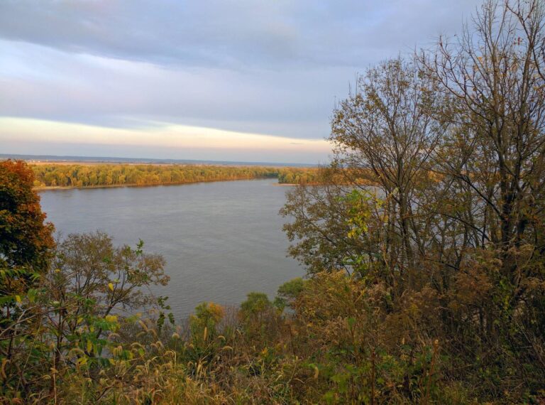
Photo: David Wilson (CC BY 2.0)
Getting to LaBelle Lake Conservation Area
Parking, trailheads and gates near LaBelle Lake Conservation Area
- Parking areaParking · 1.5 mi from the centreDirections
- Parking areaParking · 1.5 mi from the centreDirections
- Parking areaParking · 1.6 mi from the centreDirections
- Parking areaParking · 2.1 mi from the centreDirections
- Parking areaParking · 2.1 mi from the centreDirections
- Parking areaParking · 2.1 mi from the centreDirections
- Parking areaParking · 2.1 mi from the centreDirections
Parking, trailhead and gate locations come from OpenStreetMap contributors. Roads into public land can be gated or seasonal; check with the managing agency before you go.
LaBelle Lake Conservation Area, the essentials
Its acreage is 334, inside Lewis County. Line up the 4 conservation areas in Lewis County by acres and LaBelle Lake Conservation Area comes 3rd. Staff of the MDC Fabius River district, in the Northeast Region, manage LaBelle Lake Conservation Area.
MDC also notes camping (open camping-walk/float/backpack(no deer/turkey), individual campsites) and fishing (sunfish, catfish, crappie, black bass) at LaBelle Lake Conservation Area.
Habitat notes from the source: The original General Land Office survey of Lewis County, conducted in the 1840's, mapped the entirety of Labelle Lake CA as prairie. However, justone-half mile south and west of the area, open, upland prairie transitioned into the Troublesome Creek floodplain, which was at least partially wooded. This landscape pattern was characteristic of the region as described in the following passage excerpted from "Presettlement Prairie of Missouri" (Walter Schroeder): A second physiographic expression of prairie in northeast Missouri was the narrow upland or ridge prairie between the subparallel, southeast-flowing streams from the Salt River north to Iowa. These prairies, like those of the Grand-Chariton country, were narrow and elongated. This characteristic shape was expressed in names, such as Ten Mile Prairie in Lewis County.
Game listed: Deer, Turkey, Rabbit, Squirrel, Dove, Quail, Waterfowl.
- White-tailed Deer
- Wild Turkey
- Eastern Cottontail
- Gray Squirrel
- Fox Squirrel
- Mourning Dove
- Northern Bobwhite Quail
- Ducks
From the agency record (Missouri Department of Conservation); checked October 29, 2026.
Nearby
Places to hunt and shoot around LaBelle Lake Conservation Area
LaBelle Lake Conservation Area and nearby public land, mapped
8 other public places sit inside a 45-mile circle around LaBelle Lake Conservation Area; together they add 9,446 acres, and Henry Sever Lake Conservation Area is nearest.
| Area | Type | Acres | County | Straight line | Which way |
|---|---|---|---|---|---|
| Henry Sever Lake CA | Conservation area | 1,248 | Knox | 7.2 mi | southwest |
| Deer Ridge CA | Conservation area | 7,185 | Lewis | 7.3 mi | northeast |
| White Oak Bend Access | Public access area | 160 | Knox | 9.4 mi | southwest |
| Tolona Access | Public access area | 176 | Lewis | 9.6 mi | east |
| Dunn Ford Access | Public access area | 136 | Marion | 16 mi | southeast |
| Wyaconda Crossing CA | Conservation area | 148 | Lewis | 17 mi | northeast |
| McPike Access | Public access area | 79 | Marion | 17 mi | southeast |
| Neeper CA | Conservation area | 315 | Clark | 18 mi | northeast |
Points: MDC Conservation Area Centroids layer (https://gisblue.mdc.mo.gov/arcgis/rest/services/Discover_Nature/MDC_Administrative_Areas/FeatureServer/4). Straight-line distances. Statewide public land map.
Area rules at LaBelle Lake Conservation Area
MDC area rules for LaBelle Lake Conservation Area, as published for 2026-27.
| Species | Methods here | Note |
|---|---|---|
| White-tailed Deer | Archery only | Allowed |
| Wild Turkey | Archery and firearms | – |
| Eastern Cottontail | Statewide methods | – |
| Gray Squirrel | Statewide methods | – |
| Northern Bobwhite Quail | Statewide methods | – |
| Mourning Dove | Statewide methods | – |
| Ducks | Open Hunting | Nontoxic shot |
Deer hunters on LaBelle Lake Conservation Area are limited to archery methods only; antlerless permits may be used. Turkey methods on LaBelle Lake Conservation Area: archery and firearms. The FDT area table lists LaBelle Lake Conservation Area with code A (antlerless permits allowed). Deer and turkey may be hunted only on MDC areas that appear in the booklet table; LaBelle Lake Conservation Area is on it.
Sources: area page, area regulations, deer quick view; booklet table: 2026 Fall Deer and Turkey booklet, pp. 42-55. Checked October 29, 2026.
LaBelle Lake Conservation Area season calendar
County dates from Lewis County that fit LaBelle Lake Conservation Area, matched to its game list.
| Species | Portion | Covers | Begins | Through | Today |
|---|---|---|---|---|---|
| White-tailed deer | Archery, first part | Statewide | Sep 15, 2026 | Nov 13, 2026 | |
| White-tailed deer | Archery, second part | Statewide | Nov 25, 2026 | Jan 15, 2027 | |
| Wild turkey | Fall archery | Statewide | Sep 15, 2026 | Nov 13, 2026 | |
| Wild turkey | Fall firearms | Open county | Oct 1, 2026 | Oct 31, 2026 | |
| Wild turkey | Fall archery, part 2 | Statewide | Nov 25, 2026 | Jan 15, 2027 | |
| Bobwhite quail | Youth quail | Statewide | Oct 24, 2026 | Oct 25, 2026 | |
| Bobwhite quail | Quail | Statewide | Nov 1, 2026 | Jan 15, 2027 | |
| Rabbits | Rabbit hunting | Statewide | Oct 1, 2026 | Feb 15, 2027 | |
| Squirrels | Squirrel season | Statewide | May 23, 2026 | Feb 15, 2027 | |
| Doves | Dove season | Statewide | Sep 1, 2026 | Nov 29, 2026 | |
| Teal | September teal | Statewide | Sep 12, 2026 | Sep 20, 2026 | |
| Youth waterfowl | Youth waterfowl days | North Zone | Oct 24, 2026 | Oct 25, 2026 | |
| Ducks and coots | Regular ducks | North Zone | Oct 31, 2026 | Dec 29, 2026 | |
| Early Canada goose | Early Canada goose | Statewide | Oct 3, 2026 | Oct 11, 2026 | |
| Geese | Regular geese | Statewide | Nov 11, 2026 | Feb 6, 2027 | |
| Light geese | Conservation order | Statewide | Feb 7, 2027 | Apr 30, 2027 |
No firearms deer rows for LaBelle Lake Conservation Area, an archery-only area. Duck zone rows come from the MDC zone layer; check the digest near a line.
From the 2026 Fall Deer and Turkey booklet, the 2026-2027 waterfowl digest and the 2026 hunting and trapping summary (Missouri Department of Conservation); checked October 29, 2026. All Missouri seasons.
Duck season on LaBelle Lake Conservation Area
Ducks and geese on LaBelle Lake Conservation Area fall under open hunting rules. Duck dates for LaBelle Lake Conservation Area follow the North Zone (from the 2021-2025 zone layer; the new 2026-2030 line text may differ near the edge). Ducks, geese and coots may be shot only with nontoxic shot.
| Zone season | Opens | Closes |
|---|---|---|
| Youth waterfowl days | Oct 24, 2026 | Oct 25, 2026 |
| Regular ducks | Oct 31, 2026 | Dec 29, 2026 |
2026-2027 Migratory Bird and Waterfowl Digest, managed areas; area page; checked October 29, 2026.
Deer rules that reach LaBelle Lake Conservation Area
| Rule | Lewis County |
|---|---|
| Firearms antlerless limit | 4 deer |
| Antlerless portions | Open |
| CWD sampling Nov. 14-15 | No |
| Feed and mineral ban | Yes |
| Share the Harvest CWD test | Required |
| Fall firearms turkey | Open |
| Dogs, November portion | No rule |
| Elk county | No |
| Bear zone | None |
| Duck zone | North |
LaBelle Lake Conservation Area takes its deer rules from Lewis County, where the firearms antlerless fill limit is 4. Antlerless portions run here in October and December. Lewis County falls under the CWD feed and mineral ban. For 2026 MDC dropped the CWD portion, the CWD Management Zone and the antler-point restriction.
2026 Fall Deer and Turkey booklet county rules, MDC CWD rules and 2026 bear digest; checked October 29, 2026.
LaBelle Lake Conservation Area: towns and supplies
Monticello is 10 mi from LaBelle Lake Conservation Area, the nearest town on this site. Edina is the biggest town in that list, 1,012 residents in 2024. Route from the area page: From LaBelle, take Route D south 2 miles, then gravel road 212 east 0.60 mile. Drive 36 mi to Northeast Regional Office in Kirksville for the nearest MDC counter.
| Town | County | Pop. 2024 | Miles off | Bearing |
|---|---|---|---|---|
| Monticello | Lewis | 105 | 10 mi | east |
| Williamstown | Lewis | – | 11 mi | northeast |
| Plevna | Knox | – | 13 mi | southwest |
| Edina | Knox | 1,012 | 15 mi | west |
| La Grange | Lewis | 806 | 21 mi | east |
Towns from places.json (Census 2024); offices and businesses from services.json (MDC offices and business listings, chain stores and permit vendors left out); straight-line miles. Checked October 29, 2026.
County harvest around LaBelle Lake Conservation Area
These are county numbers.
In 2025, 2,407 deer were Telechecked in Lewis County, 1,143 of them does. Lewis County turkey hunters took 330 birds in spring 2026; 34 came off public land. The MDC dashboard lists 2 CWD positives in Lewis County across the years in the table, the first in 2024-2025.
| Year | Bucks | Button bucks | Does | Checked |
|---|---|---|---|---|
| 2025 | 1,066 | 198 | 1,143 | 2,407 |
| 2024 | 1,134 | 236 | 1,132 | 2,502 |
| 2023 | 1,006 | 250 | 1,103 | 2,359 |
| 2022 | 1,125 | 243 | 1,081 | 2,449 |
| 2021 | 1,011 | 178 | 874 | 2,063 |
| 2020 | 1,025 | 223 | 914 | 2,162 |
| Year | Spring total | On public land | Youth | Fall gun | Fall bow |
|---|---|---|---|---|---|
| 2026 | 330 | 34 | 43 | – | – |
| 2025 | 309 | 38 | 34 | 6 | 5 |
| 2024 | 301 | 52 | 31 | 8 | 10 |
| 2023 | 232 | 44 | 19 | 16 | 9 |
| 2022 | 184 | – | 18 | 13 | 11 |
| 2021 | 196 | – | 17 | 4 | 6 |
| Sample year | CWD samples | Positives |
|---|---|---|
| 2026 | 11 | 0 |
| 2025 | 495 | 1 |
| 2024 | 546 | 1 |
| 2023 | 100 | 0 |
| 2022 | 119 | 0 |
| 2021 | 117 | 0 |
MDC 2025 deer harvest summary, MDC turkey harvest summaries and MDC CWD dashboard; earlier years from the yearly reports. Checked October 29, 2026.
When legal light starts in LaBelle Lake Conservation Area
Deer, bear, elk and fall archery turkey may be taken from half an hour before sunrise to half an hour after sunset; ducks, geese, doves and fall firearms turkey stop at sunset.
| When | Event | Rise | Set | Big game | Birds |
|---|---|---|---|---|---|
| Sep 1, 2026 | Dove opener | 6:36 a.m. | 7:37 p.m. | 6:06 a.m. to 8:07 p.m. | 6:06 a.m. to 7:37 p.m. |
| Sep 15, 2026 | Archery opener | 6:48 a.m. | 7:15 p.m. | 6:18 a.m. to 7:45 p.m. | 6:18 a.m. to 7:15 p.m. |
| Oct 1, 2026 | Fall firearms turkey | 7:03 a.m. | 6:49 p.m. | 6:33 a.m. to 7:19 p.m. | 6:33 a.m. to 6:49 p.m. |
| Nov 7, 2026 | Middle Zone ducks | 6:40 a.m. | 5:00 p.m. | 6:10 a.m. to 5:30 p.m. | 6:10 a.m. to 5:00 p.m. |
| Nov 14, 2026 | November firearms opener | 6:48 a.m. | 4:54 p.m. | 6:18 a.m. to 5:24 p.m. | 6:18 a.m. to 4:54 p.m. |
| Dec 26, 2026 | Alternative methods | 7:23 a.m. | 4:52 p.m. | 6:53 a.m. to 5:22 p.m. | 6:53 a.m. to 4:52 p.m. |
| Jan 15, 2027 | Archery close | 7:23 a.m. | 5:10 p.m. | 6:53 a.m. to 5:40 p.m. | 6:53 a.m. to 5:10 p.m. |
Hours rule and the Jefferson City sunrise and sunset table from the MDC Migratory Bird and Waterfowl Digest (same table in the Fall Deer and Turkey booklet), adjusted 1 minute per 13.5 miles east or west as MDC directs; checked October 29, 2026. Legal hours for every county.
LaBelle Lake Conservation Area in pictures


LaBelle Lake Conservation Area hunters: public range and clubs
From LaBelle Lake Conservation Area, 7 miles separates hunters from Deer Ridge CA range, the closest public range. Club lanes within 30 miles fill the next cards.
From MDC area pages and the MDC Shooting Ranges layer, the operators’ pages and directory listings, checked October 29, 2026.
LaBelle Lake Conservation Area, quick questions
Turkey hunting at LaBelle Lake Conservation Area: what is allowed?
MDC allows archery and firearms. Fall firearms turkey runs Oct. 1-31.
Do I need a CWD sample for deer from LaBelle Lake Conservation Area?
Sampling is voluntary here; feeding and minerals are banned all year.
When does legal light start and end at LaBelle Lake Conservation Area?
Deer hunters get 6:19 a.m. to 5:25 p.m. on Nov. 14; sunset is 4:55 p.m..
Is there a draw for ducks at LaBelle Lake Conservation Area?
Open hunting; zone: North Zone.
Which town sits closest to LaBelle Lake Conservation Area?
Monticello lies 10 mi away.
Is there other public land around LaBelle Lake Conservation Area?
Try Henry Sever Lake Conservation Area (7.2 mi), Deer Ridge Conservation Area (7.3 mi) and White Oak Bend Access (9.4 mi).
Can hunters camp on LaBelle Lake Conservation Area?
Camping is listed.
How large an area is LaBelle Lake Conservation Area?
Missouri Department of Conservation runs the ground (334 acres).
Is hunting legal on LaBelle Lake Conservation Area?
Yes. The area page names deer, turkey, rabbit, squirrel, dove, quail and waterfowl.
What should I buy before a LaBelle Lake Conservation Area hunt?
Missouri hunting permits for each species; there is no separate area permit for most MDC land.
How many does may be taken around LaBelle Lake Conservation Area?
Lewis County: firearms antlerless limit 4, antlerless portions open.
What are the deer hunting methods at LaBelle Lake Conservation Area?
Deer may be taken by archery methods only. Antlerless permits are allowed.
LaBelle Lake Conservation Area final checklist
Carry your permit, notch it or the MO Hunting app right away, and Telecheck a deer or turkey by 10 p.m. on the day of harvest.
Sources: source · source · source · source; regulations from the 2026 Fall Deer and Turkey booklet. Checked October 29, 2026.
Other photos on this page: USFWS Midwest Region (Public Domain Mark 1.0); Jacob Norlund (CC BY 2.0); USFWS Midwest Region (Public Domain Mark 1.0).