Home › Ohio › Public land › West Branch Wildlife Area
Wildlife area · District 3 ground
Hunting West Branch Wildlife Area: what the ODNR record shows
2,913 acres managed as a state wildlife area in Portage County.
Photo: Tom Bower (CC BY 2.0)
Getting to West Branch Wildlife Area
Parking, trailheads and gates near West Branch Wildlife Area
- Parking areaParking · 1.0 mi from the centreDirections
- Parking areaParking · 1.1 mi from the centreDirections
- Parking areaParking · 1.2 mi from the centreDirections
- Parking areaParking · 1.2 mi from the centreDirections
- Parking areaParking · 1.4 mi from the centreDirections
- GateGate · 1.4 mi from the centreDirections
- Cable Line Road Mountain Bike TrailheadParking · 1.5 mi from the centreDirections
- Parking areaParking · 1.6 mi from the centreDirections
- Horse trailer parkingParking · 1.9 mi from the centreDirections
- Parking areaParking · 2.3 mi from the centreDirections
- Parking areaParking · 2.6 mi from the centreDirections
- Porter Road Mountain Bike TrailheadParking · 2.7 mi from the centreDirections
Parking, trailhead and gate locations come from OpenStreetMap contributors. Roads into public land can be gated or seasonal; check with the managing agency before you go.
Access and conduct rules at West Branch Wildlife Area
The status layer says restricted, so check which zones of West Branch Wildlife Area allow hunting.
- Vehicles stay on marked roads and in parking areas.
- No campsites on this property.
- Closing hours apply to hikers, not to legal hunting or trapping.
- Shooting outside a hunt or a designated range is illegal.
- Hunting deer over bait is illegal here.
- No screw-in steps or nails in trees.
- Only two antlerless deer may come from public hunting areas each year.
From the agency page, public hunting area rules; checked November 6, 2026.
Nearby
Places to hunt and shoot around West Branch Wildlife Area
Inside the West Branch Wildlife Area record
This state wildlife area in Portage County spans 2,913 acres under the ODNR Division of Wildlife. It belongs to ODNR Wildlife District 3 (Northeast Ohio), whose office is in Akron. Land tenure in the ODNR layer: leased and owned outright by the state. Ohio rule 1501:31-15-04(A)(1) names it ("West branch") as land open to public hunting.
The acreage runs from 2,913 to 2,935 depending on the layer; the headline figure is 2,913.
| Source | Size (ac) |
|---|---|
| Hunting-status layer | 2,913 |
| GIS parcel area | 2,935 |
From the agency page, ODNR hunting-status layer, OAC; retrieved 2026-11-05, checked November 6, 2026.
West Branch Wildlife Area: open seasons for its listed game
Listed game: dove and pheasant. Dates follow.
| Species | Hunt | First day | Last day | Bag |
|---|---|---|---|---|
| Pheasant | Regular | Nov 6, 2026 | Jan 10, 2027 | 2 roosters daily |
| Pheasant | Youth small game weekend | Oct 24, 2026 | Oct 25, 2026 | 2 roosters daily |
| Pheasant | Youth small game weekend | Oct 31, 2026 | Nov 1, 2026 | 2 roosters daily |
| Mourning dove | Dove | Sep 1, 2026 | Nov 8, 2026 | 15 daily |
| Mourning dove | Dove | Dec 12, 2026 | Jan 1, 2027 | 15 daily |
Dates and limits from the 2026-27 hunting seasons list and the 2026-27 Ohio Hunting and Trapping Regulations; species from the record (dove fields layer); checked November 6, 2026.
West Branch Wildlife Area: deer limits and zones by county
Portage County is a 3-deer county for 2026-27. Portage County hunters checked 3,498 deer in 2025-26 (1,408 antlered). So far in 2026-27 (through November 3, 2026) the county shows 949.
| County | Deer limit | DSA | Duck zone | Spring turkey | Fall turkey | Deer 2025-26 |
|---|---|---|---|---|---|---|
| Portage County | 3 deer | No | B | South | Open | 3,498 |
From the deer bag limit map, DSA, waterfowl zones, turkey zones, 2025-26 deer harvest report, harvest to date (ODNR Division of Wildlife); checked November 6, 2026.
West Branch Wildlife Area: fields and facilities
Dove plots mapped on West Branch Wildlife Area
Managed dove ground: 5 field(s), 27 acres, sown with wheat and sunflower. Open fields, no lottery.
| Field | Acres | Status | Planting |
|---|---|---|---|
| 14 Side Field 2 | 5.8 | Non-Controlled | wheat |
| Cableline Front Dove | 7.2 | Non-Controlled | wheat |
| Cableline Back Dove Field 2 | 2.3 | Non-Controlled | wheat |
| Booth Rd. Dove Field 1 | 9.5 | Non-Controlled | wheat, sunflower |
| Cableline Back Dove Field 1 | 1.8 | Non-Controlled | wheat |
West Branch Wildlife Area release fields
ODNR lists West Branch Wildlife Area for public release across 36 fields (187 acres). Release days are the two youth weekends and November 6, November 14 and November 26.
From the ODNR dove fields layer, pheasant release list; checked November 6, 2026.
Ohio hunting ground a short drive from West Branch Wildlife Area
The nearest other public hunting ground is West Branch State Park, 3 miles off to the east. The six nearest places include 2 state parks, 2 public access areas and 1 military site. Closed to hunting nearby: Triangle Lake Bog State Nature Preserve (nature preserve), Upper Cuyahoga-Coit Road Scenic River Area (scenic river land) and Cooperrider Kent Bog State Nature Preserve (nature preserve).
| Area | Kind | Acres | County | Miles off | Direction |
|---|---|---|---|---|---|
| West Branch State Park | State park | 5,379 | Portage | 3 miles | east |
| Camp James A. Garfield Joint Military Training Center | Military | 21,884 | Portage | 6 miles | northeast |
| Mogadore Reservoir | Access area | 1,380 | Portage | 9 miles | southwest |
| Walborn Reservoir Public Access | Access area | 1,848 | Stark | 10 miles | south |
| Marsh Wetlands SNP | Wildlife area | 152 | Portage | 10 miles | north |
| Lake Milton State Park | State park | 1,006 | Mahoning | 10 miles | east |
Point: ODNR DNR_Lands_Hunting_Status layer, 2 parcels (polygon centroid). Straight-line distances. Closed places from the lands.json closed list. Checked November 6, 2026. Statewide public land map.
Where to fuel up and grab ice near West Branch Wildlife Area
Count on Ravenna, about 4 miles out, for supplies. Of the five, Akron is the biggest with 189,664 residents (2024 estimate). The nearest ODNR office sits in Deerfield, 11 miles from the point.
| Community | County | Residents | Straight line | Direction |
|---|---|---|---|---|
| Ravenna | Portage | 11,236 | 4 miles | northwest |
| Kent | Portage | 27,720 | 10 miles | west |
| Limaville | Stark | – | 10 miles | south |
| Stow | Summit | 34,101 | 14 miles | west |
| Akron | Summit | 189,664 | 19 miles | west |
Towns from places.json (Census 2024 estimates); ODNR offices and businesses from services.json listings; straight-line miles. Checked November 6, 2026.
Phone numbers and maps for West Branch Wildlife Area
Wildlife District Three staff work from 912 Portage Lakes Dr, Akron, OH 44319; phone 330-644-2293. County wildlife officer: Marino Pellegrini, (330) 245-3040. Turn in a poacher at 1-800-POACHER (762-2437). Map note: to the east, I-76 to the south, and State Route 14 to the west. Map note: strongly sloping. The soils are poorly drained and low in productivity.
- Area map PDF · legend: boat ramp, parking, accessible, camping, campground, pheasant, safety zone, no hunting
- Google Maps pin
Address and phone from the agency page and the ODNR Property Details layer; district offices from the ODNR Districts layer; officers from the officer list; point from ODNR DNR_Lands_Hunting_Status layer, 2 parcels (polygon centroid); checked November 6, 2026.
Sun-up to sundown hunting clock for West Branch Wildlife Area
Furbearers have no hour limit in Ohio, but in the deer gun and muzzleloader weeks coyote hunting near West Branch Wildlife Area keeps to deer hours.
| Date | Why it matters | Sunrise | Sunset | Deer window | Ducks and squirrels | Sunrise birds |
|---|---|---|---|---|---|---|
| Sep 26, 2026 | Archery deer opens | 7:15 a.m. | 7:17 p.m. | 6:45 a.m. to 7:47 p.m. | 6:45 a.m. to 7:17 p.m. | 7:15 a.m. to 7:17 p.m. |
| Oct 1, 2026 | Fall turkey | 7:20 a.m. | 7:09 p.m. | 6:50 a.m. to 7:39 p.m. | 6:50 a.m. to 7:09 p.m. | 7:20 a.m. to 7:09 p.m. |
| Nov 6, 2026 | Rabbit and pheasant | 7:01 a.m. | 5:16 p.m. | 6:31 a.m. to 5:46 p.m. | 6:31 a.m. to 5:16 p.m. | 7:01 a.m. to 5:16 p.m. |
| Nov 21, 2026 | Second duck split | 7:19 a.m. | 5:03 p.m. | 6:49 a.m. to 5:33 p.m. | 6:49 a.m. to 5:03 p.m. | 7:19 a.m. to 5:03 p.m. |
| Nov 30, 2026 | Deer gun week | 7:29 a.m. | 4:58 p.m. | 6:59 a.m. to 5:28 p.m. | 6:59 a.m. to 4:58 p.m. | 7:29 a.m. to 4:58 p.m. |
| Dec 21, 2026 | Shortest day | 7:46 a.m. | 4:59 p.m. | 7:16 a.m. to 5:29 p.m. | 7:16 a.m. to 4:59 p.m. | 7:46 a.m. to 4:59 p.m. |
| Jan 2, 2027 | Muzzleloader | 7:50 a.m. | 5:06 p.m. | 7:20 a.m. to 5:36 p.m. | 7:20 a.m. to 5:06 p.m. | 7:50 a.m. to 5:06 p.m. |
Hours rules from the 2026-27 Ohio Hunting and Trapping Regulations; sunrise and sunset worked out for this location with the NOAA solar formula (Eastern Time); checked November 6, 2026. Legal hours for every county.
Photo strip: land and game around West Branch Wildlife Area
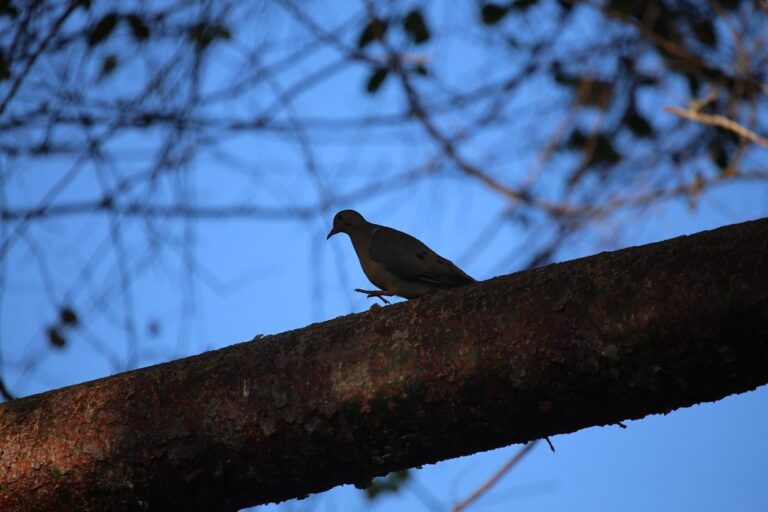

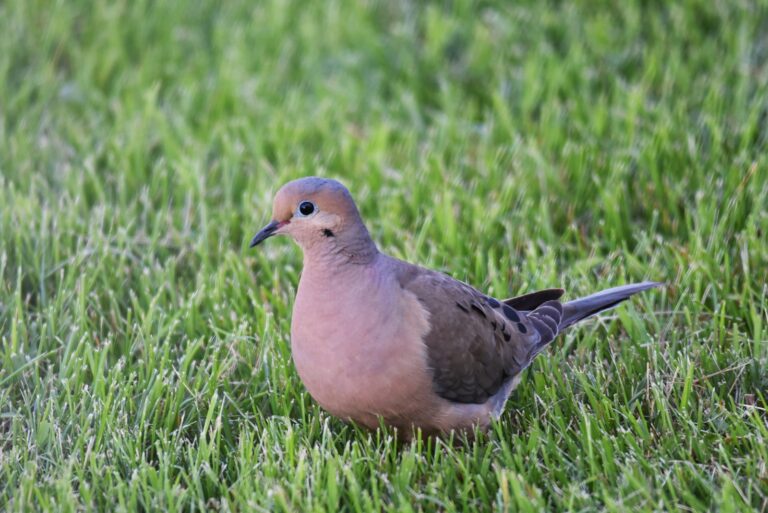
Public range and clubs on the road to West Branch Wildlife Area
Berlin Lake Wildlife Area Shooting Range is 10 miles from West Branch Wildlife Area and is the nearest public range on ODNR’s list. The other cards show clubs a 30-mile drive or less away.
From ODNR’s public range list and range pages, ranges’ own pages and directory listings, checked November 6, 2026.
Classes, hunts and dinners near West Branch Wildlife Area
Ahead: 1. Already held here: 0.
| When | Title | How far | Location | Register or details | Page |
|---|---|---|---|---|---|
| Nov 7, 2026 | ODNR Hunter Education Class (Ravenna) · hunter education class, Ravenna | 4 | Ravenna, Portage County | Register | Source |
West Branch Wildlife Area, answered one question at a time
Which parts of West Branch Wildlife Area allow hunting?
Not all of it: ODNR lists it as restricted, so use the hunting map.
When must I check game taken on West Branch Wildlife Area?
Deer and turkeys go through the electronic game check by noon the next day.
Do Sunday rules limit hunting at West Branch Wildlife Area?
Yes; Ohio sets no Sunday ban.
What licenses and permits cover a hunt on West Branch Wildlife Area?
Your Ohio license and the right permit. First-time buyers need hunter education or an apprentice license.
What size is West Branch Wildlife Area on the ODNR books?
Roughly 2,913 acres all told.
Deer bag limit for West Branch Wildlife Area?
Up to 3, by the county rule. The statewide limit is six, one antlered; public land adds a two-antlerless cap.
Does West Branch Wildlife Area have lottery hunts?
Not in 2026: hunt it during the open seasons without a draw.
Duck zone and split dates for West Branch Wildlife Area?
Zone B dates apply: Oct 17 to Oct 25, 2026; Nov 21, 2026 to Jan 10, 2027.
Overnight stays at West Branch Wildlife Area?
Camping is prohibited.
Can I hang a stand on West Branch Wildlife Area?
Stands must be portable; bait and feed are prohibited.
When is hunter orange required on West Branch Wildlife Area?
In gun and muzzleloader seasons: an orange garment, unless you hunt waterfowl.
When is legal shooting light for deer at West Branch Wildlife Area?
On the gun opener (November 30, 2026): 6:59 a.m. to 5:28 p.m.
What office handles West Branch Wildlife Area for ODNR?
Call 330-644-2293.
Sign-off notes for West Branch Wildlife Area hunters
Use this page to plan, then reread the official page for West Branch Wildlife Area the week before the trip.
Sources: source 1 · source 2 · source 3 · source 4; seasons from the 2026-27 Ohio Hunting and Trapping Regulations. Checked November 6, 2026.
Other photos on this page: cuatrok77 (CC BY-SA 2.0); Peter Wallack (CC BY-SA 3.0); U.S. Fish and Wildlife Service – Midwest Region (Public domain).