Home › West Virginia › Towns
West Virginia towns
West Virginia Hunting Towns
Towns first: distance to public ground, the county rule set, shooting hours and where to buy gear or have a deer cut.
Rapids on Hills Creek, West Virginia
Photo: Rick Wagner (CC BY 2.0)
Measured the same way
The list holds 55 county seats and 84 base towns, the Census places closest to the large public properties; 20 places are both, and 41 of the 119 are unincorporated.
Half the places have 2 properties or more within 10 miles, a median of 7,531 acres, and 8 have none in that circle.
Use the numbers to compare towns, not to plan a route: they are straight-line and unclipped.
Where most hunters live
Charleston, Huntington, Morgantown, Parkersburg, Wheeling and Martinsburg: the largest bases on the list.
Browse by county
A town that straddles a county line sits under the county of its Census point, and its page names every county it touches.
Barbour County
- Philippi2,845 people
Berkeley County
- Martinsburg19,047 people
Boone County
- GreenviewUnincorporated
- Madison2,719 people
Braxton County
- Burnsville377 people
- Flatwoods255 people
- Sutton821 people
Brooke County
- Hooverson HeightsUnincorporated
- Wellsburg2,280 people
Cabell County
- Huntington44,942 people
- Milton2,799 people
Calhoun County
- Grantsville463 people
Clay County
- Clay371 people
Doddridge County
- West Union643 people
Fayette County
- Ansted1,288 people
- CunardUnincorporated
- Fayetteville2,753 people
- Meadow Bridge311 people
- PrinceUnincorporated
- ScarbroUnincorporated
Gilmer County
- Glenville1,054 people
Grant County
- Petersburg2,277 people
Greenbrier County
- Falling Spring166 people
- Lewisburg3,765 people
- Ronceverte1,510 people
- Rupert834 people
- White Sulphur Springs2,154 people
Hampshire County
- Romney1,755 people
- SpringfieldUnincorporated
Hancock County
- Chester2,105 people
- New Cumberland974 people
Hardy County
- Moorefield2,679 people
- Wardensville260 people
Harrison County
- Clarksburg15,262 people
Jackson County
- Ripley3,067 people
Jefferson County
- Charles Town8,869 people
- ShannondaleUnincorporated
Kanawha County
- Charleston46,482 people
- Clendenin866 people
- Marmet1,423 people
- SissonvilleUnincorporated
Lewis County
- Weston3,758 people
Lincoln County
- Hamlin973 people
- HartsUnincorporated
Logan County
Marion County
- Fairmont18,063 people
- Mannington1,909 people
Marshall County
- Moundsville7,703 people
Mason County
- Apple GroveUnincorporated
- Point Pleasant3,886 people
McDowell County
- PagetonUnincorporated
- RaysalUnincorporated
- RoderfieldUnincorporated
- Welch3,413 people
Mercer County
- Princeton5,595 people
Mineral County
- Keyser4,802 people
Mingo County
- JusticeUnincorporated
- Red JacketUnincorporated
- Williamson2,779 people
Monongalia County
- BoothUnincorporated
- Cheat LakeUnincorporated
- Morgantown30,490 people
Monroe County
- Union417 people
Morgan County
- Berkeley Springs752 people
- Paw Paw410 people
Nicholas County
- BelvaUnincorporated
- Richwood1,607 people
- Summersville3,326 people
Ohio County
- Wheeling26,060 people
Pendleton County
- BrandywineUnincorporated
- Franklin540 people
Pleasants County
- Belmont822 people
- St. Marys1,749 people
Pocahontas County
- BartowUnincorporated
- CassUnincorporated
- FrankUnincorporated
- Hillsboro225 people
- HuntersvilleUnincorporated
- Marlinton954 people
Preston County
- Kingwood2,953 people
- Masontown507 people
Putnam County
- Bancroft372 people
- Winfield2,428 people
Raleigh County
- Beckley16,515 people
- GhentUnincorporated
Randolph County
- BowdenUnincorporated
- East DaileyUnincorporated
- Elkins6,698 people
- Mill Creek538 people
- PickensUnincorporated
- Valley HeadUnincorporated
- WhitmerUnincorporated
Ritchie County
- Harrisville1,547 people
Roane County
- Spencer1,936 people
Summers County
- Hinton2,159 people
Taylor County
- Flemington307 people
- Grafton4,575 people
Tucker County
- Davis578 people
- Parsons1,287 people
- St. GeorgeUnincorporated
Tyler County
- Middlebourne671 people
Upshur County
- Buckhannon5,049 people
- HinklevilleUnincorporated
Wayne County
- CrumUnincorporated
- LavaletteUnincorporated
- Wayne1,394 people
Webster County
- BergooUnincorporated
- Webster Springs679 people
Wetzel County
- JacksonburgUnincorporated
- LittletonUnincorporated
- New Martinsville5,038 people
Wirt County
- Elizabeth681 people
- NewarkUnincorporated
Wood County
- KanawhaUnincorporated
- Parkersburg28,834 people
Wyoming County
- Pineville654 people
Towns from the Census 2024 Gazetteer, populations from the Vintage 2024 estimates; towns that touch two counties are listed under the county of their Census point; checked November 18, 2026. All 55 counties.
The 25 largest towns
Large cities often have little public land inside 10 miles, which the last columns make plain.
| Town | County | People | Places, 10 mi | Acres, 10 mi |
|---|---|---|---|---|
| Charleston | Kanawha | 46,482 | 1 | 9,357 |
| Huntington | Cabell | 44,942 | 1 | 7,531 |
| Morgantown | Monongalia | 30,490 | 3 | 4,991 |
| Parkersburg | Wood | 28,834 | 1 | 3,194 |
| Wheeling | Ohio | 26,060 | 2 | 297 |
| Martinsburg | Berkeley | 19,047 | 0 | 0 |
| Fairmont | Marion | 18,063 | 1 | 1,083 |
| Beckley | Raleigh | 16,515 | 0 | 0 |
| Clarksburg | Harrison | 15,262 | 1 | 975 |
| Charles Town | Jefferson | 8,869 | 1 | 1,630 |
| Moundsville | Marshall | 7,703 | 1 | 55 |
| Elkins | Randolph | 6,698 | 1 | 123 |
| Princeton | Mercer | 5,595 | 0 | 0 |
| Buckhannon | Upshur | 5,049 | 1 | 3,000 |
| New Martinsville | Wetzel | 5,038 | 0 | 0 |
| Keyser | Mineral | 4,802 | 1 | 6,397 |
| Grafton | Taylor | 4,575 | 2 | 4,740 |
| Point Pleasant | Mason | 3,886 | 2 | 4,289 |
| Lewisburg | Greenbrier | 3,765 | 1 | 4,838 |
| Weston | Lewis | 3,758 | 2 | 21,289 |
| Welch | McDowell | 3,413 | 1 | 6,530 |
| Summersville | Nicholas | 3,326 | 1 | 5,982 |
| Ripley | Jackson | 3,067 | 5 | 8,831 |
| Kingwood | Preston | 2,953 | 3 | 4,362 |
| Philippi | Barbour | 2,845 | 2 | 3,113 |
2024 population from the Census Bureau; land rings from lands.json; checked November 18, 2026.
Towns on the map
Zoom in on a district to compare neighbours.
Towns richest in public ground
Valley Head leads with 936,007 listed acres inside 10 miles; the large national forest records in the West Virginia file push those totals up for the rest of the top twelve.
| Town | County | Acres, 10 mi | Places, 10 mi |
|---|---|---|---|
| Valley Head | Randolph | 936,007 | 4 |
| Bartow | Pocahontas | 926,794 | 4 |
| Frank | Pocahontas | 926,794 | 4 |
| Richwood | Nicholas | 319,124 | 2 |
| Parsons | Tucker | 259,833 | 3 |
| Huntersville | Pocahontas | 217,665 | 3 |
| Davis | Tucker | 214,158 | 4 |
| Marlinton | Pocahontas | 205,591 | 3 |
| Whitmer | Randolph | 189,975 | 2 |
| Cass | Pocahontas | 149,668 | 2 |
| Wardensville | Hardy | 134,117 | 5 |
| St. George | Tucker | 130,828 | 1 |

Lower Falls of Hills Creek, West VirginiaPhoto: Rick Wagner (CC BY 2.0)

Mallard drakes taking flightPhoto: USFWS Mountain Prairie (CC BY 2.0)
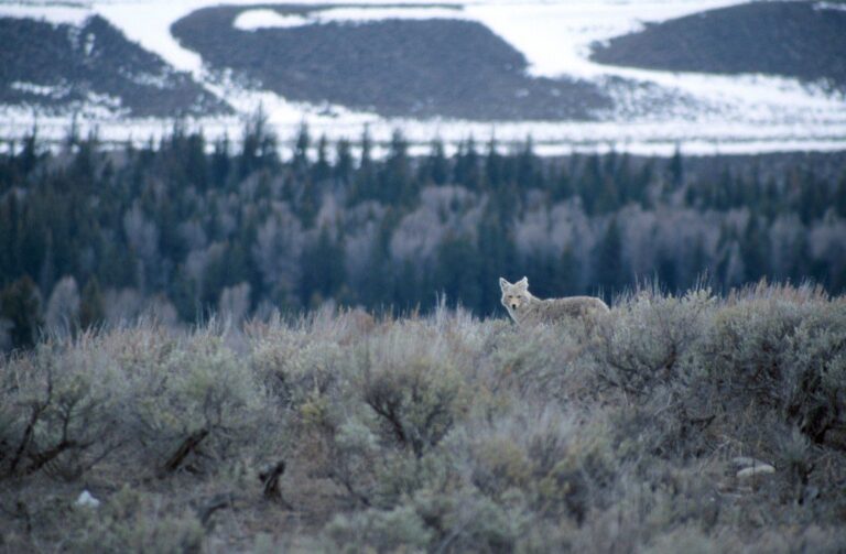
Coyote standing in the openPhoto: U.S. Geological Survey (CC0 1.0)
Town list questions
How does a place earn a spot on the town list?
Each of the 119 is a county seat (55) or a base town, the nearest Census place to a large public property (84); 20 are both.
Are the mileage figures road miles?
No. They are straight-line miles between the Census point of the town and the mapped point of each property, so a trip over mountain roads will run longer.
Can I treat the acreage totals as surveyed numbers?
Not really. A total adds the sizes printed on the records inside the circle with no clipping, which makes it a rough indicator and nothing more.
What rules do the town pages carry over from the county?
They carry the WVDNR district, firearms or archery-only deer status, antlerless tier, bear windows and dog rule, fall turkey group, wild boar, CWD Containment Area, Sunday and blaze orange rules, and the Eastern Time clock.
Do these pages assign a waterfowl zone to each town?
No, because West Virginia has one statewide set of waterfowl dates and prints no zone boundaries.
Do the pages say anything about Sunday hunting?
They repeat the 2026-27 summary: Sundays are open on private land with written permission and on federal, state forest and state wildlife land, and for waterfowl on private and public land.
How are places with no nearby public land handled?
8 places show no mapped property inside the 10-mile circle, so their pages lean on the 25-mile ring instead.
How do towns that touch two counties work?
2 places (Huntington and Wheeling) touch two counties, and each page carries one rules block per county.
Where do I find shooting ranges for a town?
Towns with enough ranges close by link to a near-town range page, and every other town links to the West Virginia ranges hub.
From places.json, lands.json, counties.json and services.json, with rules from the 2026-27 Hunting and Trapping Regulations Summary; checked November 18, 2026.