Home › Minnesota › Public land › Crow Wing River Corridor WMA
WMA · 2026-27
Crow Wing River Corridor Wildlife Management Area hunting guide and rules
Everything we could verify about this wildlife management area in Wadena County.
Photo: Tony Webster (CC BY-SA 2.0)
Getting to Crow Wing River Corridor Wildlife Management Area
Crow Wing River Corridor WMA: acres, owner and deer area
Crow Wing River Corridor WMA spreads over 750 acres of Wadena County. Of 16 wildlife management areas in Wadena County, Crow Wing River Corridor WMA is number 5 by acreage. Hunters on Crow Wing River Corridor WMA follow DPA 246, which DNR made either-sex for 2026.
The DNR Park Rapids area wildlife office manages it (parkrapids.wildlife@state.mn.us). The Crow Wing River Corridor WMA record names federal aid.
Game species: deer, black bear, small game, ruffed grouse and woodcock, waterfowl, wild turkey.
- White-tailed Deer
- Black Bear
- Eastern Cottontail
- Gray Squirrel
- Snowshoe Hare
- Ruffed Grouse
- American Woodcock
- Ducks
From the agency record (Minnesota Department of Natural Resources); checked October 28, 2026.
Nearby
Places to hunt and shoot around Crow Wing River Corridor Wildlife Management Area
Parking lots and routes for Crow Wing River Corridor WMA
DNR maps no parking point for Crow Wing River Corridor WMA; use the route text below.
| Subunit | Acres | Nearest town | Hunting | Parking | Page |
|---|---|---|---|---|---|
| Crow Wing River Corridor WMA | 750 | Nimrod | Open | – | DNR |
- Crow Wing River Corridor WMA: North unit: from Nimrod travel east 1.5 miles on CR 139 (280th Street). Parking area will be on the south side of the road. Middle unit: travel south out of Nimrod on CR 12 (280th Street). On the south side of Nimrod turn left onto CR 26. Travel south on CR 26 for 1 mile to CR 138 (270th Street). Turn left onto CR 138. In 2 miles CR 138 will turn south. Continue south on CR 138 for 1 mile. Parking area will be on the left side of the road. South unit (west side of river): travel south out of Nimrod on CR 12 (280th Street). On the south side of Nimrod turn left onto CR 26. Travel south on CR 26 for 5 miles. Turn left onto CR 137 (230th Street). Continue east for 3 miles, cross over Wilderness Drive onto the unit. Parking will be 0.3 miles east of CR 137 and Wilderness Drive intersection. South unit (east side of river): travel south out of Oylen on CR 7 for 1.3 miles. Turn right onto the unnamed minimum maintenance road across from 230th street. In 0.3 miles the minimum maintenance road will curve south, continue south on the road 0.25 miles to the unit. Hunter walking trails and former logging trails provide good access to visitors. Wheel chair access to the unit is moderate to difficult. Primitive river access points are located on the north unit. Visitors can easily access the river from parking areas in the northwest and southeast sides of the north unit. The northwest parking area is gated and would require a short walk/portage to the river.
DNR WMA detail pages (Compass feature records); checked October 28, 2026.
Map: Crow Wing River Corridor WMA and its neighbors
8 public areas lie within 45 miles of Crow Wing River Corridor WMA, adding 29,183 acres; Strike WMA is closest.
| Public land | Type | Acres | DPA | Distance | Direction |
|---|---|---|---|---|---|
| Strike WMA | WMA | 300 | 246 | 1.2 mi | west |
| Dry Sand WMA | WMA | 799 | 246 | 4.2 mi | southeast |
| Lyons State Forest | State forest | 6,349 | 246 | 4.3 mi | south |
| North Germany WMA | WMA | 278 | 246 | 4.8 mi | west |
| Farnham Lake WMA | WMA | 255 | 246 | 6.4 mi | southeast |
| Burgen Lake Prairie WMA | WMA | 2,322 | 246 | 8.7 mi | north |
| Sebeka WMA | WMA | 150 | 241 | 9.8 mi | west |
| Foot Hills State Forest | State forest | 18,729 | 246, 259 | 9.9 mi | northeast |
Points: DNR WMA detail page map point (Compass feature_detail). Straight-line distances. Statewide public land map.
Crow Wing River Corridor WMA: the use rules
These are the use rules the agency lists for Crow Wing River Corridor WMA; posted signs on site still govern.
| Rule | What applies |
|---|---|
| Hunting, trapping | Regular seasons |
| Vehicles | Designated roads, lots |
| Target shooting | Not allowed |
| Guns in transit | Cased, unloaded |
| Camping | Designated or permit |
| Portable stands, blinds | Remove daily |
| Overnight stands, northwest | Nov 1-Dec 31 |
| Dogs | Leash Apr 16-Jul 14 |
| Drones | Not allowed |
| Gear left overnight | Not allowed |
- There is currently no access to the east side of the middle unit, except by river. The east side of the south unit is accessible by minimum maintenance road; however, there is no designated parking area. Please pull to the side of the road to park.
Sources: record, agency rules; booklet: 2026-2027 Minnesota Hunting and Trapping Regulations. Checked October 28, 2026.
When you can hunt Crow Wing River Corridor WMA
Every dated hunting window for Crow Wing River Corridor WMA: 20 species, 44 rows.
| Game | Segment | Where | Starts | Ends | Status |
|---|---|---|---|---|---|
| Deer | Archery | DPA 246 | Sep 19, 2026 | Dec 31, 2026 | |
| Deer | Youth deer | DPA 246 | Oct 15, 2026 | Oct 18, 2026 | |
| Deer | Firearms, 200 series | DPA 246 | Nov 7, 2026 | Nov 15, 2026 | |
| Deer | Muzzleloader | Statewide | Nov 28, 2026 | Dec 13, 2026 | |
| Black bear | No-quota area | No Quota Area | Sep 1, 2026 | Oct 18, 2026 | |
| Black bear | Quota areas | Quota areas 45, 46 | Sep 1, 2026 | Oct 18, 2026 | |
| Wild turkey | Fall | Statewide | Oct 3, 2026 | Nov 1, 2026 | |
| Wild turkey | Spring archery-only | Statewide | Apr 14, 2027 | May 31, 2027 | |
| Wild turkey | Spring period A | Statewide | Apr 14, 2027 | Apr 20, 2027 | |
| Wild turkey | Spring youth | Statewide | Apr 14, 2027 | May 31, 2027 | |
| Wild turkey | Spring period B | Statewide | Apr 21, 2027 | Apr 27, 2027 | |
| Wild turkey | Spring period C | Statewide | Apr 28, 2027 | May 4, 2027 | |
| Wild turkey | Spring period D | Statewide | May 5, 2027 | May 11, 2027 | |
| Wild turkey | Spring period E | Statewide | May 12, 2027 | May 18, 2027 | |
| Wild turkey | Spring period F | Statewide | May 19, 2027 | May 31, 2027 | |
| Ruffed, spruce grouse | Regular | Statewide | Sep 19, 2026 | Jan 3, 2027 | |
| Hungarian partridge | Regular | Statewide | Sep 19, 2026 | Jan 3, 2027 | |
| Woodcock | Regular | Statewide | Sep 19, 2026 | Nov 2, 2026 | |
| Rabbits, hares | Regular | Statewide | Sep 19, 2026 | Feb 28, 2027 | |
| Jackrabbit | Regular | Statewide | Sep 19, 2026 | Feb 28, 2027 | |
| Squirrels | Regular | Statewide | Sep 19, 2026 | Feb 28, 2027 | |
| Crow | Crow segment | Statewide | Sep 1, 2026 | Oct 31, 2026 | |
| Canada goose | Early geese | Statewide | Sep 5, 2026 | Sep 20, 2026 | |
| Light geese | Early geese | Statewide | Sep 5, 2026 | Sep 20, 2026 | |
| Teal | Early teal season | Statewide | Sep 5, 2026 | Sep 9, 2026 | |
| Youth waterfowl | Youth days | Statewide | Sep 12, 2026 | Sep 13, 2026 | |
| Ducks | Regular ducks | North Zone | Sep 26, 2026 | Nov 24, 2026 | |
| Ducks | Regular ducks | Central Zone | Sep 26, 2026 | Oct 4, 2026 | |
| Geese | Regular geese | North Zone | Sep 26, 2026 | Dec 25, 2026 | |
| Geese | Regular geese | Central Zone | Sep 26, 2026 | Oct 4, 2026 | |
| Take-a-Kid | Take-a-Kid | Statewide | Sep 26, 2026 | Sep 27, 2026 | |
| Ducks | Regular ducks | Central Zone | Oct 10, 2026 | Nov 29, 2026 | |
| Geese | Regular geese | Central Zone | Oct 10, 2026 | Dec 30, 2026 | |
| Raccoon, foxes | Hunting (north) | North furbearer zone | Oct 17, 2026 | Mar 15, 2027 | |
| Badger, opossum, weasels | Hunting (north) | North furbearer zone | Oct 17, 2026 | Mar 15, 2027 | |
| Ducks | Regular ducks | South Zone | Oct 17, 2026 | Dec 6, 2026 | |
| Geese | Regular geese | South Zone | Oct 17, 2026 | Jan 6, 2027 | |
| Raccoon, foxes | Hunting (south) | South furbearer zone | Oct 24, 2026 | Mar 15, 2027 | |
| Badger, opossum, weasels | Hunting (south) | South furbearer zone | Oct 24, 2026 | Mar 15, 2027 | |
| Bobcat | Hunt and trap (north) | North furbearer zone | Dec 12, 2026 | Jan 17, 2027 | |
| Crow | Crow segment | Statewide | Dec 15, 2026 | Jan 15, 2027 | |
| Bobcat | Hunt and trap (south) | South furbearer zone | Jan 2, 2027 | Jan 17, 2027 | |
| Light geese | Spring light goose | Statewide | Feb 18, 2027 | Apr 30, 2027 | |
| Crow | Crow segment | Statewide | Mar 1, 2027 | Mar 31, 2027 |
Pheasant shooting starts at 9 a.m.; ducks, geese and small game stop at sunset.
From the 2026-2027 Minnesota Hunting and Trapping Regulations booklet (Minnesota Department of Natural Resources); checked October 28, 2026. All Minnesota seasons.
Crow Wing River Corridor WMA deer calendar and limits
DPA 246 (200 series) is either-sex in 2026. Either-sex rules let you take a doe in DPA 246 without a permit.
| Season | Begins | Through | Today |
|---|---|---|---|
| Archery | Sep 19, 2026 | Dec 31, 2026 | |
| Youth deer | Oct 15, 2026 | Oct 18, 2026 | |
| Firearms, 200 series | Nov 7, 2026 | Nov 15, 2026 | |
| Muzzleloader | Nov 28, 2026 | Dec 13, 2026 |
Testing for CWD is optional in DPA 246. Area of DPA 246: 802 sq mi. Counties in DPA 246: Cass, Wadena, Hubbard and Todd.
From the DNR 2026 deer season map and the 2026-2027 regulations booklet; checked October 28, 2026.
How many deer DPA 246 gives up around Crow Wing River Corridor WMA
DNR reports harvest by deer permit area, not by WMA or county; DPA 246 registered 3,143 deer in 2025, 20% up on 2024.
| Year | Adult bucks | Other deer | Total | Per sq mi |
|---|---|---|---|---|
| 2025 | 2,330 | 813 | 3,143 | 4.01 |
| 2024 | 2,044 | 580 | 2,624 | 3.35 |
| 2023 | 1,621 | 773 | 2,394 | 3.05 |
| 2022 | 1,523 | 1,399 | 2,922 | 3.73 |
| 2021 | 2,013 | 1,597 | 3,610 | 4.60 |
| 2020 | 1,825 | 1,706 | 3,531 | 4.50 |
| 2019 | 1,824 | 1,763 | 3,587 | 4.58 |
| 2018 | 1,936 | 1,996 | 3,932 | 4.68 |
| 2017 | 2,293 | 2,593 | 4,886 | 5.82 |
DNR 2025 deer harvest report; earlier years from the DNR yearly reports. Checked October 28, 2026.
Crow Wing River Corridor WMA: towns, DNR office and shops
Crow Wing River Corridor WMA is 3.9 mi from Nimrod, the nearest community. Staples is the bigger town nearby at 3,075 people. Directions on the DNR page begin at Nimrod. Park Rapids has the nearest DNR office to Crow Wing River Corridor WMA, 25 mi away.
| Nearest towns | County | Population | Miles | Heading |
|---|---|---|---|---|
| Nimrod | Wadena | 82 | 3.9 mi | northwest |
| Sebeka | Wadena | 753 | 12 mi | west |
| Staples | Wadena | 3,075 | 15 mi | south |
| Aldrich | Wadena | 34 | 16 mi | south |
| Verndale | Wadena | 512 | 16 mi | southwest |
Towns from the 2024 Census gazetteer and population estimates; offices and businesses from services.json (DNR and business listings, chain stores and license agents left out); straight-line miles. Checked October 28, 2026.
County rules that reach Crow Wing River Corridor WMA
Our Wadena County list runs to 18 public areas, including Crow Wing River Corridor WMA. Bear licenses here come from quota area 45 and 46 (45 (700 permits) and 46 (950 permits)). Turkey permit area here: 507. The county's nearest wildlife office is Park Rapids Area Wildlife Office in Park Rapids. Wadena County also has 2 closed places, Cat Creek Aquatic Management Area among them.
County acres from DNR and federal GIS layers (counties.json); zones from the 2026-2027 booklet; checked October 28, 2026.
Shooting lines in reach of Crow Wing River Corridor Wildlife Management Area
Ringneck Ridge Shooting Preserve sits 20 miles from Crow Wing River Corridor Wildlife Management Area, closer than any public range on file. Target shooting is off limits here.
From the operators’ pages and directory listings, checked October 28, 2026; target shooting rule from the DNR WMA rules.
Crow Wing River Corridor WMA country, seen through a lens
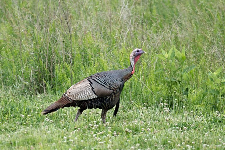
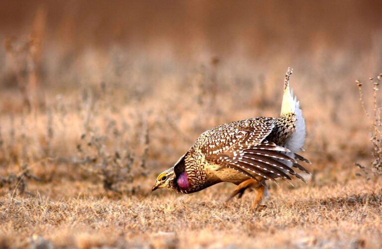
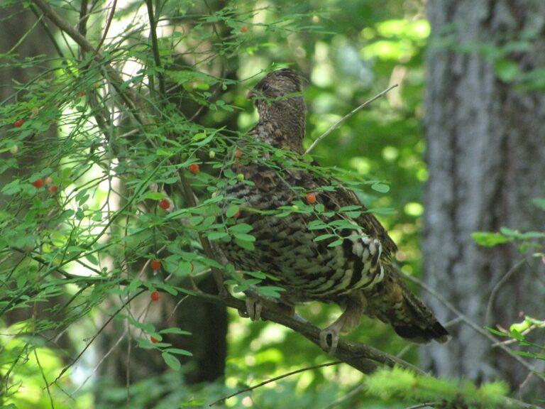
Crow Wing River Corridor WMA: sunrise, sunset and legal hours
These Crow Wing River Corridor WMA hours use the NOAA solar formula for the unit's coordinates.
| When | Event | Rise | Set | Opens | Deer, bear end | Birds end |
|---|---|---|---|---|---|---|
| Sep 19, 2026 | Archery and grouse opener | 7:01 a.m. | 7:26 p.m. | 6:31 a.m. | 7:56 p.m. | 7:26 p.m. |
| Sep 26, 2026 | Duck opener | 7:10 a.m. | 7:12 p.m. | 6:40 a.m. | 7:42 p.m. | 7:12 p.m. |
| Oct 10, 2026 | Pheasant opener | 7:28 a.m. | 6:44 p.m. | 6:58 a.m. | 7:14 p.m. | 6:44 p.m. |
| Nov 7, 2026 | Firearms deer opener | 7:09 a.m. | 4:58 p.m. | 6:39 a.m. | 5:28 p.m. | 4:58 p.m. |
| Nov 28, 2026 | Muzzleloader opener | 7:39 a.m. | 4:37 p.m. | 7:09 a.m. | 5:07 p.m. | 4:37 p.m. |
| Dec 31, 2026 | Archery close | 8:03 a.m. | 4:40 p.m. | 7:33 a.m. | 5:10 p.m. | 4:40 p.m. |
| Apr 14, 2027 | Spring turkey opener | 6:36 a.m. | 8:04 p.m. | 6:06 a.m. | 8:34 p.m. | 8:04 p.m. |
Clock times include Daylight Saving Time until Nov. 1.
Hours rule from the DNR booklet shooting hours page; sun times calculated for the unit point (NOAA method, Central Time); checked October 28, 2026. Legal hours for every county.
Crow Wing River Corridor WMA: what hunters usually ask
Crow Wing River Corridor WMA: which DPA sets the deer rules?
DPA 246, either-sex for 2026. The rifle and shotgun season goes Nov 7 to Nov 15, 2026.
What is there to hunt on Crow Wing River Corridor WMA?
On the Crow Wing River Corridor WMA record the game list reads deer, black bear, small game, ruffed grouse and woodcock, waterfowl and wild turkey.
Where do you park at Crow Wing River Corridor WMA?
North unit: from Nimrod travel east 1.5 miles on CR 139 (280th Street). Parking area will be on the south side of the road. Middle unit: travel south out of Nimrod on CR 12 (280th Street). On the south side of Nimrod turn left onto CR 26. Travel south on CR 26 for 1 mile to CR 138 (270th Street). Turn left onto CR 138. In 2 miles CR 138 will turn south. Continue south on CR 138 for 1 mile. Parking area will be on the left side of the road. South unit (west side of river): travel south out of Nimrod on CR 12 (280th Street). On the south side of Nimrod turn left onto CR 26. Travel south on CR 26 for 5 miles. Turn left onto CR 137 (230th Street). Continue east for 3 miles, cross over Wilderness Drive onto the unit. Parking will be 0.3 miles east of CR 137 and Wilderness Drive intersection. South unit (east side of river): travel south out of Oylen on CR 7 for 1.3 miles. Turn right onto the unnamed minimum maintenance road across from 230th street. In 0.3 miles the minimum maintenance road will curve south, continue south on the road 0.25 miles to the unit. No parking point is mapped.
Who should I contact about Crow Wing River Corridor WMA?
Crow Wing River Corridor WMA belongs to Minnesota Department of Natural Resources; the Park Rapids office looks after it.
Is Crow Wing River Corridor WMA inside a CWD zone?
Crow Wing River Corridor WMA sits in DPA 246, which is outside the CWD zones, with optional testing.
What time can you shoot deer at Crow Wing River Corridor WMA on Nov. 7?
Nov. 7: 6:39 a.m. to 5:28 p.m. for deer, sunrise 7:09 a.m..
What other public tracts sit near Crow Wing River Corridor WMA?
Crow Wing River Corridor WMA neighbors on our list: Strike WMA (1.2 mi), Dry Sand WMA (4.2 mi) and Lyons State Forest (4.3 mi).
Crow Wing River Corridor WMA: what are the stand and blind rules?
Take it down each evening. Crow Wing River Corridor WMA follows the WMA rule on daily removal of stands, blinds and other gear.
Are there campsites on Crow Wing River Corridor WMA?
WMA rules allow camping only in designated areas or with a permit.
Is Crow Wing River Corridor WMA public ground you can hunt?
Yes. A Minnesota license for the game you hunt is all you need on Crow Wing River Corridor WMA; WMA rules cover vehicles, stands and camping.
What size is the Crow Wing River Corridor WMA unit?
Agency maps put it at 750 acres.
Crow Wing River Corridor WMA trip checklist from this page
No paper tags in Minnesota: validate the electronic license where the animal falls, then register it on time.
Sources: source · source · source · source · source; regulations from the 2026-2027 Minnesota Hunting and Trapping Regulations. Checked October 28, 2026.
Other photos on this page: Russ (CC BY 2.0); USFWS Mountain Prairie (CC BY 2.0); GerryT (CC BY 2.0).