Home › Minnesota › Public land › Dry Sand WMA
Public hunting · WMA
Dry Sand Wildlife Management Area hunting, season by season
799 acres of public land open to hunters in Wadena County and 1 neighbor, with DPA 246 deer dates.
Photo: Tony Webster (CC BY-SA 2.0)
Getting to Dry Sand Wildlife Management Area
Dry Sand WMA in brief, from the agency file
799 acres of Wadena and Cass counties belong to Dry Sand WMA. Size rank in Wadena County: 4th of 16 wildlife management areas. For deer it falls in DPA 246, set at either-sex for 2026.
Questions go to the Brainerd DNR wildlife office at brainerd.wildlife@state.mn.us. Its DNR record carries the federal aid code OHF.
DNR notes on the habitat: WMA consists of Dry Sand Lake (206 acres) and related Turtle Shell impoundment (44 acres), surrounding area is primarily jack pine savannah. Public access on the S. side of Dry Sand Lake is carry-in type only.
Game listed: deer, black bear, small game, ruffed grouse and woodcock, waterfowl, wild turkey.
- White-tailed Deer
- Black Bear
- Eastern Cottontail
- Gray Squirrel
- Snowshoe Hare
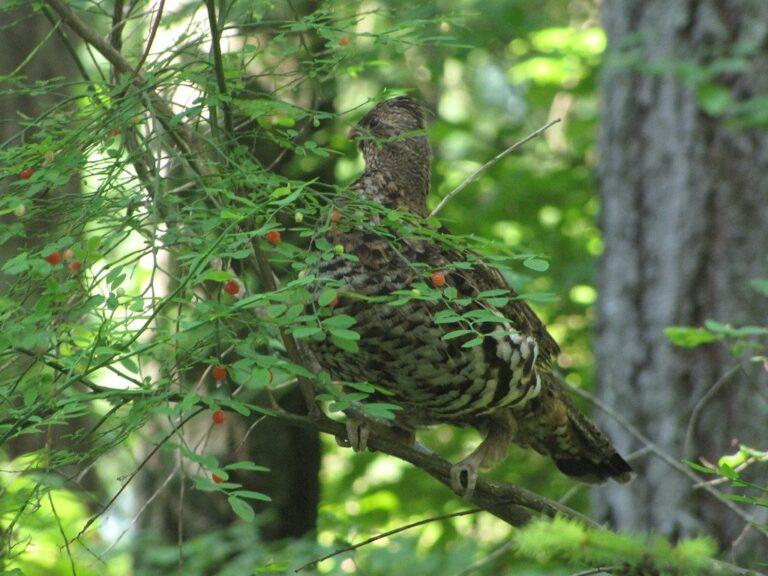
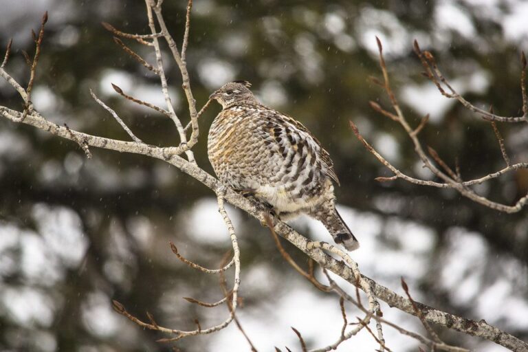
- Ruffed Grouse
- American Woodcock
- Ducks
From the agency record (Minnesota Department of Natural Resources); checked October 28, 2026.
Nearby
Places to hunt and shoot around Dry Sand Wildlife Management Area
Subunits and parking at Dry Sand WMA
Each subunit of Dry Sand WMA has its own DNR page; the map below pins 2 parking spots.
| Subunit | Acreage | Near | Open? | Parking | Page |
|---|---|---|---|---|---|
| Dry Sand WMA | 799 | Nimrod | Open | 2 | DNR |
- Dry Sand WMA: From the junction of CR's 227 & 26 on the south side of Nimrod, S. on Co. Rd. 26 4 miles, E. on Co. Rd. 9 4 miles, S. on Co. Rd. 30 2.8 miles, E. on gravel forest trail 1.25 miles to Dry Sand Lake access. None
DNR WMA detail pages (Compass feature records); checked October 28, 2026.
Dry Sand WMA pinned among nearby tracts
Farnham Lake WMA lies 2.4 mi south of Dry Sand WMA, the nearest of 8 public areas within 45 miles.
| Area | Type | Acres | DPA | Straight line | Which way |
|---|---|---|---|---|---|
| Farnham Lake WMA | WMA | 255 | 246 | 2.4 mi | south |
| Lyons State Forest | State forest | 6,349 | 246 | 3.5 mi | west |
| Crow Wing River Corridor WMA, 750 ac | WMA | 750 | 246 | 4.2 mi | northwest |
| Strike WMA | WMA | 300 | 246 | 5.1 mi | northwest |
| North Germany WMA | WMA | 278 | 246 | 7.8 mi | northwest |
| Foot Hills State Forest | State forest | 18,729 | 246, 259 | 11 mi | northeast |
| Meadow Brook WMA | WMA | 5,750 | 246 | 11 mi | east |
| Sebeka WMA | WMA | 150 | 241 | 12 mi | west |
Points: DNR WMA detail page map point (Compass feature_detail). Straight-line distances. Statewide public land map.
Rules for hunting Dry Sand WMA
Site rules for Dry Sand WMA, condensed from the record.
| Rule | Detail |
|---|---|
| Hunting, trapping | Regular seasons |
| Vehicles | Designated roads, lots |
| Target shooting | Not allowed |
| Guns in transit | Cased, unloaded |
| Camping | Designated or permit |
| Portable stands, blinds | Remove daily |
| Overnight stands, northwest | Nov 1-Dec 31 |
| Dogs | Leash Apr 16-Jul 14 |
| Drones | Not allowed |
| Gear left overnight | Not allowed |
Sources: record, agency rules; booklet: 2026-2027 Minnesota Hunting and Trapping Regulations. Checked October 28, 2026.
Dry Sand WMA season dates
This table covers Dry Sand WMA only: deer rows follow its DPA, the rest come from its game species list.
| Species | Type | Zone or DPA | Begins | Through | Today |
|---|---|---|---|---|---|
| Deer | Archery | DPA 246 | Sep 19, 2026 | Dec 31, 2026 | |
| Deer | Youth deer | DPA 246 | Oct 15, 2026 | Oct 18, 2026 | |
| Deer | Firearms, 200 series | DPA 246 | Nov 7, 2026 | Nov 15, 2026 | |
| Deer | Muzzleloader | Statewide | Nov 28, 2026 | Dec 13, 2026 | |
| Black bear | No-quota area | No Quota Area | Sep 1, 2026 | Oct 18, 2026 | |
| Black bear | Quota areas | Quota areas 45, 46 | Sep 1, 2026 | Oct 18, 2026 | |
| Wild turkey | Fall | Statewide | Oct 3, 2026 | Nov 1, 2026 | |
| Wild turkey | Spring archery-only | Statewide | Apr 14, 2027 | May 31, 2027 | |
| Wild turkey | Spring period A | Statewide | Apr 14, 2027 | Apr 20, 2027 | |
| Wild turkey | Spring youth | Statewide | Apr 14, 2027 | May 31, 2027 | |
| Wild turkey | Spring period B | Statewide | Apr 21, 2027 | Apr 27, 2027 | |
| Wild turkey | Spring period C | Statewide | Apr 28, 2027 | May 4, 2027 | |
| Wild turkey | Spring period D | Statewide | May 5, 2027 | May 11, 2027 | |
| Wild turkey | Spring period E | Statewide | May 12, 2027 | May 18, 2027 | |
| Wild turkey | Spring period F | Statewide | May 19, 2027 | May 31, 2027 | |
| Ruffed, spruce grouse | Regular | Statewide | Sep 19, 2026 | Jan 3, 2027 | |
| Hungarian partridge | Regular | Statewide | Sep 19, 2026 | Jan 3, 2027 | |
| Woodcock | Regular | Statewide | Sep 19, 2026 | Nov 2, 2026 | |
| Rabbits, hares | Regular | Statewide | Sep 19, 2026 | Feb 28, 2027 | |
| Jackrabbit | Regular | Statewide | Sep 19, 2026 | Feb 28, 2027 | |
| Squirrels | Regular | Statewide | Sep 19, 2026 | Feb 28, 2027 | |
| Crow | Crow segment | Statewide | Sep 1, 2026 | Oct 31, 2026 | |
| Canada goose | Early geese | Statewide | Sep 5, 2026 | Sep 20, 2026 | |
| Light geese | Early geese | Statewide | Sep 5, 2026 | Sep 20, 2026 | |
| Teal | Early teal season | Statewide | Sep 5, 2026 | Sep 9, 2026 | |
| Youth waterfowl | Youth days | Statewide | Sep 12, 2026 | Sep 13, 2026 | |
| Ducks | Regular ducks | North Zone | Sep 26, 2026 | Nov 24, 2026 | |
| Ducks | Regular ducks | Central Zone | Sep 26, 2026 | Oct 4, 2026 | |
| Geese | Regular geese | North Zone | Sep 26, 2026 | Dec 25, 2026 | |
| Geese | Regular geese | Central Zone | Sep 26, 2026 | Oct 4, 2026 | |
| Take-a-Kid | Take-a-Kid | Statewide | Sep 26, 2026 | Sep 27, 2026 | |
| Ducks | Regular ducks | Central Zone | Oct 10, 2026 | Nov 29, 2026 | |
| Geese | Regular geese | Central Zone | Oct 10, 2026 | Dec 30, 2026 | |
| Raccoon, foxes | Hunting (north) | North furbearer zone | Oct 17, 2026 | Mar 15, 2027 | |
| Badger, opossum, weasels | Hunting (north) | North furbearer zone | Oct 17, 2026 | Mar 15, 2027 | |
| Ducks | Regular ducks | South Zone | Oct 17, 2026 | Dec 6, 2026 | |
| Geese | Regular geese | South Zone | Oct 17, 2026 | Jan 6, 2027 | |
| Raccoon, foxes | Hunting (south) | South furbearer zone | Oct 24, 2026 | Mar 15, 2027 | |
| Badger, opossum, weasels | Hunting (south) | South furbearer zone | Oct 24, 2026 | Mar 15, 2027 | |
| Bobcat | Hunt and trap (north) | North furbearer zone | Dec 12, 2026 | Jan 17, 2027 | |
| Crow | Crow segment | Statewide | Dec 15, 2026 | Jan 15, 2027 | |
| Bobcat | Hunt and trap (south) | South furbearer zone | Jan 2, 2027 | Jan 17, 2027 | |
| Light geese | Spring light goose | Statewide | Feb 18, 2027 | Apr 30, 2027 | |
| Crow | Crow segment | Statewide | Mar 1, 2027 | Mar 31, 2027 |
Wear blaze orange or pink in the firearms deer season; waterfowl hunters on water are exempt under DNR rules.
From the 2026-2027 Minnesota Hunting and Trapping Regulations booklet (Minnesota Department of Natural Resources); checked October 28, 2026. All Minnesota seasons.
Deer seasons on Dry Sand WMA
200-series DPA 246 carries the either-sex designation this year. One deer of either sex per license in DPA 246.
| Season | Starts | Ends | Status |
|---|---|---|---|
| Archery | Sep 19, 2026 | Dec 31, 2026 | |
| Youth deer | Oct 15, 2026 | Oct 18, 2026 | |
| Firearms, 200 series | Nov 7, 2026 | Nov 15, 2026 | |
| Muzzleloader | Nov 28, 2026 | Dec 13, 2026 |
Optional CWD testing only in DPA 246. Size of DPA 246: 802 square miles. Cass, Wadena, Hubbard and Todd share DPA 246.
From the DNR 2026 deer season map and the 2026-2027 regulations booklet; checked October 28, 2026.
Deer harvest around Dry Sand WMA (DPA 246)
The whole of DPA 246 gave up 3,143 deer in 2025; the DNR publishes no figure for Dry Sand WMA itself.
| Year | Adult male | Rest | Harvest | Density |
|---|---|---|---|---|
| 2025 | 2,330 | 813 | 3,143 | 4.01 |
| 2024 | 2,044 | 580 | 2,624 | 3.35 |
| 2023 | 1,621 | 773 | 2,394 | 3.05 |
| 2022 | 1,523 | 1,399 | 2,922 | 3.73 |
| 2021 | 2,013 | 1,597 | 3,610 | 4.60 |
| 2020 | 1,825 | 1,706 | 3,531 | 4.50 |
| 2019 | 1,824 | 1,763 | 3,587 | 4.58 |
| 2018 | 1,936 | 1,996 | 3,932 | 4.68 |
| 2017 | 2,293 | 2,593 | 4,886 | 5.82 |
DNR 2025 deer harvest report; earlier years from the DNR yearly reports. Checked October 28, 2026.
Dry Sand WMA nearby towns
Nimrod is the closest town to Dry Sand WMA, about 8.1 mi away. The largest nearby is Staples (3,075 people). The DNR detail page starts its directions from Nimrod. For questions, the Park Rapids DNR office is 30 mi from Dry Sand WMA.
| Town | County | Pop. 2024 | Miles off | Bearing |
|---|---|---|---|---|
| Nimrod | Wadena | 82 | 8.1 mi | northwest |
| Staples | Wadena | 3,075 | 12 mi | south |
| Aldrich | Wadena | 34 | 14 mi | southwest |
| Verndale | Wadena | 512 | 15 mi | southwest |
| Motley | Morrison | 686 | 16 mi | southeast |
Towns from the 2024 Census gazetteer and population estimates; offices and businesses from services.json (DNR and business listings, chain stores and license agents left out); straight-line miles. Checked October 28, 2026.
Dry Sand WMA: Wadena County facts
Counting Dry Sand WMA, Wadena County has 18 listed public areas. For bear, Wadena County lies partly in quota area 45 and 46; 2026 permits: 45 (700 permits) and 46 (950 permits). Wadena County turkey hunters declare area 507. County questions go to Park Rapids Area Wildlife Office, Park Rapids. 2 places in Wadena County are closed to hunting, such as Cat Creek Aquatic Management Area.
County acres from DNR and federal GIS layers (counties.json); zones from the 2026-2027 booklet; checked October 28, 2026.
Range time on the drive to Dry Sand Wildlife Management Area
Three ranges near Dry Sand Wildlife Management Area follow, starting with Ringneck Ridge Shooting Preserve at 15 miles. No target practice on the property, per its rules.
From the operators’ pages and directory listings, checked October 28, 2026; target shooting rule from the DNR WMA rules.
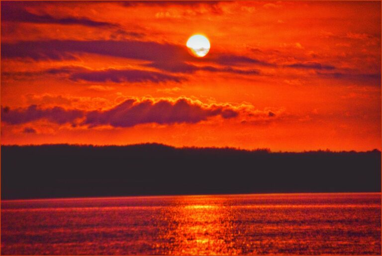
A look at the landscape around Dry Sand WMA
Dry Sand WMA shooting hours on key dates
Times are worked out for the Dry Sand WMA map point on Central Time; big game ends half an hour after sunset, birds at sunset.
| Date | Moment | Sunrise | Sunset | Open | Big game close | Birds close |
|---|---|---|---|---|---|---|
| Sep 19, 2026 | Archery and grouse opener | 7:01 a.m. | 7:25 p.m. | 6:31 a.m. | 7:55 p.m. | 7:25 p.m. |
| Sep 26, 2026 | Duck opener | 7:09 a.m. | 7:11 p.m. | 6:39 a.m. | 7:41 p.m. | 7:11 p.m. |
| Oct 10, 2026 | Pheasant opener | 7:28 a.m. | 6:44 p.m. | 6:58 a.m. | 7:14 p.m. | 6:44 p.m. |
| Nov 7, 2026 | Firearms deer opener | 7:08 a.m. | 4:57 p.m. | 6:38 a.m. | 5:27 p.m. | 4:57 p.m. |
| Nov 28, 2026 | Muzzleloader opener | 7:38 a.m. | 4:36 p.m. | 7:08 a.m. | 5:06 p.m. | 4:36 p.m. |
| Dec 31, 2026 | Archery close | 8:03 a.m. | 4:40 p.m. | 7:33 a.m. | 5:10 p.m. | 4:40 p.m. |
| Apr 14, 2027 | Spring turkey opener | 6:36 a.m. | 8:04 p.m. | 6:06 a.m. | 8:34 p.m. | 8:04 p.m. |
Times are rounded to the minute.
Hours rule from the DNR booklet shooting hours page; sun times calculated for the unit point (NOAA method, Central Time); checked October 28, 2026. Legal hours for every county.
Straight answers on hunting Dry Sand WMA
Can you hunt on Dry Sand WMA this season?
Yes. Hunting and trapping are open on state WMAs during regular seasons unless DNR posts an exception, and Dry Sand WMA shows open hunting status.
Can I camp on Dry Sand WMA during the season?
Generally no: designated areas or a permit only.
Which deer permit area holds Dry Sand WMA?
Dry Sand WMA falls in DPA 246, either-sex. Expect the firearms season from Nov 7 to Nov 15, 2026.
Roughly how large is the Dry Sand WMA unit?
The mapped size is 799 acres.
Where is the access for Dry Sand WMA?
From the junction of CR's 227 & 26 on the south side of Nimrod, S. on Co. Rd. 26 4 miles, E. on Co. Rd. 9 4 miles, S. on Co. Rd. 30 2.8 miles, E. on gravel forest trail 1.25 miles to Dry Sand Lake access. The map above shows 2 parking pins.
Which species does Dry Sand WMA hold?
Game on the agency list for Dry Sand WMA: deer, black bear, small game, ruffed grouse and woodcock, waterfowl and wild turkey.
Is CWD sampling required at Dry Sand WMA?
DNR lists DPA 246 as outside the CWD zones, with optional testing.
Who do I call about Dry Sand WMA?
Dry Sand WMA falls under Minnesota Department of Natural Resources (Brainerd office).
Which public ground lies closest to Dry Sand WMA?
Next-closest public land: Farnham Lake WMA (2.4 mi), Lyons State Forest (3.5 mi) and Crow Wing River Corridor WMA (4.2 mi).
How early does shooting start at Dry Sand WMA on the opener?
Opening day of the firearms season: shooting from 6:38 a.m., done by 5:27 p.m..
Can I leave a stand on Dry Sand WMA overnight?
Daily removal applies on Dry Sand WMA, so plan on a climber or a hang-on you carry out.
Dry Sand WMA: three things to confirm first
Carry your license, validate a deer or turkey at the kill site and register it (48 hours for deer and bear, 24 for turkey).
Sources: source · source · source · source · source; regulations from the 2026-2027 Minnesota Hunting and Trapping Regulations. Checked October 28, 2026.
Other photos on this page: Ron Cogswell (CC BY 2.0); GerryT (CC BY 2.0); GlacierNPS (Public domain).