Home › Minnesota › Public land › Morph Meadows WMA
Minnesota WMA
Morph Meadows Wildlife Management Area: seasons, rules and access
4,894 acres of wildlife management area ground in Beltrami County and 1 neighbor, deer permit area 169.
Photo: Tony Webster (CC BY 2.0)
Getting to Morph Meadows Wildlife Management Area
Parking, trailheads and gates near Morph Meadows Wildlife Management Area
- Parking areaParking · 1.3 mi from the centreDirections
- Parking areaParking · 1.4 mi from the centreDirections
- Parking areaParking · 1.5 mi from the centreDirections
- Parking areaParking · 1.6 mi from the centreDirections
- Parking areaParking · 1.8 mi from the centreDirections
- Parking areaParking · 2.0 mi from the centreDirections
Parking, trailhead and gate locations come from OpenStreetMap contributors. Roads into public land can be gated or seasonal; check with the managing agency before you go.
Morph Meadows WMA on paper: the record in brief
Morph Meadows WMA covers 4,894 acres in Beltrami and Itasca counties. Among Beltrami County’s 22 wildlife management areas, it sits 6th for acres. The 2026 deer designation for DPA 169 (it also reaches DPA 197) is antlerless permit lottery.
Management sits with the Grand Rapids area wildlife staff, reachable at grandrapids.wildlife@state.mn.us.
DNR describes the unit this way: There are over 15 miles of hunter walking trails that extend off the WMA onto other public forest lands that are also open to hunting. Camping is allowed in the parking lot in the SE portion of the WMA. Opportunities exist for trapping; particularly beaver (need permit from manager). Good opportunities for viewing wildlife along 2 miles of dikes. The WMA is open to hunting and trapping, Dike/levee constructed in 1964 created a 100 acre pool to enhance waterfowl production and migratory habitat. Levee upgraded in 2002, with financial assistance from the MN Waterfowl Association.
Hunted here: deer, black bear, small game, ruffed grouse and woodcock, waterfowl.
- White-tailed Deer
- Black Bear
- Eastern Cottontail
- Gray Squirrel
- Snowshoe Hare
- Ruffed Grouse
- American Woodcock
- Ducks
From the agency record (Minnesota Department of Natural Resources); checked October 28, 2026.
Nearby
Places to hunt and shoot around Morph Meadows Wildlife Management Area
Getting into Morph Meadows WMA
Directions and parking for Morph Meadows WMA as the DNR detail pages give them (6 parking points mapped).
| Piece | Acres | Town | Status | Lots | Detail |
|---|---|---|---|---|---|
| Morph Meadows WMA | 4,894 | Pennington | Open | 6 | DNR |
- Morph Meadows WMA: From intersection of CSAH 39 and Birchmont Beach Road, go 2.7 miles east on Birchmont Beach Road, then 6.2 miles south and east on USFS Road 2204, then 2.8 miles north on USFS Road 2671 (Third River Road) to entrance of WMA. Go 1.7 miles W to parking lot
DNR WMA detail pages (Compass feature records); checked October 28, 2026.
Use rules to read before hunting Morph Meadows WMA
Morph Meadows WMA follows the rules below on top of the statewide booklet.
| Topic | Rule |
|---|---|
| Hunting, trapping | Regular seasons |
| Vehicles | Designated roads, lots |
| Target shooting | Not allowed |
| Guns in transit | Cased, unloaded |
| Camping | Designated or permit |
| Portable stands, blinds | Remove daily |
| Overnight stands, northwest | Nov 1-Dec 31 |
| Dogs | Leash Apr 16-Jul 14 |
| Drones | Not allowed |
| Gear left overnight | Not allowed |
- The use of outboard motors, including electric trolling motors or motorized water vehicles, including amphibious vehicles is prohibited on this WMA.
Sources: record, agency rules; booklet: 2026-2027 Minnesota Hunting and Trapping Regulations. Checked October 28, 2026.
What DNR has posted about Morph Meadows WMA
- MORPH LAKE MAY BE AT LOW WATER LEVELS THIS WATERFOWL SEASON: Please note that a cleanout of the water control structure for Morph Lake occurred last winter. This required drawing down Morph Lake to remove over a decade of built-up sediment and debris that was severely limiting the ability to manage water levels. The cleanout was successful, but it will take time for the lake to refill. Depending on drought conditions this summer, hunters can expect low water levels in the lake this fall for …
DNR WMA visitor alerts on the unit page; checked October 28, 2026. CWD rules.
Morph Meadows WMA deer rules: DPA 169
DPA 169 is a 100-series area set to antlerless permit lottery for 2026, with 25 antlerless lottery permits. DPA 169 rations does: firearm hunters need an antlerless permit from the Sept. 10 lottery.
| Deer season | Opening | Closing | Right now |
|---|---|---|---|
| Archery | Sep 19, 2026 | Dec 31, 2026 | |
| Youth deer | Oct 15, 2026 | Oct 18, 2026 | |
| Firearms, 100 series | Nov 7, 2026 | Nov 22, 2026 | |
| Muzzleloader | Nov 28, 2026 | Dec 13, 2026 |
DPA 169 has optional CWD testing. At 996 square miles, DPA 169 is the unit deer rules follow. DPA 169 overlaps Itasca, Beltrami and Koochiching.
Also inside: DPA 197 (antlerless permit lottery)
From the DNR 2026 deer season map and the 2026-2027 regulations booklet; checked October 28, 2026.
Morph Meadows WMA dates, species by species
Season rows matched to Morph Meadows WMA by its game species list; trapping-only seasons are on the species pages.
| Species | Hunt | Zone | First day | Last day | Now |
|---|---|---|---|---|---|
| Deer | Archery | DPAs 169, 197 | Sep 19, 2026 | Dec 31, 2026 | |
| Deer | Youth deer | DPAs 169, 197 | Oct 15, 2026 | Oct 18, 2026 | |
| Deer | Firearms, 100 series | DPAs 169, 197 | Nov 7, 2026 | Nov 22, 2026 | |
| Deer | Muzzleloader | Statewide | Nov 28, 2026 | Dec 13, 2026 | |
| Black bear | Quota areas | Quota areas 12, 13, 27, 28, 41, 46 | Sep 1, 2026 | Oct 18, 2026 | |
| Ruffed, spruce grouse | Regular | Statewide | Sep 19, 2026 | Jan 3, 2027 | |
| Hungarian partridge | Regular | Statewide | Sep 19, 2026 | Jan 3, 2027 | |
| Woodcock | Regular | Statewide | Sep 19, 2026 | Nov 2, 2026 | |
| Rabbits, hares | Regular | Statewide | Sep 19, 2026 | Feb 28, 2027 | |
| Jackrabbit | Regular | Statewide | Sep 19, 2026 | Feb 28, 2027 | |
| Squirrels | Regular | Statewide | Sep 19, 2026 | Feb 28, 2027 | |
| Crow | Crow segment | Statewide | Sep 1, 2026 | Oct 31, 2026 | |
| Canada goose | Early geese | Statewide | Sep 5, 2026 | Sep 20, 2026 | |
| Light geese | Early geese | Statewide | Sep 5, 2026 | Sep 20, 2026 | |
| Teal | Early teal season | Statewide | Sep 5, 2026 | Sep 9, 2026 | |
| Youth waterfowl | Youth days | Statewide | Sep 12, 2026 | Sep 13, 2026 | |
| Ducks | Regular ducks | North Zone | Sep 26, 2026 | Nov 24, 2026 | |
| Ducks | Regular ducks | Central Zone | Sep 26, 2026 | Oct 4, 2026 | |
| Geese | Regular geese | North Zone | Sep 26, 2026 | Dec 25, 2026 | |
| Geese | Regular geese | Central Zone | Sep 26, 2026 | Oct 4, 2026 | |
| Take-a-Kid | Take-a-Kid | Statewide | Sep 26, 2026 | Sep 27, 2026 | |
| Ducks | Regular ducks | Central Zone | Oct 10, 2026 | Nov 29, 2026 | |
| Geese | Regular geese | Central Zone | Oct 10, 2026 | Dec 30, 2026 | |
| Raccoon, foxes | Hunting (north) | North furbearer zone | Oct 17, 2026 | Mar 15, 2027 | |
| Badger, opossum, weasels | Hunting (north) | North furbearer zone | Oct 17, 2026 | Mar 15, 2027 | |
| Ducks | Regular ducks | South Zone | Oct 17, 2026 | Dec 6, 2026 | |
| Geese | Regular geese | South Zone | Oct 17, 2026 | Jan 6, 2027 | |
| Raccoon, foxes | Hunting (south) | South furbearer zone | Oct 24, 2026 | Mar 15, 2027 | |
| Badger, opossum, weasels | Hunting (south) | South furbearer zone | Oct 24, 2026 | Mar 15, 2027 | |
| Bobcat | Hunt and trap (north) | North furbearer zone | Dec 12, 2026 | Jan 17, 2027 | |
| Crow | Crow segment | Statewide | Dec 15, 2026 | Jan 15, 2027 | |
| Bobcat | Hunt and trap (south) | South furbearer zone | Jan 2, 2027 | Jan 17, 2027 | |
| Light geese | Spring light goose | Statewide | Feb 18, 2027 | Apr 30, 2027 | |
| Crow | Crow segment | Statewide | Mar 1, 2027 | Mar 31, 2027 |
Zone rows for ducks and furbearers depend on map lines, not on this unit; DNR draws them along highways.
From the 2026-2027 Minnesota Hunting and Trapping Regulations booklet (Minnesota Department of Natural Resources); checked October 28, 2026. All Minnesota seasons.
Harvest trend near Morph Meadows WMA
In 2025 hunters registered 927 deer across DPA 169 (0.99 per square mile); the table runs back to 2017.
| Season | Adult males | Antlerless and fawns | DPA total | Deer per sq mi |
|---|---|---|---|---|
| 2025 | 907 | 20 | 927 | 0.99 |
| 2024 | 765 | 29 | 794 | 0.84 |
| 2023 | 653 | 129 | 782 | 0.83 |
| 2022 | 702 | 217 | 919 | 0.98 |
| 2021 | 934 | 239 | 1,173 | 1.25 |
| 2020 | 1,066 | 414 | 1,480 | 1.32 |
| 2019 | 1,335 | 416 | 1,751 | 1.56 |
| 2018 | 1,531 | 537 | 2,068 | 1.84 |
| 2017 | 1,589 | 984 | 2,573 | 2.29 |
DNR 2025 deer harvest report; earlier years from the DNR yearly reports. Checked October 28, 2026.
Morph Meadows WMA and the public ground around it
Straight-line distances run from the Morph Meadows WMA map point; Blackduck State Forest (1.6 mi, north) leads the list.
| Nearby | Kind | Acres | DPA | Miles | Heading |
|---|---|---|---|---|---|
| Blackduck State Forest | State forest | 41,314 | 110, 169 | 1.6 mi | north |
| Blackduck Ranger District (Chippewa NF) | Ranger district | 187,217 | 110, 169 | 2.7 mi | northeast |
| Third River RGMA | RGMA | 1,086 | 169, 197 | 4.0 mi | east |
| Dixon Lake AMA | AMA | 86 | 169 | 4.8 mi | northeast |
| Sugar Lake WMA | WMA | 382 | 197 | 7.8 mi | south |
| Sandstrom RGMA | RGMA | 758 | 169 | 13 mi | northeast |
| Carter Lake AMA | AMA | 4.0 | 684 | 14 mi | west |
| Nature's Lake WMA | WMA | 40 | 197 | 14 mi | northeast |
Points: DNR WMA detail page map point (Compass feature_detail). Straight-line distances. Statewide public land map.
Beltrami County around Morph Meadows WMA
In Beltrami County there are 47 records like Morph Meadows WMA to choose from. The feeding and attractant ban covers Beltrami County. Bear: quota area 12, 41 and 27 reaches the county, 12 (100 permits), 41 (250 permits) and 27 (450 permits) for 2026. Turkey permit area 509 and 508 covers the county. Elk zone 10 reaches Beltrami County (lottery licenses only). Red Lake WMA Area Wildlife Office (Roosevelt) is the closest area wildlife office to the county centre. Watch for closed ground in Beltrami County such as Bemidji Lake Aquatic Management Area.
County acres from DNR and federal GIS layers (counties.json); zones from the 2026-2027 booklet; checked October 28, 2026.
Gas, food and processors near Morph Meadows WMA
Closest town: Squaw Lake, 11 mi in a straight line from Morph Meadows WMA. Most services: Blackduck, population 816. The unit page lists Pennington as nearest town. The nearest DNR office is Region 1 (Northwest) Headquarters in Bemidji, 22 mi away.
| Town | County | 2024 population | Away | Which way |
|---|---|---|---|---|
| Squaw Lake | Itasca | 102 | 11 mi | east |
| Blackduck | Beltrami | 816 | 14 mi | northwest |
| Funkley | Beltrami | 12 | 16 mi | north |
| Tenstrike | Beltrami | 180 | 16 mi | northwest |
| Cass Lake | Cass | 683 | 17 mi | southwest |
Towns from the 2024 Census gazetteer and population estimates; offices and businesses from services.json (DNR and business listings, chain stores and license agents left out); straight-line miles. Checked October 28, 2026.
Before Morph Meadows Wildlife Management Area: where to check a zero
Hunters on Morph Meadows Wildlife Management Area can sight in at Northern Mississippi Range Association (17 miles), the nearest listing. Target shooting is not allowed on the property itself.
From the operators’ pages and directory listings, checked October 28, 2026; target shooting rule from the DNR WMA rules.
Legal hunting hours worked out for Morph Meadows WMA
Shooting starts 30 minutes before sunrise at Morph Meadows WMA; the two closing columns split big game from birds.
| Date | Season | Sunrise | Sunset | First shot | Last, big game | Last, birds |
|---|---|---|---|---|---|---|
| Sep 19, 2026 | Archery and grouse opener | 6:58 a.m. | 7:24 p.m. | 6:28 a.m. | 7:54 p.m. | 7:24 p.m. |
| Sep 26, 2026 | Duck opener | 7:08 a.m. | 7:10 p.m. | 6:38 a.m. | 7:40 p.m. | 7:10 p.m. |
| Oct 10, 2026 | Pheasant opener | 7:27 a.m. | 6:41 p.m. | 6:57 a.m. | 7:11 p.m. | 6:41 p.m. |
| Nov 7, 2026 | Firearms deer opener | 7:09 a.m. | 4:53 p.m. | 6:39 a.m. | 5:23 p.m. | 4:53 p.m. |
| Nov 28, 2026 | Muzzleloader opener | 7:40 a.m. | 4:31 p.m. | 7:10 a.m. | 5:01 p.m. | 4:31 p.m. |
| Dec 31, 2026 | Archery close | 8:05 a.m. | 4:35 p.m. | 7:35 a.m. | 5:05 p.m. | 4:35 p.m. |
| Apr 14, 2027 | Spring turkey opener | 6:32 a.m. | 8:04 p.m. | 6:02 a.m. | 8:34 p.m. | 8:04 p.m. |
Early teal runs sunrise to sunset.
Hours rule from the DNR booklet shooting hours page; sun times calculated for the unit point (NOAA method, Central Time); checked October 28, 2026. Legal hours for every county.
Pictures that suit a day on Morph Meadows WMA
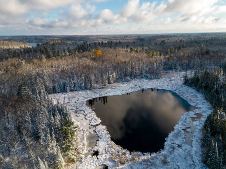
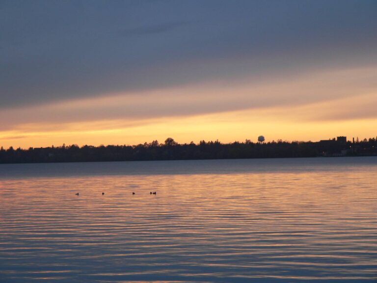
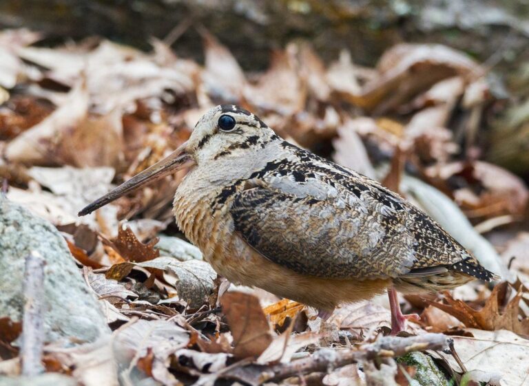
Quick answers before you hunt Morph Meadows WMA
Where can I hunt public land close to Morph Meadows WMA?
The nearest public units are Blackduck State Forest (1.6 mi), Blackduck Ranger District (Chippewa NF) (2.7 mi) and Third River RGMA (4.0 mi).
When is legal light on Morph Meadows WMA for the opener?
For the opener, 6:39 a.m. to 5:23 p.m.; birds stop at 4:53 p.m..
Is camping at Morph Meadows WMA allowed under WMA rules?
Camping is limited to designated areas or a DNR permit.
Can decoys or gear stay on Morph Meadows WMA overnight?
Stands are portable-only and leave with you; the one exception is the northwest overnight window from Nov. 1 to Dec. 31.
Morph Meadows WMA size: how much huntable ground?
Morph Meadows WMA covers 4,894 acres.
May the public hunt Morph Meadows WMA?
Yes. The DNR WMA rules allow hunting and trapping in season on Morph Meadows WMA.
What can you hunt on Morph Meadows WMA?
Expect deer, black bear, small game, ruffed grouse and woodcock and waterfowl on Morph Meadows WMA, per the record.
What are the 2026 deer rules on Morph Meadows WMA?
It is in deer permit area 169 (antlerless permit lottery). Guns: Nov 7 to Nov 22, 2026.
Which office should I call about Morph Meadows WMA?
Morph Meadows WMA is managed by Minnesota Department of Natural Resources, from its Grand Rapids office.
What route leads to Morph Meadows WMA?
From intersection of CSAH 39 and Birchmont Beach Road, go 2.7 miles east on Birchmont Beach Road, then 6.2 miles south and east on USFS Road 2204, then 2.8 miles north on USFS Road 2671 (Third River Road) to entrance of WMA. Go 1.7 miles W to parking lot Parking points on file: 6.
Do deer from Morph Meadows WMA need CWD testing?
Its DPA (169) is outside the CWD zones, with optional testing.
Morph Meadows WMA: what to double-check first
Seasons, closures and notices on Morph Meadows WMA can change mid-season; posted signs and the agency page have the final word.
Sources: source · source · source · source · source; regulations from the 2026-2027 Minnesota Hunting and Trapping Regulations. Checked October 28, 2026.
Other photos on this page: Lorie Shaull (CC BY 2.0); jjsmustang1979 (CC BY 2.0); ShenandoahNPS (Public domain).