Home › Minnesota › Public land › Huntersville State Forest
Minnesota state forest
Huntersville State Forest: seasons, rules and access
14,994 acres of state forest ground in Wadena County and 1 neighbor, deer permit area 241.
Photo: Tony Webster (CC BY-SA 2.0)
Getting to Huntersville State Forest
Parking, trailheads and gates near Huntersville State Forest
- Parking areaParking · 3.2 mi from the centreDirections
- Parking areaParking · 3.5 mi from the centreDirections
- Parking areaParking · 4.0 mi from the centreDirections
- Parking areaParking · 4.2 mi from the centreDirections
- Parking areaParking · 4.3 mi from the centreDirections
- Boat rampBoat ramp · 4.3 mi from the centreDirections
- Parking areaParking · 4.3 mi from the centreDirections
- Parking areaParking · 4.7 mi from the centreDirections
- Parking areaParking · 4.9 mi from the centreDirections
- Parking areaParking · 5.0 mi from the centreDirections
- Parking areaParking · 5.6 mi from the centreDirections
Parking, trailhead and gate locations come from OpenStreetMap contributors. Roads into public land can be gated or seasonal; check with the managing agency before you go.
Huntersville State Forest on paper: the record in brief
Huntersville State Forest covers 14,994 acres in Wadena and Hubbard counties. Among Wadena County’s 2 state forests, it sits 1st for acres. The 2026 deer designation for DPA 241 (it also reaches DPA 246) is 3-deer limit.
Minnesota Department of Natural Resources runs this land. Its statutory boundary holds 33,964 acres, of which DNR administers the mapped 14,994. DNR gives 1963 as its founding year.
From the agency record (Minnesota Department of Natural Resources); checked October 28, 2026.
Nearby
Places to hunt and shoot around Huntersville State Forest
Use rules to read before hunting Huntersville State Forest
Huntersville State Forest follows the rules below on top of the statewide booklet.
| Topic | Rule |
|---|---|
| Hunting, trapping | Open in season |
| Game refuges inside | Closed unless listed |
| Near campgrounds, lots | Cased within 200 ft |
| Stands | Portable preferred |
| Shooting lanes | No cutting |
| Private inholdings | Permission needed |
| Target shooting | Unless posted closed |
| Forest roads | OHVs unless posted |
Sources: record; booklet: 2026-2027 Minnesota Hunting and Trapping Regulations. Checked October 28, 2026.
Huntersville State Forest deer rules: DPA 241
DPA 241 is a 200-series area set to 3-deer limit for 2026. The 3-deer limit in DPA 241 is reached with bonus permits on top of the regular license.
| Deer season | Opening | Closing | Right now |
|---|---|---|---|
| Archery | Sep 19, 2026 | Dec 31, 2026 | |
| Youth deer | Oct 15, 2026 | Oct 18, 2026 | |
| Firearms, 200 series | Nov 7, 2026 | Nov 15, 2026 | |
| Muzzleloader | Nov 28, 2026 | Dec 13, 2026 |
DPA 241 has optional CWD testing. At 1,047 square miles, DPA 241 is the unit deer rules follow. DPA 241 overlaps Otter Tail, Wadena, Becker, Hubbard and Todd.
Also inside: DPA 246 (either-sex)
From the DNR 2026 deer season map and the 2026-2027 regulations booklet; checked October 28, 2026.
Huntersville State Forest dates, species by species
Season rows matched to Huntersville State Forest by the open seasons for its county; trapping-only seasons are on the species pages.
| Species | Hunt | Zone | First day | Last day | Now |
|---|---|---|---|---|---|
| Deer | Archery | DPAs 241, 246 | Sep 19, 2026 | Dec 31, 2026 | |
| Deer | Youth deer | DPAs 241, 246 | Oct 15, 2026 | Oct 18, 2026 | |
| Deer | Firearms, 200 series | DPAs 241, 246 | Nov 7, 2026 | Nov 15, 2026 | |
| Deer | Muzzleloader | Statewide | Nov 28, 2026 | Dec 13, 2026 | |
| Black bear | No-quota area | No Quota Area | Sep 1, 2026 | Oct 18, 2026 | |
| Black bear | Quota areas | Quota areas 45, 46 | Sep 1, 2026 | Oct 18, 2026 | |
| Wild turkey | Fall | Statewide | Oct 3, 2026 | Nov 1, 2026 | |
| Wild turkey | Spring archery-only | Statewide | Apr 14, 2027 | May 31, 2027 | |
| Wild turkey | Spring period A | Statewide | Apr 14, 2027 | Apr 20, 2027 | |
| Wild turkey | Spring youth | Statewide | Apr 14, 2027 | May 31, 2027 | |
| Wild turkey | Spring period B | Statewide | Apr 21, 2027 | Apr 27, 2027 | |
| Wild turkey | Spring period C | Statewide | Apr 28, 2027 | May 4, 2027 | |
| Wild turkey | Spring period D | Statewide | May 5, 2027 | May 11, 2027 | |
| Wild turkey | Spring period E | Statewide | May 12, 2027 | May 18, 2027 | |
| Wild turkey | Spring period F | Statewide | May 19, 2027 | May 31, 2027 | |
| Pheasant | Regular | Statewide | Oct 10, 2026 | Jan 3, 2027 | |
| Ruffed, spruce grouse | Regular | Statewide | Sep 19, 2026 | Jan 3, 2027 | |
| Hungarian partridge | Regular | Statewide | Sep 19, 2026 | Jan 3, 2027 | |
| Woodcock | Regular | Statewide | Sep 19, 2026 | Nov 2, 2026 | |
| Mourning dove | Regular | Statewide | Sep 1, 2026 | Nov 29, 2026 | |
| Rabbits, hares | Regular | Statewide | Sep 19, 2026 | Feb 28, 2027 | |
| Jackrabbit | Regular | Statewide | Sep 19, 2026 | Feb 28, 2027 | |
| Squirrels | Regular | Statewide | Sep 19, 2026 | Feb 28, 2027 | |
| Crow | Crow segment | Statewide | Sep 1, 2026 | Oct 31, 2026 | |
| Rails | Regular | Statewide | Sep 1, 2026 | Nov 9, 2026 | |
| Snipe | Regular | Statewide | Sep 1, 2026 | Dec 16, 2026 | |
| Canada goose | Early geese | Statewide | Sep 5, 2026 | Sep 20, 2026 | |
| Light geese | Early geese | Statewide | Sep 5, 2026 | Sep 20, 2026 | |
| Teal | Early teal season | Statewide | Sep 5, 2026 | Sep 9, 2026 | |
| Youth waterfowl | Youth days | Statewide | Sep 12, 2026 | Sep 13, 2026 | |
| Ducks | Regular ducks | North Zone | Sep 26, 2026 | Nov 24, 2026 | |
| Ducks | Regular ducks | Central Zone | Sep 26, 2026 | Oct 4, 2026 | |
| Geese | Regular geese | North Zone | Sep 26, 2026 | Dec 25, 2026 | |
| Geese | Regular geese | Central Zone | Sep 26, 2026 | Oct 4, 2026 | |
| Take-a-Kid | Take-a-Kid | Statewide | Sep 26, 2026 | Sep 27, 2026 | |
| Ducks | Regular ducks | Central Zone | Oct 10, 2026 | Nov 29, 2026 | |
| Geese | Regular geese | Central Zone | Oct 10, 2026 | Dec 30, 2026 | |
| Raccoon, foxes | Hunting (north) | North furbearer zone | Oct 17, 2026 | Mar 15, 2027 | |
| Badger, opossum, weasels | Hunting (north) | North furbearer zone | Oct 17, 2026 | Mar 15, 2027 | |
| Ducks | Regular ducks | South Zone | Oct 17, 2026 | Dec 6, 2026 | |
| Geese | Regular geese | South Zone | Oct 17, 2026 | Jan 6, 2027 | |
| Raccoon, foxes | Hunting (south) | South furbearer zone | Oct 24, 2026 | Mar 15, 2027 | |
| Badger, opossum, weasels | Hunting (south) | South furbearer zone | Oct 24, 2026 | Mar 15, 2027 | |
| Bobcat | Hunt and trap (north) | North furbearer zone | Dec 12, 2026 | Jan 17, 2027 | |
| Crow | Crow segment | Statewide | Dec 15, 2026 | Jan 15, 2027 | |
| Bobcat | Hunt and trap (south) | South furbearer zone | Jan 2, 2027 | Jan 17, 2027 | |
| Light geese | Spring light goose | Statewide | Feb 18, 2027 | Apr 30, 2027 | |
| Crow | Crow segment | Statewide | Mar 1, 2027 | Mar 31, 2027 |
Zone rows for ducks and furbearers depend on map lines, not on this unit; DNR draws them along highways.
From the 2026-2027 Minnesota Hunting and Trapping Regulations booklet (Minnesota Department of Natural Resources); checked October 28, 2026. All Minnesota seasons.
Harvest trend near Huntersville State Forest
In 2025 hunters registered 7,163 deer across DPA 241 (7.19 per square mile); the table runs back to 2017.
| Season | Adult males | Antlerless and fawns | DPA total | Deer per sq mi |
|---|---|---|---|---|
| 2025 | 3,509 | 3,654 | 7,163 | 7.19 |
| 2024 | 3,415 | 3,148 | 6,563 | 6.59 |
| 2023 | 2,725 | 3,327 | 6,052 | 6.08 |
| 2022 | 2,882 | 4,092 | 6,974 | 7.00 |
| 2021 | 3,717 | 4,353 | 8,070 | 8.10 |
| 2020 | 3,620 | 4,651 | 8,271 | 8.31 |
| 2019 | 3,744 | 4,547 | 8,291 | 8.33 |
| 2018 | 3,502 | 4,863 | 8,365 | 8.40 |
| 2017 | 3,452 | 5,332 | 8,784 | 8.82 |
DNR 2025 deer harvest report; earlier years from the DNR yearly reports. Checked October 28, 2026.
Huntersville State Forest and the public ground around it
Straight-line distances run from the Huntersville State Forest map point; Huntersville WMA (0.3 mi, east) leads the list.
| Nearby | Kind | Acres | DPA | Miles | Heading |
|---|---|---|---|---|---|
| Huntersville WMA | WMA | 521 | 246 | 0.3 mi | east |
| Burgen Lake Prairie WMA | WMA | 2,322 | 246 | 4.0 mi | southwest |
| First Crow Wing AMA | AMA | 275 | 246 | 4.6 mi | north |
| Crow Wing Chain WMA | WMA | 3,332 | 246 | 4.6 mi | north |
| Nuthatch WMA | WMA | 2,166 | 246 | 7.2 mi | east |
| Yaeger Lake WMA | WMA | 1,147 | 246 | 7.9 mi | southwest |
| Badoura State Forest | State forest | 4,566 | 246, 259 | 8.1 mi | northeast |
| Fourth Crow Wing AMA | AMA | 17 | 259 | 8.3 mi | north |
Points: DNR State Forest Management Units layer (DNR-administered land) (point inside polygon (centroid falls outside) of the largest part). Straight-line distances. Statewide public land map.
Wadena County around Huntersville State Forest
In Wadena County there are 18 records like Huntersville State Forest to choose from. Bear: quota area 45 and 46 reaches the county, 45 (700 permits) and 46 (950 permits) for 2026. Turkey permit area 507 covers the county. Park Rapids Area Wildlife Office (Park Rapids) is the closest area wildlife office to the county centre. Watch for closed ground in Wadena County such as Cat Creek Aquatic Management Area.
County acres from DNR and federal GIS layers (counties.json); zones from the 2026-2027 booklet; checked October 28, 2026.
Gas, food and processors near Huntersville State Forest
Closest town: Nimrod, 9.3 mi in a straight line from Huntersville State Forest. Most services: Park Rapids, population 4,381. The nearest DNR office is Park Rapids Area Wildlife Office in Park Rapids, 15 mi away.
| Town | County | 2024 population | Away | Which way |
|---|---|---|---|---|
| Nimrod | Wadena | 82 | 9.3 mi | south |
| Hubbard | Hubbard | – | 9.6 mi | northwest |
| Menahga | Wadena | 1,366 | 13 mi | west |
| Nevis | Hubbard | 385 | 14 mi | north |
| Park Rapids | Hubbard | 4,381 | 15 mi | northwest |
Towns from the 2024 Census gazetteer and population estimates; offices and businesses from services.json (DNR and business listings, chain stores and license agents left out); straight-line miles. Checked October 28, 2026.
Before Huntersville State Forest: where to check a zero
Hunters on Huntersville State Forest can sight in at Paul Bunyan Archery (17 miles), the nearest listing.
From the operators’ pages and directory listings, checked October 28, 2026.
Legal hunting hours worked out for Huntersville State Forest
Shooting starts 30 minutes before sunrise at Huntersville State Forest; the two closing columns split big game from birds.
| Date | Season | Sunrise | Sunset | First shot | Last, big game | Last, birds |
|---|---|---|---|---|---|---|
| Sep 19, 2026 | Archery and grouse opener | 7:01 a.m. | 7:26 p.m. | 6:31 a.m. | 7:56 p.m. | 7:26 p.m. |
| Sep 26, 2026 | Duck opener | 7:10 a.m. | 7:12 p.m. | 6:40 a.m. | 7:42 p.m. | 7:12 p.m. |
| Oct 10, 2026 | Pheasant opener | 7:28 a.m. | 6:44 p.m. | 6:58 a.m. | 7:14 p.m. | 6:44 p.m. |
| Nov 7, 2026 | Firearms deer opener | 7:09 a.m. | 4:57 p.m. | 6:39 a.m. | 5:27 p.m. | 4:57 p.m. |
| Nov 28, 2026 | Muzzleloader opener | 7:39 a.m. | 4:36 p.m. | 7:09 a.m. | 5:06 p.m. | 4:36 p.m. |
| Dec 31, 2026 | Archery close | 8:04 a.m. | 4:40 p.m. | 7:34 a.m. | 5:10 p.m. | 4:40 p.m. |
| Apr 14, 2027 | Spring turkey opener | 6:36 a.m. | 8:04 p.m. | 6:06 a.m. | 8:34 p.m. | 8:04 p.m. |
Early teal runs sunrise to sunset.
Hours rule from the DNR booklet shooting hours page; sun times calculated for the unit point (NOAA method, Central Time); checked October 28, 2026. Legal hours for every county.
Pictures that suit a day on Huntersville State Forest
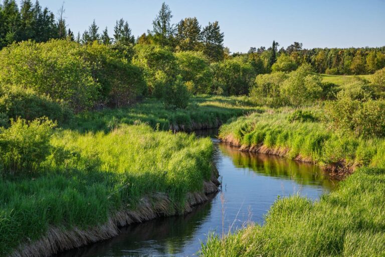

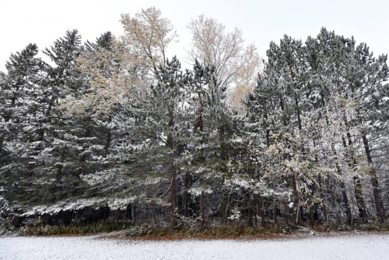
Quick answers before you hunt Huntersville State Forest
What route leads to Huntersville State Forest?
The nearest town is Nimrod, 9.3 mi away; use the map on this page for the route.
What can you hunt on Huntersville State Forest?
The agency names no species list for Huntersville State Forest; all open seasons apply under its rules.
Do deer from Huntersville State Forest need CWD testing?
Its DPA (241) is outside the CWD zones, with optional testing.
Which office should I call about Huntersville State Forest?
Huntersville State Forest is managed by Minnesota Department of Natural Resources.
Where can I hunt public land close to Huntersville State Forest?
The nearest public units are Huntersville WMA (0.3 mi), Burgen Lake Prairie WMA (4.0 mi) and First Crow Wing AMA (4.6 mi).
When is legal light on Huntersville State Forest for the opener?
For the opener, 6:39 a.m. to 5:27 p.m.; birds stop at 4:57 p.m..
May the public hunt Huntersville State Forest?
Yes, in season, following the managing agency rules for Huntersville State Forest.
Can decoys or gear stay on Huntersville State Forest overnight?
Portable is the rule of thumb on Huntersville State Forest; stands left out are public property in practice.
What are the 2026 deer rules on Huntersville State Forest?
It is in deer permit area 241 (3-deer limit). Guns: Nov 7 to Nov 15, 2026.
Huntersville State Forest size: how much huntable ground?
Huntersville State Forest covers 14,994 acres.
Huntersville State Forest: what to double-check first
Seasons, closures and notices on Huntersville State Forest can change mid-season; posted signs and the agency page have the final word.
Sources: source · source · source · source · source · source; regulations from the 2026-2027 Minnesota Hunting and Trapping Regulations. Checked October 28, 2026.
Other photos on this page: Tony Webster (CC BY 2.0); U.S. Fish and Wildlife Service (Public Domain Mark 1.0); U.S. Fish and Wildlife Service (Public Domain Mark 1.0).