Home › Pennsylvania › Public land › Hunter Access
PGC program, 2026-27
Pennsylvania Hunter Access Program
2,092 private properties and 621,414 acres open to public hunting under Game Commission agreements, now in three access levels. County totals below.
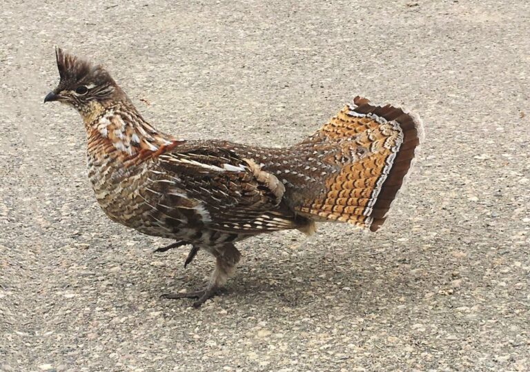
Photo: TheTurducken (CC BY 2.0)
Three ways in
Each property on the PGC map carries one of these levels.
Open Access
No permission needed. Follow the landowner rules the PGC map shows for that property.
Reservation Access
Reserve a day online with your CID number and date of birth, up to 10 reservations a month. Trappers reserve three-week blocks; waterfowl reservations take up to five hunters.
Permission Access
Contact the landowner first. Contact details show after you enter your CID and date of birth on the PGC map.
The program is about 90 years old and was overhauled for 2026-27 with mapped boundaries and the landowner’s own rules shown on each property. Cooperating landowners may choose not to allow Sunday hunting, so check each property before a Sunday hunt. Landowners with 80 or more acres enrolled may buy the $4.97 landowner hunting license.
PGC Hunter Access Program and PGC program summary; tier counts from the PGC big and small game agreement layer.
Hunter Access by county (63 counties)
McKean County leads with 108,666 acres on 19 properties; Somerset follows with 44,685 acres.
| County | Properties | Acres | PGC region |
|---|---|---|---|
| McKean County | 19 | 108,666 | Northcentral |
| Somerset County | 138 | 44,685 | Southwest |
| Forest County | 12 | 27,592 | Northwest |
| Huntingdon County | 9 | 26,915 | Southcentral |
| Warren County | 189 | 26,563 | Northwest |
| Cambria County | 81 | 25,807 | Southwest |
| Carbon County | 5 | 24,864 | Northeast |
| Westmoreland County | 165 | 23,579 | Southwest |
| Blair County | 46 | 23,082 | Southcentral |
| Venango County | 62 | 20,767 | Northwest |
| Indiana County | 147 | 20,308 | Southwest |
| Schuylkill County | 39 | 20,082 | Southeast |
| Fayette County | 45 | 15,891 | Southwest |
| Crawford County | 113 | 14,806 | Northwest |
| Washington County | 67 | 13,183 | Southwest |
| Bedford County | 34 | 9,956 | Southcentral |
| Lycoming County | 10 | 9,951 | Northcentral |
| Clarion County | 66 | 9,178 | Northwest |
| Jefferson County | 54 | 8,694 | Northwest |
| Erie County | 46 | 8,057 | Northwest |
| Mercer County | 62 | 7,393 | Northwest |
| Lancaster County | 55 | 7,241 | Southeast |
| Clearfield County | 18 | 7,235 | Northcentral |
| Armstrong County | 42 | 7,012 | Southwest |
| Monroe County | 11 | 6,810 | Northeast |
| Greene County | 32 | 6,238 | Southwest |
| Butler County | 29 | 5,880 | Northwest |
| Lawrence County | 40 | 5,291 | Northwest |
| Perry County | 11 | 5,110 | Southcentral |
| Luzerne County | 21 | 5,080 | Northeast |
| Northumberland County | 34 | 4,975 | Northeast |
| Elk County | 5 | 4,788 | Northcentral |
| Franklin County | 29 | 4,711 | Southcentral |
| Allegheny County | 40 | 4,568 | Southwest |
| Lackawanna County | 9 | 4,539 | Northeast |
| Berks County | 36 | 4,532 | Southeast |
| Beaver County | 41 | 4,122 | Southwest |
| Snyder County | 21 | 4,005 | Southcentral |
| Susquehanna County | 12 | 3,976 | Northeast |
| Cumberland County | 27 | 3,950 | Southcentral |
| Clinton County | 4 | 3,584 | Northcentral |
| Tioga County | 12 | 3,530 | Northcentral |
| Juniata County | 8 | 3,325 | Southcentral |
| Bradford County | 20 | 3,288 | Northeast |
| Columbia County | 7 | 2,349 | Northeast |
| York County | 10 | 1,977 | Southcentral |
| Centre County | 15 | 1,908 | Northcentral |
| Lebanon County | 13 | 1,570 | Southeast |
| Wyoming County | 8 | 1,393 | Northeast |
| Northampton County | 16 | 1,322 | Southeast |
| Mifflin County | 11 | 1,173 | Southcentral |
| Union County | 11 | 1,145 | Northcentral |
| Fulton County | 5 | 926 | Southcentral |
| Dauphin County | 9 | 740 | Southeast |
| Adams County | 4 | 717 | Southcentral |
| Potter County | 4 | 675 | Northcentral |
| Wayne County | 3 | 485 | Northeast |
| Chester County | 3 | 471 | Southeast |
| Montour County | 2 | 260 | Northeast |
| Montgomery County | 1 | 247 | Southeast |
| Lehigh County | 1 | 104 | Southeast |
| Bucks County | 1 | 66 | Southeast |
| Sullivan County | 1 | 59 | Northeast |
| Dauphin, Cameron, Luzerne (one property listed under several counties) | 1 | 18 | — |
Active properties and acres per county from the PGC Hunter Access reference layer, 2026-27. Properties change during the season; the PGC map is current.
Where the acres are
County totals summed by the PGC region each county belongs to.
| PGC region | Properties | Acres |
|---|---|---|
| Northwest | 673 | 134,221 |
| Northcentral | 98 | 141,482 |
| Northeast | 133 | 58,078 |
| Southwest | 798 | 165,393 |
| Southcentral | 215 | 85,847 |
| Southeast | 174 | 36,375 |
Hunter Access questions
Do I need a permit for Hunter Access land?
No separate permit. You need a valid license, and on Reservation Access properties a reservation for the day.
How many reservations can I make?
Up to 10 reservations a month for hunting; trappers reserve three-week periods.
Is Sunday hunting allowed on Hunter Access properties?
Only where the cooperator allows it. Landowners in the program may choose not to allow Sunday hunting.
Which county has the most Hunter Access acres?
McKean County, with 108,666 acres on 19 properties.
Which county has the most properties?
Warren County, with 189 properties.
How do I find a property?
Use the PGC Hunter Access map, which shows boundaries, the access level and the landowner rules for each property.
Can landowners get anything for enrolling?
Landowners with 80 or more acres enrolled may buy the $4.97 resident landowner hunting license.
Are these properties public land?
No. They stay private land opened to the public under agreements with the Game Commission, so respect the posted rules and the landowner.
Check the map first
Properties come and go during the season. Open the PGC map before each trip and follow the rules shown for that property.