Home › Michigan › Public land › Cannon Creek Flooding No.2 WMA
Flooding or WMA · Northern Lower Peninsula
Cannon Creek Flooding No.2 Wildlife Management Area: where, what and how to hunt
A hunter's summary of Cannon Creek Flooding No.2 Wildlife Management Area in Missaukee County: units and limits, rules, CWD numbers and local help.
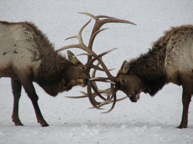
Photo: zenmasterdod (CC BY-SA 2.0)
Getting to Cannon Creek Flooding No.2 Wildlife Management Area
Parking, trailheads and gates near Cannon Creek Flooding No.2 Wildlife Management Area
- Parking areaParking · 1.0 mi from the centreDirections
Parking, trailhead and gate locations come from OpenStreetMap contributors. Roads into public land can be gated or seasonal; check with the managing agency before you go.
Cannon Creek Flooding No.2 WMA: the record card
Cannon Creek Flooding No.2 Wildlife Management Area counts as a DNR wildlife management area (a flooding or marsh unit), and it lies in Missaukee County. Its home region at the DNR is the Northern Lower Peninsula Region. The DNR Wildlife Division sets the rules on site. By acreage (92) it ranks 68th in a group of 72 wildlife management areas. It is one of the 180 rows on the DNR state game and wildlife areas list. Roughly 16 miles south of Bear Lake.
From the source page (MI DNR Wildlife Property Boundary GIS Acres field); region from the DNR wildlife region layer. Checked October 22, 2026.
Nearby
Places to hunt and shoot around Cannon Creek Flooding No.2 Wildlife Management Area
Who can hunt Cannon Creek Flooding No.2 WMA, and on what terms
Entry terms, Cannon Creek Flooding No.2 WMA
DNR floodings like Cannon Creek Flooding No.2 WMA are open to the public during Michigan seasons. Watch for posted refuges and closed areas around the water.
Michigan rules that follow you to Cannon Creek Flooding No.2 WMA
- The DNR stand rule for public land: portable, ID affixed, Sept. 1 to March 1, no nails, screws or bolts.
- From Sept. 1 to the end of deer season blinds are allowed; constructed blinds need ID and are prohibited on game areas, parks and recreation areas in Zone 3.
- From mid-August to the end of April, a hunter orange outer layer is the law in daylight; camouflage counts if half of it is orange. Turkey and waterfowl hunters are exempt.
- Harvest reporting is required for deer and turkey inside 72 hours; failing to report is a civil infraction.
- Firearm hunters keep 150 yards from occupied dwellings, cabins and farm buildings.
- Planting a food plot on public land is not legal.
- This is Lower Peninsula ground, where deer baiting and feeding are banned.
- On public land, bear bait goes on the ground, never in a container.
- ORV quiet hours on public hunting land, Nov. 15-30: 7 to 11 a.m. and 2 to 5 p.m.
Cannon Creek Flooding No.2 WMA: licenses to carry
Buy in the Hunt Fish app, at an agent or on eLicense. Every hunter needs the base license; antlerless licenses (up to 10) obey the county or DMU use limit.
Access from the source page; public-land stand, blind, safety-zone and food-plot rules from the DNR deer regulations summary; hunter orange from MCL 324.40116; prices from the 2026 license fee tables. Checked October 22, 2026.
Cannon Creek Flooding No.2 WMA and nearby public ground
Cannon Creek Flooding No.2 WMA at the big pin; the nearest 10 public places around it. Between them the nearby tracts list 19,021 acres.
| Public land | Type | Acres | Distance | Direction |
|---|---|---|---|---|
| Cannon Creek Flooding No.1 | Flooding or WMA | 156 | 0.7 mi | northeast |
| Grass Lake Marsh Flooding | Flooding or WMA | 968 | 2.5 mi | east |
| Addis Creek Flooding | Flooding or WMA | 438 | 3.2 mi | east |
| Dead Stream Flooding | Flooding or WMA | 1,024 | 10 mi | southeast |
| North Higgins Lake | State park | 166 | 11 mi | east |
| Houghton Lake Flats North Flooding | Flooding or WMA | 838 | 11 mi | southeast |
| Houghton Lake Flats South Flooding | Flooding or WMA | 991 | 12 mi | southeast |
| Houghton Lake | Research area | 12,131 | 14 mi | southeast |
| South Higgins Lake | State park | 1,367 | 16 mi | east |
| Bear Creek Flooding | Flooding or WMA | 942 | 19 mi | south |
Points from the DNR wildlife, GEMS, parks, forest, USFS, USFWS and NPS layers (MI DNR Wildlife Property Boundary GIS (point inside polygon (centroid falls outside))). Straight-line distances. Statewide public land map.
Cannon Creek Flooding No.2 WMA deer units, bear units and zones
It is Zone 2 ground in the Northern Lower Peninsula. Missaukee County allows 5 universal antlerless licenses per hunter. In DMU 057 the antler point restriction is 3 on a side. Missaukee County is an early and late antlerless county. For bear the unit is Red Oak; its 2026 hunt 0020 quota is 685. For turkeys it is unit NN (spring) and I (fall); the 2027 spring calendar has not been printed. Waterfowl: Middle Zone, regular duck season Oct 3-Nov 29 and Dec 12-Dec 13. Elk unit X overlap its counties; elk licenses come by drawing, residents only.
The deer units around Cannon Creek Flooding No.2 WMA
| DMU | Unit name | Antlerless status | Antlerless use limit | APR |
|---|---|---|---|---|
| DMU 057 | Missaukee county | Open | 5 | 3+ on one side |
Cannon Creek Flooding No.2 WMA bear units
| Bear unit | Hunts | Quota | Points (res.) | 2025 bears |
|---|---|---|---|---|
| Red Oak | 1 hunt | 685 | 9–10 | 282 |
Cannon Creek Flooding No.2 WMA turkey units
| Unit | Reported harvest | Note |
|---|---|---|
| Spring NN | 4,156 | All of unit, 2026 |
| Fall I | 822 | Unit-wide, fall to date |
Zones from the DNR 2026 zone layers as recorded in lands.json; DMU status and APR from the Wildlife Conservation Order; use limits from the 2026 deer summary; BMU hunts and quotas from the 2026 bear summary and bear registration data; turkey from the DNR turkey harvest report; CWD lists from the DNR CWD rules. Checked October 22, 2026.
Game you can hunt at Cannon Creek Flooding No.2 WMA
There is no species list for Cannon Creek Flooding No.2 WMA in the sources; the open seasons for its county and units decide what you can hunt.
Seasons for 24 species reach Missaukee County; White-tailed deer, Black bear, Elk and Wild turkey lead the 43-row table.
Species from the source (The DNR list gives no species for this area; open seasons follow statewide/zone regulations.); bag limits from the DNR regulation summaries. Checked October 22, 2026.
Cannon Creek Flooding No.2 WMA openers and closers in one table
Private ground and public ground share these dates in Cannon Creek Flooding No.2 WMA; a state park, refuge or national lakeshore can set its own limits.
| Animal | Segment | Area | Starts | Ends | Open now? |
|---|---|---|---|---|---|
| White-tailed deer | Early antlerless firearm | Listed antlerless county | Sep 12, 2026 | Sep 13, 2026 | |
| White-tailed deer | Liberty Hunt | Statewide | Sep 12, 2026 | Sep 13, 2026 | |
| White-tailed deer | Archery, early | Statewide | Oct 1, 2026 | Nov 14, 2026 | |
| White-tailed deer | Independence Hunt | Statewide | Oct 15, 2026 | Oct 18, 2026 | |
| White-tailed deer | Regular firearm | Statewide | Nov 15, 2026 | Nov 30, 2026 | |
| White-tailed deer | Archery, late | Statewide | Dec 1, 2026 | Jan 1, 2027 | |
| White-tailed deer | December firearm | Lower Peninsula | Dec 4, 2026 | Dec 6, 2026 | |
| White-tailed deer | Late antlerless firearm | Listed antlerless county | Dec 7, 2026 | Jan 1, 2027 | |
| Black bear | Hunt period 1 (firearm/bait/dogs) | Red Oak BMU | Sep 12, 2026 | Sep 22, 2026 | |
| Black bear | Period 1, archery | Red Oak BMU | Oct 2, 2026 | Oct 8, 2026 | |
| Elk | Hunt period 1 | Elk unit X | Sep 23, 2026 | Oct 4, 2026 | |
| Elk | Hunt period 2 | Elk unit X | Dec 1, 2026 | Dec 15, 2026 | |
| Wild turkey | Fall | Fall unit I | Sep 15, 2026 | Nov 14, 2026 | |
| Ruffed grouse | Fall first part | Statewide | Sep 15, 2026 | Nov 14, 2026 | |
| Ruffed grouse | Fall second part | Statewide | Dec 1, 2026 | Jan 1, 2027 | |
| Woodcock | Fall | Statewide | Sep 15, 2026 | Oct 29, 2026 | |
| Pheasant | Fall | Zone 2 | Oct 20, 2026 | Nov 14, 2026 | |
| Fox and gray squirrel | Private-land season | Statewide | Apr 1, 2026 | Sep 14, 2026 | |
| Fox and gray squirrel | Regular | Statewide | Sep 15, 2026 | Mar 31, 2027 | |
| Cottontail | Private-land season | Statewide | Apr 1, 2026 | Sep 14, 2026 | |
| Cottontail | Regular | Statewide | Sep 15, 2026 | Mar 31, 2027 | |
| Snowshoe hare | Regular | Statewide | Sep 15, 2026 | Mar 31, 2027 | |
| Crow | Summer | Statewide | Aug 1, 2026 | Sep 30, 2026 | |
| Crow | Late winter | Statewide | Feb 1, 2027 | Mar 31, 2027 | |
| Teal | Early teal | Statewide | Sep 1, 2026 | Sep 9, 2026 | |
| Ducks | Split 1 | Middle Zone | Oct 3, 2026 | Nov 29, 2026 | |
| Ducks | Split 2 | Middle Zone | Dec 12, 2026 | Dec 13, 2026 | |
| Waterfowl | Veterans days | Statewide | Sep 19, 2026 | Sep 20, 2026 | |
| Waterfowl | Youth weekend | Statewide | Sep 19, 2026 | Sep 20, 2026 | |
| Dark geese | Dark goose part 1 | Middle Zone | Sep 1, 2026 | Sep 30, 2026 | |
| Dark geese | Dark goose part 2 | Middle Zone | Oct 3, 2026 | Dec 18, 2026 | |
| Light geese | Light goose part 1 | Middle Zone | Sep 1, 2026 | Sep 30, 2026 | |
| Light geese | Light goose part 2 | Middle Zone | Oct 3, 2026 | Dec 18, 2026 | |
| Raccoon | Management season | Statewide | Apr 1, 2026 | Sep 30, 2026 | |
| Raccoon | Hunting | Statewide | Oct 1, 2026 | Mar 31, 2027 | |
| Red and gray fox | Hunting | Statewide | Oct 15, 2026 | Mar 1, 2027 | |
| Coyote | Management season | Statewide | Mar 2, 2026 | Oct 14, 2026 | |
| Coyote | Regular hunting | Statewide | Oct 15, 2026 | Mar 1, 2027 | |
| Bobcat | Hunting | Bobcat Unit D | Jan 1, 2027 | Feb 1, 2027 | |
| Feral swine | Year-round | Statewide | Year-round | Year-round | Year-round |
| Opossum | Year-round | Statewide | Year-round | Year-round | Year-round |
| Skunk | Year-round | Statewide | Year-round | Year-round | Year-round |
| Woodchuck | Year-round | Statewide | Year-round | Year-round | Year-round |
From the Michigan Department of Natural Resources 2026 hunting regulation summaries (deer, bear, elk, turkey, small game, waterfowl and furbearer editions), checked October 22, 2026.
Lodging, fuel and a processor near Cannon Creek Flooding No.2 WMA
Pick a town for the night, then a processor for the deer.
| Town | County | Miles | Population | Public land near |
|---|---|---|---|---|
| Bear Lake | Kalkaska | 16 mi | – | 121,810 |
| Lake City | Missaukee | 16 mi | 834 | 27,114 |
| Grayling | Crawford | 17 mi | 1,949 | 135,803 |
| Houghton Lake | Roscommon | 17 mi | – | 116,869 |
Each county here has its own page: Missaukee County.
Who handles a deer from Cannon Creek Flooding No.2 WMA
Office phone numbers that handle Cannon Creek Flooding No.2 WMA
Managing office: Cadillac Customer Service Center.
Towns and populations from Census 2024 estimates; public acres within 10 miles from the land layers; businesses from store locators and listings (license-only agents left out); offices from DNR, USFS and USFWS pages. Checked October 22, 2026. Call ahead.
What hunters reported from the county around Cannon Creek Flooding No.2 WMA
2025 in Missaukee County: 1,213 antlered, 1,290 antlerless, 2,503 in all. The reporting era peaked at 2,967 in 2024 and bottomed at 2,503 in 2025. Season to date (Oct. 22, 2026): 423 deer. The DNR sampled 42 deer from Missaukee County in 2023, with 0 CWD positives. With mandatory reporting new in 2026, Missaukee County logged 129 spring turkeys. These are county or unit totals, not Cannon Creek Flooding No.2 WMA alone; the DNR does not report harvest by property.
Missaukee County harvest table
| Season | Antlered | Does and fawns | Total |
|---|---|---|---|
| 2026* | 213 | 210 | 423 |
| 2025 | 1,213 | 1,290 | 2,503 |
| 2024 | 1,542 | 1,425 | 2,967 |
| 2023 | 1,501 | 1,140 | 2,641 |
| 2022 | 1,505 | 1,394 | 2,899 |
Reported by DMU, Cannon Creek Flooding No.2 WMA
| DMU | Antlered | Antlerless | 2025 total |
|---|---|---|---|
| DMU 057 | 1,213 | 1,290 | 2,503 |
CWD samples, Missaukee County
| Year | Tested | Positive |
|---|---|---|
| 2023 | 42 | 0 |
Turkeys reported in Missaukee County
| Figure | Turkeys |
|---|---|
| Spring 2026 reported | 129 |
| Fall 2026 | 5 |
| Fall 2025 survey | 0 |
| Fall 2025 hunters | 151 |
Deer from the DNR Harvest Report Summary (mandatory reporting; 2026 season to date); CWD from the DNR CWD testing data; turkeys from the turkey harvest report and the 2025 fall survey. Checked October 22, 2026.
Nearest ranges to Cannon Creek Flooding No.2 Wildlife Management Area
From Cannon Creek Flooding No.2 Wildlife Management Area, Supply Road Shooting Range is the closest range on DNR land (23 miles). Clubs inside 30 miles are included.
Offers rifle, handgun, smallbore rimfire, action pistol, silhouette
From the DNR shooting page and its range pages, checked October 22, 2026.
Cannon Creek Flooding No.2 WMA hunting-hour table for key season dates
Use the column for the hunting-time zone that covers Cannon Creek Flooding No.2 WMA on the DNR map. Zone D is the far western Upper Peninsula.
| Date | Moment | Zone A hours | Zone B hours | Zone C hours | Zone D hours |
|---|---|---|---|---|---|
| Oct 1, 2026 | Archery opener | 6:59 a.m. to 7:46 p.m. | 7:05 a.m. to 7:52 p.m. | 7:11 a.m. to 7:58 p.m. | 7:17 a.m. to 8:04 p.m. |
| Oct 15, 2026 | Independence Hunt | 7:15 a.m. to 7:24 p.m. | 7:21 a.m. to 7:30 p.m. | 7:27 a.m. to 7:36 p.m. | 7:33 a.m. to 7:42 p.m. |
| Nov 15, 2026 | Firearm opener | 6:53 a.m. to 5:48 p.m. | 6:59 a.m. to 5:54 p.m. | 7:05 a.m. to 6:00 p.m. | 7:11 a.m. to 6:06 p.m. |
| Nov 30, 2026 | Firearm close | 7:11 a.m. to 5:40 p.m. | 7:17 a.m. to 5:46 p.m. | 7:23 a.m. to 5:52 p.m. | 7:29 a.m. to 5:58 p.m. |
| Dec 5, 2026 | December hunts | 7:16 a.m. to 5:39 p.m. | 7:22 a.m. to 5:45 p.m. | 7:28 a.m. to 5:51 p.m. | 7:34 a.m. to 5:57 p.m. |
| Jan 1, 2027 | Late archery close | 7:31 a.m. to 5:40 p.m. | 7:37 a.m. to 5:46 p.m. | 7:43 a.m. to 5:52 p.m. | 7:49 a.m. to 5:58 p.m. |
Zone A times from the Michigan Department of Natural Resources deer hunting hours table, zone offsets from the DNR hunting hours map legend, checked October 22, 2026. Hunting hours for every zone.

Cannon Creek Flooding No.2 WMA: quick answers
Is Cannon Creek Flooding No.2 WMA state or federal ground?
A DNR wildlife management area (a flooding or marsh unit); the manager is the DNR Wildlife Division.
How much ground does Cannon Creek Flooding No.2 WMA hold?
The figure used here is 92 acres.
Which town makes a good base for a Cannon Creek Flooding No.2 WMA hunt?
Missaukee County; Bear Lake, the nearest town we cover, is 16 miles away.
Which seasons count on Cannon Creek Flooding No.2 WMA?
Every open Michigan season applies under the area rules; no list narrows it.
What deer rules apply on Cannon Creek Flooding No.2 WMA?
It lies in DMU 057. In Missaukee County a hunter may use up to 5 universal antlerless licenses.
How do I get a bear license for Cannon Creek Flooding No.2 WMA?
Bear unit: Red Oak. Draw a Red Oak license with preference points (2025: 9–10 points for residents).
Which unit do I pick for turkeys at Cannon Creek Flooding No.2 WMA?
The fall license ($15) is for unit I; spring hunts follow unit NN.
When can I hunt ducks at Cannon Creek Flooding No.2 WMA?
It is Middle Zone ground. Waterfowl hunters need the state waterfowl license, HIP and a federal stamp.
Is it legal to bait deer on Cannon Creek Flooding No.2 WMA?
The baiting ban applies. The DNR list of counties with a CWD-positive wild deer does not include this one.
Do turkey hunters wear orange at Cannon Creek Flooding No.2 WMA?
A hunter orange cap, hat, vest, jacket or rain gear, visible from all sides, from Aug. 15 to April 30.
Do I register a bear from Cannon Creek Flooding No.2 WMA?
Bears go to a DNR registration station within 72 hours for sealing.
When can stands go up at Cannon Creek Flooding No.2 WMA?
No: nothing may penetrate the bark on public land.
What does a license for Cannon Creek Flooding No.2 WMA cost?
Base license, then deer ($20 single, $40 combo) or other species licenses.
Final word on Cannon Creek Flooding No.2 WMA
Gates, refuges and open zones at Cannon Creek Flooding No.2 WMA are the manager's call; confirm them before opening day.
Sources for this page: Michigan DNR: state wildlife game areas list · DNR GIS; regulations from the 2026 Michigan hunting regulation summaries. Checked October 22, 2026.
Other photos on this page: fishhawk (CC BY 2.0); Flappy Pigeon (CC BY-SA 4.0).