Home › Michigan › Public land › Muskegon County Resource Recovery Center
Managed waterfowl area, southwest Michigan
Muskegon County Resource Recovery Center for deer, birds and more
11,182 acres of managed waterfowl area in Muskegon County, with 2026-27 units, use limits, rules, CWD testing and a map.
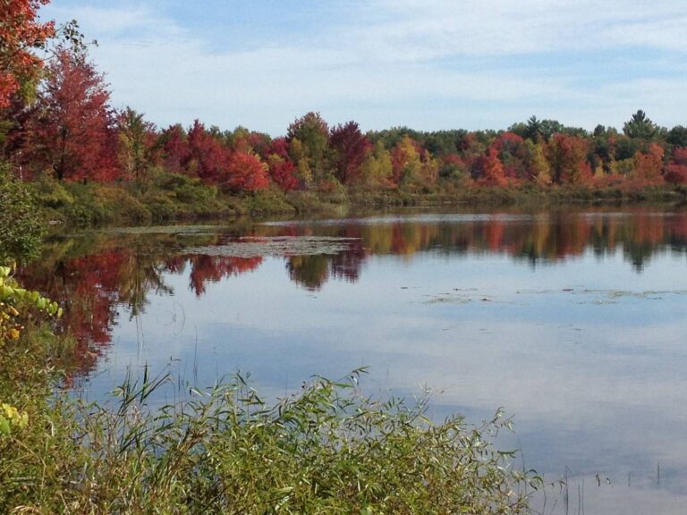
Photo: Qfamily (CC BY 2.0)
Getting to Muskegon County Resource Recovery Center
Parking, trailheads and gates near Muskegon County Resource Recovery Center
- Parking areaParking · 0.8 mi from the centreDirections
- Parking areaParking · 2.0 mi from the centreDirections
- Parking areaParking · 2.0 mi from the centreDirections
- Parking areaParking · 2.0 mi from the centreDirections
- Parking areaParking · 2.0 mi from the centreDirections
- Parking areaParking · 2.1 mi from the centreDirections
- Parking areaParking · 2.7 mi from the centreDirections
- Parking areaParking · 2.7 mi from the centreDirections
- Parking areaParking · 2.7 mi from the centreDirections
- Parking areaParking · 2.8 mi from the centreDirections
- Parking areaParking · 3.0 mi from the centreDirections
- Parking areaParking · 3.0 mi from the centreDirections
Parking, trailhead and gate locations come from OpenStreetMap contributors. Roads into public land can be gated or seasonal; check with the managing agency before you go.
Key facts on Muskegon County Resource Recovery Center
Muskegon County Resource Recovery Center belongs with the managed waterfowl areas of Muskegon County. The DNR Wildlife Division counts it in its Southwest Lower Peninsula Region, which covers southwest Michigan. Muskegon County (wastewater system land); hunting managed by Michigan DNR Wildlife Division as a managed waterfowl area manages the ground. It covers 11,182 acres. The DNR page rounds it to 8,411 acres; the other number is the mapped sum. You will find it among the 180 areas on the DNR list page. The nearest covered town is Wolf Lake, around 4 miles off as the crow flies.
From the source page (MI DNR Wildlife Property Boundary GIS Acres field); region from the DNR wildlife region layer. Checked October 22, 2026.
Nearby
Places to hunt and shoot around Muskegon County Resource Recovery Center
Access, closures and licenses on Muskegon County Resource Recovery Center
Access rules for Muskegon County Resource Recovery Center
From the agency page: State game/wildlife area: open to public hunting and trapping during Michigan seasons with the required licenses, except posted refuges, safety zones and closed areas. DNR state land rules (Wildlife Conservation Order, Land Use Orders of the Director) apply: blinds and tree stands on public land must follow the DNR rules (portable, labelled, removed per regulations).
Michigan rules that travel with you onto Muskegon County Resource Recovery Center
- Put a portable stand up after Aug. 31 and take it down by March 1; label it with your ID, and skip screw-in steps, nails and bolts.
- Blinds go up from Sept. 1. Constructed blinds carry ID and are banned on state game areas, parks and recreation areas in Zone 3; no cutting vegetation for any blind.
- Between Aug. 15 and April 30 take game in hunter orange (pink is an approved color); turkey and duck hunters do not need it.
- Deer and turkeys must be reported within 72 hours (or before the animal changes hands) through the DNR website or the Hunt Fish app.
- A 150-yard safety zone surrounds every occupied building.
- The DNR bars food plots on public land.
- Deer may not be baited or fed in the Lower Peninsula.
- No man-made containers for bear bait on public or Commercial Forest land.
Licenses and prices for Muskegon County Resource Recovery Center
A base license plus the species license is the Michigan formula. Universal antlerless licenses are sold over the counter, up to 10, with use limits by county and UP DMU.
Access from the source page; public-land stand, blind, safety-zone and food-plot rules from the DNR deer regulations summary; hunter orange from MCL 324.40116; prices from the 2026 license fee tables. Checked October 22, 2026.
Muskegon County Resource Recovery Center drawing and release notes
Daily drawings for free hunting zone permits throughout the open waterfowl season. Wetland Wonders acreage: 3,500.
Muskegon County Resource Recovery Center hunt drawings
Morning hunts: Tuesdays and Saturdays at 5:30 a.m. Afternoon hunts: Thursdays and Saturdays at 11 a.m. Open to hunting Oct. 20 – Dec. 19. Closed to hunting Thanksgiving Day. Permits for Tuesday morning drawings are valid until close of shooting hours. Note: Dry field hunting only, no water impoundments.
Dates set aside for youth: Oct. 24 (a.m. and p.m.) nonreserved.
From the DNR waterfowl summary, Wetland Wonders page. Checked October 22, 2026.
Where Muskegon County Resource Recovery Center sits among the state and federal tracts
Muskegon County Resource Recovery Center is the big pin, with 10 neighbors around it. Add them up and the neighbors hold 158,753 acres.
| Property | Type | Acres | Straight line | Which way |
|---|---|---|---|---|
| Muskegon | State game area | 15,691 | 3.0 mi | northwest |
| Grand Haven | State game area | 1,450 | 16 mi | south |
| Bass River | Recreation area | 1,662 | 17 mi | south |
| Rogue River | State game area | 6,200 | 17 mi | east |
| Bakale Wildlife Unit of Bass River | Wildlife unit | 653 | 17 mi | south |
| Duck Lake | State park | 739 | 20 mi | west |
| White Cloud | Ranger district | 130,570 | 22 mi | north |
| Blendon Township | State game area | 180 | 24 mi | south |
| Olive Township | State game area | 247 | 26 mi | south |
| Cannonsburg | State game area | 1,361 | 31 mi | southeast |
Points from the DNR wildlife, GEMS, parks, forest, USFS, USFWS and NPS layers (MI DNR Wildlife Property Boundary GIS (polygon centroid)). Straight-line distances. Statewide public land map.
Unit lines at Muskegon County Resource Recovery Center
Zone on the DNR map: Zone 3. The former Limited Firearm Deer Zone line ran through this country; it is gone for 2026, and all legal firearms are allowed. 5 is the Muskegon County cap on universal antlerless licenses used. Muskegon County hosts both antlerless firearm seasons, early and late. The Baldwin unit's first hunt period (Sept. 12–22 and Oct. 2–8) has a 2026 quota of 395 licenses. Spring turkey falls under unit ZZ and fall turkey under unit I. The 2027 spring dates are still to come. Regular duck splits here: Oct 17-Dec 13 and Dec 26-Dec 27.
Muskegon County Resource Recovery Center deer units
| Unit | Name | Antlerless | Licenses usable | Antler points |
|---|---|---|---|---|
| DMU 486 | Southern Lower Peninsula multicounty | – | By county | None |
| DMU 061 | Muskegon county | Open | 5 | None |
| DMU 161 | Muskegon south unit | – | – | None |
| DMU 341 | Sparta Unit | – | By county | None |
Muskegon County Resource Recovery Center: bear management units
| BMU | Periods | Quota | Points needed | Bears taken |
|---|---|---|---|---|
| Baldwin | 1 hunt | 395 | 7–8 | 114 |
Turkey units at Muskegon County Resource Recovery Center
| Unit | Harvest | Period |
|---|---|---|
| Spring ZZ | 13,292 | Unit-wide, spring 2026 |
| Fall I | 822 | All of unit, partial |
Zones from the DNR 2026 zone layers as recorded in lands.json; DMU status and APR from the Wildlife Conservation Order; use limits from the 2026 deer summary; BMU hunts and quotas from the 2026 bear summary and bear registration data; turkey from the DNR turkey harvest report; CWD lists from the DNR CWD rules. Checked October 22, 2026.
Muskegon County Resource Recovery Center: the game on record
The source names ducks, geese, white-tailed deer and squirrels and rabbits for Muskegon County Resource Recovery Center.
Ducks
Geese
White-tailed deer
Small game
The list is not a limit: every season open in Muskegon County applies here within the area rules.
Species from the source (Wetland Wonders page.); bag limits from the DNR regulation summaries. Checked October 22, 2026.
Muskegon County Resource Recovery Center season dates for 2026-27
23 species and 49 dated segments apply in Muskegon County Resource Recovery Center; the last column checks each against today.
| Quarry | Season | Zone | From | To | Status today |
|---|---|---|---|---|---|
| White-tailed deer | Early antlerless firearm | Listed antlerless county | Sep 12, 2026 | Sep 13, 2026 | |
| White-tailed deer | Liberty Hunt | Statewide | Sep 12, 2026 | Sep 13, 2026 | |
| White-tailed deer | Archery, early | Statewide | Oct 1, 2026 | Nov 14, 2026 | |
| White-tailed deer | Independence Hunt | Statewide | Oct 15, 2026 | Oct 18, 2026 | |
| White-tailed deer | Regular firearm | Statewide | Nov 15, 2026 | Nov 30, 2026 | |
| White-tailed deer | Archery, late | Statewide | Dec 1, 2026 | Jan 1, 2027 | |
| White-tailed deer | December firearm | Lower Peninsula | Dec 4, 2026 | Dec 6, 2026 | |
| White-tailed deer | Late antlerless firearm | Listed antlerless county | Dec 7, 2026 | Jan 1, 2027 | |
| Black bear | Hunt period 1 (firearm/bait/dogs) | Baldwin BMU | Sep 12, 2026 | Sep 22, 2026 | |
| Black bear | Period 1, archery | Baldwin BMU | Oct 2, 2026 | Oct 8, 2026 | |
| Wild turkey | Fall | Fall unit I | Sep 15, 2026 | Nov 14, 2026 | |
| Ruffed grouse | Fall first part | Statewide | Sep 15, 2026 | Nov 14, 2026 | |
| Ruffed grouse | Fall second part | Statewide | Dec 1, 2026 | Jan 1, 2027 | |
| Woodcock | Fall | Statewide | Sep 15, 2026 | Oct 29, 2026 | |
| Pheasant | Fall | Zone 2 | Oct 20, 2026 | Nov 14, 2026 | |
| Pheasant | Fall | Zone 3 | Oct 20, 2026 | Nov 14, 2026 | |
| Pheasant | December | Zone 3 | Dec 1, 2026 | Jan 1, 2027 | |
| Fox and gray squirrel | Private-land season | Statewide | Apr 1, 2026 | Sep 14, 2026 | |
| Fox and gray squirrel | Regular | Statewide | Sep 15, 2026 | Mar 31, 2027 | |
| Cottontail | Private-land season | Statewide | Apr 1, 2026 | Sep 14, 2026 | |
| Cottontail | Regular | Statewide | Sep 15, 2026 | Mar 31, 2027 | |
| Snowshoe hare | Regular | Statewide | Sep 15, 2026 | Mar 31, 2027 | |
| Crow | Summer | Statewide | Aug 1, 2026 | Sep 30, 2026 | |
| Crow | Late winter | Statewide | Feb 1, 2027 | Mar 31, 2027 | |
| Teal | Early teal | Statewide | Sep 1, 2026 | Sep 9, 2026 | |
| Ducks | Split 1 | South Zone | Oct 17, 2026 | Dec 13, 2026 | |
| Ducks | Split 2 | South Zone | Dec 26, 2026 | Dec 27, 2026 | |
| Waterfowl | Veterans days | Statewide | Sep 19, 2026 | Sep 20, 2026 | |
| Waterfowl | Youth weekend | Statewide | Sep 19, 2026 | Sep 20, 2026 | |
| Dark geese | Dark goose part 1 | South Zone | Sep 1, 2026 | Sep 30, 2026 | |
| Dark geese | Dark goose part 2 | South Zone | Oct 17, 2026 | Dec 13, 2026 | |
| Dark geese | Dark goose part 1 | Muskegon Wastewater GMU | Oct 20, 2026 | Dec 19, 2026 | |
| Dark geese | Dark goose part 3 | South Zone | Dec 26, 2026 | Jan 3, 2027 | |
| Dark geese | Dark goose part 4 | South Zone | Feb 6, 2027 | Feb 15, 2027 | |
| Light geese | Light goose part 1 | South Zone | Sep 1, 2026 | Sep 30, 2026 | |
| Light geese | Light goose part 2 | South Zone | Oct 17, 2026 | Dec 13, 2026 | |
| Light geese | Light goose part 1 | Muskegon Wastewater GMU | Oct 20, 2026 | Dec 19, 2026 | |
| Light geese | Light goose part 3 | South Zone | Dec 26, 2026 | Jan 3, 2027 | |
| Light geese | Light goose part 4 | South Zone | Feb 6, 2027 | Feb 15, 2027 | |
| Raccoon | Management season | Statewide | Apr 1, 2026 | Sep 30, 2026 | |
| Raccoon | Hunting | Statewide | Oct 1, 2026 | Mar 31, 2027 | |
| Red and gray fox | Hunting | Statewide | Oct 15, 2026 | Mar 1, 2027 | |
| Coyote | Management season | Statewide | Mar 2, 2026 | Oct 14, 2026 | |
| Coyote | Regular hunting | Statewide | Oct 15, 2026 | Mar 1, 2027 | |
| Bobcat | Hunting | Bobcat Unit H | Jan 1, 2027 | Jan 11, 2027 | |
| Feral swine | Year-round | Statewide | Year-round | Year-round | Year-round |
| Opossum | Year-round | Statewide | Year-round | Year-round | Year-round |
| Skunk | Year-round | Statewide | Year-round | Year-round | Year-round |
| Woodchuck | Year-round | Statewide | Year-round | Year-round | Year-round |
From the Michigan Department of Natural Resources 2026 hunting regulation summaries (deer, bear, elk, turkey, small game, waterfowl and furbearer editions), checked October 22, 2026.
Muskegon County Resource Recovery Center trip planning: towns and services
Each town below has its own hunting page on this site.
| Town | County | Distance | Population | Public ground, 10 mi |
|---|---|---|---|---|
| Wolf Lake | Muskegon | 4.4 mi | – | 19,195 |
| Twin Lake | Muskegon | 11 mi | – | 34,364 |
| Muskegon | Muskegon | 12 mi | 37,287 | 8,359 |
| Nunica | Ottawa | 12 mi | – | 3,117 |
Go wider with the county pages: Muskegon County.
Muskegon County Resource Recovery Center: businesses in the area
Muskegon County Resource Recovery Center: the nearest agency desks
Questions about Muskegon County Resource Recovery Center go to Muskegon State Game Area.
Towns and populations from Census 2024 estimates; public acres within 10 miles from the land layers; businesses from store locators and listings (license-only agents left out); offices from DNR, USFS and USFWS pages. Checked October 22, 2026. Call ahead.
Deer, turkeys and CWD around Muskegon County Resource Recovery Center
Last full license year (2025) Muskegon County gave up 2,819 reported deer. Since mandatory reporting began in 2022 the yearly count has ranged from 2,819 (2025) to 2,985 (2023). The 2026 bar is season to date (711 deer by Oct. 22). In 2022 the DNR tested 421 Muskegon County deer; 0 were positive. Muskegon County: 360 spring birds reported in 2026. Harvest and CWD figures describe the county as a whole.
Deer table, Muskegon County
| License year | Antlered | Antlerless | All deer |
|---|---|---|---|
| 2026* | 390 | 321 | 711 |
| 2025 | 1,506 | 1,313 | 2,819 |
| 2024 | 1,550 | 1,386 | 2,936 |
| 2023 | 1,661 | 1,324 | 2,985 |
| 2022 | 1,750 | 1,170 | 2,920 |
2025 deer by unit near Muskegon County Resource Recovery Center
| Unit | Antlered | Antlerless | Total 2025 |
|---|---|---|---|
| DMU 061 | 1,506 | 1,313 | 2,819 |
Wild deer checked for CWD in Muskegon County
| Year | Tested | Positive |
|---|---|---|
| 2022 | 421 | 0 |
Muskegon County turkeys
| Figure | Number |
|---|---|
| Spring 2026 birds | 360 |
| Fall 2026 so far | 24 |
| Fall 2025 (survey) | 85 |
| Fall 2025 hunters | 218 |
Deer from the DNR Harvest Report Summary (mandatory reporting; 2026 season to date); CWD from the DNR CWD testing data; turkeys from the turkey harvest report and the 2025 fall survey. Checked October 22, 2026.
Range time before hunting Muskegon County Resource Recovery Center
Nearest DNR range: Echo Point Shooting Range, roughly 49 miles from Muskegon County Resource Recovery Center. Nearer club ranges are shown as well.
Lines: muzzleloader, trap, archery, 3D archery, shotgun
Lines: trap, shotgun
From the DNR shooting page and its range pages, checked October 22, 2026.
DNR hunting hours for Muskegon County Resource Recovery Center
Michigan deer hours run from half an hour before sunrise to half an hour after sunset. The DNR prints one Zone A table and adds 6, 12 or 18 minutes for Zones B, C and D.
| When | Event | A zone | B zone | C zone | D zone |
|---|---|---|---|---|---|
| Oct 1, 2026 | Archery opener | 6:59 a.m. to 7:46 p.m. | 7:05 a.m. to 7:52 p.m. | 7:11 a.m. to 7:58 p.m. | 7:17 a.m. to 8:04 p.m. |
| Oct 15, 2026 | Independence Hunt | 7:15 a.m. to 7:24 p.m. | 7:21 a.m. to 7:30 p.m. | 7:27 a.m. to 7:36 p.m. | 7:33 a.m. to 7:42 p.m. |
| Nov 15, 2026 | Firearm opener | 6:53 a.m. to 5:48 p.m. | 6:59 a.m. to 5:54 p.m. | 7:05 a.m. to 6:00 p.m. | 7:11 a.m. to 6:06 p.m. |
| Nov 30, 2026 | Firearm close | 7:11 a.m. to 5:40 p.m. | 7:17 a.m. to 5:46 p.m. | 7:23 a.m. to 5:52 p.m. | 7:29 a.m. to 5:58 p.m. |
| Dec 5, 2026 | December hunts | 7:16 a.m. to 5:39 p.m. | 7:22 a.m. to 5:45 p.m. | 7:28 a.m. to 5:51 p.m. | 7:34 a.m. to 5:57 p.m. |
| Jan 1, 2027 | Late archery close | 7:31 a.m. to 5:40 p.m. | 7:37 a.m. to 5:46 p.m. | 7:43 a.m. to 5:52 p.m. | 7:49 a.m. to 5:58 p.m. |
Zone A times from the Michigan Department of Natural Resources deer hunting hours table, zone offsets from the DNR hunting hours map legend, checked October 22, 2026. Hunting hours for every zone.

Hunter questions on Muskegon County Resource Recovery Center
Which BMU do I apply for to hunt Muskegon County Resource Recovery Center?
It is in the Baldwin BMU. Apply May 1-June 1 in the bear drawing for the Baldwin unit.
Can I use universal antlerless licenses on Muskegon County Resource Recovery Center?
DMU 486, DMU 061 and DMU 161. Muskegon County allows 5 universal antlerless licenses per hunter.
Which waterfowl zone covers Muskegon County Resource Recovery Center?
South Zone splits apply. Carry non-toxic shot for ducks and geese.
What turkey license do I need for Muskegon County Resource Recovery Center?
Use spring unit ZZ or fall unit I.
Which months need orange at Muskegon County Resource Recovery Center?
No: turkey hunters are exempt from the orange rule.
What do baiting and CWD rules mean for Muskegon County Resource Recovery Center?
Not here: deer baiting and feeding are banned in the Lower Peninsula. Not a CWD county.
How long can a blind stay on Muskegon County Resource Recovery Center?
Portable stands only, from Sept. 1 to March 1, labelled with your ID.
Do I take a Muskegon County Resource Recovery Center deer to a check station?
Check stations are fewer now; mandatory online or app reporting within 72 hours is the rule.
When are the drawings at Muskegon County Resource Recovery Center?
Yes, drawings for free zone permits on the days listed above.
Do I need permission to hunt Muskegon County Resource Recovery Center?
A Michigan base license ($11 resident) plus the species license.
Whose land is Muskegon County Resource Recovery Center?
Muskegon County (wastewater system land); hunting managed by Michigan DNR Wildlife Division as a managed waterfowl area oversees this cooperative managed waterfowl area.
What public ground borders or neighbors Muskegon County Resource Recovery Center?
The three nearest are Muskegon State Game Area (3 miles), Grand Haven State Game Area (16 miles) and Bass River Recreation Area (17 miles).
Which county holds most of Muskegon County Resource Recovery Center?
Wolf Lake is closest (4 miles); the ground is in Muskegon County.
Muskegon County Resource Recovery Center: the last checklist
One last look before the drive: the Muskegon County Resource Recovery Center map, your licenses in the Hunt Fish app and any posted closures.
Sources for this page: Michigan DNR: muskegon county rr · Michigan DNR: wetland wonders · Michigan DNR: state wildlife game areas list · DNR GIS; regulations from the 2026 Michigan hunting regulation summaries. Checked October 22, 2026.
Other photos on this page: Birding for Climate (Public domain); USFWS/Southeast (CC BY 2.0).