Home › Michigan › Public land › Rainey River Flooding WMA
Public land · Flooding or WMA
Hunting Rainey River Flooding Wildlife Management Area in 2026-27
What we could verify about Rainey River Flooding Wildlife Management Area: acreage, units, area rules, harvest around it and nearby ground.
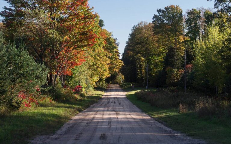
Photo: clembore (CC BY-SA 2.0)
Getting to Rainey River Flooding Wildlife Management Area
Rainey River Flooding WMA at a glance
Look for Rainey River Flooding Wildlife Management Area in Montmorency County; the record files it as a DNR wildlife management area (a flooding or marsh unit). For DNR purposes it falls in the Northern Lower Peninsula Region. Management rests with the DNR Wildlife Division. Out of 72 wildlife management areas, its 1,422 acres put it in place 29. It has a row on the DNR game and wildlife areas list. Roughly 7 miles east of Canada Creek Ranch.
From the source page (MI DNR Wildlife Property Boundary GIS Acres field); region from the DNR wildlife region layer. Checked October 22, 2026.
Nearby
Places to hunt and shoot around Rainey River Flooding Wildlife Management Area
Quarry and limits at Rainey River Flooding WMA
Rainey River Flooding WMA carries no game list of its own. Any season open where it lies is fair game, within the area rules.
Montmorency County seasons cover White-tailed deer, Black bear, Elk, Wild turkey and Ruffed grouse and more: 24 species in 44 rows.
Species from the source (The DNR list gives no species for this area; open seasons follow statewide/zone regulations.); bag limits from the DNR regulation summaries. Checked October 22, 2026.
Units and limits for Rainey River Flooding WMA
Hunting zone: Zone 2, in the Northern Lower Peninsula. The universal antlerless use limit for Montmorency County is 10. Antlerless firearm hunting in Montmorency County includes the September and December-January seasons. Red Oak BMU, hunt 0020: Sept. 12–22 and Oct. 2–8, 685 licenses. Turkey units: NN in spring, I in fall (spring 2027 dates not yet set). Middle Zone ducks: Oct 3-Nov 29 and Dec 12-Dec 13. Its counties reach elk management units I and X, open in 2026 to drawn residents only.
Rainey River Flooding WMA: DMUs and antlerless limits
| Unit | Name | Antlerless | Use limit | Antler rule |
|---|---|---|---|---|
| DMU 487 | Northeast Lower Peninsula multicounty | Open | By county | None |
| DMU 060 | Montmorency county | – | 10 | None |
BMUs over Rainey River Flooding WMA
| BMU | Hunts | Quota 2026 | Points | 2025 bears |
|---|---|---|---|---|
| Red Oak | 1 hunt | 685 | 9–10 | 282 |
Turkey hunting units over Rainey River Flooding WMA
| Unit | Reported | Basis |
|---|---|---|
| Spring NN | 4,156 | Unit total 2026 |
| Fall I | 822 | Unit total, to date |
Zones from the DNR 2026 zone layers as recorded in lands.json; DMU status and APR from the Wildlife Conservation Order; use limits from the 2026 deer summary; BMU hunts and quotas from the 2026 bear summary and bear registration data; turkey from the DNR turkey harvest report; CWD lists from the DNR CWD rules. Checked October 22, 2026.
Map: Rainey River Flooding WMA and the public tracts around it
Smaller pins show 10 nearby public tracts around Rainey River Flooding WMA. Acres across them: 422,833.
| Neighbor | Type | Acres | Miles off | Direction |
|---|---|---|---|---|
| Tomahawk Creek Flooding | Flooding or WMA | 1,144 | 5.5 mi | west |
| Atlanta Forest Management Unit | Forest unit | 291,430 | 7.8 mi | east |
| Sportsman's Pond Flooding | Flooding or WMA | 162 | 9.8 mi | south |
| Pigeon River Country State Forest | Forest unit | 123,358 | 17 mi | west |
| Dog Lake Flooding | Flooding or WMA | 1,665 | 17 mi | west |
| P.H. Hoeft | State park | 200 | 21 mi | northeast |
| Sage Lakes Flooding | Flooding or WMA | 248 | 21 mi | south |
| Greasy Creek | GEMS | 1,080 | 21 mi | south |
| Stoney Creek Flooding | Flooding or WMA | 1,110 | 22 mi | northwest |
| Lee Grand Ranch | GEMS | 2,436 | 24 mi | northwest |
Points from the DNR wildlife, GEMS, parks, forest, USFS, USFWS and NPS layers (MI DNR Wildlife Property Boundary GIS (polygon centroid)). Straight-line distances. Statewide public land map.
Rainey River Flooding WMA: what is allowed
How access works at Rainey River Flooding WMA
This wildlife management area holds water for ducks and other wildlife and is normally surrounded by state forest. Hunt or trap it in season; posted refuges and closures stay off limits.
Rainey River Flooding WMA: what the regulation summaries require
- Stands may be placed from Sept. 1 and must be gone by March 1. Portable models only, ID attached, no screw-in steps.
- Blind rule on public land: portable ones removed daily, dead-material ones need no label, constructed ones need ID and are out on Zone 3 game areas and parks.
- Wear a hunter orange cap, hat, vest, jacket or rain gear from Aug. 15 through April 30; bowhunters in archery seasons, turkey hunters and most migratory bird hunters are exempt.
- Within 72 hours of recovering a deer or turkey, report it on the DNR site or the Hunt Fish app.
- The 450-foot (150-yard) safety zone around occupied buildings applies.
- Food plots are not allowed on public ground.
- Deer baiting and feeding are banned across the Lower Peninsula, this area included.
- Bear bait on public and Commercial Forest land must sit on the ground with no man-made container.
- During the Nov. 15-30 firearm season, ORVs and snowmobiles are off public hunting land 7-11 a.m. and 2-5 p.m.
The license bill for Rainey River Flooding WMA
Start with the base license, then add the deer, turkey, waterfowl or pheasant license you need, on eLicense or in the Hunt Fish app. Universal antlerless use is limited by county or UP unit.
Access from the source page; public-land stand, blind, safety-zone and food-plot rules from the DNR deer regulations summary; hunter orange from MCL 324.40116; prices from the 2026 license fee tables. Checked October 22, 2026.
Rainey River Flooding WMA hunting calendar
Rainey River Flooding WMA rows run from the September Liberty Hunt and bear periods through the late coyote, fox and bobcat dates.
| Game | Hunt | Unit | First day | Last day | Status |
|---|---|---|---|---|---|
| White-tailed deer | Early antlerless firearm | Listed antlerless county | Sep 12, 2026 | Sep 13, 2026 | |
| White-tailed deer | Liberty Hunt | Statewide | Sep 12, 2026 | Sep 13, 2026 | |
| White-tailed deer | Archery, early | Statewide | Oct 1, 2026 | Nov 14, 2026 | |
| White-tailed deer | Independence Hunt | Statewide | Oct 15, 2026 | Oct 18, 2026 | |
| White-tailed deer | Regular firearm | Statewide | Nov 15, 2026 | Nov 30, 2026 | |
| White-tailed deer | Archery, late | Statewide | Dec 1, 2026 | Jan 1, 2027 | |
| White-tailed deer | December firearm | Lower Peninsula | Dec 4, 2026 | Dec 6, 2026 | |
| White-tailed deer | Late antlerless firearm | Listed antlerless county | Dec 7, 2026 | Jan 1, 2027 | |
| Black bear | Hunt period 1 (firearm/bait/dogs) | Red Oak BMU | Sep 12, 2026 | Sep 22, 2026 | |
| Black bear | Period 1, archery | Red Oak BMU | Oct 2, 2026 | Oct 8, 2026 | |
| Elk | Hunt period 1 | Elk unit X | Sep 23, 2026 | Oct 4, 2026 | |
| Elk | Hunt period 2 | Elk unit X | Dec 1, 2026 | Dec 15, 2026 | |
| Elk | Hunt period 2 | Elk unit X/I | Dec 1, 2026 | Dec 15, 2026 | |
| Wild turkey | Fall | Fall unit I | Sep 15, 2026 | Nov 14, 2026 | |
| Ruffed grouse | Fall first part | Statewide | Sep 15, 2026 | Nov 14, 2026 | |
| Ruffed grouse | Fall second part | Statewide | Dec 1, 2026 | Jan 1, 2027 | |
| Woodcock | Fall | Statewide | Sep 15, 2026 | Oct 29, 2026 | |
| Pheasant | Fall | Zone 2 | Oct 20, 2026 | Nov 14, 2026 | |
| Fox and gray squirrel | Private-land season | Statewide | Apr 1, 2026 | Sep 14, 2026 | |
| Fox and gray squirrel | Regular | Statewide | Sep 15, 2026 | Mar 31, 2027 | |
| Cottontail | Private-land season | Statewide | Apr 1, 2026 | Sep 14, 2026 | |
| Cottontail | Regular | Statewide | Sep 15, 2026 | Mar 31, 2027 | |
| Snowshoe hare | Regular | Statewide | Sep 15, 2026 | Mar 31, 2027 | |
| Crow | Summer | Statewide | Aug 1, 2026 | Sep 30, 2026 | |
| Crow | Late winter | Statewide | Feb 1, 2027 | Mar 31, 2027 | |
| Teal | Early teal | Statewide | Sep 1, 2026 | Sep 9, 2026 | |
| Ducks | Split 1 | Middle Zone | Oct 3, 2026 | Nov 29, 2026 | |
| Ducks | Split 2 | Middle Zone | Dec 12, 2026 | Dec 13, 2026 | |
| Waterfowl | Veterans days | Statewide | Sep 19, 2026 | Sep 20, 2026 | |
| Waterfowl | Youth weekend | Statewide | Sep 19, 2026 | Sep 20, 2026 | |
| Dark geese | Dark goose part 1 | Middle Zone | Sep 1, 2026 | Sep 30, 2026 | |
| Dark geese | Dark goose part 2 | Middle Zone | Oct 3, 2026 | Dec 18, 2026 | |
| Light geese | Light goose part 1 | Middle Zone | Sep 1, 2026 | Sep 30, 2026 | |
| Light geese | Light goose part 2 | Middle Zone | Oct 3, 2026 | Dec 18, 2026 | |
| Raccoon | Management season | Statewide | Apr 1, 2026 | Sep 30, 2026 | |
| Raccoon | Hunting | Statewide | Oct 1, 2026 | Mar 31, 2027 | |
| Red and gray fox | Hunting | Statewide | Oct 15, 2026 | Mar 1, 2027 | |
| Coyote | Management season | Statewide | Mar 2, 2026 | Oct 14, 2026 | |
| Coyote | Regular hunting | Statewide | Oct 15, 2026 | Mar 1, 2027 | |
| Bobcat | Hunting | Bobcat Unit C | Jan 1, 2027 | Mar 1, 2027 | |
| Feral swine | Year-round | Statewide | Year-round | Year-round | Year-round |
| Opossum | Year-round | Statewide | Year-round | Year-round | Year-round |
| Skunk | Year-round | Statewide | Year-round | Year-round | Year-round |
| Woodchuck | Year-round | Statewide | Year-round | Year-round | Year-round |
From the Michigan Department of Natural Resources 2026 hunting regulation summaries (deer, bear, elk, turkey, small game, waterfowl and furbearer editions), checked October 22, 2026.
Reported deer and turkeys near Rainey River Flooding WMA
The 2025 reported total for Montmorency County was 2,465 deer (1,199 antlered). 2024 was the busiest year on the chart (2,802 deer), 2023 the leanest (1,986). License year 2026 is still running; 250 deer reported by Oct. 22. Spring 2026 turkey reports for Montmorency County: 122 birds. These numbers cover the country around Rainey River Flooding WMA, not the property alone.
Deer reported near Rainey River Flooding WMA
| Year | Antlered | Antlerless | Reported |
|---|---|---|---|
| 2026* | 57 | 193 | 250 |
| 2025 | 1,199 | 1,266 | 2,465 |
| 2024 | 1,401 | 1,401 | 2,802 |
| 2023 | 1,046 | 940 | 1,986 |
| 2022 | 1,233 | 1,554 | 2,787 |
Rainey River Flooding WMA: deer units, 2025
| Unit | Bucks | Antlerless | Deer 2025 |
|---|---|---|---|
| DMU 060 | 439 | 480 | 919 |
Montmorency County turkey harvest
| Item | Birds |
|---|---|
| Spring reported | 122 |
| Fall to date | 6 |
| Fall 2025 | 37 |
| Fall hunters | 150 |
Deer from the DNR Harvest Report Summary (mandatory reporting; 2026 season to date); CWD from the DNR CWD testing data; turkeys from the turkey harvest report and the 2025 fall survey. Checked October 22, 2026.
Base camps, butchers and DNR desks around Rainey River Flooding WMA
Towns first; the services after them are in this county or the next one over.
| Town | County | Distance | People | Public acres, 10 mi |
|---|---|---|---|---|
| Canada Creek Ranch | Montmorency | 7.1 mi | – | 131,423 |
| Hillman | Montmorency | 12 mi | 660 | 32,727 |
| Atlanta | Montmorency | 13 mi | – | 90,776 |
| Tower | Cheboygan | 16 mi | – | 95,064 |
County pages that cover this ground: Montmorency County.
Processors, mounts and gun counters near Rainey River Flooding WMA
Local DNR and federal offices for Rainey River Flooding WMA
The DNR area list points to Atlanta Field Office.
Towns and populations from Census 2024 estimates; public acres within 10 miles from the land layers; businesses from store locators and listings (license-only agents left out); offices from DNR, USFS and USFWS pages. Checked October 22, 2026. Call ahead.
When the hunting day opens and closes at Rainey River Flooding WMA
Ducks and geese stop at sunset and early teal and woodcock start at sunrise; these deer times are for big game and most small game.
| Date | Moment | Zone A hours | Zone B hours | Zone C hours | Zone D hours |
|---|---|---|---|---|---|
| Oct 1, 2026 | Archery opener | 6:59 a.m. to 7:46 p.m. | 7:05 a.m. to 7:52 p.m. | 7:11 a.m. to 7:58 p.m. | 7:17 a.m. to 8:04 p.m. |
| Oct 15, 2026 | Independence Hunt | 7:15 a.m. to 7:24 p.m. | 7:21 a.m. to 7:30 p.m. | 7:27 a.m. to 7:36 p.m. | 7:33 a.m. to 7:42 p.m. |
| Nov 15, 2026 | Firearm opener | 6:53 a.m. to 5:48 p.m. | 6:59 a.m. to 5:54 p.m. | 7:05 a.m. to 6:00 p.m. | 7:11 a.m. to 6:06 p.m. |
| Nov 30, 2026 | Firearm close | 7:11 a.m. to 5:40 p.m. | 7:17 a.m. to 5:46 p.m. | 7:23 a.m. to 5:52 p.m. | 7:29 a.m. to 5:58 p.m. |
| Dec 5, 2026 | December hunts | 7:16 a.m. to 5:39 p.m. | 7:22 a.m. to 5:45 p.m. | 7:28 a.m. to 5:51 p.m. | 7:34 a.m. to 5:57 p.m. |
| Jan 1, 2027 | Late archery close | 7:31 a.m. to 5:40 p.m. | 7:37 a.m. to 5:46 p.m. | 7:43 a.m. to 5:52 p.m. | 7:49 a.m. to 5:58 p.m. |
Zone A times from the Michigan Department of Natural Resources deer hunting hours table, zone offsets from the DNR hunting hours map legend, checked October 22, 2026. Hunting hours for every zone.
Rainey River Flooding Wildlife Management Area: ranges nearby
Drive about 9 miles to Voyer Lake Shooting Range for a DNR range. The next cards are clubs nearby.
Set up for rifle, handgun
Set up for rifle, air gun
Set up for trap, skeet, sporting clays, shotgun, rifle
From the DNR shooting page and its range pages, checked October 22, 2026.

Rainey River Flooding WMA hunting questions, short answers
Is Rainey River Flooding WMA in a spring turkey unit?
Spring NN and fall I.
Is there a bear season at Rainey River Flooding WMA?
Red Oak for bear. A bear license for a hunt period comes from the drawing or leftover sales.
Is Rainey River Flooding WMA under the Lower Peninsula baiting ban?
Deer bait is illegal here. The county has no CWD positives on the DNR list.
Is Rainey River Flooding WMA in the North, Middle or South Zone?
Middle Zone for ducks and geese. Shotguns hold 3 shells and fire non-toxic shot.
How many hours do I have to report a Rainey River Flooding WMA deer?
Within 72 hours of recovery or before the animal changes hands.
Can bowhunters skip orange at Rainey River Flooding WMA?
Hunter pink is an approved alternative; the rule runs Aug. 15 to April 30.
Is an extra permit required for Rainey River Flooding WMA?
Residents pay $11 for the base license and $40 for the deer combo.
What are the blind rules at Rainey River Flooding WMA?
From Sept. 1; they must be gone by March 1.
Which division or agency runs Rainey River Flooding WMA?
The DNR Wildlife Division manages it; the land is a DNR wildlife management area (a flooding or marsh unit).
Which other areas sit within reach of Rainey River Flooding WMA?
Nearest neighbors: Tomahawk Creek Flooding Wildlife Management Area (6 miles), Atlanta Forest Management Unit (State Forest) (8 miles) and Sportsman's Pond Flooding Wildlife Management Area (10 miles).
Which town makes a good base for a Rainey River Flooding WMA hunt?
Montmorency County, roughly 7 miles from Canada Creek Ranch.
Is Rainey River Flooding WMA large enough for a full day afield?
Acreage on record: 1,422.
Which deer units take in Rainey River Flooding WMA?
DMU 487 and 060. Montmorency County caps antlerless use at 10.
Rainey River Flooding WMA wrap-up
Print the Rainey River Flooding WMA map, carry your licenses, and check the agency page the week you go.
Sources for this page: Michigan DNR: state wildlife game areas list · DNR GIS; regulations from the 2026 Michigan hunting regulation summaries. Checked October 22, 2026.
Other photos on this page: ShenandoahNPS (Public domain); USFWS/Southeast (Public domain).