Home › Minnesota › Public land › Clay County WMA
WMA · DPA 269
Hunting on Clay County Wildlife Management Area in 2026-27
Wildlife management area hunting in Clay County: rules, season dates, parking and nearby public land.
Photo: Tony Webster (CC BY 2.0)
Getting to Clay County Wildlife Management Area
The record behind Clay County WMA, summed up
The mapped area of Clay County WMA is 925 acres, in Clay County. Clay County has 19 wildlife management areas on our list; this one is the 4th largest. Deer rules come from DPA 269, an either-sex area in 2026.
Detroit Lakes is the DNR wildlife area office for Clay County WMA (detroitlakes.wildlife@state.mn.us). DNR records Pittman-Robertson funding for Clay County WMA.
The WMA page says: Excellent upland bird hunting opportunities, including prairie chickens, as well as deer, and limited waterfowl.
Species named: deer, small game, pheasant, waterfowl, mourning dove.
- White-tailed Deer
- Eastern Cottontail
- Gray Squirrel
- Snowshoe Hare
- Ring-necked Pheasant
- Ducks
- Canada Goose
- Mourning Dove
From the agency record (Minnesota Department of Natural Resources); checked October 28, 2026.
Nearby
Places to hunt and shoot around Clay County Wildlife Management Area
Clay County WMA regulations in short
Read these before a first trip to Clay County WMA; they come from the agency page.
| Item | Allowed? |
|---|---|
| Hunting, trapping | Regular seasons |
| Vehicles | Designated roads, lots |
| Target shooting | Not allowed |
| Guns in transit | Cased, unloaded |
| Camping | Designated or permit |
| Portable stands, blinds | Remove daily |
| Overnight stands, northwest | Nov 1-Dec 31 |
| Dogs | Leash Apr 16-Jul 14 |
| Drones | Not allowed |
| Gear left overnight | Not allowed |
Sources: record, agency rules; booklet: 2026-2027 Minnesota Hunting and Trapping Regulations. Checked October 28, 2026.
DPA 269 dates for Clay County WMA
For 2026, DNR made DPA 269 either-sex; its firearms deer season is the 200-series window. Either-sex in DPA 269 means the regular license covers a buck or a doe.
| Deer season | Opens | Closes | Today |
|---|---|---|---|
| Archery | Sep 19, 2026 | Dec 31, 2026 | |
| Youth deer | Oct 15, 2026 | Oct 18, 2026 | |
| Firearms, 200 series | Nov 7, 2026 | Nov 15, 2026 | |
| Muzzleloader | Nov 28, 2026 | Dec 13, 2026 |
No mandatory CWD sampling in DPA 269; testing is optional. DPA 269 takes in 652 square miles. Part of Clay and Wilkin falls in DPA 269.
From the DNR 2026 deer season map and the 2026-2027 regulations booklet; checked October 28, 2026.
Hunting seasons at Clay County WMA
34 season windows for 19 species reach Clay County WMA, filtered by its game species list.
| Game | Season | Area | From | To | Open now? |
|---|---|---|---|---|---|
| Deer | Archery | DPA 269 | Sep 19, 2026 | Dec 31, 2026 | |
| Deer | Youth deer | DPA 269 | Oct 15, 2026 | Oct 18, 2026 | |
| Deer | Firearms, 200 series | DPA 269 | Nov 7, 2026 | Nov 15, 2026 | |
| Deer | Muzzleloader | Statewide | Nov 28, 2026 | Dec 13, 2026 | |
| Pheasant | Regular | Statewide | Oct 10, 2026 | Jan 3, 2027 | |
| Ruffed, spruce grouse | Regular | Statewide | Sep 19, 2026 | Jan 3, 2027 | |
| Hungarian partridge | Regular | Statewide | Sep 19, 2026 | Jan 3, 2027 | |
| Mourning dove | Regular | Statewide | Sep 1, 2026 | Nov 29, 2026 | |
| Rabbits, hares | Regular | Statewide | Sep 19, 2026 | Feb 28, 2027 | |
| Jackrabbit | Regular | Statewide | Sep 19, 2026 | Feb 28, 2027 | |
| Squirrels | Regular | Statewide | Sep 19, 2026 | Feb 28, 2027 | |
| Crow | Crow segment | Statewide | Sep 1, 2026 | Oct 31, 2026 | |
| Canada goose | Early geese | Statewide | Sep 5, 2026 | Sep 20, 2026 | |
| Light geese | Early geese | Statewide | Sep 5, 2026 | Sep 20, 2026 | |
| Teal | Early teal season | Statewide | Sep 5, 2026 | Sep 9, 2026 | |
| Youth waterfowl | Youth days | Statewide | Sep 12, 2026 | Sep 13, 2026 | |
| Ducks | Regular ducks | North Zone | Sep 26, 2026 | Nov 24, 2026 | |
| Ducks | Regular ducks | Central Zone | Sep 26, 2026 | Oct 4, 2026 | |
| Geese | Regular geese | North Zone | Sep 26, 2026 | Dec 25, 2026 | |
| Geese | Regular geese | Central Zone | Sep 26, 2026 | Oct 4, 2026 | |
| Take-a-Kid | Take-a-Kid | Statewide | Sep 26, 2026 | Sep 27, 2026 | |
| Ducks | Regular ducks | Central Zone | Oct 10, 2026 | Nov 29, 2026 | |
| Geese | Regular geese | Central Zone | Oct 10, 2026 | Dec 30, 2026 | |
| Raccoon, foxes | Hunting (north) | North furbearer zone | Oct 17, 2026 | Mar 15, 2027 | |
| Badger, opossum, weasels | Hunting (north) | North furbearer zone | Oct 17, 2026 | Mar 15, 2027 | |
| Ducks | Regular ducks | South Zone | Oct 17, 2026 | Dec 6, 2026 | |
| Geese | Regular geese | South Zone | Oct 17, 2026 | Jan 6, 2027 | |
| Raccoon, foxes | Hunting (south) | South furbearer zone | Oct 24, 2026 | Mar 15, 2027 | |
| Badger, opossum, weasels | Hunting (south) | South furbearer zone | Oct 24, 2026 | Mar 15, 2027 | |
| Bobcat | Hunt and trap (north) | North furbearer zone | Dec 12, 2026 | Jan 17, 2027 | |
| Crow | Crow segment | Statewide | Dec 15, 2026 | Jan 15, 2027 | |
| Bobcat | Hunt and trap (south) | South furbearer zone | Jan 2, 2027 | Jan 17, 2027 | |
| Light geese | Spring light goose | Statewide | Feb 18, 2027 | Apr 30, 2027 | |
| Crow | Crow segment | Statewide | Mar 1, 2027 | Mar 31, 2027 |
Blaze orange or pink is required during the firearms deer seasons, including for most small game hunters.
From the 2026-2027 Minnesota Hunting and Trapping Regulations booklet (Minnesota Department of Natural Resources); checked October 28, 2026. All Minnesota seasons.
Clay County WMA directions and parking
The DNR route text for each subunit of Clay County WMA, with 0 mapped lots.
| Unit | Size | Closest town | Hunting | Parking spots | Link |
|---|---|---|---|---|---|
| Clay County WMA | 925 | Hawley | Open | – | DNR |
- Clay County WMA: From Hawley, go 9 miles S on CSAH 31 then 1 mile W on TWP RD. Clay WMA consists of two distinct units with various access points from Hwy 10 on the north side, 210th St. S. which goes between both units, 100th Ave S. which borders the west unit on the north and the east unit on the south, and 220th St. S. on the east side.
DNR WMA detail pages (Compass feature records); checked October 28, 2026.
Other places to hunt near Clay County WMA
The closest other public land to Clay County WMA is McDonald WPA, 0.9 mi to the south; the table lists 8 neighbors with 2,374 acres between them.
| Name | Type | Size (ac) | Deer area | Away | Bearing |
|---|---|---|---|---|---|
| McDonald WPA | WPA | 40 | 269 | 0.9 mi | south |
| Hay Creek WMA | WMA | 40 | 269 | 1.5 mi | southeast |
| Janssen WMA | WMA | 319 | 269 | 1.5 mi | south |
| Bjornson WMA | WMA | 648 | 269 | 1.9 mi | north |
| Skree WMA | WMA | 165 | 269 | 2.2 mi | east |
| Bjornson WPA | WPA | 116 | 269 | 2.4 mi | northwest |
| Kenyon WPA | WPA | 779 | 269 | 3.5 mi | northeast |
| Magnusson WMA | WMA | 267 | 269 | 3.9 mi | northwest |
Points: DNR WMA detail page map point (Compass feature_detail). Straight-line distances. Statewide public land map.
Towns and offices around Clay County WMA
The town nearest Clay County WMA is Barnesville at 7.1 mi. DNR names Hawley as the nearest town on its unit page. Detroit Lakes Area Wildlife Office (Detroit Lakes) is the closest DNR office, 23 mi off.
| Community | County | Residents | Straight line | Direction |
|---|---|---|---|---|
| Barnesville | Clay | 2,765 | 7.1 mi | south |
| Hawley | Clay | 2,274 | 9.2 mi | north |
| Baker | Clay | – | 9.7 mi | west |
| Glyndon | Clay | 1,369 | 13 mi | northwest |
| Sabin | Clay | 601 | 14 mi | west |
Towns from the 2024 Census gazetteer and population estimates; offices and businesses from services.json (DNR and business listings, chain stores and license agents left out); straight-line miles. Checked October 28, 2026.
Clay County WMA area deer harvest by year
DPA 269 totals, which include all the land around Clay County WMA: 464 deer in 2025 against 418 in 2024.
| Year | Bucks | Does, fawns | All deer | Per sq mi |
|---|---|---|---|---|
| 2025 | 367 | 97 | 464 | 0.71 |
| 2024 | 338 | 80 | 418 | 0.64 |
| 2023 | 294 | 101 | 395 | 0.61 |
| 2022 | 308 | 122 | 430 | 0.66 |
| 2021 | 347 | 111 | 458 | 0.70 |
| 2020 | 372 | 107 | 479 | 0.74 |
| 2019 | 334 | 107 | 441 | 0.68 |
| 2018 | 329 | 140 | 469 | 0.72 |
| 2017 | 321 | 99 | 420 | 0.65 |
DNR 2025 deer harvest report; earlier years from the DNR yearly reports. Checked October 28, 2026.
The county setting of Clay County WMA
Clay County holds 82 public hunting records on this site; Clay County WMA is one of them. No deer feeding or attractants in Clay County (DNR ban). Rifles are legal statewide since 2025, but Clay County has a shotgun-only ordinance (partial shotgun-only ordinance). Bear: Clay County is in the no-quota area, with licenses over the counter. For turkey the county is in permit area 509 and 506. Wildlife office for Clay County: Detroit Lakes Area Wildlife Office. Unlike Clay County WMA, Beva Paulson Memorial Hardwood Forest Scientific and Natural Area and Blanket Flower Prairie Scientific and Natural Area are shut to hunters.
County acres from DNR and federal GIS layers (counties.json); zones from the 2026-2027 booklet; checked October 28, 2026.
Clay County WMA: first legal light and last
Calculated for the exact spot of Clay County WMA, so the minutes differ a little from the county tables.
| Day | Hunt | First sun | Last sun | Start | Big game stop | Bird stop |
|---|---|---|---|---|---|---|
| Sep 19, 2026 | Archery and grouse opener | 7:07 a.m. | 7:32 p.m. | 6:37 a.m. | 8:02 p.m. | 7:32 p.m. |
| Sep 26, 2026 | Duck opener | 7:16 a.m. | 7:18 p.m. | 6:46 a.m. | 7:48 p.m. | 7:18 p.m. |
| Oct 10, 2026 | Pheasant opener | 7:34 a.m. | 6:50 p.m. | 7:04 a.m. | 7:20 p.m. | 6:50 p.m. |
| Nov 7, 2026 | Firearms deer opener | 7:15 a.m. | 5:03 p.m. | 6:45 a.m. | 5:33 p.m. | 5:03 p.m. |
| Nov 28, 2026 | Muzzleloader opener | 7:45 a.m. | 4:42 p.m. | 7:15 a.m. | 5:12 p.m. | 4:42 p.m. |
| Dec 31, 2026 | Archery close | 8:10 a.m. | 4:46 p.m. | 7:40 a.m. | 5:16 p.m. | 4:46 p.m. |
| Apr 14, 2027 | Spring turkey opener | 6:42 a.m. | 8:10 p.m. | 6:12 a.m. | 8:40 p.m. | 8:10 p.m. |
Spring turkey uses the bird column.
Hours rule from the DNR booklet shooting hours page; sun times calculated for the unit point (NOAA method, Central Time); checked October 28, 2026. Legal hours for every county.
Clay County Wildlife Management Area hunters: nearest gun clubs on file
Before a hunt on Clay County Wildlife Management Area, the closest range on file is Pelican River Gun Club, 18 miles off. Sight in elsewhere: the area rules bar target shooting.
From the operators’ pages and directory listings, checked October 28, 2026; target shooting rule from the DNR WMA rules.
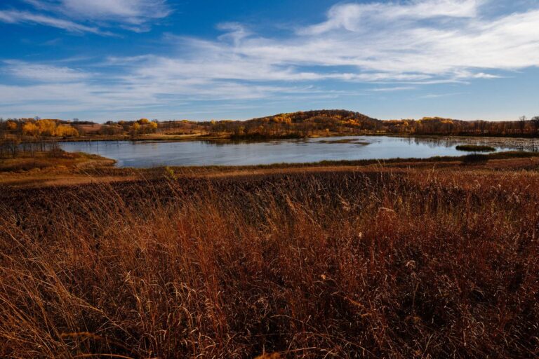
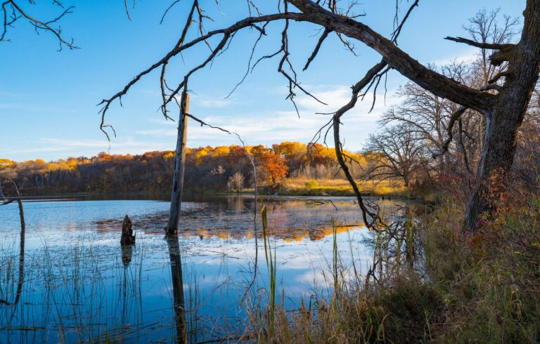
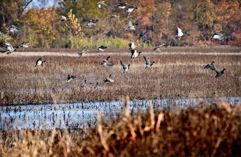
Clay County WMA and country like it, in photos
Clay County WMA FAQ for 2026-27
Is Clay County WMA a big piece of land?
About 925 acres, per the agency GIS.
When does firearms deer season open on Clay County WMA?
Deer permit area 269; the 2026 designation is either-sex. Firearms dates in that DPA are Nov 7 to Nov 15, 2026.
What game is on Clay County WMA?
The record for Clay County WMA lists deer, small game, pheasant, waterfowl and mourning dove.
What are the directions to Clay County WMA?
From Hawley, go 9 miles S on CSAH 31 then 1 mile W on TWP RD. 0 mapped lots.
Which office should I call about Clay County WMA?
The Detroit Lakes office of Minnesota Department of Natural Resources runs Clay County WMA.
What are the CWD rules on Clay County WMA?
CWD status: DPA 269 is outside the CWD zones, with optional testing.
Clay County WMA: deer hours on opening day?
About 6:45 a.m. to 5:33 p.m. on opening day of firearms deer.
Any other public ground within a short drive of Clay County WMA?
Closest on the map: McDonald WPA (0.9 mi), Hay Creek WMA (1.5 mi) and Janssen WMA (1.5 mi).
Are permanent stands allowed on Clay County WMA?
No overnight gear on Clay County WMA: stands and blinds go home each day unless the northwest exception covers the unit.
Can I stay the night on Clay County WMA?
No, except designated sites or by permit.
Clay County WMA: is hunting allowed there?
Open to hunting in regular seasons, under the general WMA rules and any notes on the unit page.
Other photos on this page: Tony Webster (CC BY-SA 2.0); Tony Webster (CC BY-SA 2.0); U.S. Fish and Wildlife Service – Midwest Region (Public domain).