Home › Minnesota › Public land › McDougall WMA
WMA in Morrison County
Hunting McDougall Wildlife Management Area, Minnesota public land
A 2026-27 hunter guide to this wildlife management area in Morrison County, 472 acres.
Photo: Tony Webster (CC BY-SA 2.0)
Getting to McDougall Wildlife Management Area
Parking, trailheads and gates near McDougall Wildlife Management Area
- Parking areaParking · 0.5 mi from the centreDirections
- Boat rampBoat ramp · 1.3 mi from the centreDirections
- Parking areaParking · 2.3 mi from the centreDirections
- Parking areaParking · 2.4 mi from the centreDirections
- Parking areaParking · 3.3 mi from the centreDirections
- Parking areaParking · 3.3 mi from the centreDirections
- Parking areaParking · 3.4 mi from the centreDirections
- Parking areaParking · 3.4 mi from the centreDirections
- Parking areaParking · 3.6 mi from the centreDirections
Parking, trailhead and gate locations come from OpenStreetMap contributors. Roads into public land can be gated or seasonal; check with the managing agency before you go.
McDougall WMA at a glance for hunters
You get 472 acres at McDougall WMA, which lies in Morrison County. By size it ranks 8th of the 18 wildlife management areas we list in Morrison County. DPA 221 sets the deer limit here: 3-deer limit this year.
The managing office is Little Falls (DNR Wildlife), littlefalls.wildlife@state.mn.us.
What the DNR page says about it: Management of this unit focuses on maintaining and improving the habitat for a diversity of native plants and wildlife, with emphasis on grassland and forest habitats.
Listed game: deer, small game, ruffed grouse and woodcock, pheasant, waterfowl, wild turkey, mourning dove.
- White-tailed Deer
- Eastern Cottontail
- Gray Squirrel
- Snowshoe Hare
- Ruffed Grouse
- American Woodcock
- Ring-necked Pheasant
- Ducks
From the agency record (Minnesota Department of Natural Resources); checked October 28, 2026.
Nearby
Places to hunt and shoot around McDougall Wildlife Management Area
What is allowed on McDougall WMA
Short version of the rules that apply on McDougall WMA, taken from the managing agency.
| What | Rule here |
|---|---|
| Hunting, trapping | Regular seasons |
| Vehicles | Designated roads, lots |
| Target shooting | Not allowed |
| Guns in transit | Cased, unloaded |
| Camping | Designated or permit |
| Portable stands, blinds | Remove daily |
| Overnight stands, northwest | Nov 1-Dec 31 |
| Dogs | Leash Apr 16-Jul 14 |
| Drones | Not allowed |
| Gear left overnight | Not allowed |
- Motorized vehicles are prohibited on the WMA except on designated routes and parking lots. Off-highway vehicles (OHVs), all-terrain vehicles (ATVs), and snowmobiles are prohibited anywhere on the WMA, including on designated parking lots and access road.
Sources: record, agency rules; booklet: 2026-2027 Minnesota Hunting and Trapping Regulations. Checked October 28, 2026.
Deer on McDougall WMA in 2026-27
Deer on McDougall WMA fall under DPA 221: 3-deer limit, 200 series. Fill the DPA 221 limit of 3 with your license plus bonus permits.
| Deer window | From | To | Open now? |
|---|---|---|---|
| Archery | Sep 19, 2026 | Dec 31, 2026 | |
| Youth deer | Oct 15, 2026 | Oct 18, 2026 | |
| Early antlerless | Oct 15, 2026 | Oct 18, 2026 | |
| Firearms, 200 series | Nov 7, 2026 | Nov 15, 2026 | |
| Muzzleloader | Nov 28, 2026 | Dec 13, 2026 |
CWD testing in DPA 221: optional. DPA 221 spans 650 square miles. DPA 221 reaches Morrison and Benton counties.
From the DNR 2026 deer season map and the 2026-2027 regulations booklet; checked October 28, 2026.
McDougall WMA hunting calendar 2026-27
McDougall WMA season dates for 2026-27, picked by its game species list and its deer permit area.
| Species | Season | Applies | Opens | Closes | Today |
|---|---|---|---|---|---|
| Deer | Archery | DPA 221 | Sep 19, 2026 | Dec 31, 2026 | |
| Deer | Early antlerless | DPA 221 | Oct 15, 2026 | Oct 18, 2026 | |
| Deer | Youth deer | DPA 221 | Oct 15, 2026 | Oct 18, 2026 | |
| Deer | Firearms, 200 series | DPA 221 | Nov 7, 2026 | Nov 15, 2026 | |
| Deer | Muzzleloader | Statewide | Nov 28, 2026 | Dec 13, 2026 | |
| Wild turkey | Fall | Statewide | Oct 3, 2026 | Nov 1, 2026 | |
| Wild turkey | Spring archery-only | Statewide | Apr 14, 2027 | May 31, 2027 | |
| Wild turkey | Spring period A | Statewide | Apr 14, 2027 | Apr 20, 2027 | |
| Wild turkey | Spring youth | Statewide | Apr 14, 2027 | May 31, 2027 | |
| Wild turkey | Spring period B | Statewide | Apr 21, 2027 | Apr 27, 2027 | |
| Wild turkey | Spring period C | Statewide | Apr 28, 2027 | May 4, 2027 | |
| Wild turkey | Spring period D | Statewide | May 5, 2027 | May 11, 2027 | |
| Wild turkey | Spring period E | Statewide | May 12, 2027 | May 18, 2027 | |
| Wild turkey | Spring period F | Statewide | May 19, 2027 | May 31, 2027 | |
| Pheasant | Regular | Statewide | Oct 10, 2026 | Jan 3, 2027 | |
| Ruffed, spruce grouse | Regular | Statewide | Sep 19, 2026 | Jan 3, 2027 | |
| Hungarian partridge | Regular | Statewide | Sep 19, 2026 | Jan 3, 2027 | |
| Woodcock | Regular | Statewide | Sep 19, 2026 | Nov 2, 2026 | |
| Mourning dove | Regular | Statewide | Sep 1, 2026 | Nov 29, 2026 | |
| Rabbits, hares | Regular | Statewide | Sep 19, 2026 | Feb 28, 2027 | |
| Jackrabbit | Regular | Statewide | Sep 19, 2026 | Feb 28, 2027 | |
| Squirrels | Regular | Statewide | Sep 19, 2026 | Feb 28, 2027 | |
| Crow | Crow segment | Statewide | Sep 1, 2026 | Oct 31, 2026 | |
| Canada goose | Early geese | Statewide | Sep 5, 2026 | Sep 20, 2026 | |
| Light geese | Early geese | Statewide | Sep 5, 2026 | Sep 20, 2026 | |
| Teal | Early teal season | Statewide | Sep 5, 2026 | Sep 9, 2026 | |
| Youth waterfowl | Youth days | Statewide | Sep 12, 2026 | Sep 13, 2026 | |
| Ducks | Regular ducks | North Zone | Sep 26, 2026 | Nov 24, 2026 | |
| Ducks | Regular ducks | Central Zone | Sep 26, 2026 | Oct 4, 2026 | |
| Geese | Regular geese | North Zone | Sep 26, 2026 | Dec 25, 2026 | |
| Geese | Regular geese | Central Zone | Sep 26, 2026 | Oct 4, 2026 | |
| Take-a-Kid | Take-a-Kid | Statewide | Sep 26, 2026 | Sep 27, 2026 | |
| Ducks | Regular ducks | Central Zone | Oct 10, 2026 | Nov 29, 2026 | |
| Geese | Regular geese | Central Zone | Oct 10, 2026 | Dec 30, 2026 | |
| Raccoon, foxes | Hunting (north) | North furbearer zone | Oct 17, 2026 | Mar 15, 2027 | |
| Badger, opossum, weasels | Hunting (north) | North furbearer zone | Oct 17, 2026 | Mar 15, 2027 | |
| Ducks | Regular ducks | South Zone | Oct 17, 2026 | Dec 6, 2026 | |
| Geese | Regular geese | South Zone | Oct 17, 2026 | Jan 6, 2027 | |
| Raccoon, foxes | Hunting (south) | South furbearer zone | Oct 24, 2026 | Mar 15, 2027 | |
| Badger, opossum, weasels | Hunting (south) | South furbearer zone | Oct 24, 2026 | Mar 15, 2027 | |
| Bobcat | Hunt and trap (north) | North furbearer zone | Dec 12, 2026 | Jan 17, 2027 | |
| Crow | Crow segment | Statewide | Dec 15, 2026 | Jan 15, 2027 | |
| Bobcat | Hunt and trap (south) | South furbearer zone | Jan 2, 2027 | Jan 17, 2027 | |
| Light geese | Spring light goose | Statewide | Feb 18, 2027 | Apr 30, 2027 | |
| Crow | Crow segment | Statewide | Mar 1, 2027 | Mar 31, 2027 |
Furbearer rows list both zones: the line follows I-94 and US 10, so check which side of it you hunt.
From the 2026-2027 Minnesota Hunting and Trapping Regulations booklet (Minnesota Department of Natural Resources); checked October 28, 2026. All Minnesota seasons.
McDougall WMA: access points
3 parking points and the route text DNR posts for McDougall WMA.
| Subunit | Acres | Nearest town | Hunting | Parking | Page |
|---|---|---|---|---|---|
| McDougall WMA | 472 | Royalton | Open | 3 | DNR |
- McDougall WMA: From Royalton, go 1 mile west on county road 26, then 1.5 miles north on county road 258 (Hilton Road).
DNR WMA detail pages (Compass feature records); checked October 28, 2026.
Public land within a drive of McDougall WMA
When McDougall WMA is crowded, McDougall AMA sits 0.6 mi away to the south.
| Place | Type | Acres | DPA | Miles off | Direction |
|---|---|---|---|---|---|
| McDougall AMA | AMA | 40 | 215 | 0.6 mi | south |
| Crane Meadows NWR | Wildlife refuge | 2,165 | 221 | 7.4 mi | northeast |
| Happy Valley WMA | WMA | 205 | 215 | 7.6 mi | southwest |
| Rice-Skunk WMA | WMA | 664 | 221 | 7.9 mi | northeast |
| Crane Meadows WMA | WMA | 189 | 221 | 8.2 mi | northeast |
| Sartell WMA | WMA | 368 | 221 | 8.7 mi | southeast |
| Brockway WPA | WPA | 180 | 215 | 8.8 mi | south |
| Rice Area Sportsmens Club WMA, 580 ac | WMA | 580 | 221 | 9.5 mi | east |
Points: DNR WMA detail page map point (Compass feature_detail). Straight-line distances. Statewide public land map.
McDougall WMA nearest towns and help
Fuel and food: Royalton lies 2.8 mi from McDougall WMA. For more services, Rice (2,207) is 7.9 mi out. DNR's nearest town for this unit: Royalton. Nearest DNR desk: Little Falls Area Wildlife Office, 11 mi.
| Town | County | People (2024) | Distance | Direction |
|---|---|---|---|---|
| Royalton | Morrison | 1,280 | 2.8 mi | southeast |
| Bowlus | Morrison | 271 | 3.6 mi | southwest |
| Elmdale | Morrison | 115 | 7.2 mi | west |
| Rice | Benton | 2,207 | 7.9 mi | southeast |
| Sobieski | Morrison | 218 | 8.4 mi | northwest |
Towns from the 2024 Census gazetteer and population estimates; offices and businesses from services.json (DNR and business listings, chain stores and license agents left out); straight-line miles. Checked October 28, 2026.
McDougall WMA: deer taken in DPA 221
4,908 deer were registered in DPA 221 during 2025, 7.65 per square mile of the unit.
| Year | Adult bucks | Other deer | DPA harvest | Per square mile |
|---|---|---|---|---|
| 2025 | 2,283 | 2,625 | 4,908 | 7.65 |
| 2024 | 2,171 | 2,267 | 4,438 | 6.91 |
| 2023 | 1,774 | 2,276 | 4,050 | 6.31 |
| 2022 | 1,778 | 2,508 | 4,286 | 6.68 |
| 2021 | 2,037 | 2,546 | 4,583 | 7.14 |
| 2020 | 2,066 | 2,560 | 4,626 | 7.21 |
| 2019 | 1,821 | 2,182 | 4,003 | 6.24 |
| 2018 | 1,571 | 1,771 | 3,342 | 5.21 |
| 2017 | 1,524 | 1,350 | 2,874 | 4.48 |
DNR 2025 deer harvest report; earlier years from the DNR yearly reports. Checked October 28, 2026.
McDougall WMA and the rest of Morrison County
Morrison County has 27 public hunting areas on file, McDougall WMA among them. Morrison County bear hunting runs through quota area 45, 45 (700 permits). The county sits in turkey permit area 508 and 507. Nearest DNR area wildlife office to the county centre: Little Falls Area Wildlife Office, (320) 232-1063. Not every public place in Morrison County is open: Little Rock Creek Aquatic Management Area is closed to hunting.
County acres from DNR and federal GIS layers (counties.json); zones from the 2026-2027 booklet; checked October 28, 2026.
When shooting starts and stops at McDougall WMA
Sun times computed for McDougall WMA itself, since the 2026 booklet prints no tables.
| Date | Why | Sunrise | Sunset | Legal from | Big game to | Waterfowl to |
|---|---|---|---|---|---|---|
| Sep 19, 2026 | Archery and grouse opener | 6:59 a.m. | 7:23 p.m. | 6:29 a.m. | 7:53 p.m. | 7:23 p.m. |
| Sep 26, 2026 | Duck opener | 7:08 a.m. | 7:10 p.m. | 6:38 a.m. | 7:40 p.m. | 7:10 p.m. |
| Oct 10, 2026 | Pheasant opener | 7:26 a.m. | 6:43 p.m. | 6:56 a.m. | 7:13 p.m. | 6:43 p.m. |
| Nov 7, 2026 | Firearms deer opener | 7:05 a.m. | 4:57 p.m. | 6:35 a.m. | 5:27 p.m. | 4:57 p.m. |
| Nov 28, 2026 | Muzzleloader opener | 7:34 a.m. | 4:37 p.m. | 7:04 a.m. | 5:07 p.m. | 4:37 p.m. |
| Dec 31, 2026 | Archery close | 7:58 a.m. | 4:41 p.m. | 7:28 a.m. | 5:11 p.m. | 4:41 p.m. |
| Apr 14, 2027 | Spring turkey opener | 6:35 a.m. | 8:01 p.m. | 6:05 a.m. | 8:31 p.m. | 8:01 p.m. |
Pheasant hours start at 9 a.m.
Hours rule from the DNR booklet shooting hours page; sun times calculated for the unit point (NOAA method, Central Time); checked October 28, 2026. Legal hours for every county.
McDougall Wildlife Management Area: hunts and banquets nearby
DU gun or purse bingo and NWTF hunting heritage fundraiser: 2 upcoming events, on site or a few miles away.
Booked dates
| Held on | Event | Miles off | Where held | Link | Checked at |
|---|---|---|---|---|---|
| Dec 13, 2026 | Morrison County DU Bags & Barrels Winter Bingo Dec 2026 (Little Falls), a DU gun or purse bingo | 10 | Rice Creek Hunt Club (Little Falls) | Buy tickets | Source |
| Mar 20, 2027 | Morrison Co. Wild Gobblers Hunting Heritage Event NWTF Fundraiser, an NWTF hunting heritage fundraiser | 10 | Little Falls | Buy tickets | Source |
Ranges a McDougall Wildlife Management Area hunter can reach
From McDougall Wildlife Management Area, the nearest listed range is Eastern Morrison County Sportsmans Club at 11 miles; public ranges on file are over 60 miles away. Plinking on the property is not allowed.
From the operators’ pages and directory listings, checked October 28, 2026; target shooting rule from the DNR WMA rules.
McDougall WMA region in a few frames
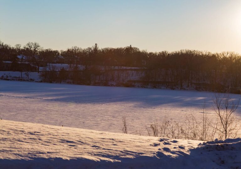
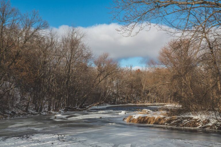
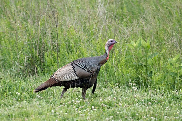
Hunter questions about McDougall WMA, short answers
What deer permit area is McDougall WMA in?
The record puts it in DPA 221: 3-deer limit. Its firearms season: Nov 7 to Nov 15, 2026.
McDougall WMA acreage: how much ground is it?
It runs to 472 acres.
How do you get to McDougall WMA?
From Royalton, go 1 mile west on county road 26, then 1.5 miles north on county road 258 (Hilton Road). 3 parking spots on the DNR map.
What game species does McDougall WMA list?
The agency names deer, small game, ruffed grouse and woodcock, pheasant, waterfowl, wild turkey and mourning dove for McDougall WMA.
McDougall WMA and CWD: what applies?
For CWD, DPA 221 is outside the CWD zones, with optional testing.
McDougall WMA: who is the land manager?
Questions about McDougall WMA go to Minnesota Department of Natural Resources at its Little Falls office.
McDougall WMA neighbors: what public land is nearby?
Short-drive options from the map: McDougall AMA (0.6 mi), Crane Meadows NWR (7.4 mi) and Happy Valley WMA (7.6 mi).
On the deer opener, when can you shoot at McDougall WMA?
Deer shooting on Nov. 7 opens at 6:35 a.m. and ends at 5:27 p.m. at the McDougall WMA point.
Can hunters set up a tent camp on McDougall WMA?
Only at designated sites or by permit.
Can blinds stay up overnight at McDougall WMA?
Only for the day: WMA rules make you remove portable stands and blinds daily, outside the northwest Nov. 1-Dec. 31 exception.
Does McDougall WMA allow public hunting?
It is open: DNR lists every subunit of McDougall WMA with an open or partial hunting status.
Other photos on this page: Tony Webster (CC BY-SA 2.0); Tony Webster (CC BY-SA 2.0); Russ (CC BY 2.0).