Home › Ohio › Public land › Portage Path Conservation Area
Hunting access · Ohio wildlife area
Hunt Portage Path Conservation Area this 2026-27 season
Hunting ground of 90 acres, run as a state wildlife area in Summit County.
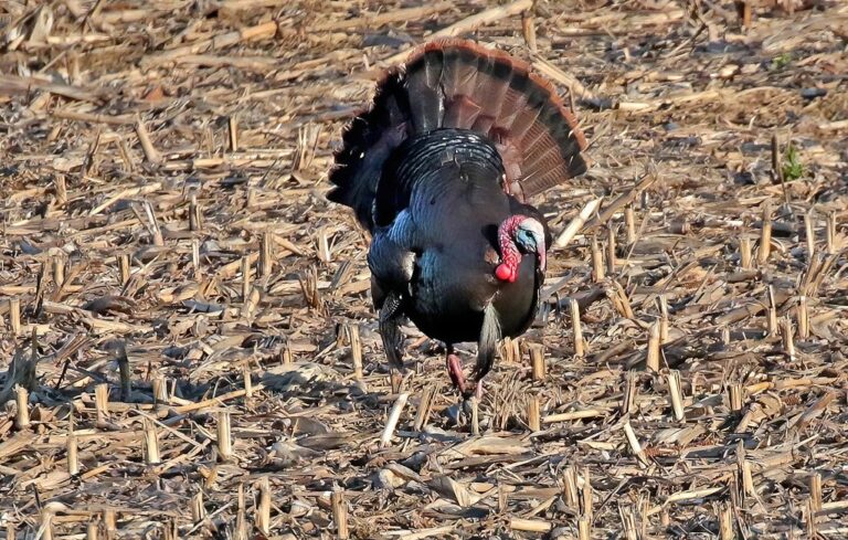
Photo: Tom Bower (CC BY 2.0)
Getting to Portage Path Conservation Area
Parking, trailheads and gates near Portage Path Conservation Area
- Parking areaParking · 0.7 mi from the centreDirections
- Parking areaParking · 0.8 mi from the centreDirections
- Parking areaParking · 0.8 mi from the centreDirections
- Parking areaParking · 1.0 mi from the centreDirections
- Wilbeth Road TrailheadParking · 1.3 mi from the centreDirections
- Parking areaParking · 1.4 mi from the centreDirections
- State Mill Boat LaunchParking · 1.6 mi from the centreDirections
- Parking areaParking · 1.9 mi from the centreDirections
- Parking areaParking · 1.9 mi from the centreDirections
- Parking areaParking · 1.9 mi from the centreDirections
- Parking areaParking · 1.9 mi from the centreDirections
- Parking areaParking · 1.9 mi from the centreDirections
Parking, trailhead and gate locations come from OpenStreetMap contributors. Roads into public land can be gated or seasonal; check with the managing agency before you go.
Portage Path Conservation Area by the numbers ODNR keeps
The ODNR Division of Wildlife manages Portage Path Conservation Area, 90 acres of state wildlife area ground in Summit County. For wildlife work it falls under District 3, run from Akron. By tenure the ground is protected by a conservation easement and owned outright by the state. It appears in OAC 1501:31-15-04(A)(1) as "Portage path", the legal list of public hunting land.
Layers give between 90 and 91 acres, so the table shows each one.
| Measure | Acres |
|---|---|
| Hunting-status layer | 90 |
| GIS parcel area | 91 |
From the agency page, ODNR hunting-status layer, OAC; retrieved 2026-11-05, checked November 6, 2026.
Nearby
Places to hunt and shoot around Portage Path Conservation Area
Ground rules for hunting Portage Path Conservation Area
Portage Path Conservation Area is open ground in the ODNR status map.
- No driving off the posted roads; park in the lots.
- No camping; only three wildlife areas allow it.
- Closed 8 p.m. to 6 a.m. from September through May 1 to anything but hunting, trapping and fishing.
- Guns may be fired only in lawful hunting, trapping or range use.
- Feed and bait are not allowed.
- Bring a portable stand; permanent stands are illegal.
- The public-area antlerless limit is two per license year.
From the agency page, public hunting area rules; checked November 6, 2026.
Dates and limits for hunting Portage Path Conservation Area
No species list exists for Portage Path Conservation Area; Ohio statewide seasons govern it. Spring turkey rows show the 2026 dates; the 2027 spring dates were not out when checked.
| Game | Window | From | To | Daily limit |
|---|---|---|---|---|
| Deer | Archery | Sep 26, 2026 | Feb 7, 2027 | County limit |
| Deer | Youth gun | Nov 21, 2026 | Nov 22, 2026 | County limit |
| Deer | Gun | Nov 30, 2026 | Dec 6, 2026 | County limit |
| Deer | Bonus gun | Dec 19, 2026 | Dec 20, 2026 | County limit |
| Deer | Muzzleloader | Jan 2, 2027 | Jan 5, 2027 | County limit |
| Wild turkey | Fall | Oct 1, 2026 | Oct 25, 2026 | 1 turkey |
| Squirrels | Regular | Sep 1, 2026 | Jan 31, 2027 | 6 daily |
| Cottontail | Regular | Nov 6, 2026 | Feb 28, 2027 | 4 daily |
| Pheasant | Regular | Nov 6, 2026 | Jan 10, 2027 | 2 roosters daily |
| Cottontail | Youth small game weekend | Oct 24, 2026 | Oct 25, 2026 | 4 daily |
| Cottontail | Youth small game weekend | Oct 31, 2026 | Nov 1, 2026 | 4 daily |
| Pheasant | Youth small game weekend | Oct 24, 2026 | Oct 25, 2026 | 2 roosters daily |
| Pheasant | Youth small game weekend | Oct 31, 2026 | Nov 1, 2026 | 2 roosters daily |
| Raccoon | Hunting | Nov 10, 2026 | Jan 31, 2027 | No limit |
| Raccoon | Trapping | Nov 10, 2026 | Jan 31, 2027 | No limit |
Dates and limits from the 2026-27 hunting seasons list and the 2026-27 Ohio Hunting and Trapping Regulations; species from the record (No species named by ODNR for this area); checked November 6, 2026.
Portage Path Conservation Area: next-nearest open land, by miles
Closest neighbour on the ODNR map: Portage Lakes State Park, 3 miles south. Neighbour mix: 2 state parks, 2 public access areas and 1 controlled hunt area. Do not mistake these for open ground: Portage Lakes Wetland Non-Dedicated Natural Area (natural area), Karlo Fen Dedicated Natural Area (nature preserve) and Myersville Fen State Nature Preserve (nature preserve).
| Public land | Kind | Acres | County | Distance | Direction |
|---|---|---|---|---|---|
| Portage Lakes State Park | State park | 411 | Summit | 3 miles | south |
| Nimisila Reservoir | Controlled hunts | – | Summit | 6 miles | south |
| Wingfoot Lake Wildlife Area | Wildlife area | 614 | Portage | 9 miles | east |
| Mogadore Reservoir | Access area | 1,380 | Portage | 12 miles | east |
| Quail Hollow State Park | State park | 701 | Stark | 12 miles | east |
| Walborn Reservoir Public Access | Access area | 1,848 | Stark | 19 miles | east |
Point: ODNR DNR_Lands_Hunting_Status layer, 2 parcels (polygon centroid). Straight-line distances. Closed places from the lands.json closed list. Checked November 6, 2026. Statewide public land map.
Where Portage Path Conservation Area sits in Ohio's rules
The Summit County deer limit is 4 this season, only one of them antlered statewide. The 2025-26 deer total for Summit County was 1,922, by ODNR's final report. Through November 3, 2026: 721 deer checked.
| County | Bag | CWD area | Waterfowl | Turkey zone | Fall | Harvest 2025-26 |
|---|---|---|---|---|---|---|
| Summit County | 4 deer | No | B | South | Open | 1,922 |
From the deer bag limit map, DSA, waterfowl zones, turkey zones, 2025-26 deer harvest report, harvest to date (ODNR Division of Wildlife); checked November 6, 2026.
Portage Path Conservation Area: towns, shops and the nearest ODNR office
Akron is the closest town on this site to Portage Path Conservation Area, 4 miles in a straight line. ODNR staff closest to Portage Path Conservation Area work out of Akron, 1 mile off.
| Town | County | Pop. 2024 | Miles off | Bearing |
|---|---|---|---|---|
| Akron | Summit | 189,664 | 4 miles | north |
| Green | Summit | 27,476 | 6 miles | southeast |
| Cuyahoga Falls | Summit | 50,979 | 11 miles | north |
| Stow | Summit | 34,101 | 12 miles | northeast |
| Kent | Portage | 27,720 | 13 miles | northeast |
Towns from places.json (Census 2024 estimates); ODNR offices and businesses from services.json listings; straight-line miles. Checked November 6, 2026.
Portage Path Conservation Area legal-hour chart by opener
Ohio deer hunters may shoot from half an hour before sunrise to half an hour after sunset; ducks, geese, squirrels and fall turkeys stop at sunset; rabbits, pheasants, quail and doves wait for sunrise.
| When | Event | Rise | Set | Deer | Waterfowl | Small game |
|---|---|---|---|---|---|---|
| Sep 26, 2026 | Archery deer opens | 7:16 a.m. | 7:19 p.m. | 6:46 a.m. to 7:49 p.m. | 6:46 a.m. to 7:19 p.m. | 7:16 a.m. to 7:19 p.m. |
| Oct 1, 2026 | Fall turkey | 7:21 a.m. | 7:10 p.m. | 6:51 a.m. to 7:40 p.m. | 6:51 a.m. to 7:10 p.m. | 7:21 a.m. to 7:10 p.m. |
| Nov 6, 2026 | Rabbit and pheasant | 7:02 a.m. | 5:18 p.m. | 6:32 a.m. to 5:48 p.m. | 6:32 a.m. to 5:18 p.m. | 7:02 a.m. to 5:18 p.m. |
| Nov 21, 2026 | Second duck split | 7:20 a.m. | 5:04 p.m. | 6:50 a.m. to 5:34 p.m. | 6:50 a.m. to 5:04 p.m. | 7:20 a.m. to 5:04 p.m. |
| Nov 30, 2026 | Deer gun week | 7:30 a.m. | 5:00 p.m. | 7:00 a.m. to 5:30 p.m. | 7:00 a.m. to 5:00 p.m. | 7:30 a.m. to 5:00 p.m. |
| Dec 21, 2026 | Shortest day | 7:47 a.m. | 5:01 p.m. | 7:17 a.m. to 5:31 p.m. | 7:17 a.m. to 5:01 p.m. | 7:47 a.m. to 5:01 p.m. |
| Jan 2, 2027 | Muzzleloader | 7:51 a.m. | 5:08 p.m. | 7:21 a.m. to 5:38 p.m. | 7:21 a.m. to 5:08 p.m. | 7:51 a.m. to 5:08 p.m. |
Hours rules from the 2026-27 Ohio Hunting and Trapping Regulations; sunrise and sunset worked out for this location with the NOAA solar formula (Eastern Time); checked November 6, 2026. Legal hours for every county.
Reaching Portage Path Conservation Area and its managers
Your district office: 912 Portage Lakes Dr, Akron, OH 44319, 330-644-2293. The officer assigned to Summit County is Daniel Shroyer, (330) 245-3042. Call 1-800-POACHER to report a violation anonymously. The map PDF adds: This 89-acre wildlife area lies two-tenths of a mile south of the city of Akron in the Portage Lakes in Summit County. The map PDF adds: access to Long Lake is off State Route 93 on Cove Road.
- Area map PDF · legend: boat ramp, parking, waterfowl hunting, hunting area, wetland, woodland, lake
- Open the point in Google Maps
Address and phone from the agency page and the ODNR Property Details layer; district offices from the ODNR Districts layer; officers from the officer list; point from ODNR DNR_Lands_Hunting_Status layer, 2 parcels (polygon centroid); checked November 6, 2026.
Images for sizing up a Portage Path Conservation Area hunt


Public range and clubs on the road to Portage Path Conservation Area
Portage County holds the ODNR-listed range nearest Portage Path Conservation Area: Wingfoot Wildlife Area Shooting Range (9 miles). Club and private ranges within 30 miles fill the other cards.
From ODNR’s public range list and range pages, ranges’ own pages and directory listings, checked November 6, 2026.
Common Portage Path Conservation Area questions with sourced answers
Can I camp at Portage Path Conservation Area?
No overnight camping.
When can ducks be hunted on Portage Path Conservation Area this year?
Ducks in Zone B open Oct 17 to Oct 25, 2026; Nov 21, 2026 to Jan 10, 2027.
Hunter orange rules for Portage Path Conservation Area in deer season?
A hunter orange vest or coat during the gun deer seasons; no square-inch rule.
Stand and bait rules for Portage Path Conservation Area?
Portable stands only, with nothing driven into the tree, and no bait: deer baiting is illegal on public hunting areas.
Which phone line answers questions on Portage Path Conservation Area?
330-644-2293 reaches the managers.
What are deer hunting hours at Portage Path Conservation Area on the gun opener?
Deer hours run 7:00 a.m. to 5:30 p.m. on November 30, 2026, worked out for this spot.
Is hunting restricted anywhere on Portage Path Conservation Area?
Open: no restricted parcels.
Where is Portage Path Conservation Area relative to the nearest town?
About 4 miles from Akron.
Does Ohio law allow Sunday hunts on Portage Path Conservation Area?
Sunday is a normal hunting day in Ohio.
Game check rules after a kill on Portage Path Conservation Area?
Noon the next day is the deadline for the game check.
Acreage check: how large is Portage Path Conservation Area?
90 acres, from the ODNR lands layer SUM_CALC_ACRES.
Which Ohio license and permits do I need for Portage Path Conservation Area?
A hunting license and species permits, as anywhere in Ohio; no separate area permit for general hunting.
Can I apply for a drawn hunt at Portage Path Conservation Area?
No controlled hunts are on file for it.
Last checks before loading up for Portage Path Conservation Area
Report your deer or turkey by noon the next day, and keep your license and permits on you while hunting Portage Path Conservation Area.
Sources: source 1 · source 2 · source 3 · source 4; seasons from the 2026-27 Ohio Hunting and Trapping Regulations. Checked November 6, 2026.
Other photos on this page: PierreSelim (CC BY 3.0); Wing-Chi Poon (CC BY-SA 2.5); fishhawk (CC BY 2.0).