Home › Oregon › Public land › Willamette National Forest
Oregon national forest
Willamette National Forest: Hunting Rules and Units
National forest in Lane County and 6 more counties, 1,689,605 acres in the 6 hunting units.
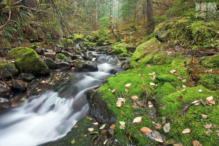
Photo: USDA Forest Service Pacific Northwest Region (Public Domain Mark 1.0)
Getting to Willamette National Forest
Parking, trailheads and gates near Willamette National Forest
- Grasshopper Meadows TrailheadParking · 2.4 mi from the centreDirections
- Blair Lake TrailheadParking · 3.4 mi from the centreDirections
- Parking areaParking · 3.5 mi from the centreDirections
- Grasshopper TrailheadParking · 5.7 mi from the centreDirections
- Shale Ridge TrailheadTrailhead · 5.9 mi from the centreDirections
- Parking areaParking · 5.9 mi from the centreDirections
- Swan Lake TrailheadTrailhead · 6.5 mi from the centreDirections
- Parking areaParking · 6.5 mi from the centreDirections
- Parking areaParking · 6.6 mi from the centreDirections
Parking, trailhead and gate locations come from OpenStreetMap contributors. Roads into public land can be gated or seasonal; check with the managing agency before you go.
Size, counties and manager of Willamette National Forest
Willamette National Forest counts as a national forest, so the general national forest shooting limits apply alongside Oregon seasons. Its published size is 1,689,605 acres, the figure from the USFS land statistics. On a county map it falls in Lane County, Linn County, Marion County, Douglas County, Jefferson County and Clackamas County and 1 more (West Region of ODFW). Local ODFW biologists: the Upper Willamette (Springfield), Mid Willamette (Corvallis) and Deschutes (Bend) districts.
From the USFS hunting and shooting page: In Oregon, licenses and regulations for hunting and fishing are managed by the Oregon Department of Fish & Wildlife (ODFW). Learn about Oregon fishing & hunting regulations and how to get a license . Please remember: It's your responsibility to know property boundaries and respect nearby private lands while hunting on the national forest. The USFS hunting page does not name species; Oregon seasons for the WMUs apply.

Nearby
Places to hunt and shoot around Willamette National Forest
Hunter access and site rules on Willamette National Forest
Hunters on Willamette National Forest may not shoot within 150 yards of a dwelling, building, campsite or developed recreation area under 36 CFR 261.10. Shooting from, along or across a forest road or a body of water is also prohibited. Check the free Motor Vehicle Use Map for Willamette National Forest before driving off pavement; ODFW travel management areas add seasonal road closures.
Sources: 36 CFR 261.10 · Forest Service page · ODFW travel management areas; checked November 8, 2026.
Drawing a tag for Willamette National Forest
What drawn hunters at Willamette National Forest are after.

Counting every series, there are 76 drawn hunts whose 2026 hunt area overlaps the units of Willamette National Forest (22,188 tags). A hunt area can reach well beyond Willamette National Forest, and a hunt there does not guarantee the tag is valid on every acre of it; read the hunt description. Draw timing in 2026: spring bear by February 10, everything else by May 15, results June 12. Three quarters of the tags in the point-based series go by preference points, one quarter by lottery; bighorn, goat and premium hunts are pure lottery.
| Series | Count | Tags 2026 | First-choice apps 2025 |
|---|---|---|---|
| Buck deer (100) | 19 | 9,687 | 2,710 |
| Premium deer (L) | 6 | 6 | – |
| Antlerless deer (600) | 13 | 964 | 5,863 |
| Elk (200) | 25 | 4,516 | 5,502 |
| Premium elk (M) | 6 | 6 | – |
| Pronghorn (400) | 3 | 133 | 995 |
| Premium pronghorn (N) | 1 | 1 | – |
| Spring bear (700) | 3 | 6,875 | 7,814 |
Demand peaks at hunt 123B (Melrose – N Bank Habitat), where 213 people put it first for 3 tags. If odds matter more than the place, 477R (E Slope Bow /) offered 55 tags to 1 first choices. The 2026 booklet marks DE101, DG102, DE101R, DE101R1, DG102R and DE101M as new.
| Hunt no. | Hunt name | Type | Season | 2026 tags | 2025 apps |
|---|---|---|---|---|---|
| 119A | W High Cascade | Any legal weapon | Sep 12–20, 2026 | 3,300 | 1,311 |
| DG103 | Devils Garden 03 | Any legal weapon | Oct 3–14, 2026 | 1,870 | – |
| DG102 | Devils Garden 02 | Any legal weapon | Oct 3–14, 2026 | 1,430 | – |
| DE101 | Deschutes 01 | Any legal weapon | Oct 3–14, 2026 | 990 | – |
| L16 | Santiam | Premium (any legal weapon) | Aug 1–Nov 30, 2026 | 1 | – |
| L19 | McKenzie | Premium (any legal weapon) | Aug 1–Nov 30, 2026 | 1 | – |
| L21 | Indigo | Premium (any legal weapon) | Aug 1–Nov 30, 2026 | 1 | – |
| LDE01 | Deschutes 01 | Premium (any legal weapon) | Aug 1–Nov 30, 2026 | 1 | – |
| 619 | W McKenzie | Any legal weapon | Oct 3–Nov 6, 2026 | 303 | 2,069 |
| 621 | W Indigo | Any legal weapon | Oct 3–Nov 6, 2026 | 142 | 701 |
| 619T | McKenzie Unit Youth | Youth only | Nov 14–25, 2026 | 109 | 460 |
| 621T | N Indigo Youth | Youth only | Nov 14–25, 2026 | 80 | 151 |
| 234X | E Central Cascades | Any legal weapon | Oct 28–Nov 1, 2026 | 1,320 | 1,300 |
| 200M | Cascade Muzzleloader | Muzzleloader | Nov 21–27, 2026 | 990 | 300 |
| 235X | Paulina – E Fort Rock No. 1 | Any legal weapon | Oct 28–Nov 1, 2026 | 495 | 573 |
| 200R | Oregon Youth Bow | Youth only | Aug 29–Sep 27, 2026 | 330 | 124 |
| M16 | Santiam | Premium (any legal weapon) | Aug 1–Nov 30, 2026 | 1 | – |
| M19 | McKenzie | Premium (any legal weapon) | Aug 1–Nov 30, 2026 | 1 | – |
| M21 | Indigo | Premium (any legal weapon) | Aug 1–Nov 30, 2026 | 1 | – |
| M34 | Upper Deschutes | Premium (any legal weapon) | Aug 1–Nov 30, 2026 | 1 | – |
| 477R | E Slope Bow / | Archery | Aug 29–Sep 27, 2026 | 55 | 1 |
| 476A | Fort Rock – Silver Lake | Any legal weapon | Aug 15–23, 2026 | 39 | 793 |
| 476M | Fort Rock-Silver Lake Muzzleloader | Muzzleloader | Sep 5–13, 2026 | 39 | 201 |
| N77 | Fort Rock/Silver Lake | Premium (any legal weapon) | Aug 1–Nov 30, 2026 | 1 | – |
Hunt numbers, 2026 tags and 2025 first-choice applicants from the 2026 Oregon Big Game Hunting Regulations; hunt areas from ODFW’s 2026 controlled hunt boundary layers; draw rules from ODFW. Checked November 8, 2026.
No-draw seasons around Willamette National Forest
Buy-and-go tags apply here for black bear, cougar, deer and elk, as listed below for the Willamette National Forest units. A general bear tag covers August 1 to December 31, and the cougar season lasts the whole year unless the zone quota is reached. Western general rifle buck season in 2026 was October 3 to November 6; youth hunters kept going November 7 and 8.
| Hunt | Animal | First day | Last day | Units |
|---|---|---|---|---|
| General Western Oregon buck deer – Any legal weapon | Deer | Oct 3, 2026 | Nov 6, 2026 | 16, 19, 21 |
| Youth extension – Western Oregon general buck deer | Deer | Nov 7, 2026 | Nov 8, 2026 | 16, 19, 21 |
| General archery – Western Oregon deer | Deer | Aug 29, 2026 | Sep 27, 2026 | 21 |
| General archery – Western Oregon deer | Deer | Aug 29, 2026 | Dec 13, 2026 | 16, 19, 21 |
| General West Cascade bull elk | Elk | Nov 7, 2026 | Nov 13, 2026 | 16, 19, 21 |
| General archery elk – Western Oregon | Elk | Aug 29, 2026 | Sep 27, 2026 | 16, 19, 21 |
| General archery elk – Eastern Oregon | Elk | Aug 29, 2026 | Sep 27, 2026 | 34, 39, 77 |
| General season antlerless elk damage | Elk | Aug 1, 2026 | Mar 31, 2027 | 16 |
| General fall black bear (statewide) | Black bear | Aug 1, 2026 | Dec 31, 2026 | All |
| General cougar (statewide, zone quotas) | Cougar | Jan 1, 2026 | Dec 31, 2026 | All |
General seasons and dates from the 2026 Oregon Big Game Hunting Regulations; tag sale deadlines on the general seasons page. Checked November 8, 2026.
Hunting units around Willamette National Forest
For tags and seasons, Willamette National Forest counts as Santiam Unit (16), McKenzie Unit (19), Indigo Unit (21), Upper Deschutes Unit (34), Metolius Unit (39) and Fort Rock Unit (77). The Cascade split runs through it, giving it western units with general deer and eastern units with controlled deer only.
| WMU | Number | Oregon side | Square miles | Cougar zone | District office |
|---|---|---|---|---|---|
| Santiam Unit | 16 | West | 3,327 | A (180) | North Willamette – Cascade Unit (Clackamas) |
| McKenzie Unit | 19 | West | 2,642 | B (200) | Upper Willamette (Springfield) |
| Indigo Unit | 21 | West | 1,939 | B (200) | Upper Willamette (Springfield) |
| Upper Deschutes Unit | 34 | East | 1,400 | C (80) | Deschutes (Bend) |
| Metolius Unit | 39 | East | 666 | A (180) | Deschutes (Bend) |
| Fort Rock Unit | 77 | East | 1,762 | C (80) | Klamath (Klamath) |
Units from the ODFW Wildlife Management Units layer overlaid on the land record; cougar quotas from the 2026 cougar zone table; checked November 8, 2026.
Harvest figures for the Willamette National Forest units
No agency counts the harvest on Willamette National Forest alone; the table adds up ODFW's 2025 rows for each unit. Santiam Unit posted the biggest 2025 elk harvest of these units, about 186 animals. The most bucks, around 2,707, came from Santiam Unit.
| Unit | Buck deer hunters | Buck deer harvest | Elk hunters | Elk harvest | Pronghorn hunters | Pronghorn harvest | Black bear hunters | Black bear harvest | Cougar hunters | Cougar harvest |
|---|---|---|---|---|---|---|---|---|---|---|
| Santiam Unit | 8,520 | 2,707 | 1,706 | 186 | – | – | 1,791 | 133 | 1,093 | 9 |
| McKenzie Unit | 5,623 | 2,020 | 1,037 | 106 | – | – | 943 | 62 | 672 | 6 |
| Indigo Unit | 3,366 | 1,401 | 780 | 77 | – | – | 1,096 | 123 | 393 | 8 |
| Upper Deschutes Unit | 1,235 | 261 | 662 | 88 | – | – | 290 | 18 | 181 | 3 |
| Metolius Unit | 182 | 85 | 231 | 49 | – | – | 132 | 6 | 104 | 0 |
| Fort Rock Unit | 1,210 | 232 | 372 | 15 | 27 | 16 | 242 | 18 | 158 | 5 |
ODFW 2025 harvest summaries (2025 buck deer, any legal weapon summary · 2025 elk, any legal weapon summary · 2025 pronghorn summary · 2025 black bear summary · 2025 cougar summary); unit totals summed from the report rows; checked November 8, 2026.
Bird hunting zones near Willamette National Forest
The counties of Willamette National Forest use Zone A (Western Oregon) and Zone B (Central Oregon) of ODFW's game bird hours table. For geese, Willamette National Forest counties fall in the Northwest Permit Zone, Southwest Zone and South Coast Zone. The Northwest Permit Zone needs a goose permit and a passed ID test; dusky Canada geese are closed. Zones 1 and 2 for ducks and doves appear only on the ODFW map; look there before choosing dates.
| County | Bird hours zone | Goose zone |
|---|---|---|
| Lane County | A (Western Oregon) | Northwest Permit Zone |
| Linn County | A (Western Oregon) | Northwest Permit Zone |
| Marion County | A (Western Oregon) | Northwest Permit Zone |
| Douglas County | A (Western Oregon) | Southwest Zone, South Coast Zone |
| Jefferson County | B (Central Oregon) | Map only |
| Clackamas County | A (Western Oregon) | Northwest Permit Zone |
| Deschutes County | B (Central Oregon) | Map only |
From the 2026-27 Oregon Game Bird Hunting Regulations: goose zones, shooting-hours zones, duck zone map. Checked November 8, 2026. Waterfowl and goose zones.
Cougar zones, deer areas and closures near Willamette National Forest
The cougar season around Willamette National Forest ends early if Zone A (quota 180), Zone B (quota 200) and Zone C (quota 80) fills. For eastern buck tags, check the Deschutes and Devils Garden hunt areas listed below. Expect seasonal road closures: 7 travel management areas cover parts of the Willamette National Forest units. General season antlerless elk damage tags are valid in part of these units from August 1 to March 31.
| Rule type | Applies to | Detail |
|---|---|---|
| Zone (cougar) | Zone A, Coast/North Cascade | Quota 180 |
| Zone (cougar) | Zone B, Southwest Cascades | Quota 200 |
| Zone (cougar) | Zone C, Southeast Cascades | Quota 80 |
| Herd range | Deschutes (DE) | DE01 |
| Herd range | Devils Garden (DG) | DG01, DG02, DG03, DG04 |
| Elk damage | Willamette Valley | Aug. 1 – Mar. 31 |
| Travel area | 19A Smith Ridge | Permanent Closure |
| Travel area | 19B Chucksney Mountain | Permanent Closure |
| Travel area | 19C Skookum Flat | Permanent Closure |
| Travel area | 19D Scott Creek | Permanent Closure |
| Travel area | 19E East Lane TMA | Operational from the opening of the buck deer ALW season until the close of the General… |
| Travel area | 77A Walker Rim | 3 days prior to opening of controlled buck deer ALW season through the close of the… |
| Travel area | 77C Sugarpine Mountain | Permanent Closure |
| Rifle restriction | West Cascade Bull Elk (November 7 – November 13) | Units 16-30 |
| Rifle restriction | Rocky Mountain Bull Elk (controlled) 1st Season (October 28 – November 1) | Units 31-77 |
| Rifle restriction | Rocky Mountain Bull Elk 2nd Season (November 7 – November 15) | Units 32-77 |
From the 2026 Oregon Big Game Hunting Regulations: cougar zones, Deer Hunt Areas, travel management areas, elk damage areas, rifle restrictions. Checked November 8, 2026.
Nearby public ground on the Willamette National Forest map
Head northwest roughly 26 miles for East Lane TMA-Law enforcement project. Pinned nearby: 3 ranger districts, 1 A&H access area and 1 national forest.
| Name | Kind | Size (ac) | County | Away | Bearing |
|---|---|---|---|---|---|
| East Lane TMA-Law enforcement project | A&H access area | 39,825 | Lane | 26 miles | northwest |
| Cottage Grove RD | Ranger district | 87,069 | Lane | 28 miles | southwest |
| Crescent Ranger District | Ranger district | 309,760 | Klamath | 31 miles | southeast |
| Deschutes National Forest | National forest | 1,612,334 | Deschutes | 33 miles | east |
| Bend/Fort Rock RD | Ranger district | 978,472 | Deschutes | 41 miles | east |
| Gilchrist State Forest | State forest | 72,000 | Klamath | 42 miles | southeast |
Point: OR_FRAMEWORK Oregon Land Management (USFS) inside the USFS EDW ranger district boundaries of the unit (polygon centroid of the largest part). Straight-line distances. Statewide public land map.
The family of records around Willamette National Forest
Drill down into its 4 sub-units below.
Willamette National Forest acres by county
The biggest county slice of Willamette National Forest is Lane County, with some 1,027,745 acres.
| County | Acres | Share |
|---|---|---|
| Lane County | 1,027,745 | 61% |
| Linn County | 464,141 | 27% |
| Marion County | 145,457 | 9% |
| Douglas County | 49,782 | 3% |
| Jefferson County | 1,248 | 0% |
| Clackamas County | 848 | 0% |
| Deschutes County | 383 | 0% |
From the USFS Lands Area Statistics; checked November 8, 2026.
Closed places sharing units with Willamette National Forest
These places share units or counties with Willamette National Forest but are closed to hunting under an Oregon license. No state tag is valid on tribal land; tribal governments issue their own permits.
| Place | Reason closed | County | Acres |
|---|---|---|---|
| Warm Springs Reservation | Tribal land | Wasco, Jefferson, Clackamas, Marion | 647,897 |
| Metolius Wildlife Refuge | Closed by regulation | – | – |
| Crater Lake NP | National Park Service unit | Klamath, Douglas, Jackson | 182,234 |
| Cow Creek Reservation | Tribal land | Douglas | 22,823 |
| Coos, Lower Umpqua, and Siuslaw reservation | Tribal land | Douglas, Lane, Coos, Curry | 14,732 |
| Ankeny NWR | Refuge not in 50 CFR 32.56 | Marion | 2,797 |
| Grand Ronde trust land | Tribal land | Tillamook, Polk, Lane, Yamhill | 1,233 |
| Siletz trust land | Tribal land | Lincoln, Marion | 1,010 |
| Oregon Islands NWR | Refuge not in 50 CFR 32.56 | Curry, Coos, Lincoln, Tillamook, Clatsop, Lane | 514 |
| Coquille trust land | Tribal land | Coos, Jackson, Lane | 146 |
Closed places from lands.json: tribal land (Census TIGERweb; 18 U.S.C. 1165; ODFW), NPS units (36 CFR 2.2), refuges not in 50 CFR 32.56 and ODFW regulation closures. Checked November 8, 2026.
Opening and closing light at Willamette National Forest
Deer, elk, bear and cougar hunters around Willamette National Forest follow the mammal window; grouse, quail, chukar, pheasant, ducks and geese follow the bird table.
| Day | Why it matters | Sun up | Sun down | Deer and elk | Upland and ducks |
|---|---|---|---|---|---|
| Aug 29, 2026 | Archery opener | 6:28 a.m. | 7:52 p.m. | 5:58 a.m. to 8:22 p.m. | Not in table |
| Sep 12, 2026 | Eastern buck rifle | 6:43 a.m. | 7:27 p.m. | 6:13 a.m. to 7:57 p.m. | 6:22 a.m. to 7:22 p.m. |
| Oct 3, 2026 | General buck opener | 7:07 a.m. | 6:48 p.m. | 6:37 a.m. to 7:18 p.m. | 6:46 a.m. to 6:44 p.m. |
| Oct 10, 2026 | Duck opener and upland opener | 7:15 a.m. | 6:36 p.m. | 6:45 a.m. to 7:06 p.m. | 6:55 a.m. to 6:31 p.m. |
| Dec 21, 2026 | Shortest day | 7:40 a.m. | 4:34 p.m. | 7:10 a.m. to 5:04 p.m. | 7:15 a.m. to 4:37 p.m. |
| Apr 15, 2027 | Spring turkey | 6:27 a.m. | 7:51 p.m. | 5:57 a.m. to 8:21 p.m. | Not in table |
Hours rules from the ODFW general hunting regulations; game bird times from the 2026-27 game bird shooting hours table; mammal sunrise and sunset worked out for this location with the NOAA solar formula (Pacific Time); checked November 8, 2026. Legal hours for every county.
Restocking near Willamette National Forest
Supplies are closest in Westfir, a straight-line 17 miles from Willamette National Forest. The 2024 Census estimate makes Springfield the largest nearby, at 61,182 people. Within ten miles of Black Butte Ranch, Detroit, Gates and Sweet Home you reach Willamette National Forest. The closest ODFW office is in Springfield, 41 miles away.
| Town | County | 2024 population | Away | Which way |
|---|---|---|---|---|
| Westfir | Lane | 255 | 17 miles | southwest |
| Crescent | Klamath | – | 38 miles | southeast |
| Springfield | Lane | 61,182 | 41 miles | west |
| Black Butte Ranch | Deschutes | – | 43 miles | northeast |
| Sisters | Deschutes | 2,957 | 43 miles | northeast |
Towns from places.json (Census 2024 estimates); ODFW offices from the ODFW contact page; businesses from services.json listings; straight-line miles. Checked November 8, 2026.
Willamette National Forest: ranges within a drive
From Willamette National Forest, the nearest pin on the range map is Emerald Empire Gun Club, 42 miles away.
From ODFW’s E.E. Wilson visitors guide, the BLM qualified range list, club sites and directory listings, checked November 8, 2026.

Willamette National Forest hunting questions, answered from the sources
Does Oregon limit hunting days at Willamette National Forest?
Yes, unless the place’s own rules name hunt days.
What agency is responsible for Willamette National Forest?
The USDA Forest Service. ODFW sets the seasons and tags that apply.
Do I have to report a hunt on Willamette National Forest?
Yes, even if you did not hunt. Deadlines: January 31, 2027 or April 15, 2027 depending on when the hunt ends; a late deer or elk report costs $25.
Is hunting allowed on Willamette National Forest?
It is open: hunting on Willamette National Forest is regulated by ODFW, and the Forest Service sets shooting-safety and road rules.
What unit numbers apply to Willamette National Forest?
Santiam Unit (16), McKenzie Unit (19), Indigo Unit (21), Upper Deschutes Unit (34), Metolius Unit (39) and Fort Rock Unit (77). Each unit has its own page with seasons and hunt numbers.
Which controlled hunts reach Willamette National Forest?
76 controlled or premium hunts (22,188 tags in 2026) overlap its units; apply by May 15 (spring bear February 10).
Which general seasons apply on Willamette National Forest?
General seasons in its units cover black bear, cougar, deer and elk; buy the tag before the sale deadline.
Which license covers a hunt on Willamette National Forest?
An Oregon hunting license ($39.00 resident, $193.00 nonresident in 2026) plus the tag or validation for your game.
When do legal hours begin and end at Willamette National Forest?
Around 6:23 a.m. to 5:22 p.m. on November 8, 2026 for deer and elk, from the NOAA solar formula. Game birds follow ODFW’s table: 6:31 a.m. to 4:51 p.m.
Must I wear hunter orange at Willamette National Forest?
Oregon requires orange only of youth under 18 using a firearm for game mammals or upland birds other than turkey.
Has chronic wasting disease been found anywhere near Willamette National Forest?
No. CWD has not been detected in Oregon (3,682 deer and 1,607 elk results not detected as of October 15, 2026). Parts brought in from other states are restricted.
What acreage does Willamette National Forest cover?
It covers about 1,689,605 acres.
Wrapping up plans for Willamette National Forest
Rules, closures and permits for Willamette National Forest change during the year; posted signs and the managing agency outrank this page.
Sources: source 1 · source 2 · source 3 · source 4 · source 5 · source 6; seasons from the 2026 Oregon Big Game Hunting Regulations and the 2026-27 Oregon Game Bird Hunting Regulations. Checked November 8, 2026.
Other photos on this page: USDA Forest Service Pacific Northwest Region (Public Domain Mark 1.0); Jeff Gunn (CC BY 2.0).