Home › Oregon › Public land › National forests
Forest Service · ODFW seasons
Oregon National Forests for Hunters
12 national forests with 15,668,109 acres of National Forest System land in Oregon, 44 ranger districts and the Crooked River National Grassland.
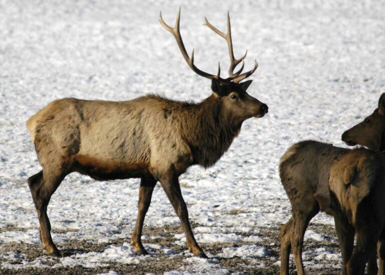
Photo: Bonnie Moreland (Public Domain Mark 1.0)
Oregon national forests and the grassland
National forest is the largest block of hunting ground in Oregon. ODFW sets every season, tag and bag limit on it; the Forest Service runs the land, the roads and the campgrounds and enforces 36 CFR 261.10, which bans firing within 150 yards of a residence, building, campsite, developed recreation site or occupied area, and bans shooting across or on a forest road or a body of water. Eleven of the forests are run from the Pacific Northwest Region; the twelfth record is the Oak Knoll district of the Klamath National Forest, administered from California, whose hunting page names California seasons even though Oregon tags apply on the Oregon acres. Wallowa-Whitman and Fremont-Winema are the largest; Siuslaw on the coast is the smallest of the full forests. Inside the forests, two special areas are closed to all hunting under the 2026 big game booklet: the Newberry Crater refuge within the crater rim and the Metolius refuge in Unit 39. On the Crooked River National Grassland, the Rimrock Springs Wildlife Area is closed as well. Cooperative travel management areas close roads in season across many districts.
| Forest or grassland | Counties | Units | NFS acres | Districts |
|---|---|---|---|---|
| Wallowa-Whitman National Forest | Wallowa, Baker, Union + | 49, 50, 51 + | 2,260,830 | 5 |
| Fremont-Winema National Forest | Klamath, Lake | 21, 30, 31 + | 2,253,676 | 7 |
| Malheur National Forest | Grant, Harney, Baker + | 46, 47, 50 + | 1,722,078 | 3 |
| Willamette National Forest | Lane, Linn, Marion + | 16, 19, 21 + | 1,689,605 | 4 |
| Rogue River-Siskiyou National Forests | Curry, Jackson, Josephine + | 22, 25, 26 + | 1,635,981 | 5 |
| Deschutes National Forest | Deschutes, Klamath, Lake + | 16, 19, 21 + | 1,612,334 | 3 |
| Umatilla National Forest | Umatilla, Grant, Morrow + | 45, 48, 49 + | 1,106,621 | 4 |
| Mt. Hood NF | Clackamas, Hood River, Wasco + | 16, 41, 42 | 1,015,093 | 4 |
| Umpqua National Forest | Douglas, Lane, Jackson | 21, 22, 29 + | 985,950 | 4 |
| Ochoco National Forest | Crook, Wheeler, Jefferson + | 36, 37, 38 + | 728,634 | 3 |
| Siuslaw National Forest | Lane, Lincoln, Tillamook + | 14, 17, 18 + | 630,498 | 2 |
| Klamath National Forest (Oregon Part) | Jackson | 28 | 26,809 | 1 |
| Crooked River National Grassland | Jefferson | 38, 39 | 115,002 | 0 |
Sources: USFS Lands Area Statistics · 36 CFR 261.10 · ODFW refuges and special areas; checked November 8, 2026.
All 44 ranger districts
Ranger district pages narrow a forest down to the ground one district office manages. Districts range from 26,809 to 978,472 acres of National Forest System land.
| Ranger district | Forest | Counties | Units | NFS acres |
|---|---|---|---|---|
| Bend/Fort Rock RD | Deschutes | Deschutes, Lake + | 19, 34, 35 + | 978,472 |
| Crescent Ranger District | Deschutes | Klamath, Deschutes + | 19, 21, 34 + | 309,760 |
| Sisters Ranger District | Deschutes | Deschutes, Jefferson | 16, 19, 34 + | 324,102 |
| Bly Ranger District | Fremont-Winema | Klamath, Lake | 32, 75, 76 | 333,647 |
| Chemult Ranger District | Fremont-Winema | Klamath | 21, 33, 76 + | 396,489 |
| Chiloquin Ranger District | Fremont-Winema | Klamath | 31, 32, 33 + | 462,081 |
| Klamath Ranger District | Fremont-Winema | Klamath | 30, 31, 33 | 190,967 |
| Lakeview Ranger District | Fremont-Winema | Lake, Klamath | 74, 75 | 316,540 |
| Paisley Ranger District | Fremont-Winema | Lake, Klamath | 75, 76 | 255,154 |
| Silver Lake RD | Fremont-Winema | Lake, Klamath | 35, 76, 77 | 298,798 |
| Oak Knoll RD | Klamath | Jackson | 28 | 26,809 |
| Blue Mountain RD | Malheur | Grant | 46, 47, 50 + | 706,705 |
| Emigrant Creek RD | Malheur | Harney, Grant + | 46, 66, 72 | 634,041 |
| Prairie City RD | Malheur | Grant, Baker + | 46, 65, 66 | 381,332 |
| Barlow Ranger District | Mt. Hood | Wasco, Hood River | 16, 41 | 167,461 |
| Clackamas River RD | Mt. Hood | Clackamas, Marion + | 16 | 401,650 |
| Hood River RD | Mt. Hood | Hood River, Wasco + | 16, 41, 42 | 190,241 |
| Zigzag Ranger District | Mt. Hood | Clackamas, Multnomah + | 16, 42 | 255,741 |
| Lookout Mountain RD | Ochoco | Crook, Wheeler | 36, 37, 38 | 237,467 |
| Paulina Ranger District | Ochoco | Crook, Wheeler + | 37 | 376,165 |
| Gold Beach RD | Rogue River-Siskiyou | Curry, Josephine + | 25, 26, 27 | 463,028 |
| High Cascades RD | Rogue River-Siskiyou | Jackson, Klamath + | 22, 30, 31 | 424,047 |
| Powers Ranger District | Rogue River-Siskiyou | Curry, Coos | 25, 26 | 138,999 |
| Siskiyou Mountains RD | Rogue River-Siskiyou | Jackson, Josephine | 28 | 153,445 |
| Wild Rivers RD | Rogue River-Siskiyou | Josephine, Curry | 27, 28 | 456,462 |
| Central Coast RD | Siuslaw | Lane, Lincoln + | 18, 20, 24 | 481,780 |
| Hebo Ranger District | Siuslaw | Tillamook, Lincoln + | 14, 17 | 148,718 |
| Heppner Ranger District | Umatilla | Morrow, Grant + | 45, 48 | 209,952 |
| North Fork John Day | Umatilla | Grant, Umatilla + | 48, 49, 50 + | 479,054 |
| Pomeroy Ranger District | Umatilla | Wallowa | 56 | 67,468 |
| Walla Walla RD | Umatilla | Umatilla, Union + | 54, 55, 56 | 350,147 |
| Cottage Grove RD | Umpqua | Lane, Douglas | 21 | 87,069 |
| Diamond Lake RD | Umpqua | Douglas | 21, 22, 30 + | 316,632 |
| North Umpqua RD | Umpqua | Douglas, Lane | 21, 22 | 256,493 |
| Tiller Ranger District | Umpqua | Douglas, Jackson | 22, 29 | 325,756 |
| Eagle Cap RD | Wallowa-Whitman | Wallowa, Union + | 53, 60, 61 + | 389,089 |
| Hells Canyon National Recreation area | Wallowa-Whitman | Wallowa, Baker | 58, 59, 61 + | 482,851 |
| La Grande RD | Wallowa-Whitman | Union, Baker + | 49, 52, 53 + | 441,452 |
| Wallowa Valley RD | Wallowa-Whitman | Wallowa, Union | 57, 58, 61 | 309,342 |
| Whitman Ranger District | Wallowa-Whitman | Baker, Grant + | 50, 51, 52 + | 638,096 |
| Detroit Ranger District | Willamette | Linn, Marion + | 16, 39 | 305,849 |
| McKenzie River RD | Willamette | Lane, Linn + | 16, 19, 34 + | 503,001 |
| Middle Fork RD | Willamette | Lane, Douglas | 19, 21, 34 + | 690,478 |
| Sweet Home RD | Willamette | Linn | 16, 19 | 190,277 |