Home › Wisconsin › Public land › East Fork of the Black River State Natural Area
Jackson County, Wisconsin
East Fork of the Black River State Natural Area: the hunter's file
Deer unit DMU 203 and DMU 202, bear and turkey zones, closures, licenses and the nearest towns and services.
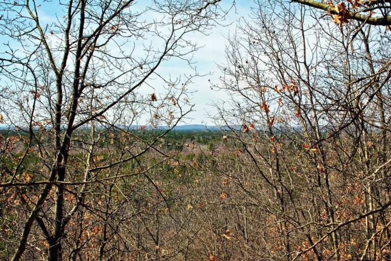
Photo: Aaron Volkening (CC BY 2.0)
Getting to East Fork of the Black River State Natural Area
Parking, trailheads and gates near East Fork of the Black River State Natural Area
- Parking areaParking · 1.2 mi from the centreDirections
- Parking areaParking · 1.7 mi from the centreDirections
- East Arbutus Park Boat RampBoat ramp · 2.4 mi from the centreDirections
- Parking areaParking · 2.4 mi from the centreDirections
- North Arbutus Boat LaunchBoat ramp · 2.6 mi from the centreDirections
- Parking areaParking · 2.6 mi from the centreDirections
- Parking areaParking · 3.4 mi from the centreDirections
- Parking areaParking · 3.5 mi from the centreDirections
- Boat rampBoat ramp · 3.6 mi from the centreDirections
- Parking areaParking · 3.6 mi from the centreDirections
- North Arnold Creek AccessBoat ramp · 3.6 mi from the centreDirections
Parking, trailhead and gate locations come from OpenStreetMap contributors. Roads into public land can be gated or seasonal; check with the managing agency before you go.
Key facts for East Fork of the Black River State Natural Area
East Fork of the Black River State Natural Area is a DNR-owned State Natural Area in Jackson and Clark counties. The DNR files it under its West Central Region (west-central Wisconsin). Management sits with the Wisconsin DNR. Acreage: 513, which places it 115th of 449 state natural areas. Listed as SNA 612; survey location T22N-R2W, Sections 5, 6. T23N-R2W, Sections 31, 32. The closest covered town is Hatfield, around 5 miles off as the crow flies. It belongs to Black River State Forest.
From the source page (WI DNR SNA parcel ownership GIS OWNER_ACRE_AMT, WDNR-owned parcels); region from the DNR county layer. Checked October 19, 2026.
Nearby
Places to hunt and shoot around East Fork of the Black River State Natural Area
East Fork of the Black River State Natural Area by zone and unit
Deer: Central Forest zone, DMU 203 and DMU 202. 450 and 775 antlerless deer: the 2026 quota for the units. Bear hunters here apply for Zone C: 7,605 applied for 2026 and 4,465 permits went out. In Zone 3 turkey hunters held 55,612 spring tags in 2025 (spring 2027 levels are not out yet). CWD-positive deer have been recorded in Jackson and Clark counties; free testing is offered statewide. Baiting and feeding deer are banned in Jackson and Clark counties.
DMU figures for East Fork of the Black River State Natural Area
| Unit | Deer zone | Quota | Public-access bonus | Private bonus | Farmland per license |
|---|---|---|---|---|---|
| DMU 203 | Central Forest | 450 | 0 | 268 | — |
| DMU 202 | Central Forest | 775 | 0 | 1,436 | — |
East Fork of the Black River State Natural Area zone table
| Zone | Setting | Data | Also | Last season |
|---|---|---|---|---|
| Bear zone C | No dogs | 875 target, 4,465 permits | 2 points | 663 bears in 2025 |
| Turkey 3 | 55,612 spring tags (2025) | 22% success | 12,324 gobblers | 1,500 fall bonus |
| Ruffed grouse A | Sep 12–Jan 3 | 5 a day | ||
| Duck | Southern | Oct 3–Oct 11 Oct 17–Dec 6 | ||
| Goose | Southern | Sep 16–Oct 11 Oct 17–Dec 6 Dec 19–Jan 2 | ||
| Elk | Central (Black River Elk Range) | 6 bull and 6 antlerless | Public land nearly 70% | |
| Wolf 5 | No hunt | Endangered status |
Zones from the DNR zone layers as recorded in lands.json; quotas and bonus tags from the 2026 antlerless quota table; bear figures from the 2026 bear drawing summary and 2025 bear harvest; turkey from the 2025 spring turkey report; CWD and baiting lists from the DNR. Checked October 19, 2026.
East Fork of the Black River State Natural Area: the property description
Copied from the official listing.
The East Fork of the Black River is one of the longest stretches of undammed and essentially undeveloped river corridors in the southern 2/3rds of Wisconsin. The southern extremity of the Canadian Shield, or Laurentian Plateau, is exposed here, exemplified by pre-Cambrian granitic bedrock outcroppings that occur along the shores. The site is a biologically significant mosaic of terrestrial and aquatic communities and supports several rare plants and animals. Along with the East Fork proper, the primary features at this site include a series of ridges and swales that parallel the river on its south side.
Here, the ridges support a mature dry-mesic forest of white and red pine and oak. The swales contain a variety of wetland communities, including white pine-red maple swamp, tamarack swamp, northern sedge meadow, and alder thicket. These natural communities harbor a diversity of bird species including pine, black-throated green, blackburnian, Nashville, hermit thrush, veery, and northern raven. A state-threatened species also occurs here. The East Fork of the Black River is owned by the DNR and was designated a State Natural Area in 2010.
Quoted from the property page, retrieved 2026-10-19; checked October 19, 2026.
Access, closures and licenses for East Fork of the Black River State Natural Area
East Fork of the Black River State Natural Area: open to whom, and how
Expect open hunting and trapping on the DNR-owned parcels, with no camping, motor vehicles, drones or plant collecting allowed.
Orange, stands and GameReg at East Fork of the Black River State Natural Area
Bowhunters too: when a gun deer season is on, 50% of the coat and hat must be orange or pink, unless you are hunting waterfowl. A ground blind on DNR property needs 144 sq in of orange or pink during gun deer seasons. South of Hwy. 64 every stand and blind leaves with you; north of it, two portable stands per county may stay out Sept. 1-Jan. 31. Use GameReg (online or 844-426-3734) before 5 p.m. the day after the harvest.
Tags and licenses for East Fork of the Black River State Natural Area
Licenses sell on Go Wild. On public land, antlerless deer need a public-access authorization for the unit.
Access from the source page; closures from the DNR closed and restricted areas layer; stocking and dove fields from the DNR upland bird layers; rules from the Fall 2026-Spring 2027 regulations; prices from Go Wild. Checked October 19, 2026.
East Fork of the Black River State Natural Area: parent and sister units
Black River State Forest is the parent; 12 more units share it.
More of Black River State Forest
| Name | Kind | Counties | Acres |
|---|---|---|---|
| Komensky Barrens | State natural area | Jackson | 1,831 |
| Upper Black River | State natural area | Jackson | 1,533 |
| Starlight Wetlands | State natural area | Jackson | 1,052 |
| Washburn Marsh | State natural area | Jackson | 604 |
| Ketchum Creek Pines | State natural area | Jackson | 424 |
| Wildcat Ridge | State natural area | Jackson | 379 |
| Arbutus Oaks | State natural area | Clark | 214 |
| Milllston Ridge Barrens | State natural area | Jackson | 193 |
| Waazija Haci | State natural area | Jackson | 142 |
| Robinson Creek Pines | State natural area | Jackson | 126 |
| Castle Mound Pine Forest | State natural area | Jackson | 115 |
| Catfish Eddy Terraces | State natural area | Jackson | 75 |
Which animals East Fork of the Black River State Natural Area lists
The agency names no particular game for East Fork of the Black River State Natural Area: all open seasons apply, within the property rules.
The Jackson County dates (42 rows) follow.
Species from the property record (No species list published for this property; open seasons follow statewide/zone regulations where hunting is allowed.); bag limits from the DNR regulations. Checked October 19, 2026.
Which seasons are open in East Fork of the Black River State Natural Area
Deer dates are statewide in Wisconsin; bear, turkey, grouse, cottontail and waterfowl dates follow zone lines, so only the rows for East Fork of the Black River State Natural Area are listed.
| Species | Season | Where it applies | Opens | Closes | Today |
|---|---|---|---|---|---|
| White-tailed deer | Archery and crossbow | Statewide | Sep 12, 2026 | Jan 3, 2027 | |
| White-tailed deer | Youth/disabled gun hunt | Statewide | Oct 10, 2026 | Oct 11, 2026 | |
| White-tailed deer | Gun deer (9-day) | Statewide | Nov 21, 2026 | Nov 29, 2026 | |
| White-tailed deer | Muzzleloader | Statewide | Nov 30, 2026 | Dec 9, 2026 | |
| White-tailed deer | December antlerless hunt | Statewide | Dec 10, 2026 | Dec 13, 2026 | |
| White-tailed deer | Antlerless-only Holiday Hunt | Holiday Hunt, Jackson | Dec 24, 2026 | Jan 1, 2027 | |
| White-tailed deer | Extended archery and crossbow | Extended archery | Jan 4, 2027 | Jan 31, 2027 | |
| Black bear | Bear, Class A draw | Bear Zone E/C | Sep 9, 2026 | Oct 13, 2026 | |
| Elk | Elk, all weapons | Central Elk Zone | Oct 17, 2026 | Dec 13, 2026 | |
| Wild turkey | Fall turkey | Turkey Zone 1/3 | Sep 12, 2026 | Jan 3, 2027 | |
| Wild turkey | Spring youth turkey hunt | Turkey Zone 1/3 | Apr 17, 2027 | Apr 18, 2027 | |
| Wild turkey | Spring turkey Period A | Turkey Zone 1/3 | Apr 21, 2027 | Apr 27, 2027 | |
| Wild turkey | Spring turkey Period B | Turkey Zone 1/3 | Apr 28, 2027 | May 4, 2027 | |
| Wild turkey | Spring turkey Period C | Turkey Zone 1/3 | May 5, 2027 | May 11, 2027 | |
| Wild turkey | Spring turkey Period D | Turkey Zone 1/3 | May 12, 2027 | May 18, 2027 | |
| Wild turkey | Spring turkey Period E | Turkey Zone 1/3 | May 19, 2027 | May 25, 2027 | |
| Wild turkey | Spring turkey Period F | Turkey Zone 1/3 | May 26, 2027 | Jun 1, 2027 | |
| Ruffed Grouse | Ruffed grouse | Grouse Zone A | Sep 12, 2026 | Jan 3, 2027 | |
| Pheasant | Pheasant | Statewide | Oct 17, 2026 | Jan 3, 2027 | |
| Bobwhite Quail | Bobwhite quail | Statewide | Oct 17, 2026 | Dec 9, 2026 | |
| Hungarian partridge | Hungarian partridge | Statewide | Oct 17, 2026 | Jan 3, 2027 | |
| Squirrel | Squirrel | Statewide | Sep 12, 2026 | Feb 28, 2027 | |
| Cottontail | Cottontail rabbit | Southern cottontail zone | Oct 17, 2026 | Feb 28, 2027 | |
| Snowshoe Hare | Snowshoe hare | Statewide | Year-round | Year-round | Year-round |
| American Crow | Crow | Statewide | Nov 21, 2026 | Mar 24, 2027 | |
| Ducks | Youth waterfowl hunt | Statewide | Sep 19, 2026 | Sep 20, 2026 | |
| Ducks | Regular duck (split 1) | Southern Duck Zone | Oct 3, 2026 | Oct 11, 2026 | |
| Ducks | Regular duck (split 2) | Southern Duck Zone | Oct 17, 2026 | Dec 6, 2026 | |
| Teal | Early teal | Statewide | Sep 1, 2026 | Sep 9, 2026 | |
| Geese | Regular goose (split 1) | Southern Goose Zone | Sep 16, 2026 | Oct 11, 2026 | |
| Geese | Regular goose (split 2) | Southern Goose Zone | Oct 17, 2026 | Dec 6, 2026 | |
| Geese | Regular goose (holiday split) | Southern Goose Zone | Dec 19, 2026 | Jan 2, 2027 | |
| Canada goose | Early Canada goose | Statewide | Sep 1, 2026 | Sep 15, 2026 | |
| Raccoon | Raccoon (resident) | Statewide | Oct 17, 2026 | Feb 15, 2027 | |
| Raccoon | Raccoon (nonresident) | Statewide | Oct 31, 2026 | Feb 15, 2027 | |
| Red and gray fox | Fox (red and gray) | Statewide | Oct 17, 2026 | Feb 15, 2027 | |
| Coyote | Coyote (hunting) | Statewide | Year-round | Year-round | Year-round |
| Bobcat | Bobcat, Period 1 | North of Hwy. 64 | Oct 17, 2026 | Dec 25, 2026 | |
| Bobcat | Bobcat, Period 1 | South of Hwy. 64 | Oct 17, 2026 | Dec 25, 2026 | |
| Bobcat | Bobcat, Period 2 | North of Hwy. 64 | Dec 26, 2026 | Jan 31, 2027 | |
| Bobcat | Bobcat, Period 2 | South of Hwy. 64 | Dec 26, 2026 | Jan 31, 2027 | |
| Unprotected species | Unprotected species | Statewide | Year-round | Year-round | Year-round |
From the Wisconsin Department of Natural Resources Fall 2026-Spring 2027 hunting regulations and season dates, checked October 19, 2026.
East Fork of the Black River State Natural Area: county harvest and CWD tests
Hunters registered 4,911 deer in the Jackson County unit in 2025: 2,333 bucks and 2,578 antlerless. High year on the chart: 2022 at 6,250; low year: 2025 at 4,911. Preliminary 2026 count to Oct. 19: 79 in DMU 203 and 114 in DMU 202. Jackson County CWD testing (2025): 1 positives out of 198 samples. Cumulative total 4 positives in 3,127 tests. Jackson County bear harvest, 2025: 47. Harvest and CWD figures cover Jackson County as a whole.
Jackson County deer by year
| Year | Buck | Antlerless | Deer |
|---|---|---|---|
| 2025 | 2,333 | 2,578 | 4,911 |
| 2024 | 2,940 | 2,780 | 5,720 |
| 2023 | 2,884 | 2,403 | 5,287 |
| 2022 | 3,230 | 3,020 | 6,250 |
| 2021 | 3,143 | 2,533 | 5,676 |
| 2020 | 3,198 | 3,018 | 6,216 |
Testing for CWD, Jackson County
| Year | Deer tested | CWD positive |
|---|---|---|
| 2026 (partial) | 19 | 0 |
| 2025 | 198 | 1 |
| 2024 | 213 | 1 |
| 2023 | 225 | 2 |
| 2022 | 204 | 0 |
| 2021 | 186 | 0 |
Bears by year, Jackson County
| Year | Bears | Male | Female |
|---|---|---|---|
| 2024 | 110 | 48 | 62 |
| 2025 | 47 | 25 | 22 |
Deer from DNR Deer Metrics harvest history and the 2026 harvest to date; CWD from the DNR CWD summary; bears from the DNR bear harvest reports. Checked October 19, 2026.
East Fork of the Black River State Natural Area pinned among its neighbours
Map of East Fork of the Black River State Natural Area and the 10 nearest public places. That is 267,330 acres of public ground.
| Area | Category | Acreage | Distance | Direction |
|---|---|---|---|---|
| Bauer-Brockway Barrens | State natural area | 120 | 9.7 mi | southwest |
| Jackson | County forest | 122,685 | 12 mi | southeast |
| Clark | County forest | 134,742 | 14 mi | north |
| Tank Creek | Fishery area | 503 | 15 mi | west |
| S Branch Trempealeau River (Remnant) | Fishery area | 180 | 15 mi | west |
| Halls (Stockwell) Creek | Fishery area | 814 | 16 mi | west |
| North Branch Trempealeau River | Fishery area | 306 | 17 mi | west |
| Jay Creek Pine Forest | State natural area | 441 | 18 mi | southeast |
| Smith Pond | Fishery area | 96 | 19 mi | west |
| Monroe | County forest | 7,443 | 19 mi | south |
Points from the DNR managed lands, SNA, county forest, FWS realty, USFS, NPS and DoD layers (WI DNR State Natural Areas parcel ownership GIS (centroid of WDNR-owned parcels) (polygon centroid)). Straight-line distances. Statewide public land map.
Towns, processors and DNR desks near East Fork of the Black River State Natural Area
Start with a town, then line up a cooler, a butcher and a mount.
| Town | County | Miles off | People | Public acres (10 mi) |
|---|---|---|---|---|
| Hatfield | Jackson | 4.8 mi | — | 89,996 |
| Mission | Jackson | 7.4 mi | — | 101,157 |
| Sand Pillow | Jackson | 8.1 mi | — | 102,555 |
| Merrillan | Jackson | 9.1 mi | 549 | 64,264 |
For the wider county picture: Jackson County, Clark County.
Venison, mounts and ammo near East Fork of the Black River State Natural Area
East Fork of the Black River State Natural Area: agency contacts
County service center: DNR La Crosse Service Center (608-785-9000).
Towns and populations from the Census 2024 estimates; public acres within 10 miles from the land layers; businesses from store locators and listings (license-only agents left out); offices from DNR, USFS and USFWS pages. Checked October 19, 2026. Call ahead.
East Fork of the Black River State Natural Area: nearest ranges
Sherwood Shooting Range in Clark County is the nearest DNR-map range, 14 miles out. Two nearby club ranges follow.
rifle, trap, sporting clays, shotgun on file
sporting clays, shotgun on file
trap, shotgun on file
From the DNR public range map and its map layer, checked October 19, 2026.
First and last legal minute at East Fork of the Black River State Natural Area
Deer, bear, elk, small game and fall turkey: 30 minutes before sunrise until 20 minutes after sunset. Ducks, geese, doves and spring turkey: same start, done at sunset.
| Date | Season moment | Northern Area | Southern Area |
|---|---|---|---|
| Sep 12, 2026 | Bow, turkey, grouse opener | 6:07 a.m. to 7:39 p.m. | 6:09 a.m. to 7:38 p.m. |
| Oct 17, 2026 | Pheasant and duck dates | 6:51 a.m. to 6:33 p.m. | 6:50 a.m. to 6:36 p.m. |
| Nov 1, 2026 | Early November | 6:12 a.m. to 5:09 p.m. | 6:09 a.m. to 5:13 p.m. |
| Nov 21, 2026 | Gun deer opener | 6:40 a.m. to 4:46 p.m. | 6:35 a.m. to 4:52 p.m. |
| Dec 1, 2026 | Muzzleloader week | 6:52 a.m. to 4:40 p.m. | 6:47 a.m. to 4:47 p.m. |
| Dec 24, 2026 | Holiday Hunt opener | 7:11 a.m. to 4:42 p.m. | 7:05 a.m. to 4:50 p.m. |
| Jan 3, 2027 | Archery close (most units) | 7:13 a.m. to 4:51 p.m. | 7:07 a.m. to 4:58 p.m. |
Deer, bear, elk, small game and fall turkey table times from the Wisconsin Department of Natural Resources shooting hours tables, plus the Zone D offset of 12 minutes for longitude 90.65 W, checked October 19, 2026. Shooting hours for every county.

Questions hunters raise about East Fork of the Black River State Natural Area
How many turkey permits go to the East Fork of the Black River State Natural Area zone?
Turkey Zone 3. 55,612 spring tags were issued there in 2025.
What waterfowl dates apply at East Fork of the Black River State Natural Area?
Duck zone: Southern; goose zone: Southern. Southern Zone ducks open Oct 3, 2026-27.
Can I put out corn for deer at East Fork of the Black River State Natural Area?
Not here: Jackson and Clark counties is under the ban. CWD has been found in wild deer in Jackson and Clark counties.
How much orange do I wear at East Fork of the Black River State Natural Area?
During any firearm deer season: 50% of your outer clothing above the waist and 50% of any cap, blaze orange or pink. Waterfowl hunters are exempt.
When must I register a turkey from East Fork of the Black River State Natural Area?
Deer: online, phone or station by 5 p.m. next day. Turkeys: online or phone only.
Which tags work on East Fork of the Black River State Natural Area?
No special permit for most of it; buy the license on Go Wild and carry public-access antlerless tags.
Is there other public ground around East Fork of the Black River State Natural Area?
By straight-line distance: Bauer-Brockway Barrens State Natural Area (10 miles), Jackson County Forest (12 miles) and Clark County Forest (14 miles).
What is the parent of East Fork of the Black River State Natural Area?
Black River State Forest holds it.
What type of property is East Fork of the Black River State Natural Area on the record?
It is a DNR-owned State Natural Area, managed by the Wisconsin DNR.
What size is East Fork of the Black River State Natural Area on the record?
About 513 acres.
What is the nearest town to East Fork of the Black River State Natural Area?
Base in Hatfield, 5 miles away; the ground is in Jackson and Clark counties.
Which species are allowed at East Fork of the Black River State Natural Area?
There is no species list. Any season open in the county works here within the rules.
What is the antlerless quota at East Fork of the Black River State Natural Area?
DMU 203 and DMU 202, part of the Central Forest zone. Antlerless goal for 2026: 450 and 775.
East Fork of the Black River State Natural Area: one more look before the drive
Signs on the ground beat any web page. Read the posted boundaries at East Fork of the Black River State Natural Area when you arrive.
Sources for this page: DNR: EastForkBlackRiver · DNR GIS · DNR: StateNaturalAreas; regulations from the Fall 2026-Spring 2027 Wisconsin hunting regulations. Checked October 19, 2026.
Other photos on this page: GlacierNPS (Public Domain Mark 1.0); USFWS Mountain Prairie (CC BY 2.0).