Home › Minnesota › Public land › Wolf Trail WMA
WMA · Northwest region
Wolf Trail Wildlife Management Area hunting, 2026-27
Seasons, access rules and the nearest towns for this wildlife management area in Beltrami County.
Photo: jjsmustang1979 (CC BY 2.0)
Getting to Wolf Trail Wildlife Management Area
Parking, trailheads and gates near Wolf Trail Wildlife Management Area
- Parking areaParking · 2.1 mi from the centreDirections
Parking, trailhead and gate locations come from OpenStreetMap contributors. Roads into public land can be gated or seasonal; check with the managing agency before you go.
What the file says about Wolf Trail WMA
Wolf Trail WMA adds 7,793 acres of public ground to Beltrami County. Line up the 22 wildlife management areas in Beltrami County by acres and Wolf Trail WMA comes 5th. Its deer permit area is 111; the 2026 designation there is antlerless permit lottery.
DNR runs Wolf Trail WMA from its Thief River Falls area office; email thiefriver.wildlife@state.mn.us.
In DNR's words: Management goals for Willow-Run and Wolf Trail WMAs include maintaining an open mix of grass and brush for sharp-tailed grouse, and young forest for deer, ruffed grouse, and woodcock. These habitats are maintained by a combination of prescribed fire and shearing/mowing. Where soils allow the development of more mature and commercially viable timber, longer rotation timber harvests are anticipated.
Species on the record: deer, black bear, small game, ruffed grouse and woodcock, sharp-tailed grouse.
- White-tailed Deer
- Black Bear
- Eastern Cottontail
- Gray Squirrel
- Snowshoe Hare
- Ruffed Grouse
- American Woodcock
- Sharp-tailed Grouse
From the agency record (Minnesota Department of Natural Resources); checked October 28, 2026.
Nearby
Places to hunt and shoot around Wolf Trail Wildlife Management Area
Wolf Trail WMA route text and lots
Use these DNR directions to find Wolf Trail WMA; the map pins its 0 parking points.
| Section | Acres | Town | Hunting | Lots | DNR |
|---|---|---|---|---|---|
| Wolf Trail WMA | 7,793 | Grygla | Open | – | DNR |
- Wolf Trail WMA: From Grygla, go 10.5 miles E on MN 89, then 3 miles S on Jelle Rd to the campground entrance on the west side of the road. Several gravel roads bisect or border the WMA. These roads may not have shoulders or soft shoulders so use caution. A few pull-offs (field approaches) are available. A primitive campground consisting of a mowed opening is available on the west side of Jelle Rd. A portion of the Fourtown-Grygla ATV trail cuts through the WMA and is generally open from June 1st to October 31st, but consult the DNR website for open/closure postings. ATVs are also allowed under limited conditions to retrieve known downed deer during the hunting season. Consult the DNR regulations for more information. A portion of the maintained Fourtown-Grygla snowmobile trail cuts through the WMA and snowmobiles are allowed throughout the WMA according to State regulations.
DNR WMA detail pages (Compass feature records); checked October 28, 2026.
Wolf Trail WMA access rules
The rows below restate the access rules on the agency record for Wolf Trail WMA.
| Activity | Status |
|---|---|
| Hunting, trapping | Regular seasons |
| Vehicles | Designated roads, lots |
| Target shooting | Not allowed |
| Guns in transit | Cased, unloaded |
| Camping | Designated or permit |
| Portable stands, blinds | Remove daily |
| Overnight stands, northwest | Nov 1-Dec 31 |
| Dogs | Leash Apr 16-Jul 14 |
| Drones | Not allowed |
| Gear left overnight | Not allowed |
Sources: record, agency rules; booklet: 2026-2027 Minnesota Hunting and Trapping Regulations. Checked October 28, 2026.
Wolf Trail WMA and deer permit area 111
The 2026 designation for DPA 111 is antlerless permit lottery, and 25 antlerless permits go out by lottery; firearms dates follow the 100-series window. Antlerless deer in DPA 111 need a lottery permit for the firearms seasons; the declaration deadline was Sept. 10.
| Hunt | First day | Last day | Now |
|---|---|---|---|
| Archery | Sep 19, 2026 | Dec 31, 2026 | |
| Youth deer | Oct 15, 2026 | Oct 18, 2026 | |
| Firearms, 100 series | Nov 7, 2026 | Nov 22, 2026 | |
| Muzzleloader | Nov 28, 2026 | Dec 13, 2026 |
CWD sampling in DPA 111 is voluntary. DNR notes extra WMA rules in DPA 111. The DPA covers 1,386 square miles. DPA 111 counties: Lake of the Woods, Beltrami, Roseau and Marshall.
From the DNR 2026 deer season map and the 2026-2027 regulations booklet; checked October 28, 2026.
Seasons open on Wolf Trail WMA
Dated seasons that apply on Wolf Trail WMA (22 rows), with today's status in the last column.
| Quarry | Season | Where | Opening | Closing | Status |
|---|---|---|---|---|---|
| Deer | Archery | DPA 111 | Sep 19, 2026 | Dec 31, 2026 | |
| Deer | Youth deer | DPA 111 | Oct 15, 2026 | Oct 18, 2026 | |
| Deer | Firearms, 100 series | DPA 111 | Nov 7, 2026 | Nov 22, 2026 | |
| Deer | Muzzleloader | Statewide | Nov 28, 2026 | Dec 13, 2026 | |
| Black bear | Quota areas | Quota areas 12, 13, 27, 28, 41, 46 | Sep 1, 2026 | Oct 18, 2026 | |
| Ruffed, spruce grouse | Regular | Statewide | Sep 19, 2026 | Jan 3, 2027 | |
| Sharp-tailed grouse | Northwest zone | Northwest zone (north part) | Sep 19, 2026 | Nov 30, 2026 | |
| Hungarian partridge | Regular | Statewide | Sep 19, 2026 | Jan 3, 2027 | |
| Woodcock | Regular | Statewide | Sep 19, 2026 | Nov 2, 2026 | |
| Rabbits, hares | Regular | Statewide | Sep 19, 2026 | Feb 28, 2027 | |
| Jackrabbit | Regular | Statewide | Sep 19, 2026 | Feb 28, 2027 | |
| Squirrels | Regular | Statewide | Sep 19, 2026 | Feb 28, 2027 | |
| Crow | Crow segment | Statewide | Sep 1, 2026 | Oct 31, 2026 | |
| Take-a-Kid | Take-a-Kid | Statewide | Sep 26, 2026 | Sep 27, 2026 | |
| Raccoon, foxes | Hunting (north) | North furbearer zone | Oct 17, 2026 | Mar 15, 2027 | |
| Badger, opossum, weasels | Hunting (north) | North furbearer zone | Oct 17, 2026 | Mar 15, 2027 | |
| Raccoon, foxes | Hunting (south) | South furbearer zone | Oct 24, 2026 | Mar 15, 2027 | |
| Badger, opossum, weasels | Hunting (south) | South furbearer zone | Oct 24, 2026 | Mar 15, 2027 | |
| Bobcat | Hunt and trap (north) | North furbearer zone | Dec 12, 2026 | Jan 17, 2027 | |
| Crow | Crow segment | Statewide | Dec 15, 2026 | Jan 15, 2027 | |
| Bobcat | Hunt and trap (south) | South furbearer zone | Jan 2, 2027 | Jan 17, 2027 | |
| Crow | Crow segment | Statewide | Mar 1, 2027 | Mar 31, 2027 |
Waterfowl rows show the North, Central and South zones because DNR draws those lines on highways (MN 210/23/39, US 212/I-494/I-94), not by unit; check the DNR map.
From the 2026-2027 Minnesota Hunting and Trapping Regulations booklet (Minnesota Department of Natural Resources); checked October 28, 2026. All Minnesota seasons.
DPA 111 harvest, the area around Wolf Trail WMA
Harvest numbers below are DPA 111 totals (412 in 2025), the closest DNR figure for Wolf Trail WMA.
| Season | Bucks (adult) | Others | Registered | Per sq mi |
|---|---|---|---|---|
| 2025 | 403 | 9 | 412 | 0.30 |
| 2024 | 364 | 6 | 370 | 0.27 |
| 2023 | 311 | 7 | 318 | 0.23 |
| 2022 | 281 | 9 | 290 | 0.21 |
| 2021 | 390 | 16 | 406 | 0.29 |
| 2020 | 299 | 48 | 347 | 0.25 |
| 2019 | 326 | 136 | 462 | 0.32 |
| 2018 | 418 | 192 | 610 | 0.42 |
| 2017 | 462 | 178 | 640 | 0.45 |
DNR 2025 deer harvest report; earlier years from the DNR yearly reports. Checked October 28, 2026.
Wolf Trail WMA on the map with nearby land
Big pins mark Wolf Trail WMA; Saw-whet WMA is the nearest neighbor at 2.1 mi.
| Neighbor | Category | Acreage | DPA | Distance | Direction |
|---|---|---|---|---|---|
| Saw-whet WMA | WMA | 1,286 | 111 | 2.1 mi | northeast |
| Lee WMA | WMA | 2,244 | 111 | 2.7 mi | south |
| Hamre WMA | WMA | 4,530 | 111 | 4.0 mi | southeast |
| Gun-dog WMA | WMA | 1,357 | 111 | 4.5 mi | east |
| Willow-Run WMA | WMA | 3,564 | 111 | 4.5 mi | west |
| Fireweed WMA | WMA | 2,266 | 111 | 4.5 mi | east |
| Carmelee WMA | WMA | 3,907 | 111 | 4.7 mi | southwest |
| Benville WMA | WMA | 1,194 | 101 | 5.1 mi | northwest |
Points: DNR WMA detail page map point (Compass feature_detail). Straight-line distances. Statewide public land map.
What Beltrami County adds to a Wolf Trail WMA trip
Wolf Trail WMA is one of 47 public places we list in Beltrami County. Feeding ban: Beltrami County is inside it. Quota bear area 12, 41 and 27 overlaps the county (12 (100 permits), 41 (250 permits) and 27 (450 permits)). Turkey: permit area 509 and 508. Elk: zone 10, by lottery. Area wildlife office: Red Lake WMA Area Wildlife Office ((218) 783-6861). Do not mistake Wolf Trail WMA for closed Beltrami County ground such as Bemidji Lake Aquatic Management Area and Big Turtle Lake Isl. Aquatic Management Area.
County acres from DNR and federal GIS layers (counties.json); zones from the 2026-2027 booklet; checked October 28, 2026.
Supplies and help close to Wolf Trail WMA
From Wolf Trail WMA the nearest town is Grygla (8.2 mi). Oklee, with 407 residents, is the biggest town on the list. On the DNR record, the reference town is Grygla. DNR staff closest to Wolf Trail WMA work out of Middle River (28 mi).
| Place | County | Population | Distance | Direction |
|---|---|---|---|---|
| Grygla | Marshall | 171 | 8.2 mi | northwest |
| Goodridge | Pennington | 107 | 17 mi | southwest |
| Ponemah | Beltrami | – | 30 mi | southeast |
| Little Rock | Beltrami | – | 31 mi | southeast |
| Oklee | Red Lake | 407 | 33 mi | southwest |
Towns from the 2024 Census gazetteer and population estimates; offices and businesses from services.json (DNR and business listings, chain stores and license agents left out); straight-line miles. Checked October 28, 2026.
Closest Minnesota ranges to Wolf Trail Wildlife Management Area
Lock & Load Hunting Club, 35 miles away, is the nearest range to Wolf Trail Wildlife Management Area; check its access rule before going. The property rules exclude target shooting.
From the operators’ pages and directory listings, checked October 28, 2026; target shooting rule from the DNR WMA rules.
Wolf Trail WMA legal light on key dates
Legal light at Wolf Trail WMA: half an hour before sunrise to half an hour after sunset for deer and bear, and to sunset for turkey, waterfowl and small game.
| Day | Season point | Sun up | Sun down | Shooting opens | Deer close | Bird close |
|---|---|---|---|---|---|---|
| Sep 19, 2026 | Archery and grouse opener | 7:03 a.m. | 7:29 p.m. | 6:33 a.m. | 7:59 p.m. | 7:29 p.m. |
| Sep 26, 2026 | Duck opener | 7:12 a.m. | 7:14 p.m. | 6:42 a.m. | 7:44 p.m. | 7:14 p.m. |
| Oct 10, 2026 | Pheasant opener | 7:32 a.m. | 6:45 p.m. | 7:02 a.m. | 7:15 p.m. | 6:45 p.m. |
| Nov 7, 2026 | Firearms deer opener | 7:15 a.m. | 4:56 p.m. | 6:45 a.m. | 5:26 p.m. | 4:56 p.m. |
| Nov 28, 2026 | Muzzleloader opener | 7:47 a.m. | 4:33 p.m. | 7:17 a.m. | 5:03 p.m. | 4:33 p.m. |
| Dec 31, 2026 | Archery close | 8:13 a.m. | 4:36 p.m. | 7:43 a.m. | 5:06 p.m. | 4:36 p.m. |
| Apr 14, 2027 | Spring turkey opener | 6:36 a.m. | 8:09 p.m. | 6:06 a.m. | 8:39 p.m. | 8:09 p.m. |
Raccoon and fox may be hunted at night under DNR rules.
Hours rule from the DNR booklet shooting hours page; sun times calculated for the unit point (NOAA method, Central Time); checked October 28, 2026. Legal hours for every county.
Photos to set the scene for Wolf Trail WMA


Wolf Trail WMA questions answered from its record
What DPA is Wolf Trail WMA, and what is its designation?
DPA 111 (100 series, antlerless permit lottery). Firearms deer runs Nov 7 to Nov 22, 2026 there.
What animals can be hunted at Wolf Trail WMA?
Deer, black bear, small game, ruffed grouse and woodcock and sharp-tailed grouse, according to the agency page for Wolf Trail WMA.
How do hunters reach Wolf Trail WMA?
From Grygla, go 10.5 miles E on MN 89, then 3 miles S on Jelle Rd to the campground entrance on the west side of the road. Lots mapped: 0.
Who holds title to Wolf Trail WMA?
Land manager for Wolf Trail WMA: Minnesota Department of Natural Resources, Thief River Falls office.
Does chronic wasting disease testing apply on Wolf Trail WMA?
DPA 111 is outside the CWD zones, with optional testing.
What are the legal shooting hours at Wolf Trail WMA?
On the Nov. 7 firearms opener, legal deer hours at Wolf Trail WMA run 6:45 a.m. to 5:26 p.m..
If Wolf Trail WMA is full, where is the next public land?
Public ground nearest by straight line: Saw-whet WMA (2.1 mi), Lee WMA (2.7 mi) and Hamre WMA (4.0 mi).
Are tree stands allowed on Wolf Trail WMA, and for how long?
No. Portable stands and blinds come off Wolf Trail WMA every day (northwest Minnesota has an overnight exception Nov. 1-Dec. 31), and no equipment stays overnight.
Wolf Trail WMA: is overnight camping allowed?
Not unless DNR designates a site or issues a permit; WMA rules bar other camping.
Is hunting legal on Wolf Trail WMA in 2026-27?
Yes, in the regular seasons. Read the special restrictions on the DNR page and watch for posted refuge areas.
How many acres of hunting does Wolf Trail WMA offer?
7,793 acres.
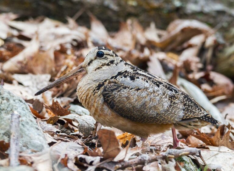
Other photos on this page: U.S. Fish and Wildlife Service (Public Domain Mark 1.0); ShenandoahNPS (Public domain); U.S. Fish and Wildlife Service (Public Domain Mark 1.0).