Home › Mississippi › Public land › Wildlife management areas › Mason Creek WMA
Mississippi wildlife management area
Mason Creek Wildlife Management Area: Rules, Seasons and Permits
Wildlife management area in Greene County; 28,000 acres under MDWFP.
Home › Mississippi › Public land › Wildlife management areas › Mason Creek WMA
Mississippi wildlife management area
Wildlife management area in Greene County; 28,000 acres under MDWFP.
Photo: 25or6to4 (CC BY-SA 4.0)
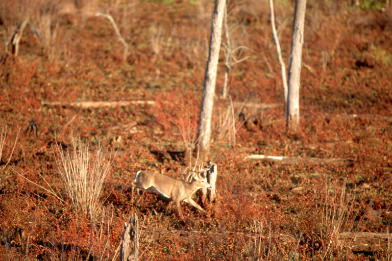
MDWFP manages the 28,000 acres of Mason Creek WMA, a wildlife management area wildlife management area in Greene County. For regional help, the brochure sends Mason Creek WMA hunters to the South Regional Office. The game listed for Mason Creek WMA is deer, turkey, squirrel, rabbit, raccoon, opossum and bobcat and trapping.
From the agency records read on November 14, 2026: MDWFP area page, MDWFP WMA list, WMA brochure, source 4.
Nearby
Navigation point from the MDWFP WMA boundary layer: 31.3896, -88.6630. State Line lies 12 miles from the Mason Creek WMA point, the shortest hop to a town.
From the source, the route. Mason Creek is located in Greene County near Laurel. Take Highway 42 East at Richton, travel through Sand Hill, check station on right.
From the source, the route. Chickasawhay Wma: At Laurel, take Highway 15 south to Tiger Creek Church Road in Ovett. Turn left and travel to Forest Service Road 202. Turn right and travel to Forest Service Road 205. Turn left and follow to the WMA headquarters on the left. Driving Directions: From Richton, take Highway 42 east approximately 13.7 miles. The WMA check station is on the right. DOG RESTRICTIONS: Small game hunting with dogs is allowed during any small game season.
From the area page and brochure (MDWFP area page, MDWFP WMA list, WMA brochure) and the MDWFP WMA boundary layer; checked November 14, 2026.
Read the Mason Creek WMA brochure as 17 dated lines, split 7 to 10 between deer and other game. Each date comes straight from the brochure, while the notes cell condenses the printed comment. Chickasawhay and Mason Creek share this brochure, and certain exceptions in it belong to one area only.
| Season line | Start | End | Who may hunt | Remark | Today? |
|---|---|---|---|---|---|
| Raccoon | Jul 1, 2026 | Sep 30, 2026 | Open | Fri and Sat nights | |
| Youth squirrel | Sep 24, 2026 | Sep 30, 2026 | Open | – | |
| Raccoon, opossum, bobcat | Oct 1, 2026 | Feb 28, 2027 | Open | – | |
| Squirrel | Oct 1, 2026 | Feb 28, 2027 | Open | – | |
| Deer, archery | Oct 15, 2026 | Nov 20, 2026 | Open | Antlerless and bucks | |
| Rabbit | Oct 17, 2026 | Feb 28, 2027 | Open | – | |
| Trapping | Nov 1, 2026 | Feb 28, 2027 | Open | – | |
| Deer, youth deer | Nov 7, 2026 | Nov 20, 2026 | Open | Antlerless and bucks | |
| Deer, gun | Nov 21, 2026 | Dec 1, 2026 | Open | – | |
| Deer, primitive weapon | Dec 2, 2026 | Dec 15, 2026 | Open | Antlerless and bucks | |
| Deer, gun | Dec 16, 2026 | Dec 22, 2026 | Open | Bucks only | |
| Deer, gun | Dec 23, 2026 | Jan 20, 2027 | Open | – | |
| Deer, primitive weapon | Jan 21, 2027 | Feb 15, 2027 | Open | Bucks only | |
| Youth turkey | Mar 8, 2027 | Mar 14, 2027 | Open | – | |
| Turkey | Mar 15, 2027 | May 2, 2027 | Open | – | |
| Youth turkey | Mar 27, 2027 | Mar 28, 2027 | Open | – | |
| Turkey | Apr 1, 2027 | May 2, 2027 | Open | – |
From the 2026-27 WMA brochure (Mississippi Department of Wildlife, Fisheries, and Parks), brochure dated April 2026; checked November 14, 2026.
The permit that covers Mason Creek WMA is the annual statewide WMA User Permit ($15.00 resident, $30.00 non-resident), carried on your person. The price page adds an agent fee of $1.00 and a process fee of $2.49 for residents. A valid license is still required on top of the permit; see the Mississippi hunting license page for prices. On the map layer for Mason Creek WMA you will find 4 camp site, 1 check station and 1 permit station. Some or all hunting here is by permit or draw, so read the WMA draw hunts guide before you plan a trip.
| Contact | Listed value |
|---|---|
| Phone | (601) 783-2911, (601) 965-1600 |
| southeastwma@wfp.ms.gov | |
| HQ GPS | 31.5179, -88.9569 |
MDWFP price page and the area brochure (MDWFP area page, MDWFP WMA list, WMA brochure); checked November 14, 2026.
The deer weapon list for Mason Creek WMA reads centerfire rifles, slug or buckshot shotguns, primitive weapons and centerfire handguns. The legal buck test at Mason Creek WMA is a spread of 10 inches or a beam of 13 inches, and hunters 15 and younger are exempt from it. Rule 1.1 is the statewide safety rule printed in each brochure, and it covers this area too. You will find Rule 1.1 laid out on the WMA hub page.
| Item | Summary |
|---|---|
| Camping | Forest Service rules |
| Horses | Hunting from horseback |
| Dogs | Small game dogs |
| ORVs and ATVs | Forest Service rules |
| Legal buck | 10 in. spread or 13 in. beam |
| Bag limits | Statewide, with exceptions |
| Rule | Quoted from the source |
|---|---|
| Weapons | Only centerfire rifles, shotguns with slugs or buckshot, primitive weapons, and centerfire handguns may be used for deer hunting, EXCEPT FOR Chickasawhay where only centerfire rifles, shotguns with slugs, primitive weapons, and centerfire handguns may be used for deer hunting. |
| Camping | CODE OF FEDERAL REGULATIONS, TITLE 36, will be enforced. For additional information, contact the Forest Service at (601) 965-1600. Chickasawhay/ Mason Creek |
From the 2026-27 area brochure and the MDWFP area page (MDWFP area page, MDWFP WMA list, WMA brochure); Rule 1.1 and area texts; checked November 14, 2026.
On the 2024 report, Mason Creek WMA accounts for 7 reported deer: 1 bucks, 6 does. The report puts it at 4000 acres for each deer reported, over 28,000 acres. 4 birds came off Mason Creek WMA in spring 2025 after 174 man-days of hunting. The year before, spring 2024, recorded 207 man-days and 3 birds; the ten-year averages are 219 man-days and 6 birds.
Both counts come from MDWFP and include only animals hunters reported.
From 2024 DMAP report and the spring 2025 WMA turkey totals; checked November 14, 2026.
Greene county lies outside the three CWD management zones, so the zone feeding and carcass rules do not apply on county grounds. 0 positives came out of 254 samples counted for Greene County. Because the layer carries no date, these are totals as of our read, not a season figure. Read the unit lines on the map: only North Central is a county list, and none of these counties is on it. The CWD management zones, county test results and deer units each have a page.
| County | Region on layer | Dist. | Zone extent | Feed ban | Tested positive |
|---|---|---|---|---|---|
| Greene | South | 2 | Outside zones | No ban | 0 of 254 |
MDWFP county layer (County_Info), CWD management zones and deer management units; region labels are the layer’s only county source; checked November 14, 2026.
Wildlife management area brochures can set their own hours, so check the area page before you plan a dawn walk near Mason Creek WMA.
| Date | Opener | Rise | Set | Deer hours | Duck and dove hours |
|---|---|---|---|---|---|
| Oct 1, 2026 | Archery, Delta and Hills | 6:47 a.m. | 6:41 p.m. | 6:17 a.m. to 7:11 p.m. | 6:17 a.m. to 6:41 p.m. |
| Oct 15, 2026 | Archery, Southeast | 6:57 a.m. | 6:24 p.m. | 6:27 a.m. to 6:54 p.m. | 6:27 a.m. to 6:24 p.m. |
| Nov 7, 2026 | Youth gun deer | 6:15 a.m. | 5:02 p.m. | 5:45 a.m. to 5:32 p.m. | 5:45 a.m. to 5:02 p.m. |
| Nov 21, 2026 | Gun deer opens | 6:27 a.m. | 4:54 p.m. | 5:57 a.m. to 5:24 p.m. | 5:57 a.m. to 4:54 p.m. |
| Nov 26, 2026 | Quail season opens | 6:32 a.m. | 4:53 p.m. | 6:02 a.m. to 5:23 p.m. | 6:02 a.m. to 4:53 p.m. |
| Nov 27, 2026 | Duck season opens | 6:32 a.m. | 4:53 p.m. | 6:02 a.m. to 5:23 p.m. | 6:02 a.m. to 4:53 p.m. |
| Dec 2, 2026 | Primitive weapon deer | 6:37 a.m. | 4:52 p.m. | 6:07 a.m. to 5:22 p.m. | 6:07 a.m. to 4:52 p.m. |
| Dec 21, 2026 | Year's shortest day | 6:49 a.m. | 4:56 p.m. | 6:19 a.m. to 5:26 p.m. | 6:19 a.m. to 4:56 p.m. |
| Mar 15, 2027 | Turkey season opens | 7:06 a.m. | 7:02 p.m. | 6:36 a.m. to 7:32 p.m. | 6:36 a.m. to 7:02 p.m. |
Hours rules from the MDWFP general hunting rules and the 2026-27 migratory game bird digest (Mississippi Department of Wildlife, Fisheries, and Parks); sunrise and sunset worked out for this location with the NOAA solar formula on Central Time; checked November 14, 2026. Legal hours for every county.
Going northwest, Chickasawhay Ranger District is 11 miles away and the next public land over. Neighbouring ground comes to 2 ranger district, 2 WMA and 1 national forest. These are direct-line distances, measured from the Mason Creek WMA point.
| Public land | Kind | Acres | County | Distance | Direction |
|---|---|---|---|---|---|
| Chickasawhay Ranger District | Ranger district | 151,409 | Wayne | 11 miles | northwest |
| De Soto National Forest | National forest | 532,432 | Perry | 11 miles | northwest |
| Chickasawhay WMA | WMA | 30,000 | Jones | 19 miles | northwest |
| Leaf River WMA | WMA | 41,411 | Perry | 30 miles | southwest |
| Lake Bogue Homa | State lake | 882 | Jones | 30 miles | northwest |
| De Soto Ranger District | Ranger district | 381,023 | Perry | 41 miles | southwest |
Point from the MDWFP WMA boundary layer; straight-line distances. Statewide public land map.
From Mason Creek WMA, the five closest towns are 12 miles to 22 miles away. The population leader is Waynesboro (4,507 in 2024). The closest MDWFP CWD sample drop-off site is Bogue Homa Lake in Laurel, 30 miles away.
| Community | County | Residents | Straight line | Direction |
|---|---|---|---|---|
| State Line | Wayne | 459 | 12 miles | east |
| Richton | Perry | 936 | 17 miles | west |
| Leakesville | Greene | 3,743 | 18 miles | south |
| Waynesboro | Wayne | 4,507 | 20 miles | north |
| Ovett | Jones | – | 22 miles | west |
Towns from Census 2024 estimates; CWD drop-off sites from the MDWFP drop-off list; businesses from services listings; straight-line miles; checked November 14, 2026.

Sandy track through longleaf pine woods in the De Soto National ForestPhoto: Woodlot (CC BY-SA 3.0)

Tall pines in the De Soto National Forest near BrooklynPhoto: Joe Furr (myself) (Public domain)

Old steel truss bridge over Black Creek in the De Soto National ForestPhoto: formulanone (CC BY-SA 2.0)
In Greene County stands Mason Creek WMA. For supplies, the closest town is State Line at 12 miles. The area brochure lists the South Regional Office for the region.
MDWFP manages Mason Creek WMA, which covers 28,000 acres. The acreage comes from the agency record.
A WMA User Permit is part of the paperwork here: $15.00 resident, $30.00 non-resident, on top of the license. Drawn permits cover some seasons too.
Listed quarry is deer, turkey, squirrel, rabbit, raccoon, opossum and bobcat and trapping. Bag limits and dates sit on the statewide seasons page.
The brochure table starts on Jul 1, 2026 with raccoon and finishes on May 2, 2027, 17 lines. 7 lines concern deer.
Count 0 hunts and 0 permits at Mason Creek WMA. Apply online inside the application window, and unsuccessful applicants gain a bonus point. The WMA draw hunts guide covers the details.
The agency wording is Camping is allowed subject to US Forest Service regulations. CODE OF FEDERAL REGULATIONS, TITLE 36, will be enforced. For additional information, contact the Forest Service at (601) 965-1600. Chickasawhay/ Mason Creek
At a glance: dogs: small game dogs; ORVs and ATVs: forest service rules; horses: hunting from horseback. Check the PDF for conditions.
Statewide, resident game gets half an hour either side of daylight and migratory birds stop at sunset; no turkey hours are stated. The hours page has every county.
On the layer, Greene County has 254 samples and 0 positives, with 0 of 1 in a zone. The zone guide covers carcass transport.
The three nearest records are Chickasawhay Ranger District (11 miles), De Soto National Forest (11 miles) and Chickasawhay WMA (19 miles).
Nearest on the map: State Line (12 miles), Richton (17 miles) and Leakesville (18 miles).
Yes. The brochure requires deer to be recorded on the daily use permit card or the WMA Check-In App before you leave, and biological data are collected at a check or data station.
Other photos on this page: NPS Photo (Public domain).