Home › Mississippi › Public land › National forests
6 forests, 7 districts
Mississippi National Forests
6 forests and 7 districts are mapped to 14 WMAs, so you know whose rules apply.
Photo: Justin Meissen (CC BY-SA 2.0)
Understanding forest hunting
About 1,189,636 acres sit in the forest records, and the Forest Service names 14 WMAs on them. A forest that overlaps a WMA is hunted under MDWFP seasons and WMA rules.
Forests with counties and acres
| Forest | Counties | Acres | Districts | WMAs |
|---|---|---|---|---|
| Bienville National Forest | Scott, Smith, Jasper + | 180,227 | 1 | 3 |
| De Soto National Forest | Perry, Wayne, Harrison + | 532,432 | 2 | 5 |
| Delta National Forest | Sharkey | 61,472 | 1 | 1 |
| Holly Springs National Forest | Benton, Lafayette, Marshall + | 156,210 | 1 | 1 |
| Homochitto National Forest | Franklin, Amite, Wilkinson + | 191,846 | 1 | 2 |
| Tombigbee National Forest | Winston, Chickasaw, Choctaw + | 67,449 | 1 | 2 |
Districts and their forests
| District | Forest | Counties | Acres |
|---|---|---|---|
| Bienville Ranger District | Bienville National Forest | Scott, Smith, Jasper + | 180,227 |
| Chickasawhay Ranger District | De Soto National Forest | Wayne, Jones, Greene | 151,409 |
| De Soto Ranger District | De Soto National Forest | Perry, Harrison, Stone + | 381,023 |
| Delta Ranger District | Delta National Forest | Sharkey | 61,472 |
| Holly Springs Ranger District | Holly Springs National Forest | Benton, Lafayette, Marshall + | 156,210 |
| Homochitto Ranger District | Homochitto National Forest | Franklin, Amite, Wilkinson + | 191,846 |
| Tombigbee Ranger District | Tombigbee National Forest | Winston, Chickasaw, Choctaw + | 67,449 |
Forest WMAs and their forests
On the list below, 14 state areas overlie forest ground, and MDWFP rules plus the user permit apply.
| WMA | Forest | Counties | Acres |
|---|---|---|---|
| Bienville WMA | Bienville | Scott | 23,500 |
| Caney Creek WMA | Bienville | Scott, Smith | 28,437 |
| Caston Creek WMA | Homochitto | Amite, Franklin | 28,214 |
| Chickasaw WMA | Tombigbee | Chickasaw, Pontotoc | 28,000 |
| Chickasawhay WMA | De Soto | Jones | 30,000 |
| Choctaw WMA | Tombigbee | Choctaw, Winston | 21,396 |
| Leaf River WMA | De Soto | Perry | 41,411 |
| Little Biloxi WMA | De Soto | Stone, Harrison | 13,699 |
| Mason Creek WMA | De Soto | Greene | 28,000 |
| Red Creek WMA | De Soto | Stone, Jackson + | 23,000 |
| Sandy Creek WMA | Homochitto | Adams, Franklin | 16,407 |
| Sunflower WMA | Delta | Sharkey | 60,000 |
| Tallahala WMA | Bienville | Jasper, Smith + | 27,585 |
| Upper Sardis WMA | Holly Springs | Lafayette, Marshall + | 50,485 |
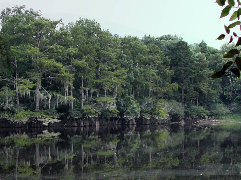
Pascagoula River oxbow with a wooded shorelinePhoto: Ronnie Blackwell (CC BY-SA 2.0)

Cotton picker working a white cotton fieldPhoto: NatalieMaynor (CC BY 2.0)

Wooded valley and river seen from a high overlook on the Yazoo RiverPhoto: Kevin (CC BY 2.0)
Forest hunting FAQ
How many national forests are in Mississippi?
This guide records 6 national forests and 7 ranger districts.
Can I hunt in a Mississippi national forest?
Yes, mostly through the state WMAs that overlie forest land, with an MDWFP license and WMA user permit, as the forest and WMA pages explain.
Whose seasons apply on forest land?
Where a WMA covers the forest tract, MDWFP seasons and WMA rules apply. Check the forest page for any Forest Service rules on camping and vehicles.
Which forests have WMAs?
14 WMAs are named on the forest records, and each forest page lists its own.
Where do I find a ranger district?
The districts table above lists each district with its forest and counties, and each district has a page.
Is a Forest Service permit needed?
The forest and district pages describe any Forest Service requirements, such as for camping or vehicle use.