Home › Oregon › Public land › Mt. Hood NF
National forest · 2026-27
Mt. Hood National Forest: Access, Units and Tags
National forest in Clackamas County and 5 more counties: 1,015,093 acres, Santiam, White River and Hood units.
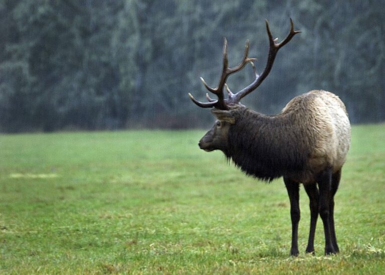
Photo: Bonnie Moreland (Public Domain Mark 1.0)
Getting to Mt. Hood National Forest
Parking, trailheads and gates near Mt. Hood National Forest
- Devil's Peak TrailheadParking · 2.4 mi from the centreDirections
- Dry Fir / Veda Lake TrailheadTrailhead · 2.6 mi from the centreDirections
- Parking areaParking · 2.6 mi from the centreDirections
- Salmon River EastTrailhead · 2.9 mi from the centreDirections
- Parking areaParking · 4.4 mi from the centreDirections
- Eureka Peak TrailheadTrailhead · 4.4 mi from the centreDirections
- Parking areaParking · 5.2 mi from the centreDirections
- Parking areaParking · 5.3 mi from the centreDirections
- Parking areaParking · 5.3 mi from the centreDirections
- Boat rampBoat ramp · 5.4 mi from the centreDirections
- Parking areaParking · 5.4 mi from the centreDirections
- Boat rampBoat ramp · 5.4 mi from the centreDirections
Parking, trailhead and gate locations come from OpenStreetMap contributors. Roads into public land can be gated or seasonal; check with the managing agency before you go.
Mt. Hood National Forest: owner, acreage and counties
Mt. Hood National Forest is a national forest under the USDA Forest Service; the Forest Service manages the land and ODFW sets the seasons and tags. The managing agency puts it at 1,015,093 acres (USFS land statistics). It sits within Clackamas County, Hood River County, Wasco County, Marion County, Multnomah County and Jefferson County, on the West Region side of ODFW’s map. The ODFW district staff for it work out of North Willamette – Cascade Unit (Clackamas), Mid Columbia (The Dalles) and Mid Willamette (Corvallis).
What the Forest Service says online: Please remember: It's your responsibility to know property boundaries and respect nearby private lands while hunting on the national forest. The USFS hunting page does not name species; Oregon seasons for the WMUs apply.

Nearby
Places to hunt and shoot around Mt. Hood National Forest
WMUs that include Mt. Hood National Forest
On the ODFW unit map Mt. Hood National Forest falls in Santiam Unit (16), White River Unit (41) and Hood Unit (42). Because it spans Western and Eastern Oregon units, read the deer rules for the unit you stand in.
| Unit | No. | Side | Unit size (sq mi) | Cougar zone | ODFW district |
|---|---|---|---|---|---|
| Santiam Unit | 16 | West | 3,327 | A (180) | North Willamette – Cascade Unit (Clackamas) |
| White River Unit | 41 | East | 938 | A (180) | Mid Columbia (The Dalles) |
| Hood Unit | 42 | East | 376 | A (180) | Mid Columbia (The Dalles) |
Units from the ODFW Wildlife Management Units layer overlaid on the land record; cougar quotas from the 2026 cougar zone table; checked November 8, 2026.
Regulation text behind Mt. Hood National Forest
Mind the 150-yard rule on Mt. Hood National Forest; 36 CFR 261.10(d) forbids discharging a firearm that close to any residence, building or occupied site. It also bans firing on or across forest roads and bodies of water and wherever the shot endangers anyone. Motor Vehicle Use Maps show which roads on Mt. Hood National Forest are open; cooperative travel management areas close more roads during hunting seasons.
Sources: 36 CFR 261.10 · Forest Service page · ODFW travel management areas; checked November 8, 2026.
Over-the-counter hunting at Mt. Hood National Forest
Without a drawn tag, Mt. Hood National Forest still offers general seasons for black bear, cougar, deer and elk. Statewide, fall bear is open from August 1 to December 31; cougar runs January through December with quotas by zone. General buck deer in the western units: October 3 through November 6, plus November 7 and 8 for youth hunters.
| Season | Species | From | To | Valid units |
|---|---|---|---|---|
| General Western Oregon buck deer – Any legal weapon | Deer | Oct 3, 2026 | Nov 6, 2026 | 16 |
| Youth extension – Western Oregon general buck deer | Deer | Nov 7, 2026 | Nov 8, 2026 | 16 |
| General archery – Western Oregon deer | Deer | Aug 29, 2026 | Dec 13, 2026 | 16 |
| General West Cascade bull elk | Elk | Nov 7, 2026 | Nov 13, 2026 | 16 |
| General archery elk – Western Oregon | Elk | Aug 29, 2026 | Sep 27, 2026 | 16 |
| General archery elk – Eastern Oregon | Elk | Aug 29, 2026 | Sep 27, 2026 | 41, 42 |
| General season antlerless elk damage | Elk | Aug 1, 2026 | Mar 31, 2027 | 16 |
| General fall black bear (statewide) | Black bear | Aug 1, 2026 | Dec 31, 2026 | All |
| General cougar (statewide, zone quotas) | Cougar | Jan 1, 2026 | Dec 31, 2026 | All |
General seasons and dates from the 2026 Oregon Big Game Hunting Regulations; tag sale deadlines on the general seasons page. Checked November 8, 2026.
Hunt numbers around Mt. Hood National Forest
One of the species in this draw.
The 2026 draw offers 41 hunts whose 2026 hunt area overlaps the units of Mt. Hood National Forest, 11,429 tags in all. Before applying, read each hunt's boundary text; overlap is measured by unit, not by the Mt. Hood National Forest boundary. Applications for the 2026 hunts were due May 15 (spring bear February 10); ODFW posted results by June 12. Preference points decide 75% of deer, elk, pronghorn and spring bear tags; the other 25% are drawn at random, and sheep, goat and premium hunts ignore points.
| Hunt series | Hunt numbers | Tags (2026) | 1st-choice applicants (2025) |
|---|---|---|---|
| Buck deer (100) | 12 | 5,824 | 1,311 |
| Premium deer (L) | 3 | 3 | – |
| Antlerless deer (600) | 8 | 252 | 2,089 |
| Elk (200) | 13 | 3,554 | 2,332 |
| Premium elk (M) | 3 | 3 | – |
| Spring bear (700) | 2 | 1,793 | 2,223 |
Hunt 616A1, NW Santiam, draws the longest odds: 1,093 first-choice applicants against 50 tags. Hunt 216R1 (Santiam Unit Traditional Bow (Traditional Bow Only)) is easier to draw: 55 tags against 10 first choices. First offered in 2026: MC101, MC101-1, MC101-2, MC101R, MC101M and MC101T.
| Number | Name | Weapon | Open | Tags | 1st-choice apps |
|---|---|---|---|---|---|
| 119A | W High Cascade | Any legal weapon | Sep 12–20, 2026 | 3,300 | 1,311 |
| MC101 | Mid-Columbia 01 | Any legal weapon | Oct 3–14, 2026 | 1,265 | – |
| MC102 | Mid-Columbia 02 | Any legal weapon | Oct 3–14, 2026 | 550 | – |
| MC101R | Mid-Columbia 01 Bow | Archery | Aug 29–Sep 27, 2026 | 385 | – |
| L16 | Santiam | Premium (any legal weapon) | Aug 1–Nov 30, 2026 | 1 | – |
| LMC01 | Mid-Columbia 01 | Premium (any legal weapon) | Aug 1–Nov 30, 2026 | 1 | – |
| LMC02 | Mid-Columbia 02 | Premium (any legal weapon) | Aug 1–Nov 30, 2026 | 1 | – |
| 616A2 | SW Santiam | Any legal weapon | Oct 3–Nov 6, 2026 | 55 | 695 |
| 616T1 | SW Santiam Youth | Youth only | Nov 14–25, 2026 | 53 | 140 |
| 616A1 | NW Santiam | Any legal weapon | Oct 3–Nov 6, 2026 | 50 | 1,093 |
| 616T2 | NW Santiam Youth | Youth only | Nov 14–25, 2026 | 33 | 161 |
| 241Y | White River – Hood No. 2 | Any legal weapon | Nov 7–15, 2026 | 1,210 | 379 |
| 200M | Cascade Muzzleloader | Muzzleloader | Nov 21–27, 2026 | 990 | 300 |
| 241X | White River – Hood No. 1 | Any legal weapon | Oct 28–Nov 1, 2026 | 550 | 310 |
| 200R | Oregon Youth Bow | Youth only | Aug 29–Sep 27, 2026 | 330 | 124 |
| M16 | Santiam | Premium (any legal weapon) | Aug 1–Nov 30, 2026 | 1 | – |
| M41 | White River | Premium (any legal weapon) | Aug 1–Nov 30, 2026 | 1 | – |
| M42 | Hood | Premium (any legal weapon) | Aug 1–Nov 30, 2026 | 1 | – |
| 710A | NW Oregon | Any legal weapon | Apr 1–May 31, 2026 | 1,430 | 1,749 |
| 741A | White River – Hood | Any legal weapon | Apr 1–May 31, 2026 | 363 | 474 |
Hunt numbers, 2026 tags and 2025 first-choice applicants from the 2026 Oregon Big Game Hunting Regulations; hunt areas from ODFW’s 2026 controlled hunt boundary layers; draw rules from ODFW. Checked November 8, 2026.
Mt. Hood National Forest units: 2025 harvest
Read these as 2025 harvest for the whole unit around Mt. Hood National Forest, summed from ODFW's hunt-by-unit tables. In 2025 the most elk came out of Santiam Unit, roughly 186. Santiam Unit topped the buck table with roughly 2,707 deer.
| Unit | Buck deer hunters | Buck deer harvest | Elk hunters | Elk harvest | Black bear hunters | Black bear harvest | Cougar hunters | Cougar harvest |
|---|---|---|---|---|---|---|---|---|
| Santiam Unit | 8,520 | 2,707 | 1,706 | 186 | 1,791 | 133 | 1,093 | 9 |
| White River Unit | 836 | 405 | 1,297 | 166 | 593 | 28 | 359 | 11 |
| Hood Unit | 295 | 82 | 243 | 51 | 279 | 44 | 111 | 2 |
ODFW 2025 harvest summaries (2025 buck deer, any legal weapon summary · 2025 elk, any legal weapon summary · 2025 black bear summary · 2025 cougar summary); unit totals summed from the report rows; checked November 8, 2026.
Zones and road rules around Mt. Hood National Forest
For cougar, Mt. Hood National Forest counts toward Zone A with a quota of 180; hunting dogs are not allowed for cougar. Deer Hunt Areas replaced unit-based buck hunts in the east for 2026, and Mt. Hood National Forest falls in Mid Columbia. The antlerless elk damage season (August 1 to March 31) covers the area(s) listed.
| Kind | Area | Note |
|---|---|---|
| Cougar zone | Zone A, Coast/North Cascade | Quota 180 |
| Deer range | Mid Columbia (MC) | MC01, MC02 |
| Damage area | Willamette Valley | Aug. 1 – Mar. 31 |
| Centerfire limit | West Cascade Bull Elk (November 7 – November 13) | Units 16-30 |
| Centerfire limit | Rocky Mountain Bull Elk (controlled) 1st Season (October 28 – November 1) | Units 31-77 |
| Centerfire limit | Rocky Mountain Bull Elk 2nd Season (November 7 – November 15) | Units 32-77 |
From the 2026 Oregon Big Game Hunting Regulations: cougar zones, Deer Hunt Areas, travel management areas, elk damage areas, rifle restrictions. Checked November 8, 2026.
Off-limits ground near Mt. Hood National Forest
The table lists land close to Mt. Hood National Forest that is closed to hunting with a state license. ODFW seasons stop at the reservation boundary, which Oregon law treats as enclosed land when posted.
| Closed place | Why | Counties | Acres |
|---|---|---|---|
| Warm Springs Reservation | Tribal land | Wasco, Jefferson, Clackamas, Marion | 647,897 |
| Warm Springs trust land | Tribal land | Gilliam, Wasco, Sherman, Hood River | 5,439 |
| Ankeny NWR | Refuge not in 50 CFR 32.56 | Marion | 2,797 |
| Siletz trust land | Tribal land | Lincoln, Marion | 1,010 |
| Celilo Village | Tribal land | Wasco | 114 |
Closed places from lands.json: tribal land (Census TIGERweb; 18 U.S.C. 1165; ODFW), NPS units (36 CFR 2.2), refuges not in 50 CFR 32.56 and ODFW regulation closures. Checked November 8, 2026.
Parent and sub-units of Mt. Hood National Forest
Its 4 parts are listed below.
County acreage for Mt. Hood National Forest
Clackamas County has the lion's share of Mt. Hood National Forest at about 536,954 acres.
| County | Federal acres | % |
|---|---|---|
| Clackamas County | 536,954 | 53% |
| Hood River County | 190,668 | 19% |
| Wasco County | 171,541 | 17% |
| Marion County | 58,482 | 6% |
| Multnomah County | 54,471 | 5% |
| Jefferson County | 2,978 | 0% |
From the USFS Lands Area Statistics; checked November 8, 2026.
Which bird zones cover Mt. Hood National Forest
Bird hunters at Mt. Hood National Forest read the 2026-27 shooting-hours table under Zone A (Western Oregon) and Zone B (Central Oregon). ODFW places the counties of Mt. Hood National Forest in the Northwest Permit Zone. Northwest Permit Zone rules apply: pass the goose identification test for the permit, and never shoot a dusky Canada goose. Duck, coot, snipe and dove Zones 1 and 2 are drawn only on ODFW's map, so check it for this spot.
| County | Hours zone | Goose zone |
|---|---|---|
| Clackamas County | A (Western Oregon) | Northwest Permit Zone |
| Hood River County | B (Central Oregon) | Map only |
| Wasco County | B (Central Oregon) | Map only |
| Marion County | A (Western Oregon) | Northwest Permit Zone |
| Multnomah County | A (Western Oregon) | Northwest Permit Zone |
| Jefferson County | B (Central Oregon) | Map only |
From the 2026-27 Oregon Game Bird Hunting Regulations: goose zones, shooting-hours zones, duck zone map. Checked November 8, 2026. Waterfowl and goose zones.
Nearest towns and an ODFW office for Mt. Hood National Forest
Mount Hood Villages, 10 miles off, is the closest town on this site. Of the five, Sandy is the biggest at 12,990 residents. Detroit, Dufur, Gresham and Happy Valley list Mt. Hood National Forest within ten miles. Nearest ODFW office: Tygh Valley, 23 miles.
| Nearest towns | County | Population | Miles | Heading |
|---|---|---|---|---|
| Mount Hood Villages | Clackamas | – | 10 miles | northwest |
| Sportsmans Park | Wasco | – | 21 miles | east |
| Parkdale | Hood River | – | 23 miles | northeast |
| Sandy | Clackamas | 12,990 | 24 miles | northwest |
| Pine Grove | Wasco | – | 25 miles | east |
Towns from places.json (Census 2024 estimates); ODFW offices from the ODFW contact page; businesses from services.json listings; straight-line miles. Checked November 8, 2026.
Where Mt. Hood National Forest sits among nearby public land
Columbia River Gorge national scenic area is the closest neighbour, 27 miles north of the Mt. Hood National Forest point. The nearest six break down as 3 wildlife areas, 1 national scenic area and 1 BLM field office.
| Public land | Kind | Acres | County | Distance | Direction |
|---|---|---|---|---|---|
| Columbia River Gorge national scenic area | Scenic area | 45,755 | Multnomah | 27 miles | north |
| White River WA | Wildlife area | 29,480 | Wasco | 28 miles | east |
| BLM Cascades FO | BLM field office | 171,303 | Clackamas | 31 miles | southwest |
| Detroit Ranger District | Ranger district | 305,849 | Linn | 39 miles | south |
| Lower Deschutes WA | Wildlife area | 18,780 | Wasco | 42 miles | east |
| Crates Point WA | Wildlife area | 120 | Wasco | 42 miles | northeast |
Point: OR_FRAMEWORK Oregon Land Management (USFS) inside the USFS EDW ranger district boundaries of the unit (polygon centroid of the largest part). Straight-line distances. Statewide public land map.
Sun times and legal hours at Mt. Hood National Forest
Oregon clocks fall back on November 1, 2026 and spring forward on March 14, 2027, so the Mt. Hood National Forest times below jump an hour across those dates.
| Date | Marker | Sunrise | Sunset | Game mammals | Game birds (ODFW) |
|---|---|---|---|---|---|
| Aug 29, 2026 | Archery opener | 6:24 a.m. | 7:53 p.m. | 5:54 a.m. to 8:23 p.m. | Not in table |
| Sep 12, 2026 | Eastern buck rifle | 6:41 a.m. | 7:27 p.m. | 6:11 a.m. to 7:57 p.m. | 6:22 a.m. to 7:22 p.m. |
| Oct 3, 2026 | General buck opener | 7:06 a.m. | 6:46 p.m. | 6:36 a.m. to 7:16 p.m. | 6:46 a.m. to 6:44 p.m. |
| Oct 10, 2026 | Duck opener and upland opener | 7:15 a.m. | 6:33 p.m. | 6:45 a.m. to 7:03 p.m. | 6:55 a.m. to 6:31 p.m. |
| Dec 21, 2026 | Shortest day | 7:43 a.m. | 4:27 p.m. | 7:13 a.m. to 4:57 p.m. | 7:15 a.m. to 4:37 p.m. |
| Apr 15, 2027 | Spring turkey | 6:24 a.m. | 7:51 p.m. | 5:54 a.m. to 8:21 p.m. | Not in table |
Hours rules from the ODFW general hunting regulations; game bird times from the 2026-27 game bird shooting hours table; mammal sunrise and sunset worked out for this location with the NOAA solar formula (Pacific Time); checked November 8, 2026. Legal hours for every county.
Mt. Hood National Forest: practice before the trip
At 20 miles, Lost Art Bowhunters is the closest range to Mt. Hood National Forest; read its access line before going.
From ODFW’s E.E. Wilson visitors guide, the BLM qualified range list, club sites and directory listings, checked November 8, 2026.


Your Mt. Hood National Forest questions answered
Do I need orange clothing at Mt. Hood National Forest?
Only hunters under 18 hunting game mammals or upland birds (not turkey) with a firearm must wear it; adults are not required to.
What time does legal shooting start at Mt. Hood National Forest?
Half an hour before sunrise to half an hour after sunset: on November 8, 2026 that is 6:25 a.m. to 5:18 p.m. here (NOAA formula). Game birds follow ODFW’s table: 6:31 a.m. to 4:51 p.m.
What is the published acreage of Mt. Hood National Forest?
Roughly 1,015,093 acres, going by the USFS land statistics.
Is there CWD in the deer and elk of Mt. Hood National Forest?
ODFW has not detected CWD in Oregon; its October 15, 2026 update shows 3,682 deer and 1,607 elk tested not detected. Importing cervid parts from other states is restricted.
Where is hunting not allowed near Mt. Hood National Forest?
Avoid Warm Springs Reservation, Warm Springs trust land and Ankeny NWR; Oregon tags do not apply there.
Where can I buy supplies near Mt. Hood National Forest?
Nearest: Mount Hood Villages (10 miles) and the ODFW White River Wildlife Area Office (23 miles).
Can I hunt Mt. Hood National Forest seven days a week?
No statewide limit on Sundays; refuge or wildlife area rules may restrict days.
How do I know which roads are open on Mt. Hood National Forest?
Stay on open routes; seasonal closures apply in travel management areas.
What reporting rules apply after a hunt at Mt. Hood National Forest?
Mandatory reporting applies to every deer, elk, pronghorn, bear, cougar and turkey tag; the deadlines are January 31 and April 15, 2027.
Which office oversees Mt. Hood National Forest?
The USDA Forest Service is in charge.
Which hunting units include Mt. Hood National Forest?
You are in Santiam Unit (16), White River Unit (41) and Hood Unit (42) when hunting it.
Can I hunt on Mt. Hood National Forest with an Oregon license?
Yes, under ODFW seasons and tags. The Forest Service adds the 150-yard and road and water shooting limits of 36 CFR 261.10.
Before you head out to Mt. Hood National Forest
Saw a wildlife crime on Mt. Hood National Forest? Oregon State Police take reports at *OSP (*677) or 1-800-452-7888, and tips can earn a reward.
Sources: source 1 · source 2 · source 3 · source 4 · source 5 · source 6; seasons from the 2026 Oregon Big Game Hunting Regulations and the 2026-27 Oregon Game Bird Hunting Regulations. Checked November 8, 2026.
Other photos on this page: Brandon Olafsson (CC BY 2.0); Oregon Department of Fish and Wildlife (CC BY-SA 2.0).