Home › Oregon › Public land › Rogue River-Siskiyou National Forests
National forest · hunting ground
Rogue River-Siskiyou National Forests for Hunters, 2026-27
National forest in Curry County and 5 more counties; 7 hunting units, 1,635,981 acres.
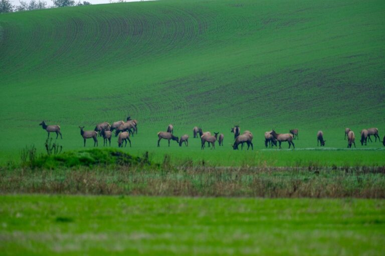
Photo: USDA Forest Service Pacific Northwest Region (Public Domain Mark 1.0)
Getting to Rogue River-Siskiyou National Forests
What the regulations allow on Rogue River-Siskiyou National Forests
Federal law keeps gunfire on Rogue River-Siskiyou National Forests at least 150 yards from residences, buildings, campsites and developed sites. The same rule forbids shooting across or on a Forest Service road or a body of water, or anywhere a person or property is put at risk. Roads on Rogue River-Siskiyou National Forests open or close by the Motor Vehicle Use Map, and some close again under ODFW cooperative travel management areas.
Rogue River Area
All land within 1 mi of Rogue River between Grave Creek and Lobster Creek closed to bear hunting. All land within 1/4 mi of Rogue River in the wild rvr section from Grave Creek downstream to Watson Creek is closed to all hunting except during authorized seasons.
Sources: 36 CFR 261.10 · Forest Service page · ODFW travel management areas; checked November 8, 2026.
Nearby
Places to hunt and shoot around Rogue River-Siskiyou National Forests
Land manager and acreage for Rogue River-Siskiyou National Forests
Rogue River-Siskiyou National Forests is a national forest under the USDA Forest Service; the Forest Service manages the land and ODFW sets the seasons and tags. By the agency's own count it holds 1,635,981 acres. Its ground spreads over Curry County, Jackson County, Josephine County, Coos County, Klamath County and Douglas County, all handled by the ODFW West Region. For questions about game on the ground, the ODFW district is Rogue (Central Point), Charleston (Charleston) and Klamath (Klamath).
The Forest Service hunting page adds: The mountain ranges that run through the forest and the valleys are home to deer and elk, and provide numerous remote spaces for hunters. For Fishing Regulations go to : Oregon Department of Fish and Wildlife To find hunting resources and to learn more about hunting opportunities on the Rogue River-Siskiyou National Forest, visit the Oregon Department of Fish and Wildlife website .

Spring draw hunts near Rogue River-Siskiyou National Forests
Game of the Rogue River-Siskiyou National Forests units, by controlled tag.
There are 64 hunt numbers whose 2026 hunt area overlaps the units of Rogue River-Siskiyou National Forests; together they carry 15,166 tags for 2026. Hunt boundaries follow units and roads, not the edge of Rogue River-Siskiyou National Forests, so check the description for each hunt number. Each series allows one application with up to five hunt choices; the 2026 cutoff was May 15 except spring bear. ODFW splits most series 75/25 between point holders and a random pool, while sheep, goat and the L, M and N premium hunts are drawn at random.
| Kind of hunt | Hunts | Tags offered | First choices |
|---|---|---|---|
| Buck deer (100) | 12 | 5,142 | 3,660 |
| Premium deer (L) | 7 | 7 | – |
| Antlerless deer (600) | 10 | 727 | 3,919 |
| Elk (200) | 26 | 3,838 | 3,855 |
| Premium elk (M) | 7 | 7 | – |
| Spring bear (700) | 2 | 5,445 | 6,065 |
For long odds, look at 122 (Dixon Unit): 15 tags and 1,012 first choices last year. Among the easier draws is 200M, Cascade Muzzleloader: 300 first choices for 990 tags. New for 2026: 228, 228T, KE101, KE101R, KE101R1 and KE101T.
| Hunt no. | Hunt name | Type | Season | 2026 tags | 2025 apps |
|---|---|---|---|---|---|
| 119A | W High Cascade | Any legal weapon | Sep 12–20, 2026 | 3,300 | 1,311 |
| KE101 | Keno 01 | Any legal weapon | Oct 3–14, 2026 | 825 | – |
| 128M | Applegate Unit Muzzleloader | Muzzleloader | Nov 14–Dec 6, 2026 | 330 | 1,028 |
| KE101R | Keno 01 Bow | Archery | Aug 29–Sep 27, 2026 | 275 | – |
| L22 | Dixon | Premium (any legal weapon) | Aug 1–Nov 30, 2026 | 1 | – |
| L25 | Sixes | Premium (any legal weapon) | Aug 1–Nov 30, 2026 | 1 | – |
| L26 | Powers | Premium (any legal weapon) | Aug 1–Nov 30, 2026 | 1 | – |
| L27 | Chetco | Premium (any legal weapon) | Aug 1–Nov 30, 2026 | 1 | – |
| 621 | W Indigo | Any legal weapon | Oct 3–Nov 6, 2026 | 142 | 701 |
| 625 | Sixes Unit | Any legal weapon | Oct 3–Nov 6, 2026 | 121 | 360 |
| 625T | Sixes Unit Youth | Youth only | Dec 15–Jan 5, 2027 | 94 | 37 |
| 626 | Powers Unit | Any legal weapon | Oct 3–Nov 6, 2026 | 91 | 440 |
| 200M | Cascade Muzzleloader | Muzzleloader | Nov 21–27, 2026 | 990 | 300 |
| 231X | SE Cascades | Any legal weapon | Oct 28–Nov 1, 2026 | 880 | 393 |
| 200R | Oregon Youth Bow | Youth only | Aug 29–Sep 27, 2026 | 330 | 124 |
| 226X | Powers Unit No. 1 | Any legal weapon | Nov 14–18, 2026 | 330 | 126 |
| M22 | Dixon | Premium (any legal weapon) | Aug 1–Nov 30, 2026 | 1 | – |
| M25 | Sixes | Premium (any legal weapon) | Aug 1–Nov 30, 2026 | 1 | – |
| M26 | Powers | Premium (any legal weapon) | Aug 1–Nov 30, 2026 | 1 | – |
| M27 | Chetco | Premium (any legal weapon) | Aug 1–Nov 30, 2026 | 1 | – |
| 722A | SW Oregon | Any legal weapon | Apr 1–May 31, 2026 | 4,840 | 5,532 |
| 731A | S Central | Any legal weapon | Apr 1–May 31, 2026 | 605 | 533 |
Hunt numbers, 2026 tags and 2025 first-choice applicants from the 2026 Oregon Big Game Hunting Regulations; hunt areas from ODFW’s 2026 controlled hunt boundary layers; draw rules from ODFW. Checked November 8, 2026.
Rogue River-Siskiyou National Forests by Wildlife Management Unit
Unit lines put Rogue River-Siskiyou National Forests in Dixon Unit (22), Sixes Unit (25), Powers Unit (26), Chetco Unit (27), Applegate Unit (28) and Rogue Unit (30) and 1 more. That puts it on both sides of ODFW's line: 6 Western Oregon unit(s) and 1 Eastern Oregon unit(s), with different deer rules.
| Unit | # | West/East | Size (sq mi) | Cougar | Biologist district |
|---|---|---|---|---|---|
| Dixon Unit | 22 | West | 1,553 | B (200) | Douglas (Roseburg) |
| Sixes Unit | 25 | West | 994 | A (180) | Rogue (Central Point) |
| Powers Unit | 26 | West | 825 | A (180) | Charleston (Charleston) |
| Chetco Unit | 27 | West | 1,688 | A (180) | Rogue (Central Point) |
| Applegate Unit | 28 | West | 1,325 | B (200) | Rogue (Central Point) |
| Rogue Unit | 30 | West | 1,460 | B (200) | Rogue (Central Point) |
| Keno Unit | 31 | East | 1,041 | B (200) | Klamath (Klamath) |
Units from the ODFW Wildlife Management Units layer overlaid on the land record; cougar quotas from the 2026 cougar zone table; checked November 8, 2026.
Rogue River-Siskiyou National Forests general tag seasons
Over-the-counter tags cover black bear, cougar, deer and elk somewhere around Rogue River-Siskiyou National Forests; no draw is needed for these rows. Two seasons cover every unit: fall bear (August 1 to December 31) and cougar (all of 2026, by zone quota). For black-tailed bucks the general any-legal-weapon season was October 3 to November 6, with a two-day youth extension.
| Season name | Species | Begins | Ends | Here |
|---|---|---|---|---|
| General Western Oregon buck deer – Any legal weapon | Deer | Oct 3, 2026 | Nov 6, 2026 | 22, 25, 26 + |
| Youth extension – Western Oregon general buck deer | Deer | Nov 7, 2026 | Nov 8, 2026 | 22, 25, 26 + |
| General archery – Western Oregon deer | Deer | Aug 29, 2026 | Sep 27, 2026 | 22, 27, 28 |
| General archery – Western Oregon deer | Deer | Aug 29, 2026 | Dec 6, 2026 | 25, 26, 30 |
| General West Cascade bull elk | Elk | Nov 7, 2026 | Nov 13, 2026 | 22, 30 |
| General Western Oregon Coast bull elk – 1st season | Elk | Nov 14, 2026 | Nov 17, 2026 | 28 |
| General Western Oregon Coast bull elk – 2nd season | Elk | Nov 21, 2026 | Nov 27, 2026 | 28 |
| General archery elk – Western Oregon | Elk | Aug 29, 2026 | Sep 27, 2026 | 22, 25, 26 + |
| General archery elk – Eastern Oregon | Elk | Aug 29, 2026 | Sep 27, 2026 | 31 |
| General season antlerless elk damage | Elk | Aug 1, 2026 | Mar 31, 2027 | 27, 30 |
| General fall black bear (statewide) | Black bear | Aug 1, 2026 | Dec 31, 2026 | All |
| General cougar (statewide, zone quotas) | Cougar | Jan 1, 2026 | Dec 31, 2026 | All |
General seasons and dates from the 2026 Oregon Big Game Hunting Regulations; tag sale deadlines on the general seasons page. Checked November 8, 2026.
Rogue River-Siskiyou National Forests in context
There are 5 child records under it.
Unit-level rules that reach Rogue River-Siskiyou National Forests
Cougar hunters at Rogue River-Siskiyou National Forests fall under Zone A and Zone B, with quotas of 180 and 200. Eastern deer tags here belong to the Keno herd range, organised from 2026 into Deer Hunt Areas. Vehicles and e-bikes face seasonal limits here under 4 cooperative travel management areas. Elk damage tags (antlerless, general season) can be used in the listed damage areas, August 1 through March 31.
| Item | Name | Detail |
|---|---|---|
| Cougar | Zone A, Coast/North Cascade | Quota 180 |
| Cougar | Zone B, Southwest Cascades | Quota 200 |
| Herd range | Keno (KE) | KE01 |
| Elk damage area | Evans Creek | Aug. 1 – Mar. 31 |
| Elk damage area | Chetco | Aug. 1 – Mar. 31 |
| Closure area | 30A Upper Rogue | 3 days prior to opening of general West Cascade elk season through the close of general… |
| Closure area | 30B Jackson | October 15 – April 30 |
| Closure area | 31A Pokegama | November 20 – March 31 |
| Closure area | 31B Green Diamond (formerly JWTR) | Permanent Closure |
| Rifle rule | West Cascade Bull Elk (November 7 – November 13) | Units 16-30 |
| Rifle rule | Rocky Mountain Bull Elk (controlled) 1st Season (October 28 – November 1) | Units 31-77 |
| Rifle rule | Coast Bull Elk 1st Season (November 14 – November 17) | Units 10-27 |
| Rifle rule | Coast Bull Elk 2nd Season (November 21 – November 27) | Units 10-27 |
| Rifle rule | S. Coast Controlled Bull Elk (November 14 – November 18) (November 21 – November 29) | Units 24-27 |
From the 2026 Oregon Big Game Hunting Regulations: cougar zones, Deer Hunt Areas, travel management areas, elk damage areas, rifle restrictions. Checked November 8, 2026.
Map: Rogue River-Siskiyou National Forests and the closest public land
The nearest other public land on this site is BLM Grants Pass FO, 23 miles to the northeast. The six closest pins include 2 BLM field offices, 1 BLM district and 1 national preserve.
| Name | Kind | Size (ac) | County | Away | Bearing |
|---|---|---|---|---|---|
| BLM Grants Pass FO | BLM field office | 437,698 | Josephine | 23 miles | northeast |
| BLM Medford District | BLM district | 898,557 | Jackson | 23 miles | northeast |
| Oregon Caves National Preserve | National preserve | 4,524 | Josephine | 36 miles | southeast |
| New River Aleutian goose project | A&H access area | 1,653 | Curry | 44 miles | northwest |
| BLM Myrtlewood FO | BLM field office | 123,475 | Coos | 55 miles | north |
| Bandon Marsh NWR | Wildlife refuge | 904 | Coos | 55 miles | north |
Point: OR_FRAMEWORK Oregon Land Management (USFS) inside the USFS EDW ranger district boundaries of the unit (polygon centroid of the largest part). Straight-line distances. Statewide public land map.
Rogue River-Siskiyou National Forests: neighbouring closures
Not everything near Rogue River-Siskiyou National Forests is open: the land below is closed to state-licensed hunting. Tribal land has no state seasons; tribes set their own rules, and ORS 498.120 treats posted reservation boundaries as enclosed land.
| Closed area | Status | Counties | Size (ac) |
|---|---|---|---|
| Cow Creek Reservation | Tribal land | Douglas | 22,823 |
| Coos, Lower Umpqua, and Siuslaw reservation | Tribal land | Douglas, Lane, Coos, Curry | 14,732 |
| Coquille Reservation | Tribal land | Coos | 6,494 |
| Coquille trust land | Tribal land | Coos, Jackson, Lane | 146 |
| Coos, Lower Umpqua, and Siuslaw trust land | Tribal land | Lane, Coos | 129 |
| Crater Lake NP | National Park Service unit | Klamath, Douglas, Jackson | 182,234 |
| Oregon Islands NWR | Refuge not in 50 CFR 32.56 | Curry, Coos, Lincoln, Tillamook, Clatsop, Lane | 514 |
| Klamath Reservation | Tribal land | Klamath | 318 |
| Dean Creek elk viewing area | Closed by regulation | Douglas | – |
Closed places from lands.json: tribal land (Census TIGERweb; 18 U.S.C. 1165; ODFW), NPS units (36 CFR 2.2), refuges not in 50 CFR 32.56 and ODFW regulation closures. Checked November 8, 2026.
Last season's take around Rogue River-Siskiyou National Forests
Harvest here means the 2025 unit totals from ODFW's mandatory reporting estimates, not animals taken on Rogue River-Siskiyou National Forests. For elk, Sixes Unit led with roughly 219 taken in 2025. For deer, Dixon Unit leads with about 1,879 bucks in 2025.
| Unit | Buck deer hunters | Buck deer harvest | Elk hunters | Elk harvest | Black bear hunters | Black bear harvest | Cougar hunters | Cougar harvest |
|---|---|---|---|---|---|---|---|---|
| Dixon Unit | 4,095 | 1,879 | 732 | 65 | 874 | 104 | 298 | 9 |
| Sixes Unit | 1,145 | 609 | 490 | 219 | 221 | 35 | 68 | 2 |
| Powers Unit | 1,284 | 581 | 339 | 96 | 364 | 38 | 96 | 2 |
| Chetco Unit | 2,071 | 992 | 145 | 44 | 743 | 110 | 209 | 9 |
| Applegate Unit | 3,740 | 1,523 | 262 | 16 | 1,236 | 176 | 374 | 14 |
| Rogue Unit | 5,701 | 1,612 | 1,336 | 78 | 1,611 | 147 | 614 | 8 |
| Keno Unit | 579 | 189 | 447 | 28 | 304 | 24 | 163 | 2 |
ODFW 2025 harvest summaries (2025 buck deer, any legal weapon summary · 2025 elk, any legal weapon summary · 2025 black bear summary · 2025 cougar summary); unit totals summed from the report rows; checked November 8, 2026.
Bird zones for Rogue River-Siskiyou National Forests
ODFW prints legal bird hours by zone; Rogue River-Siskiyou National Forests is in Zone A (Western Oregon) and Zone C (Klamath and Lake counties). Goose seasons here follow the Southwest Zone and South Coast Zone. ODFW defines duck Zones 1 and 2 by map alone; confirm which one covers this ground.
| County | Shooting-hours zone | Goose zone |
|---|---|---|
| Curry County | A (Western Oregon) | Southwest Zone, South Coast Zone |
| Jackson County | A (Western Oregon) | Southwest Zone |
| Josephine County | A (Western Oregon) | Southwest Zone |
| Coos County | A (Western Oregon) | Southwest Zone, South Coast Zone |
| Klamath County | C (Klamath and Lake counties) | Map only |
| Douglas County | A (Western Oregon) | Southwest Zone, South Coast Zone |
From the 2026-27 Oregon Game Bird Hunting Regulations: goose zones, shooting-hours zones, duck zone map. Checked November 8, 2026. Waterfowl and goose zones.
Rogue River-Siskiyou National Forests acres by county
Curry County holds the largest share of Rogue River-Siskiyou National Forests, about 619,347 acres of National Forest System land.
| County | NFS acres | Share |
|---|---|---|
| Curry County | 619,347 | 38% |
| Jackson County | 414,487 | 25% |
| Josephine County | 401,575 | 25% |
| Coos County | 68,842 | 4% |
| Klamath County | 67,819 | 4% |
| Douglas County | 63,910 | 4% |
From the USFS Lands Area Statistics; checked November 8, 2026.
Where to resupply near Rogue River-Siskiyou National Forests
The map puts Gold Beach 23 miles from Rogue River-Siskiyou National Forests, the shortest hop to town. Grants Pass (39,468 people in 2024) is the larger service town in the list. Town pages that show Rogue River-Siskiyou National Forests nearby: Ashland, Cave Junction, Fort Klamath and Gold Beach. For ODFW help, Gold Beach is nearest at 23 miles.
| Community | County | Residents | Straight line | Direction |
|---|---|---|---|---|
| Gold Beach | Curry | 2,272 | 23 miles | west |
| Cave Junction | Josephine | 2,092 | 24 miles | southeast |
| Grants Pass | Josephine | 39,468 | 33 miles | east |
| Powers | Coos | 703 | 33 miles | north |
| Glendale | Douglas | 867 | 36 miles | northeast |
Towns from places.json (Census 2024 estimates); ODFW offices from the ODFW contact page; businesses from services.json listings; straight-line miles. Checked November 8, 2026.
Rogue River-Siskiyou National Forests sunrise, sunset and legal light
Fee pheasant hunts, youth upland hunts and the Northwest Permit goose season keep their own hours, which are not in this Rogue River-Siskiyou National Forests table.
| Date | Opener | Rise | Set | Mammal hours | Bird table |
|---|---|---|---|---|---|
| Aug 29, 2026 | Archery opener | 6:37 a.m. | 7:58 p.m. | 6:07 a.m. to 8:28 p.m. | Not in table |
| Oct 3, 2026 | General buck opener | 7:14 a.m. | 6:56 p.m. | 6:44 a.m. to 7:26 p.m. | 6:46 a.m. to 6:44 p.m. |
| Oct 10, 2026 | Duck opener and upland opener | 7:21 a.m. | 6:44 p.m. | 6:51 a.m. to 7:14 p.m. | 6:55 a.m. to 6:31 p.m. |
| Dec 21, 2026 | Shortest day | 7:42 a.m. | 4:46 p.m. | 7:12 a.m. to 5:16 p.m. | 7:15 a.m. to 4:37 p.m. |
| Apr 15, 2027 | Spring turkey | 6:36 a.m. | 7:56 p.m. | 6:06 a.m. to 8:26 p.m. | Not in table |
Hours rules from the ODFW general hunting regulations; game bird times from the 2026-27 game bird shooting hours table; mammal sunrise and sunset worked out for this location with the NOAA solar formula (Pacific Time); checked November 8, 2026. Legal hours for every county.
Ranges and clubs nearest Rogue River-Siskiyou National Forests
The listed range closest to Rogue River-Siskiyou National Forests is Josephine County Sportsman Association, about 32 miles in a straight line.
From ODFW’s E.E. Wilson visitors guide, the BLM qualified range list, club sites and directory listings, checked November 8, 2026.

Quick answers for a Rogue River-Siskiyou National Forests trip
What land near Rogue River-Siskiyou National Forests is off limits?
Yes, including Cow Creek Reservation, Coos, Lower Umpqua, and Siuslaw reservation and Coquille Reservation.
What is the nearest town and ODFW office to Rogue River-Siskiyou National Forests?
Head for Gold Beach (23 miles) and the ODFW Gold Beach Field Office (23 miles).
Does Oregon limit hunting days at Rogue River-Siskiyou National Forests?
Oregon does not restrict Sunday hunting; some areas set hunt days of their own.
Are roads open on Rogue River-Siskiyou National Forests in hunting season?
Use the agency’s travel or Motor Vehicle Use Map; ODFW cooperative travel management areas also close roads during listed seasons.
When is the harvest report due after hunting Rogue River-Siskiyou National Forests?
All big game and turkey tags must be reported by the ODFW deadline (January 31 or April 15, 2027), whether or not you filled them.
Who can answer questions about Rogue River-Siskiyou National Forests?
It is managed by the USDA Forest Service, while hunting seasons come from ODFW.
May a licensed hunter use Rogue River-Siskiyou National Forests?
Yes. Hunting is managed by ODFW on Forest Service land like Rogue River-Siskiyou National Forests. The Sandy River Delta is closed apart from shotgun waterfowl hunting north and east of the powerline.
Which animals does Rogue River-Siskiyou National Forests list?
Elk and deer, according to USFS forest hunting & shooting page.
How many draw tags cover Rogue River-Siskiyou National Forests?
There are 64 hunt numbers in its units for 2026, 15,166 tags, drawn in the spring.
Which units does Rogue River-Siskiyou National Forests fall in?
It overlaps Dixon Unit (22), Sixes Unit (25), Powers Unit (26), Chetco Unit (27), Applegate Unit (28), Rogue Unit (30) and Keno Unit (31).
What licence and tags do I need for Rogue River-Siskiyou National Forests?
A hunting license ($39.00 for residents, $193.00 for nonresidents) and the right tag, validation or permit.
Are there over-the-counter tags for Rogue River-Siskiyou National Forests?
Over-the-counter tags apply for black bear, cougar, deer and elk.
Final checks for a Rogue River-Siskiyou National Forests trip
Plan with this page, then reread the agency source for Rogue River-Siskiyou National Forests in the week before you go.
Sources: source 1 · source 2 · source 3 · source 4 · source 5 · source 6; seasons from the 2026 Oregon Big Game Hunting Regulations and the 2026-27 Oregon Game Bird Hunting Regulations. Checked November 8, 2026.
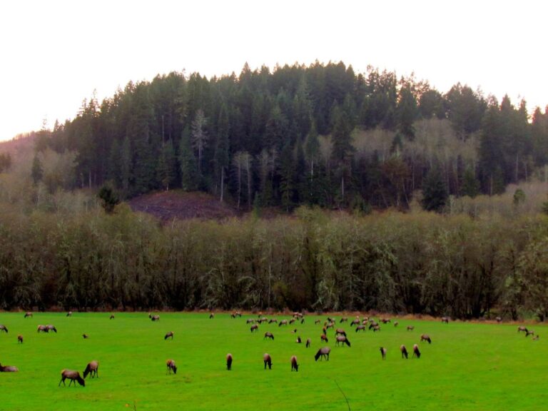
Other photos on this page: USDA Forest Service Pacific Northwest Region (Public Domain Mark 1.0); U.S. Fish and Wildlife Service Pacific Region (Public Domain Mark 1.0).