Home › Oregon › Public land › Umatilla National Forest
Oregon national forest
Umatilla National Forest: Access, Units and Tags
National forest in Umatilla County and 6 more counties (8 hunting units; 1,106,621 acres).
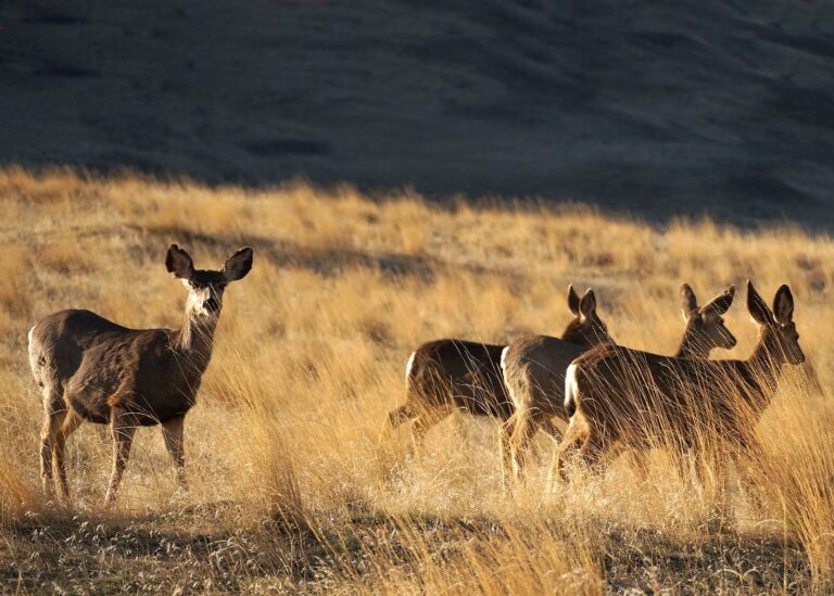
Photo: USDA Forest Service Pacific Northwest Region (Public Domain Mark 1.0)
Getting to Umatilla National Forest
Parking, trailheads and gates near Umatilla National Forest
- Woodland SnoparkParking · 2.5 mi from the centreDirections
- Parking areaParking · 4.3 mi from the centreDirections
- Coyote Ridge TrailheadParking · 4.3 mi from the centreDirections
- Parking areaParking · 4.9 mi from the centreDirections
- Recreation AreaParking · 5.0 mi from the centreDirections
- Snow ParkParking · 5.2 mi from the centreDirections
- Parking areaParking · 6.1 mi from the centreDirections
- Parking areaParking · 7.4 mi from the centreDirections
Parking, trailhead and gate locations come from OpenStreetMap contributors. Roads into public land can be gated or seasonal; check with the managing agency before you go.
Where Umatilla National Forest lies and who runs it
Umatilla National Forest is a national forest: the Forest Service runs camps, roads and closures, while ODFW decides who hunts what and when. The USFS land statistics lists it at 1,106,621 acres. County lines put it in Umatilla County, Grant County, Morrow County, Wallowa County, Union County and Wheeler County and 1 more; ODFW counts it in its East Region. It falls to the Umatilla (Pendleton), Grant (John Day) and Heppner (Heppner) wildlife district for ODFW.
Forest Service wording: Whether you are hunting high in the mountains in the thick lodge pole pine stands or out in the meadow, hunters will find a landscape that supports a variety of species and hunting styles. Image Scouting (Forest Service) Check the Oregon Department of Fish and Wildlife and Washington Department of Fish & Wildlife websites for hunting regulations. The USFS hunting page does not name species; Oregon seasons for the WMUs apply.

Nearby
Places to hunt and shoot around Umatilla National Forest
Hunting rules that apply at Umatilla National Forest
On Umatilla National Forest, as on all national forest land, shooting is not allowed within 150 yards of homes, buildings, campsites or developed sites (36 CFR 261.10). Do not fire across a national forest road or a lake or stream, and never where someone could be hurt. Gates and the Motor Vehicle Use Map decide where trucks may go on Umatilla National Forest; travel management areas tighten that in season.
Mill Creek Watershed (Umatilla Co)
Closed to all access and hunting except during specific hunt dates by USFS permit and ODFW controlled hunt tag (255A). Entry at any other time is prohibited. Each tag holder will be permitted to have one person accompany them during the hunt. After the kill, up to three people may assist the tag holder to remove the elk.
Sources: 36 CFR 261.10 · Forest Service page · ODFW travel management areas; checked November 8, 2026.
Unit map for Umatilla National Forest
Umatilla National Forest overlaps 8 Wildlife Management Units: Fossil Unit (45), Heppner Unit (48), Ukiah Unit (49), Desolation Unit (50), Starkey Unit (52) and Mount Emily Unit (54) and 2 more. Eastern Oregon rules apply, so deer hunting needs a controlled hunt tag drawn in the spring.
| WMU | No. | Side | Sq mi | Cougar zone | ODFW office |
|---|---|---|---|---|---|
| Fossil Unit | 45 | East | 1,407 | D (100) | Heppner (Heppner) |
| Heppner Unit | 48 | East | 1,438 | E (270) | Heppner (Heppner) |
| Ukiah Unit | 49 | East | 874 | E (270) | Umatilla (Pendleton) |
| Desolation Unit | 50 | East | 670 | E (270) | Grant (John Day) |
| Starkey Unit | 52 | East | 806 | E (270) | Union (La Grande) |
| Mount Emily Unit | 54 | East | 768 | E (270) | Umatilla (Pendleton) |
| Walla Walla Unit | 55 | East | 305 | E (270) | Umatilla (Pendleton) |
| Wenaha Unit | 56 | East | 412 | E (270) | Wallowa (Enterprise) |
Units from the ODFW Wildlife Management Units layer overlaid on the land record; cougar quotas from the 2026 cougar zone table; checked November 8, 2026.
Draw tags for Umatilla National Forest
An animal of the draw hunts around Umatilla National Forest.

143 hunts whose 2026 hunt area overlaps the units of Umatilla National Forest go through the spring draw, 36,880 tags between them. Some of these hunts cover only part of a unit; the booklet description decides whether Umatilla National Forest is inside. The 2026 application deadline was May 15 for most series and February 10 for spring bear; results came out June 12. Tags in the main series go 75% by preference points and 25% at random; sheep, goat and premium hunts have no points.
| Series | Hunts | Tags | Applicants |
|---|---|---|---|
| Buck deer (100) | 35 | 16,453 | – |
| Premium deer (L) | 11 | 11 | – |
| Antlerless deer (600) | 6 | 210 | – |
| Elk (200) | 63 | 18,202 | 42,909 |
| Premium elk (M) | 8 | 8 | – |
| Pronghorn (400) | 5 | 127 | 970 |
| Premium pronghorn (N) | 1 | 1 | – |
| California bighorn (500) | 4 | 56 | – |
| Mountain goat (900) | 4 | 10 | – |
| Spring bear (700) | 6 | 1,802 | 4,187 |
254Y1 (Mt Emily Unit No. 2) is the toughest tag: 8,621 first choices, 58 tags. At the other end, hunt 252A2 (Starkey Unit No. 2) had 97 first choices for 990 tags. Hunts new in 2026: FX103, FX103-1, NB102, PH101, FX103R and NB102R.
| Hunt | Area name | Hunt type | Dates | Tags 2026 | First choices 2025 |
|---|---|---|---|---|---|
| NB102 | North Blues 02 | Any legal weapon | Oct 3–14, 2026 | 2,420 | – |
| FX103 | Fox 03 | Any legal weapon | Oct 3–14, 2026 | 1,980 | – |
| PH101 | Painted Hills 01 | Any legal weapon | Oct 3–14, 2026 | 1,254 | – |
| FX102 | Fox 02 | Any legal weapon | Oct 3–14, 2026 | 1,210 | – |
| LEH01 | Elkhorn 01 | Premium (any legal weapon) | Aug 1–Nov 30, 2026 | 1 | – |
| LEH02 | Elkhorn 02 | Premium (any legal weapon) | Aug 1–Nov 30, 2026 | 1 | – |
| LFX01 | Fox 01 | Premium (any legal weapon) | Aug 1–Nov 30, 2026 | 1 | – |
| LFX02 | Fox 02 | Premium (any legal weapon) | Aug 1–Nov 30, 2026 | 1 | – |
| NB602T | North Blues 02 Youth | Youth only | Nov 21–Dec 6, 2026 | 50 | – |
| NB601 | North Blues 01 | Any legal weapon | Nov 16–29, 2026 | 44 | – |
| NE605 | Northeast 05 / (Archery/Muzzleloader ONLY) | Any legal weapon | Nov 16–29, 2026 | 44 | – |
| FX601 | Fox 01 | Any legal weapon | Oct 17–25, 2026 | 28 | – |
| 248R2 | Heppner Unit Bow No. 2 | Archery | Aug 29–Sep 27, 2026 | 1,430 | 431 |
| 249R2 | Ukiah Unit Bow No. 2 | Archery | Aug 29–Sep 27, 2026 | 1,300 | 315 |
| 252R | Starkey Bow | Archery | Aug 29–Sep 27, 2026 | 1,300 | 1,074 |
| 250X | Desolation Unit | Any legal weapon | Oct 28–Nov 1, 2026 | 1,100 | 1,782 |
| M45 | Fossil | Premium (any legal weapon) | Aug 1–Nov 30, 2026 | 1 | – |
| M48 | Heppner | Premium (any legal weapon) | Aug 1–Nov 30, 2026 | 1 | – |
| M49 | Ukiah | Premium (any legal weapon) | Aug 1–Nov 30, 2026 | 1 | – |
| M50 | Desolation | Premium (any legal weapon) | Aug 1–Nov 30, 2026 | 1 | – |
| 440A1 | Columbia Plateau No. 1 | Any legal weapon | Oct 17–25, 2026 | 55 | 181 |
| 445A | Fossil Unit No. 1 | Any legal weapon | Oct 17–25, 2026 | 28 | 91 |
| 440A2 | Columbia Plateau No. 2 | Any legal weapon | Oct 17–25, 2026 | 26 | 437 |
| 445B | Fossil Unit No. 2 | Any legal weapon | Oct 17–25, 2026 | 11 | 121 |
Hunt numbers, 2026 tags and 2025 first-choice applicants from the 2026 Oregon Big Game Hunting Regulations; hunt areas from ODFW’s 2026 controlled hunt boundary layers; draw rules from ODFW. Checked November 8, 2026.
General big game seasons for Umatilla National Forest
You can hunt black bear, cougar and elk around Umatilla National Forest on a general tag bought before the deadline. Fall black bear runs August 1 to December 31 statewide, and cougar is open all year until a zone fills its quota.
| Season | Species | Opens | Closes | Units here |
|---|---|---|---|---|
| General Eastern Oregon Rocky Mountain elk – 2nd season | Elk | Nov 7, 2026 | Nov 15, 2026 | 48, 49, 50 + |
| General archery elk – Eastern Oregon | Elk | Aug 29, 2026 | Sep 27, 2026 | 45 |
| General season antlerless elk damage | Elk | Aug 1, 2026 | Nov 30, 2026 | 48, 49, 52 + |
| General fall black bear (statewide) | Black bear | Aug 1, 2026 | Dec 31, 2026 | All |
| General cougar (statewide, zone quotas) | Cougar | Jan 1, 2026 | Dec 31, 2026 | All |
General seasons and dates from the 2026 Oregon Big Game Hunting Regulations; tag sale deadlines on the general seasons page. Checked November 8, 2026.
Special rules in the Umatilla National Forest units
Cougar zone: D (Columbia Basin, 100 cats) and E (Blue Mountains, 270 cats), closed when that quota is met. From 2026 ODFW groups eastern deer hunts by herd range; Umatilla National Forest touches Aldrich, Elkhorn, Fox and North Blues. Plan on walking more in season, since 9 travel management areas shut roads in these units. ODFW sells general antlerless elk damage tags for the areas below; the season runs August 1 to March 31.
| Rule | Where | Details |
|---|---|---|
| Cougar zone | Zone D, Columbia Basin | Quota 100 |
| Cougar zone | Zone E, Blue Mountains | Quota 270 |
| Mule deer range | Aldrich (AD) | AD01 |
| Mule deer range | Elkhorn (EH) | EH01, EH02 |
| Mule deer range | Fox (FX) | FX01, FX02, FX03 |
| Mule deer range | North Blues (NB) | NB01, NB02 |
| Mule deer range | Northeast (NE) | NE01, NE02, NE03, NE04, NE05, NE06 |
| Mule deer range | Painted Hills (PH) | PH01 |
| Antlerless elk damage | Ukiah and Heppner | Aug. 1 – Nov. 30 |
| Antlerless elk damage | Walla Walla | Aug. 1 – Nov. 30 |
| Antlerless elk damage | Grande Ronde Baker Keating Valleys | Aug. 1 – Nov. 30 |
| Travel management | 45A Umatilla NF | Permanent Closure |
| Travel management | 48A Umatilla NF | Permanent Closure |
| Travel management | 49A Meacham | Permanent Closure |
| Travel management | 52A Clear Creek | 3 days prior to the opening of deer and elk archery season through the close of Rocky… |
| Travel management | 52B Trail Creek | 3 days prior to the opening of Rocky Mountain bull elk first season through the close of… |
| Travel management | 52C Indian Creek-Gorham Butte | 3 days prior to the opening of deer and elk archery season through the close of Rocky… |
| Travel management | 52D Starkey Exp Forest Enclosure | Permanent Closure |
| Travel management | 52E Dry Beaver-Ladd Canyon | Permanent Closure |
| Travel management | 54A Umatilla NF | Permanent Closure |
| Rifle limit | Rocky Mountain Bull Elk (controlled) 1st Season (October 28 – November 1) | Units 31-77 |
| Rifle limit | Rocky Mountain Bull Elk 2nd Season (November 7 – November 15) | Units 32-77 |
From the 2026 Oregon Big Game Hunting Regulations: cougar zones, Deer Hunt Areas, travel management areas, elk damage areas, rifle restrictions. Checked November 8, 2026.
How many animals the Umatilla National Forest units gave up in 2025
ODFW publishes harvest by hunt and unit, not by property, so these are 2025 totals for whole units that overlap Umatilla National Forest. Starkey Unit gave up the most elk, around 486 in the 2025 any-legal-weapon tables. Heppner Unit produced the largest buck harvest, roughly 401.
| Unit | Buck deer hunters | Buck deer harvest | Elk hunters | Elk harvest | Pronghorn hunters | Pronghorn harvest | Black bear hunters | Black bear harvest | Cougar hunters | Cougar harvest |
|---|---|---|---|---|---|---|---|---|---|---|
| Fossil Unit | 1,120 | 361 | 967 | 270 | 18 | 6 | 85 | 1 | 166 | 5 |
| Heppner Unit | 1,669 | 401 | 2,647 | 425 | 5 | 1 | 707 | 13 | 704 | 15 |
| Ukiah Unit | 841 | 192 | 2,198 | 347 | – | – | 544 | 46 | 437 | 3 |
| Desolation Unit | 525 | 199 | 1,265 | 167 | – | – | 490 | 25 | 336 | 3 |
| Starkey Unit | 280 | 88 | 2,301 | 486 | – | – | 520 | 32 | 368 | 8 |
| Mount Emily Unit | 393 | 156 | 393 | 130 | – | – | 380 | 91 | 131 | 2 |
| Walla Walla Unit | 179 | 97 | 244 | 90 | – | – | 114 | 18 | 52 | 2 |
| Wenaha Unit | 208 | 86 | 266 | 72 | – | – | 361 | 59 | 122 | 2 |
ODFW 2025 harvest summaries (2025 buck deer, any legal weapon summary · 2025 elk, any legal weapon summary · 2025 pronghorn summary · 2025 black bear summary · 2025 cougar summary); unit totals summed from the report rows; checked November 8, 2026.
Umatilla National Forest game bird zones
Game bird shooting hours here come from ODFW's printed table for Zone B (Central Oregon) and Zone D (Eastern Oregon; part of Malheur County is on Mountain Time). The ODFW waterfowl map is the only source for duck Zone 1 or Zone 2 here.
| County | Game bird zone | Goose zone |
|---|---|---|
| Umatilla County | D (Eastern Oregon; part of Malheur County is on Mountain Time) | Map only |
| Grant County | D (Eastern Oregon; part of Malheur County is on Mountain Time) | Map only |
| Morrow County | D (Eastern Oregon; part of Malheur County is on Mountain Time) | Map only |
| Wallowa County | D (Eastern Oregon; part of Malheur County is on Mountain Time) | Map only |
| Union County | D (Eastern Oregon; part of Malheur County is on Mountain Time) | Map only |
| Wheeler County | B (Central Oregon) | Map only |
| Baker County | D (Eastern Oregon; part of Malheur County is on Mountain Time) | Map only |
From the 2026-27 Oregon Game Bird Hunting Regulations: goose zones, shooting-hours zones, duck zone map. Checked November 8, 2026. Waterfowl and goose zones.
Related records for Umatilla National Forest
Inside it are 4 separate records on this site.
Umatilla National Forest county by county
By county, Umatilla County carries the biggest piece, around 373,844 acres.
| County | Acres | Part of total |
|---|---|---|
| Umatilla County | 373,844 | 34% |
| Grant County | 323,265 | 29% |
| Morrow County | 144,233 | 13% |
| Wallowa County | 123,657 | 11% |
| Union County | 102,348 | 9% |
| Wheeler County | 39,233 | 4% |
| Baker County | 41 | 0% |
From the USFS Lands Area Statistics; checked November 8, 2026.
Closed ground beside Umatilla National Forest
Keep out of the places below when hunting around Umatilla National Forest; Oregon seasons do not apply there. Reservations and trust land follow tribal law, not ODFW seasons; 18 U.S.C. 1165 makes unauthorised entry to hunt a federal offense. ODFW added a closure for 2026-27: no fall turkey or beardless permit hunting on tribal or allotted land of the Umatilla Reservation.
| Closed land | Reason | County | Acres |
|---|---|---|---|
| Umatilla Reservation | Tribal land | Umatilla, Union | 172,932 |
| Umatilla trust land | Tribal land | Umatilla, Wallowa | 4,280 |
| John Day Fossil Beds | National Park Service unit | Grant, Wheeler | 13,960 |
| Nez Perce NHP | National Park Service unit | Wallowa | 13 |
Closed places from lands.json: tribal land (Census TIGERweb; 18 U.S.C. 1165; ODFW), NPS units (36 CFR 2.2), refuges not in 50 CFR 32.56 and ODFW regulation closures. Checked November 8, 2026.
Other public land within reach of Umatilla National Forest
A 21 miles hop southeast brings you to Minam River WA, the next public land on this site. Around it on the map: 5 wildlife areas and 1 national forest.
| Area | Kind | Acres | County | Miles off | Direction |
|---|---|---|---|---|---|
| Minam River WA | Wildlife area | 17,087 | Wallowa | 21 miles | southeast |
| Wallowa Wildlife Area | Wildlife area | 27 | Wallowa | 24 miles | southeast |
| Wenaha Wildlife Area | Wildlife area | 11,351 | Wallowa | 26 miles | northeast |
| Wallowa-Whitman National Forest | National forest | 2,260,830 | Wallowa | 30 miles | southeast |
| Ladd Marsh WA | Wildlife area | 5,597 | Union | 35 miles | south |
| Lostine Wildlife Area | Wildlife area | 1,010 | Wallowa | 38 miles | southeast |
Point: OR_FRAMEWORK Oregon Land Management (USFS) inside the USFS EDW ranger district boundaries of the unit (polygon centroid of the largest part). Straight-line distances. Statewide public land map.
Groceries, gas and game care near Umatilla National Forest
The handiest town is Elgin, about 15 miles from Umatilla National Forest. La Grande, 31 miles out, is bigger: 13,058 people (2024). Base towns within ten miles: Elgin, Heppner, La Grande and Pendleton. Enterprise has the nearest ODFW office, 30 miles out.
| Place | County | Population | Distance | Direction |
|---|---|---|---|---|
| Elgin | Union | 1,694 | 15 miles | south |
| Weston | Umatilla | 705 | 20 miles | west |
| Wallowa | Wallowa | 815 | 27 miles | southeast |
| Island City | Union | 1,131 | 30 miles | south |
| La Grande | Union | 13,058 | 31 miles | south |
Towns from places.json (Census 2024 estimates); ODFW offices from the ODFW contact page; businesses from services.json listings; straight-line miles. Checked November 8, 2026.
Legal light on Umatilla National Forest by date
Game birds run on ODFW's own printed table, and Umatilla National Forest uses Zone D of it, so the bird column below is copied from the 2026-27 booklet rather than calculated.
| Date | Season point | Sunrise | Sunset | Mammals | Birds |
|---|---|---|---|---|---|
| Aug 29, 2026 | Archery opener | 6:08 a.m. | 7:38 p.m. | 5:38 a.m. to 8:08 p.m. | Not in table |
| Oct 3, 2026 | Eastern buck rifle | 6:51 a.m. | 6:31 p.m. | 6:21 a.m. to 7:01 p.m. | 6:27 a.m. to 6:24 p.m. |
| Oct 10, 2026 | Duck opener and upland opener | 7:00 a.m. | 6:17 p.m. | 6:30 a.m. to 6:47 p.m. | 6:35 a.m. to 6:12 p.m. |
| Dec 21, 2026 | Shortest day | 7:30 a.m. | 4:10 p.m. | 7:00 a.m. to 4:40 p.m. | 6:55 a.m. to 4:18 p.m. |
| Apr 15, 2027 | Spring turkey | 6:08 a.m. | 7:37 p.m. | 5:38 a.m. to 8:07 p.m. | Not in table |
Hours rules from the ODFW general hunting regulations; game bird times from the 2026-27 game bird shooting hours table; mammal sunrise and sunset worked out for this location with the NOAA solar formula (Pacific Time); checked November 8, 2026. Legal hours for every county.
Umatilla National Forest hunters: nearest ranges on file
Hunters bound for Umatilla National Forest can practise at East End Rod and Gun Club, 20 miles off and the nearest listing.
From ODFW’s E.E. Wilson visitors guide, the BLM qualified range list, club sites and directory listings, checked November 8, 2026.

Umatilla National Forest: questions and answers
Does Umatilla National Forest border closed ground?
Umatilla Reservation, Umatilla trust land and John Day Fossil Beds are closed to Oregon-licensed hunting.
Where is the nearest town to Umatilla National Forest?
Straight-line distances put Elgin (15 miles) and the ODFW Wenaha Wildlife Area Office (30 miles) closest.
Can I hunt Umatilla National Forest seven days a week?
Yes, statewide there is no Sunday ban; specific areas may set their own hunt days.
What road rules apply on Umatilla National Forest?
Check the current motor vehicle map and the travel management areas in the units.
Must I report my tag after hunting Umatilla National Forest?
Yes. Every deer, elk, pronghorn, bear, cougar and turkey tag must be reported, hunted or not: by January 31, 2027 for hunts ending by December 31, 2026, and by April 15, 2027 for later hunts.
Who owns or runs Umatilla National Forest day to day?
The manager is the USDA Forest Service.
Which ODFW units is Umatilla National Forest in?
Fossil Unit (45), Heppner Unit (48), Ukiah Unit (49), Desolation Unit (50), Starkey Unit (52), Mount Emily Unit (54), Walla Walla Unit (55) and Wenaha Unit (56); hunt boundaries follow these units.
Does Umatilla National Forest allow hunting with a state license?
Yes, apart from any special closures; Oregon seasons apply on Umatilla National Forest. One exception: the Sandy River Delta is closed to all hunting except waterfowl, shotgun only, north and east of the powerline.
Can I hunt Umatilla National Forest on a general tag?
You can buy general tags for black bear, cougar and elk.
Which spring-draw tags work around Umatilla National Forest?
Yes for drawn species: 143 hunts and 36,880 tags in 2026.
What time does legal shooting start at Umatilla National Forest?
On November 8, 2026, mammal hours there run 6:11 a.m. to 5:01 p.m. (half an hour either side of sunrise and sunset, worked out with the NOAA solar formula). Game birds follow ODFW’s table: 6:11 a.m. to 4:31 p.m.
Which Oregon license and tags apply on Umatilla National Forest?
The 2026 hunting license costs $39.00 (resident) or $193.00 (nonresident); tags and validations are extra.
Last-minute checks for Umatilla National Forest hunters
Look up road, fire and weather closures affecting Umatilla National Forest before you set off.
Sources: source 1 · source 2 · source 3 · source 4 · source 5 · source 6; seasons from the 2026 Oregon Big Game Hunting Regulations and the 2026-27 Oregon Game Bird Hunting Regulations. Checked November 8, 2026.
Other photos on this page: USDA Forest Service Pacific Northwest Region (Public Domain Mark 1.0); USDA Forest Service Pacific Northwest Region (Public Domain Mark 1.0).