Home › Wisconsin › Public land › Eau Claire River Fishery Area
Langlade County · Fishery area
Hunting at Eau Claire River Fishery Area
Eau Claire River Fishery Area, 42 acres in Langlade County: whitetails, ducks and geese, squirrels, cottontails and hares and raccoons, foxes and coyotes, zones and tags, property rules, county harvest and the land nearby.
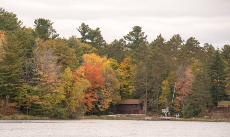
Photo: aarongunnar (CC BY-SA 2.0)
Getting to Eau Claire River Fishery Area
Eau Claire River Fishery Area on one card
Hunters reach Eau Claire River Fishery Area in Langlade County; it is a DNR fishery area that is open to hunting. This is the Northwoods, in the DNR Northern Region. Day-to-day it is in the hands of the Wisconsin DNR. Measured at 42 acres, it comes in 164th of 245 fishery areas. Summit Lake is the nearest town with a guide on this site, about 9 miles away; the land lies southeast of it.
From the source page (WI DNR Managed Lands GIS ACRES field, sum of parcels open to hunting); region from the DNR county layer. Checked October 19, 2026.
Nearby
Places to hunt and shoot around Eau Claire River Fishery Area
Zones that take in Eau Claire River Fishery Area
Eau Claire River Fishery Area is Northern Forest deer country, unit DMU 123. Antlerless quota, 2026: 795. The Zone B bear quota for 2026 is 850, spread over 1,545 drawn permits. Zone 5 turkey numbers for 2025: 12,008 spring tags, 20% success. Wild deer with CWD have been confirmed in Langlade County. Leave the corn at home; Langlade County bans deer baiting.
Antlerless tags near Eau Claire River Fishery Area
| Unit | Zone | Quota 2026 | Bonus, public | Bonus, private | Farmland tags |
|---|---|---|---|---|---|
| DMU 123 | Northern Forest | 795 | 788 | 1,624 | — |
Eau Claire River Fishery Area: other game zones
| Zone | Detail | Numbers | More | 2025 |
|---|---|---|---|---|
| Bear zone B | Hounds allowed | 850 target, 1,545 permits | 11 points | 851 bears in 2025 |
| Turkey 5 | 12,008 spring tags (2025) | 20% success | 2,446 gobblers | — |
| Ruffed grouse A | Sep 12–Jan 3 | 5 a day | ||
| Duck zone | Northern | Sep 26–Nov 24 | ||
| Canada goose | Northern | Sep 16–Dec 16 | ||
| Wolf 2 | No harvest | Federal listing |
Zones from the DNR zone layers as recorded in lands.json; quotas and bonus tags from the 2026 antlerless quota table; bear figures from the 2026 bear drawing summary and 2025 bear harvest; turkey from the 2025 spring turkey report; CWD and baiting lists from the DNR. Checked October 19, 2026.
How the DNR describes Eau Claire River Fishery Area
The managing agency's own text.
The Eau Claire River is classified as class 2 trout water; there are some stretches of class 1 trout water in the project as well, although the entire stretch is officially classed as class 2. Picture Title (picture optional) © photographer –> Species from deer to spring peepers are common throughout the Eau Claire Fishery Area. The water in the stream is an exceptional fall attractant for mallards. However, wood ducks and bluewing teal are also common.
Successful duck hunting on this corridor is very common. The corridor is also used by mink, muskrat, otter, fox, coyote, raccoon, and an occasional beaver. Trappers utilize all of these species. Nongame birds such as great blue herons, green herons, warblers, indigo buntings, and numerous others use the area during migration, as well as for summer breeding and feeding habitat. Nongame mammals, reptiles, and amphibians also find their life requirements in this area. Directions: Eau Claire River Fishery Area is 9 miles northeast of Antigo in Langlade County off County Hwy A adjacent to Peter's Marsh Wildlife Area.
Hunting notes printed for Eau Claire River Fishery Area
- Hunting – deer, fowl, & small game
Quoted from the property page, retrieved 2026-10-19; checked October 19, 2026.
What Eau Claire River Fishery Area requires of hunters
Eau Claire River Fishery Area access terms
Where the managed-lands map marks it open, this fishery land takes hunters and trappers in season (NR 45).
The rule book on Eau Claire River Fishery Area
Half of your outer clothing above the waist, and half of your hat, must be blaze orange or pink whenever a firearm deer season is open (waterfowl hunters excepted). Ground blinds need a 144-square-inch orange or pink patch in gun deer seasons on DNR ground. Stands may not damage trees. North of Hwy. 64 they can stay overnight Sept. 1, 2026 to Jan. 31, 2027 (two per hunter per county); south of Hwy. 64 they come down daily. Deer and turkeys go into GameReg online or by phone by 5 p.m. the next day.
Go Wild shopping list for Eau Claire River Fishery Area
A gun deer or archery license comes with a buck authorization; antlerless deer on this land need a public-access authorization.
Access from the source page; closures from the DNR closed and restricted areas layer; stocking and dove fields from the DNR upland bird layers; rules from the Fall 2026-Spring 2027 regulations; prices from Go Wild. Checked October 19, 2026.
What hunters pursue at Eau Claire River Fishery Area
Species the agency lists here: whitetails, ducks and geese, squirrels, cottontails and hares and raccoons, foxes and coyotes.
White-tailed deer
Ducks and geese
Small game
Furbearers
Unlisted species follow the Langlade County dates below, subject to the property rules.
Species from the property record (species named by the source); bag limits from the DNR regulations. Checked October 19, 2026.
Eau Claire River Fishery Area: opening and closing days
From bear baiting in September to the last spring turkey period, 39 season segments apply to Eau Claire River Fishery Area.
| Species | Hunt type | Zone or unit | Opening | Closing | Now |
|---|---|---|---|---|---|
| White-tailed deer | Archery and crossbow | Statewide | Sep 12, 2026 | Jan 3, 2027 | |
| White-tailed deer | Youth/disabled gun hunt | Statewide | Oct 10, 2026 | Oct 11, 2026 | |
| White-tailed deer | Gun deer (9-day) | Statewide | Nov 21, 2026 | Nov 29, 2026 | |
| White-tailed deer | Muzzleloader | Statewide | Nov 30, 2026 | Dec 9, 2026 | |
| White-tailed deer | December antlerless hunt | Statewide | Dec 10, 2026 | Dec 13, 2026 | |
| Black bear | Bear, Class A draw | Bear Zone B | Sep 9, 2026 | Sep 15, 2026 | |
| Black bear | Bear, Class A draw | Bear Zone C | Sep 9, 2026 | Oct 13, 2026 | |
| Black bear | Bear, Class A draw | Bear Zone B | Sep 16, 2026 | Oct 6, 2026 | |
| Black bear | Bear, Class A draw | Bear Zone B | Oct 7, 2026 | Oct 13, 2026 | |
| Wild turkey | Fall turkey | Turkey Zone 5 | Sep 12, 2026 | Jan 3, 2027 | |
| Wild turkey | Spring youth turkey hunt | Turkey Zone 5 | Apr 17, 2027 | Apr 18, 2027 | |
| Wild turkey | Spring turkey Period A | Turkey Zone 5 | Apr 21, 2027 | Apr 27, 2027 | |
| Wild turkey | Spring turkey Period B | Turkey Zone 5 | Apr 28, 2027 | May 4, 2027 | |
| Wild turkey | Spring turkey Period C | Turkey Zone 5 | May 5, 2027 | May 11, 2027 | |
| Wild turkey | Spring turkey Period D | Turkey Zone 5 | May 12, 2027 | May 18, 2027 | |
| Wild turkey | Spring turkey Period E | Turkey Zone 5 | May 19, 2027 | May 25, 2027 | |
| Wild turkey | Spring turkey Period F | Turkey Zone 5 | May 26, 2027 | Jun 1, 2027 | |
| Ruffed Grouse | Ruffed grouse | Grouse Zone A | Sep 12, 2026 | Jan 3, 2027 | |
| Pheasant | Pheasant | Statewide | Oct 17, 2026 | Jan 3, 2027 | |
| Bobwhite Quail | Bobwhite quail | Statewide | Oct 17, 2026 | Dec 9, 2026 | |
| Hungarian partridge | Hungarian partridge | Statewide | Oct 17, 2026 | Jan 3, 2027 | |
| Squirrel | Squirrel | Statewide | Sep 12, 2026 | Feb 28, 2027 | |
| Cottontail | Cottontail rabbit | Northern cottontail zone | Sep 12, 2026 | Feb 28, 2027 | |
| Snowshoe Hare | Snowshoe hare | Statewide | Year-round | Year-round | Year-round |
| American Crow | Crow | Statewide | Nov 21, 2026 | Mar 24, 2027 | |
| Ducks | Youth waterfowl hunt | Statewide | Sep 19, 2026 | Sep 20, 2026 | |
| Ducks | Regular duck | Northern Duck Zone | Sep 26, 2026 | Nov 24, 2026 | |
| Teal | Early teal | Statewide | Sep 1, 2026 | Sep 9, 2026 | |
| Geese | Regular goose | Northern Goose Zone | Sep 16, 2026 | Dec 16, 2026 | |
| Canada goose | Early Canada goose | Statewide | Sep 1, 2026 | Sep 15, 2026 | |
| Raccoon | Raccoon (resident) | Statewide | Oct 17, 2026 | Feb 15, 2027 | |
| Raccoon | Raccoon (nonresident) | Statewide | Oct 31, 2026 | Feb 15, 2027 | |
| Red and gray fox | Fox (red and gray) | Statewide | Oct 17, 2026 | Feb 15, 2027 | |
| Coyote | Coyote (hunting) | Statewide | Year-round | Year-round | Year-round |
| Bobcat | Bobcat, Period 1 | North of Hwy. 64 | Oct 17, 2026 | Dec 25, 2026 | |
| Bobcat | Bobcat, Period 1 | South of Hwy. 64 | Oct 17, 2026 | Dec 25, 2026 | |
| Bobcat | Bobcat, Period 2 | North of Hwy. 64 | Dec 26, 2026 | Jan 31, 2027 | |
| Bobcat | Bobcat, Period 2 | South of Hwy. 64 | Dec 26, 2026 | Jan 31, 2027 | |
| Unprotected species | Unprotected species | Statewide | Year-round | Year-round | Year-round |
From the Wisconsin Department of Natural Resources Fall 2026-Spring 2027 hunting regulations and season dates, checked October 19, 2026.
Langlade County harvest near Eau Claire River Fishery Area
Deer registered in the Langlade County unit, 2025: 2,007. The decade peaked at 4,284 in 2018 and bottomed at 2,007 in 2025. Through Oct. 19, 2026: 80 antlered and 55 antlerless in DMU 123 (preliminary). CWD year 2025 brought 145 Langlade County samples and 0 positives. Running total since 1999: 2,176 tested. The 2025 bear count for Langlade County was 169. No harvest is published for Eau Claire River Fishery Area itself, so the county unit is the finest level.
Registered deer in the Eau Claire River Fishery Area county unit
| Year | Antlered | Antlerless | Total |
|---|---|---|---|
| 2025 | 905 | 1,102 | 2,007 |
| 2024 | 1,963 | 1,678 | 3,641 |
| 2023 | 1,908 | 1,459 | 3,367 |
| 2022 | 2,378 | 1,716 | 4,094 |
| 2021 | 1,853 | 807 | 2,660 |
| 2020 | 1,766 | 1,147 | 2,913 |
CWD tests in Langlade County
| CWD year | Wild deer sampled | Positive |
|---|---|---|
| 2026 (partial) | 6 | 0 |
| 2025 | 145 | 0 |
| 2024 | 159 | 0 |
| 2023 | 169 | 0 |
| 2022 | 144 | 1 |
| 2021 | 118 | 0 |
Bear numbers near Eau Claire River Fishery Area
| Year | Total | Male | Female |
|---|---|---|---|
| 2024 | 201 | 103 | 98 |
| 2025 | 169 | 87 | 82 |
Deer from DNR Deer Metrics harvest history and the 2026 harvest to date; CWD from the DNR CWD summary; bears from the DNR bear harvest reports. Checked October 19, 2026.
Around Eau Claire River Fishery Area: more places to hunt
The big marker is Eau Claire River Fishery Area. Smaller ones are its 10 closest neighbours. The neighbours add 11,714 acres between them.
| Nearby | Kind | Acres | Miles | Heading |
|---|---|---|---|---|
| Crystal Springs Rearing Station | Fishery area | 30 | 0.6 mi | north |
| Peters Marsh | Wildlife area | 1,770 | 0.8 mi | east |
| Lawrence Lake | State natural area | 246 | 4.8 mi | east |
| Upper Wolf River | Fishery area | 9,205 | 5.7 mi | northeast |
| Knoke Spring State Spring Ponds | Fishery area | 21 | 7.6 mi | north |
| Hunting River Alders | State natural area | 150 | 8.4 mi | northwest |
| Rabes Lake | Fishery area | 120 | 10 mi | south |
| Rolling Stone Lake | Wildlife area | 19 | 12 mi | northeast |
| Demlows Lake | Fishery area | 73 | 12 mi | south |
| Swamp Creek Fen | State natural area | 80 | 12 mi | north |
Points from the DNR managed lands, SNA, county forest, FWS realty, USFS, NPS and DoD layers (WI DNR Managed Lands GIS (polygon centroid of hunting-open parcels) (polygon centroid)). Straight-line distances. Statewide public land map.
Eau Claire River Fishery Area: nearby towns and businesses
Town pages first, then shops, processors and DNR desks.
| Base town | County | Away | Residents | Public acres near |
|---|---|---|---|---|
| Summit Lake | Langlade | 8.8 mi | — | 82,723 |
| Post Lake | Langlade | 10.0 mi | — | 75,672 |
| Antigo | Langlade | 11 mi | 8,096 | 18,960 |
| Mole Lake | Forest | 15 mi | — | 53,945 |
County-level hunting pages: Langlade County.
Shops a short drive from Eau Claire River Fishery Area
DNR desks closest to Eau Claire River Fishery Area
Service center for Langlade County business: DNR Rhinelander Service Center.
Towns and populations from the Census 2024 estimates; public acres within 10 miles from the land layers; businesses from store locators and listings (license-only agents left out); offices from DNR, USFS and USFWS pages. Checked October 19, 2026. Call ahead.
Eau Claire River Fishery Area: nearest ranges
About 13 miles separates Eau Claire River Fishery Area from Langlade (County forest), the nearest public map range. Nearby rod and gun clubs round out the list.
rifle, trap, shotgun on file
rifle on file
archery, 3D archery on file
From the DNR public range map and its map layer, checked October 19, 2026.
Shooting light at Eau Claire River Fishery Area by date
At Eau Claire River Fishery Area the offset is 8 minutes (Zone C). The times below already include it for both DNR shooting-hours areas.
| Day | Season | North table | South table |
|---|---|---|---|
| Sep 12, 2026 | Bow, turkey, grouse opener | 6:03 a.m. to 7:35 p.m. | 6:05 a.m. to 7:34 p.m. |
| Oct 17, 2026 | Pheasant and duck dates | 6:47 a.m. to 6:29 p.m. | 6:46 a.m. to 6:32 p.m. |
| Nov 1, 2026 | Early November | 6:08 a.m. to 5:05 p.m. | 6:05 a.m. to 5:09 p.m. |
| Nov 21, 2026 | Gun deer opener | 6:36 a.m. to 4:42 p.m. | 6:31 a.m. to 4:48 p.m. |
| Dec 1, 2026 | Muzzleloader week | 6:48 a.m. to 4:36 p.m. | 6:43 a.m. to 4:43 p.m. |
| Dec 24, 2026 | Holiday Hunt opener | 7:07 a.m. to 4:38 p.m. | 7:01 a.m. to 4:46 p.m. |
| Jan 3, 2027 | Archery close (most units) | 7:09 a.m. to 4:47 p.m. | 7:03 a.m. to 4:54 p.m. |
Deer, bear, elk, small game and fall turkey table times from the Wisconsin Department of Natural Resources shooting hours tables, plus the Zone C offset of 8 minutes for longitude 89.07 W, checked October 19, 2026. Shooting hours for every county.

What people ask about hunting Eau Claire River Fishery Area
What are the waterfowl zones for Eau Claire River Fishery Area?
It sits in the Northern duck and Northern goose zones. In the Northern Zone the regular duck split begins Sep 26.
Which turkey zone is Eau Claire River Fishery Area in?
Zone 5, one bird per spring authorization.
Do I need blaze orange at Eau Claire River Fishery Area?
In any open firearm deer season, wear blaze orange or pink on at least half your coat and cap.
Is deer baiting legal near Eau Claire River Fishery Area?
No: Langlade County bans deer baiting and feeding. Wild deer with CWD are documented in Langlade County.
Which Wisconsin license covers Eau Claire River Fishery Area?
Go Wild sells everything needed; antlerless tags on public land must be public-access tags.
How do I register a deer from Eau Claire River Fishery Area?
Through GameReg (online, phone or a station) by 5 p.m. the day after recovery.
Which agency sets the rules on Eau Claire River Fishery Area?
The Wisconsin DNR treats it as a DNR fishery area that is open to hunting.
If Eau Claire River Fishery Area is full, where next?
Within a short drive: Crystal Springs Rearing Station (1 mile), Peters Marsh Wildlife Area (1 mile) and Lawrence Lake State Natural Area (5 miles).
Where do Eau Claire River Fishery Area hunters spend the night?
Start from Summit Lake; the land is 9 miles off, in Langlade County.
What acreage is listed for Eau Claire River Fishery Area?
Roughly 42 acres.
Which DMU takes in Eau Claire River Fishery Area?
Deer unit DMU 123; zone Northern Forest. The 2026 antlerless quota is 795 (DMU 123); use a public-access antlerless tag here.
Which species are hunted on Eau Claire River Fishery Area?
Listed: whitetails, ducks and geese, squirrels, cottontails and hares and raccoons, foxes and coyotes.
Which bear management zone holds Eau Claire River Fishery Area?
Bear Zone B. Zone B took 11 preference points in 2026.
Check Eau Claire River Fishery Area once more
Refuges, closed areas and park windows at Eau Claire River Fishery Area can shift mid-season; the property page and the DNR map have the current picture.
Sources for this page: DNR: 880eauclaireriver · DNR GIS · DNR: county; regulations from the Fall 2026-Spring 2027 Wisconsin hunting regulations. Checked October 19, 2026.
Other photos on this page: Birding for Climate (Public domain); colmmcsky (CC BY-SA 2.0).