Home › Wisconsin › Public land › Upper Wolf River Fishery Area
Fishery area, the Northwoods
Upper Wolf River Fishery Area hunting notes
9,205 acres of fishery area in Langlade County, with 2026-27 zones, quotas, rules, CWD testing and a map.
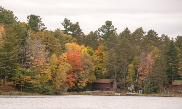
Photo: aarongunnar (CC BY-SA 2.0)
Getting to Upper Wolf River Fishery Area
Parking, trailheads and gates near Upper Wolf River Fishery Area
- Parking areaParking · 1.9 mi from the centreDirections
- Parking areaParking · 2.0 mi from the centreDirections
- Parking areaParking · 2.0 mi from the centreDirections
- Parking areaParking · 2.1 mi from the centreDirections
- Parking areaParking · 2.7 mi from the centreDirections
- Sioux Parking LotParking · 2.7 mi from the centreDirections
- Irquois Parking LotParking · 2.8 mi from the centreDirections
- Parking areaParking · 2.8 mi from the centreDirections
Parking, trailhead and gate locations come from OpenStreetMap contributors. Roads into public land can be gated or seasonal; check with the managing agency before you go.
Upper Wolf River Fishery Area, by its record
Count Upper Wolf River Fishery Area among the fishery areas of Langlade County. It falls in the DNR Northern Region, the Northwoods. The Wisconsin DNR manages the land. By size (9,205 acres) it is number 1 among 245 fishery areas on our list. Head southeast from Post Lake for about 7 miles. 3 smaller units sit inside it, each with its own page.
From the source page (WI DNR Managed Lands GIS ACRES field, sum of parcels open to hunting); region from the DNR county layer. Checked October 19, 2026.
Nearby
Places to hunt and shoot around Upper Wolf River Fishery Area
Zone lines at Upper Wolf River Fishery Area
Deer rules follow the Northern Forest and Central Farmland zones and DMU 123, Langlade and DMU 126. For 2026 the antlerless quota stands at 795, 1,100 and 1,105. In Bear Zone B the DNR drew 1,545 permits for a target of 850 bears; drawn hunters needed 11 points. Turkey Zone 5: 12,008 spring authorizations in 2025 and 20% hunter success. Langlade County is on the CWD list: a positive wild deer has been found. Deer may not be baited or fed in Langlade County.
Upper Wolf River Fishery Area deer management units
| DMU | Zone | 2026 antlerless | Public bonus | Private bonus | Free per license |
|---|---|---|---|---|---|
| DMU 123 | Northern Forest | 795 | 788 | 1,624 | — |
| Langlade Central Farmland | Central Farmland | 1,100 | 723 | 3,253 | 2 |
| DMU 126 | Northern Forest | 1,105 | 0 | 1,105 | — |
Bear, turkey, grouse and waterfowl lines through Upper Wolf River Fishery Area
| Zone | Setting | Data | Also | Last season |
|---|---|---|---|---|
| Bear B | Hound hunting | 850 target, 1,545 permits | 11 points | 851 bears in 2025 |
| Bear C | No hound hunting | 875 target, 4,465 permits | 2 points | 663 bears in 2025 |
| Turkey 5 | 12,008 spring tags (2025) | 20% success | 2,446 gobblers | — |
| Grouse A | Sep 12–Jan 3 | 5 a day | ||
| Ducks | Northern | Sep 26–Nov 24 | ||
| Canada geese | Northern | Sep 16–Dec 16 | ||
| Wolf zone 2/2B | Closed | Federal protection |
Zones from the DNR zone layers as recorded in lands.json; quotas and bonus tags from the 2026 antlerless quota table; bear figures from the 2026 bear drawing summary and 2025 bear harvest; turkey from the 2025 spring turkey report; CWD and baiting lists from the DNR. Checked October 19, 2026.
Hunting Upper Wolf River Fishery Area within the rules
Who may hunt Upper Wolf River Fishery Area
This DNR fishery land is open to public hunting and trapping in state seasons wherever the DNR managed-lands map shows it open; NR 45 rules apply.
Statewide rules that reach Upper Wolf River Fishery Area
Wisconsin asks for 50% blaze orange or fluorescent pink above the waist in firearm deer seasons, archers included, waterfowlers not. Ground blinds on DNR land in a firearm deer season show at least 144 square inches of solid orange or pink, visible from all sides. Unattended stands carry your name or customer ID; they may be left out north of State Hwy. 64 (up to two per county), never south of it. Registration through GameReg closes at 5 p.m. on the day after recovery.
Upper Wolf River Fishery Area license list
Residents often take the Conservation Patron, which bundles the hunting licenses. Antlerless tags on public land must be public-access tags.
Access from the source page; closures from the DNR closed and restricted areas layer; stocking and dove fields from the DNR upland bird layers; rules from the Fall 2026-Spring 2027 regulations; prices from Go Wild. Checked October 19, 2026.
Upper Wolf River Fishery Area: the game on record
The source names whitetails, black bears, wild turkeys, ducks and geese, squirrels, cottontails and hares and raccoons, foxes and coyotes for Upper Wolf River Fishery Area.
White-tailed deer
Black bear
Wild turkey
Ducks and geese
Small game
Furbearers
Every other open season that reaches Langlade County applies too, within the property rules.
Species from the property record (species named by the source); bag limits from the DNR regulations. Checked October 19, 2026.
Upper Wolf River Fishery Area hunting dates, fall 2026 to spring 2027
20 species and 39 segments reach Upper Wolf River Fishery Area. The last column compares each one with today.
| Quarry | Season | Zone | From | To | Status today |
|---|---|---|---|---|---|
| White-tailed deer | Archery and crossbow | Statewide | Sep 12, 2026 | Jan 3, 2027 | |
| White-tailed deer | Youth/disabled gun hunt | Statewide | Oct 10, 2026 | Oct 11, 2026 | |
| White-tailed deer | Gun deer (9-day) | Statewide | Nov 21, 2026 | Nov 29, 2026 | |
| White-tailed deer | Muzzleloader | Statewide | Nov 30, 2026 | Dec 9, 2026 | |
| White-tailed deer | December antlerless hunt | Statewide | Dec 10, 2026 | Dec 13, 2026 | |
| Black bear | Bear, Class A draw | Bear Zone B | Sep 9, 2026 | Sep 15, 2026 | |
| Black bear | Bear, Class A draw | Bear Zone C | Sep 9, 2026 | Oct 13, 2026 | |
| Black bear | Bear, Class A draw | Bear Zone B | Sep 16, 2026 | Oct 6, 2026 | |
| Black bear | Bear, Class A draw | Bear Zone B | Oct 7, 2026 | Oct 13, 2026 | |
| Wild turkey | Fall turkey | Turkey Zone 5 | Sep 12, 2026 | Jan 3, 2027 | |
| Wild turkey | Spring youth turkey hunt | Turkey Zone 5 | Apr 17, 2027 | Apr 18, 2027 | |
| Wild turkey | Spring turkey Period A | Turkey Zone 5 | Apr 21, 2027 | Apr 27, 2027 | |
| Wild turkey | Spring turkey Period B | Turkey Zone 5 | Apr 28, 2027 | May 4, 2027 | |
| Wild turkey | Spring turkey Period C | Turkey Zone 5 | May 5, 2027 | May 11, 2027 | |
| Wild turkey | Spring turkey Period D | Turkey Zone 5 | May 12, 2027 | May 18, 2027 | |
| Wild turkey | Spring turkey Period E | Turkey Zone 5 | May 19, 2027 | May 25, 2027 | |
| Wild turkey | Spring turkey Period F | Turkey Zone 5 | May 26, 2027 | Jun 1, 2027 | |
| Ruffed Grouse | Ruffed grouse | Grouse Zone A | Sep 12, 2026 | Jan 3, 2027 | |
| Pheasant | Pheasant | Statewide | Oct 17, 2026 | Jan 3, 2027 | |
| Bobwhite Quail | Bobwhite quail | Statewide | Oct 17, 2026 | Dec 9, 2026 | |
| Hungarian partridge | Hungarian partridge | Statewide | Oct 17, 2026 | Jan 3, 2027 | |
| Squirrel | Squirrel | Statewide | Sep 12, 2026 | Feb 28, 2027 | |
| Cottontail | Cottontail rabbit | Northern cottontail zone | Sep 12, 2026 | Feb 28, 2027 | |
| Snowshoe Hare | Snowshoe hare | Statewide | Year-round | Year-round | Year-round |
| American Crow | Crow | Statewide | Nov 21, 2026 | Mar 24, 2027 | |
| Ducks | Youth waterfowl hunt | Statewide | Sep 19, 2026 | Sep 20, 2026 | |
| Ducks | Regular duck | Northern Duck Zone | Sep 26, 2026 | Nov 24, 2026 | |
| Teal | Early teal | Statewide | Sep 1, 2026 | Sep 9, 2026 | |
| Geese | Regular goose | Northern Goose Zone | Sep 16, 2026 | Dec 16, 2026 | |
| Canada goose | Early Canada goose | Statewide | Sep 1, 2026 | Sep 15, 2026 | |
| Raccoon | Raccoon (resident) | Statewide | Oct 17, 2026 | Feb 15, 2027 | |
| Raccoon | Raccoon (nonresident) | Statewide | Oct 31, 2026 | Feb 15, 2027 | |
| Red and gray fox | Fox (red and gray) | Statewide | Oct 17, 2026 | Feb 15, 2027 | |
| Coyote | Coyote (hunting) | Statewide | Year-round | Year-round | Year-round |
| Bobcat | Bobcat, Period 1 | North of Hwy. 64 | Oct 17, 2026 | Dec 25, 2026 | |
| Bobcat | Bobcat, Period 1 | South of Hwy. 64 | Oct 17, 2026 | Dec 25, 2026 | |
| Bobcat | Bobcat, Period 2 | North of Hwy. 64 | Dec 26, 2026 | Jan 31, 2027 | |
| Bobcat | Bobcat, Period 2 | South of Hwy. 64 | Dec 26, 2026 | Jan 31, 2027 | |
| Unprotected species | Unprotected species | Statewide | Year-round | Year-round | Year-round |
From the Wisconsin Department of Natural Resources Fall 2026-Spring 2027 hunting regulations and season dates, checked October 19, 2026.
The land at Upper Wolf River Fishery Area
This is the agency description, quoted.
The Upper Wolf River Fishery Area is comprised of many DNR owned properties along the Wolf River in Langlade County. About 95 percent of the Wolf River watershed is wooded and wild. The Wolf River in Langlade County is classified as an Outstanding Resource Water (ORW). The origin of the Wolf River is Pine Lake in southern Forest County. Flowing south, the Wolf River crosses eight counties before it enters Lake Poygan in Winnebago County. Five principal tributaries join the Wolf River in Langlade County including Swamp Creek, Pickerel Creek, Hunting River, Lily River, and Ninemile Creek.
Numerous small streams also contribute water to the Wolf River. The Wolf River has long been recognized for its unique aesthetically pleasing characteristics. It is a wide, boulder-strewn, natural, undeveloped stream with a rapid gradient in many locations. Fish species inhabiting the Wolf River include brook, brown and rainbow trout, large and smallmouth bass, northern pike, musky, walleye and numerous species of pan fish and forage minnows. Trout are most prevalent from County Highway T downstream to the county line.
Smallmouth bass inhabits the entire length of the river in Langlade County.
The hunting sentence for Upper Wolf River Fishery Area
- Hunting – deer, bear, turkey, small game, and waterfowl
Quoted from the property page, retrieved 2026-10-19; checked October 19, 2026.
Upper Wolf River Fishery Area, unit by unit
The 3 parts of Upper Wolf River Fishery Area total 706 acres.
| Page | Type | County | Acres | Listed game |
|---|---|---|---|---|
| Wolf River Woods | State natural area | Langlade | 403 | — |
| Oxbow Rapids, Upper Wolf River | State natural area | Langlade | 153 | — |
| Hunting River Alders | State natural area | Langlade | 150 | — |
Deer, bears and CWD around Upper Wolf River Fishery Area
Last full season (2025) the Langlade County unit gave up 2,007 deer. Since 2016 the yearly total has ranged from 2,007 (2025) to 4,284 (2018). So far in 2026 (preliminary, Oct. 19): DMU 123 135 deer, Langlade Central Farmland 161 deer and DMU 126 278 deer. In CWD year 2025, 145 Langlade County deer were tested and 0 came back positive. Since 1999: 2,176 sampled, 1 positive. Bear hunters registered 169 bears in Langlade County in 2025. Property-level harvest does not exist for Upper Wolf River Fishery Area; county numbers stand in.
Deer table, Langlade County
| Season | Antlered | Antlerless | All deer |
|---|---|---|---|
| 2025 | 905 | 1,102 | 2,007 |
| 2024 | 1,963 | 1,678 | 3,641 |
| 2023 | 1,908 | 1,459 | 3,367 |
| 2022 | 2,378 | 1,716 | 4,094 |
| 2021 | 1,853 | 807 | 2,660 |
| 2020 | 1,766 | 1,147 | 2,913 |
CWD results near Upper Wolf River Fishery Area
| CWD year | Sampled | Positive |
|---|---|---|
| 2026 (partial) | 6 | 0 |
| 2025 | 145 | 0 |
| 2024 | 159 | 0 |
| 2023 | 169 | 0 |
| 2022 | 144 | 1 |
| 2021 | 118 | 0 |
Bear table, Langlade County
| Season | Total bears | Male | Female |
|---|---|---|---|
| 2024 | 201 | 103 | 98 |
| 2025 | 169 | 87 | 82 |
Deer from DNR Deer Metrics harvest history and the 2026 harvest to date; CWD from the DNR CWD summary; bears from the DNR bear harvest reports. Checked October 19, 2026.
Where Upper Wolf River Fishery Area hunters stay and shop
Every town listed has a hunting guide of its own on this site.
| Town | County | Distance | Population | Public ground (10 mi) |
|---|---|---|---|---|
| Post Lake | Langlade | 6.5 mi | — | 75,672 |
| Mole Lake | Forest | 9.1 mi | — | 53,945 |
| Summit Lake | Langlade | 9.5 mi | — | 82,723 |
| Crandon | Forest | 16 mi | 1,737 | 70,336 |
County hunting overviews: Langlade County.
Upper Wolf River Fishery Area: businesses in the area
Offices that answer for Upper Wolf River Fishery Area
Langlade County is served by the DNR Rhinelander Service Center.
Towns and populations from the Census 2024 estimates; public acres within 10 miles from the land layers; businesses from store locators and listings (license-only agents left out); offices from DNR, USFS and USFWS pages. Checked October 19, 2026. Call ahead.
The closest public land to Upper Wolf River Fishery Area
Upper Wolf River Fishery Area is the large pin, with 10 neighbours around it. Their acreage adds up to 2,466.
| Property | Type | Acres | Straight line | Which way |
|---|---|---|---|---|
| Knoke Spring State Spring Ponds | Fishery area | 21 | 5.0 mi | northwest |
| Peters Marsh | Wildlife area | 1,770 | 5.2 mi | southwest |
| Crystal Springs Rearing Station | Fishery area | 30 | 5.2 mi | southwest |
| Eau Claire River | Fishery area | 42 | 5.7 mi | southwest |
| Rolling Stone Lake | Wildlife area | 19 | 6.1 mi | northeast |
| Lawrence Lake | State natural area | 246 | 6.7 mi | south |
| Martin Springs State Spring Ponds | Fishery area | 71 | 7.0 mi | northeast |
| Swamp Creek Fen | State natural area | 80 | 7.0 mi | north |
| Bishop Lake | Fishery area | 21 | 8.8 mi | north |
| Lambert Springs | Fishery area | 166 | 9.2 mi | east |
Points from the DNR managed lands, SNA, county forest, FWS realty, USFS, NPS and DoD layers (WI DNR Managed Lands GIS (polygon centroid of hunting-open parcels) (point inside polygon (centroid falls outside))). Straight-line distances. Statewide public land map.
DNR shooting hours for Upper Wolf River Fishery Area
Wisconsin prints its shooting hours as tables. For deer, bear, elk, small game and fall turkey the day runs from 30 minutes before sunrise to 20 minutes after sunset; migratory birds and spring turkey stop at sunset.
| When | Event | North | South |
|---|---|---|---|
| Sep 12, 2026 | Bow, turkey, grouse opener | 6:03 a.m. to 7:35 p.m. | 6:05 a.m. to 7:34 p.m. |
| Oct 17, 2026 | Pheasant and duck dates | 6:47 a.m. to 6:29 p.m. | 6:46 a.m. to 6:32 p.m. |
| Nov 1, 2026 | Early November | 6:08 a.m. to 5:05 p.m. | 6:05 a.m. to 5:09 p.m. |
| Nov 21, 2026 | Gun deer opener | 6:36 a.m. to 4:42 p.m. | 6:31 a.m. to 4:48 p.m. |
| Dec 1, 2026 | Muzzleloader week | 6:48 a.m. to 4:36 p.m. | 6:43 a.m. to 4:43 p.m. |
| Dec 24, 2026 | Holiday Hunt opener | 7:07 a.m. to 4:38 p.m. | 7:01 a.m. to 4:46 p.m. |
| Jan 3, 2027 | Archery close (most units) | 7:09 a.m. to 4:47 p.m. | 7:03 a.m. to 4:54 p.m. |
Deer, bear, elk, small game and fall turkey table times from the Wisconsin Department of Natural Resources shooting hours tables, plus the Zone C offset of 8 minutes for longitude 89.01 W, checked October 19, 2026. Shooting hours for every county.
Upper Wolf River Fishery Area: nearest ranges
Closest public range: Langlade (County forest), roughly 19 miles from the middle of Upper Wolf River Fishery Area. Nearby club or private ranges are shown too.
rifle, trap, shotgun on file
sporting clays, muzzleloader, handgun, action pistol, benchrest on file
archery, 3D archery on file
From the DNR public range map and its map layer, checked October 19, 2026.

Upper Wolf River Fishery Area: the questions that come up
In which Wisconsin county is Upper Wolf River Fishery Area?
Post Lake is closest (7 miles); the property is in Langlade County.
How many acres does Upper Wolf River Fishery Area cover?
9,205 acres, per WI DNR Managed Lands GIS ACRES field, sum of parcels open to hunting.
Can I shoot antlerless deer on Upper Wolf River Fishery Area?
Northern Forest and Central Farmland zones; unit DMU 123, Langlade and DMU 126. 795, 1,100 and 1,105 antlerless deer is the 2026 quota.
Which animals are listed at Upper Wolf River Fishery Area?
6 groups on the list: whitetails, black bears, wild turkeys, ducks and geese, squirrels, cottontails and hares and raccoons, foxes and coyotes.
What turkey tag do I need for Upper Wolf River Fishery Area?
Your spring tag must be for Zone 5 and a period A-F.
What are the bear rules around Upper Wolf River Fishery Area?
It is in Bear Zone B, target 850 bears in 2026.
Does the baiting ban cover Upper Wolf River Fishery Area?
Banned in Langlade County. Langlade County has had CWD-positive wild deer.
Which duck and goose zones cover Upper Wolf River Fishery Area?
Use the Northern duck dates and the Northern goose dates. Regular duck hunting in the Northern Zone starts Sep 26.
Is there a check station for Upper Wolf River Fishery Area?
Use GameReg online or call 844-426-3734 by 5 p.m. the day after.
What does the orange rule mean at Upper Wolf River Fishery Area?
Yes, 50% orange or pink above the waist from the youth deer hunt through the Holiday Hunt.
Which properties are close to Upper Wolf River Fishery Area?
Nearest on the list: Knoke Spring State Spring Ponds (5 miles), Peters Marsh Wildlife Area (5 miles) and Crystal Springs Rearing Station (5 miles).
How do I get permission to hunt Upper Wolf River Fishery Area?
A regular Wisconsin license from Go Wild (gun deer $24 for residents); antlerless deer need a public-access tag.
Whose property is Upper Wolf River Fishery Area?
The Wisconsin DNR oversees this DNR fishery area that is open to hunting.
Upper Wolf River Fishery Area: confirm on the ground
A last look before the drive: the Upper Wolf River Fishery Area map, your Go Wild licenses and any posted closures.
Sources for this page: DNR: 2740upperwolfriver · DNR GIS · DNR: county; regulations from the Fall 2026-Spring 2027 Wisconsin hunting regulations. Checked October 19, 2026.
Other photos on this page: U.S. Fish and Wildlife Service – Midwest Region (Public domain); colmmcsky (CC BY-SA 2.0).