Home › Illinois › Public land › Shawnee National Forest
National forest · 2026-27
Where and When to Hunt Shawnee National Forest
National forest in Pope County and 9 more counties sized at 286,498 acres by the agency.
Home › Illinois › Public land › Shawnee National Forest
National forest · 2026-27
National forest in Pope County and 9 more counties sized at 286,498 acres by the agency.
Photo: Forest Service, Eastern Region (Public Domain Mark 1.0)
Parking, trailhead and gate locations come from OpenStreetMap contributors. Roads into public land can be gated or seasonal; check with the managing agency before you go.
Shawnee National Forest is a national forest run by the Forest Service. Forest Service land is hunted under Illinois seasons, and the agency adds its own safety and vehicle rules. By the Forest Service land statistics it holds 286,498 acres. It spans 10 counties (Pope County, Jackson County, Union County, Hardin County, Alexander County and Johnson County and 4 more), filed by IDNR under South.
Oakwood Bottoms Greentree Reservoir and other popular waterfowl areas have special Illinois hunting regulations (see the IDNR Oakwood Bottoms fact sheet). Hunter fact sheet: "Hunting and trapping opportunities are abundant throughout the national forest." Two Forest Service figures exist: 280,000 acres on the about page and 286,498 in the land statistics, which this page uses. Game named by the source page: deer, turkey, upland birds and waterfowl.

Nearby
Added detail, each from its source page:
Statewide rules also cover Shawnee National Forest, in brief:
| Digest item | Standard |
|---|---|
| Firearm deer clothing | 400 square inches orange |
| Ground blinds, firearm season | 400 square inches orange |
| Hunter safety card | Born on or after 1980 |
| Habitat stamp | Required to hunt |
| Baiting or feeding deer | Illegal |
| Sunday hunting | Not stated in sources |
Digest rules from the 2026-27 Illinois Hunting and Trapping Digest (Illinois Department of Natural Resources); orange rule at IDNR hunter orange page; baiting at IDNR baiting page; Sunday rule: IDNR Sunday page. Site rules from the record source. Checked November 13, 2026.
Sub-records under Shawnee National Forest: 2, each linked.
| Name | Type | Acreage | County |
|---|---|---|---|
| Hidden Springs Ranger District | Ranger district | 169,222 | Pope, Hardin |
| Mississippi Bluffs Ranger District | Ranger district | 117,276 | Jackson, Union |
See also these linked places: Oakwood Bottoms Federal Lands, Bluff Lakes Federal Lands and LaRue Swamp Federal Lands.
Firearm deer, CWD and turkey zone rules differ by county, so check the row for the county you will hunt. No confirmed CWD appears for the 10 counties in the table.
| County | Firearm deer | Leftover permits | CWD | Spring turkey |
|---|---|---|---|---|
| Pope | Open | 2,324 | None found | South |
| Jackson | Open | 2,227 | None found | South |
| Union | Open | 120 | None found | South |
| Hardin | Open | 731 | None found | South |
| Alexander | Open | 287 | None found | South |
| Johnson | Open | 451 | None found | South |
| Saline | Open | 1,231 | None found | South |
| Gallatin | Open | 569 | None found | South |
Go deeper with the county guides: Pope County, Jackson County, Union County, Hardin County, Alexander County, Johnson County, Saline County and Gallatin County and 2 more.
County rules from the Digest, IDNR CWD counties and the leftover permit list (IDNR permit page); checked November 13, 2026.
Do not hunt these sites near Shawnee National Forest: the data lists them as closed.
| Closed site | Type | Straight line | County |
|---|---|---|---|
| Rose Hotel | Historic site | 10 miles | Hardin |
| Gibbons Creek Barrens | Natural area | 10 miles | Pope |
| Collier Limestone Glade | Natural area | 11 miles | Hardin |
| Lusk Creek Canyon | Natural area | 16 miles | Pope |
Closed rows are IDNR sites with no Hunt Illinois fact sheet and no hunting flag on the land-use layer; see the full closed list. Checked November 13, 2026.
Elizabethtown is the nearest town with a page here, 9 miles from Shawnee National Forest in a straight line. Harrisburg is the largest of the five, with 7,937 residents in 2024. Shawnee National Forest appears on the town pages of Elizabethtown and Shawneetown.
| Town | County | Pop. 2024 | Miles off | Bearing |
|---|---|---|---|---|
| Elizabethtown | Hardin | 223 | 9 miles | south |
| Shawneetown | Gallatin | 998 | 10 miles | north |
| Equality | Gallatin | 506 | 12 miles | northwest |
| Harrisburg | Saline | 7,937 | 19 miles | northwest |
| Golconda | Pope | 623 | 20 miles | southwest |
Towns from places.json (Census 2024 estimates); IDNR sites from the CWD sampling list and the IDNR contact page; businesses from services.json listings; straight-line miles. Checked November 13, 2026.
Next closest on the map: Cave in Rock State Park Kaegi Tract, 9 miles southeast. By type, the six neighbours count as 2 state parks, 2 recreation areas and 1 fish and wildlife area.
| Place | Type | Acres | County | Straight line | Which way |
|---|---|---|---|---|---|
| Cave in Rock State Park Kaegi Tract | State park | 175 | Hardin | 9 miles | southeast |
| Saline County SFWA | Fish and wildlife area | 1,000 | Saline | 11 miles | northwest |
| Big Grand Pierre Glade SNA | Natural area | 318 | Pope | 14 miles | southwest |
| Rauchfuss Hill SRA | Recreation area | 70 | Pope | 19 miles | southwest |
| Sahara Woods SRA | Recreation area | 3,800 | Saline | 25 miles | northwest |
| Cedar/Draper Bluff Hunting Area | State park | 1,275 | Pope | 26 miles | southwest |
Point: USFS EDW Basic Ownership (USDA Forest Service land of the Shawnee National Forest; point inside polygon (centroid falls outside) of the largest part). Straight-line distances. Statewide public land map.
The Digest sets deer hours at half an hour before sunrise until half an hour after sunset, so the window around Shawnee National Forest below comes from the NOAA solar formula for this spot.
| When | Event | First sun | Last sun | Deer legal | Duck legal | Turkey legal |
|---|---|---|---|---|---|---|
| Oct 1, 2026 | Bow season opens | 6:47 a.m. | 6:38 p.m. | 6:17 a.m. to 7:08 p.m. | 6:17 a.m. to 6:38 p.m. | Not in season |
| Oct 10, 2026 | Youth deer weekend | 6:55 a.m. | 6:24 p.m. | 6:25 a.m. to 6:54 p.m. | 6:25 a.m. to 6:24 p.m. | Not in season |
| Nov 7, 2026 | Pheasant and quail | 6:24 a.m. | 4:50 p.m. | 5:54 a.m. to 5:20 p.m. | 5:54 a.m. to 4:50 p.m. | Not in season |
| Nov 20, 2026 | Shotgun deer opens | 6:38 a.m. | 4:40 p.m. | 6:08 a.m. to 5:10 p.m. | 6:08 a.m. to 4:40 p.m. | Not in season |
| Dec 11, 2026 | Muzzleloader weekend | 6:58 a.m. | 4:35 p.m. | 6:28 a.m. to 5:05 p.m. | 6:28 a.m. to 4:35 p.m. | Not in season |
| Dec 21, 2026 | Year's shortest day | 7:04 a.m. | 4:38 p.m. | 6:34 a.m. to 5:08 p.m. | 6:34 a.m. to 4:38 p.m. | Not in season |
| Apr 5, 2027 | Spring turkey opens | 6:34 a.m. | 7:18 p.m. | 6:04 a.m. to 7:48 p.m. | 6:04 a.m. to 7:18 p.m. | 6:04 a.m. to 1:00 p.m. |
Hours rules from the 2026-27 Illinois Hunting and Trapping Digest (Illinois Department of Natural Resources); sunrise and sunset worked out for this location with the NOAA solar formula on Central Time; checked November 13, 2026. Legal hours for every county.
Built around prairie, farm and river country.
Amazon links are affiliate links. We may earn a commission at no cost to you.
Hamilton County (IDNR site), 33 miles from Shawnee National Forest, heads the three nearest range cards.
From the IDNR archery and hand-trap page, the Sparta complex pages, club sites and directory listings, checked November 13, 2026.

A prescribed burn moving through an opening in the Shawnee National ForestPhoto: Forest Service, Eastern Region (Public Domain Mark 1.0)
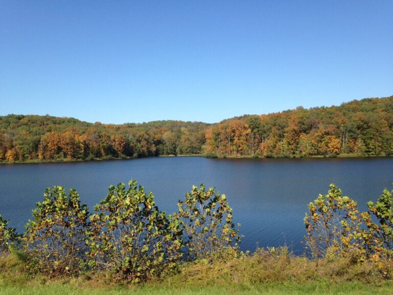
Dutchman Lake below fall-colored hills in the Shawnee National ForestPhoto: Forest Service, Eastern Region (Public Domain Mark 1.0)
The sources describe no extra permit for Shawnee National Forest. The usual license, habitat stamp and county permits cover the hunting.
Hunters can pursue deer, turkey, upland birds and waterfowl, according to the listing. Dates and limits follow state rules.
Statewide seasons govern Shawnee National Forest; the record has no grid of its own. Season calendar.
Size: 286,498 acres; location: Pope County, Jackson County, Union County, Hardin County and Alexander County and 5 more. IDNR region: South.
Details are published by the Forest Service. The record lists no phone or address. Official page.
IDNR's area report does not list Shawnee National Forest, so we show no numbers. County totals: Pope County.
Use Elizabethtown (9 miles) as the base. Next: Shawneetown (10 miles) and Equality (12 miles). Elizabethtown hunting page.
Gun deer seasons call for a blaze orange or pink hat and at least 400 square inches of orange or pink on the upper body. Turkey hunters are not required to wear it. Source.
Pope County is open to firearm deer, and no confirmed chronic wasting disease finding is on the list. Leftover either-sex firearm permits after round 3: 2,324. Pope County page.
No Sunday rule appears in the sources, and we will not guess. IDNR page.
No: 4 sites within 25 miles are listed as closed to hunting, such as Rose Hotel. They stay off the open list.
Deer: half an hour before sunrise to half an hour after sunset. Spring turkey: to 1 pm Regular ducks and geese: sunrise rules to sunset. Site rules can be tighter. Hours for every county.
Carry your license, habitat stamp and any site permit, and check the managers for closures before you set off for Shawnee National Forest.
Sources: source 1 · source 2 · source 3 · source 4 · source 5 · source 6; statewide seasons from the 2026-27 Illinois Hunting and Trapping Digest. Checked November 13, 2026.
Other photos on this page: Forest Service, Eastern Region (Public Domain Mark 1.0).