Home › Colorado › Public land › Billy Creek SWA
Hunting ground · SWA
Billy Creek State Wildlife Area hunting access and seasons
State wildlife area in Ouray County and Montrose County; 5,498 acres.
Photo: Tony Webster (CC BY 2.0)
Getting to Billy Creek State Wildlife Area
Parking, trailheads and gates near Billy Creek State Wildlife Area
- Boat rampBoat ramp · 3.6 mi from the centreDirections
- Parking areaParking · 3.6 mi from the centreDirections
- Parking areaParking · 3.7 mi from the centreDirections
- Parking areaParking · 3.7 mi from the centreDirections
- Mear's Bay TrailheadTrailhead · 3.7 mi from the centreDirections
Parking, trailhead and gate locations come from OpenStreetMap contributors. Roads into public land can be gated or seasonal; check with the managing agency before you go.
Inside the Billy Creek SWA listing
5,498 acres is the figure the CPW SWA page gives for Billy Creek SWA. Rank by area: 32nd of the 224 state wildlife areas we cover. It falls in CPW Area 18, Southwest Region, where the Ridgway and Montrose W district wildlife manager patrols. For Billy Creek SWA, the page gives 970-252-6000 at the Area CPW Office, Montrose office. CPW printed deer, elk, rabbit, dove under hunting for Billy Creek SWA in the 2026 brochure. Fishing line in the brochure: cold-water stream, pond. Recreation entry: wildlife viewing. No camping icon appears on the Billy Creek SWA page.
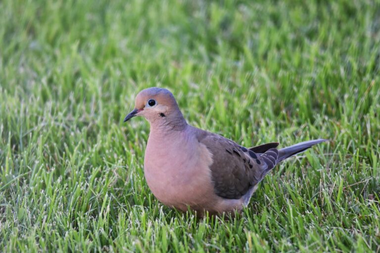
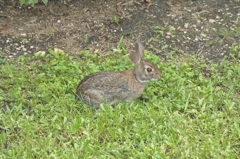
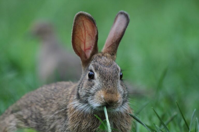
Species the agency lists here: Deer, Elk, Doves, Rabbits.
Activity icons: Hunting, Fishing, Nature Viewing.
From the agency page, 2026 Recreation Lands brochure, p. 6 (Colorado Parks and Wildlife); retrieved 2026-11-04, checked November 5, 2026.
Nearby
Places to hunt and shoot around Billy Creek State Wildlife Area
Access rules on Billy Creek SWA
Like every SWA, Billy Creek SWA asks people 16 and older for a Colorado hunting or fishing license or the wildlife area pass. Off-road driving is out, and so is camping outside authorized sites. The stand rule is portable equipment only, placed no earlier than 30 days before the season. No shooting a firearm or bow in parking, camping or picnic areas.
Property restrictions for Billy Creek SWA:
- Open for public access May 1 to December 31. Open year round for hunting, fishing and trapping along Uncompahgre River corridor, from Highway 550 to 100 feet from E bank of river.
- Camping allowed by licensed hunters during big-game season, plus 3 days before and 3 days after each season.
From the agency source, CPW SWA finder; checked November 5, 2026.
Billy Creek SWA route and map files
Printed directions: Beckett Tract: From Montrose, go 18 miles S on Highway 550 to Ouray CR 4, then turn left. Go 0.5 miles. Billy Creek Tract: From Montrose, go 16 miles S on Highway 550 to Ouray CR 2, then turn left. Road also leads to Nicoll and Porter tracts. Colona Tract: From Montrose, go 7 miles S on Highway 550 to Government Springs Road Continue on Horsefly Road to signed access road. Carmichael Tract: From Montrose, go 21 miles S on Highway 550 to Ouray CR 8, turn left on lower road. Go through ranch yard; then go 1.25 miles on main road to access road.
Mapped centre: 38.2623, -107.6895.
Directions from the 2026 Colorado State Recreation Lands brochure; map files from the CPW property page; point from CPW Managed Properties (public access only) layer, CPWAdminData (8 polygons) (polygon centroid of the largest part); checked November 5, 2026.
Unit map facts for Billy Creek SWA
Check the license against the unit; Billy Creek SWA falls in 2 GMUs: GMU 62, GMU 65.
Bull elk hunters in GMU 62 and GMU 65 must count points before shooting. CWD sampling is required for some rifle elk hunt codes in GMU 62 and GMU 65. The lion season closes when group 13 reaches its limit. The lynx recovery area takes in GMU 65.
| GMU | Covers | Notes |
|---|---|---|
| GMU 62 | Montrose, Mesa, Ouray | elk antler point rule, elk CWD testing, lion group 13 |
| GMU 65 | Ouray, Montrose, Gunnison | elk antler point rule, elk CWD testing, lion group 13 |
There is no property-level harvest figure for Billy Creek SWA; GMU 62 topped the 2024 unit tables with 1,024 elk.
| GMU | Animal | Taken | Hunters | Success rate |
|---|---|---|---|---|
| GMU 62 | Elk | 1,024 | 5,669 | 18% |
| GMU 62 | Deer | 599 | 1,374 | 44% |
| GMU 62 | Black bear | 41 | – | – |
| GMU 65 | Elk | 755 | 3,000 | 25% |
| GMU 65 | Deer | 270 | 717 | 38% |
| GMU 65 | Black bear | 66 | – | – |
GMU overlay from the CPW Big Game GMU layer; unit rules from the 2026 Big Game brochure; 2024 elk harvest by GMU, 2024 deer harvest by GMU, 2024 pronghorn harvest by GMU, 2024 bear harvest by GMU; checked November 5, 2026.
Billy Creek SWA: which hunts are open when
20 big game season rows from the 2026 brochures are valid in the units of Billy Creek SWA. No draw is needed for the elk OTC rows. Not listed: 18 private-only or RFW rows. Rows for big game not on the Billy Creek SWA list (10) are left out.
| Species | Method | Sex | License | Opens | Closes | Units here |
|---|---|---|---|---|---|---|
| Elk | Archery | either sex | Limited, nonresident | Sep 2, 2026 | Sep 30, 2026 | 62, 65 |
| Elk | Archery | either sex | OTC, residents | Sep 2, 2026 | Sep 30, 2026 | 62, 65 |
| Elk | Muzzleloader | bull | Limited draw | Sep 12, 2026 | Sep 20, 2026 | 62, 65 |
| Elk | Muzzleloader | cow | Limited draw | Sep 12, 2026 | Sep 20, 2026 | 62, 65 |
| Elk | Rifle | bull | Limited draw | Oct 14, 2026 | Oct 18, 2026 | 62 |
| Elk | Rifle | cow | Limited draw | Oct 14, 2026 | Oct 18, 2026 | 62, 65 |
| Elk | Rifle | either sex | Limited draw | Oct 14, 2026 | Oct 18, 2026 | 65 |
| Elk | Rifle | cow | Limited draw | Oct 24, 2026 | Nov 1, 2026 | 62, 65 |
| Elk | Second rifle | bull | OTC | Oct 24, 2026 | Nov 1, 2026 | 62, 65 |
| Elk | Rifle | cow | Limited draw | Nov 7, 2026 | Nov 15, 2026 | 62, 65 |
| Elk | Third rifle | bull | OTC | Nov 7, 2026 | Nov 15, 2026 | 62, 65 |
| Elk | Rifle | cow | Limited draw | Nov 18, 2026 | Nov 22, 2026 | 62, 65 |
| Elk | Rifle | either sex | Limited draw | Nov 18, 2026 | Nov 22, 2026 | 62, 65 |
| Deer | Archery | buck | Limited draw | Sep 2, 2026 | Sep 30, 2026 | 62, 65 |
| Deer | Muzzleloader | buck | Limited draw | Sep 12, 2026 | Sep 20, 2026 | 62, 65 |
| Deer | Rifle | buck | Limited, early | Sep 12, 2026 | Sep 20, 2026 | 65 |
| Deer | Rifle | buck | Limited draw | Oct 14, 2026 | Oct 18, 2026 | 62, 65 |
| Deer | Rifle | buck | Limited draw | Oct 24, 2026 | Nov 1, 2026 | 62, 65 |
| Deer | Rifle | buck | Limited draw | Nov 7, 2026 | Nov 15, 2026 | 62, 65 |
| Deer | Rifle | buck | Limited draw | Nov 18, 2026 | Nov 22, 2026 | 62, 65 |
Other listed game
| Bird or animal | Season | Zone | First day | Last day |
|---|---|---|---|---|
| Mourning dove | Season | Statewide | Sep 1, 2026 | Nov 29, 2026 |
| Cottontail | Season | Statewide | Oct 1, 2026 | Feb 28, 2027 |
Season rows and hunt codes from the 2026 Colorado Big Game brochure, the 2026 Small Game and Waterfowl brochure, the Turkey brochure and the Mountain Lion brochure; property access dates still apply; checked November 5, 2026.
Other public ground within reach of Billy Creek SWA
Head 4 miles southwest and you reach Ridgway State Park. Around it on the map: 2 state parks, 2 SWAs and 1 NPS recreation area. Within 25 miles but not open to hunters: Lake Fork of Gunnison River State Wildlife Area (CPW lists no hunting).
| Area | Kind | Acres | County | Miles off | Direction |
|---|---|---|---|---|---|
| Ridgway State Park | State park | 2,100 | Ouray | 4 miles | southwest |
| Cimarron SWA | SWA | 6,455 | Montrose | 10 miles | northeast |
| Cerro Summit SWA | SWA | 162 | Montrose | 13 miles | north |
| Curecanti | NPS recreation area | 41,054 | Gunnison | 24 miles | northeast |
| Crawford State Park | State park | 381 | Delta | 29 miles | north |
| Gunnison National Forest | National forest | 1,666,609 | Gunnison | 31 miles | northeast |
Point: CPW Managed Properties (public access only) layer, CPWAdminData (8 polygons) (polygon centroid of the largest part). Straight-line distances. Closed places from lands.json closed rows. Statewide public land map.
Stores, processors and towns for Billy Creek SWA
From the Billy Creek SWA point, Colona sits 7 miles away. Montrose, 17 miles out, is larger, with 21,646 people in 2024. For licenses in person, the Montrose CPW office is 17 miles off.
| Place | County | Population | Distance | Direction |
|---|---|---|---|---|
| Colona | Ouray | – | 7 miles | northwest |
| Ouray | Ouray | 912 | 16 miles | south |
| Montrose | Montrose | 21,646 | 17 miles | northwest |
| Telluride | San Miguel | 2,486 | 23 miles | south |
| Lake City | Hinsdale | 413 | 26 miles | southeast |
Towns from places.json (Census 2024 estimates); CPW offices from the CPW Contact Us page; businesses from services.json listings; straight-line miles. Checked November 5, 2026.
Billy Creek SWA: when the legal day starts and ends
The CPW brochures print Denver sunrise and sunset tables with town offsets; the times for Billy Creek SWA here are worked out with the NOAA solar formula for its own location.
| Date | Opener | Sunrise | Sunset | Elk window | Duck window |
|---|---|---|---|---|---|
| Sep 2, 2026 | Archery opener | 6:41 a.m. | 7:42 p.m. | 6:11 a.m. to 8:12 p.m. | 6:11 a.m. to 7:42 p.m. |
| Sep 12, 2026 | Muzzleloader opens | 6:49 a.m. | 7:26 p.m. | 6:19 a.m. to 7:56 p.m. | 6:19 a.m. to 7:26 p.m. |
| Oct 3, 2026 | Duck season opens | 7:07 a.m. | 6:53 p.m. | 6:37 a.m. to 7:23 p.m. | 6:37 a.m. to 6:53 p.m. |
| Oct 24, 2026 | Second rifle opens | 7:28 a.m. | 6:23 p.m. | 6:58 a.m. to 6:53 p.m. | 6:58 a.m. to 6:23 p.m. |
| Nov 23, 2026 | Lion season opens | 7:00 a.m. | 4:55 p.m. | 6:30 a.m. to 5:25 p.m. | 6:30 a.m. to 4:55 p.m. |
| Dec 21, 2026 | Shortest day | 7:24 a.m. | 4:54 p.m. | 6:54 a.m. to 5:24 p.m. | 6:54 a.m. to 4:54 p.m. |
Hours rules from the 2026 Colorado Big Game brochure and the Small Game and Waterfowl brochure; sunrise and sunset worked out for this location with the NOAA solar formula (Mountain Time); checked November 5, 2026. Legal hours for every county.
What the region around Billy Creek SWA looks like
Billy Creek State Wildlife Area hunters: public range plus clubs
For a no-dues line, Billy Creek State Wildlife Area hunters head 70 miles to Cameo Shooting and Education Complex. After the public range come the nearest clubs within 30 miles.
From the CPW Shooting Range Finder, ranges’ own pages and directory listings, checked November 5, 2026.
Billy Creek SWA: questions hunters ask
What must I wear on Billy Creek SWA during rifle season?
At least 500 square inches of solid orange or pink above the waist and a hat; archers hunting during rifle seasons wear it too.
Whom should I phone with questions about Billy Creek SWA?
Area CPW Office in Montrose, 970-252-6000.
When must I stop shooting on Billy Creek SWA each evening?
6:13 a.m. to 5:37 p.m. for big game on November 7, 2026 (Ouray County, NOAA solar formula). See the table above for other dates.
Can deer or elk be baited on Billy Creek SWA?
No. Deer and elk may not be hunted over bait; migratory bird hunters also follow the federal 10-day baited-area rule.
Where can I read the source for Billy Creek SWA?
Read the official source before each trip.
Is there an authorized camp area on Billy Creek SWA?
Look for a campground nearby; none is listed here.
What size is Billy Creek SWA on the agency count?
The CPW SWA page lists 5,498 acres.
Which pass must I carry on Billy Creek SWA?
No separate permit in most cases: a hunting or fishing license (or SWA Pass) for everyone 16+, unless the restrictions here say otherwise.
Which GMU numbers does Billy Creek SWA fall in?
The ground lies in GMU 62 and GMU 65, and a big game license must be valid for the unit.
What counties does Billy Creek SWA reach into?
Inside Ouray County and Montrose County.
Which animals does the agency list for Billy Creek SWA?
On record: deer, elk, doves and rabbits. Seasons and licenses still decide what is open.
Is Billy Creek SWA open every day of the season?
Open for public access May 1 to December 31. Open year round for hunting, fishing and trapping along Uncompahgre River corridor, from Highway 550 to 100 feet from E bank of river.
Do elk point rules or CWD testing apply on Billy Creek SWA?
Elk point rules: GMU 62 and GMU 65. CWD heads must be submitted from selected rifle elk hunt codes in GMU 62 and GMU 65, at no charge.
How do I get an elk tag for Billy Creek SWA?
Yes: 3 over-the-counter elk rows are valid in these units, for example archery (OTC, residents).
Where do I buy gas and ice near Billy Creek SWA?
Colona is 7 miles from the record point.
Wrap-up for Billy Creek SWA
Snow and mud close roads in Colorado without much notice; check access to Billy Creek SWA before the drive.
Sources: source 1 · source 2 · source 3 · source 4; seasons from the 2026 Colorado Big Game brochure. Checked November 5, 2026.
Other photos on this page: U.S. Fish and Wildlife Service – Midwest Region (Public domain); btrentler (CC BY 2.0); Jim, the Photographer (CC BY 2.0).