Home › Colorado › Public land › State trust lands
CPW State Trust Lands
Hunting Colorado trust land parcels
409 leased trust land parcels, 959,617 acres on their CPW pages, open to hunting and fishing on set dates with a Colorado license.
Photo: U.S. Department of Agriculture (Public Domain Mark 1.0)
How Colorado trust land access works
The Colorado State Land Board owns trust land to earn money for schools. CPW leases part of it for public hunting and fishing access. Everyone 16 or older on a parcel must carry a valid Colorado hunting or fishing license. Most parcels are open seasonally for hunting and fishing only, typically September 1 through the end of February unless the parcel page says otherwise, and they are closed to the public at other times. The STL finder says the program covers 973,000 acres; CPW parcel pages say more than 900,000 acres; the 409 parcel pages here add up to 959,617 acres. Badger Basin and Pawnee Valley are fishing-only parcels and are listed with the closed places on the public land hub.
| Open dates | Parcels |
|---|---|
| Sep 1–end Feb | 231 |
| Aug 15–end Feb | 86 |
| Sep 1–May 31 | 35 |
| Aug 1–end Feb | 8 |
| First day of archery | 8 |
| Aug 15–May 31 | 6 |
| Sep 1–May 31, 4 a.m. | 4 |
| Year-round for fishi | 3 |
| Sep 1–end Feb, 4 a.m | 3 |
| Sep 1–end Feb Open y | 2 |
From CPW STL pages, the STL finder and the 2026 Recreation Lands brochure Checked November 5, 2026.
Trust land parcels by Colorado county
| County | Parcels | Acres |
|---|---|---|
| Moffat County | 83 | 141,543 |
| Otero County | 20 | 103,897 |
| Bent County | 4 | 73,585 |
| Conejos County | 22 | 57,474 |
| Lincoln County | 4 | 56,000 |
| Pueblo County | 3 | 50,309 |
| Logan County | 7 | 46,120 |
| Saguache County | 20 | 46,110 |
| Fremont County | 30 | 45,458 |
| Park County | 19 | 44,021 |
| Jackson County | 18 | 42,669 |
| Kiowa County | 2 | 38,992 |
| Grand County | 12 | 31,438 |
| Weld County | 21 | 22,038 |
| El Paso County | 2 | 16,577 |
| Routt County | 13 | 15,145 |
| Morgan County | 4 | 15,112 |
| Huerfano County | 18 | 14,914 |
| Larimer County | 14 | 13,214 |
| Washington County | 1 | 11,842 |
| Chaffee County | 8 | 11,329 |
| Baca County | 16 | 10,332 |
| Yuma County | 9 | 7,364 |
| Las Animas County | 10 | 7,340 |
| San Miguel County | 9 | 5,120 |
| Kit Carson County | 4 | 4,971 |
| Rio Grande County | 5 | 3,828 |
| Custer County | 6 | 3,700 |
| Alamosa County | 3 | 3,399 |
| Gunnison County | 4 | 2,335 |
| Adams County | 1 | 2,289 |
| Elbert County | 1 | 2,086 |
| Lake County | 3 | 1,416 |
| Eagle County | 2 | 1,294 |
| Dolores County | 2 | 1,280 |
| San Juan County | 2 | 1,280 |
| Montezuma County | 2 | 1,076 |
| Clear Creek County | 2 | 800 |
| Cheyenne County | 1 | 640 |
| Prowers County | 1 | 640 |
| Teller County | 1 | 640 |
Every Colorado trust land parcel
| Place | Kind | County | Acres | GMUs | Open |
|---|---|---|---|---|---|
| 63 Ranch | State trust land | Park | 1,635 | 49, 50 | Aug 15–end Feb |
| Adelaide | State trust land | Fremont | 640 | 581 | Sep 1–May 1 |
| Agate Mountain | State trust land | Park | 2,893 | 58 | Sep 1–end Feb |
| Agua Ramon | State trust land | Rio Grande | 640 | 79 | Sep 1–end Feb |
| Aguilar Tv Hill | State trust land | Las Animas | 500 | 85 | Sep 1–end Feb |
| Alamaditas Mesa | State trust land | Conejos | 640 | 81 | Aug 15–end Feb |
| Alamosa Canyon | State trust land | Conejos | 240 | 81 | Sep 1–end Feb |
| Alkali Arroyo | State trust land | Otero | 640 | 130 | Sep 1–end Feb |
| Alta | State trust land | Conejos | 640 | 81 | Sep 1–end Feb |
| American Gulch | State trust land | Rio Grande | 640 | 80 | Sep 1–end Feb |
| Antelope Creek | State trust land | Grand | 1,240 | 181 | Sep 1–end Feb |
| Antelope Flats | State trust land | Morgan | 5,000 | 99 | Sep 1–end Feb |
| Antelope Tank | State trust land | Las Animas | 640 | 136 | Sep 1–end Feb |
| Antero | State trust land | Park | 11,060 | 49, 50, 58 | Aug 15–end Feb |
| Apishapa North | State trust land | Las Animas | 1,880 | 133 | Sep 1–end Feb |
| Arrowhead | State trust land | Larimer | 200 | 8 | Sep 1–end Feb |
| Aspen Ridge | State trust land | Chaffee | 542 | 57 | Sep 1–end Feb |
| Atwood | State trust land | Logan | 120 | 96 | Sep 1–May 31, 4 a.m. |
| Aubury Creek | State trust land | Baca | 640 | 144 | Sep 1–end Feb |
| Badger Creek (Upper, Lower Units) | State trust land | Fremont, Park | 3,799 | 57, 58 | Lower Unit: Year-rou |
| Badger Flats | State trust land | Park | 3,570 | 50, 581 | Sep 1–end Feb |
| Badito | State trust land | Huerfano | 640 | 85 | Sep 1–end Feb |
| Bakers Peak | State trust land | Moffat | 12,393 | 3, 4 | Aug 1–end Feb |
| Bakerville | State trust land | Clear Creek | 320 | 39 | Sep 1–end Feb Open y |
| Baking Powder Ridge | State trust land | Moffat | 640 | 10 | Aug 15–end Feb |
| Bald Mountain | State trust land | Moffat | 6,266 | 2, 3 | Aug 16–end Feb |
| Bear Creek | State trust land | Huerfano | 640 | 85 | Sep 1–end Feb |
| Bear Gulch | State trust land | Custer | 640 | 69 | First day of archery |
| Beaver Brook | State trust land | Clear Creek | 480 | 39 | Sep 1–end Feb |
| Beddows Mountain | State trust land | Custer | 500 | 691 | First day of archery |
| Beecher Island | State trust land | Yuma | 320 | 102 | Sep 1–end Feb |
| Ben Morgan Canyon | State trust land | Moffat | 640 | 211 | Sep 1–end Feb |
| Big Hole Butte | State trust land | Moffat | 640 | 3 | Aug 15–end Feb |
| Big Hole Gulch | State trust land | Moffat | 3,048 | 2, 3 | Aug 15–end Feb |
| Big Sandy Creek | State trust land | Cheyenne | 640 | 121, 122 | Aug 15–end Feb |
| Big Springs | State trust land | El Paso | 8,601 | 110 | Sep 1–end Feb |
| Black Hawk | State trust land | Huerfano | 1,511 | 85 | Sep 1–May 31 |
| Black Mountain | State trust land | Huerfano | 640 | 84 | Sep 1–May 31 |
| Black Sage Pass | State trust land | Gunnison | 415 | 551 | Aug 15–end Feb |
| Black Wolf Creek | State trust land | Yuma | 320 | 102 | Sep 1–end Feb |
| Bloom Hills | State trust land | Otero | 676 | 135 | Sep 1–end Feb |
| Blue Lake | State trust land | Bent, Kiowa | 60,323 | 125 | Year-round for fishi |
| Blue Spring | State trust land | Huerfano, Custer | 640 | 84 | Aug 15–May 31 |
| Bonny Creek | State trust land | Yuma | 630 | 103 | Sep 1–end Feb |
| Boston Flats | State trust land | Moffat | 104 | 3, 11 | Year-round for fishi |
| Box Creek | State trust land | Lake | 629 | 48 | Aug 15–end Feb |
| Box Elder North | State trust land | Moffat | 640 | 211 | Sep 1–end Feb |
| Box Elder | State trust land | Moffat | 628 | 211 | Sep 1–end Feb |
| Brammer | State trust land | Morgan | 2,918 | 95 | Sep 1–end Feb |
| Bravo | State trust land | Logan | 107 | 91 | Sep 1–end Feb, 4 a.m |
| Brett Gray Ranch | State trust land | Lincoln | 49,596 | 119 | Sep 1–end Feb |
| Briggsdale | State trust land | Weld | 1,855 | 87 | Sep 1–end Feb |
| Browns Park | State trust land | Moffat | 1,305 | 1, 201 | Open year-round |
| Brush Hollow | State trust land | Fremont | 1,398 | 59 | Sep 1–end Feb |
| Buckwater Draw | State trust land | Moffat | 640 | 10 | Aug 15–end Feb |
| Buffalo Gulch | State trust land | Park | 640 | 58 | Sep 1–end Feb |
| Bull Canyon | State trust land | Moffat | 640 | 10 | Aug 15–end Feb |
| Bull Mountain | State trust land | Larimer | 640 | 8 | Sep 1–end Feb |
| Bull Pasture | State trust land | Otero | 640 | 135 | Sep 1–end Feb |
| Burchfield | State trust land | Baca | 640 | 139 | Sep 1–end Feb |
| Burns Canyon | State trust land | Chaffee | 600 | 57 | Sep 1–end Feb |
| Burro Springs | State trust land | Saguache | 28,905 | 68 | May 1–end Feb |
| Bustos Flat | State trust land | Huerfano | 640 | 133 | Sep 1–end Feb |
| Carrica | State trust land | Otero | 640 | 130 | Sep 1–end Feb |
| Carter Creek | State trust land | Grand | 1,301 | 181 | Sep 1–end Feb |
| Carter Place | State trust land | San Miguel | 320 | 70 | Sep 1–end Feb |
| Castor Gulch | State trust land | Moffat | 640 | 13 | Aug 1–end Feb |
| Cedar Springs | State trust land | Moffat | 640 | 11 | Sep 1–end Feb |
| Cedars | State trust land | Moffat | 640 | 4 | Aug 1–end Feb |
| Chiquito Peak | State trust land | Conejos | 640 | 80 | Sep 1–end Feb |
| Chubb Park | State trust land | Chaffee | 3,640 | 49, 57 | Sep 1–end Feb |
| Cimarron River | State trust land | Baca | 519 | 145 | Sep 1–end Feb |
| Citadel | State trust land | Moffat | 640 | 11 | Sep 1–end Feb |
| Coal Bank Gulch | State trust land | Routt | 879 | 441 | From first day of ar |
| Coal Creek | State trust land | Moffat | 640 | 11 | Aug 15–end Feb |
| Coal Ridge | State trust land | Moffat | 640 | 10 | Aug 15–end Feb |
| Cody Park | State trust land | Fremont | 640 | 691 | Aug 15–May 31 |
| Cohagen | State trust land | Jackson | 2,848 | 171 | Aug 15–end Feb |
| Cold Springs Mountain | State trust land | Moffat | 25,739 | 2, 201 | Aug 1–Dec 31 |
| Copper Gulch | State trust land | Fremont | 638 | 691 | Sep 1–end Feb |
| Copper Mountain | State trust land | Grand | 640 | 28 | Sep 1–end Feb |
| Cottonwood Creek | State trust land | Routt | 640 | 441 | From first day of ar |
| Cottonwood Ridge | State trust land | Fremont | 640 | 58 | Sep 1–May 31 |
| Crooked Arroyo | State trust land | Otero | 640 | 135 | Sep 1–end Feb |
| Crooked Top | State trust land | Park | 400 | 46 | Sep 1–end Feb |
| Cross Mountain | State trust land | Moffat | 640 | 10, 11 | Sep 1–end Feb |
| Crow Valley | State trust land | Weld | 1,520 | 87 | Sep 1–end Feb |
| Crystal Lake | State trust land | Lake | 467 | 48, 49 | Sep 1–end Feb Open y |
| Daley Gulch | State trust land | Saguache, Gunnison | 644 | 551 | Sep 1–end Feb |
| David Canyon | State trust land | Otero | 640 | 135 | Sep 1–end Feb |
| Dead Horse Creek | State trust land | San Miguel | 640 | 70 | Sep 1–end Feb |
| Dearfield | State trust land | Weld | 1,480 | 951 | Sep 1–end Feb |
| Deer Haven | State trust land | Fremont | 640 | 581 | Sep 1–May 31 |
| Delmonica Gulch | State trust land | Lake | 320 | 49 | Sep 1–end Feb |
| Dick's Peak | State trust land | Park | 640 | 58 | Sep 1–end Feb |
| Dirty Gulch | State trust land | Fremont | 640 | 58 | Sep 1–May 31 |
| Disappointment Creek | State trust land | Dolores | 640 | 711 | Sep 1–end Feb |
| Disappointment Valley | State trust land | San Miguel | 320 | 70, 711 | Sep 1–end Feb |
| Dixie Bluffs | State trust land | Otero | 630 | 130, 135 | Sep 1–end Feb |
| Dobbins Spring | State trust land | Moffat | 640 | 10 | Aug 15–end Feb |
| Douglas Mountain | State trust land | Moffat | 640 | 2, 11 | Aug 15–end Feb |
| Dry Creek Basin | State trust land | San Miguel | 640 | 70 | Sep 1–end Feb |
| Dry Creek North | State trust land | Larimer | 640 | 8 | Sep 1–end Feb |
| Dry Creek | State trust land | Rio Grande | 1,280 | 80 | Aug 15–May 31 |
| Duck Creek | State trust land | Logan | 640 | 90 | Sep 1–end Feb, 4 a.m |
| Eagle Canyon | State trust land | Larimer | 640 | 20 | Sep 1–end Feb Access |
| East Alamosa | State trust land | Alamosa | 1,480 | 83 | Sep 1–end Feb |
| East Bend | State trust land | Conejos | 720 | 81 | Sep 1–end Feb |
| East Boone Draw | State trust land | Moffat | 640 | 2 | Aug 15–end Feb |
| East Carrizo Creek | State trust land | Las Animas | 640 | 143 | Sep 1–end Feb |
| East Carter Mountain | State trust land | Grand | 1,794 | 181 | Sep 1–end Feb |
| East Delaney Butte Lake | State trust land | Jackson | 640 | 16 | Aug 15–end Feb |
| East Timpas | State trust land | Otero | 640 | 135 | Sep 1–end Feb |
| Eastman Basin | State trust land | Weld | 2,681 | 87 | Sep 1–end Feb |
| Ecklund | State trust land | Yuma | 640 | 102 | Sep 1–end Feb |
| Edler | State trust land | Baca | 640 | 144 | Sep 1–end Feb |
| Eleven Mile | State trust land | Park | 2,887 | 58, 581 | Sep 1–end Feb |
| Elk Mountain | State trust land | Jackson | 2,839 | 6 | Aug 15–end Feb |
| Elk Springs No. 1 | State trust land | Moffat | 640 | 11 | Sep 1–end Feb |
| Elk Springs No. 3 | State trust land | Moffat | 1,810 | 10 | Aug 15–end Feb |
| Fernleaf Gulch | State trust land | Fremont | 520 | 58 | Sep 1–May 31 |
| Flagler | State trust land | Kit Carson | 640 | 107 | Sep 1–end Feb |
| Florence | State trust land | Fremont | 640 | 69 | Sep 1–May 31 |
| Fly Gulch | State trust land | Routt | 460 | 214 | Sep 1–end Feb |
| Flying A | State trust land | Pueblo | 29,057 | 128 | Sep 1–end Feb |
| Ford Bridge | State trust land | Logan | 280 | 91 | Sep 1–end Feb, 4 a.m |
| Fortification | State trust land | Moffat | 866 | 301 | Day after 4th rifle |
| Foster Gulch | State trust land | Custer | 640 | 84, 86 | Aug 15–end Feb |
| Fourmile | State trust land | Moffat | 640 | 4 | Aug 1–end Feb for bi |
| Froze Creek | State trust land | Custer | 640 | 86 | Aug 15–end Feb |
| Gallegos | State trust land | Conejos | 480 | 81 | Sep 1–end Feb |
| Geary Creek | State trust land | Weld | 160 | 87 | Sep 1–end Feb |
| Gerrard | State trust land | Rio Grande | 799 | 80 | Sep 1–end Feb |
| Godiva Rim | State trust land | Moffat | 640 | 3 | Aug 1–end Feb |
| Grape Creek | State trust land | Fremont | 1,280 | 69, 691 | Aug 15–May 31 |
| Grassy Creek | State trust land | Routt | 360 | 13 | Aug 15–end Feb |
| Greasewood Lake | State trust land | Weld | 640 | 951 | Sep 1–end Feb |
| Greasewood | State trust land | Moffat | 3,518 | 3 | Aug 1–end Feb |
| Great Divide | State trust land | Moffat | 640 | 3 | Aug 1–end Feb |
| Guillermo Ranch | State trust land | Huerfano | 2,118 | 85 | Sep 1–end Feb |
| Haight | State trust land | Otero | 640 | 135 | Sep 1–end Feb |
| Hamilton Mesa | State trust land | San Miguel | 640 | 70 | Sep 1–end Feb |
| Hartsel South | State trust land | Park | 1,788 | 58 | Sep 1–end Feb |
| Hartsel | State trust land | Park | 380 | 58 | Sep 1–end Feb |
| Hay Gulch Overlook | State trust land | Yuma | 640 | 102 | Sep 1–end Feb |
| Hiawatha | State trust land | Moffat | 640 | 2 | Aug 15–end Feb |
| Higbee Canyon | State trust land | Otero | 640 | 130, 135 | Sep 1–end Feb |
| High Creek | State trust land | Park | 1,121 | 49, 50 | Aug 15–end Feb |
| Hightower | State trust land | Moffat | 640 | 11 | Aug 15–end Feb |
| Homestead | State trust land | Moffat | 640 | 11 | Aug 15–end Feb |
| Horse Gulch | State trust land | Moffat | 640 | 301 | Aug 15–end Feb |
| Howard Creek | State trust land | Weld | 640 | 87 | Sep 1–end Feb |
| Hungerford | State trust land | Pueblo | 7,039 | 128 | Sep 1–end Feb |
| Iles Grove | State trust land | Moffat | 2,079 | 12, 211 | Sep 1–end Feb |
| Independence Mountain | State trust land | Jackson | 11,239 | 161 | Aug 15–end Feb |
| Indian Creek | State trust land | Jackson | 640 | 171 | Aug 15–end Feb |
| Iron Springs | State trust land | Otero | 640 | 135 | Sep 1–end Feb |
| Jack Canyon | State trust land | Otero | 7,564 | 135 | Sep 1–end Feb |
| Jack Springs | State trust land | Moffat | 640 | 10 | Aug 15–end Feb |
| Jacks Creek | State trust land | Saguache | 640 | 681 | Sep 1–end Feb |
| Jeffway Gulch | State trust land | Moffat | 640 | 13 | Sep 1–end Feb |
| Jimmy Creek | State trust land | Larimer | 640 | 8 | Sep 1–end Feb |
| Jimmy Dunn Gulch | State trust land | Routt | 5,253 | 441 | last Sat. in Aug–end |
| Johnny Moore Mountain | State trust land | Jackson | 7,671 | 6, 171 | Aug 15–end Feb South |
| Johnson Gulch | State trust land | Custer | 640 | 69 | Sep 1–end Feb |
| Jubb Creek | State trust land | Moffat | 638 | 211 | Sep 1–end Feb |
| Jumping Cow | State trust land | Elbert | 2,086 | 105 | Sep 1–May 31 |
| Juniper Hot Springs | State trust land | Moffat | 493 | 3, 211 | Sep 1–end Feb |
| Karney Ranch | State trust land | Bent | 1,000 | 126 | Aug 15–Dec 31 for de |
| Karval | State trust land | Lincoln | 640 | 120 | Sep 1–end Feb |
| Keller | State trust land | Bent | 2,160 | 146 | Sep 1–end Feb |
| Kemp Draw | State trust land | Jackson | 520 | 171 | Aug 15–end Feb |
| Keota | State trust land | Weld | 640 | 87 | Sep 1–end Feb |
| Kerber Creek | State trust land | Saguache | 320 | 681 | Sep 1–end Feb |
| Kinney Lake | State trust land | Lincoln | 320 | 113 | Sep 1–end Feb |
| Kirkwell | State trust land | Baca | 640 | 144 | Sep 1–end Feb |
| Klondike Basin | State trust land | San Miguel | 640 | 70 | Sep 1–end Feb |
| La Jara | State trust land | Conejos | 42,881 | 81 | Sep 1–end Feb |
| La Junta | State trust land | Otero | 6,715 | 125 | Sep 1–end Feb |
| Lagarde Creek | State trust land | Larimer | 640 | 7 | Sep 1–end Feb |
| Landsman Creek | State trust land | Yuma, Kit Carson | 332 | 103, 109 | Sep 1–May 31 |
| Las Mesitas | State trust land | Conejos | 640 | 81 | Sep 1–end Feb |
| Laughlin Gulch | State trust land | Saguache | 640 | 68 | Sep 1–end Feb |
| Lazy D | State trust land | Weld | 2,721 | 88 | Sep 1–end Feb |
| Little Cochetopa Creek | State trust land | Chaffee | 320 | 561 | Sep 1–May 31 |
| Little La Garita Creek | State trust land | Saguache | 640 | 79 | Sep 1–end Feb |
| Little Muddy | State trust land | Adams | 2,289 | 99 | Sep 1–end Feb |
| Little Sheep Mountain | State trust land | Huerfano | 640 | 85 | Sep 1–May 31 |
| Little Snake | State trust land | Moffat | 640 | 2, 3 | Sep 1–end Feb |
| Lone Rock | State trust land | Baca | 646 | 137 | Sep 1–end Feb |
| Lone Tree Gulch | State trust land | Moffat | 637 | 11 | Aug 15–end Feb |
| Los Creek | State trust land | Saguache | 320 | 67 | Aug 15–end Feb |
| Los Mogotes Peak | State trust land | Conejos | 640 | 81 | Aug 15–end Feb |
| Lost Creek | State trust land | Weld | 640 | 99 | Sep 1–end Feb |
| Macfarlane Reservoir | State trust land | Jackson | 2,880 | 17 | Aug 15–end Feb |
| Maitland | State trust land | Huerfano | 640 | 85 | Sep 1–end Feb |
| Manhattan Creek | State trust land | Larimer | 320 | 191 | Sep 1–end Feb |
| Manzanares Creek | State trust land | Huerfano | 1,420 | 861 | Aug 15–May 31 |
| Maverick Flats | State trust land | Moffat | 640 | 10 | Aug 15–end Feb |
| Maxwell Park | State trust land | Chaffee | 4,901 | 481 | Aug 15–end Feb |
| Maybell | State trust land | Moffat | 9,208 | 3, 11 | Aug 15–end Feb |
| Maynard Gulch | State trust land | Routt | 724 | 441 | First day of archery |
| Mcarthur Gulch | State trust land | Park | 480 | 501 | Sep 1 through end th |
| Mccoy Gulch | State trust land | Fremont | 640 | 86 | Sep 1–May 31 |
| Mckenna Peak | State trust land | San Miguel | 640 | 70 | Sep 1–end Feb |
| Meadow Creek | State trust land | Larimer | 640 | 191 | Sep 1–end Feb |
| Menefee Peak | State trust land | Montezuma | 635 | 73 | Sep 1–May 31 |
| Middle Carter (Gunsight) | State trust land | Grand | 5,400 | 181 | Sep 1–end Feb |
| Middle Creek | State trust land | Saguache | 640 | 681 | Sep 1–end Feb |
| Middle Park | State trust land | Grand | 4,144 | 27 | Sep 1–end Feb |
| Middle Wolf Creek | State trust land | Moffat | 640 | 10 | Aug 15–end Feb |
| Milk Creek | State trust land | Grand | 10,955 | 27 | Sep 1–end Feb |
| Miner's Draw | State trust land | Moffat | 640 | 10 | Aug 15–end Feb |
| Mineral Hot Springs | State trust land | Saguache | 640 | 82 | Aug 15–end Feb |
| Mirage | State trust land | Saguache | 640 | 82 | Sep 1–end Feb |
| Mishak Lakes | State trust land | Saguache | 2,567 | 82, 682 | Aug 15–end Feb |
| Monument Butte | State trust land | Moffat | 653 | 12 | Sep 1–end Feb |
| Moody Creek | State trust land | Routt | 640 | 231 | Sep 1–end Feb |
| Moonhill | State trust land | Routt | 640 | 14 | Sep 1–end Feb |
| Moore Draw | State trust land | Baca | 640 | 145 | Sep 1–end Feb |
| Moosehead Mountain | State trust land | Moffat | 640 | 10 | Aug 15–end Feb |
| Morapos Creek | State trust land | Moffat | 640 | 12 | Sep 1–end Feb |
| Morgan Gulch | State trust land | Moffat | 640 | 211 | Sep 1–end Feb |
| Morrison Creek | State trust land | Routt | 640 | 15 | Sep 1–end Feb |
| Mud Springs | State trust land | Park | 640 | 50 | Sep 1–end Feb |
| Newlin Creek | State trust land | Fremont | 640 | 69 | Sep 1–May 31 |
| North Canyon | State trust land | Baca | 632 | 144 | Aug 15–end Feb |
| North Devils Canyon | State trust land | Otero | 640 | 135 | Sep 1–end Feb |
| North Pawnee Creek | State trust land | Weld | 640 | 88 | Sep 1–end Feb |
| North Rabbit Creek | State trust land | Larimer | 640 | 191 | Aug 15–Jan 31 for bi |
| North Scandinavian Gulch | State trust land | Moffat | 280 | 3 | Aug 15–end Feb |
| Oil Well Flats | State trust land | Fremont | 600 | 581 | Sep 1–May 31 |
| Old Man's Gulch | State trust land | Eagle | 692 | 44 | Sep 1–end Feb |
| Old Woman Creek | State trust land | Saguache | 640 | 79 | Sep 1–end Feb |
| Orchard | State trust land | Weld | 640 | 951 | Sep 1–end Feb |
| Oritz | State trust land | Conejos | 640 | 81 | Sep 1–end Feb |
| Overland Trail | State trust land | Logan | 40 | 96 | Sep 1–May 31, 4 a.m. |
| Owl Creek | State trust land | Jackson | 640 | 171 | Aug 15–end Feb |
| Owl Mountain | State trust land | Jackson | 640 | 171 | Aug 15–end Feb |
| Oxbow | State trust land | Moffat | 640 | 2 | Aug 15–end Feb |
| Packers Gap | State trust land | Otero | 640 | 135 | Sep 1–end Feb |
| Parkdale | State trust land | Fremont | 640 | 58, 691 | Year-round for fishi |
| Pass Creek | State trust land | Larimer | 640 | 7 | Sep 1–end Feb |
| Pat Canyon/Whitby | State trust land | Baca | 1,302 | 144 | Sep 1–end Feb |
| Pawnee Coal Creek | State trust land | Weld | 440 | 87 | Sep 1–end Feb |
| Peck Mesa | State trust land | Moffat | 640 | 11 | Aug 1–end Feb |
| Pfister Draw | State trust land | Larimer | 1,920 | 7, 8 | Sep 1–end Feb |
| Pine Arroyo | State trust land | Huerfano | 640 | 128 | Sep 1–end Feb |
| Pine Tree Gulch | State trust land | Moffat | 640 | 11, 211 | Sep 1–May 31 |
| Pinkham Mountain | State trust land | Jackson | 520 | 6 | Aug 15–end Feb |
| Pinnacle Rock | State trust land | Fremont | 520 | 691 | Sep 1–May 31 |
| Pinon Hills | State trust land | Conejos | 640 | 81 | Sep 1–end Feb |
| Pinon Ridge | State trust land | Moffat | 640 | 11 | Sep 1–end Feb |
| Point Of Rocks | State trust land | Weld | 640 | 951 | Sep 1–end Feb |
| Poison Spyder | State trust land | San Miguel | 640 | 70 | Sep 1–end Feb |
| Poitrey Canyon | State trust land | Las Animas | 640 | 136 | Sep 1–end Feb |
| Poitrey Creek | State trust land | Las Animas | 640 | 136, 143 | Sep 1–end Feb |
| Pole Gulch | State trust land | Moffat | 11,026 | 3 | Aug 1–end Feb |
| Poncha Pass | State trust land | Chaffee | 360 | 561 | Sep 1–end Feb |
| Poudre River | State trust land | Larimer | 4,694 | 191 | Sep 1–May 15 |
| Powder Wash | State trust land | Moffat | 640 | 2, 3 | Aug 15–end Feb |
| Prospect | State trust land | Weld | 140 | 99 | Sep 1–end Feb |
| Ptarmigan | State trust land | Grand | 640 | 28 | Sep 1–end Feb |
| Punche Valley | State trust land | Conejos | 640 | 81 | Sep 1–end Feb |
| Punkin Center | State trust land | Lincoln | 5,444 | 119 | Sep 1–end Feb |
| Quakey Mountain | State trust land | Gunnison | 640 | 551 | Aug 15–end Feb |
| Queens | State trust land | Kiowa, Prowers | 38,352 | 126, 127 | Sep 1–end Feb |
| Rabbit Ears | State trust land | Jackson | 5,229 | 16 | Aug 15–end Feb |
| Railroad Gulch | State trust land | Chaffee | 369 | 57 | Sep 1–end Feb |
| Rajadero Canyon | State trust land | Conejos | 673 | 81 | Sep 1–end Feb |
| Rattlesnake Hill | State trust land | Moffat | 640 | 211 | Sep 1–end Feb |
| Rattlesnake | State trust land | Huerfano | 640 | 128 | Sep 1–end Feb |
| Red Canyon | State trust land | Jackson | 640 | 16 | Aug 15–end Feb |
| Red Lion Ranch | State trust land | Logan | 200 | 92 | Sep 1–May 31, 4 a.m. |
| Red Rock | State trust land | Otero | 640 | 135 | Sep 1–end Feb |
| Red Wash | State trust land | Moffat | 640 | 10 | Aug 15–end Feb |
| Reservoir Draw | State trust land | Moffat | 640 | 2 | Aug 15–end Feb |
| Ridge Road | State trust land | Jackson | 320 | 16 | Aug 15–end Feb |
| Robinson Creek | State trust land | Weld | 640 | 87 | Sep 1–end Feb |
| Robinson Draw | State trust land | Moffat | 640 | 10 | Aug 15–end Feb |
| Rock Creek | State trust land | Saguache | 640 | 82 | Sep 1–end Feb |
| Rock Fall | State trust land | Otero | 640 | 135 | Sep 1–end Feb |
| Romeo | State trust land | Conejos | 640 | 81 | Sep 1–end Feb |
| Rosener | State trust land | Morgan | 634 | 99 | Sep 1–end Feb |
| Rosita | State trust land | Custer | 640 | 84 | First day of archery |
| Round Top | State trust land | Otero | 640 | 135 | Sep 1–end Feb |
| Russell Creek | State trust land | Saguache | 1,920 | 682 | Sep 1–end Feb |
| Rye Slough | State trust land | Park, Fremont | 8,973 | 58 | Sep 1–end Feb |
| Saddle Mountain | State trust land | Park | 640 | 581 | Sep 1–end Feb |
| Sage Creek | State trust land | Routt | 640 | 13 | First day of archery |
| Saguache Creek | State trust land | Saguache | 2,714 | 82, 682 | Aug 15–end Feb |
| Saint Charles | State trust land | Pueblo | 14,213 | 128 | Aug 15–end Feb |
| Sakariason | State trust land | Las Animas | 560 | 85 | Sep 1–May 31 |
| San Antonito | State trust land | Conejos | 640 | 81 | Sep 1–end Feb |
| San Luis Hills | State trust land | Conejos | 640 | 81 | Aug 15–end Feb |
| San Luis Lakes | State trust land | Alamosa | 1,300 | 82 | July 15–end Feb |
| Sand Arroyo | State trust land | Baca | 640 | 139 | Sep 1–end Feb |
| Sand Canyon | State trust land | Baca | 640 | 144 | Sep 1–end Feb |
| Sand Creek Central | State trust land | Chaffee | 597 | 56 | Sep 1–end Feb |
| Sand Creek South | State trust land | Baca | 319 | 144 | Sep 1–May 31 |
| Sand Creek | State trust land | Jackson | 3,280 | 6 | Aug 15–end Feb |
| Sand Gulch No. 1 | State trust land | Fremont | 640 | 58 | Sep 1–May 31 |
| Sand Gulch No. 2 | State trust land | Fremont | 560 | 57 | Sep 1–May 31 |
| Sand Gulch No. 3 | State trust land | Fremont | 640 | 58 | Sep 1–May 31 |
| Sand Gulch No. 4 | State trust land | Fremont | 640 | 58 | Sep 1–May 31 |
| Sandy Bluffs | State trust land | Yuma | 3,682 | 102 | Sep 1–May 31, 4 a.m. |
| Savory East | State trust land | Las Animas | 640 | 137 | Sep 1–end Feb |
| Scandinavian Gulch | State trust land | Moffat | 640 | 3 | Aug 15–end Feb |
| Schultz Canyon | State trust land | Huerfano | 960 | 85 | Sep 1–May 31 |
| Settlement | State trust land | Kit Carson | 960 | 109 | Sep 1–end Feb |
| Sevenmile Ridge | State trust land | Moffat | 640 | 2 | Aug 15–end Feb |
| Shaw Creek | State trust land | Rio Grande | 469 | 80 | Sep 1–end Feb Open t |
| Sheephead Basin | State trust land | Moffat | 640 | 2 | Aug 15–end Feb Aug 1 |
| Sheepherder Springs | State trust land | Moffat | 640 | 2 | Aug 15–end Feb |
| Shelf Road | State trust land | Teller | 640 | 581 | Sep 1–end Feb |
| Short Creek Baldy | State trust land | Fremont | 640 | 86 | Sep 1–May 31 |
| Sikes Ranch | State trust land | Baca | 641 | 144 | Sep 1–end Feb |
| Simmons | State trust land | Yuma | 160 | 102 | Sep 1–May 31 |
| Simsberry Draw | State trust land | Moffat | 640 | 3 | Sep 1–end Feb |
| Sixteen Ditch | State trust land | Jackson | 280 | 161 | Sep 1–end Feb |
| Skull Creek | State trust land | Moffat | 639 | 10 | Aug 15–end Feb |
| Sleeping Giant | State trust land | Routt | 400 | 214 | Sep 1–end Feb |
| Slide Mountain | State trust land | Grand | 1,280 | 18 | Sep 1–end Feb |
| Snyder Prairie | State trust land | Washington | 11,842 | 101 | Sep 1–end Feb |
| South 80 | State trust land | Moffat | 80 | 3 | Aug 15–end Feb |
| South Duffy Mountain | State trust land | Moffat | 640 | 211 | Sep 1–end Feb |
| South Fork Republican | State trust land | Kit Carson, Yuma | 2,411 | 109 | Sep 1–end Feb |
| South Fork Spring Canyon | State trust land | Yuma | 640 | 102 | Sep 1–end Feb |
| South Gardner | State trust land | Huerfano | 640 | 85 | Sep 1–end Feb |
| South Middle Creek | State trust land | Huerfano | 585 | 85 | Sep 1–May 31 |
| South Mountain | State trust land | Dolores | 640 | 711 | Sep 1–end Feb |
| South Nipple Rim | State trust land | Moffat | 19,962 | 2, 3 | Aug 15–end Feb |
| South Pawnee Creek | State trust land | Weld | 1,720 | 88 | Sep 1–end Feb |
| South Pinon Hills | State trust land | Conejos | 2,240 | 81 | Sep 1–end Feb |
| South Roggen | State trust land | Weld | 1,880 | 99 | Sep 1–end Feb |
| Spencer Draw | State trust land | Moffat | 640 | 10 | Aug 15–end Feb |
| Spinney | State trust land | Park | 4,674 | 50, 58, 581 | Sep 1–end Feb |
| Spring Creek Basin | State trust land | San Miguel | 640 | 70 | Sep 1–end Feb |
| Spring Gulch | State trust land | Saguache | 640 | 68 | Sep 1–end Feb |
| Spring Valley | State trust land | Kit Carson | 960 | 109 | Sep 1–end Feb |
| State Line | State trust land | Baca | 496 | 144 | Sep 1–end Feb |
| Steel Canyon | State trust land | Saguache | 640 | 82 | Aug 15–end Feb |
| Steinhoff Hill | State trust land | Larimer | 480 | 191 | Sep 1–end Feb |
| Sterling Prairie | State trust land | Logan | 44,733 | 93, 97, 98 | Sep 1–end Feb |
| Steven's Gulch | State trust land | Larimer | 480 | 191 | Sep 1–end Feb |
| Stokes Gulch | State trust land | Routt | 1,863 | 13 | First day of archery |
| Stone Corral | State trust land | Weld | 1,041 | 87 | Sep 1–end Feb |
| Stonehouse Gulch | State trust land | Saguache | 560 | 681 | Aug 15–end Feb |
| Stoney Face Mountain | State trust land | Fremont | 640 | 58 | Sep 1–May 31 |
| Sugar Loaf | State trust land | Conejos | 640 | 81 | Sep 1–end Feb |
| Sultan Creek | State trust land | San Juan | 640 | 74 | Sep 1–end Feb |
| Sunny Moon | State trust land | Baca | 640 | 144 | Sep 1–end Feb |
| Sweetwater | State trust land | Kiowa | 640 | 126 | For fishing, from la |
| Table Mountain | State trust land | Fremont | 9,427 | 59 | Sep 1–May 31 |
| Tallahassee Road | State trust land | Fremont | 640 | 58 | Sep 1–May 31 |
| Taos Valley | State trust land | Conejos | 640 | 81 | Sep 1–end Feb |
| Taylor Draw | State trust land | Jackson | 320 | 171 | Aug 15–end Feb |
| Tecolote Creek | State trust land | Las Animas | 560 | 143 | Sep 1–end Feb |
| Ted's Canyon | State trust land | Moffat | 640 | 11 | Aug 15–end Feb |
| Temple Canyon | State trust land | Moffat | 637 | 211 | Sep 1–end Feb |
| Texas Creek No. 1 | State trust land | Fremont | 250 | 58 | Sep 1–May 31 |
| Texas Creek No. 2 | State trust land | Fremont | 160 | 58 | Sep 1–end Feb |
| Hogback | State trust land | Huerfano | 640 | 133 | Sep 1–end Feb |
| Poso | State trust land | Conejos | 640 | 81 | Sep 1–end Feb |
| Sloughs | State trust land | Moffat | 650 | 10 | Aug 15–end Feb |
| Thompson Draw | State trust land | Moffat | 642 | 2 | Aug 15–end Feb |
| Thornburg Draw | State trust land | Moffat | 640 | 11 | Sep 1–end Feb |
| Three Mile Mountain | State trust land | Park | 640 | 58 | Sep 1–end Feb |
| Three Sisters | State trust land | Jackson | 1,523 | 6 | Aug 15–end Feb |
| Timberlake | State trust land | Otero, Crowley +2 | 59,445 | 120, 125 | Sep 1–end Feb |
| Tinaja Canyon | State trust land | Huerfano | 640 | 128 | Sep 1–end Feb |
| Tobe Creek | State trust land | Las Animas | 640 | 136, 143 | Sep 1–end Feb |
| Tomichi Dome | State trust land | Gunnison | 640 | 551 | Aug 15–end Feb |
| Treasurevault Mountain | State trust land | Park, Lake | 320 | 49 | Sep 1–end Feb |
| Treetop | State trust land | Bent | 10,102 | 126 | Sep 1–end Feb |
| Triangle | State trust land | Moffat | 1,122 | 3, 11 | Sep 1–end Feb |
| Troublesome Valley Ranch | State trust land | Grand | 876 | 18 | Sep 1–end Feb |
| Trowel | State trust land | Moffat | 640 | 3 | Aug 15–end Feb |
| Trujillo Canyon | State trust land | Conejos | 640 | 81 | Sep 1–end Feb |
| Tunnel Drive | State trust land | Fremont | 360 | 691 | Sep 1–end Feb |
| Turkey Gulch | State trust land | Fremont | 640 | 691 | Sep 1–May 31 |
| Turkey Ridge | State trust land | Huerfano, Pueblo | 640 | 128 | Sep 1–end Feb |
| Turkey Track Ranch | State trust land | El Paso | 7,976 | 118 | Aug 15–end Feb |
| Turner's Creek | State trust land | Moffat | 640 | 10 | Aug 15–end Feb |
| Two Buttes | State trust land | Prowers | 640 | 139 | Sep 1–end Feb |
| Twomile Creek | State trust land | Weld | 640 | 88 | Sep 1–end Feb |
| Utleyville | State trust land | Baca | 657 | 137 | Sep 1–end Feb |
| Vaughn Draw | State trust land | Moffat | 640 | 2 | Aug 15–end Feb |
| Vermillion Creek | State trust land | Moffat | 640 | 2 | Aug 15–end Feb |
| Villa Grove | State trust land | Saguache | 1,120 | 82, 681 | Sep 1–end Feb |
| Vincente Canyon | State trust land | Conejos | 640 | 81 | Aug 15–May 31 |
| Warmer Gulch | State trust land | Park | 640 | 58, 581 | Sep 1–May 31 |
| Waugh Mountain | State trust land | Fremont, Park | 15,066 | 58 | First day of archery |
| Weber Canyon | State trust land | Montezuma | 441 | 73 | Sep 1–last day of sp |
| Weldon Valley | State trust land | Morgan | 6,560 | 95 | Sep 1–end Feb |
| Werner Arroyo | State trust land | Saguache | 640 | 682 | Aug 15–end Feb |
| West Bear Gulch | State trust land | Fremont | 640 | 69 | Sep 1–May 31 |
| West Carter Mountain | State trust land | Grand | 2,360 | 181 | Sep 1–end Feb |
| West Lime Creek | State trust land | San Juan | 640 | 74 | Sep 1–end Feb |
| Whetstone Mountain | State trust land | Gunnison | 640 | 54 | Aug 15–end Feb |
| Whiskey Creek | State trust land | Eagle | 602 | 36, 45 | Sep 1–end Feb |
| Whiterock | State trust land | Otero, Pueblo | 19,907 | 135 | Sep 1–end Feb |
| Wild Horse | State trust land | Weld | 640 | 88 | Sep 1–end Feb |
| Willow Creek | State trust land | Moffat | 640 | 4 | Sep 1–May 31 |
| Windy Ridge | State trust land | Grand | 808 | 27 | Sep 1–end Feb |
| Winter Valley Gulch | State trust land | Moffat | 640 | 10 | Aug 15–end Feb |
| Yampa River | State trust land | Routt | 2,006 | 13 | First day of archery |
| Youghal | State trust land | Moffat | 640 | 10 | Aug 15–end Feb |
| Zapata Falls | State trust land | Alamosa | 619 | 82 | Sep 1–end Feb for bi |
Plains and foothills where trust land lies
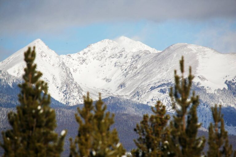

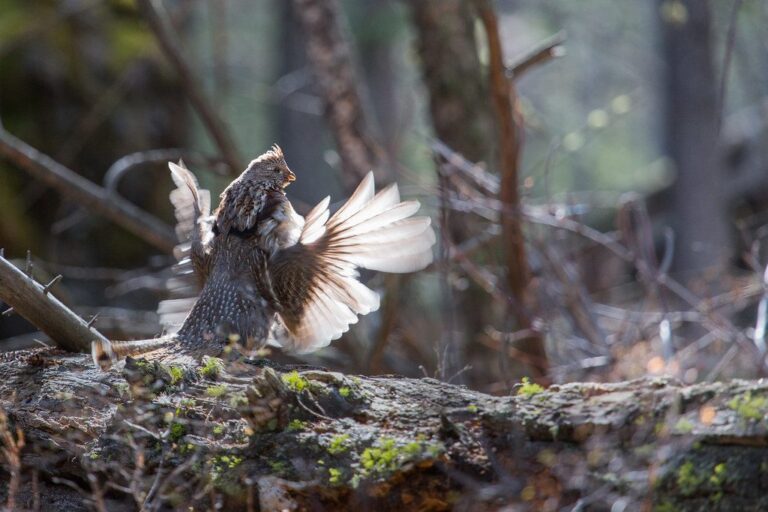
Other photos on this page: Bob Denaro (CC BY 2.0); Max and Dee Bernt (CC BY 2.0); YellowstoneNPS (Public domain).