Colorado public land
Colorado public hunting land
All 739 places on this site where Colorado hunting is allowed, sorted by kind, plus 120 public places that are closed to hunting and why.
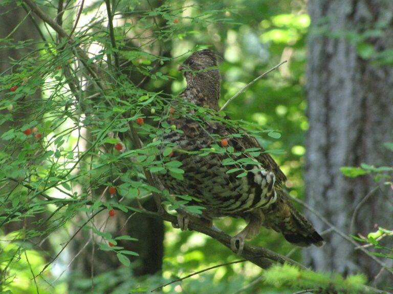
Photo: Bob Denaro (CC BY 2.0)
Colorado public land by kind
Colorado hunters have two big pools of public ground. The federal pool is huge: 13,853,852 acres of national forest across 12 forests, 636,591 acres on the Pawnee and Comanche national grasslands, and about 8.3 million acres of BLM land by the BLM Colorado figure. The state pool is smaller but scattered everywhere: 224 State Wildlife Areas (570,567 acres on their pages) and 409 State Trust Land parcels leased by CPW for hunting and fishing (959,617 acres). On top of that, 33 state parks and recreation areas allow hunting in designated areas, six national wildlife refuges open parts of their ground under 50 CFR 32.25, and the Walk-In Access program opens leased private fields on the eastern plains to foot hunters with a small game license and a Habitat Stamp.
| Kind of land | Places | Acres listed |
|---|---|---|
| State Wildlife Area | 224 | 570,567 |
| State Trust Land | 409 | 959,617 |
| State Park | 31 | 169,204 |
| State Recreation Area | 2 | 10,767 |
| National Forest | 12 | 13,853,852 |
| National Grassland | 2 | 636,591 |
| National Forest Ranger District | 32 | same as forests |
| BLM Field Office | 10 | 7,228,806 |
| BLM Public Lands | 1 | 8,300,000 |
| National Wildlife Refuge | 6 | 157,076 |
| National Recreation Area | 1 | 41,054 |
| National Park Preserve | 1 | 40,818 |
| Military Installation | 3 | 383,465 |
| Walk-In Access Program | 2 | 330,995 |
| Hunting Access Program | 1 | 973,000 |
| Private Land Hunting Access Program | 2 | 1,049,840 |
Acres come from each record: CPW property pages for SWAs and trust land, the USFS EDW statistics for national forest system land, BLM office pages, FWS and NPS GIS layers and the DoD MIRTA boundary for military land. Ranger districts carry the same acres as their forests, so do not add the two rows.
From lands.json (CPW SWA finder, CPW STL finder, USFS, BLM, USFWS, NPS and DoD sources) Checked November 5, 2026.
Hunting places per CPW region
CPW runs wildlife work through four regions. Records are assigned to the region that holds most of their ground, so a big forest that crosses a line counts once.
| CPW region | Places | SWAs | STL parcels | Country |
|---|---|---|---|---|
| Northeast Region | 158 | 67 | 73 | the Front Range from Fort Collins to Denver, the South Platte valley, the northe… |
| Northwest Region | 218 | 56 | 128 | the White River and Flat Tops country, the Yampa valley, Moffat County sagebrush… |
| Southeast Region | 203 | 46 | 139 | the Arkansas River valley, the southeastern plains and grasslands, the Wet Mount… |
| Southwest Region | 156 | 55 | 69 | the San Juan Mountains, the Gunnison basin, the Uncompahgre Plateau, the San Lui… |
Regions from the CPWAdminData region layer Checked November 5, 2026.
Every Colorado public hunting place on this site
Type a name, a county, a GMU number or a species to narrow the list. Every row links to a page with access rules, season dates for its units, directions and nearby towns.
| Place | Kind | County | Acres | GMUs |
|---|---|---|---|---|
| Arapaho National Forest | National forest | Grand, Clear Creek +6 | 720,567 | 17, 18, 27 + |
| Grand Mesa National Forest | National forest | Mesa, Delta +1 | 345,933 | 40, 41, 52 + |
| Gunnison National Forest | National forest | Gunnison, Saguache +3 | 1,666,609 | 53, 54, 55 + |
| Manti-La Sal National Forest | National forest | Montrose, Mesa | 27,051 | 60 |
| Pike National Forest | National forest | Park, Douglas +4 | 1,097,266 | 46, 49, 50 + |
| Rio Grande National Forest | National forest | Saguache, Mineral +6 | 1,839,118 | 66, 68, 76 + |
| Roosevelt National Forest | National forest | Larimer, Boulder +2 | 814,417 | 7, 8, 19 + |
| Routt National Forest | National forest | Routt, Jackson +4 | 1,125,628 | 4, 5, 6 + |
| San Isabel National Forest | National forest | Chaffee, Lake +8 | 1,108,474 | 37, 48, 49 + |
| San Juan National Forest | National forest | Archuleta, La Plata +7 | 1,866,191 | 70, 71, 73 + |
| Uncompahgre National Forest | National forest | Montrose, Mesa +6 | 952,961 | 61, 62, 65 + |
| White River National Forest | National forest | Eagle, Pitkin +7 | 2,289,637 | 12, 23, 24 + |
| Comanche National Grassland | National grassland | Baca, Otero +1 | 443,642 | 130, 135, 136 + |
| Pawnee National Grassland | National grassland | Weld | 192,949 | 87, 88, 89 + |
| land in Colorado | BLM | Moffat, Rio Blanco +49 | 8,300,000 | 1, 2, 3 + |
| Alamosa | Refuge | Alamosa, Conejos | 11,760 | 80, 83 |
| Arapaho | Refuge | Jackson | 26,344 | 6, 16, 17 + |
| Baca | Refuge | Saguache, Alamosa | 84,039 | 82, 791 |
| Browns Park | Refuge | Moffat | 12,574 | 1, 201 |
| Monte Vista | Refuge | Rio Grande, Alamosa | 15,799 | 80 |
| Rocky Flats | Refuge | Jefferson | 6,560 | 38 |
| Curecanti | NPS recreation area | Gunnison, Montrose | 41,054 | 54, 63, 64 + |
| Sand Dunes Preserve | NPS preserve | Saguache, Alamosa | 40,818 | 82 |
| Big Game Walk-In Access | Big Game WIA | Otero, Sedgwick +15 | 157,394 | 87, 88, 89 + |
| Walk-In Access | Walk-In Access | Otero, Sedgwick +17 | 173,601 | 30, 72, 87 + |
| access program | STL program | Adams, Alamosa +40 | 973,000 | 1, 2, 3 + |
| Bighorn Sheep Access Program | Sheep access | Statewide | – | – |
| Ranching for Wildlife | Ranching for Wildlife | Statewide | 1,049,840 | 3, 4, 5 + |
| 63 Ranch | SWA | Park | 1,200 | 50 |
| Adams | SWA | Routt | 650 | 15 |
| Adobe Creek Reservoir (Blue Lake) | SWA | Bent | 5,147 | 125 |
| Almont Triangle | SWA | Gunnison | 643 | 55 |
| Andrick Ponds | SWA | Morgan | 711 | 95 |
| Apishapa | SWA | Las Animas | 7,935 | 133, 134 |
| Atwood | SWA | Logan | 180 | 96 |
| Axial Basin | SWA | Moffat | 4,543 | 211 |
| Banner Lakes | SWA | Weld | 934 | 99 |
| Basalt | SWA | Eagle | 2,577 | 47, 444 |
| Beaver Creek | SWA | Fremont | 2,227 | 59 |
| Bergen Peak | SWA | Clear Creek, Jefferson | 1,093 | 39 |
| Big Thompson Ponds | SWA | Larimer | 51 | 20 |
| Bill Patterson | SWA | Garfield | 4 | 31 |
| Billy Creek | SWA | Ouray, Montrose | 5,498 | 62, 65 |
| Bitter Brush | SWA | Moffat | 8,081 | 11 |
| Blacktail (Conservation Easement) | SWA | Routt | 610 | 15 |
| Bliss | SWA | Larimer | 352 | 8, 19 |
| Bodo | SWA | La Plata | 2,942 | 741 |
| Boedecker Reservoir | SWA | Larimer | 308 | 20 |
| Boreas Pass Ranch Hunting Easement | SWA | Park | 1,270 | 500 |
| Bosque Del Oso | SWA | Las Animas | 30,000 | 851 |
| Bravo | SWA | Logan | 1,082 | 91 |
| Brower | SWA | Weld | 65 | 94 |
| Brown Lakes | SWA | Hinsdale | 520 | 76 |
| Brown's Park | SWA | Moffat | 201 | 2, 201 |
| Brush Prairie Ponds | SWA | Morgan | 1,600 | 99 |
| Brush | SWA | Morgan | 588 | 96 |
| Burchfield | SWA | Baca | 178 | 139 |
| Cabin Creek | SWA | Gunnison | 640 | 55 |
| Centennial | SWA | Gunnison | 1,800 | 54 |
| Centennial Valley | SWA | Weld | 1,195 | 951 |
| Cerro Summit | SWA | Montrose | 162 | 64 |
| Chance Gulch | SWA | Gunnison | 645 | 67 |
| Charlie Meyers | SWA | Park | 1,082 | 58 |
| Cherokee (All units) | SWA | Larimer | 25,497 | 8, 191 |
| Chesmore (Fishing Easement) | SWA | Chaffee | 5 | 49 |
| Chuck Lewis | SWA | Routt | 288 | 131 |
| Cimarron | SWA | Montrose, Gunnison | 6,455 | 65 |
| Clear Creek Reservoir | SWA | Chaffee | 500 | 48, 49, 481 |
| Cline Ranch | SWA | Park | 1,600 | 500 |
| Coal Creek Ranch (Access Easement) | SWA | Rio Blanco | 1,122 | 23 |
| Coalbed Canyon | SWA | Dolores | 2,359 | 72, 711 |
| Cochetopa | SWA | Saguache | 6,712 | 67 |
| Collard Ranch | SWA | Park | 1,892 | 50 |
| Coller | SWA | Mineral, Rio Grande | 579 | 76, 79 |
| Collins Mountain Ranch (Access Easement) | SWA | Rio Blanco | 2,421 | 23 |
| Colorado River Island | SWA | Mesa | 67 | 30, 41 |
| Colorow Mountain | SWA | Rio Blanco | 1,982 | 11 |
| Cottonwood | SWA | Morgan | 884 | 96 |
| Cowdrey Lake | SWA | Jackson | 78 | 161 |
| Crooked Wash Ranch (Access Easement) | SWA | Moffat | 9,796 | 11 |
| Cross Canyon | SWA | Dolores | 119 | 72 |
| Dan Noble | SWA | San Miguel | 2,223 | 70 |
| Deadman | SWA | Prowers | 503 | 127 |
| Delaney Butte Lakes | SWA | Jackson | 2,620 | 16 |
| Devil Creek | SWA | Archuleta | 561 | 77 |
| Deweese Reservoir | SWA | Custer | 780 | 69, 691 |
| Diamond J | SWA | Jackson | 3,129 | 161 |
| Dolores River | SWA | Montezuma | 57 | 73 |
| Dome Lakes | SWA | Saguache | 420 | 67 |
| Dome Rock | SWA | Teller | 6,980 | 581 |
| Dowdy Lake | SWA | Larimer | 120 | 191 |
| Droney Gulch | SWA | Chaffee | 2,949 | 56 |
| Dry Creek Basin | SWA | San Miguel | 12,775 | 70 |
| Duck Creek | SWA | Logan | 1,121 | 90 |
| Dune Ridge | SWA | Logan | 400 | 96 |
| Dutch Gulch | SWA | Gunnison | 320 | 67 |
| Eagle Rock | SWA | Yuma | 1,718 | 102 |
| Echo Canyon Reservoir | SWA | Archuleta | 211 | 78 |
| Elk Springs Ranch (Private Property Access Easement) | SWA | Moffat | 1,400 | 10, 11 |
| Elliott | SWA | Morgan | 2,576 | 95, 96 |
| Escalante | SWA | Delta, Montrose +1 | 7,612 | 62 |
| Fish Creek | SWA | Dolores | 314 | 71 |
| Flagler Reservoir | SWA | Kit Carson | 400 | 107 |
| Flanders Ranch (Hunting & Fishing Easement) | SWA | Routt | 1,659 | 441 |
| Fort Lyon | SWA | Bent | 523 | 125, 146 |
| Four Mile | SWA | Douglas | 362 | 51 |
| Franklin Island | SWA | Mesa | 38 | 30, 41 |
| Frenchman Creek | SWA | Phillips | 69 | 98 |
| Garfield Creek | SWA | Garfield | 13,179 | 42, 43 |
| Georgetown | SWA | Clear Creek | 670 | 39 |
| Granada | SWA | Prowers | 5,630 | 127, 132 |
| Grieve Ranch (Conservation Easement) | SWA | Routt | 2,511 | 5 |
| Gunnison River (Van Tuyl & Redden) | SWA | Gunnison | 81 | 54 |
| Gunnison | SWA | Gunnison | 2,800 | 54 |
| Gypsum Ponds | SWA | Eagle | 90 | 35, 44 |
| Haviland Lake | SWA | La Plata | 208 | 74 |
| Heckendorf | SWA | Chaffee | 720 | 481 |
| Hereford Haven | SWA | Routt | 190 | 441 |
| Higel | SWA | Alamosa | 1,465 | 791 |
| Hohnholz Lakes | SWA | Larimer | 80 | 7 |
| Holbrook Reservoir | SWA | Otero | 670 | 125 |
| Holly | SWA | Prowers | 277 | 127, 132 |
| Holyoke | SWA | Phillips | 80 | 98 |
| Horsethief Canyon | SWA | Mesa | 1,439 | 30, 40 |
| Hot Creek | SWA | Conejos | 9,485 | 81 |
| Hot Sulphur Springs | SWA | Grand | 2,160 | 18, 28 |
| Huerfano | SWA | Huerfano | 544 | 861 |
| Hugo | SWA | Lincoln | 2,240 | 113 |
| Indian Run | SWA | Routt | 2,039 | 12 |
| Jackson Lake | SWA | Morgan | 394 | 95 |
| James M John | SWA | Las Animas | 8,200 | 140 |
| James Mark Jones | SWA | Park | 17,429 | 50 |
| Jean K Tool | SWA | Morgan | 903 | 96 |
| Jensen | SWA | Rio Blanco | 5,955 | 12, 23, 211 |
| Jim Olterman – Lone Cone | SWA | Dolores | 5,030 | 70 |
| Joe Moore Reservoir | SWA | Montezuma | 120 | 73 |
| Jumbo (Julesburg) Reservoir | SWA | Sedgwick, Logan | 1,703 | 90 |
| Jumping Cow (Access Easement) | SWA | Elbert | 14,733 | 105 |
| Junction Butte | SWA | Grand | 1,304 | 37 |
| Karney Ranch | SWA | Bent | 13,580 | 126 |
| Karval Reservoir | SWA | Lincoln | 235 | 120 |
| Kemp – Breeze | SWA | Grand | 1,714 | 18, 28 |
| Kinney Lake | SWA | Lincoln | 320 | 113 |
| Knudson | SWA | Logan | 581 | 96 |
| La Jara Creek | SWA | Conejos | 2,808 | 81 |
| La Jara Reservoir | SWA | Conejos | 635 | 81 |
| Lake Dorothey | SWA | Las Animas | 4,500 | 140 |
| Lake John | SWA | Jackson | 282 | 161 |
| Lake Pueblo | SWA | Pueblo | 11,864 | 84 |
| Leaps Gulch | SWA | Gunnison | 560 | 55 |
| Little Snake | SWA | Moffat | 4,860 | 3 |
| Lon Hagler | SWA | Larimer | 121 | 20 |
| Lone Dome | SWA | Montezuma, Dolores | 1,724 | 711 |
| Louisiana Purchase Ranch (Access Easement) | SWA | Moffat | 1 | 11 |
| Mason Family | SWA | Hinsdale | 1,429 | 66, 67 |
| McCluskey | SWA | Delta | 1,600 | 53 |
| Meeker Pasture | SWA | Rio Blanco | 48 | 23 |
| Melon Valley | SWA | Otero | 278 | 125 |
| Messex | SWA | Washington, Logan | 680 | 96 |
| Michigan Creek | SWA | Park | 125 | 50, 501 |
| Middle Taylor Creek | SWA | Custer | 486 | 86 |
| Mike Higbee | SWA | Prowers | 876 | 132 |
| Miller Ranch | SWA | Gunnison | 1,604 | 54 |
| Mitani-Tokuyasu | SWA | Weld | 68 | 951 |
| Mogensen Ponds | SWA | Mesa | 11 | 421 |
| Mount Evans | SWA | Clear Creek | 3,438 | 39 |
| Nakagawa | SWA | Weld | 159 | 951 |
| Narraguinnep Reservoir | SWA | Montezuma | 764 | 711 |
| North Lake | SWA | Las Animas | 840 | 85, 851 |
| Oak Ridge | SWA | Rio Blanco | 13,663 | 23 |
| Orchard Mesa Wildlife Area | SWA | Mesa | 148 | 30, 41 |
| Overland Trail | SWA | Logan | 192 | 96 |
| Owl Mountain | SWA | Jackson | 920 | 171 |
| Oxbow | SWA | Otero | 410 | 125, 130 |
| Paddock | SWA | Lake | 1,300 | 49 |
| Parachute Ponds | SWA | Garfield | 42 | 32 |
| Parvin Lake | SWA | Larimer | 180 | 191 |
| Pastorius Reservoir | SWA | La Plata | 83 | 75 |
| Perins Peak | SWA | La Plata | 7,720 | 74 |
| Perkins (Access Easement) | SWA | Grand | 83 | 181 |
| Piceance | SWA | Rio Blanco, Garfield | 25,193 | 21, 22, 31 |
| Pikes Peak | SWA | Teller | 637 | 59 |
| Plateau Creek | SWA | Mesa | 1,346 | 421 |
| Playa Blanca | SWA | Alamosa | 714 | 80 |
| Pony Express | SWA | Sedgwick | 1,854 | 92 |
| Pot Creek (Access Easement) | SWA | Moffat | 1,747 | 1 |
| Pothook Ranch (Fishing Easement: Slater Creek) | SWA | Moffat | 2,355 | 4 |
| Poudre River | SWA | Larimer | 395 | 19, 191 |
| Prewitt Reservoir | SWA | Washington, Logan | 2,924 | 96 |
| Puett Reservoir | SWA | Montezuma | 177 | 73 |
| Purgatoire River | SWA | Bent | 960 | 130 |
| Queens | SWA | Kiowa, Prowers | 13,886 | 126, 127 |
| Radium | SWA | Grand, Routt | 10,996 | 15, 361 |
| Ralston Creek | SWA | Jefferson, Gilpin | 2,100 | 38 |
| Ramah | SWA | El Paso | 400 | 110 |
| Red Dog | SWA | Prowers | 569 | 127 |
| Red Lion | SWA | Logan | 1,297 | 90, 92 |
| Richard (Hunting & Fishing Lease) | SWA | Jackson | 2,323 | 161 |
| Rio Blanco Lake | SWA | Rio Blanco | 383 | 11, 22 |
| Rio Grande | SWA | Rio Grande | 935 | 791 |
| Rock Creek | SWA | Routt, Grand | 205 | 15 |
| Rocky Ford | SWA | Otero | 1,142 | 125 |
| Roeber | SWA | Delta | 11 | 53 |
| Russell Lakes | SWA | Saguache | 4,739 | 682 |
| San Luis Hills | SWA | Costilla | 17,000 | 83 |
| San Luis Lakes | SWA | Alamosa | 3,317 | 82 |
| Sand Draw | SWA | Sedgwick | 209 | 93 |
| Sandsage | SWA | Yuma | 287 | 101 |
| Sandy Bluffs | SWA | Yuma | 3,202 | 102 |
| Sapinero | SWA | Gunnison | 7,129 | 54 |
| Sarvis Creek | SWA | Routt | 309 | 15 |
| Sedgwick Bar | SWA | Sedgwick | 885 | 92 |
| Sego Springs | SWA | Conejos | 640 | 81 |
| Setchfield | SWA | Bent | 2,438 | 130 |
| Seymour Lake | SWA | Jackson | 81 | 17 |
| Sharptail Ridge | SWA | Douglas | 699 | 51 |
| Shriver-Wright | SWA | Rio Grande | 120 | 791 |
| Sikes Ranch | SWA | Baca, Las Animas | 7,139 | 143, 144 |
| Simmons | SWA | Yuma | 2,157 | 102 |
| Simpson Ponds | SWA | Larimer | 44 | 20 |
| Smith Reservoir | SWA | Costilla | 278 | 83 |
| South Republican | SWA | Yuma, Kit Carson | 18,365 | 103, 109 |
| Spanish Peaks | SWA | Las Animas | 6,450 | 85 |
| Spinney Mountain | SWA | Park | 1,937 | 58, 581 |
| Stalker Lake | SWA | Yuma | 75 | 98 |
| Summit Reservoir | SWA | Montezuma | 526 | 73 |
| Tamarack Ranch | SWA | Logan | 10,695 | 91, 93 |
| Tarryall Reservoir | SWA | Park | 711 | 50, 501 |
| Teter-Michigan Creek | SWA | Park | 950 | 500 |
| Thurston Reservoir | SWA | Prowers | 400 | 127 |
| Tilman Bishop | SWA | Mesa | 113 | 30, 41 |
| Timpas Creek | SWA | Otero | 141 | 135 |
| Tomahawk | SWA | Park | 1,655 | 50 |
| Tomichi Creek | SWA | Gunnison | 465 | 67 |
| Totten Reservoir | SWA | Montezuma | 250 | 73 |
| Turks Pond | SWA | Baca | 200 | 139 |
| Twin Sisters | SWA | Larimer | 640 | 20 |
| Two Buttes Reservoir | SWA | Baca, Prowers | 8,533 | 139 |
| Upper Red Cliff Ranch | SWA | Custer | 480 | 84 |
| Van Tuyl (Cabin Creek & Lost Canyon Units) | SWA | Gunnison | 510 | 55 |
| Webster | SWA | Weld | 158 | 94 |
| Wellington | SWA | Larimer, Weld | 1,793 | 87 |
| West Lake (Larimer County) | SWA | Larimer | 38 | 191 |
| West Rifle Creek | SWA | Garfield | 941 | 33 |
| Wheeler | SWA | Garfield | 48 | 33 |
| Whitehorse | SWA | Adams | 400 | 104 |
| Williams Creek Reservoir | SWA | Hinsdale | 508 | 77 |
| Williams Hill | SWA | Pitkin | 487 | 47, 431 |
| Willow Creek Reservoir (Fishing & Hunting Lease) | SWA | Grand | 200 | 18 |
| Willow Creek (Fishing & Hunting Lease) | SWA | Yuma | 920 | 102 |
| Yampa River | SWA | Routt | 866 | 13 |
| Yarmony Ranch (Fishing and Hunting Easement) | SWA | Jackson | 3,719 | 17, 171 |
| Barr Lake | State park | Adams | 1,164 | 104 |
| Boyd Lake | State park | Larimer | 2,004 | 20 |
| Crawford | State park | Delta, Montrose | 381 | 53, 63 |
| Eldorado Canyon | State park | Boulder, Jefferson | 1,441 | 29 |
| Eleven Mile | State park | Park | 4,167 | 58, 581 |
| Elkhead Reservoir | State park | Routt, Moffat | 1,208 | 4, 441 |
| Fishers Peak | State park | Las Animas | 19,253 | 140 |
| Golden Gate Canyon | State park | Gilpin, Jefferson | 11,895 | 38 |
| Harvey Gap | State park | Garfield | 106 | 33 |
| Highline Lake | State park | Mesa | 389 | 30 |
| Jackson Lake | State park | Morgan | 580 | 95 |
| James M Robb Colorado River | State park | Mesa | 20 | 30, 31, 40 + |
| Lake Pueblo | State park | Pueblo | 12,885 | 84 |
| Lathrop | State park | Huerfano | 1,780 | 85 |
| Lone Mesa | State park | Dolores | 11,780 | 711 |
| Lory | State park | Larimer | 2,591 | 19 |
| Mueller | State park | Teller | 5,109 | 581 |
| Navajo | State park | Archuleta | 2,087 | 771 |
| North Sterling | State park | Logan | 2,820 | 89 |
| Paonia | State park | Gunnison | 1,250 | 53, 521 |
| Pearl Lake | State park | Routt | 134 | 14 |
| Ridgway | State park | Ouray | 2,100 | 62, 65 |
| Rifle Gap | State park | Garfield | 973 | 33 |
| Spinney Mountain | State park | Park | 3,990 | 58, 581 |
| Stagecoach | State park | Routt | 810 | 15 |
| State Forest | State park | Jackson, Larimer | 71,024 | 6, 7, 19 + |
| Steamboat Lake | State park | Routt | 1,809 | 14, 214 |
| Sweitzer Lake | State park | Delta | 466 | 64 |
| Sylvan Lake | State park | Eagle | 1,532 | 44 |
| Trinidad Lake | State park | Las Animas | 2,512 | 85, 851 |
| Vega | State park | Mesa | 944 | 421 |
| Arkansas Headwaters | Recreation area | Chaffee, Fremont +1 | 5,115 | 48, 49, 56 + |
| Cameo Shooting and Education Complex | Recreation area | Mesa | 5,652 | 31 |
| Fort Carson | Military | El Paso, Pueblo +1 | 136,376 | 59, 591 |
| Pinon Canyon | Military | Las Animas | 229,545 | 135, 142, 147 |
| Air Force Academy | Military | El Paso | 17,544 | 512 |
| Colorado River Valley | BLM field office | Garfield, Eagle +4 | 567,000 | 15, 22, 23 + |
| Grand Junction | BLM field office | Mesa, Garfield +2 | 1,000,000 | 21, 30, 31 + |
| Gunnison | BLM field office | Gunnison, Hinsdale +4 | 600,000 | 54, 55, 64 + |
| Kremmling | BLM field office | Jackson, Grand +3 | 381,806 | 6, 7, 8 + |
| Little Snake | BLM field office | Moffat, Routt +1 | 1,300,000 | 1, 2, 3 + |
| Royal Gorge | BLM field office | Fremont, Park +23 | 600,000 | 9, 20, 29 + |
| San Luis Valley | BLM field office | Saguache, Conejos +3 | 500,000 | 68, 79, 80 + |
| Tres Rios | BLM field office | San Miguel, Montezuma +5 | 600,000 | 70, 71, 72 + |
| Uncompahgre | BLM field office | Montrose, Delta +4 | 680,000 | 52, 53, 60 + |
| White River | BLM field office | Rio Blanco, Moffat +1 | 1,000,000 | 10, 11, 12 + |
| Aspen Ranger District | Ranger district | Pitkin | 261,051 | 43, 47, 431 + |
| Blanco Ranger District | Ranger district | Rio Blanco, Garfield +2 | 358,111 | 12, 23, 24 + |
| Boulder Ranger District | Ranger district | Boulder, Gilpin +1 | 163,820 | 20, 29, 38 |
| Canyon Lakes Ranger District | Ranger district | Larimer, Boulder | 650,597 | 7, 8, 19 + |
| Clear Creek Ranger District | Ranger district | Clear Creek, Gilpin +2 | 180,913 | 38, 39 |
| Columbine Ranger District | Ranger district | La Plata, San Juan +2 | 687,144 | 71, 74, 75 + |
| Conejos Peak Ranger District | Ranger district | Conejos, Rio Grande +2 | 378,403 | 78, 80, 81 + |
| Dillon Ranger District | Ranger district | Summit | 312,792 | 37, 371 |
| Divide Ranger District | Ranger district | Mineral, Rio Grande +3 | 939,062 | 66, 76, 79 + |
| Eagle Ranger District | Ranger district | Eagle, Garfield +1 | 308,724 | 24, 25, 26 + |
| Grand Valley Ranger District | Ranger district | Mesa, Delta +2 | 544,110 | 40, 41, 52 + |
| Gunnison Ranger District | Ranger district | Gunnison, Saguache +1 | 1,284,166 | 54, 55, 65 + |
| Hahns Peak-Bears Ears Ranger District | Ranger district | Routt, Moffat +2 | 477,199 | 4, 5, 14 + |
| Holy Cross Ranger District | Ranger district | Eagle, Pitkin | 344,297 | 36, 45, 361 |
| Leadville Ranger District | Ranger district | Lake, Chaffee | 280,143 | 37, 48, 49 + |
| Mancos/Dolores Ranger District | Ranger district | Dolores, Montezuma +1 | 597,178 | 70, 71, 73 + |
| Moab Ranger District | Ranger district | Montrose, Mesa | 27,051 | 60 |
| Norwood Ranger District | Ranger district | San Miguel, Montrose +1 | 338,551 | 61, 62, 70 |
| Ouray Ranger District | Ranger district | Ouray, Montrose +5 | 339,891 | 61, 62, 65 + |
| Pagosa Ranger District | Ranger district | Archuleta, Mineral +3 | 581,869 | 77, 78, 771 |
| Paonia Ranger District | Ranger district | Gunnison, Delta +1 | 458,785 | 53, 54, 55 + |
| Parks Ranger District | Ranger district | Jackson, Grand | 410,804 | 6, 14, 16 + |
| Pikes Peak Ranger District | Ranger district | Teller, El Paso +1 | 231,123 | 51, 59, 511 |
| Rifle Ranger District | Ranger district | Garfield, Mesa +1 | 301,844 | 23, 24, 33 + |
| Saguache Ranger District | Ranger district | Saguache | 521,653 | 68, 79, 82 + |
| Salida Ranger District | Ranger district | Chaffee, Fremont +3 | 444,686 | 49, 56, 57 + |
| San Carlos Ranger District | Ranger district | Custer, Huerfano +4 | 383,645 | 69, 84, 85 + |
| Sopris Ranger District | Ranger district | Pitkin, Eagle +2 | 402,980 | 43, 44, 47 + |
| South Park Ranger District | Ranger district | Park, Teller | 457,778 | 49, 50, 58 + |
| South Platte Ranger District | Ranger district | Park, Douglas +3 | 408,365 | 46, 51, 461 + |
| Sulphur Ranger District | Ranger district | Grand | 410,005 | 18, 28, 37 |
| Yampa Ranger District | Ranger district | Routt, Rio Blanco +2 | 367,113 | 12, 15, 24 + |
| 63 Ranch | State trust land | Park | 1,635 | 49, 50 |
| Adelaide | State trust land | Fremont | 640 | 581 |
| Agate Mountain | State trust land | Park | 2,893 | 58 |
| Agua Ramon | State trust land | Rio Grande | 640 | 79 |
| Aguilar Tv Hill | State trust land | Las Animas | 500 | 85 |
| Alamaditas Mesa | State trust land | Conejos | 640 | 81 |
| Alamosa Canyon | State trust land | Conejos | 240 | 81 |
| Alkali Arroyo | State trust land | Otero | 640 | 130 |
| Alta | State trust land | Conejos | 640 | 81 |
| American Gulch | State trust land | Rio Grande | 640 | 80 |
| Antelope Creek | State trust land | Grand | 1,240 | 181 |
| Antelope Flats | State trust land | Morgan | 5,000 | 99 |
| Antelope Tank | State trust land | Las Animas | 640 | 136 |
| Antero | State trust land | Park | 11,060 | 49, 50, 58 |
| Apishapa North | State trust land | Las Animas | 1,880 | 133 |
| Arrowhead | State trust land | Larimer | 200 | 8 |
| Aspen Ridge | State trust land | Chaffee | 542 | 57 |
| Atwood | State trust land | Logan | 120 | 96 |
| Aubury Creek | State trust land | Baca | 640 | 144 |
| Badger Creek (Upper, Lower Units) | State trust land | Fremont, Park | 3,799 | 57, 58 |
| Badger Flats | State trust land | Park | 3,570 | 50, 581 |
| Badito | State trust land | Huerfano | 640 | 85 |
| Bakers Peak | State trust land | Moffat | 12,393 | 3, 4 |
| Bakerville | State trust land | Clear Creek | 320 | 39 |
| Baking Powder Ridge | State trust land | Moffat | 640 | 10 |
| Bald Mountain | State trust land | Moffat | 6,266 | 2, 3 |
| Bear Creek | State trust land | Huerfano | 640 | 85 |
| Bear Gulch | State trust land | Custer | 640 | 69 |
| Beaver Brook | State trust land | Clear Creek | 480 | 39 |
| Beddows Mountain | State trust land | Custer | 500 | 691 |
| Beecher Island | State trust land | Yuma | 320 | 102 |
| Ben Morgan Canyon | State trust land | Moffat | 640 | 211 |
| Big Hole Butte | State trust land | Moffat | 640 | 3 |
| Big Hole Gulch | State trust land | Moffat | 3,048 | 2, 3 |
| Big Sandy Creek | State trust land | Cheyenne | 640 | 121, 122 |
| Big Springs | State trust land | El Paso | 8,601 | 110 |
| Black Hawk | State trust land | Huerfano | 1,511 | 85 |
| Black Mountain | State trust land | Huerfano | 640 | 84 |
| Black Sage Pass | State trust land | Gunnison | 415 | 551 |
| Black Wolf Creek | State trust land | Yuma | 320 | 102 |
| Bloom Hills | State trust land | Otero | 676 | 135 |
| Blue Lake | State trust land | Bent, Kiowa | 60,323 | 125 |
| Blue Spring | State trust land | Huerfano, Custer | 640 | 84 |
| Bonny Creek | State trust land | Yuma | 630 | 103 |
| Boston Flats | State trust land | Moffat | 104 | 3, 11 |
| Box Creek | State trust land | Lake | 629 | 48 |
| Box Elder North | State trust land | Moffat | 640 | 211 |
| Box Elder | State trust land | Moffat | 628 | 211 |
| Brammer | State trust land | Morgan | 2,918 | 95 |
| Bravo | State trust land | Logan | 107 | 91 |
| Brett Gray Ranch | State trust land | Lincoln | 49,596 | 119 |
| Briggsdale | State trust land | Weld | 1,855 | 87 |
| Browns Park | State trust land | Moffat | 1,305 | 1, 201 |
| Brush Hollow | State trust land | Fremont | 1,398 | 59 |
| Buckwater Draw | State trust land | Moffat | 640 | 10 |
| Buffalo Gulch | State trust land | Park | 640 | 58 |
| Bull Canyon | State trust land | Moffat | 640 | 10 |
| Bull Mountain | State trust land | Larimer | 640 | 8 |
| Bull Pasture | State trust land | Otero | 640 | 135 |
| Burchfield | State trust land | Baca | 640 | 139 |
| Burns Canyon | State trust land | Chaffee | 600 | 57 |
| Burro Springs | State trust land | Saguache | 28,905 | 68 |
| Bustos Flat | State trust land | Huerfano | 640 | 133 |
| Carrica | State trust land | Otero | 640 | 130 |
| Carter Creek | State trust land | Grand | 1,301 | 181 |
| Carter Place | State trust land | San Miguel | 320 | 70 |
| Castor Gulch | State trust land | Moffat | 640 | 13 |
| Cedar Springs | State trust land | Moffat | 640 | 11 |
| Cedars | State trust land | Moffat | 640 | 4 |
| Chiquito Peak | State trust land | Conejos | 640 | 80 |
| Chubb Park | State trust land | Chaffee | 3,640 | 49, 57 |
| Cimarron River | State trust land | Baca | 519 | 145 |
| Citadel | State trust land | Moffat | 640 | 11 |
| Coal Bank Gulch | State trust land | Routt | 879 | 441 |
| Coal Creek | State trust land | Moffat | 640 | 11 |
| Coal Ridge | State trust land | Moffat | 640 | 10 |
| Cody Park | State trust land | Fremont | 640 | 691 |
| Cohagen | State trust land | Jackson | 2,848 | 171 |
| Cold Springs Mountain | State trust land | Moffat | 25,739 | 2, 201 |
| Copper Gulch | State trust land | Fremont | 638 | 691 |
| Copper Mountain | State trust land | Grand | 640 | 28 |
| Cottonwood Creek | State trust land | Routt | 640 | 441 |
| Cottonwood Ridge | State trust land | Fremont | 640 | 58 |
| Crooked Arroyo | State trust land | Otero | 640 | 135 |
| Crooked Top | State trust land | Park | 400 | 46 |
| Cross Mountain | State trust land | Moffat | 640 | 10, 11 |
| Crow Valley | State trust land | Weld | 1,520 | 87 |
| Crystal Lake | State trust land | Lake | 467 | 48, 49 |
| Daley Gulch | State trust land | Saguache, Gunnison | 644 | 551 |
| David Canyon | State trust land | Otero | 640 | 135 |
| Dead Horse Creek | State trust land | San Miguel | 640 | 70 |
| Dearfield | State trust land | Weld | 1,480 | 951 |
| Deer Haven | State trust land | Fremont | 640 | 581 |
| Delmonica Gulch | State trust land | Lake | 320 | 49 |
| Dick's Peak | State trust land | Park | 640 | 58 |
| Dirty Gulch | State trust land | Fremont | 640 | 58 |
| Disappointment Creek | State trust land | Dolores | 640 | 711 |
| Disappointment Valley | State trust land | San Miguel | 320 | 70, 711 |
| Dixie Bluffs | State trust land | Otero | 630 | 130, 135 |
| Dobbins Spring | State trust land | Moffat | 640 | 10 |
| Douglas Mountain | State trust land | Moffat | 640 | 2, 11 |
| Dry Creek Basin | State trust land | San Miguel | 640 | 70 |
| Dry Creek North | State trust land | Larimer | 640 | 8 |
| Dry Creek | State trust land | Rio Grande | 1,280 | 80 |
| Duck Creek | State trust land | Logan | 640 | 90 |
| Eagle Canyon | State trust land | Larimer | 640 | 20 |
| East Alamosa | State trust land | Alamosa | 1,480 | 83 |
| East Bend | State trust land | Conejos | 720 | 81 |
| East Boone Draw | State trust land | Moffat | 640 | 2 |
| East Carrizo Creek | State trust land | Las Animas | 640 | 143 |
| East Carter Mountain | State trust land | Grand | 1,794 | 181 |
| East Delaney Butte Lake | State trust land | Jackson | 640 | 16 |
| East Timpas | State trust land | Otero | 640 | 135 |
| Eastman Basin | State trust land | Weld | 2,681 | 87 |
| Ecklund | State trust land | Yuma | 640 | 102 |
| Edler | State trust land | Baca | 640 | 144 |
| Eleven Mile | State trust land | Park | 2,887 | 58, 581 |
| Elk Mountain | State trust land | Jackson | 2,839 | 6 |
| Elk Springs No. 1 | State trust land | Moffat | 640 | 11 |
| Elk Springs No. 3 | State trust land | Moffat | 1,810 | 10 |
| Fernleaf Gulch | State trust land | Fremont | 520 | 58 |
| Flagler | State trust land | Kit Carson | 640 | 107 |
| Florence | State trust land | Fremont | 640 | 69 |
| Fly Gulch | State trust land | Routt | 460 | 214 |
| Flying A | State trust land | Pueblo | 29,057 | 128 |
| Ford Bridge | State trust land | Logan | 280 | 91 |
| Fortification | State trust land | Moffat | 866 | 301 |
| Foster Gulch | State trust land | Custer | 640 | 84, 86 |
| Fourmile | State trust land | Moffat | 640 | 4 |
| Froze Creek | State trust land | Custer | 640 | 86 |
| Gallegos | State trust land | Conejos | 480 | 81 |
| Geary Creek | State trust land | Weld | 160 | 87 |
| Gerrard | State trust land | Rio Grande | 799 | 80 |
| Godiva Rim | State trust land | Moffat | 640 | 3 |
| Grape Creek | State trust land | Fremont | 1,280 | 69, 691 |
| Grassy Creek | State trust land | Routt | 360 | 13 |
| Greasewood Lake | State trust land | Weld | 640 | 951 |
| Greasewood | State trust land | Moffat | 3,518 | 3 |
| Great Divide | State trust land | Moffat | 640 | 3 |
| Guillermo Ranch | State trust land | Huerfano | 2,118 | 85 |
| Haight | State trust land | Otero | 640 | 135 |
| Hamilton Mesa | State trust land | San Miguel | 640 | 70 |
| Hartsel South | State trust land | Park | 1,788 | 58 |
| Hartsel | State trust land | Park | 380 | 58 |
| Hay Gulch Overlook | State trust land | Yuma | 640 | 102 |
| Hiawatha | State trust land | Moffat | 640 | 2 |
| Higbee Canyon | State trust land | Otero | 640 | 130, 135 |
| High Creek | State trust land | Park | 1,121 | 49, 50 |
| Hightower | State trust land | Moffat | 640 | 11 |
| Homestead | State trust land | Moffat | 640 | 11 |
| Horse Gulch | State trust land | Moffat | 640 | 301 |
| Howard Creek | State trust land | Weld | 640 | 87 |
| Hungerford | State trust land | Pueblo | 7,039 | 128 |
| Iles Grove | State trust land | Moffat | 2,079 | 12, 211 |
| Independence Mountain | State trust land | Jackson | 11,239 | 161 |
| Indian Creek | State trust land | Jackson | 640 | 171 |
| Iron Springs | State trust land | Otero | 640 | 135 |
| Jack Canyon | State trust land | Otero | 7,564 | 135 |
| Jack Springs | State trust land | Moffat | 640 | 10 |
| Jacks Creek | State trust land | Saguache | 640 | 681 |
| Jeffway Gulch | State trust land | Moffat | 640 | 13 |
| Jimmy Creek | State trust land | Larimer | 640 | 8 |
| Jimmy Dunn Gulch | State trust land | Routt | 5,253 | 441 |
| Johnny Moore Mountain | State trust land | Jackson | 7,671 | 6, 171 |
| Johnson Gulch | State trust land | Custer | 640 | 69 |
| Jubb Creek | State trust land | Moffat | 638 | 211 |
| Jumping Cow | State trust land | Elbert | 2,086 | 105 |
| Juniper Hot Springs | State trust land | Moffat | 493 | 3, 211 |
| Karney Ranch | State trust land | Bent | 1,000 | 126 |
| Karval | State trust land | Lincoln | 640 | 120 |
| Keller | State trust land | Bent | 2,160 | 146 |
| Kemp Draw | State trust land | Jackson | 520 | 171 |
| Keota | State trust land | Weld | 640 | 87 |
| Kerber Creek | State trust land | Saguache | 320 | 681 |
| Kinney Lake | State trust land | Lincoln | 320 | 113 |
| Kirkwell | State trust land | Baca | 640 | 144 |
| Klondike Basin | State trust land | San Miguel | 640 | 70 |
| La Jara | State trust land | Conejos | 42,881 | 81 |
| La Junta | State trust land | Otero | 6,715 | 125 |
| Lagarde Creek | State trust land | Larimer | 640 | 7 |
| Landsman Creek | State trust land | Yuma, Kit Carson | 332 | 103, 109 |
| Las Mesitas | State trust land | Conejos | 640 | 81 |
| Laughlin Gulch | State trust land | Saguache | 640 | 68 |
| Lazy D | State trust land | Weld | 2,721 | 88 |
| Little Cochetopa Creek | State trust land | Chaffee | 320 | 561 |
| Little La Garita Creek | State trust land | Saguache | 640 | 79 |
| Little Muddy | State trust land | Adams | 2,289 | 99 |
| Little Sheep Mountain | State trust land | Huerfano | 640 | 85 |
| Little Snake | State trust land | Moffat | 640 | 2, 3 |
| Lone Rock | State trust land | Baca | 646 | 137 |
| Lone Tree Gulch | State trust land | Moffat | 637 | 11 |
| Los Creek | State trust land | Saguache | 320 | 67 |
| Los Mogotes Peak | State trust land | Conejos | 640 | 81 |
| Lost Creek | State trust land | Weld | 640 | 99 |
| Macfarlane Reservoir | State trust land | Jackson | 2,880 | 17 |
| Maitland | State trust land | Huerfano | 640 | 85 |
| Manhattan Creek | State trust land | Larimer | 320 | 191 |
| Manzanares Creek | State trust land | Huerfano | 1,420 | 861 |
| Maverick Flats | State trust land | Moffat | 640 | 10 |
| Maxwell Park | State trust land | Chaffee | 4,901 | 481 |
| Maybell | State trust land | Moffat | 9,208 | 3, 11 |
| Maynard Gulch | State trust land | Routt | 724 | 441 |
| Mcarthur Gulch | State trust land | Park | 480 | 501 |
| Mccoy Gulch | State trust land | Fremont | 640 | 86 |
| Mckenna Peak | State trust land | San Miguel | 640 | 70 |
| Meadow Creek | State trust land | Larimer | 640 | 191 |
| Menefee Peak | State trust land | Montezuma | 635 | 73 |
| Middle Carter (Gunsight) | State trust land | Grand | 5,400 | 181 |
| Middle Creek | State trust land | Saguache | 640 | 681 |
| Middle Park | State trust land | Grand | 4,144 | 27 |
| Middle Wolf Creek | State trust land | Moffat | 640 | 10 |
| Milk Creek | State trust land | Grand | 10,955 | 27 |
| Miner's Draw | State trust land | Moffat | 640 | 10 |
| Mineral Hot Springs | State trust land | Saguache | 640 | 82 |
| Mirage | State trust land | Saguache | 640 | 82 |
| Mishak Lakes | State trust land | Saguache | 2,567 | 82, 682 |
| Monument Butte | State trust land | Moffat | 653 | 12 |
| Moody Creek | State trust land | Routt | 640 | 231 |
| Moonhill | State trust land | Routt | 640 | 14 |
| Moore Draw | State trust land | Baca | 640 | 145 |
| Moosehead Mountain | State trust land | Moffat | 640 | 10 |
| Morapos Creek | State trust land | Moffat | 640 | 12 |
| Morgan Gulch | State trust land | Moffat | 640 | 211 |
| Morrison Creek | State trust land | Routt | 640 | 15 |
| Mud Springs | State trust land | Park | 640 | 50 |
| Newlin Creek | State trust land | Fremont | 640 | 69 |
| North Canyon | State trust land | Baca | 632 | 144 |
| North Devils Canyon | State trust land | Otero | 640 | 135 |
| North Pawnee Creek | State trust land | Weld | 640 | 88 |
| North Rabbit Creek | State trust land | Larimer | 640 | 191 |
| North Scandinavian Gulch | State trust land | Moffat | 280 | 3 |
| Oil Well Flats | State trust land | Fremont | 600 | 581 |
| Old Man's Gulch | State trust land | Eagle | 692 | 44 |
| Old Woman Creek | State trust land | Saguache | 640 | 79 |
| Orchard | State trust land | Weld | 640 | 951 |
| Oritz | State trust land | Conejos | 640 | 81 |
| Overland Trail | State trust land | Logan | 40 | 96 |
| Owl Creek | State trust land | Jackson | 640 | 171 |
| Owl Mountain | State trust land | Jackson | 640 | 171 |
| Oxbow | State trust land | Moffat | 640 | 2 |
| Packers Gap | State trust land | Otero | 640 | 135 |
| Parkdale | State trust land | Fremont | 640 | 58, 691 |
| Pass Creek | State trust land | Larimer | 640 | 7 |
| Pat Canyon/Whitby | State trust land | Baca | 1,302 | 144 |
| Pawnee Coal Creek | State trust land | Weld | 440 | 87 |
| Peck Mesa | State trust land | Moffat | 640 | 11 |
| Pfister Draw | State trust land | Larimer | 1,920 | 7, 8 |
| Pine Arroyo | State trust land | Huerfano | 640 | 128 |
| Pine Tree Gulch | State trust land | Moffat | 640 | 11, 211 |
| Pinkham Mountain | State trust land | Jackson | 520 | 6 |
| Pinnacle Rock | State trust land | Fremont | 520 | 691 |
| Pinon Hills | State trust land | Conejos | 640 | 81 |
| Pinon Ridge | State trust land | Moffat | 640 | 11 |
| Point Of Rocks | State trust land | Weld | 640 | 951 |
| Poison Spyder | State trust land | San Miguel | 640 | 70 |
| Poitrey Canyon | State trust land | Las Animas | 640 | 136 |
| Poitrey Creek | State trust land | Las Animas | 640 | 136, 143 |
| Pole Gulch | State trust land | Moffat | 11,026 | 3 |
| Poncha Pass | State trust land | Chaffee | 360 | 561 |
| Poudre River | State trust land | Larimer | 4,694 | 191 |
| Powder Wash | State trust land | Moffat | 640 | 2, 3 |
| Prospect | State trust land | Weld | 140 | 99 |
| Ptarmigan | State trust land | Grand | 640 | 28 |
| Punche Valley | State trust land | Conejos | 640 | 81 |
| Punkin Center | State trust land | Lincoln | 5,444 | 119 |
| Quakey Mountain | State trust land | Gunnison | 640 | 551 |
| Queens | State trust land | Kiowa, Prowers | 38,352 | 126, 127 |
| Rabbit Ears | State trust land | Jackson | 5,229 | 16 |
| Railroad Gulch | State trust land | Chaffee | 369 | 57 |
| Rajadero Canyon | State trust land | Conejos | 673 | 81 |
| Rattlesnake Hill | State trust land | Moffat | 640 | 211 |
| Rattlesnake | State trust land | Huerfano | 640 | 128 |
| Red Canyon | State trust land | Jackson | 640 | 16 |
| Red Lion Ranch | State trust land | Logan | 200 | 92 |
| Red Rock | State trust land | Otero | 640 | 135 |
| Red Wash | State trust land | Moffat | 640 | 10 |
| Reservoir Draw | State trust land | Moffat | 640 | 2 |
| Ridge Road | State trust land | Jackson | 320 | 16 |
| Robinson Creek | State trust land | Weld | 640 | 87 |
| Robinson Draw | State trust land | Moffat | 640 | 10 |
| Rock Creek | State trust land | Saguache | 640 | 82 |
| Rock Fall | State trust land | Otero | 640 | 135 |
| Romeo | State trust land | Conejos | 640 | 81 |
| Rosener | State trust land | Morgan | 634 | 99 |
| Rosita | State trust land | Custer | 640 | 84 |
| Round Top | State trust land | Otero | 640 | 135 |
| Russell Creek | State trust land | Saguache | 1,920 | 682 |
| Rye Slough | State trust land | Park, Fremont | 8,973 | 58 |
| Saddle Mountain | State trust land | Park | 640 | 581 |
| Sage Creek | State trust land | Routt | 640 | 13 |
| Saguache Creek | State trust land | Saguache | 2,714 | 82, 682 |
| Saint Charles | State trust land | Pueblo | 14,213 | 128 |
| Sakariason | State trust land | Las Animas | 560 | 85 |
| San Antonito | State trust land | Conejos | 640 | 81 |
| San Luis Hills | State trust land | Conejos | 640 | 81 |
| San Luis Lakes | State trust land | Alamosa | 1,300 | 82 |
| Sand Arroyo | State trust land | Baca | 640 | 139 |
| Sand Canyon | State trust land | Baca | 640 | 144 |
| Sand Creek Central | State trust land | Chaffee | 597 | 56 |
| Sand Creek South | State trust land | Baca | 319 | 144 |
| Sand Creek | State trust land | Jackson | 3,280 | 6 |
| Sand Gulch No. 1 | State trust land | Fremont | 640 | 58 |
| Sand Gulch No. 2 | State trust land | Fremont | 560 | 57 |
| Sand Gulch No. 3 | State trust land | Fremont | 640 | 58 |
| Sand Gulch No. 4 | State trust land | Fremont | 640 | 58 |
| Sandy Bluffs | State trust land | Yuma | 3,682 | 102 |
| Savory East | State trust land | Las Animas | 640 | 137 |
| Scandinavian Gulch | State trust land | Moffat | 640 | 3 |
| Schultz Canyon | State trust land | Huerfano | 960 | 85 |
| Settlement | State trust land | Kit Carson | 960 | 109 |
| Sevenmile Ridge | State trust land | Moffat | 640 | 2 |
| Shaw Creek | State trust land | Rio Grande | 469 | 80 |
| Sheephead Basin | State trust land | Moffat | 640 | 2 |
| Sheepherder Springs | State trust land | Moffat | 640 | 2 |
| Shelf Road | State trust land | Teller | 640 | 581 |
| Short Creek Baldy | State trust land | Fremont | 640 | 86 |
| Sikes Ranch | State trust land | Baca | 641 | 144 |
| Simmons | State trust land | Yuma | 160 | 102 |
| Simsberry Draw | State trust land | Moffat | 640 | 3 |
| Sixteen Ditch | State trust land | Jackson | 280 | 161 |
| Skull Creek | State trust land | Moffat | 639 | 10 |
| Sleeping Giant | State trust land | Routt | 400 | 214 |
| Slide Mountain | State trust land | Grand | 1,280 | 18 |
| Snyder Prairie | State trust land | Washington | 11,842 | 101 |
| South 80 | State trust land | Moffat | 80 | 3 |
| South Duffy Mountain | State trust land | Moffat | 640 | 211 |
| South Fork Republican | State trust land | Kit Carson, Yuma | 2,411 | 109 |
| South Fork Spring Canyon | State trust land | Yuma | 640 | 102 |
| South Gardner | State trust land | Huerfano | 640 | 85 |
| South Middle Creek | State trust land | Huerfano | 585 | 85 |
| South Mountain | State trust land | Dolores | 640 | 711 |
| South Nipple Rim | State trust land | Moffat | 19,962 | 2, 3 |
| South Pawnee Creek | State trust land | Weld | 1,720 | 88 |
| South Pinon Hills | State trust land | Conejos | 2,240 | 81 |
| South Roggen | State trust land | Weld | 1,880 | 99 |
| Spencer Draw | State trust land | Moffat | 640 | 10 |
| Spinney | State trust land | Park | 4,674 | 50, 58, 581 |
| Spring Creek Basin | State trust land | San Miguel | 640 | 70 |
| Spring Gulch | State trust land | Saguache | 640 | 68 |
| Spring Valley | State trust land | Kit Carson | 960 | 109 |
| State Line | State trust land | Baca | 496 | 144 |
| Steel Canyon | State trust land | Saguache | 640 | 82 |
| Steinhoff Hill | State trust land | Larimer | 480 | 191 |
| Sterling Prairie | State trust land | Logan | 44,733 | 93, 97, 98 |
| Steven's Gulch | State trust land | Larimer | 480 | 191 |
| Stokes Gulch | State trust land | Routt | 1,863 | 13 |
| Stone Corral | State trust land | Weld | 1,041 | 87 |
| Stonehouse Gulch | State trust land | Saguache | 560 | 681 |
| Stoney Face Mountain | State trust land | Fremont | 640 | 58 |
| Sugar Loaf | State trust land | Conejos | 640 | 81 |
| Sultan Creek | State trust land | San Juan | 640 | 74 |
| Sunny Moon | State trust land | Baca | 640 | 144 |
| Sweetwater | State trust land | Kiowa | 640 | 126 |
| Table Mountain | State trust land | Fremont | 9,427 | 59 |
| Tallahassee Road | State trust land | Fremont | 640 | 58 |
| Taos Valley | State trust land | Conejos | 640 | 81 |
| Taylor Draw | State trust land | Jackson | 320 | 171 |
| Tecolote Creek | State trust land | Las Animas | 560 | 143 |
| Ted's Canyon | State trust land | Moffat | 640 | 11 |
| Temple Canyon | State trust land | Moffat | 637 | 211 |
| Texas Creek No. 1 | State trust land | Fremont | 250 | 58 |
| Texas Creek No. 2 | State trust land | Fremont | 160 | 58 |
| Hogback | State trust land | Huerfano | 640 | 133 |
| Poso | State trust land | Conejos | 640 | 81 |
| Sloughs | State trust land | Moffat | 650 | 10 |
| Thompson Draw | State trust land | Moffat | 642 | 2 |
| Thornburg Draw | State trust land | Moffat | 640 | 11 |
| Three Mile Mountain | State trust land | Park | 640 | 58 |
| Three Sisters | State trust land | Jackson | 1,523 | 6 |
| Timberlake | State trust land | Otero, Crowley +2 | 59,445 | 120, 125 |
| Tinaja Canyon | State trust land | Huerfano | 640 | 128 |
| Tobe Creek | State trust land | Las Animas | 640 | 136, 143 |
| Tomichi Dome | State trust land | Gunnison | 640 | 551 |
| Treasurevault Mountain | State trust land | Park, Lake | 320 | 49 |
| Treetop | State trust land | Bent | 10,102 | 126 |
| Triangle | State trust land | Moffat | 1,122 | 3, 11 |
| Troublesome Valley Ranch | State trust land | Grand | 876 | 18 |
| Trowel | State trust land | Moffat | 640 | 3 |
| Trujillo Canyon | State trust land | Conejos | 640 | 81 |
| Tunnel Drive | State trust land | Fremont | 360 | 691 |
| Turkey Gulch | State trust land | Fremont | 640 | 691 |
| Turkey Ridge | State trust land | Huerfano, Pueblo | 640 | 128 |
| Turkey Track Ranch | State trust land | El Paso | 7,976 | 118 |
| Turner's Creek | State trust land | Moffat | 640 | 10 |
| Two Buttes | State trust land | Prowers | 640 | 139 |
| Twomile Creek | State trust land | Weld | 640 | 88 |
| Utleyville | State trust land | Baca | 657 | 137 |
| Vaughn Draw | State trust land | Moffat | 640 | 2 |
| Vermillion Creek | State trust land | Moffat | 640 | 2 |
| Villa Grove | State trust land | Saguache | 1,120 | 82, 681 |
| Vincente Canyon | State trust land | Conejos | 640 | 81 |
| Warmer Gulch | State trust land | Park | 640 | 58, 581 |
| Waugh Mountain | State trust land | Fremont, Park | 15,066 | 58 |
| Weber Canyon | State trust land | Montezuma | 441 | 73 |
| Weldon Valley | State trust land | Morgan | 6,560 | 95 |
| Werner Arroyo | State trust land | Saguache | 640 | 682 |
| West Bear Gulch | State trust land | Fremont | 640 | 69 |
| West Carter Mountain | State trust land | Grand | 2,360 | 181 |
| West Lime Creek | State trust land | San Juan | 640 | 74 |
| Whetstone Mountain | State trust land | Gunnison | 640 | 54 |
| Whiskey Creek | State trust land | Eagle | 602 | 36, 45 |
| Whiterock | State trust land | Otero, Pueblo | 19,907 | 135 |
| Wild Horse | State trust land | Weld | 640 | 88 |
| Willow Creek | State trust land | Moffat | 640 | 4 |
| Windy Ridge | State trust land | Grand | 808 | 27 |
| Winter Valley Gulch | State trust land | Moffat | 640 | 10 |
| Yampa River | State trust land | Routt | 2,006 | 13 |
| Youghal | State trust land | Moffat | 640 | 10 |
| Zapata Falls | State trust land | Alamosa | 619 | 82 |
Colorado public places closed to hunting
These 120 public places look like hunting ground on a map but are not open to hunting. Most are State Wildlife Areas that CPW runs for fishing access or wildlife viewing, where the property page says no hunting opportunities are available. National park units are closed under 36 CFR 2.2 unless a park rule allows hunting; the Great Sand Dunes Preserve and Curecanti NRA are the NPS exceptions and have their own pages. Ten state parks have no hunting designation or prohibit it outright.
| Place | Kind | County | Why not hunting land | Source |
|---|---|---|---|---|
| Amache NHS | National Historic Site | Prowers | National Park Service unit closed to hunting | source |
| Bent's Old Fort NHS | National Historic Site | Otero | National Park Service unit closed to hunting | source |
| Sand Creek Massacre NHS | National Historic Site | Kiowa | National Park Service unit closed to hunting | source |
| Colorado NM | National Monument | Mesa | National Park Service unit closed to hunting | source |
| Dinosaur NM | National Monument | Moffat | National Park Service unit closed to hunting | source |
| Florissant Fossil Beds NM | National Monument | Teller | National Park Service unit closed to hunting | source |
| Hovenweep NM | National Monument | Montezuma | National Park Service unit closed to hunting | source |
| Yucca House NM | National Monument | Montezuma | National Park Service unit closed to hunting | source |
| Black Canyon NP | National Park | Montrose | National Park Service unit closed to hunting | source |
| Great Sand Dunes NP | National Park | Saguache, Alamosa | National Park Service unit closed to hunting | source |
| Mesa Verde NP | National Park | Montezuma | National Park Service unit closed to hunting | source |
| Rocky Mountain NP | National Park | Larimer, Grand, Boulder | National Park Service unit closed to hunting | source |
| Rocky Mountain Arsenal NWR | National Wildlife Refuge | – | fishing only | source |
| Two Ponds NWR | National Wildlife Refuge | – | not open to hunting | source |
| Castlewood Canyon State Park | State Park | Douglas | no hunting designation in the 2026 park rules | source |
| Chatfield State Park | State Park | Douglas, Jefferson | no hunting designation in the 2026 park rules | source |
| Cherry Creek State Park | State Park | Arapahoe | no hunting designation in the 2026 park rules | source |
| Cheyenne Mountain State Park | State Park | El Paso | park rules prohibit hunting | source |
| Mancos State Park | State Park | Montezuma | no hunting designation in the 2026 park rules | source |
| Rifle Falls State Park | State Park | Garfield | no hunting designation in the 2026 park rules | source |
| Roxborough State Park | State Park | Douglas | no hunting designation in the 2026 park rules | source |
| St. Vrain State Park | State Park | Weld | no hunting designation in the 2026 park rules | source |
| Staunton State Park | State Park | Jefferson, Park | no hunting designation in the 2026 park rules | source |
| Yampa River State Park | State Park | Moffat, Routt | no hunting designation in the 2026 park rules | source |
| Badger Basin State Trust Land | State Trust Land | Park | CPW page lists no hunting opportunities | source |
| Pawnee Valley State Trust Land | State Trust Land | Logan | CPW page lists no hunting opportunities | source |
| Alberta Park Reservoir | State Wildlife Area | Mineral | CPW page lists no hunting opportunities | source |
| Alma | State Wildlife Area | Park | CPW page lists no hunting opportunities | source |
| Andrews Lake | State Wildlife Area | San Juan | CPW page lists no hunting opportunities | source |
| Arkansas River/Big Bend | State Wildlife Area | Chaffee | fishing only | source |
| Badger Basin | State Wildlife Area | Park | CPW page lists no hunting opportunities | source |
| Bayfield Lions Club Shooting Range | State Wildlife Area | La Plata | CPW page lists no hunting opportunities | source |
| Beaver Creek Reservoir | State Wildlife Area | Rio Grande | CPW page lists no hunting opportunities | source |
| Beaver Lake | State Wildlife Area | Gunnison | CPW page lists no hunting opportunities | source |
| Bellaire Lake | State Wildlife Area | Larimer | CPW page lists no hunting opportunities | source |
| Big Meadows Reservoir | State Wildlife Area | Mineral | CPW page lists no hunting opportunities | source |
| Bighorn Springs (Fishing Easement) | State Wildlife Area | Chaffee | CPW page lists no hunting opportunities | source |
| Blue River | State Wildlife Area | Summit | CPW page lists no hunting opportunities | source |
| Bob Terrell | State Wildlife Area | Garfield | CPW page lists no hunting opportunities | source |
| Brownlee II (Fishing Lease) | State Wildlife Area | Jackson | CPW page lists no hunting opportunities | source |
| Brownlee (Fishing Lease) | State Wildlife Area | Jackson | CPW page lists no hunting opportunities | source |
| Brush Creek | State Wildlife Area | Eagle | not open to hunting | source |
| Brush Hollow | State Wildlife Area | Fremont | CPW page lists no hunting opportunities | source |
| Buena Vista (Fishing Easement) | State Wildlife Area | Chaffee | CPW page lists no hunting opportunities | source |
| Burry | State Wildlife Area | Garfield | CPW page lists no hunting opportunities | source |
| Chaffee County Shooting Range | State Wildlife Area | Chaffee | CPW page lists no hunting opportunities | source |
| Champion (Fishing Easement) | State Wildlife Area | Chaffee | CPW page lists no hunting opportunities | source |
| Christina (Fishing Easement: Elk River) | State Wildlife Area | Routt | CPW page lists no hunting opportunities | source |
| Chubb Park Ranch | State Wildlife Area | Chaffee | CPW page lists no hunting opportunities | source |
| Coke Oven | State Wildlife Area | Pitkin | not open to hunting | source |
| Cottonwood Creek | State Wildlife Area | Routt | CPW page lists no hunting opportunities | source |
| Creede | State Wildlife Area | Mineral | CPW page lists no hunting opportunities | source |
| Dawn Pond | State Wildlife Area | Bent | CPW page lists no hunting opportunities | source |
| Douglas Reservoir | State Wildlife Area | Larimer | CPW page lists no hunting opportunities | source |
| Eagle River (Fishing leases) | State Wildlife Area | Eagle | CPW page lists no hunting opportunities | source |
| Emerald Mountain | State Wildlife Area | Routt | CPW page lists no hunting opportunities | source |
| Frank | State Wildlife Area | Larimer, Weld | CPW page lists no hunting opportunities | source |
| Frantz Lake | State Wildlife Area | Chaffee | CPW page lists no hunting opportunities | source |
| Frying Pan River (Fishing Lease) | State Wildlife Area | Eagle | CPW page lists no hunting opportunities | source |
| Granby Ranch (Conservation Easement) | State Wildlife Area | Grand | CPW page lists no hunting opportunities | source |
| Grand Junction: West Lake | State Wildlife Area | Mesa | CPW page lists no hunting opportunities | source |
| Granite | State Wildlife Area | Chaffee | CPW page lists no hunting opportunities | source |
| Groundhog Reservoir | State Wildlife Area | Dolores | CPW page lists no hunting opportunities | source |
| Hardeman (Fishing Easement) | State Wildlife Area | Lake | CPW page lists no hunting opportunities | source |
| Harmon (Fishing Easement) | State Wildlife Area | Chaffee | CPW page lists no hunting opportunities | source |
| Hayden Shooting Range | State Wildlife Area | Routt | CPW page lists no hunting opportunities | source |
| Headwaters Ranch (Fishing Easement) | State Wildlife Area | Lake | CPW page lists no hunting opportunities | source |
| Home Lake | State Wildlife Area | Rio Grande | CPW page lists no hunting opportunities | source |
| Horse Creek Reservoir (Timber Lake) | State Wildlife Area | Otero | CPW page lists no hunting opportunities | source |
| Jackson (Fishing Lease) | State Wildlife Area | Garfield | CPW page lists no hunting opportunities | source |
| Jerry Creek Reservoirs | State Wildlife Area | Mesa | CPW page lists no hunting opportunities | source |
| Johnson Village (Fishing Easement) | State Wildlife Area | Chaffee | CPW page lists no hunting opportunities | source |
| Knight-Imler (Fishing Easement) | State Wildlife Area | Park | CPW page lists no hunting opportunities | source |
| Lake Beckwith | State Wildlife Area | Pueblo | CPW page lists no hunting opportunities | source |
| Lake Fork of Gunnison River | State Wildlife Area | Hinsdale | CPW page lists no hunting opportunities | source |
| Leatha Jean Stassen | State Wildlife Area | Mesa | CPW page lists no hunting opportunities | source |
| Loma Boat Launch | State Wildlife Area | Mesa | CPW page lists no hunting opportunities | source |
| Love Meadow | State Wildlife Area | Chaffee | CPW page lists no hunting opportunities | source |
| Manville (Fishing Lease) | State Wildlife Area | Jackson | CPW page lists no hunting opportunities | source |
| Mount Ouray | State Wildlife Area | Chaffee | CPW page lists no hunting opportunities | source |
| Mount Shavano | State Wildlife Area | Chaffee | CPW page lists no hunting opportunities | source |
| Mount Werner (Fishing Easement) | State Wildlife Area | Routt | CPW page lists no hunting opportunities | source |
| Mountain Home Reservoir | State Wildlife Area | Costilla | CPW page lists no hunting opportunities | source |
| Murphy (Fishing Lease) | State Wildlife Area | Jackson | CPW page lists no hunting opportunities | source |
| North Fork | State Wildlife Area | Larimer | CPW page lists no hunting opportunities | source |
| Ogden-Treat | State Wildlife Area | Fremont | CPW page lists no hunting opportunities | source |
| Orient Mine | State Wildlife Area | Saguache | CPW page lists no hunting opportunities | source |
| Pridemore (Fishing Lease) | State Wildlife Area | Chaffee | CPW page lists no hunting opportunities | source |
| Red Mountain | State Wildlife Area | Grand | CPW page lists no hunting opportunities | source |
| Reddy | State Wildlife Area | Lake | CPW page lists no hunting opportunities | source |
| Rio Grande River (Fishing Easement: Del Norte ) | State Wildlife Area | Rio Grande | CPW page lists no hunting opportunities | source |
| Rito Hondo Reservoir | State Wildlife Area | Hinsdale | CPW page lists no hunting opportunities | source |
| Road Canyon Reservoir | State Wildlife Area | Hinsdale | CPW page lists no hunting opportunities | source |
| Roaring Fork/Gianinetti (Fishing Lease) | State Wildlife Area | Garfield | CPW page lists no hunting opportunities | source |
| Rosemont Reservoir | State Wildlife Area | Teller | CPW page lists no hunting opportunities | source |
| Runyon/Fountain Lakes | State Wildlife Area | Pueblo | CPW page lists no hunting opportunities | source |
| Sam Caudill | State Wildlife Area | Garfield | CPW page lists no hunting opportunities | source |
| San Miguel (Fishing Easement: Applebaugh) | State Wildlife Area | San Miguel | CPW page lists no hunting opportunities | source |
| Sanchez Reservoir | State Wildlife Area | Costilla | CPW page lists no hunting opportunities | source |
| Sands Lake | State Wildlife Area | Chaffee | CPW page lists no hunting opportunities | source |
| Sawhill Ponds | State Wildlife Area | Boulder | CPW page lists no hunting opportunities | source |
| Skaguay Reservoir | State Wildlife Area | Teller | CPW page lists no hunting opportunities | source |
| Skck (Fishing Easement) | State Wildlife Area | Routt | CPW page lists no hunting opportunities | source |
| Steamboat Springs (Fishing Easement) | State Wildlife Area | Routt | CPW page lists no hunting opportunities | source |
| Storm Mountain Access Road | State Wildlife Area | Larimer | CPW page lists no hunting opportunities | source |
| Taylor River | State Wildlife Area | Gunnison | CPW page lists no hunting opportunities | source |
| Terrace Reservoir | State Wildlife Area | Conejos | CPW page lists no hunting opportunities | source |
| Trujillo Meadows | State Wildlife Area | Conejos | CPW page lists no hunting opportunities | source |
| Twenty Mile Pond (Fishing Easement) | State Wildlife Area | Routt | CPW page lists no hunting opportunities | source |
| Twin Spruce Ponds | State Wildlife Area | Montezuma | CPW page lists no hunting opportunities | source |
| Vail Deer Underpass | State Wildlife Area | Eagle | CPW page lists no hunting opportunities | source |
| Verner (Fishing Lease) | State Wildlife Area | Jackson | CPW page lists no hunting opportunities | source |
| Wahatoya | State Wildlife Area | Huerfano | CPW page lists no hunting opportunities | source |
| Walker | State Wildlife Area | Mesa | CPW page lists no hunting opportunities | source |
| Watson Lake | State Wildlife Area | Larimer | CPW page lists no hunting opportunities | source |
| Waunita | State Wildlife Area | Gunnison | CPW page lists no hunting opportunities | source |
| Wind in the Willows (Fishing Easement) | State Wildlife Area | Hinsdale | CPW page lists no hunting opportunities | source |
| Windy Gap | State Wildlife Area | Grand | CPW page lists no hunting opportunities | source |
| Woods Lake | State Wildlife Area | San Miguel | CPW page lists no hunting opportunities | source |
| Wright's Lake | State Wildlife Area | Chaffee | CPW page lists no hunting opportunities | source |
Places with conflicting sources
Flagged records: five SWAs (Coalbed Canyon, Dutch Gulch, Fort Lyon, Four Mile and Higel) are listed because the CPW page shows hunting while the brochure entry has none, and Thurston Reservoir and Adobe Creek Reservoir (Blue Lake) SWAs are listed because the brochure shows hunting while the CPW page says no. Their pages say so; check with CPW before hunting them. Left out on purpose: the John Martin Reservoir State Park (the park rules never allow hunting; the John Martin Reservoir SWA has its own page), the San Luis Valley and Sangre de Cristo conservation easements, nine Department of Defense sites with no public hunting, and five Corps of Engineers projects whose recreation land is a state park or city park.
Colorado hunting country in pictures


Colorado public land questions
Across every agency, how many acres can Colorado hunters use?
National forest system land alone is 14,490,443 acres including the two grasslands (USFS EDW); BLM states more than 8.3 million acres; CPW leases about 973,000 acres of State Trust Land and lists 224 SWAs with hunting.
Do I need a pass to hunt a State Wildlife Area?
Everyone 16 or older needs a Colorado hunting or fishing license or a State Wildlife Area Pass on SWAs, unless a property rule says otherwise. State Trust Lands need a hunting or fishing license.
Are State Trust Lands open all year?
No. Most trust land parcels are open September 1 through the end of February, but each parcel page shows its own open dates, and the land is closed to the public at other times.
Is Rocky Mountain National Park ever open to hunters?
No. Rocky Mountain and the other national parks and monuments in Colorado are closed to hunting; the closed table above lists all twelve NPS units with the reason.
Where can I find walk-in hunting?
The Walk-In Access page lists acres by county; the fields are mostly on the eastern plains.
How are GMUs shown?
Each place lists the game management units its ground falls in, taken from the CPW GMU layer; big game licenses are sold by unit and hunt code.
Is hunting allowed on every state park?
No. Only parks where the Division designates hunting areas; ten parks are closed and listed above.
Who checked these records?
Every record carries the agency URL it came from; the build was checked November 5, 2026.
Other photos on this page: Max and Dee Bernt (CC BY 2.0); U.S. Department of Agriculture (Public Domain Mark 1.0); GerryT (CC BY 2.0).