Home › Colorado › Public land › West Rifle Creek SWA
SWA · Garfield County
West Rifle Creek State Wildlife Area, a guide for Colorado hunters
State wildlife area in Garfield County, 941 acres.
Photo: Tony Webster (CC BY 2.0)
Getting to West Rifle Creek State Wildlife Area
Parking, trailheads and gates near West Rifle Creek State Wildlife Area
- Rifle Arch TrailheadParking · 3.3 mi from the centreDirections
Parking, trailhead and gate locations come from OpenStreetMap contributors. Roads into public land can be gated or seasonal; check with the managing agency before you go.
Facts on file for West Rifle Creek SWA
West Rifle Creek SWA takes in 941 acres according to the CPW SWA page. Note the gap between sources: the boundary layer holds 2,104 acres. Size places it 101st out of 224 state wildlife areas in Colorado. 6 state wildlife areas touch Garfield County, and West Rifle Creek SWA is one of the set. Northwest Region, Area 7, Rifle N district: that is the CPW chain for West Rifle Creek SWA. Contact on the property page: Area CPW Office, Grand Junction, phone 970-255-6100. The 2026 Recreation Lands brochure gives the hunting line for West Rifle Creek SWA as deer, elk, bear, lion, turkey, rabbit, dove, bobcat. The brochure also notes hiking, wildlife viewing. Overnight stays: not an offered amenity here.
Hunting opportunities on record: Deer, Elk, Black bear, Mountain lion, Wild turkey, Doves, Rabbits, Bobcat.
Page activities: Hunting, Hiking and Walking, Nature Viewing.
From the agency page, 2026 Recreation Lands brochure, p. 29 (Colorado Parks and Wildlife); retrieved 2026-11-04, checked November 5, 2026.
Nearby
Places to hunt and shoot around West Rifle Creek State Wildlife Area
What West Rifle Creek SWA allows and forbids
At 16 and older, entry to West Rifle Creek SWA takes a Colorado hunting or fishing license or the SWA Pass. Vehicles stay on roads signed open, and camping is limited to authorized spots. Leave permanent stands at home: portable blinds and stands only, set up within 30 days of the opener. Never fire a gun or loose an arrow in a parking, camping or picnic area.
Restrictions on West Rifle Creek SWA:
- Public access prohibited on designated shooting range between sunset and sunrise.
- Discharge of firearms or bows prohibited, except while hunting or on the designated shooting range.
- Camping only by licensed hunters during big-game season, plus 3 days before and 3 days after each season.
- Fires allowed within containment structure while camping. Additional Resources: Shooting Range Benches for shooting available. Sight in at 200 yards.
From the agency source, CPW SWA finder; checked November 5, 2026.
Finding West Rifle Creek SWA on the ground
Brochure directions: From Rifle, go 4 miles N on Highway 13 to Highway 325, turn right and go 4 miles to CR 252. Go 1.5 miles NW.
West Rifle Creek SWA is plotted at 39.6606, -107.8177 on the statewide map.
Directions from the 2026 Colorado State Recreation Lands brochure; map files from the CPW property page; point from CPW Managed Properties (public access only) layer, CPWAdminData (1 polygon) (polygon centroid of the largest part); checked November 5, 2026.
GMUs and unit rules on West Rifle Creek SWA
Big game licenses here are sold by unit, and West Rifle Creek SWA touches 1 GMU: GMU 33.
Elk antler point restrictions apply in GMU 33. Mandatory free CWD testing applies to listed rifle elk hunt codes in GMU 33. For lions, the units fall in harvest-limit group 2.
CPW publishes harvest by GMU, not by property. In 2024, GMU 33 led these units with 429 deer taken.
GMU overlay from the CPW Big Game GMU layer; unit rules from the 2026 Big Game brochure; 2024 elk harvest by GMU, 2024 deer harvest by GMU, 2024 pronghorn harvest by GMU, 2024 bear harvest by GMU; checked November 5, 2026.
West Rifle Creek SWA season calendar by GMU
The units of West Rifle Creek SWA carry 26 big game seasons this year. You can buy an OTC license for black bear, elk and wild turkey here; other rows are limited. We dropped 11 rows valid only on private land or enrolled ranches. The table follows the species list for West Rifle Creek SWA, which removes 4 rows. Spring 2027 turkey dates are not published yet, so the spring row is last year's.
| Species | Season | Sex | Kind | From | To | Units |
|---|---|---|---|---|---|---|
| Elk | Archery | either sex | Limited draw | Sep 2, 2026 | Sep 30, 2026 | 33 |
| Elk | Muzzleloader | cow | Limited draw | Sep 12, 2026 | Sep 20, 2026 | 33 |
| Elk | Muzzleloader | either sex | Limited draw | Sep 12, 2026 | Sep 20, 2026 | 33 |
| Elk | Rifle | bull | Limited draw | Oct 14, 2026 | Oct 18, 2026 | 33 |
| Elk | Rifle | cow | Limited draw | Oct 14, 2026 | Oct 18, 2026 | 33 |
| Elk | Rifle | cow | Limited draw | Oct 24, 2026 | Nov 1, 2026 | 33 |
| Elk | Second rifle | bull | OTC | Oct 24, 2026 | Nov 1, 2026 | 33 |
| Elk | Rifle | cow | Limited draw | Nov 7, 2026 | Nov 15, 2026 | 33 |
| Elk | Third rifle | bull | OTC | Nov 7, 2026 | Nov 15, 2026 | 33 |
| Elk | Rifle | bull | Limited draw | Nov 18, 2026 | Nov 22, 2026 | 33 |
| Elk | Rifle | cow | Limited draw | Nov 18, 2026 | Nov 22, 2026 | 33 |
| Deer | Archery | either sex | Limited draw | Sep 2, 2026 | Sep 30, 2026 | 33 |
| Deer | Muzzleloader | buck | Limited draw | Sep 12, 2026 | Sep 20, 2026 | 33 |
| Deer | Muzzleloader | doe | Limited draw | Sep 12, 2026 | Sep 20, 2026 | 33 |
| Deer | Rifle | buck | Limited draw | Oct 24, 2026 | Nov 1, 2026 | 33 |
| Deer | Rifle | buck | Limited draw | Nov 7, 2026 | Nov 15, 2026 | 33 |
| Deer | Rifle | buck | Limited draw | Nov 18, 2026 | Nov 22, 2026 | 33 |
| Black bear | Archery | either sex | Limited draw | Sep 2, 2026 | Sep 30, 2026 | 33 |
| Black bear | Archery | either sex | OTC | Sep 2, 2026 | Sep 30, 2026 | 33 |
| Black bear | Rifle | either sex | Limited draw | Sep 2, 2026 | Sep 30, 2026 | 33 |
| Black bear | Muzzleloader | either sex | Limited draw | Sep 12, 2026 | Sep 20, 2026 | 33 |
| Black bear | Muzzleloader | either sex | OTC | Sep 12, 2026 | Sep 20, 2026 | 33 |
| Black bear | Rifle | either sex | OTC | Oct 14, 2026 | Nov 22, 2026 | 33 |
| Mountain lion | All methods | – | Group harvest limit | Nov 23, 2026 | Mar 31, 2027 | 33 |
| Wild turkey | Spring | – | OTC | Apr 11, 2026 | May 31, 2026 | 33 |
| Wild turkey | Fall | – | OTC | Sep 1, 2026 | Oct 4, 2026 | 33 |
Seasons for the smaller game on the list
| Species | Season | Zone | Opens | Closes |
|---|---|---|---|---|
| Mourning dove | Season | Statewide | Sep 1, 2026 | Nov 29, 2026 |
| Cottontail | Season | Statewide | Oct 1, 2026 | Feb 28, 2027 |
| Bobcat | Season | Statewide | Dec 1, 2026 | Feb 28, 2027 |
Season rows and hunt codes from the 2026 Colorado Big Game brochure, the 2026 Small Game and Waterfowl brochure, the Turkey brochure and the Mountain Lion brochure; property access dates still apply; checked November 5, 2026.
Mapped neighbours of West Rifle Creek SWA
Rifle Gap State Park sits 4 miles southeast of the West Rifle Creek SWA point. Nearby public places include 4 SWAs and 2 state parks. Neighbours closed to hunting: Rifle Falls State Park (no hunting designation).
| Public land | Kind | Acres | County | Distance | Direction |
|---|---|---|---|---|---|
| Rifle Gap State Park | State park | 973 | Garfield | 4 miles | southeast |
| Harvey Gap State Park | State park | 106 | Garfield | 9 miles | east |
| Wheeler SWA | SWA | 48 | Garfield | 11 miles | southeast |
| Garfield Creek SWA | SWA | 13,179 | Garfield | 18 miles | southeast |
| Parachute Ponds SWA | SWA | 42 | Garfield | 19 miles | southwest |
| Collins Mountain Ranch SWA (Access Easement) | SWA | 2,421 | Rio Blanco | 21 miles | north |
Point: CPW Managed Properties (public access only) layer, CPWAdminData (1 polygon) (polygon centroid of the largest part). Straight-line distances. Closed places from lands.json closed rows. Statewide public land map.
West Rifle Creek SWA: nearby towns, shops and the CPW office
Measured in a straight line, Rifle is 9 miles from West Rifle Creek SWA. You can reach the Glenwood Springs CPW office in about 20 miles of straight line.
| Town | County | 2024 population | Away | Which way |
|---|---|---|---|---|
| Rifle | Garfield | 10,663 | 9 miles | south |
| Silt | Garfield | 3,727 | 12 miles | southeast |
| New Castle | Garfield | 4,894 | 17 miles | east |
| Glenwood Springs | Garfield | 10,311 | 26 miles | east |
| Meeker | Rio Blanco | 2,390 | 27 miles | north |
Towns from places.json (Census 2024 estimates); CPW offices from the CPW Contact Us page; businesses from services.json listings; straight-line miles. Checked November 5, 2026.
Legal light on West Rifle Creek SWA, opener by opener
Big game light near West Rifle Creek SWA starts 30 minutes before sunrise and ends 30 minutes after sunset; turkeys, small game and ducks end at sunset.
| Day | Marker | Sun up | Sun down | Elk and deer | Turkey and ducks |
|---|---|---|---|---|---|
| Aug 15, 2026 | Pronghorn bow opener | 6:23 a.m. | 8:10 p.m. | 5:53 a.m. to 8:40 p.m. | 5:53 a.m. to 8:10 p.m. |
| Sep 2, 2026 | Archery opener | 6:40 a.m. | 7:44 p.m. | 6:10 a.m. to 8:14 p.m. | 6:10 a.m. to 7:44 p.m. |
| Sep 12, 2026 | Muzzleloader opens | 6:49 a.m. | 7:27 p.m. | 6:19 a.m. to 7:57 p.m. | 6:19 a.m. to 7:27 p.m. |
| Oct 3, 2026 | Duck season opens | 7:08 a.m. | 6:53 p.m. | 6:38 a.m. to 7:23 p.m. | 6:38 a.m. to 6:53 p.m. |
| Oct 24, 2026 | Second rifle opens | 7:30 a.m. | 6:22 p.m. | 7:00 a.m. to 6:52 p.m. | 7:00 a.m. to 6:22 p.m. |
| Nov 23, 2026 | Lion season opens | 7:04 a.m. | 4:52 p.m. | 6:34 a.m. to 5:22 p.m. | 6:34 a.m. to 4:52 p.m. |
| Dec 21, 2026 | Shortest day | 7:28 a.m. | 4:51 p.m. | 6:58 a.m. to 5:21 p.m. | 6:58 a.m. to 4:51 p.m. |
Hours rules from the 2026 Colorado Big Game brochure and the Small Game and Waterfowl brochure; sunrise and sunset worked out for this location with the NOAA solar formula (Mountain Time); checked November 5, 2026. Legal hours for every county.
Classes and banquets near West Rifle Creek State Wildlife Area
On November 4, 2026 the 10-mile circle held 1 listing ahead, covering NWTF banquet.
| Scheduled | Event | Distance | Where held | Link | Origin |
|---|---|---|---|---|---|
| May 15, 2027 | Western Slope Longbeards Banquet · NWTF banquet in Rifle | 9 | Grand River Health Conference Center in Rifle, Garfield County | Buy tickets | Source |
Landscape and game around West Rifle Creek SWA

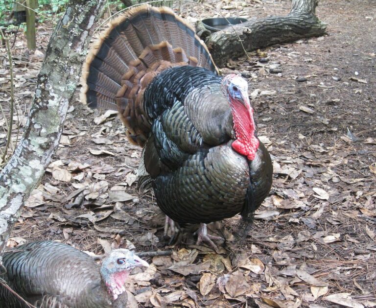
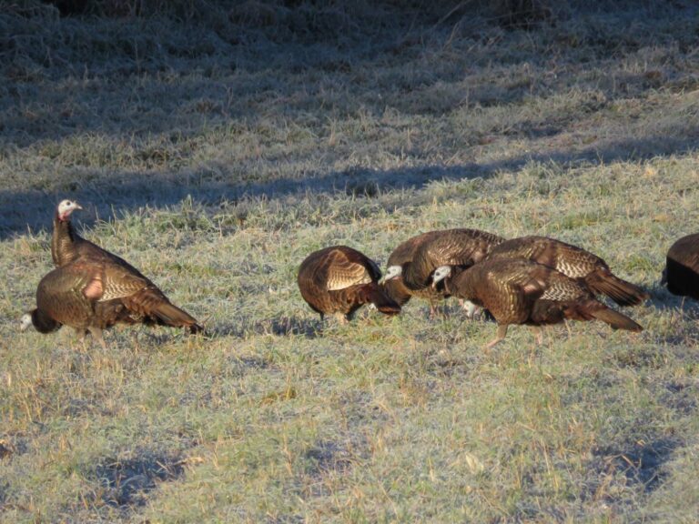
Range stops on the way to West Rifle Creek State Wildlife Area
Cameo Shooting and Education Complex (per the CPW page) is 44 miles from West Rifle Creek State Wildlife Area. Beside it sit the closest club ranges inside 30 miles.
From the CPW Shooting Range Finder, ranges’ own pages and directory listings, checked November 5, 2026.
Quick answers about West Rifle Creek SWA
What does it take to hunt West Rifle Creek SWA legally?
The SWA rule applies: 16 and older need a Colorado hunting or fishing license, or the wildlife area pass.
What acreage does the record give for West Rifle Creek SWA?
All told it takes in 941 acres.
What part of Colorado holds West Rifle Creek SWA?
Look in Garfield County.
What hunt code unit applies to West Rifle Creek SWA?
It overlaps GMU 33.
Are there date or time limits on West Rifle Creek SWA?
Public access prohibited on designated shooting range between sunset and sunrise.
What game can be hunted on West Rifle Creek SWA?
The agency lists deer, elk, black bear, mountain lion, wild turkey, doves, rabbits and bobcat.
Is elk on West Rifle Creek SWA draw only?
Yes, for part of the elk calendar: 2 rows, including second rifle (OTC). Leftover licenses went on sale August 4.
Which special elk rules cover West Rifle Creek SWA?
Free mandatory CWD tests apply to some rifle elk codes in GMU 33. GMU 33 carry the elk antler point restriction.
What is the closest town with services to West Rifle Creek SWA?
The closest town with a page here is Rifle (9 miles).
Where do I report trouble on West Rifle Creek SWA?
Area CPW Office in Grand Junction, 970-255-6100; CPW offices close on state holidays.
Must I wear blaze orange or pink on West Rifle Creek SWA?
Yes for firearm big game: 500 square inches of fluorescent orange or pink on the upper body and a matching head covering. Camo orange does not count.
Is it legal to hunt over bait on West Rifle Creek SWA?
No. It is illegal to hunt big game, turkey, small game or migratory birds over bait in Colorado, whoever placed it.
When does big game light begin and end on West Rifle Creek SWA?
Big game 6:16 a.m. to 5:35 p.m. on November 7, 2026 at the Garfield County centre; turkey, small game and ducks stop at sunset.
Where do hunters sleep when they hunt West Rifle Creek SWA?
Off the property: no camping icon shows on the CPW page.
Which agency page should I check for West Rifle Creek SWA?
The Colorado Parks and Wildlife page has the current rules.
West Rifle Creek SWA: the final check
Property rules, closures and reservation needs on West Rifle Creek SWA can change mid-season; posted signs and the agency page have the last word.
Sources: source 1 · source 2 · source 3 · source 4; seasons from the 2026 Colorado Big Game brochure. Checked November 5, 2026.
Other photos on this page: Kahunapule Michael Johnson (CC BY-SA 2.0); Alabama Extension (CC0 1.0); U.S. Fish and Wildlife Service – Midwest Region (Public domain).