2026-27 county guides
Idaho Hunting by County
All 44 Idaho counties with their hunting units, elk zones, controlled hunts, public land acres, CWD units and time zones, checked November 12, 2026.
Photo: Bureau of Land Management (CC BY 2.0)
Idaho counties for hunters
Idaho has 44 counties, and IDFG groups them into seven regions: Panhandle (5), Clearwater (5), Southwest (10), Magic Valley (8), Southeast (7), Upper Snake (7) and Salmon (2); 14 counties straddle a regional line. Big game seasons are written for 99 numbered hunting units rather than for counties, so each county guide opens with the units that reach it and how much of each lies inside. Idaho County touches the most units (18), while Boundary County, Canyon County and Jerome County each sit inside a single unit; Idaho County has the most controlled hunts with units reaching it (103).
General elk tags are sold for one of 28 elk zones as an A tag or a B tag, so the county guides also show which zones cross each county and the tag lines for those zones. Public land comes from merged GIS layers: Idaho County has the most open public ground, about 4,543,787 acres, and Lewis County the least, near 6,462 acres. Summed county by county, the open public total is about 32,207,639 GIS acres of WMAs, national forest, Curlew National Grassland, BLM land, listed refuges and the Craters of the Moon National Preserve, with tribal land removed.
Regions from the IDFG regions; units from the IDFG Game Units layer; elk zones from the IDFG Elk Zones layer; hunts from the Idaho Big Game 2026 Seasons and Rules; public land from merged GIS layers (not official acreage). Checked November 12, 2026.
All 44 county guides in one table
Type a county, seat or unit number to filter the table.
| County | IDFG region | Seat | People 2024 | Units | Elk zones | Drawn hunts | Public acres (GIS) | Time zone | CWD units |
|---|---|---|---|---|---|---|---|---|---|
| Ada County | Southwest | Boise | 535,799 | 3 | 2 | 21 | 288,924 | Mountain | — |
| Adams County | Southwest | Council | 4,998 | 5 | 3 | 43 | 553,203 | Mountain | 18, 23 |
| Bannock County | Southeast | Pocatello | 91,010 | 5 | 2 | 28 | 188,278 | Mountain | — |
| Bear Lake County | Southeast | Paris | 6,779 | 4 | 2 | 23 | 281,798 | Mountain | — |
| Benewah County | Panhandle | St. Maries | 10,529 | 4 | 2 | 33 | 47,606 | Pacific | — |
| Bingham County | Southeast | Blackfoot | 50,889 | 6 | 4 | 48 | 271,007 | Mountain | 69 |
| Blaine County | Magic Valley | Hailey | 25,261 | 9 | 4 | 91 | 1,241,293 | Mountain | — |
| Boise County | Southwest | Idaho City | 8,581 | 6 | 3 | 30 | 871,064 | Mountain | — |
| Bonner County | Panhandle | Sandpoint | 53,955 | 4 | 1 | 40 | 509,445 | Pacific | — |
| Bonneville County | Upper Snake | Idaho Falls | 133,644 | 7 | 5 | 60 | 571,300 | Mountain | 63A, 69 |
| Boundary County | Panhandle | Bonners Ferry | 14,040 | 1 | 1 | 25 | 529,873 | Pacific | 1 |
| Butte County | Upper Snake | Arco | 2,735 | 6 | 5 | 61 | 838,724 | Mountain | — |
| Camas County | Magic Valley | Fairfield | 1,247 | 4 | 1 | 43 | 432,983 | Mountain | — |
| Canyon County | Southwest | Caldwell | 266,892 | 1 | 1 | 7 | 11,544 | Mountain | — |
| Caribou County | Southeast | Soda Springs | 7,239 | 7 | 4 | 44 | 433,988 | Mountain | 69 |
| Cassia County | Magic Valley | Burley | 25,976 | 5 | 2 | 53 | 815,867 | Mountain | — |
| Clark County | Upper Snake | Dubois | 794 | 8 | 4 | 62 | 680,113 | Mountain | — |
| Clearwater County | Clearwater | Orofino | 9,151 | 7 | 4 | 42 | 816,866 | Pacific | — |
| Custer County | Salmon | Challis | 4,597 | 9 | 5 | 92 | 2,853,213 | Mountain | — |
| Elmore County | Southwest | Mountain Home | 29,729 | 7 | 4 | 66 | 1,326,365 | Mountain | — |
| Franklin County | Southeast | Preston | 15,638 | 5 | 2 | 23 | 128,764 | Mountain | — |
| Fremont County | Upper Snake | St. Anthony | 14,399 | 5 | 1 | 45 | 673,874 | Mountain | — |
| Gem County | Southwest | Emmett | 21,857 | 3 | 2 | 21 | 129,867 | Mountain | — |
| Gooding County | Magic Valley | Gooding | 16,189 | 3 | 2 | 28 | 244,996 | Mountain | — |
| Idaho County | Clearwater | Grangeville | 17,912 | 18 | 8 | 103 | 4,543,787 | Split | 14, 18, 23 |
| Jefferson County | Upper Snake | Rigby | 34,854 | 6 | 4 | 64 | 214,597 | Mountain | 63A, 64 |
| Jerome County | Magic Valley | Jerome | 26,056 | 1 | 1 | 3 | 129,873 | Mountain | — |
| Kootenai County | Panhandle | Coeur d'Alene | 188,323 | 6 | 1 | 44 | 271,201 | Pacific | — |
| Latah County | Clearwater | Moscow | 42,180 | 3 | 2 | 13 | 111,874 | Pacific | — |
| Lemhi County | Salmon | Salmon | 8,397 | 12 | 4 | 98 | 2,609,649 | Mountain | — |
| Lewis County | Clearwater | Nezperce | 3,728 | 2 | 2 | 13 | 6,462 | Pacific | — |
| Lincoln County | Magic Valley | Shoshone | 5,556 | 3 | 2 | 18 | 560,271 | Mountain | — |
| Madison County | Upper Snake | Rexburg | 55,549 | 5 | 3 | 47 | 57,277 | Mountain | 63A, 64 |
| Minidoka County | Magic Valley | Rupert | 22,691 | 3 | 1 | 11 | 226,659 | Mountain | — |
| Nez Perce County | Clearwater | Lewiston | 42,847 | 4 | 2 | 27 | 117,728 | Pacific | — |
| Oneida County | Southeast | Malad City | 4,976 | 4 | 2 | 29 | 382,072 | Mountain | — |
| Owyhee County | Southwest | Murphy | 12,748 | 5 | 2 | 41 | 3,548,193 | Mountain | — |
| Payette County | Southwest | Payette | 27,662 | 2 | 2 | 11 | 63,833 | Mountain | — |
| Power County | Southeast | American Falls | 8,381 | 6 | 3 | 37 | 261,869 | Mountain | — |
| Shoshone County | Panhandle | Wallace | 14,074 | 7 | 3 | 45 | 1,319,465 | Pacific | — |
| Teton County | Upper Snake | Driggs | 12,932 | 4 | 2 | 21 | 94,267 | Mountain | 64 |
| Twin Falls County | Magic Valley | Twin Falls | 96,509 | 4 | 2 | 40 | 581,571 | Mountain | — |
| Valley County | Southwest | Cascade | 12,777 | 10 | 4 | 57 | 2,005,635 | Mountain | — |
| Washington County | Southwest | Weiser | 11,539 | 4 | 2 | 31 | 360,401 | Mountain | — |
Counties, seats and population from the Census (2024); units and zones from IDFG layers; drawn hunts are hunt numbers whose units reach the county (whole units); public land from GIS layers; time zones from 49 CFR 71.9; CWD units from the 2026 brochure. Checked November 12, 2026.
Map of Idaho counties
Solid pins mark counties on Pacific Time (and split Idaho County); hollow pins Mountain Time counties.
Tribal land of 1,000 acres or more lies in Bannock County, Benewah County, Bingham County, Boundary County, Caribou County, Clearwater County, Idaho County, Kootenai County, Lewis County, Nez Perce County, Owyhee County and Power County; it is closed to non-member hunting except under tribal authority, and each county guide lists it apart from the public total. The CWD Management Zone (Units 14, 18 and the Boundary County part of Unit 1) and the 2026 mandatory deer testing units (23, 63A, 64 and 69) reach 9 counties: Adams, Bingham, Bonneville, Boundary, Caribou, Idaho, Jefferson, Madison and Teton. Nine northern counties keep Pacific Time, Idaho County is split by the main channel of the Salmon River, and the remaining 34 counties keep Mountain Time; shooting light tables on each guide use the county's own zone.
IDFG publishes harvest by unit and by hunt, never by county, so the harvest tables in the guides are 2025 totals for the units that reach each county. Every one of the 221 public land records has its own page, and each county guide links the ones that lie in or near it. Controlled hunts are drawn at random; the hunts band of each county guide lists every hunt number whose units reach the county, with 2026 tags and dates.
Tribal rule from 18 U.S.C. 1165; CWD rules from the 2026 brochure; harvest note from the IDFG Hunt Planner statistics. Checked November 12, 2026.
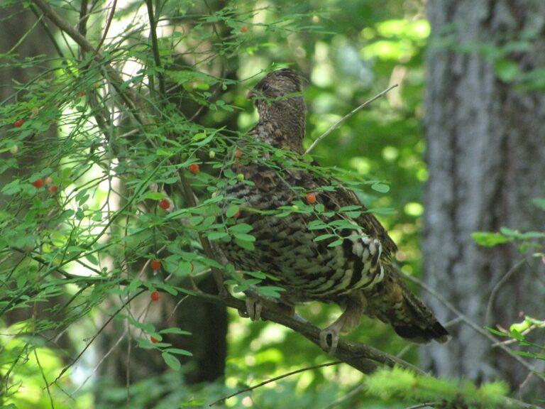
Ruffed grouse in the woodsPhoto: GerryT (CC BY 2.0)

A dark gray wolf standing in open grasslandPhoto: Gregory "Slobirdr" Smith (CC BY-SA 2.0)

Two greater sage-grouse in dry grassPhoto: Tom Koerner (USFWS, posted by Bureau of Land Management Idaho) (CC BY 2.0)
Counties by IDFG region
Each county is listed under the region holding most of its land.
IDFG Panhandle Region counties
- Benewah Countyseat St. Maries; 4 units
- Bonner Countyseat Sandpoint; 4 units
- Boundary Countyseat Bonners Ferry; 1 unit
- Kootenai Countyseat Coeur d'Alene; 6 units
- Shoshone Countyseat Wallace; 7 units
IDFG Clearwater Region counties
- Clearwater Countyseat Orofino; 7 units
- Idaho Countyseat Grangeville; 18 units
- Latah Countyseat Moscow; 3 units
- Lewis Countyseat Nezperce; 2 units
- Nez Perce Countyseat Lewiston; 4 units
IDFG Southwest Region counties
- Ada Countyseat Boise; 3 units
- Adams Countyseat Council; 5 units
- Boise Countyseat Idaho City; 6 units
- Canyon Countyseat Caldwell; 1 unit
- Elmore Countyseat Mountain Home; 7 units
- Gem Countyseat Emmett; 3 units
- Owyhee Countyseat Murphy; 5 units
- Payette Countyseat Payette; 2 units
- Valley Countyseat Cascade; 10 units
- Washington Countyseat Weiser; 4 units
IDFG Magic Valley Region counties
- Blaine Countyseat Hailey; 9 units
- Camas Countyseat Fairfield; 4 units
- Cassia Countyseat Burley; 5 units
- Gooding Countyseat Gooding; 3 units
- Jerome Countyseat Jerome; 1 unit
- Lincoln Countyseat Shoshone; 3 units
- Minidoka Countyseat Rupert; 3 units
- Twin Falls Countyseat Twin Falls; 4 units
IDFG Southeast Region counties
- Bannock Countyseat Pocatello; 5 units
- Bear Lake Countyseat Paris; 4 units
- Bingham Countyseat Blackfoot; 6 units
- Caribou Countyseat Soda Springs; 7 units
- Franklin Countyseat Preston; 5 units
- Oneida Countyseat Malad City; 4 units
- Power Countyseat American Falls; 6 units
IDFG Upper Snake Region counties
- Bonneville Countyseat Idaho Falls; 7 units
- Butte Countyseat Arco; 6 units
- Clark Countyseat Dubois; 8 units
- Fremont Countyseat St. Anthony; 5 units
- Jefferson Countyseat Rigby; 6 units
- Madison Countyseat Rexburg; 5 units
- Teton Countyseat Driggs; 4 units
IDFG Salmon Region counties
- Custer Countyseat Challis; 9 units
- Lemhi Countyseat Salmon; 12 units
Other photos on this page: GerryT (CC BY 2.0); Gregory "Slobirdr" Smith (CC BY-SA 2.0); Tom Koerner (USFWS, posted by Bureau of Land Management Idaho) (CC BY 2.0).