Home › Idaho › Public land › BLM land
Idaho public land
Idaho BLM Land for Hunters
4 districts, 12 field offices, the Birds of Prey NCA and the BLM part of Craters of the Moon.
Photo: Matt Lavin (CC BY-SA 2.0)
Idaho BLM districts and their field offices
BLM public land in Idaho is open to hunting under Idaho seasons and rules unless an area closure applies; acres here are GIS measures of BLM land inside each office boundary, and districts contain their field offices, so the figures overlap.
For the Morley Nelson Snake River Birds of Prey NCA the record says only that it is open to hunting under Idaho seasons and rules: no NCA-specific hunting statement was read, so none is printed.
At Craters of the Moon, the BLM-administered part of the monument and the national preserve are open, while the National Park Service monument is closed.
| Office | Level | Counties | BLM acres (GIS) | Units |
|---|---|---|---|---|
| Boise District | District | Owyhee, Elmore + | 3,946,282 | 22, 23 + |
| Bruneau Field Office | Field office | Owyhee | 1,434,859 | 40, 41 + |
| Four Rivers Field Office | Field office | Elmore, Ada + | 1,254,788 | 22, 23 + |
| Owyhee Field Office | Field office | Owyhee | 1,256,635 | 40, 41 + |
| Twin Falls District | District | Owyhee, Lincoln + | 3,878,489 | 44, 45 + |
| Burley Field Office | Field office | Cassia, Twin Falls + | 832,707 | 46, 47 + |
| Jarbidge Field Office | Field office | Owyhee, Twin Falls + | 1,324,786 | 46, 47 |
| Shoshone Field Office | Field office | Lincoln, Blaine + | 1,720,996 | 44, 45 + |
| Idaho Falls District | District | Custer, Lemhi + | 3,625,567 | 21A, 28 + |
| Challis Field Office | Field office | Custer, Lemhi | 790,729 | 28, 36A + |
| Pocatello Field Office | Field office | Oneida, Power + | 528,311 | 56, 57 + |
| Salmon Field Office | Field office | Lemhi | 492,721 | 21A, 28 + |
| Upper Snake Field Office | Field office | Butte, Clark + | 1,813,806 | 50, 51 + |
| Coeur d'Alene District | District | Idaho, Shoshone + | 230,672 | 1, 2 + |
| Coeur d'Alene Field Office | Field office | Shoshone, Benewah + | 99,586 | 1, 2 + |
| Cottonwood Field Office | Field office | Idaho, Nez Perce + | 131,086 | 8, 10A + |
From BLM office pages, the BLM admin unit and Idaho surface management layers; checked November 12, 2026.
Birds of Prey NCA, Craters BLM land and BLM statewide
The national conservation area and the monument land carry their own access wording, quoted from the record.
| Area | Counties | Acres | Units | Access on record |
|---|---|---|---|---|
| Morley Nelson Snake River… | Ada, Elmore + | 599,951 | 38, 40 + | Open to hunting under Idaho seasons and rules. |
| Craters of The Moon… | Blaine, Minidoka + | 750,978 | 49, 50 + | NPS Craters of the Moon laws page: "Hunting is permitted in Craters of the Moon National Preserve and the surrounding BLM administered lands. |
BLM Public Lands in Idaho: 11,681,144 acres (GIS), own page.
District and special-area records in detail
Every published fact for each district and special area, with the IDFG regions and elk zones its land reaches, so a hunter can see which tag zones apply before opening a county page.
Boise District: facts on file
Acreage: 3,946,282 acres (GIS area of BLM land (SMA layer) inside the district boundary)
Managed by: 3 managing units: Bruneau Field Office, Four Rivers Field Office and Owyhee Field Office
Stated management: Multiple use and sustainable yield; major activities are livestock grazing, wildland fire suppression and motorized and non-motorized recreation
Wildlife noted: Birds of Prey NCA: some 800 pairs of hawks, owls, eagles and falcons nest each spring
Habitat and cover: About 4 million acres from the central Idaho mountains to the Oregon and Nevada borders; Bruneau, Four Rivers and Owyhee field offices
Field offices: Bruneau Field Office, Owyhee Field Office, Four Rivers Field Office
Elk zones: Boise River Zone, Brownlee Zone, McCall Zone, Owyhee Zone, Sawtooth Zone, Smoky-Bennett Zone, South Hills Zone, Weiser River Zone
IDFG regions: Southwest Region and Magic Valley Region
Twin Falls District: facts on file
Acreage: 3,878,489 acres (GIS area of BLM land (SMA layer) inside the district boundary)
Managed by: 3 managing units: Burley Field Office, Jarbidge Field Office and Shoshone Field Office
Stated management: Livestock grazing, recreation and a fuels program treating hundreds of thousands of acres a year to restore native vegetation
Named waters: Stretches north toward Redfish Lake, east to American Falls and west to the Bruneau River; Snake River Canyon at Twin Falls
Field offices: Shoshone Field Office, Jarbidge Field Office, Burley Field Office
Elk zones: Big Desert Zone, Pioneer Zone, Smoky-Bennett Zone, South Hills Zone
IDFG regions: Magic Valley Region, Southwest Region, Southeast Region and Upper Snake Region
Idaho Falls District: facts on file
Acreage: 3,625,567 acres (GIS area of BLM land (SMA layer) inside the district boundary)
Managed by: 4 managing units: Challis Field Office, Pocatello Field Office, Salmon Field Office and Upper Snake Field Office
Habitat and cover: Sagebrush and desert to high-elevation forests, from Craters of the Moon on the west to the Teton Range on the east
Stated management: Multiple use and sustainable yield: grazing, recreation, mining, wildlife and fisheries, fire, riparian and wetland management
Field offices: Upper Snake Field Office, Challis Field Office, Pocatello Field Office, Salmon Field Office
Elk zones: Bannock Zone, Bear River Zone, Beaverhead Zone, Big Desert Zone, Diamond Creek Zone, Island Park Zone, Lemhi Zone, Palisades Zone, Pioneer Zone, Salmon Zone
IDFG regions: Upper Snake Region, Salmon Region, Southeast Region and Magic Valley Region
Coeur d'Alene District: facts on file
Acreage: 230,672 acres (GIS area of BLM land (SMA layer) inside the district boundary)
Managed by: 2 managing units: Coeur d'Alene Field Office and Cottonwood Field Office
Named waters: Northern panhandle known for abundant rivers and lakes; Cottonwood (130,000 ac) and Coeur d'Alene (98,000 ac) field offices
Stated management: Water-based recreation and a robust forestry program are the district's two primary focus areas
Field offices: Cottonwood Field Office, Coeur d'Alene Field Office
Elk zones: Dworshak Zone, Elk City Zone, Hells Canyon Zone, McCall Zone, Palouse Zone, Panhandle Zone
IDFG regions: Panhandle Region, Clearwater Region and Southwest Region
Morley Nelson Snake River Birds of Prey National Conservation Area: facts on file
Acreage: 599,951 acres (GIS area of the BLM NLCS boundary)
History: Established by Congress August 4, 1993; renamed in 2009 for Morley Nelson; special protection first given in 1971
Wildlife noted: Greatest concentration of nesting birds of prey in North America: some 800 pairs of hawks, owls, eagles and falcons each spring
Stated management: BLM mission is to preserve this raptor habitat while providing for other compatible uses; few public facilities
Named waters: Snake River canyon with cliffs up to 700 feet; CJ Strike Reservoir cove and Halverson Bar/Lake
Facilities: Celebration Park, Guffey Railroad Bridge Trail, Dedication Point Overlook
Elk zones: Boise River Zone, Owyhee Zone, Smoky-Bennett Zone, South Hills Zone
IDFG regions: Southwest Region and Magic Valley Region
Craters of The Moon National Monument (BLM part): facts on file
Acreage: 750,978 acres (GIS area of the BLM NLCS boundary)
History: Expanded monument created by presidential proclamation November 9, 2000; BLM monument portion 274,800 acres
Habitat and cover: Great Rift (52-mile crack), lava fields, lava tubes, craters and cinder cones; eruptions from 15,000 to 2,100 years ago
Area rules: Hunting is permitted in the Preserve and surrounding BLM lands under state law; hunting prohibited in the NPS-administered Monument
Managed by: Cooperatively managed by the BLM (Shoshone Field Office) and the National Park Service
Facilities: Network of primitive roads in the BLM backcountry for high-clearance 4WD vehicles; Laidlaw Park guided tour
Elk zones: Big Desert Zone, Pioneer Zone
IDFG regions: Magic Valley Region, Upper Snake Region and Southeast Region
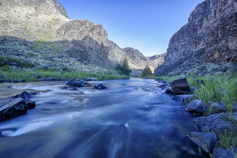
A riffle on the Bruneau River below tall canyon cliffsPhoto: Bureau of Land Management (CC BY 2.0)
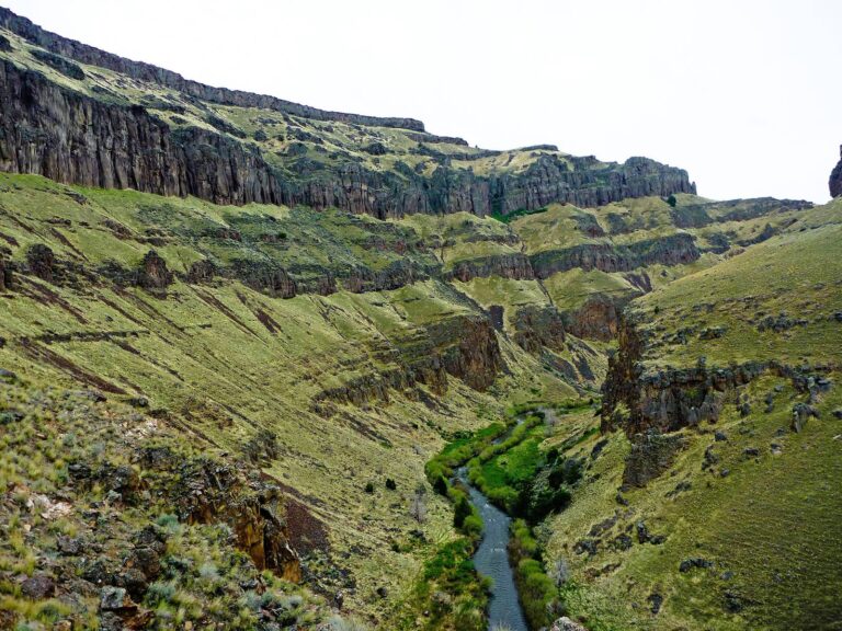
A green creek bottom in the West Fork Bruneau canyon below basalt rimsPhoto: Bureau of Land Management Idaho (CC BY 2.0)

The Bruneau River far below layered basalt and rhyolite canyon wallsPhoto: Bureau of Land Management (CC BY 2.0)