Home › Kentucky › Public land › Daniel Boone National Forest
National forest · 2026-27
A hunter's guide to Daniel Boone National Forest
National forest in Whitley County and 25 more counties: 710,298 acres, Deer Zones 1-4.
Hunting gearPhoto: Cindy Stuntz (CC BY 2.0)
Getting to Daniel Boone National Forest
Parking, trailheads and gates near Daniel Boone National Forest
- Parking areaParking · 0.4 mi from the centreDirections
- Parking areaParking · 1.4 mi from the centreDirections
- Bark Camp Trail #413Trailhead · 1.5 mi from the centreDirections
- Parking areaParking · 1.5 mi from the centreDirections
- Parking areaParking · 1.8 mi from the centreDirections
- Dog Slaughter Falls Trailhead (Lower)Trailhead · 1.8 mi from the centreDirections
- Parking areaParking · 1.8 mi from the centreDirections
- Dog Slaughter Falls Trailhead (Upper) CLOSEDTrailhead · 2.6 mi from the centreDirections
- Parking areaParking · 3.3 mi from the centreDirections
- Parking areaParking · 3.3 mi from the centreDirections
- Parking areaParking · 3.7 mi from the centreDirections
- Parking areaParking · 3.8 mi from the centreDirections
Parking, trailhead and gate locations come from OpenStreetMap contributors. Roads into public land can be gated or seasonal; check with the managing agency before you go.
The Daniel Boone National Forest ownership, permits and caveats
The Daniel Boone National Forest takes in Corps of Engineers ground at Cave Run Lake and Laurel River Lake.
Sources: eCFR · Forest Service; checked November 10, 2026.
Nearby
Places to hunt and shoot around Daniel Boone National Forest
The Daniel Boone National Forest: acreage, habitat and directions
With roughly 710,298 acres in 26 Kentucky counties, the Daniel Boone National Forest is one of the Southeast Region's public hunting places. For upkeep and posted rules, look to the USDA Forest Service.
In the agency's words, the Daniel Boone National Forest offers this:
- From Tenn. line in McCreary County north to Fleming and Lewis counties. Many US, state and county roads lead into and across area; forest roads, marked hiking trails in many sections.
- Primarily mountainous with many sections quite steep and rugged, but with some fairly flat river and creek bottoms and ridge tops. Migratory waterfowl, bald eagles often seen around Cave Run and Laurel lakes. Many trout streams, small lakes throughout, several rivers offer float fishing.
- Several recreational areas maintained by U.S. Forest Service offer camping, picnicking, hiking, horseback trails, etc. Maps, additional information available from U. S. Forest Service,1700 Bypass Road, Winchester, KY 40391. NOTE: Much land within forest boundaries is still privately owned and permission should be obtained before entering these private holdings.
About 95 percent of the Daniel Boone National Forest is forest, the largest cover type on record.
Counties by GIS overlay: Bath, Clay, Estill, Harlan, Jackson, Laurel, Lee, Leslie, McCreary, Menifee, Morgan, Owsley, Perry, Powell, Pulaski, Rockcastle, Rowan, Wayne, Whitley and Wolfe; the layer attribute names a different set. Not every agency agrees on size, since KDFWR states 710,288 acres and the Forest Service states 708,879.

Sandstone outcrop rising above fall forest in the Red River Gorge
Acres: USFS EDW Lands Area Statistics, NFS acres in Kentucky (Daniel Boone National Forest). Description and habitat from the area record; checked November 10, 2026.
Limits posted for the Daniel Boone National Forest hunters
County statewide regulations apply on the Daniel Boone National Forest except for the specific items below.
- Portions of the forest are open during quota elk hunts to persons who possess the appropriate elk hunting permit.
- Areas of the DBNF located in any other county are not open for the special antlerless season.
- USFS: "Hunting is allowed in most areas of the Daniel Boone National Forest" with restrictions: no hunting within 150 yards of a residence, building, campsite, developed recreation area or occupied area; forest land between KY 801 and the shores of Cave Run Lake (incl. Shallow Flats Wildlife Viewing Area) restricted; Pioneer Weapons WMA longbow, crossbow and muzzleloader only. Baiting prohibited (301 KAR 2:178 Section 8(1)).
Area regulations as printed on the Forest Service. Checked November 10, 2026.
The Daniel Boone National Forest season chart for 2026-27
KDFWR's grid for the Daniel Boone National Forest reads 24 open, 0 closed, 0 quota cells for 2026-27.
| Season type | Open or not | Note no. |
|---|---|---|
| Deer archery, crossbow | Open | – |
| Deer muzzleloader | Open | – |
| Deer modern gun | Open | – |
| Deer youth gun | Open | – |
| Fall squirrel | Open | – |
| Rabbit | Open | – |
| Grouse | Open | – |
| Quail | Open | – |
| Fall turkey | Open | – |
| Furbearer | Open | – |
| Bear | Open | – |
| Elk quota | Open | 1 |
- Portions open during quota elk hunts to persons who possess the appropriate elk hunting permit.
| Season type | Open or not | Note no. |
|---|---|---|
| Deer archery, crossbow | Open | – |
| Deer muzzleloader | Open | – |
| Deer modern gun | Open | – |
| Deer youth gun | Open | – |
| Fall squirrel | Open | – |
| Rabbit | Open | – |
| Grouse | Open | – |
| Quail | Open | – |
| Fall turkey | Open | – |
| Furbearer | Open | – |
| Bear | Open | – |
| Elk quota | Open | 1 |
- Portions open during quota elk hunts to persons who possess the appropriate elk hunting permit.
From the 2026-27 quick reference charts on the KDFWR Public Land Hunting page; footnotes are KDFWR exceptions as printed. Checked November 10, 2026.
Deer zones for the Daniel Boone National Forest
Typical game for this part of Kentucky.
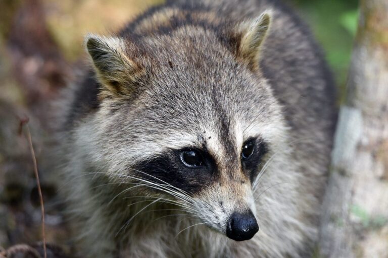
Raccoon portrait
Zone lines run through the Daniel Boone National Forest: the rules change at county lines across Deer Zones 1-4. Zone maps from earlier years are out of date for Carter, Jackson, Lewis, Menifee, Morgan, Rockcastle and Rowan counties, which changed zone in 2026.
| County | Deer zone | Zone limit | Zone change | CWD zone | Bear | Elk zone | Small game |
|---|---|---|---|---|---|---|---|
| Bath County | Deer Zone 2 | Up to 4 deer | No | No | Bear Zone 2 | No | Eastern |
| Breathitt County | Deer Zone 4 | 2 deer, 1 antlerless | No | No | Bear Zone 2 | Yes | Eastern |
| Carter County | Deer Zone 1 | Unlimited antlerless | 2 to 1 | No | Bear Zone 2 | No | Eastern |
| Clay County | Deer Zone 4 | 2 deer, 1 antlerless | No | No | Bear Zone 2 | Yes | Eastern |
| Estill County | Deer Zone 3 | 4 deer, 1 gun antlerless | No | No | Bear Zone 2 | No | Eastern |
| Fleming County | Deer Zone 2 | Up to 4 deer | No | No | Bear Zone 2 | No | Eastern |
| Harlan County | Deer Zone 4 | 2 deer, 1 antlerless | No | No | Bear Zone 1 | Yes | Eastern |
| Jackson County | Deer Zone 3 | 4 deer, 1 gun antlerless | 4 to 3 | No | Bear Zone 2 | No | Eastern |
| Knox County | Deer Zone 4 | 2 deer, 1 antlerless | No | No | Bear Zone 2 | Yes | Eastern |
| Laurel County | Deer Zone 3 | 4 deer, 1 gun antlerless | No | Yes | Bear Zone 2 | No | Eastern |
| Lee County | Deer Zone 4 | 2 deer, 1 antlerless | No | No | Bear Zone 2 | No | Eastern |
| Leslie County | Deer Zone 4 | 2 deer, 1 antlerless | No | No | Bear Zone 2 | Yes | Eastern |
| Lewis County | Deer Zone 1 | Unlimited antlerless | 2 to 1 | No | Bear Zone 2 | No | Eastern |
| Madison County | Deer Zone 2 | Up to 4 deer | No | No | Bear Zone 2 | No | Eastern |
| McCreary County | Deer Zone 4 | 2 deer, 1 antlerless | No | Check county | Bear Zone 1 | Yes | Eastern |
| Menifee County | Deer Zone 3 | 4 deer, 1 gun antlerless | 4 to 3 | No | Bear Zone 2 | No | Eastern |
| Morgan County | Deer Zone 2 | Up to 4 deer | 3 to 2 | No | Bear Zone 2 | No | Eastern |
| Owsley County | Deer Zone 4 | 2 deer, 1 antlerless | No | No | Bear Zone 2 | No | Eastern |
| Perry County | Deer Zone 4 | 2 deer, 1 antlerless | No | No | Bear Zone 2 | Yes | Eastern |
| Powell County | Deer Zone 3 | 4 deer, 1 gun antlerless | No | No | Bear Zone 2 | No | Eastern |
| Pulaski County | Deer Zone 3 | 4 deer, 1 gun antlerless | No | Check county | Bear Zone 2 | No | Eastern |
| Rockcastle County | Deer Zone 3 | 4 deer, 1 gun antlerless | 4 to 3 | Yes | Bear Zone 2 | No | Eastern |
| Rowan County | Deer Zone 2 | Up to 4 deer | 3 to 2 | No | Bear Zone 2 | No | Eastern |
| Wayne County | Deer Zone 3 | 4 deer, 1 gun antlerless | No | Check county | Bear Zone 3 | No | Eastern |
| Whitley County | Deer Zone 4 | 2 deer, 1 antlerless | No | Yes | Bear Zone 2 | Yes | Eastern |
| Wolfe County | Deer Zone 3 | 4 deer, 1 gun antlerless | No | No | Bear Zone 2 | No | Eastern |
Zones 1-4 statewide deer seasons
| Season | Covers | Begins | Ends | Right now | Source |
|---|---|---|---|---|---|
| Archery | Statewide | Sep 5, 2026 | Jan 18, 2027 | Guide p. 12 | |
| Crossbow | Statewide | Sep 19, 2026 | Jan 18, 2027 | Guide p. 12 | |
| Youth, senior crossbow | Statewide | Sep 5, 2026 | Jan 18, 2027 | Guide p. 12 | |
| CWD antlerless | CWD counties | Sep 25, 2026 | Sep 28, 2026 | Guide p. 12 | |
| Youth gun | Statewide | Oct 10, 2026 | Oct 18, 2026 | Guide p. 12 | |
| Early Muzzleloader | Statewide | Oct 17, 2026 | Oct 18, 2026 | Guide p. 12 | |
| Modern gun | Zone 1 | Nov 14, 2026 | Nov 29, 2026 | Guide p. 12 | |
| Late Muzzleloader | Zone 1 | Dec 12, 2026 | Dec 20, 2026 | Guide p. 12 | |
| Free youth weekend | Statewide | Dec 26, 2026 | Dec 27, 2026 | Guide p. 12 | |
| Modern gun | Zone 2 | Nov 14, 2026 | Nov 29, 2026 | Guide p. 12 | |
| Late Muzzleloader | Zone 2 | Dec 12, 2026 | Dec 20, 2026 | Guide p. 12 | |
| Modern gun | Zone 3 | Nov 14, 2026 | Nov 29, 2026 | Guide p. 12 | |
| Late Muzzleloader | Zone 3 | Dec 12, 2026 | Dec 20, 2026 | Guide p. 12 | |
| Modern gun | Zone 4 | Nov 14, 2026 | Nov 29, 2026 | Guide p. 12 | |
| Late Muzzleloader | Zone 4 | Dec 12, 2026 | Dec 20, 2026 | Guide p. 12 |
Dates above are the Zones 1-4 framework, not a promise that the Daniel Boone National Forest is open every day of them.
Zones from 301 KAR 2:172 and the KDFWR deer zone layer; dates from the 2026-27 Kentucky Hunting &
Big game zones touching the Daniel Boone National Forest
Deer disease zone
The Daniel Boone National Forest lies within the CWD Surveillance Zone through Laurel, McCreary, Pulaski, Rockcastle, Wayne and Whitley counties; whole carcasses stay in the zone. In McCreary, Pulaski and Wayne counties, the opening modern gun days (November 14 to November 16, 2026) carry a mandatory staffed check. Laurel, Pulaski, Rockcastle and Wayne counties have the September 25 to September 28, 2026 CWD antlerless season; confirm the Daniel Boone National Forest on the chart.
Bear hunting
Bear Zones 1, 2 and 3 dates apply on the Daniel Boone National Forest, and any licensed hunter can buy a bear permit. No bear dog hunting on the Daniel Boone National Forest.
| Season | Bear zone | Windows | Status | Cite |
|---|---|---|---|---|
| Chase only | Bear Zones 1, 2, 3 | Jun 1–Aug 31 Sep 9–30 | Guide p. 18 | |
| Archery, crossbow | Bear Zone 1 | Oct 24–26 | Guide p. 18 | |
| With dogs | Bear Zone 1 | Oct 19–23 | Guide p. 18 | |
| Firearm | Bear Zone 1 | Dec 12–14 | Guide p. 18 | |
| Archery, crossbow | Bear Zone 2 | Oct 24–28 | Guide p. 18 | |
| With dogs | Bear Zone 2 | Oct 19–23 Oct 29–Nov 6 | Guide p. 18 | |
| Firearm | Bear Zone 2 | Dec 12–16 | Guide p. 18 | |
| Archery, crossbow | Bear Zone 3 | Sep 19–Oct 2 Oct 24–28 | Guide p. 18 | |
| With dogs | Bear Zone 3 | Oct 19–23 Oct 29–Nov 6 | Guide p. 18 | |
| Firearm | Bear Zone 3 | Dec 12–16 | Guide p. 18 |
Elk rules
Drawn elk hunters can use the Daniel Boone National Forest, part of Elk Hunting Unit 2, Elk Hunting Unit 3 and Elk Hunting Unit 4. There were 500 elk permits in the 2026 drawing.
| Hunt | Dates | Right now | Source |
|---|---|---|---|
| Bull, firearms | Sep 26–30 Oct 3–7 | Guide p. 22 | |
| Cow, firearms | Nov 28–Dec 2 Jan 2–6 | Guide p. 22 | |
| Archery, crossbow | Sep 12–25 Dec 5–11 | Guide p. 22 | |
| Youth quota | Sep 12–Jan 6 | Guide p. 22 |
CWD from the KDFWR CWD Surveillance Zone; bear from 301 KAR 2:300; elk from 301 KAR 2:132; checked November 10, 2026. CWD zone · bear zones · elk zone.
How the Daniel Boone National Forest fits with nearby listings
The pages below cover the 6 parts of the Daniel Boone National Forest one by one. KDFWR also ties the Daniel Boone National Forest to Pioneer Weapons WMA.
Nearest towns and KDFWR contacts for the Daniel Boone National Forest
North Corbin, roughly 12 miles out, is the first town you reach from the Daniel Boone National Forest on this site. Williamsburg counts 5,332 residents (2024), more than any other town in the table. Williamsburg, 14 miles away, holds the closest KDFWR office. KDFWR's Southeast Region line: (606) 344-0585.
| Nearest towns | County | Population | Miles | Heading |
|---|---|---|---|---|
| North Corbin | Laurel | – | 12 miles | northeast |
| Williamsburg | Whitley | 5,332 | 12 miles | southeast |
| Emlyn | Whitley | – | 15 miles | southeast |
| Whitley City | McCreary | – | 15 miles | southwest |
| Stearns | McCreary | – | 17 miles | southwest |
Towns from places.json (Census 2024 estimates); KDFWR offices from the KDFWR contact page and the regional biologists map; businesses from services.json listings (call ahead); straight-line miles. Checked November 10, 2026.
Where the Daniel Boone National Forest sits among nearby areas
Beaver Creek WMA is the nearest neighbour, 8 miles to the west. The nearest six break down as 6 wildlife management areas.
| Public land | Kind | Acres | County | Distance | Direction |
|---|---|---|---|---|---|
| Beaver Creek WMA | WMA | 17,753 | McCreary | 8 miles | west |
| Cane Creek WMA | WMA | 6,677 | Laurel | 10 miles | north |
| University of the Cumberlands WMA | WMA | 10,275 | McCreary | 14 miles | south |
| Rockcastle River WMA | WMA | 2,922 | Pulaski | 16 miles | north |
| Buck Creek WMA | WMA | 850 | Pulaski | 17 miles | northwest |
| Ping-Sinking Valley WMA | WMA | 806 | Pulaski | 22 miles | north |
Point: KDFWR Public Hunting Areas layer (point inside polygon (centroid falls outside) of the largest part). Straight-line distances. Statewide public land map.
Earliest and latest legal shots at the Daniel Boone National Forest
the Daniel Boone National Forest clocks fall back on November 1, 2026 and spring ahead on March 14, 2027, shifting every time in this table by an hour across those dates.
| Date | Season point | Sunrise | Sunset | General hours | Migratory birds | Clock |
|---|---|---|---|---|---|---|
| Sep 5, 2026 | Deer archery opens | 7:10 a.m. | 8:02 p.m. | 6:40 a.m. to 8:32 p.m. | 6:40 a.m. to 8:02 p.m. | EDT |
| Sep 19, 2026 | Deer crossbow opens | 7:21 a.m. | 7:41 p.m. | 6:51 a.m. to 8:11 p.m. | 6:51 a.m. to 7:41 p.m. | EDT |
| Sep 26, 2026 | Bull elk week | 7:27 a.m. | 7:30 p.m. | 6:57 a.m. to 8:00 p.m. | 6:57 a.m. to 7:30 p.m. | EDT |
| Oct 10, 2026 | Youth gun opens | 7:39 a.m. | 7:09 p.m. | 7:09 a.m. to 7:39 p.m. | 7:09 a.m. to 7:09 p.m. | EDT |
| Oct 17, 2026 | Early muzzleloader | 7:45 a.m. | 6:59 p.m. | 7:15 a.m. to 7:29 p.m. | 7:15 a.m. to 6:59 p.m. | EDT |
| Oct 24, 2026 | Bear Zone 2 archery | 7:52 a.m. | 6:50 p.m. | 7:22 a.m. to 7:20 p.m. | 7:22 a.m. to 6:50 p.m. | EDT |
| Nov 14, 2026 | Zone 4 gun opener | 7:14 a.m. | 5:30 p.m. | 6:44 a.m. to 6:00 p.m. | 6:44 a.m. to 5:30 p.m. | EST |
| Nov 26, 2026 | Duck season opens | 7:26 a.m. | 5:23 p.m. | 6:56 a.m. to 5:53 p.m. | 6:56 a.m. to 5:23 p.m. | EST |
| Nov 29, 2026 | Zone 4 gun closes | 7:29 a.m. | 5:22 p.m. | 6:59 a.m. to 5:52 p.m. | 6:59 a.m. to 5:22 p.m. | EST |
| Dec 12, 2026 | Bear Zone 2 firearm; late muzzleloader | 7:40 a.m. | 5:21 p.m. | 7:10 a.m. to 5:51 p.m. | 7:10 a.m. to 5:21 p.m. | EST |
| Dec 21, 2026 | Shortest day | 7:46 a.m. | 5:24 p.m. | 7:16 a.m. to 5:54 p.m. | 7:16 a.m. to 5:24 p.m. | EST |
| Dec 26, 2026 | Free youth weekend | 7:48 a.m. | 5:26 p.m. | 7:18 a.m. to 5:56 p.m. | 7:18 a.m. to 5:26 p.m. | EST |
Hours rules from the 2026-27 Kentucky Hunting &
Bring these along to the Daniel Boone National Forest
the Daniel Boone National Forest hunters get four items suited to a Kentucky year, from the September bow opener to February rabbits.
Amazon links are affiliate links. We may earn a commission at no cost to you.
Climbing stand
From the September bow opener to the January close, a climbing stand earns its keep.
Daniel Boone National Forest: practice before the trip
4 miles separates Daniel Boone National Forest from Whitman Branch Shooting Range, the nearest range on file.
From the KDFWR range layer and permit list, club sites and directory listings, checked November 10, 2026.

Goldenrod in front of steep green wooded hills in the Daniel Boone National ForestPhoto: Jason Everett Morris (CC BY-SA 3.0)

A wide valley of golden fall forest in the Red River GorgePhoto: Cindy Stuntz (CC BY 2.0)
Hunters ask, the records answer: the Daniel Boone National Forest
Elk at the Daniel Boone National Forest?
Drawn permit holders can hunt it (Elk Hunting Unit 2, Elk Hunting Unit 3 and Elk Hunting Unit 4).
Which agency runs the Daniel Boone National Forest?
USDA Forest Service; it covers about 710,298 acres.
Is there a town near the Daniel Boone National Forest?
Yes, North Corbin, some 12 miles away.
Start and stop times for hunting the Daniel Boone National Forest?
Most game: half an hour before sunrise to half an hour after sunset; ducks and geese end at sunset.
How do I contact KDFWR about the Daniel Boone National Forest?
Try (859) 745-3100 first, then the regional coordinator on (606) 344-0585.
Any added paperwork for the Daniel Boone National Forest?
No extra permit is listed, but Corps project rules (36 CFR 327.8) apply on the Corps land.
Is the Daniel Boone National Forest in one deer zone?
No, it reaches Deer Zones 1-4, so zone rules change at county lines.
What does the KDFWR chart say about the Daniel Boone National Forest?
24 open, 0 closed and 0 quota columns for 2026-27, each with its exceptions.
Do I need a draw to hunt the Daniel Boone National Forest?
Not for deer: no deer quota hunt is listed there this season.
Does the Daniel Boone National Forest fall inside the CWD Surveillance Zone?
Yes, through Laurel, McCreary, Pulaski, Rockcastle, Wayne and Whitley counties; carcass export limits apply.
Is there a bear quota for the Daniel Boone National Forest?
No; Kentucky has no bear quota and bear permits are over the counter.
Double-checking plans for the Daniel Boone National Forest
Report a poaching case on the Daniel Boone National Forest to KDFWR law enforcement; the KDFWR Information Center is (800) 858-1549.
Sources: Forest Service · KDFWR area page · KDFWR page · KDFWR map layer · KDFWR PDF · Forest Service; seasons from the 2026-27 Kentucky Hunting &
Other photos on this page: Cindy Stuntz (CC BY 2.0); Charles Patrick Ewing (CC BY 2.0).