Home › Mississippi › Public land › Wildlife management areas › Upper Sardis WMA

WMA · 50,485 acres

Upper Sardis Wildlife Management Area: What Hunters Need to Know

Wildlife management area in Lafayette County and 2 more counties, about 50,485 acres and managed by MDWFP.

Hunting gear

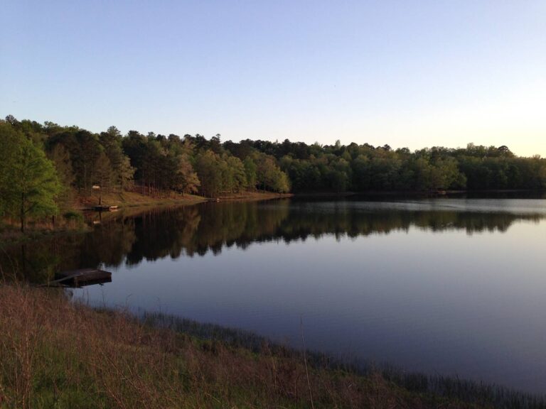
Borrowed from Holly Springs National Forest, a neighbour of Upper Sardis WMA.

Photo: Matthew Nichols (CC BY-SA 3.0)

Getting to Upper Sardis Wildlife Management Area

Upper Sardis WMA at a glance

The wildlife management area called Upper Sardis WMA holds 50,485 acres across 3 counties including Lafayette, Marshall and Union and answers to MDWFP. The 2026-27 brochure for Upper Sardis WMA names the North Regional Office as the regional contact. Upper Sardis WMA carries the following game in its record: deer, turkey, squirrel, rabbit, raccoon, opossum and bobcat, trapping and waterfowl.

50,485Acres
3Counties
NorthMDWFP region
9Game groups
$15User permit
8Draw hunts
White-tailed buck walking through hardwood leaf litter

From the agency records read on November 14, 2026: MDWFP area page, MDWFP WMA list, WMA brochure, source 4.

Nearby

Places to hunt and shoot around Upper Sardis Wildlife Management Area

Holly Springs National Forest

Public land · 17 mi from Upper Sardis Wildlife Management Area

Directions
Chickasaw Wildlife Management Area

Public land · 37 mi from Upper Sardis Wildlife Management Area

Directions
Shooting Ranges Near Olive Branch

Range · 47 mi from Upper Sardis Wildlife Management Area

Directions
Hunting Near Olive Branch, Mississippi

Town · 47 mi from Upper Sardis Wildlife Management Area

Directions
Canal Section Wildlife Management Area

Public land · 51 mi from Upper Sardis Wildlife Management Area

Directions
Shooting Ranges Near Southaven

Range · 52 mi from Upper Sardis Wildlife Management Area

Directions

Where Upper Sardis WMA is and how to drive there

Plot Upper Sardis WMA at 34.4190, -89.3277, the point on the MDWFP WMA boundary layer. Bethlehem is the closest town with a page here, 11 miles in a straight line.

Directions as the agency prints them. Instructions And Equipment Will Be Provided.: From the intersection of Highway 7 and Highway 30 at Oxford, go 10 miles east on Highway 30. The WMA headquarters is on the right.

From the area page and brochure (MDWFP area page, MDWFP WMA list, WMA brochure) and the MDWFP WMA boundary layer; checked November 14, 2026.

When each hunt runs at Upper Sardis WMA

The 2026-27 brochure for Upper Sardis WMA prints 15 dated season rows: 6 for deer and 9 for other game. The brochure PDF outranks this table whenever a note looks too short.

SeasonOpensClosesEntryNotesToday
RaccoonJul 1, 2026Sep 30, 2026OpenFri and Sat nights
Youth squirrelSep 24, 2026Sep 30, 2026Open–
Deer, archeryOct 1, 2026Nov 20, 2026OpenAntlerless and bucks
Raccoon, opossum, bobcatOct 1, 2026Feb 28, 2027Open–
SquirrelOct 1, 2026Feb 28, 2027Open–
RabbitOct 17, 2026Feb 28, 2027Open–
TrappingNov 1, 2026Feb 28, 2027Open–
Deer, youth deerNov 7, 2026Nov 20, 2026OpenAntlerless and bucks
Deer, gunNov 21, 2026Dec 1, 2026OpenAntlerless and bucks
Deer, primitive weaponDec 2, 2026Dec 15, 2026OpenAntlerless and bucks
Deer, gunDec 16, 2026Jan 20, 2027OpenAntlerless and bucks
Deer, primitive weaponJan 21, 2027Jan 31, 2027OpenAntlerless and bucks
Youth turkeyMar 8, 2027Mar 14, 2027Open–
TurkeyMar 15, 2027Mar 31, 2027PermitPermit rules apply
TurkeyApr 1, 2027May 2, 2027Open–

From the 2026-27 WMA brochure (Mississippi Department of Wildlife, Fisheries, and Parks), brochure dated April 2026; checked November 14, 2026.

Entry requirements at Upper Sardis WMA

Before you step onto Upper Sardis WMA, buy the annual WMA User Permit ($15.00 resident, $30.00 non-resident) unless you are exempt from licensing. Fees printed beside the resident price: $1.00 agent and $2.49 process. Add any license or stamp the game requires; the license page lists them. The MDWFP point layer maps these features on Upper Sardis WMA: 2 data collection, 1 headquarters and 5 permit station. Drawn hunts are part of the picture at Upper Sardis WMA, covered on the draw hunts page.

ContactListed value
Phone(601) 432-2199, (662) 563-6222
Emailnorthwestwmas@wfp.ms.gov
HQ GPS34.4193, -89.3286

MDWFP price page and the area brochure (MDWFP area page, MDWFP WMA list, WMA brochure); checked November 14, 2026.

Upper Sardis WMA: weapons, dogs, camping and more

Plan your deer rig around centerfire rifles, slug shotguns, primitive weapons and centerfire handguns, the weapons the brochure names. Bucks must show 10 inches between the main beams or a 13 inch main beam, except that youth 15 and under may take any antlered buck. Every brochure repeats Rule 1.1, the general WMA safety and conduct rule, so it applies here as well. The WMA hub page sets Rule 1.1 out in one place.

TopicCondensed
CampingForest Service rules
HorsesHunting from horseback
DogsSmall game only
ORVs and ATVsForest Service rules
Legal buck10 in. spread or 13 in. beam
Bag limitsStatewide, with exceptions
TopicWhat the sources say
Bag limitsSame as statewide bag limits, except the bag limit on antlerless deer is one (1) per day and one of the three (3) bucks may be any antlered deer on Upper Sardis, and for permitted turkey hunts the bag limit is one gobbler per permitted hunter. ALL harvested deer and turkey count towards statewide bag limits, unless otherwise stated.
Deer check-inAll deer harvested must be checked at a self-service data collection station and recorded on DAILY VISITOR USE PERMIT card or the WMA Check-In App by the hunter who harvested them before leaving the WMA. If WMA personnel are not available to check the deer, the hunter is responsible for collecting and legibly recording ALL biolog- ical data (weight, antler measurements, and jawbone).
TurkeyTurkey hunting for March 15 to March 31 is allowed by special permit only on Upper Sardis. You may apply online at mdwfp.com.
DogsHog hunting with dogs is allowed during daylight hours only during February 1 to February 28 with weapons legal for small game. Driving Directions: From the intersection of Highway 7 and Highway 30 at Oxford, go 10 miles east on Highway 30. The WMA headquarters is on the right.
ORVsOff-road vehicle use will be governed by US Army Corps of Engineers regulations on property owned by the Corps within Upper Sardis WMA. Except for retrieval of harvested deer or hogs, no motorized vehicles, including electric bicycles, are allowed off-road or on closed roads on US Forest Service-owned portion of Upper Sardis WMA or the US

From the 2026-27 area brochure and the MDWFP area page (MDWFP area page, MDWFP WMA list, WMA brochure); Rule 1.1 and area texts; checked November 14, 2026.

How the draw works at Upper Sardis WMA

320 permits are spread over 8 hunts in the draw tables that name Upper Sardis WMA. Apply inside the printed window for the draw type you want; they are listed beneath. After an unsuccessful application you receive a bonus point for that draw type, worth one extra entry in a later draw. No more than one permit in ten of a hunt's quota can go to a non-resident.

Draw typeHuntsQuotaOpensEndsYear
Turkey, 20268320March 14 – 15March 29 – 31Held in 2026
DrawApplications openApplications close
TurkeyJanuary 15January 31

From the MDWFP WMA draw hunts page and its schedules (Turkey table); bonus points and the non-resident cap from the bonus point page; checked November 14, 2026. Deer draw hunts statewide.

Upper Sardis WMA by the numbers

Hunters reported 39 deer from Upper Sardis WMA in the 2025 DMAP report (27 bucks, 12 does). The density figure on the report is 1294 acres per deer on 50,485 acres. In spring 2025 hunters at Upper Sardis WMA logged 1,093 man-days and took 60 turkeys. Back one year, the table lists 1,135 man-days and 68 birds, against ten-year averages of 1,109 and 44.

392025 deer reported
27Bucks
12Does
1294Acres per deer
60Spring 2025 birds
1,093Man-days 2025

Only reported animals are in these agency totals.

From 2025 DMAP report and the spring 2025 WMA turkey totals; checked November 14, 2026.

County layer facts for Upper Sardis WMA

3 of the 3 counties are inside a CWD management zone (North MS Management Zone). Samples tested for the 3 counties of Upper Sardis WMA: 5,652, with 197 positives, per the MDWFP county layer. The layer prints no season or date, so read the counts as running totals from the day we looked. Supplemental feeding is banned in Lafayette, Marshall and Union counties. MDWFP assigns Marshall to the North Central unit by name. Details are on the CWD zones page, the county results page and the deer units page.

CountyRegionMDWFP districtZoneSupplemental feedCWD positives
LafayetteNorth9Whole countyBanned3 of 1,326
MarshallNorth9Whole countyBanned192 of 3,106
UnionNorth9Whole countyBanned2 of 1,220

MDWFP county layer (County_Info), CWD management zones and deer management units; region labels are the layer’s only county source; checked November 14, 2026.

Shooting light schedule for Upper Sardis WMA

The sources print no separate spring turkey hours, so this Upper Sardis WMA table covers deer and waterfowl days only.

DayNoteSunupSundownDeer dayDuck day
Oct 1, 2026Archery, Delta and Hills6:51 a.m.6:43 p.m.6:21 a.m. to 7:13 p.m.6:21 a.m. to 6:43 p.m.
Oct 15, 2026Archery, Southeast7:02 a.m.6:24 p.m.6:32 a.m. to 6:54 p.m.6:32 a.m. to 6:24 p.m.
Nov 7, 2026Youth gun deer6:22 a.m.5:00 p.m.5:52 a.m. to 5:30 p.m.5:52 a.m. to 5:00 p.m.
Nov 21, 2026Gun deer opens6:36 a.m.4:51 p.m.6:06 a.m. to 5:21 p.m.6:06 a.m. to 4:51 p.m.
Nov 26, 2026Quail season opens6:41 a.m.4:49 p.m.6:11 a.m. to 5:19 p.m.6:11 a.m. to 4:49 p.m.
Nov 27, 2026Duck season opens6:42 a.m.4:49 p.m.6:12 a.m. to 5:19 p.m.6:12 a.m. to 4:49 p.m.
Dec 2, 2026Primitive weapon deer6:46 a.m.4:48 p.m.6:16 a.m. to 5:18 p.m.6:16 a.m. to 4:48 p.m.
Dec 21, 2026Year's shortest day7:00 a.m.4:51 p.m.6:30 a.m. to 5:21 p.m.6:30 a.m. to 4:51 p.m.
Mar 15, 2027Turkey season opens7:10 a.m.7:04 p.m.6:40 a.m. to 7:34 p.m.6:40 a.m. to 7:04 p.m.

Central Time; daylight time ends November 1.

Hours rules from the MDWFP general hunting rules and the 2026-27 migratory game bird digest (Mississippi Department of Wildlife, Fisheries, and Parks); sunrise and sunset worked out for this location with the NOAA solar formula on Central Time; checked November 14, 2026. Legal hours for every county.

The Upper Sardis WMA neighbourhood on the land map

Holly Springs National Forest lies 17 miles north of the Upper Sardis WMA point, the closest alternative. Around the point you will find 4 WMA, 1 national forest and 1 ranger district. Miles are measured as the crow flies from the Upper Sardis WMA point; roads add to them.

NearbyTypeAcresCountyMilesHeading
Holly Springs National ForestNational forest156,210Benton17 milesnorth
Holly Springs Ranger DistrictRanger district156,210Benton17 milesnorth
Hell Creek WMAWMA2,344Tippah20 milesnortheast
Chickasaw WMAWMA28,000Chickasaw37 milessoutheast
George P. Cossar State Park WMAWMA460Yalobusha37 milessouthwest
Charles Ray Nix WMAWMA4,000Panola38 mileswest

Point from the MDWFP WMA boundary layer; straight-line distances. Statewide public land map.

Nearest towns and services for Upper Sardis WMA

The nearest five towns stretch from 11 miles out to 18 miles from Upper Sardis WMA. With 26,801 residents in 2024, Oxford is the largest nearby. Deer heads for CWD testing can go to Fire Station 1 (Oxford), 12 miles from here in Oxford.

TownCountyPeople (2024)DistanceDirection
BethlehemMarshall–11 milesnorth
OxfordLafayette26,80113 mileswest
Hickory FlatBenton49216 milesnortheast
Potts CampMarshall39816 milesnorth
New AlbanyUnion7,72918 mileseast

University Sporting Goods sporting goods

Oxford, Lafayette County · about 11 mi

Thacker Mountain Lodge guide or outfitter

Oxford, Lafayette County · about 15 mi

Ed's Gun Shop sporting goods

New Albany, Union County · about 20 mi

Pontotoc American Arms sporting goods

Pontotoc, Pontotoc County · about 21 mi

Pitcock Meats meat processing

Pope, Panola County · about 32 mi

The Wild Life Taxidermy taxidermy

Tupelo, Lee County · about 33 mi

Towns from Census 2024 estimates; CWD drop-off sites from the MDWFP drop-off list; businesses from services listings; straight-line miles; checked November 14, 2026.

Calm water and shoreline at Puskus Lake in the Holly Springs National Forest

Calm water and shoreline at Puskus Lake in the Holly Springs National ForestPhoto: Fredlyfish4 (CC BY-SA 3.0)

Open cotton field ready for harvest beside a road

Open cotton field ready for harvest beside a roadPhoto: carnavalet (CC BY-SA 2.0)

Tractor plowing a cotton field near Evansville

Tractor plowing a cotton field near EvansvillePhoto: Free Public Domain Illustrations by rawpixel (CC BY 2.0)

Your Upper Sardis WMA questions answered

Where will I find Upper Sardis WMA?

Upper Sardis WMA lies across 3 counties including Lafayette, Marshall and Union, as a wildlife management area under MDWFP. Bethlehem is 11 miles away, the shortest hop to a town. The brochure names the North Regional Office as the regional contact.

Who manages Upper Sardis WMA and how big is it?

It is 50,485 acres of wildlife management area under MDWFP. The number is from the agency record.

What do I need in hand before hunting Upper Sardis WMA?

Yes. The annual statewide WMA User Permit is required of everyone except those exempt from licensing: $15.00 for residents and $30.00 for non-residents. Some hunts here also need a drawn permit.

What animals can hunters pursue at Upper Sardis WMA?

Game on file: deer, turkey, squirrel, rabbit, raccoon, opossum and bobcat, trapping and waterfowl. Dates for every species are on the seasons page.

When is hunting season at Upper Sardis WMA?

Brochure seasons run from Jul 1, 2026 (raccoon) to May 2, 2027 (turkey), 15 rows in all. 6 rows are for deer.

Are permits drawn for Upper Sardis WMA?

8 drawn hunts and 320 permits are on the schedules. You apply online within the type's window; unsuccessful applicants collect bonus points. The WMA draw hunts guide has the schedule rules.

Does Upper Sardis WMA allow overnight camping?

Per the record: Camping is allowed subject to US Forest Service regulations.

Can I use dogs, ATVs or horses at Upper Sardis WMA?

The rules in brief are dogs: small game only; ORVs and ATVs: forest service rules; horses: hunting from horseback; exceptions are in the brochure.

What are the legal hunting hours at Upper Sardis WMA?

Deer and other resident game: half an hour before sunrise until half an hour past sunset. Ducks, geese and doves: until sunset. Spring turkey hours are not printed in the sources. Look up your date on the hours page.

Has CWD been found in the counties around Upper Sardis WMA?

For its 3 counties the layer lists 5,652 samples and 197 positives; 3 of 3 counties are in a zone. The CWD zones page has the rules.

Which public hunting areas are close to Upper Sardis WMA?

The next public lands on the map are Holly Springs National Forest (17 miles), Holly Springs Ranger District (17 miles) and Hell Creek WMA (20 miles).

Which towns serve hunters at Upper Sardis WMA?

The three closest are Bethlehem (11 miles), Oxford (13 miles) and Hickory Flat (16 miles).

What data collection applies to deer at Upper Sardis WMA?

Every deer is recorded before you leave the area, on the card or in the app, with biological data taken at a check station.

A short list to settle ahead of Upper Sardis WMA

Seasons, permits and closures for Upper Sardis WMA change during the year, and posted signs plus the managing agency outrank this page.

Sources: source 1 · source 2 · source 3 · source 4 · source 5 · source 6; statewide seasons from the 2026-27 MDWFP hunting seasons sheet. Checked November 14, 2026.

Other photos on this page: U.S. Fish and Wildlife Service Midwest Region (Public Domain Mark 1.0).