Home › Montana › Public land › Access programs
Checked November 19, 2026
Montana access programs, Indexed for Hunters
From 31 counties, 74 access program records are listed with acres, entry rules and source links.
The photo above is regional landscape, chosen to set the mood and not to picture a place.
Photo: U.S. Forest Service Northern Region (CC BY 2.0)
Access programs, what the data adds up to
Counting records, there are 74 access program records in 31 counties, with no combined acreage printed.
On acreage, Stimson Lumber Company wins with 133,543, and Square Butte Spencer Cow Lower and Prison Ranch take second and third.
Deer turn up in 5 of the 74 records.
Largest program groups: FWP Public Access Land Agreement (46), FWP Regional Access Projects (6) and FWP Access Public Land (6).
Counts from the Montana land records (FWP public lands page, FWP lands layers, Forest Service, BLM, Fish and Wildlife Service and DNRC pages), retrieved November 19, 2026; checked November 19, 2026. Acres are printed size and not checked against a survey.
Land list
| Name | Kind | Where | Size | How in |
|---|---|---|---|---|
| 05-22-01 | Access area | Petroleum | 645 | Access agreement |
| 06-24-01 | Access area | Phillips | 41 | Access agreement |
| 06-24-02 | Access area | Phillips | 79 | Access agreement |
| 06-24-03 | Access area | Phillips | 80 | Access agreement |
| 06-24-05 | Access area | Phillips | 279 | Access agreement |
| AJ Kuhry Ranch | Access area | Petroleum | 2,904 | Access agreement |
| American Prairie Pn Ranch | Access area | Fergus | 3,439 | Access agreement |
| Angela Farm | Access area | Rosebud | 16,965 | Access agreement |
| Blackman Waterfowl | Access area | Lewis and Clark | 108 | Access agreement |
| Access area | Teton | 8,248 | Access agreement | |
| Brewer Greater Green | Access area | Chouteau, Blaine | 10,217 | Access agreement |
| Broken Spoke Ranch | Access area | Teton | 358 | Access agreement |
| Buxbaum Ranch | Access area | Granite | 1,190 | Access agreement |
| Access area | Missoula | 145 | Access agreement | |
| Connor Beach Pala | Access area | Carter | 309 | Access agreement |
| Country Cross Ranch Pala | Access area | Dawson | 967 | Access agreement |
| Cut Coulee Pala | Access area | Phillips, Valley | 1,818 | Access agreement |
| Doug Weeding Pala | Access area | Garfield | 2,967 | Access agreement |
| Douglas Creek | Access area | Powell | 2,245 | Access agreement |
| Dunn Canyon Pala | Access area | Jefferson | 12,929 | Access agreement |
| Eayrs Ranch Pala | Access area | Prairie | 9,103 | Access agreement |
| Fisher Coulee | Access area | Petroleum, Fergus | 12,277 | Access agreement |
| Fivemile Creek | Access area | Powell | 2,960 | Access agreement |
| Fortyfour Coulee Pala | Access area | McCone | 1,276 | Access agreement |
| Harbaugh Ranch Pala | Access area | Garfield | 5,086 | Access agreement |
| Access area | Carter | 34,400 | Access agreement | |
| Hofmann Ranch Inc | Access area | Custer | 1,275 | Access agreement |
| Jackson Place | Access area | Petroleum | 3,942 | Access agreement |
| Jared Kountz Pala | Access area | Prairie | 318 | Access agreement |
| Access area | Phillips | 2,233 | Access agreement | |
| Judith Pala | Access area | Judith Basin | 7,634 | Access agreement |
| Kenny McKerlick Ranch | Access area | McCone, Garfield | 8,120 | Access agreement |
| Keyes_Hunt_Area | Access area | Park | 51 | Access agreement |
| Kirkland Dry Arm | Access area | McCone, Garfield | 6,944 | Access agreement |
| Kirkland Stole Creek | Access area | Garfield, McCone | 4,174 | Access agreement |
| Larb Hills Apl | Access area | Phillips | 4,044 | Access agreement |
| M&V Farm And Ranch | Access area | Liberty, Hill | 2,538 | Access agreement |
| Manley Ranch | Access area | Granite, Powell | 4,602 | Access agreement |
| Mike Grewell Pala | Access area | Carbon | 162 | Access agreement |
| Morris Coulee Pala | Access area | McCone | 1,595 | Access agreement |
| Mr2 Apl | Access area | Chouteau | 4,087 | Access agreement |
| Nancy Elliott Pala | Access area | Carbon, Yellowstone | 307 | Access agreement |
| North Arrow Creek | Access area | Chouteau | 2,366 | Access agreement |
| Paradise Valley Ranch | Access area | Park | 286 | Access agreement |
| Prison Ranch | Access area | Powell | 35,918 | Access agreement |
| Reverse E Ranch Pala | Access area | Prairie | 4,366 | Access agreement |
| Robert Reukauf Ranch | Access area | Prairie | 2,633 | Access agreement |
| Ruby Dell Pala | Access area | Madison | 716 | Access agreement |
| Ry O'Connor | Access area | Fallon | 1,564 | Access agreement |
| Sackman Inc Pala | Access area | Prairie | 75 | Access agreement |
| Sapphire Ranch Pthfv | Access area | Missoula | 328 | Access agreement |
| South Bitter Creek Pala | Access area | Valley | 7,611 | Access agreement |
| South Phillips Bor Apl | Access area | Phillips | 5,477 | Access agreement |
| Square Butte Duval | Access area | Phillips | 8,325 | Access agreement |
| Access area | Blaine | 83,390 | Access agreement | |
| Access area | Blaine, Phillips | 15,537 | Access agreement | |
| Sterling Ranch | Access area | Lewis and Clark | 567 | Access agreement |
| Stimson Lumber Company | Access area | 3 counties | 133,543 | Access agreement |
| Sweetwater Pala | Access area | Madison | 1,674 | Access agreement |
| Ten Deer Creek Pala | Access area | McCone | 954 | Access agreement |
| Three Buttes Apl | Access area | Richland | 9,665 | Access agreement |
| Tongue River Ranch | Access area | Custer | 20,078 | Access agreement |
| Twitchell Pala | Access area | McCone | 808 | Access agreement |
| Warrick Road Apl | Access area | Chouteau | 27,802 | Access agreement |
| Wherley Ranch | Access area | Fergus | 361 | Access agreement |
| Wittmayer Lower Eighth | Access area | Valley | 5,965 | Access agreement |
| Wittmayer Middle Eighth | Access area | Valley | 2,386 | Access agreement |
| Wittmayer Seventh Ridge | Access area | Valley | 6,075 | Access agreement |
| Wittmayer Sixth Ridge | Access area | Valley | 4,843 | Access agreement |
| Wittmayer Sutherland | Access area | Valley | 8,252 | Access agreement |
| Xc Ranch Pala | Access area | Jefferson | 659 | Access agreement |
| the Block Management Program | Access area | Statewide | – | Program rules |
| the Montana access programs | Access area | Statewide | – | Program rules |
| Access area | Statewide | – | Program rules |
Counts and names from the Montana land records, retrieved November 19, 2026.
Where these lands sit

Upper Missouri Wild and Scenic River, MontanaPhoto: Bureau of Land Management (CC BY 2.0)

Eastern gray squirrel on the groundPhoto: PierreSelim (CC BY 3.0)
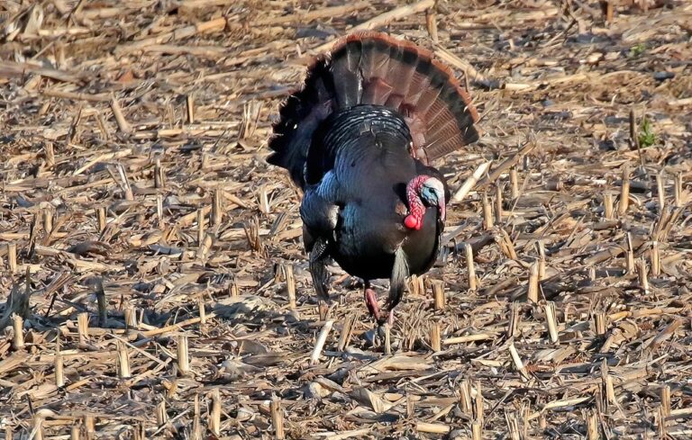
Adult wild turkey gobblerPhoto: fishhawk (CC BY 2.0)
Brief answers about access program records
Is advance booking part of using the access programs?
Each access program has its own agreement, so the rules sheet on a record says how to sign in, where to park and what dates apply. Check the page before you drive.
Can bait, snares or set guns be used on the access programs?
The rule is statewide: food, salt, traps, snares and set guns may not be used on game animals or game birds (hunting laws page).
Is there a pin map that shows the access programs?
Pick by county, by name in the filter, or by pin on the land map, then open the page for distances to the closest towns.
Do all the state parks admit hunters?
Check the closed list: 55 places are shut to hunters, from state parks to reservations.
Is the Conservation License part of the price for the access programs?
Start with $10 plus $8 (resident) or $50 plus $10 (nonresident), then buy the species license (license page).
What is the square-inch rule for hunter orange?
The orange rule is statewide at 400 square inches above the waist (hunting laws page).
What about hunting between the high water marks?
Hunting game animals between the ordinary high water marks of a stream needs landowner permission, while upland game birds and waterfowl may be hunted below the mark, with permission needed to retrieve above it.
What size is the list of hunting access programs for this state?
There are 74 records across 31 counties on file.
Which of the access programs spreads over the most ground?
At 133,543 acres, Stimson Lumber Company outweighs every other record in this group (Stimson Lumber Company).
From the table to the trailhead
Check access, seasons and permits with the managing agency before the truck is loaded.