Home › Montana › Public land › Block Management › Region 4 BMAs
Checked November 19, 2026
Where Region 4 Hunters Find Block Management
160 sheets, 12 counties and 1,256,408 acres make up Region 4.
The photo above is regional landscape, chosen to set the mood and not to picture a place.
Photo: U.S. Forest Service Northern Region (CC BY 2.0)
Region 4 by the data
110 sign-in areas, 46 permission-first areas and 4 mixed ones make up the region.
159 of the 160 sheets print a deer and elk district number that matches a district page.
Chain Buttes BMA is the biggest of the 160, with 155,287 acres.
FWP Region 4 headquarters office answers for Region 4 at (406) 454-5840.
Counts from the FWP Block Management records, retrieved November 19, 2026; checked November 19, 2026. A BMA is identified by region plus number.
Every Region 4 area in one table
| Block | Counties | Acreage | Permission type | HD |
|---|---|---|---|---|
| 2 Calf BMA | Fergus | 7,016 | Type 1 | HD 417 |
| 2 Wolf Creeks BMA | Judith Basin | 6,320 | Type 1 | HD 419 and more |
| 9 Bar Diamond BMA | Chouteau | 5,485 | Type 2 | HD 447 |
| Aj Kuhry Ranch BMA | Petroleum | 4,520 | Type 1 | HD 410 |
| Ap-2 Crow BMA | Petroleum | 7,335 | Type 2 | HD 410 |
| Ap-Pn Ranch BMA | Fergus | 16,000 | Type 2 | HD 426 and more |
| Armington BMA | Cascade | 1,612 | Type 1 | HD 432 |
| Judith Basin | 3,743 | Type 1 | HD 419 and more | |
| B&H Ranch BMA | Judith Basin | 7,080 | Type 1 | HD 418 |
| B&L Farms BMA | Teton | 459 | Type 1 | HD 404 |
| Bair Ranch Foundation BMA | Meagher | 30,937 | Type 2 | HD 416 and more |
| Bear Springs Bench BMA | Fergus | 3,480 | Type 1 | HD 426 |
| Big Rose Colony BMA | Toole | 13,046 | Type 1 | HD 401 and more |
| Big Stone Colony BMA | Cascade | 9,876 | Type 1 | HD 413 |
| Birch Creek BMA | Meagher | 15,380 | Type 1 | HD 446 |
| Birch Creek Colony BMA | Pondera | 12,780 | Type 1 | HD 406 and more |
| Bird Creek Ranch BMA | Cascade | 2,292 | Type 2 | HD 445 |
| Birdtail Butte BMA | Cascade | 8,922 | Type 2 | HD 421 |
| Black Butte BMA | Fergus | 2,465 | Type 2 | HD 412 |
| Blakeslee BMA | Petroleum | 3,114 | Type 1 | HD 410 |
| Bold Ranch BMA | Fergus | 8,150 | Type 2 | HD 417 |
| Teton | 11,455 | Type 1 | HD 404 | |
| Boone And Crockett BMA | Teton | 6,072 | Type 2 | HD 441 |
| Bossele Ridge BMA | Teton | 1,515 | Type 1 | HD 404 |
| Box Elder Creek BMA | Petroleum | 2,367 | Type 1 | HD 410 |
| Boyce Bros BMA | Fergus | 7,870 | Type 2 | HD 417 |
| Browning Ranch BMA | Petroleum | 4,520 | Type 1 | HD 410 and more |
| Camrose Colony BMA | Toole | 3,990 | Type 1 | HD 400 |
| Cascade Colony BMA | Cascade | 21,883 | Type 1 | HD 421 |
| Catlin Ranch BMA | Meagher | 8,437 | Type 1 | HD 451 and more |
| Chain Buttes BMA | Petroleum | 155,287 | Type 1 | HD 410 |
| Checkerboard Creek BMA | Meagher | 2,272 | Type 2 | HD 452 |
| Chimney Rock BMA | Petroleum | 8,776 | Type 1 | HD 410 |
| Chokecherry Bend BMA | Cascade | 718 | Type 2 | HD 445 |
| Cl&A BMA | Teton | 5,752 | Type 1 and 2 | HD 404 |
| Coffee Creek BMA | Judith Basin | 1,760 | Type 2 | HD 419 |
| Cottonwood Creek BMA | Fergus | 2,925 | Type 2 | HD 411 |
| Coyote Bench BMA | Judith Basin | 4,008 | Type 1 | HD 419 and more |
| Pondera | 2,154 | Type 1 | HD 400 and more | |
| Davis Gilfeather BMA | Petroleum | 4,600 | Type 1 | HD 410 |
| Dawson Ranch (North) BMA | Cascade | 4,079 | Type 2 | HD 432 and more |
| Dawson Ranch (South) BMA | Cascade | 5,255 | Type 2 | HD 432 |
| Deadman BMA | Lewis and Clark | 3,800 | Type 2 | HD 421 |
| Desert Claims Farm BMA | Liberty | 5,666 | Type 1 | HD 400 |
| Diamond BMA | Teton | 310 | Type 1 | HD 404 |
| Double A BMA | Pondera | 1,820 | Type 1 | HD 406 |
| Double Creek Farms BMA | Teton | 1,404 | Type 1 | HD 404 |
| Duce Creek BMA | Liberty, Toole | 15,160 | Type 1 | HD 401 |
| Duck Creek BMA | Petroleum | 1,407 | Type 1 | HD 410 |
| Dugout Coulee BMA | Chouteau | 7,635 | Type 1 | HD 400 |
| Eagle Point BMA | Teton | 1,280 | Type 1 | HD 450 |
| East Indian Buttes BMA | Fergus | 76,324 | Type 1 | HD 410 |
| Ecc BMA | Liberty | 13,605 | Type 2 | HD 401 |
| Elk Creek Colony BMA | Lewis and Clark | 4,744 | Type 1 | HD 444 and more |
| Erf BMA | Toole | 4,600 | Type 1 | HD 401 |
| Evergreen Farms BMA | Liberty | 7,072 | Type 1 | HD 400 |
| Everson Bench BMA | Fergus | 2,550 | Type 1 | HD 426 |
| Fairhaven Colony BMA | Cascade | 21,396 | Type 1 | HD 421 |
| Farbo Farms BMA | Toole | 2,380 | Type 1 | HD 403 |
| Flat Creek BMA | Chouteau | 2,883 | Type 1 | HD 471 |
| Freezeout Lake BMA | Teton | 7,590 | Type 1 | HD 444 |
| Pondera | 3,399 | Type 2 | HD 406 | |
| Geyser South BMA | Judith Basin | 994 | Type 2 | HD 432 |
| Golden Spur BMA | Pondera | 1,090 | Type 1 | HD 400 |
| Grasslands Colony BMA | Cascade | 9,357 | Type 1 | HD 413 |
| Greenleaf BMA | Cascade | 191 | Type 2 | HD 404 |
| Grr Farms BMA | Liberty | 2,500 | Type 1 | HD 400 |
| H&F Farms BMA | Teton | 1,504 | Type 1 | HD 404 |
| Haywire Cattle Company BMA | Petroleum | 4,318 | Type 1 | HD 410 |
| Hfi BMA | Teton | 3,074 | Type 1 | HD 404 |
| Hi-Line BMA | Toole | 8,164 | Type 1 | HD 401 |
| Hill Top Colony BMA | Cascade | 9,210 | Type 1 | HD 413 |
| Cascade | 1,087 | Type 1 | HD 421 | |
| Holiday West BMA | Pondera | 5,235 | Type 1 | HD 404 and more |
| Indian Creek Forks BMA | Judith Basin | 513 | Type 1 | HD 419 |
| J Bar J BMA | Petroleum | 7,720 | Type 1 | HD 410 |
| Judith River BMA | Judith Basin | 1,200 | Type 1 | HD 420 |
| Kevin Rim BMA | Toole | 13,005 | Type 1 | HD 403 |
| King Coulee BMA | Fergus | 1,307 | Type 1 | HD 426 |
| Lake Creek BMA | Teton | 6,044 | Type 1 | HD 404 |
| Lane Elk Ridge BMA | Cascade | 12,522 | Type 1 | HD 445 |
| Lazy H BMA | Chouteau | 3,511 | Type 2 | HD 404 |
| Leveque Ranch BMA | Cascade | 2,200 | Type 2 | HD 445 |
| Liberty Colony BMA | Liberty | 8,358 | Type 1 | HD 400 and more |
| Little Muddy Creek BMA | Cascade | 906 | Type 2 | HD 445 |
| Little Valley Ranch BMA | Pondera | 1,294 | Type 1 | HD 406 |
| Loneman Coulee BMA | Pondera | 22,439 | Type 1 | HD 406 |
| 3 counties | 16,350 | Type 2 | HD 400 and more | |
| Many Hills BMA | Chouteau | 2,121 | Type 1 | HD 405 |
| Marias River BMA | Liberty | 83,898 | Type 1 | HD 400 |
| Mathews Ranch BMA | Judith Basin | 3,461 | Type 1 | HD 418 |
| McCarthy Creek BMA | Judith Basin | 2,552 | Type 1 | HD 419 and more |
| McDowell Ranch BMA | Liberty | 6,023 | Type 2 | HD 401 |
| Milford Colony BMA | Lewis and Clark | 12,075 | Type 1 | HD 422 and more |
| Miller Colony BMA | Teton | 3,282 | Type 1 | HD 404 |
| Moline Ranch BMA | Chouteau | 4,929 | Type 2 | HD 471 |
| Mortag Ranch BMA | Cascade | 1,400 | Type 1 | HD 445 |
| Mr2 BMA | Chouteau | 9,506 | Type 2 | HD 447 |
| Murphy Coulee BMA | Fergus | 10,078 | Type 1 | HD 417 |
| N Bar F BMA | Toole | 1,120 | Type 1 | HD 400 |
| New Dorsey BMA | Meagher | 3,615 | Type 1 | HD 580 |
| New Rockport Colony BMA | Teton | 12,611 | Type 2 | HD 404 |
| O Lazy F BMA | Pondera | 640 | Type 1 | HD 400 |
| Oka Butte BMA | Judith Basin | 4,500 | Type 2 | HD 418 and more |
| Olson Farms BMA | Cascade | 4,691 | Type 1 | HD 421 |
| Judith Basin | 800 | Type 2 | HD 432 | |
| Paradise Ranch BMA | Fergus | 1,560 | Type 2 | HD 412 |
| Pheasant Bend BMA | Cascade | 289 | Type 1 | HD 445 |
| Teton | 266 | Type 1 | HD 404 | |
| Pheasants Forever BMA | Fergus | 800 | Type 1 | HD 426 |
| Pike Creek BMA | Petroleum | 1,120 | Type 1 | HD 411 |
| Pleasant Valley Colony BMA | Cascade | 9,698 | Type 1 | HD 413 |
| Plenty Water BMA | Toole | 11,349 | Type 1 | HD 401 |
| Ployhar Farms BMA | Fergus | 256 | Type 1 | HD 426 |
| Promised Land Farm BMA | Chouteau | 3,000 | Type 1 | HD 404 |
| Rader Ranch BMA | Meagher | 2,694 | Type 2 | HD 446 |
| Ridgway Ranch BMA | Judith Basin | 403 | Type 1 | HD 419 |
| Rimrock Colony BMA | Toole | 11,199 | Type 1 | HD 403 |
| Riverdale Ranch BMA | Cascade | 850 | Type 2 | HD 445 |
| Roat Ranch BMA | Fergus | 1,640 | Type 2 | HD 411 |
| Rockport Colony BMA | Teton | 13,895 | Type 1 | HD 441 |
| Rocky Point BMA | Fergus | 4,120 | Type 1 | HD 417 |
| Rtm BMA | Judith Basin | 4,100 | Type 1 and 2 | HD 419 and more |
| Sieben Elk Ridge BMA | Meagher | 1,280 | Type 1 | HD 446 |
| 3 counties | 54,419 | Type 2 | – | |
| Sieben Martien Place BMA | Lewis and Clark | 2,169 | Type 2 | HD 392 and more |
| Silo BMA | Cascade | 374 | Type 1 | HD 445 |
| Simons BMA | Toole | 3,700 | Type 2 | HD 401 |
| South Fork BMA | Meagher | 720 | Type 1 | HD 452 |
| Spring Valley Simmental BMA | Cascade | 1,978 | Type 2 | HD 445 |
| Springdale Colony BMA | Meagher | 9,768 | Type 1 | HD 446 |
| Springdale Ranch BMA | Judith Basin | 80 | Type 2 | HD 418 |
| Sunnybrook Colony BMA | Chouteau | 15,462 | Type 1 | HD 400 |
| Surenough Pass BMA | Fergus | 240 | Type 1 | HD 411 |
| Surprise Creek HB BMA | Judith Basin | 11,920 | Type 1 | HD 419 and more |
| Sweetgrass Hills BMA | Liberty | 41,525 | Type 1 and 2 | HD 401 |
| Petroleum | 20,226 | Type 1 | HD 410 | |
| T Hill BMA | Judith Basin | 3,142 | Type 1 | HD 419 |
| Taffy Creek BMA | Fergus | 5,835 | Type 1 and 2 | HD 417 and more |
| Taplin Rose Farms BMA | Toole | 1,150 | Type 1 | HD 401 |
| Teton River BMA | Chouteau | 2,886 | Type 1 | HD 404 |
| Thurman Field BMA | Cascade | 1,173 | Type 2 | HD 445 |
| Tiber Coulee BMA | Liberty | 1,257 | Type 1 | HD 404 |
| Tiber View BMA | Toole | 5,986 | Type 1 | HD 400 |
| Tin Can BMA | Petroleum | 640 | Type 1 | HD 410 |
| Tomsheck BMA | Toole | 7,353 | Type 1 | HD 401 |
| Townsend Ranch BMA | Meagher | 7,919 | Type 1 | HD 416 and more |
| Tureck BMA | Fergus | 5,000 | Type 2 | HD 419 and more |
| Tv Tower BMA | Petroleum | 1,560 | Type 1 | HD 410 |
| Twin Hills Colony BMA | Chouteau | 1,020 | Type 1 | HD 404 |
| Twin Sisters BMA | Judith Basin | 15,229 | Type 2 | HD 418 |
| Twin Springs BMA | Toole | 803 | Type 1 | HD 401 |
| Vimy Ridge BMA | Chouteau | 4,970 | Type 1 | HD 400 |
| Warm Springs BMA | Fergus | 629 | Type 2 | HD 412 |
| Wedsworth Trust BMA | Cascade | 2,973 | Type 2 | HD 421 |
| White Rock Ranch BMA | Judith Basin | 6,100 | Type 1 | HD 418 |
| Whitlash BMA | Liberty | 1,675 | Type 2 | HD 401 |
| Willow Ridge Ranch BMA | Toole | 8,851 | Type 1 | HD 401 |
| Willshaw Flats BMA | Toole | 5,762 | Type 1 | HD 401 |
| Winnett-South BMA | Petroleum | 1,268 | Type 1 | HD 411 |
Names, counties and sheet data from the FWP Block Management records, retrieved November 19, 2026.
Where these lands sit

Upper Missouri Wild and Scenic River, MontanaPhoto: Bureau of Land Management (CC BY 2.0)
Male northern bobwhite quailPhoto: ilouque (CC BY 2.0)
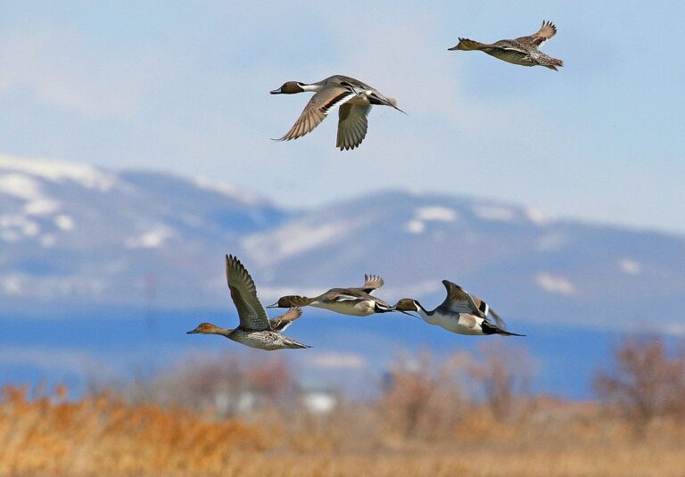
Northern pintails in flightPhoto: USFWS Headquarters (CC BY 2.0)
Brief answers about Region 4 Block Management
Do all the state parks admit hunters?
Check the closed list: 55 places are shut to hunters, from state parks to reservations.
Is the Conservation License part of the price for the Block Management Areas?
Start with $10 plus $8 (resident) or $50 plus $10 (nonresident), then buy the species license (license page).
What is the square-inch rule for hunter orange?
The orange rule is statewide at 400 square inches above the waist (hunting laws page).
What about hunting between the high water marks?
Hunting game animals between the ordinary high water marks of a stream needs landowner permission, while upland game birds and waterfowl may be hunted below the mark, with permission needed to retrieve above it.
What size is the list of Block Management Areas for this state?
There are 160 records across 12 counties and 1,256,408 printed acres on file.
Which of the Block Management Areas spreads over the most ground?
At 155,287 acres, Chain Buttes BMA outweighs every other record in this group (Chain Buttes BMA).
Is advance booking part of using the Block Management Areas?
Block Management is free to the public: Type I areas ask the hunter to sign in, Type II areas need permission from the landowner or FWP first, and each sheet says which. Check the page before you drive.
Can bait, snares or set guns be used on the Block Management Areas?
The rule is statewide: food, salt, traps, snares and set guns may not be used on game animals or game birds (hunting laws page).
Is there a pin map that shows the Block Management Areas?
Pick by county, by name in the filter, or by pin on the land map, then open the page for distances to the closest towns.
From the table to the trailhead
Check access, seasons and permits with the managing agency before the truck is loaded.