Home › Mississippi › Public land › Wildlife management areas › Canal Section WMA

WMA · North Mississippi

Canal Section Wildlife Management Area Hunting Rules and Seasons

Wildlife management area in Itawamba County and 3 more counties with 29,762 acres, run by MDWFP.

Hunting gear

The banner is Monroe County, the closest place with a photograph on file.

Photo: Rob Westbrook (CC BY 2.0)

Getting to Canal Section Wildlife Management Area

Parking, trailheads and gates near Canal Section Wildlife Management Area

  • Old Highway 78 Boat RampBoat ramp · 1.5 mi from the centreDirections
  • Parking areaParking · 2.1 mi from the centreDirections
  • Parking areaParking · 2.2 mi from the centreDirections
  • Parking areaParking · 2.2 mi from the centreDirections
  • Parking areaParking · 2.3 mi from the centreDirections
  • Parking areaParking · 2.3 mi from the centreDirections
  • Parking areaParking · 2.3 mi from the centreDirections
  • Parking areaParking · 2.4 mi from the centreDirections
  • Parking areaParking · 2.4 mi from the centreDirections
  • Parking areaParking · 2.4 mi from the centreDirections
  • Parking areaParking · 2.5 mi from the centreDirections
  • Parking areaParking · 2.5 mi from the centreDirections

Parking, trailhead and gate locations come from OpenStreetMap contributors. Roads into public land can be gated or seasonal; check with the managing agency before you go.

Canal Section WMA at a glance

Across 4 counties including Itawamba, Monroe and Prentiss, Canal Section WMA is a wildlife management area wildlife management area of 29,762 acres under MDWFP. The area brochure ties Canal Section WMA to the North Regional Office for regional questions. Records for Canal Section WMA list these quarry: deer, turkey, squirrel, rabbit, raccoon, opossum and bobcat, trapping and waterfowl.

29,762Acres
4Counties
NorthMDWFP region
9Game groups
$15User permit
8Draw hunts
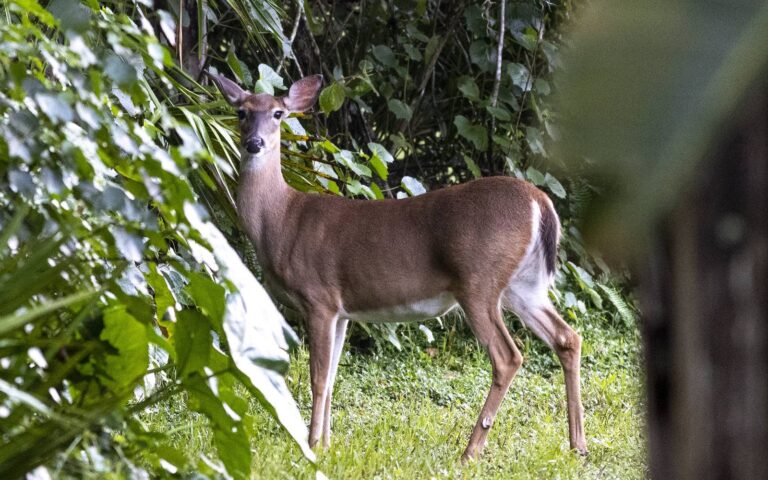
Whitetail doe standing at the edge of a green clearing

From the agency records read on November 14, 2026: MDWFP area page, MDWFP WMA list, WMA brochure, source 4.

Nearby

Places to hunt and shoot around Canal Section Wildlife Management Area

Shooting Ranges Near Fulton

Range · 3 mi from Canal Section Wildlife Management Area

Directions
Hunting Near Fulton, Mississippi

Town · 3 mi from Canal Section Wildlife Management Area

Directions
Hunting Near Mantachie, Mississippi

Town · 5 mi from Canal Section Wildlife Management Area

Directions
Lee County

County · 13 mi from Canal Section Wildlife Management Area

Directions
Shooting Ranges Near Tupelo

Range · 16 mi from Canal Section Wildlife Management Area

Directions
Shooting Ranges Near Okolona

Range · 25 mi from Canal Section Wildlife Management Area

Directions

Canal Section WMA season dates, 2026-27

The table counts 16 season lines taken from the Canal Section WMA brochure, with 7 aimed at deer. Where the brochure adds a comment, the notes cell carries a short version of it. Because the brochure is joint (Canal Section and John Bell Williams), check which area each line names.

HuntOpeningClosingPermit?CommentOpen now?
RaccoonJul 1, 2026Sep 30, 2026OpenFri and Sat nights
Youth squirrelSep 24, 2026Sep 30, 2026Open–
Deer, archeryOct 1, 2026Nov 20, 2026OpenAntlerless and bucks
Raccoon, opossum, bobcatOct 1, 2026Feb 28, 2027Open–
SquirrelOct 1, 2026Feb 28, 2027Open–
RabbitOct 17, 2026Feb 28, 2027Open–
TrappingNov 1, 2026Feb 28, 2027Open–
Deer, youth deerNov 7, 2026Nov 20, 2026OpenAntlerless and bucks
Deer, gunNov 21, 2026Dec 1, 2026OpenBucks only
Deer, primitive weaponDec 2, 2026Dec 15, 2026OpenAntlerless and bucks
Deer, gunDec 16, 2026Dec 23, 2026OpenAntlerless and bucks
Deer, gunDec 24, 2026Jan 20, 2027OpenBucks only
Deer, primitive weaponJan 21, 2027Jan 31, 2027OpenAntlerless and bucks
Youth turkeyMar 8, 2027Mar 14, 2027Open–
TurkeyMar 15, 2027Mar 31, 2027OpenPermit rules apply
TurkeyApr 1, 2027May 2, 2027Open–

From the 2026-27 WMA brochure (Mississippi Department of Wildlife, Fisheries, and Parks), brochure dated April 2026; checked November 14, 2026.

Permits and check-in at Canal Section WMA

Everyone on Canal Section WMA except those exempt from buying a hunting or fishing license carries the annual statewide WMA User Permit: $15.00 for residents and $30.00 for non-residents. Residents also pay $1.00 to the agent and $2.49 to process the sale, as the price page prints. The permit does not replace your hunting license, which is covered on the license page. Features MDWFP has plotted at Canal Section WMA: 17 boat ramp, 2 check station, 1 data collection, 6 deer station, 1 headquarters and 3 permit station. Part of the hunting on Canal Section WMA runs through the draw, and the draw hunts page explains how it works.

ContactListed value
Phone(601) 432-2199, (662) 563-6221, (662) 840-5172
HQ GPS34.4863, -88.3567

MDWFP price page and the area brochure (MDWFP area page, MDWFP WMA list, WMA brochure); checked November 14, 2026.

How the draw works at Canal Section WMA

Across 1 draw schedules the area offers 8 hunts, a combined quota of 240. The windows in the second table are the ones MDWFP printed for each draw type. Missing a draw earns one bonus point per type per year, which stacks as extra entries. Non-resident applicants share the pool but cannot take more than a tenth of the quota.

Draw tableHuntsPermitsBeginsWraps upWhen
Turkey, 20268240March 14 – 15March 29 – 31Held in 2026
DrawStart of windowEnd of window
TurkeyJanuary 15January 31

From the MDWFP WMA draw hunts page and its schedules (Turkey table); bonus points and the non-resident cap from the bonus point page; checked November 14, 2026. Deer draw hunts statewide.

Where Canal Section WMA is and how to drive there

The map point for Canal Section WMA is 34.2615, -88.4512, taken from the MDWFP WMA boundary layer. For supplies, the closest listed town is Fulton, 3 miles off.

The printed route reads as follows. Contact Information

From the area page and brochure (MDWFP area page, MDWFP WMA list, WMA brochure) and the MDWFP WMA boundary layer; checked November 14, 2026.

Canal Section WMA: weapons, dogs, camping and more

Canal Section WMA limits deer hunters to centerfire rifles, slug shotguns, primitive weapons and centerfire handguns. A legal buck has an inside spread of at least 12 inches or a main beam of at least 15 inches, and any antlered buck is legal for hunters 15 and younger. Do not skip Rule 1.1 of the brochure; its safety and conduct items bind every WMA hunter. The wildlife management areas hub summarizes Rule 1.1 for all 54 areas.

SubjectShort answer
CampingNot allowed
HorsesBarred in deer season
DogsSmall game only
Legal buck12 in. spread or 15 in. beam
Bag limitsStatewide, with exceptions
TopicSource text
Bag limitsSame as statewide bag limits, except the bag limit on antlerless deer is one (1) per day and for permitted turkey hunts the bag limit is one gobbler per permitted hunter. ALL harvested deer and turkey count towards statewide bag limits, unless otherwise stated.
WeaponsThe AB3 Waterfowl Impoundment and Matubby Creek Island are closed to all firearms. EXCEPTION: Only archery equipment is allowed for deer hunting in the ARCHERY ONLY DEER HUNTING AREA.
Deer check-inAll deer harvested must be checked at a check station and recorded on WMA Daily Visitor Use Permit card or WMA Check-In App by the hunter who harvested them before leaving the WMA.
TurkeyTurkey hunting for March 15 to March 31 is allowed by special permit only on Canal Section and John Bell Williams WMAs.
WaterfowlThe WMA may be hunted each day from one-half hour before sunrise until 12:00 pm All decoys, boats, and blinds must be removed from the hunting area by 1:00 pm each day. OFF-ROAD MOTORIZED VEHICLES/ATVs/
ArcheryArchery only deer hunting areas include the portions of the WMA between the Tenn-Tom Waterway and the waterway levee from the Acker Lake Tract south to Highway 45/25 at Aberdeen and between the Tombigbee River and the Tenn-Tom Waterway from Highway 6 south to the intersection of the old Tombigbee River and the Tenn-Tom Waterway.
HorsesAt all other times, horseback riding is restricted to hard surface roads. No hunting from horses allowed on Canal Section or John Bell Williams WMAs.
CampingNo camping allowed. John Bell Williams WMA – From the intersection of Highway 30 and Highway 4 on the east side of Booneville, turn east on Highway 4 and go 10.3 miles to County Road 4101. Turn south on County Road 4101 and go 8.9 miles. The WMA headquarters is on the right.
High water (brochure)All hunting seasons (excluding waterfowl season) are closed for 24 hours from south of Walker's Levee boat ramp road to north of Ironwood Bluff Road on the WMA when the 5 am Tombigbee River gauge at Fulton reads 16.0 ft or higher.
Closed areas (brochure)No deer or hog hunting from the Tenn-Tom Waterway Levee. No loaded centerfire rifles or primitive weapons allowed on the Tenn-Tom Waterway levee. Hunters must be past the toe of the levee before loaded weapons for deer hunting are allowed.
Boats (brochure)ORVs/ATVs/Electric bicycles are not allowed on Canal Section WMA. ORVs/ ATVs/ Electric bicycles are allowed on John Bell Williams WMA only for the retrieval of harvested deer or hogs. Watercraft left unattended must be registered or have the owner's name and phone number permanently and legibly written and attached to the hull.

From the 2026-27 area brochure and the MDWFP area page (MDWFP area page, MDWFP WMA list, WMA brochure); Rule 1.1 and area texts; checked November 14, 2026.

Harvest on file for Canal Section WMA

The 2025 DMAP report counts 30 deer reported harvested at Canal Section WMA: 23 bucks and 7 does. Spread over 29,762 DMAP acres, the count is one deer per 992 acres.

302025 deer reported
23Bucks
7Does
992Acres per deer

These totals are MDWFP's, limited to harvest that was reported.

From 2025 DMAP report; checked November 14, 2026.

Shooting light schedule for Canal Section WMA

Resident game, deer included, may be taken from half an hour before sunrise until half an hour after sunset, and the Canal Section WMA figures below are worked out with the NOAA solar formula.

WhenEventFirst lightLast lightDeer legalMigratory legal
Oct 1, 2026Archery, Delta and Hills6:47 a.m.6:40 p.m.6:17 a.m. to 7:10 p.m.6:17 a.m. to 6:40 p.m.
Oct 15, 2026Archery, Southeast6:58 a.m.6:21 p.m.6:28 a.m. to 6:51 p.m.6:28 a.m. to 6:21 p.m.
Nov 7, 2026Youth gun deer6:19 a.m.4:57 p.m.5:49 a.m. to 5:27 p.m.5:49 a.m. to 4:57 p.m.
Nov 21, 2026Gun deer opens6:32 a.m.4:48 p.m.6:02 a.m. to 5:18 p.m.6:02 a.m. to 4:48 p.m.
Nov 26, 2026Quail season opens6:37 a.m.4:46 p.m.6:07 a.m. to 5:16 p.m.6:07 a.m. to 4:46 p.m.
Nov 27, 2026Duck season opens6:38 a.m.4:46 p.m.6:08 a.m. to 5:16 p.m.6:08 a.m. to 4:46 p.m.
Dec 2, 2026Primitive weapon deer6:42 a.m.4:45 p.m.6:12 a.m. to 5:15 p.m.6:12 a.m. to 4:45 p.m.
Dec 21, 2026Year's shortest day6:56 a.m.4:48 p.m.6:26 a.m. to 5:18 p.m.6:26 a.m. to 4:48 p.m.
Mar 15, 2027Turkey season opens7:06 a.m.7:01 p.m.6:36 a.m. to 7:31 p.m.6:36 a.m. to 7:01 p.m.

Migratory birds stop at sunset.

Hours rules from the MDWFP general hunting rules and the 2026-27 migratory game bird digest (Mississippi Department of Wildlife, Fisheries, and Parks); sunrise and sunset worked out for this location with the NOAA solar formula on Central Time; checked November 14, 2026. Legal hours for every county.

Canal Section WMA: CWD zones, regions and districts by county

MDWFP places 2 of these counties in North MS Management Zone. The layer lists 4,940 samples and 8 positives for the 4 counties of Canal Section WMA. The county layer gives no year for the counts, which makes them running totals. Do not put out supplemental feed in Prentiss and Tishomingo counties; the ban is in force. Deer units here follow highway and river boundaries, so no county can be assigned to one. Follow the links to the zone map page, the county table or the unit definitions.

CountyMDWFP regionDistrictCWD zoneFeedingPositives of samples
ItawambaNorth9Outside zonesNo ban0 of 2,277
MonroeNo label8Outside zonesNo ban0 of 593
PrentissNorth9Whole countyBanned1 of 282
TishomingoNorth9Whole countyBanned7 of 1,788

MDWFP county layer (County_Info), CWD management zones and deer management units; region labels are the layer’s only county source; checked November 14, 2026.

Base towns for a Canal Section WMA trip

The five towns closest to Canal Section WMA range from 3 miles to 25 miles away. Tupelo is the biggest of the five at 37,775 people in 2024. For CWD samples, the nearest drop-off is Canal Section WMA HQ (Fulton), under a mile off.

TownCountyPop. 2024Miles offBearing
FultonItawamba4,6403 mileseast
MantachieItawamba1,1455 milesnorthwest
TupeloLee37,77516 mileswest
New SitePrentiss–20 milesnorth
OkolonaChickasaw2,41625 milessouthwest

Dsp Armory, Inc sporting goods

Fulton, Itawamba County · about 3 mi

Nabe's Gun Shop Incorp sporting goods

Fulton, Itawamba County · about 5 mi

Ben Mears taxidermy

Mantachie, Itawamba County · about 8 mi

Buse Sporting Goods sporting goods

Mantachie, Itawamba County · about 8 mi

Country Taxidermist taxidermy

Nettleton, Monroe County · about 15 mi

Ray Smith taxidermy

Amory, Monroe County · about 20 mi

Towns from Census 2024 estimates; CWD drop-off sites from the MDWFP drop-off list; businesses from services listings; straight-line miles; checked November 14, 2026.

What sits near Canal Section WMA

Next on the map is John Bell Williams WMA, a 16 miles hop north. The six closest pins break down as 6 WMA. Distances are straight lines from the Canal Section WMA point and ignore roads, rivers and closures.

NameKindSize (ac)CountyAwayBearing
John Bell Williams WMAWMA3,000Prentiss16 milesnorth
Divide Section WMAWMA15,300Tishomingo33 milesnorth
Chickasaw WMAWMA28,000Chickasaw34 milessouthwest
Hell Creek WMAWMA2,344Tippah43 milesnorthwest
Tuscumbia WMAWMA2,600Alcorn48 milesnorth
Upper Sardis WMAWMA50,485Lafayette51 mileswest

Point from the MDWFP WMA boundary layer; straight-line distances. Statewide public land map.

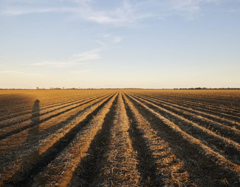
Plowed cotton rows glowing in low sun

Plowed cotton rows glowing in low sunPhoto: Free Public Domain Illustrations by rawpixel (CC BY 2.0)

Wooded valley and river seen from a high overlook on the Yazoo River

Wooded valley and river seen from a high overlook on the Yazoo RiverPhoto: Kevin (CC BY 2.0)

Cotton picker working a white cotton field

Cotton picker working a white cotton fieldPhoto: NatalieMaynor (CC BY 2.0)

Canal Section WMA hunting questions, answered from the sources

Where will I find Canal Section WMA?

Canal Section WMA is a wildlife management area across 4 counties including Itawamba, Monroe and Prentiss. Its nearest listed town is Fulton, about 3 miles in a straight line. Its regional office is the North Regional Office.

Who manages Canal Section WMA and how big is it?

Canal Section WMA covers 29,762 acres and answers to MDWFP. Its source is the agency record.

What do I need in hand before hunting Canal Section WMA?

The brochure requires the annual WMA User Permit, priced at $15.00 for residents and $30.00 for others. Certain seasons require winning the draw.

What animals can hunters pursue at Canal Section WMA?

Per the agency sources: deer, turkey, squirrel, rabbit, raccoon, opossum and bobcat, trapping and waterfowl. Check the hunting seasons guide for dates and limits.

What are the season dates for Canal Section WMA?

The 2026-27 brochure prints 16 dated season rows, from raccoon on Jul 1, 2026 to turkey ending May 2, 2027. Deer take up 7 rows.

Is there a lottery for Canal Section WMA?

MDWFP lists 8 draw hunts with 240 permits for Canal Section WMA; apply online in the window for the hunt type, and bonus points add entries after an unsuccessful try. The WMA draw hunts guide lays out the rules.

Does Canal Section WMA allow overnight camping?

Camping is not allowed, per the brochure.

What do the rules say about vehicles, dogs and horses at Canal Section WMA?

In short, dogs: small game only; horses: barred in deer season. The brochure carries the full wording.

What are the legal hunting hours at Canal Section WMA?

Resident game, deer included, runs from half an hour before sunrise to half an hour after sunset, while migratory birds end at sunset; the sources print no hours for spring turkey. Daily times are on the hours page.

What is the CWD status around Canal Section WMA?

8 of 4,940 samples from its 4 counties tested positive on the layer, and 2 of 4 counties are zoned. Rules for each zone sit on the CWD page.

Which public hunting areas are close to Canal Section WMA?

Closest by straight line: John Bell Williams WMA (16 miles), Divide Section WMA (33 miles) and Chickasaw WMA (34 miles).

Which towns are closest to Canal Section WMA?

Hunters resupply in Fulton (3 miles), Mantachie (5 miles) and Tupelo (16 miles).

Do I have to record my harvest at Canal Section WMA?

Yes, a deer taken on the area must be recorded on the card or the app before you leave, and hunters collect weight, antler and jawbone data when staff are absent.
Settle these points before going to Canal Section WMA

Plan with this page, then reread the agency page for Canal Section WMA in the week before you go.

Sources: source 1 · source 2 · source 3 · source 4 · source 5; statewide seasons from the 2026-27 MDWFP hunting seasons sheet. Checked November 14, 2026.

Other photos on this page: Gary Leavens (CC BY-SA 2.0).