Home › Montana › Counties › Roosevelt County
FWP Region 6
Roosevelt County hunting by district and season
A district-by-district look at Roosevelt County, covering 1 deer and elk district, the season table and 15 public hunting areas.
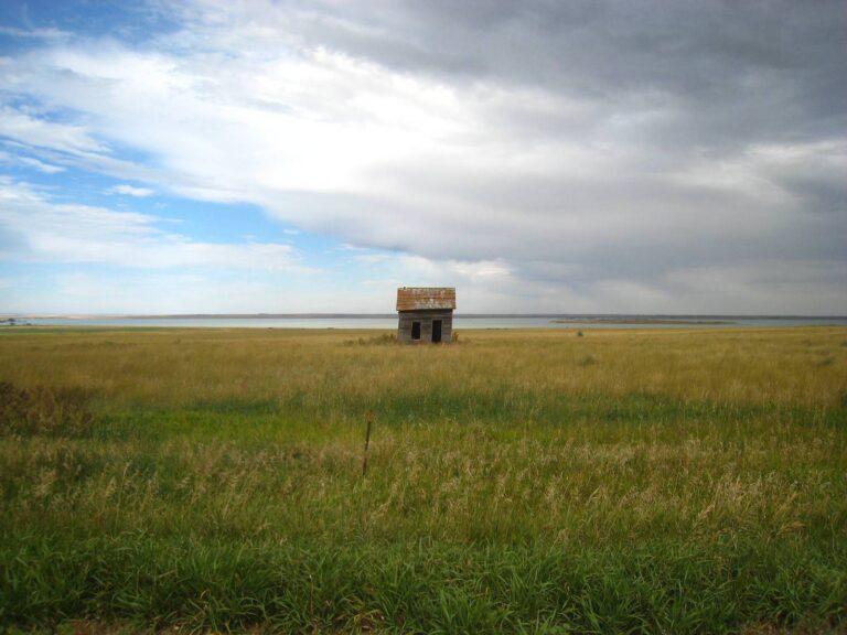
Rugged Hills, Lakeside, MT, Roosevelt County, Montana
Photo: Warren LeMay (CC BY-SA 2.0)
Roosevelt County, first look
The 2024 Census estimate puts Roosevelt County at 10,197 residents. The figure is 5.6 percent below the 2020 base of 10,798, which places the county 21st of 56 by headcount.
Census measurements give Roosevelt County 2,355 square miles of land. That ranks 29th of 56 counties by land, so plan moderate drives between stops.
Roosevelt County shares county lines with Sheridan County, Richland County, Daniels County, McCone County and Valley County. North Dakota supplies the other neighbors, McKenzie County and Williams County, so check that side’s agency before crossing.
The region assigned to Roosevelt County is Region 6. Its doors are at 1 Airport Road in Glasgow, and its posted hours read Monday – Friday, 8 a.m. – 5 p.m.
Wolf Point serves as the county seat, and the sheriff there can answer local access questions.
Mountain Time (MT) is the clock in Roosevelt County, as it is across the whole state. The spring change comes March 14, 2027, after the last dates in the tables.
Facts from the Census Bureau (2024 estimates and Gazetteer) and the FWP contact page (checked November 19, 2026); key dates from the 2026-27 deer, elk and antelope regulations (Montana Fish, Wildlife & Parks).
Nearby
Places to hunt and shoot around Roosevelt County Hunting Guide
Which districts reach Roosevelt County
The hunting district is the unit that counts: 1 deer and elk district touches Roosevelt County, and the table below names each one.
The legal description of each district names Roosevelt County; none of the 1 rests on a map overlay, and none means the whole county is open.
The deer and elk list
| District | Name | Counties touched | Placed by |
|---|---|---|---|
| HD 640 | Northeast Montana | 4 counties | Legal text |
Other animals and their units
Antelope, moose, sheep, goat, bison, lion and bear use their own district and unit lists, so a number here can name a different area than the deer and elk district with the same digits.
| Game | District or unit numbers | Count | See |
|---|---|---|---|
| Antelope districts | HD 640 | 1 | Tool page |
| Moose districts | HD 600 | 1 | Tool page |
| Bighorn sheep districts | None listed | 0 | Tool page |
| Mountain goat districts | None listed | 0 | Tool page |
| Lion management units | LMU 600 | 1 | Tool page |
| Bear management units | BMU 600 | 1 | Tool page |
| Bison districts | None listed | 0 | Tool page |
| Wolf units | Region 6 | 1 | Tool page |
Money and dates
The cost of a hunt starts with two licenses every hunter needs, the base license and the Conservation License, then adds $16 for resident deer or $20 for resident elk; the drawn nonresident combination is $1,312.
Three draw deadlines matter: April 1 for deer and elk permits and the drawn nonresident combination, May 1 for moose, sheep, goat and bison, and June 1 for Deer B, Elk B and antelope.
Districts and county links from the FWP legal descriptions and the deer, elk and antelope regulations; fees from the FWP fee page and the draw dates from the FWP draw page (Montana Fish, Wildlife & Parks), checked November 19, 2026.
Which seasons reach into Roosevelt County
Duck and goose dates follow the flyway lines, and Roosevelt County sits in the Central Flyway Zone 1, so the waterfowl rows below carry that zone name.
| Game | Season | Paperwork | Where | Earliest | Latest | Today |
|---|---|---|---|---|---|---|
| Deer | B licenses | B license | 1 district | Oct. 24, 2026 | Dec. 20, 2026 | |
| Deer | General license | General license | 1 district | Oct. 24, 2026 | Dec. 20, 2026 | |
| Elk | General license | General license | 1 district | Oct. 24, 2026 | Dec. 20, 2026 | |
| Moose | Drawing licenses | Drawing | 1 district | Sept. 15, 2026 | Nov. 29, 2026 | |
| Black bear | Bear by unit | Bear license | 1 district | Sept. 15, 2026 | Nov. 29, 2026 | |
| Mountain lion | Quota seasons | Quota license | 1 district | Oct. 24, 2026 | May 25, 2027 | |
| Wolf | Wolf, Region 6 | Wolf license | Region 6 | Sept. 15, 2026 | March 15, 2027 | |
| Wolf | Wolf, Region 6 | Wolf license | Region 6 | Nov. 30, 2026 | March 15, 2027 | |
| Wolf | Wolf, Region 6 | Wolf license | Region 6 | Jan. 1, 2027 | Feb. 15, 2027 | |
| Bobcat | Bobcat, Region 6 | Resident license | Region 6 | Dec. 1, 2026 | March 1, 2027 | |
| Pheasant | General pheasant season | Upland license | Statewide | Oct. 10, 2026 | Jan. 1, 2027 | |
| Pheasant | Nonresident 3-day license pheasant | Hunting license | Statewide | Oct. 17, 2026 | Jan. 1, 2027 | |
| Pheasant | General pheasant season | Upland license | Statewide | Oct. 20, 2026 | Jan. 1, 2027 | |
| Pheasant | Nonresident 3-day license pheasant | Hunting license | Statewide | Oct. 20, 2026 | Jan. 1, 2027 | |
| Sharp-tailed grouse | General season | Upland license | Statewide | Sept. 1, 2026 | Jan. 1, 2027 | |
| Sharp-tailed grouse | General season | Upland license | Statewide | Sept. 11, 2026 | Jan. 1, 2027 | |
| Mountain grouse | General season | Upland license | Statewide | Sept. 1, 2026 | Jan. 1, 2027 | |
| Partridge | General season | Upland license | Statewide | Sept. 1, 2026 | Jan. 1, 2027 | |
| Partridge | General season | Upland license | Statewide | Sept. 11, 2026 | Jan. 1, 2027 | |
| Turkey | General turkey license | Over the counter | Statewide | Sept. 1, 2026 | Jan. 1, 2027 | |
| Turkey | Region 6 turkey | Over the counter | Region 6 | Sept. 1, 2026 | Jan. 1, 2027 | |
| Turkey | General turkey license | Over the counter | Statewide | Sept. 11, 2026 | Jan. 1, 2027 | |
| Turkey | Region 6 turkey | Over the counter | Region 6 | Sept. 11, 2026 | Jan. 1, 2027 | |
| Snipe | Statewide snipe season | Migratory license | Statewide | Sept. 1, 2026 | Dec. 16, 2026 | |
| Ducks | Zone 1 ducks | License and stamps | Central zone 1 | Oct. 3, 2026 | Jan. 7, 2027 | |
| Coots | Central Flyway Zone 1 | Migratory license | Central zone 1 | Oct. 3, 2026 | Jan. 7, 2027 | |
| Geese | Zone 1 gooses | Migratory license | Central zone 1 | Oct. 3, 2026 | Jan. 15, 2027 | |
| Sandhill crane | Central Flyway over-the-counter permit | Free license | Central Flyway outside the | Oct. 3, 2026 | Nov. 29, 2026 | |
| Tundra swan | Central Flyway swan special | Special license | Central Flyway | Oct. 3, 2026 | Jan. 7, 2027 | |
| Waterfowl falconry | Central Flyway Zone 1 | Falconry license | Central zone 1 | Sept. 23, 2026 | Jan. 7, 2027 | |
| Waterfowl falconry | Central Flyway Zone 1 | Falconry license | Central zone 1 | Oct. 3, 2026 | Jan. 15, 2027 | |
| Beaver | Trapping season Regions 4-7 | Trapping license | Regions 4 to 7 | Sept. 1, 2026 | May 31, 2027 | |
| Mink | Mink trapping season | Trapping license | Statewide | Nov. 1, 2026 | April 15, 2027 | |
| Muskrat | Muskrat trapping season | Trapping license | Statewide | Nov. 1, 2026 | April 15, 2027 | |
| River otter | Otter trapping season Region | Trapping license | Region 6 | Nov. 1, 2026 | April 15, 2027 | |
| Upland falconry | Falconry season | Upland license | Statewide | Sept. 1, 2026 | March 31, 2027 | |
| Upland falconry | Falconry season | Upland license | Statewide | Sept. 11, 2026 | March 31, 2027 |
From the 2026-27 deer, elk and antelope regulations and the other FWP regulation booklets (Montana Fish, Wildlife & Parks), checked November 19, 2026.
Roosevelt County shooting window on key days
Montana keeps one clock from Libby to Ekalaka, so each reading for Roosevelt County ends in MT, and the sharpest change in the table is the shift back to standard time on November 1.
| Day | Season point | Sun up | Sun down | First legal light | Last legal light |
|---|---|---|---|---|---|
| Sept. 1, 2026 | Fall turkey | 6:16 a.m. MT | 7:44 p.m. MT | 5:46 a.m. MT | 8:14 p.m. MT |
| Sept. 5, 2026 | Archery only | 6:22 a.m. MT | 7:36 p.m. MT | 5:52 a.m. MT | 8:06 p.m. MT |
| Sept. 15, 2026 | Bear and wolf | 6:35 a.m. MT | 7:15 p.m. MT | 6:05 a.m. MT | 7:45 p.m. MT |
| Oct. 10, 2026 | Pheasant | 7:10 a.m. MT | 6:23 p.m. MT | 6:40 a.m. MT | 6:53 p.m. MT |
| Oct. 15, 2026 | Youth deer | 7:18 a.m. MT | 6:13 p.m. MT | 6:48 a.m. MT | 6:43 p.m. MT |
| Oct. 24, 2026 | General season | 7:32 a.m. MT | 5:57 p.m. MT | 7:02 a.m. MT | 6:27 p.m. MT |
| Dec. 1, 2026 | Lion winter | 7:29 a.m. MT | 4:09 p.m. MT | 6:59 a.m. MT | 4:39 p.m. MT |
| Dec. 12, 2026 | Heritage muzzleloader | 7:41 a.m. MT | 4:06 p.m. MT | 7:11 a.m. MT | 4:36 p.m. MT |
| Dec. 21, 2026 | Shortest day | 7:48 a.m. MT | 4:08 p.m. MT | 7:18 a.m. MT | 4:38 p.m. MT |
Hours rules from the FWP deer, elk and antelope regulations (Montana Fish, Wildlife & Parks); sunrise and sunset worked out for this location with the NOAA solar formula on Mountain Time, not copied from the official FWP tables; checked November 19, 2026. Legal hours for every county.
Roosevelt, public acres
The land records name 15 areas in or touching the county (11 Block Management Areas, 1 fishing access site, 1 BLM unit, 1 national wildlife refuge and 1 waterfowl production area), led by Miles City Field Office with 375,000 acres.
Where a refuge, forest or management area crosses into another county, the acres shown cover all of it, and 5 areas do that here.
Block Management Areas number 11 here, filed under Region 6; the number repeats from region to region, so each is named by region and number in the table.
Parcels of state school trust land are not mapped to Roosevelt County in the data, so none is counted here; the trust land page covers the Conservation License and the legal-access rule.
FWP and the federal agencies close Fort Peck Indian Reservation to hunting, so leave it off your scouting list.
For a change of scenery, the nearest areas across the line are Prong Creek BMA (13 miles), Bengochea BMA (14 miles) and Hines BMA (15 miles).
| Type | Total | Largest |
|---|---|---|
| Block Management Areas | 11 | Mccabe BMA |
| Fishing access sites | 1 | |
| BLM units | 1 | Miles City Field Office |
| National wildlife refuges | 1 | |
| Waterfowl production areas | 1 |
Block Management list
| Name | Label | Size in acres | HD |
|---|---|---|---|
| Mccabe BMA | Region 6 #113 | 31,491 | 640 |
| Sandhills BMA | Region 6 #82 | 22,795 | 640 |
| Lost Creek BMA | Region 6 #91 | 6,534 | 640 |
| Sheep Creek BMA | Region 6 #89 | 5,164 | 640 |
| Johnson Lake BMA | Region 6 #90 | 5,021 | 640 |
| Floyd Candee BMA | Region 6 #163 | 4,840 | 650 |
| East Froid BMA | Region 6 #92 | 4,006 | 640 |
| Sand Creek BMA | Region 6 #94 | 3,952 | 640 |
| Big Muddy BMA | Region 6 #109 | 3,432 | 640 |
| Panasuk BMA | Region 6 #108 | 1,634 | 640 |
| Krogedal BMA | Region 6 #110 | 1,025 | 640 |
Other public ground
| Property | Type | Size in acres | Game |
|---|---|---|---|
| Fishing access | 35 | Not listed | |
| Miles City Field Office | BLM | 375,000 | Not listed |
| Refuge | 31,399 | ||
| Production area | 9,942 | Not listed |
Ground in the next counties
| Area | County | Kind | From center |
|---|---|---|---|
| Prong Creek BMA | Richland County | Block Management | 13 miles |
| Bengochea BMA | Richland County | Block Management | 14 miles |
| Hines BMA | Richland County | Block Management | 15 miles |
| Charley Creek BMA | Richland County | Block Management | 17 miles |
| Ralston BMA | Richland County | Block Management | 19 miles |
Areas from the FWP Block Management pages, the wildlife management area pages, FWP fishing access and state park lists and the federal forest, BLM and refuge lists (checked November 19, 2026); acres are the record values, forest and district acres overlap, and distances are straight lines from the county center.
Reported take, district by district
FWP prints deer and elk harvest by hunting district, never by county, so the figures below are hunting district totals for the license year 2025 and cover each whole district, including the parts outside Roosevelt County.
The largest deer count among these districts is HD 640 with 1,696 reported (741 resident and 955 nonresident), worked out from the rows.
| District | Deer taken | Elk taken |
|---|---|---|
| HD 640 | 1,696 | 27 |
Pronghorn takes
| Antelope district | Game | Reported 2025 |
|---|---|---|
| HD 640 | Pronghorn | 76 |
Permit species by district
| Game | District | Reported 2025 |
|---|---|---|
| Moose | HD 600 | 9 |
Turkey harvest does come by county: an estimate of about 19 birds in Roosevelt County for 2025, with about 7 coming in the fall season.
Harvest from the FWP harvest reports and the 2025 turkey workbook (file); district rows added from the resident and nonresident lines, checked November 19, 2026.
Roosevelt County and the CWD zones
Roosevelt County is outside both CWD management zones.
FWP's priority sampling areas leave Roosevelt County out.
Detection maps from FWP are by district, so a county label would be a guess, and none is given.
The stations below belong to the FWP regions that hold most of Roosevelt County; their locations are not county lines.
| Site | Dates open | Hours |
|---|---|---|
| Havre Area Resource Office | ||
| Havre CWD Sampling Station | ||
| Malta CWD Sampling Station |
From the 2026-27 deer, elk and antelope regulations and the FWP CWD page (Montana Fish, Wildlife & Parks, November 2026); zone and priority overlaps worked out from FWP map layers and the Census county layer; checked November 19, 2026.
Towns in Roosevelt County
Roosevelt has 6 places with guides on this site, led by the seat, Wolf Point, and the largest is Wolf Point with 2,522 people.
5 towns in Roosevelt County are incorporated; the others are unincorporated places counted by the Census.
| Place | Role | Residents | Acres within 10 mi |
|---|---|---|---|
| Wolf Point | City | 2,522 | 4,644 acres |
| Poplar | City | 722 | 5,052 acres |
| Culbertson | Town | 706 | 40,521 acres |
| Bainville | Town | 261 | 32,516 acres |
| Froid | Town | 185 | 54,396 acres |
| Brockton | Cdp | Not listed | 24,141 acres |
Towns from the Census Bureau 2024 Gazetteer and population estimates; land within 10 miles sums listed area acres by straight-line distance, so it is an indicator, not a surveyed figure (checked November 19, 2026).
Roosevelt County processors, shops and taxidermists
Local trade, as listed: 2 meat processors, 1 sporting goods store and 1 guide or outfitter listing.
1 guide listing for Roosevelt County appear on the guides' town page entries.
None of these shops has been visited for this guide, and a listing does not vouch for quality.
Businesses from public directories, state lists and the outfitter association (checked November 19, 2026); call ahead for hours.
Roosevelt wildlife office
The FWP desk for Roosevelt County belongs to Region 6. It works from 1 Airport Road in Glasgow.
This page points to offices and leaves out personal names, which change faster than the data do.
FWP Region 6 headquarters office (Glasgow)
FWP headquarters
Havre Area Resource Office
Offices from the FWP contact page (checked November 19, 2026); regions from the FWP region layer, joined to county lines by area overlap.
Events in Roosevelt County
The calendar lists no banquet, class or trial in Roosevelt County, but RMEF Elk River Chapter Banquet in Sidney on December 5, 2026 and Glendive Ducks Unlimited Bingo Night in Glendive on November 21, 2026 are on the board.
Events from organizer pages and public feeds, each row linked to its source; file checked November 19, 2026. Dates change, so confirm with the organizer.
Roosevelt sight-in spots
Nothing in Roosevelt County appears on the range list, a count of zero, so the closest options are Medicine Lake Gun Club (Medicine Lake, 28 miles), Valley County Rifle & Pistol Club (Glasgow, 74 miles) and Forsyth Rifle & Pistol Club (Forsyth, 160 miles), measured from the county center.
| Range | Kind | Town | From center | Phone |
|---|---|---|---|---|
| Medicine Lake Gun Club | Club range | Medicine Lake, Sheridan | 28 miles | (406) 963-2512 |
| Club range | Glasgow, Valley | 74 miles | Not listed | |
| Club range | Forsyth, Rosebud | 160 miles | (866) 239-9451 |
Ranges from club pages, FWP listings and public directories, each row linked to its source on the ranges page; file checked November 19, 2026. Call before you drive: access and hours change.
Roosevelt and the counties around it
Neighbors from the Census adjacency file; district counts, CWD zones and land counts from the 2026-27 regulations and the land records (checked November 19, 2026).
Prairie and an old shed near Medicine Lake, Sheridan County, MontanaPhoto: Chris M Morris (CC BY 2.0)

Vandalia Reservoir on the Milk River, Valley County, MontanaPhoto: Warren LeMay (CC BY-SA 2.0)

Fort Peck spillway, McCone County, MontanaPhoto: Mobilus In Mobili (CC BY-SA 2.0)
Roosevelt hunter FAQ
Which regional desk handles Roosevelt County?
The Region 6 desk in Glasgow takes calls for Roosevelt at (406) 228-3700, and sits at 1 Airport Road.
Which hunting districts are in Roosevelt County?
There are 1 deer and elk district here, HD 640, and every one crosses into other counties too.
What is the first legal day for deer around Roosevelt?
Archery-only deer hunting starts September 5 and the general season October 24 in the earliest district that touches Roosevelt County; later districts open later, so read the district row.
What kinds of open ground does Roosevelt County have?
The county shows 15 public hunting areas: 11 Block Management Areas, 1 fishing access site, 1 BLM unit, 1 national wildlife refuge and 1 waterfowl production area.
What does a Block Management sign-in box mean in Roosevelt?
Hunting on a Block Management Area costs nothing beyond your licenses; Type I means signing in at a box, Type II means getting permission from the landowner or FWP, and Roosevelt County has 11.
When does legal light start and stop today near Roosevelt County?
Today’s window for big game, November 19, 2026, begins 6:42 a.m. MT and ends 4:49 p.m. MT; the figures come from a solar calculation at the county center.
What should a Roosevelt hunter know about CWD?
No CWD management zone lies in Roosevelt County; the two 2026 zones are the Libby zone in Lincoln County and the Kalispell zone in Flathead County, and FWP names no county as a CWD county.
Why can't I find a harvest figure for Roosevelt County itself?
No county deer count exists. District totals do: HD 640 reported 1,696 deer in 2025, the most on this list.
What is the price of getting licensed to hunt Roosevelt County?
Budget $10 plus $8 as a resident before species licenses of $16 (deer) or $20 (elk); a nonresident starts at $50 plus $10 and buys the $1,312 combination.
What does FWP say about Sunday hunting in Roosevelt?
The regulation booklets read for this guide state no statewide Sunday rule, so this page states none for Roosevelt County; confirm with FWP before you plan a Sunday hunt.
Does Roosevelt County follow the Pacific or the Central flyway for ducks?
Waterfowl seasons here are the Central Flyway Zone 1 dates, shown in the season table.
Does age decide hunter education in Roosevelt County?
The rule turns on birth date: after Jan. 1, 1985, a course is required before a license is sold, whatever county you hunt.
From the 2026-27 deer, elk and antelope regulations, the FWP CWD page, the FWP harvest reports and the FWP fee page; checked November 19, 2026.