Home › Georgia › Public land › Chattahoochee Fall Line WMA VPA Tracts
Marion County, Georgia
Chattahoochee Fall Line WMA VPA Tracts Hunting Notes
2026-27 dates for whitetails, squirrels and rabbits, ducks and geese and gobblers, quota lines, reported harvest, access rules and the nearest towns.
Photo: Sitimans (CC BY-SA 2.0)
Getting to Chattahoochee Fall Line WMA: VPA Tracts
Where Chattahoochee Fall Line WMA VPA Tracts sits and who runs it
Chattahoochee Fall Line WMA: VPA Tracts is a privately owned tract that WRD leases for public hunting in Marion and Muscogee counties. It falls in Game Management Region 5, served by the Albany office. It is run by the Georgia DNR Wildlife Resources Division. Size: 9,048 acres, number 1 of 9 VPA properties. Look west of Box Springs (the nearest town we cover), about 3 miles out. Several tracts make up Chattahoochee Fall Line WMA; this is one.
County context for Chattahoochee Fall Line WMA VPA Tracts
| County | Seat | People (2024) | Private-land deer zone | Bear zone | Gator zone | Deer checked 2025-26 |
|---|---|---|---|---|---|---|
| Marion County | Buena Vista | 7,635 | Green | None | Zone 1 | 1,433 |
| Muscogee County | Columbus | 201,830 | Green | None | Zone 1 | 689 |
From the source page (Georgia 2026-27 Hunting Regulations (eRegulations) area listing); counties and zones from the WRD county zone tables; county deer counts from WRD Game Check; population from the Census 2024 estimates. Checked October 13, 2026.
Nearby
Places to hunt and shoot around Chattahoochee Fall Line WMA: VPA Tracts
When Chattahoochee Fall Line WMA VPA Tracts is open this season
Chattahoochee Fall Line WMA VPA Tracts has 5 season lines in the 2026-27 guide, for deer, small game, waterfowl and turkey.
| Species | Season | Days open | Symbols | Details |
|---|---|---|---|---|
| Deer | Archery | Sept. 12-Jan. 10 | — | Antler Restricted Area |
| Deer | Archery | Kendall Creek Tract: Sept. 12-Jan. 31 | — | Antler Restricted Area |
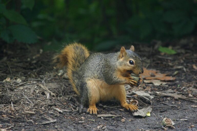
| Small game | — | State Seasons. | — | No fox squirrel hunting. |
| Waterfowl | — | State Seasons | — | Shooting hours end at noon. |
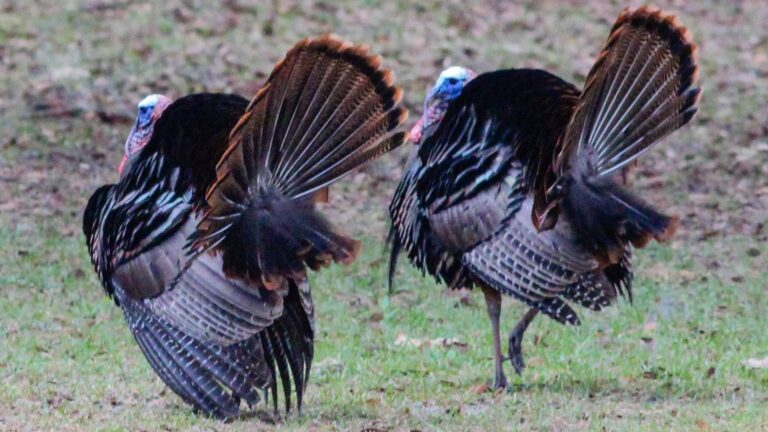
| Turkey | — | Apr. 3-May 15 | — |
Dates and symbols from the 2026-27 Georgia regulations listing, wording as printed by the source. Checked October 13, 2026.
Chattahoochee Fall Line WMA VPA Tracts harvest from Game Check
Game Check logged 35 deer from Chattahoochee Fall Line WMA VPA Tracts in 2025-26: 19 antlered, 16 antlerless. Since 2019-20, totals have run from 4 to 35. The 2026-27 season is under way: 8 deer reported so far. Turkey hunters reported 12 gobblers from Chattahoochee Fall Line WMA VPA Tracts in spring 2026, and 34 across the springs shown. Unadjusted Game Check reports, the finest level WRD publishes.
Deer by season at Chattahoochee Fall Line WMA VPA Tracts
| Year | Bucks | Does | Deer |
|---|---|---|---|
| 2026-27 (in progress) | 2 | 6 | 8 |
| 2025-26 | 19 | 16 | 35 |
| 2024-25 | 7 | 6 | 13 |
| 2023-24 | 6 | 4 | 10 |
| 2022-23 | 9 | 3 | 12 |
| 2021-22 | 7 | 3 | 10 |
| 2020-21 | 6 | 6 | 12 |
| 2019-20 | 3 | 1 | 4 |
Chattahoochee Fall Line WMA VPA Tracts turkey table
| Spring | Turkeys |
|---|---|
| Spring 2026 | 12 |
| Spring 2025 | 4 |
| Spring 2024 | 3 |
| Spring 2023 | 4 |
| Spring 2022 | 1 |
| Spring 2021 | 3 |
| Spring 2020 | 7 |
Deer from WRD deer harvest reports, turkeys from WRD turkey harvest layer; as of 2026-10-13. Checked October 13, 2026.
Chattahoochee Fall Line WMA VPA Tracts: rules before the first hunt
The first card is specific to this ground; the rest are statewide rules that matter here.
Rules on Chattahoochee Fall Line WMA VPA Tracts
Open to the public through a WRD lease, on listed dates only. Entry at 16 and up takes a Georgia license that covers state land, or a Georgia Lands Pass. For deer, bear and turkey you register on Go Outdoors Georgia, starting the previous day. Antler rule here: 4 points (1 inch+) on a side or a 15-inch spread.
- No ATVs or horses
Paperwork for Chattahoochee Fall Line WMA VPA Tracts
A Sportsman's License bundles hunting, big game and fishing for residents; the Harvest Record is free but still required for deer, bear and turkey.
Chattahoochee Fall Line WMA VPA Tracts: orange, pink and baiting
Wear 500 sq in of fluorescent orange or blaze pink above the waist whenever deer or bear firearms or primitive weapons hunts are on. The private-land baiting allowance stops at the boundary; public land is bait-free. Log the animal on your Harvest Record, then report it to Game Check within a day.
Directions to Chattahoochee Fall Line WMA VPA Tracts
From JCT Hwy 80 and 355, go south on 355. Tracts are located on Doctor Brooks Rd., Parker Mill Rd., and Hwy 355. Distance to tracts is between 4 and 10 miles from Hwy 80.
About the land at Chattahoochee Fall Line WMA VPA Tracts
Agency description, field lists and related areas.
Description from WRD
The VPA Tracts total 3,134 acres and are managed as part of Chattahoochee Fall Line WMA. These tracts offers archery hunting opportunities for deer. Turkey and small game may be hunted with all legal weapons. Hunters must check kiosk daily for prescribed burning schedule and locations. Hunters utilizing these areas for deer or turkey hunting should be sure to check their game using Georgia Game Check and select Public Land option, Marion County, and then Chattahoochee Fall Line VPA (for the tracts below only).
Kiosk and hunt maps for all CFL VPA tracts are located on young road. The Chattahoochee Fall Line WMA is made up of 4 management tracts: The Chattahoochee Fall Line WMA was created through a partnership between the DNR, The Nature Conservancy and the U.S. Army at Fort Benning. Through the Army Compatible Use Buffer program, ecologically significant land near the military installation’s border is protected from development that is incompatible with the installation’s national security mission.
Collectively, these areas form a landscape of priority habitats that have enormous potential for ecological restoration, including expansion of a fire-managed longleaf pine ecosystem beneficial to the red-cockaded woodpecker, gopher tortoise and other imperiled species. Individually, they provide for more public recreation lands for such activities as hunting, hiking, fishing, camping, and wildlife viewing.
Other pages that share Chattahoochee Fall Line WMA VPA Tracts's land
| Name | Kind | County | Acres | Deer reported |
|---|---|---|---|---|
| Chattahoochee Fall Line WMA: Fort Perry Tract | WMA | Marion | 2,100 | 6 |
| Chattahoochee Fall Line WMA: Almo Tract | WMA | Talbot, Marion | 6,700 | 31 |
| Chattahoochee Fall Line WMA: Hilliard Plantation Tract | WMA | Marion | 8,089 | 45 |
Text and lists from the source page, Georgia regulations, WRD GIS, WRD GIS; retrieved 2026-10-13, checked October 13, 2026.
Game at Chattahoochee Fall Line WMA VPA Tracts, with limits
Listed game for Chattahoochee Fall Line WMA VPA Tracts: whitetails, squirrels and rabbits, ducks and geese and gobblers.
Species from the area record; bag limits from the WRD bag limit table. Checked October 13, 2026.
Chattahoochee Fall Line WMA VPA Tracts on the map, with its neighbours
Chattahoochee Fall Line WMA VPA Tracts sits at the orange pin, with 12 public neighbours inside 30 miles. That is 60,289 acres of listed ground.
| Area | Category | Acreage | Straight line | Direction | Game Check deer |
|---|---|---|---|---|---|
| Upatoi Ravines Natural Area | Natural area | 9,500 | 7 mi | northeast | — |
| Chattahoochee Fall Line WMA: Fort Perry Tract | WMA | 2,100 | 11 mi | east | 6 |
| Chattahoochee Fall Line WMA: Hilliard Plantation Tract | WMA | 8,089 | 11 mi | southeast | 45 |
| Chattahoochee Fall Line WMA: Almo Tract | WMA | 6,700 | 12 mi | east | 31 |
| Sandhills WMA: West | WMA | 2,500 | 18 mi | east | 19 |
| Standing Boy Creek State Park | State park | 1,580 | 19 mi | west | 22 |
| F.D. Roosevelt State Park | State park | 9,049 | 22 mi | north | — |
| Big Lazer Creek WMA | WMA | 7,200 | 24 mi | northeast | 51 |
| Sandhills WMA: East | WMA | 870 | 25 mi | east | — |
| Sprewell Bluff WMA: West | WMA | 6,571 | 26 mi | northeast | 59 |
| Sprewell Bluff WMA: East | WMA | 1,330 | 26 mi | northeast | 12 |
| Blanton Creek WMA | WMA | 4,800 | 28 mi | northwest | 28 |
Points from WRD, USFS, USFWS, NPS, DoD and Recreation.gov layers (WRD WMA Boundary GIS (point inside polygon (centroid falls outside))). Distances are straight-line. Statewide public land map.
Practice before hunting Chattahoochee Fall Line WMA: VPA Tracts
Big Lazer Creek Shooting Range in Talbot County is the nearest range on the WRD list, 23 miles out. Closer private options sit beside it.
Facilities: 100-yard Range
Lines for trap, skeet, sporting clays, 5-stand, steel and shotgun
Lines for rifle, handgun, smallbore, muzzleloader and shotgun
From the WRD range list and the GA DNR range layer, checked October 13, 2026.
Chattahoochee Fall Line WMA VPA Tracts: nearest towns and businesses
Closest towns first; businesses by county and distance.
| Town | County | Miles off | People | Public acres (10 mi) |
|---|---|---|---|---|
| Box Springs | Talbot | 3 mi | — | 27,131 |
| Columbus | Muscogee | 10 mi | 201,830 | 810 |
| Talbotton | Talbot | 13 mi | 738 | 20,519 |
| Cusseta | Chattahoochee | 14 mi | 8,548 | 3,786 |
Counties covered: Marion County, Muscogee County.
Help near Chattahoochee Fall Line WMA VPA Tracts
Chattahoochee Fall Line WMA VPA Tracts contacts
Towns and populations from the Census 2024 estimates; public acres within 10 miles from WRD, USFS, USFWS and DoD layers; businesses from WRD lists, store locators and listings; offices from WRD, DNR Law Enforcement and USFS pages. Checked October 13, 2026. Call ahead.
A week of shooting light for Chattahoochee Fall Line WMA VPA Tracts
WRD’s rule: half an hour before sunrise until half an hour after sunset, with migratory birds ending right at sunset.
Worked out for Chattahoochee Fall Line WMA VPA Tracts in Eastern time from the rule in the Georgia DNR Wildlife Resources Division guide (hunting hours). Hogs, coyotes, raccoons and some furbearers may be hunted at night on private land; check the guide. Shooting hours for every county.
Chattahoochee Fall Line WMA VPA Tracts, asked and answered
When do gobbler hunts run on Chattahoochee Fall Line WMA VPA Tracts?
Apr. 3-May 15. Take one gobbler per area at most.
What game is listed for Chattahoochee Fall Line WMA VPA Tracts?
The area lists whitetails, squirrels and rabbits, ducks and geese and gobblers.
Is hunting at Chattahoochee Fall Line WMA VPA Tracts first come?
No application is needed; the area has no quota lines.
Can I camp during a hunt at Chattahoochee Fall Line WMA VPA Tracts?
The area allows camping in designated spots.
How many deer get reported from Chattahoochee Fall Line WMA VPA Tracts?
Hunters reported 35 deer in 2025-26 (19 bucks).
Are alligators hunted around Chattahoochee Fall Line WMA VPA Tracts?
It is in zone 1; apply in the alligator draw.
What areas neighbour Chattahoochee Fall Line WMA VPA Tracts?
Try Upatoi Ravines Natural Area (7 miles), Chattahoochee Fall Line WMA: Fort Perry Tract (11 miles) and Chattahoochee Fall Line WMA: Hilliard Plantation Tract (11 miles); each has its own page.
How much orange does Chattahoochee Fall Line WMA VPA Tracts require?
500 square inches of orange or blaze pink above the waist during primitive weapons and firearms deer and bear hunts.
What reporting applies at Chattahoochee Fall Line WMA VPA Tracts?
Log it on the Harvest Record before moving it, then report it to Game Check the same day or next.
Is it legal to bait hogs on Chattahoochee Fall Line WMA VPA Tracts?
Not here: the baiting allowance covers private land only.
What kind of place is Chattahoochee Fall Line WMA VPA Tracts?
It is a privately owned tract that WRD leases for public hunting, managed by the Georgia DNR Wildlife Resources Division.
Is Chattahoochee Fall Line WMA VPA Tracts big enough for a full day?
About 9,048 acres.
Chattahoochee Fall Line WMA VPA Tracts: confirm before you go
Public land rules change more often than the printed guide. Recheck Chattahoochee Fall Line WMA VPA Tracts with the manager before you go.
Sources for this page: WRD: chattahoochee fall line wma vpa tracts · Georgia regulations: voluntary public access opportunities · WRD GIS · WRD GIS · WRD GIS; regulations from the 2026-27 Georgia hunting regulations. Checked October 13, 2026.
Other photos on this page: Russ (CC BY 2.0); U.S. Fish and Wildlife Service Southeast Region (Public domain).