Home › New York › Public land › East Branch Fish Creek South Conservation Easement Tract
Easement tract · Region 6
East Branch Fish Creek South Conservation Easement Tract: a hunter's guide for 2026-27
A 2026-27 hunter guide to this easement tract in Lewis County, 22,371 acres.
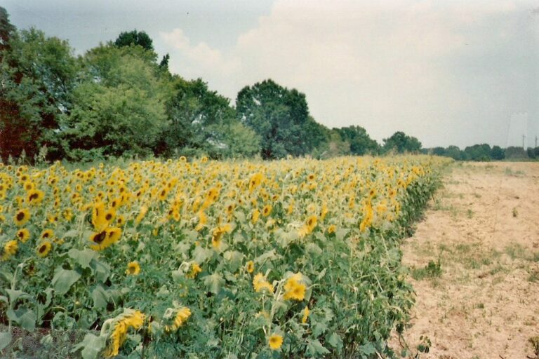
Photo: Dougtone (CC BY-SA 2.0)
Getting to East Branch Fish Creek South Conservation Easement Tract
Where East Branch Fish Creek South Conservation Easement Tract is and who runs it
East Branch Fish Creek South Conservation Easement Tract sits in Lewis County, filed as a conservation easement tract with public recreation rights. Its towns are West Turin, Osceola, Lewis and Turin. Region 6 of DEC covers it, along with the rest of the western Adirondacks, Tug Hill and the St. Lawrence Valley. 22,371 acres are on record from computed area of the DEC Conservation Easements layer polygon(s). Sorted by acreage, the 13 easement tracts put it 5th.
The property page says: Hunting is allowed on the East Branch Fish Creek West Area.
From DEC east branch fish creek south conservat; acreage computed area of the DEC Conservation Easements layer polygon(s); checked October 27, 2026.
Nearby
Places to hunt and shoot around East Branch Fish Creek South Conservation Easement Tract
East Branch Fish Creek South Conservation Easement Tract pinned with nearby tracts
The nearest public land to East Branch Fish Creek South Conservation Easement Tract is Lot 74 Forest Preserve Detached Parcel, 0.5 mi away to the southeast. Combined: 5,086 acres.
| Public land | Type | Acres | WMU | Distance | Direction |
|---|---|---|---|---|---|
| Lot 74 | Detached parcel | 239 | 6N | 0.5 mi | southeast |
| Lot 98 | Detached parcel | 188 | 6N | 1.6 mi | south |
| Lot 69 | Detached parcel | 24 | 6N | 2.4 mi | west |
| Lot 127 | Detached parcel | 272 | 6K | 4.1 mi | southwest |
| East Branch Fish Creek | State forest | 1,399 | 6N | 4.4 mi | north |
| Lot 38 | Detached parcel | 61 | 6N | 4.4 mi | northwest |
| East Osceola | State forest | 1,964 | 6K, 6N | 4.7 mi | southwest |
| Lot 50 | Detached parcel | 124 | 6N | 5.3 mi | west |
| Lot 134 | Detached parcel | 74 | 6K | 5.3 mi | southwest |
| Swancott Mill | State forest | 741 | 6K, 6N | 6.1 mi | south |
Points: DEC Conservation Easements layer (polygon centroid). Straight-line distances. Statewide public land map.
East Branch Fish Creek South Conservation Easement Tract regulations, plainly
On East Branch Fish Creek South Conservation Easement Tract the DEC state land use rules set the ground rules:
- Nothing may be nailed, screwed or cut on East Branch Fish Creek South Conservation Easement Tract: no permanent stands, natural blinds or shooting lanes.
- Tagged portable stands are fine on East Branch Fish Creek South Conservation Easement Tract for the season (name and address or license number on them), then they have to be removed.
- Personal property cannot be stored on East Branch Fish Creek South Conservation Easement Tract, and that includes trail cameras.
- ATVs and trucks are kept to designated or maintained roads.
- Plan any overnight camp around the DEC camping permit rules.
State law reminders for East Branch Fish Creek South Conservation Easement Tract
- Fluorescent orange or pink (250 square inches above the waist, or a hat at least half orange or pink) is required for anyone hunting deer or bear with a gun.
- Firearms may not be discharged within 500 feet of an occupied dwelling, farm building, school, playground or church without permission; bows 150 feet, crossbows 250 feet.
- No baiting for big game, upland birds, turkey or waterfowl, and no salt or mineral licks for deer or bear.
- New York allows hunting on Sundays in every county.
From DEC east branch fish creek south conservat, DEC state land use rules, DEC Places to Hunt, 2026-27 DEC guide; checked October 27, 2026.
WMU 6K facts for East Branch Fish Creek South Conservation Easement Tract
The WMU map puts East Branch Fish Creek South Conservation Easement Tract in 6K, with 6N also overlapping; 6K spans 1,161 square miles of Oneida, Oswego and Lewis. DEC set a 2026 target of 6,500 Deer Management Permits for 6K; average DMP success there runs 18.0%, and a resident's first DMP chance is rated med. Western Periphery bear rules cover 6K. The fall turkey window for 6K is Oct. 1-14.
| WMU | Deer zone | DMP goal | Success rate | Odds (resident) | APR | Implements | Bear | Turkey (fall) |
|---|---|---|---|---|---|---|---|---|
| 6K | Northern | 6,500 | 18.0% | med | No | All | Western Periphery | Oct. 1-14 |
| 6N | Northern | Not authorized by law | NA | – | No | All | Western Periphery | Oct. 1-14 |
Deer take in WMU 6K
6K yielded 5,072 deer in 2022; the WMU tables stop at 2022.
| Year | Total | Adult bucks |
|---|---|---|
| 2016 | 3,960 | 2,358 |
| 2017 | 3,580 | 2,248 |
| 2018 | 4,271 | 2,530 |
| 2019 | 4,483 | 2,968 |
| 2020 | 5,300 | 2,854 |
| 2021 | 4,613 | 2,974 |
| 2022 | 5,072 | 2,892 |
The 2025 bear harvest in 6K came to 18.
DEC's bear plan for 6K reads "Maintain low bear density".
WMU facts from the 2026 DMP table, the 2026-27 DEC guide, DEC deer take reports and the DEC bear harvest dashboard; WMU from the DEC WMU layer; checked October 27, 2026.
Every season window on East Branch Fish Creek South Conservation Easement Tract
31 species have open dates on East Branch Fish Creek South Conservation Easement Tract this license year; the table holds 46 rows and a live open-or-closed column.
| Quarry | Season | Covers | Starts | Ends | Open? |
|---|---|---|---|---|---|
| White-tailed deer | Early Bowhunting | WMUs 6K, 6N | Sep 27, 2026 | Oct 23, 2026 | |
| White-tailed deer | Youth deer weekend | WMUs 6K, 6N | Oct 10, 2026 | Oct 12, 2026 | |
| White-tailed deer | Early Muzzleloading | WMU 6N | Oct 17, 2026 | Oct 23, 2026 | |
| White-tailed deer | Early Muzzleloading | WMU 6K | Oct 17, 2026 | Oct 23, 2026 | |
| White-tailed deer | Regular Season | WMUs 6K, 6N | Oct 24, 2026 | Dec 6, 2026 | |
| Black bear | Early Bowhunting | WMUs 6K, 6N | Sep 19, 2026 | Oct 23, 2026 | |
| Black bear | Youth Firearms Bear Hunt | WMUs 6K, 6N | Oct 10, 2026 | Oct 12, 2026 | |
| Black bear | Early Muzzleloading | WMUs 6K, 6N | Oct 17, 2026 | Oct 23, 2026 | |
| Black bear | Regular Season (Western Periphery) | WMUs 6K, 6N | Oct 24, 2026 | Dec 6, 2026 | |
| Wild turkey | Fall Season | WMUs 6K, 6N | Oct 1, 2026 | Oct 14, 2026 | |
| Wild turkey | Youth Spring Turkey Hunt | WMUs 6K, 6N | Apr 24, 2027 | Apr 25, 2027 | |
| Wild turkey | Spring Season | WMUs 6K, 6N | May 1, 2027 | May 31, 2027 | |
| Pheasant | Youth Pheasant Hunt | WMUs 6K, 6N | Sep 26, 2026 | Sep 27, 2026 | |
| Pheasant | Regular (either sex) | WMUs 6K, 6N | Oct 1, 2026 | Feb 28, 2027 | |
| Ruffed grouse | Hunting | WMUs 6K, 6N | Sep 20, 2026 | Feb 28, 2027 | |
| Woodcock | Hunting | WMUs 6K, 6N | Oct 1, 2026 | Nov 14, 2026 | |
| Cottontail | Hunting | WMUs 6K, 6N | Oct 1, 2026 | Mar 21, 2027 | |
| Snowshoe hare | Hunting | WMUs 6K, 6N | Oct 1, 2026 | Mar 21, 2027 | |
| Gray squirrel | Hunting | WMUs 6K, 6N | Sep 1, 2026 | Feb 28, 2027 | |
| Black squirrel | Hunting | WMUs 6K, 6N | Sep 1, 2026 | Feb 28, 2027 | |
| Fox squirrel | Hunting | WMUs 6K, 6N | Sep 1, 2026 | Feb 28, 2027 | |
| Ducks | Split 1 | Northeastern Zone | Oct 10, 2026 | Nov 29, 2026 | |
| Ducks | Split 2 | Northeastern Zone | Dec 12, 2026 | Dec 20, 2026 | |
| Scaup | 2-scaup window | Northeastern Zone | Nov 19, 2026 | Nov 29, 2026 | |
| Scaup | 2-scaup window | Northeastern Zone | Dec 12, 2026 | Dec 20, 2026 | |
| Canada goose | September season | Northeast goose area | Sep 1, 2026 | Sep 25, 2026 | |
| Canada goose | Regular season | Northeast goose area | Oct 24, 2026 | Nov 29, 2026 | |
| Canada goose | Regular season | Northeast goose area | Dec 12, 2026 | Dec 19, 2026 | |
| Snow goose | Regular season | Northeastern Zone | Oct 1, 2026 | Dec 31, 2026 | |
| Snow goose | Regular season | Northeastern Zone | Feb 26, 2027 | Mar 10, 2027 | |
| Brant | Regular season | Northeastern Zone | Oct 10, 2026 | Nov 8, 2026 | |
| Youth waterfowl | Youth days | Northeastern Zone | Sep 26, 2026 | Sep 27, 2026 | |
| Veteran waterfowl | Veteran days | Northeastern Zone | Sep 26, 2026 | Sep 27, 2026 | |
| Snipe | Hunting | WMUs 6K, 6N | Sep 1, 2026 | Nov 9, 2026 | |
| Rails | Hunting | WMUs 6K, 6N | Sep 1, 2026 | Nov 9, 2026 | |
| Gallinule | Hunting | WMUs 6K, 6N | Sep 1, 2026 | Nov 9, 2026 | |
| Crow | Hunting | WMUs 6K, 6N | Sep 1, 2026 | Mar 31, 2027 | |
| Coyote | Hunting | WMUs 6K, 6N | Oct 1, 2026 | Mar 28, 2027 | |
| Raccoon | Hunting | WMUs 6K, 6N | Oct 25, 2026 | Feb 15, 2027 | |
| Red fox | Hunting | WMUs 6K, 6N | Oct 25, 2026 | Feb 15, 2027 | |
| Gray fox | Hunting | WMUs 6K, 6N | Oct 25, 2026 | Feb 15, 2027 | |
| Bobcat | Hunting | WMU 6N | Oct 25, 2026 | Feb 15, 2027 | |
| Skunk | Hunting | WMUs 6K, 6N | Oct 25, 2026 | Feb 15, 2027 | |
| Opossum | Hunting | WMUs 6K, 6N | Oct 25, 2026 | Feb 15, 2027 | |
| Weasel | Hunting | WMUs 6K, 6N | Oct 25, 2026 | Feb 15, 2027 | |
| Snapping turtle | Hunting | Statewide | Jul 15, 2026 | Sep 30, 2026 |
Season rows from the 2026-27 New York Hunting and Trapping Regulations Guide, matched to the DEC WMU, duck zone and goose area layers; checked October 27, 2026. All New York seasons.
Getting into East Branch Fish Creek South Conservation Easement Tract: parking and maps
Park at one of the 3 access points DEC gives for East Branch Fish Creek South Conservation Easement Tract.
| Access and location | Map |
|---|---|
| Camp Four Road Entrance provides access to the southern portion of the property. Access from Osceola Road in the Town of Lewis. From Osceola Road, head north on Gallo Road, then make left onto the first gravel road: 43.4680, -75.5971 | Open map |
| Michigan Mills Extension Road Entrance provides access to the northern section of the property. Access from the Village of Constableville, following the Highmarket Road which becomes Michigan Mills Road: 43.6040, -75.6175 | Open map |
| Camp Five Road Parking Area is located at the intersection of Camp Four Road and Camp Five Road: 43.5073, -75.6045 | Open map |
Map download: East Branch Fish Creek South Conservation Easement Map · Full Map
Accessible facilities: From the Camp 5 Road Parking Area on East Fork of the Salmon River, wheelchair accessible features include the: Fishing/viewing platform
Parking points and maps from DEC east branch fish creek south conservat; checked October 27, 2026.
East Branch Fish Creek South Conservation Easement Tract: town and county harvest
DEC's last take-by-town table (2019) credits the town of West Turin with 195 deer, 148 of them adult bucks.
| Town | County | 2015 | 2016 | 2017 | 2018 | 2019 | Bucks 2019 |
|---|---|---|---|---|---|---|---|
| West Turin | Lewis | 143 | 172 | 178 | 188 | 195 | 148 |
| Osceola | Lewis | 98 | 142 | 126 | 137 | 110 | 71 |
| Lewis | Lewis | 52 | 106 | 113 | 88 | 118 | 89 |
| Turin | Lewis | 147 | 63 | 145 | 185 | 176 | 114 |
Bears reported by town: West Turin 6 in 2020; West Turin 3 in 2021; West Turin 3 in 2022; Osceola 1 in 2020; Osceola 5 in 2021; Osceola 4 in 2022.
Lewis County deer, 2025: 3,638.
| Year | County deer | Adult bucks | Adult does |
|---|---|---|---|
| 2021 | 3,399 | 2,324 | 927 |
| 2022 | 3,709 | 2,453 | 959 |
| 2023 | 3,541 | 2,393 | 843 |
| 2024 | 3,705 | 2,484 | 1,032 |
| 2025 | 3,638 | 2,244 | 1,097 |
DEC deer take by town and county (towns 2007-2019), county deer take 2021-2025 and DEC bear take by town; checked October 27, 2026.
East Branch Fish Creek South Conservation Easement Tract hunting-hour table
Sun times below are calculated for East Branch Fish Creek South Conservation Easement Tract; the game column adds the big game half hour and the bird column stops at sunset.
| Date | Moment | Sunrise | Sunset | Deer and bear | Waterfowl |
|---|---|---|---|---|---|
| Sep 27, 2026 | Northern bow opener | 6:53 a.m. | 6:52 p.m. | 6:23 a.m. to 7:22 p.m. | 6:23 a.m. to 6:52 p.m. |
| Oct 1, 2026 | Southern bow opener | 6:58 a.m. | 6:45 p.m. | 6:28 a.m. to 7:15 p.m. | 6:28 a.m. to 6:45 p.m. |
| Oct 24, 2026 | Northern regular opener | 7:26 a.m. | 6:06 p.m. | 6:56 a.m. to 6:36 p.m. | 6:56 a.m. to 6:06 p.m. |
| Nov 21, 2026 | Southern regular opener | 7:03 a.m. | 4:33 p.m. | 6:33 a.m. to 5:03 p.m. | 6:33 a.m. to 4:33 p.m. |
| Dec 14, 2026 | Southern late season | 7:28 a.m. | 4:25 p.m. | 6:58 a.m. to 4:55 p.m. | 6:58 a.m. to 4:25 p.m. |
| Jan 1, 2027 | Late season close | 7:36 a.m. | 4:34 p.m. | 7:06 a.m. to 5:04 p.m. | 7:06 a.m. to 4:34 p.m. |
| May 1, 2027 | Spring turkey opener | 5:55 a.m. | 8:03 p.m. | 5:25 a.m. to 8:33 p.m. | 5:25 a.m. to 8:03 p.m. |
Hours rule from the DEC guide sunrise and sunset page; sun times calculated for the county centre (NOAA method), checked against the guide’s Albany table; checked October 27, 2026. Legal hours for every county.
East Branch Fish Creek South Conservation Easement Tract: nearby towns and services
Constableville is the nearest town with its own page, 11 mi from East Branch Fish Creek South Conservation Easement Tract.
| Town | County | Miles | Population | Public land near |
|---|---|---|---|---|
| Constableville | Lewis | 11 mi | 302 | 21,077 |
| Lyons Falls | Lewis | 15 mi | 596 | 34,192 |
| Camden | Oneida | 15 mi | 2,149 | 21,494 |
| Port Leyden | Lewis | 15 mi | 591 | 28,270 |
East Branch Fish Creek South Conservation Easement Tract falls inside these county guides: Lewis County.
East Branch Fish Creek South Conservation Easement Tract: businesses close by
10 licensed guides are registered in Lewis County, per DEC. DEC licensed guides
DEC offices closest to East Branch Fish Creek South Conservation Easement Tract
Towns and populations from Census 2024 estimates; businesses from store locators and listings; DEC offices and licensed guide counts from DEC. Checked October 27, 2026.
East Branch Fish Creek South Conservation Easement Tract: nearest firing lines
Nearest range to East Branch Fish Creek South Conservation Easement Tract: Camden Rod & Gun Club, roughly 15 miles. DEC has no firearm range, and no local public range is close.
From DEC, the operators’ pages and directory listings, checked October 27, 2026.
East Branch Fish Creek South Conservation Easement Tract in pictures


East Branch Fish Creek South Conservation Easement Tract: short answers
How does access work on East Branch Fish Creek South Conservation Easement Tract?
No special permit is listed; a valid license and the open seasons are what count.
What does East Branch Fish Creek South Conservation Easement Tract measure?
About 22,371 acres by the source used here.
Which WMU rules apply on East Branch Fish Creek South Conservation Easement Tract?
WMU 6K (also 6N), in the Northern Zone.
When does the main deer season run on East Branch Fish Creek South Conservation Easement Tract?
WMUs 6K, 6N: regular Season Oct 24 to Dec 6, 2026.
When can I bowhunt deer on East Branch Fish Creek South Conservation Easement Tract?
Bowhunting opens Sep 27, 2026 (WMUs 6K, 6N).
What are the DMP odds near East Branch Fish Creek South Conservation Easement Tract?
Resident first-permit odds in 6K are med; the target is 6,500.
How long is spring turkey on East Branch Fish Creek South Conservation Easement Tract?
May 1 to May 31, 2027, with shooting until noon.
When does bear hunting open near East Branch Fish Creek South Conservation Easement Tract?
Oct 24 to Dec 6, 2026 (regular Season (Western Periphery)).
Which town page is closest to East Branch Fish Creek South Conservation Easement Tract?
Constableville, about 11 mi away.
What are the stand rules on East Branch Fish Creek South Conservation Easement Tract?
No permanent stands or screw-in steps; a labeled portable stand may stay during the season.
What colors are required at East Branch Fish Creek South Conservation Easement Tract in gun season?
Orange or pink, 250 square inches, when hunting deer or bear with a firearm.
What time does hunting end at East Branch Fish Creek South Conservation Easement Tract?
Big game ends 30 minutes after sunset; upland birds at sunset.
East Branch Fish Creek South Conservation Easement Tract: what to double-check
After a deer, bear or turkey on East Branch Fish Creek South Conservation Easement Tract, report it: paper tags within 48 hours, e-tags right away in HuntFishNY.
Sources: DEC east branch fish creek south conservat · DEC · DEC GIS · DEC; regulations from the 2026-27 New York Hunting and Trapping Regulations Guide. Checked October 27, 2026.
Other photos on this page: Tony Webster (CC BY-SA 2.0); greenebriar (Public domain); eflon (CC BY 2.0).