Home › Pennsylvania › Seasons › WMUs
Wildlife Management Units
Pennsylvania WMU Map and Guide
All 22 Wildlife Management Units with their boundaries, public land, antlerless allocations, CWD status and harvest, each linked to its own guide.
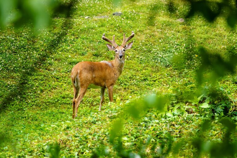
Photo: TheTurducken (CC BY 2.0)
How the WMU system works
Seasons for deer, bear, turkey and furbearers are set by unit. Elk, ducks, geese and other migratory birds use their own zones.
PGC uses 22 Wildlife Management Units in 2026-27 (1A, 1B, 2A-2G, 3A-3D, 4A-4E, 5A-5D) to manage all game except elk, waterfowl and other migratory birds. There is no WMU 2H on the current PGC WMU map or boundary-maps page. Boundaries follow roads and rivers, not county lines; PGC does not publish a county list per WMU (counties null). Boundary text transcribed from PGC map images.
PGC WMU boundary maps, digest. Checked October 12, 2026.
All 22 units side by side
1,469,000 antlerless licenses across the units this year. Sell-out dates are from the 2025-26 sales.
| WMU | Sq mi | SGL sq mi | Public | Antler rule | Antlerless lic. | Sold out 2025 | CWD | Deer 2025-26 | Bears 2025 | Counties |
|---|---|---|---|---|---|---|---|---|---|---|
| 1A | 1,846 | 127 | 7% | 3 up | 52,000 | 8/11 | – | 25,800 | 33 | 6 |
| 1B | 2,118 | 82 | 4% | 3 up | 44,000 | 7/28 | – | 28,700 | 68 | 4 |
| 2A | 1,811 | 69 | 4% | 3 up | 49,000 | 8/30 | – | 22,000 | 2 | 6 |
| 2B | 1,363 | 2 | 0% | 3 up | 62,000 | 11/8 | – | 24,000 | 6 | 5 |
| 2C | 2,934 | 246 | 13% | 3 points | 117,000 | 10/18 | Yes | 34,400 | 106 | 7 |
| 2D | 2,487 | 84 | 3% | 3 up | 112,000 | 8/29 | Yes | 42,300 | 175 | 8 |
| 2E | 1,427 | 119 | 10% | 3 points | 63,000 | 9/8 | Yes | 20,200 | 57 | 4 |
| 2F | 2,411 | 221 | 56% | 3 points | 67,000 | 7/31 | Yes | 26,500 | 228 | 7 |
| 2G | 4,112 | 294 | 51% | 3 points | 57,000 | 8/3 | – | 19,900 | 488 | 10 |
| 3A | 1,508 | 87 | 11% | 3 points | 21,000 | 7/28 | – | 14,500 | 206 | 4 |
| 3B | 2,220 | 277 | 22% | 3 points | 53,000 | 8/26 | – | 22,000 | 300 | 8 |
| 3C | 2,192 | 71 | 3% | 3 points | 57,000 | 8/28 | – | 22,700 | 204 | 5 |
| 3D | 2,102 | 249 | 20% | 3 points | 52,000 | 9/2 | – | 15,600 | 416 | 7 |
| 4A | 1,736 | 157 | 15% | 3 points | 64,000 | N/A | Yes | 13,500 | 73 | 5 |
| 4B | 1,583 | 66 | 15% | 3 points | 71,000 | 11/8 | Yes | 21,100 | 66 | 8 |
| 4C | 1,716 | 261 | 17% | 3 points | 51,000 | 8/13 | Yes | 23,300 | 189 | 8 |
| 4D | 2,743 | 222 | 28% | 3 points | 120,000 | 9/30 | Yes | 24,800 | 152 | 11 |
| 4E | 1,736 | 60 | 4% | 3 points | 61,000 | 9/6 | Yes | 25,000 | 90 | 10 |
| 5A | 1,310 | 14 | 11% | 3 points | 65,000 | 11/20 | Yes | 12,100 | 9 | 4 |
| 5B | 2,640 | 62 | 2% | 3 points | 86,000 | 9/1 | Yes | 30,100 | 2 | 8 |
| 5C | 1,982 | 52 | 3% | 3 points | 101,000 | 10/8 | – | 26,100 | 19 | 7 |
| 5D | 1,327 | 16 | 1% | 3 points | 44,000 | 10/18 | – | 10,100 | 1 | 5 |
PGC WMU maps, allocations, deer harvest 2025-26, bear report 2025. Checked October 12, 2026.
Where each unit sits
Boundary text is transcribed from the PGC unit maps; the guides carry the full description and a link to the PGC map image.
WMU 1A
From Ohio/PA state line, US Route 6 east to US Route 322 at Conneaut Lake; US Route 322 east to PA Route 8 at Franklin; PA Route 8 south to PA Route 228 near Gibsonia; PA Route 228 west to I-76 (PA Turnpike) to PA Route…
WMU 1B
From the New York/PA state line, US Route 62 south to US Route 6 near Warren; US Route 6 west to PA Route 27 at Pittsfield; PA Route 27 south to PA Route 8 at Titusville; PA Route 8 south to US Route 322 at Franklin; US…
WMU 2A
From the Ohio/PA state line, Ohio River east to PA Route 60 near Vanport; PA Route 60 south to US Route 22 near Moon Run; US Route 22 west to PA Route 980 near Santiago; PA Route 980 south to I-79; I-79 south to I-70 at…
WMU 2B
From Washington, I-79 north to PA Route 980 near Canonsburg; PA Route 980 north to US Route 22 near Santiago; US Route 22 east to PA Route 60 near Moon Run; PA Route 60 north to I-76 near New Beaver; I-76 east to PA…
WMU 2C
From the West Virginia/PA state line, US Route 119 north to Toll Road Route 66 near New Stanton; Toll Road Route 66 north to US Route 22 near Delmont; US Route 22 east to I-99 near Hollidaysburg; I-99 south to US Route…
WMU 2D
From Franklin, US Route 322 east to I-80 near Corsica; I-80 east to US Route 219 near DuBois; US Route 219 south to US Route 119 near DuBois; US Route 119 south to US Route 22 near Black Lick; US Route 22 west to PA…
WMU 2E
From near DuBois, I-80 east to PA Route 53 near Kylertown; PA Route 53 south to US Route 22 near Cresson; US Route 22 west to US Route 119 near Blairsville; US Route 119 north to US Route 219 near DuBois; US Route 219…
WMU 2F
From the New York/PA state line, US Route 219 south to I-80 near DuBois; I-80 west to US Route 322 near Corsica; US Route 322 west to PA Route 8 at Franklin; PA Route 8 north to PA Route 27 at Titusville; PA Route 27…
WMU 2G
From the intersection of US Route 6 & Route 872 near Coudersport east on US Route 6 to US Route 15 at Mansfield; US Route 15 south to US Route 220 at Williamsport; US Route 220 west to I-80; I-80 west to US Route 219;…
WMU 3A
From the New York/PA state line, PA Route 14 south to US Route 6 near Troy; US Route 6 west to US Route 219 at Lantz Corners; US Route 219 north to New York/PA state…
WMU 3B
From Mansfield, US Route 6 east to the Susquehanna River at Towanda; Susquehanna River east to US Route 6 at Tunkhannock; US Route 6 east to I-81 near Scranton; I-81 south to PA Route 29 near Nanticoke; PA Route 29…
WMU 3C
From the New York/PA state line, PA Route 652 west to US Route 6 at Indian Orchard; US Route 6 west to Tunkhannock; the boundary between WMUs 3C and 3B between Tunkhannock and Towanda is the Susquehanna River; US Route…
WMU 3D
From the New Jersey/PA line, Portland Toll Bridge to PA Route 611 at Portland; PA Route 611 south to PA Route 512 near Mount Bethel; PA Route 512 west to PA Route 946 near Moorestown; PA Route 946 west to PA Route 248…
WMU 4A
From the Maryland/PA state line, US Route 220 north to I-99 near Bedford; I-99 north to US Route 22 near Hollidaysburg; US Route 22 east to US Route 522 near Mount Union; US Route 522 south to US Route 30 near…
WMU 4B
From Mount Union, US Route 22/522 east to Lewistown; from Lewistown, US Route 22/322 east to PA Route 35 near Mifflintown; PA Route 35 east to PA Route 104 at Mount Pleasant Mills; PA Route 104 south to intersection…
WMU 4C
From Millersburg, US Route 209 east to I-81 near Joliett; I-81 north to PA Route 61 near Frackville; PA Route 61 north to PA Route 42 at Centralia; PA Route 42 north to I-80 near Bloomsburg; I-80 east to I-476 near…
WMU 4D
From Williamsport, US Route 15 to Susquehanna River; Susquehanna River south to PA Route 45 at Lewisburg; PA Route 45 west to PA Route 104 at Mifflinburg; PA Route 104 south to PA Route 35 at Mount Pleasant Mills; PA…
WMU 4E
From Muncy, PA Route 405 east to PA Route 118 at Hughesville; PA Route 118 east to PA Route 29 near Pikes Creek; PA Route 29 south to I-81 near Nanticoke; I-81 south to I-80; I-80 west to PA Route 42 near Bloomsburg; PA…
WMU 5A
From the Maryland/PA state line, PA Route 75 north to US Route 30 at Fort Loudon; US Route 30 east to US Route 11 at Chambersburg; US Route 11 north to PA Route 997 at Green Village; PA Route 997 north to I-76 near…
WMU 5B
From the Maryland/PA state line, PA Route 94 north to US Route 15 near York Springs; US Route 15 north to I-81 near Harrisburg; I-81 east to I-78; I-78 to PA Route 61 near Hamburg; PA Route 61 south to US Route 222 near…
WMU 5C
From Maryland/PA state line, north along the Octoraro Creek to PA Route 372; PA Route 372 east to PA Route 10; PA 10 to I-76; I-76 west to US Route 222; PA Route 222 north to PA Route 61 west of Reading; PA Route 61…
WMU 5D
From Delaware/PA state line near Yorklyn, PA Route 82 west to US Route 30; US Route 30 east to PA Route 113 at Downingtown; PA Route 113 north to I-476; I-476 west to PA Route 563 (Ridge Road); PA Route 563 east…
Which units share which rules
The same groups show up season after season, so this table is a quick way to see what changes when you cross a unit line.
| Rule or season | WMUs |
|---|---|
| Deer archery from Sept. 19 | 2B, 5C, 5D |
| “Three up” antler rule | 1A, 1B, 2A, 2B, 2D |
| CWD detected | 2C, 2D, 2E, 2F, 4A, 4B, 4C, 4D, 4E, 5A, 5B |
| Extended antlerless to Jan. 24 | 2B, 5C, 5D |
| Extended antlerless to Jan. 18 | 4A, 4C, 4D, 5A |
| Bear archery Sept. 19 to Nov. 27 | 2B, 5C, 5D |
| Bear archery Oct. 3 to Nov. 20 | 3C, 3D, 5B |
| Extended bear Nov. 28-Dec. 6 | 3A, 3B, 3C, 3D, 4C, 4E, 5A |
| Extended bear Nov. 28-Dec. 13 | 2B, 5B, 5C, 5D |
| Fall turkey: Oct. 31-Nov. 15 | 1A, 2G, 3A, 4A, 4B, 4D |
| Fall turkey: Oct. 31-Nov. 8 | 1B, 3D, 4C, 4E |
| Fall turkey: Oct. 31-Nov. 15; Nov. 25-27 | 2A, 2F, 3B, 3C |
| Fall turkey: Oct. 31-Nov. 20; Nov. 25-27 | 2B, 2C, 2D, 2E |
| Fall turkey: Oct. 31-Nov. 3 | 5A, 5B |
| Fall turkey: Closed | 5C, 5D |
| Bobcat open | 2A, 2B, 2C, 2D, 2E, 2F, 2G, 3A, 3B, 3C, 3D, 4A, 4B, 4C, 4D, 4E, 5A |
| Fisher open | 1B, 2C, 2D, 2E, 2F, 2G, 3A, 3B, 3C, 3D, 4A, 4B, 4C, 4D, 4E |
| River otter open | 1A, 1B, 2F, 2G, 3A, 3B, 3C, 3D, 4C, 4E |
| Beaver 20 daily / 60 season | 1A, 1B |
| Beaver 20 daily / 40 season | 2A, 2B, 3C |
| Beaver 20 daily / 20 season | 2C, 2D, 2E, 2F, 3A, 3B, 3D, 5C, 5D |
| Beaver 5 daily / 5 season | 2G, 4A, 4B, 4C, 4D, 4E, 5A, 5B |
season table, digest. Checked October 12, 2026.
Licenses and harvest compared
allocations, harvest. Checked October 12, 2026.
WMU questions
How many WMUs does Pennsylvania have?
22: 1A, 1B, 2A to 2G, 3A to 3D, 4A to 4E and 5A to 5D. There is no WMU 2H; it was merged into 2G in 2024.
Which WMU is the largest?
WMU 2G, at 4,112 square miles, with 294 square miles of State Game Lands.
Do WMU lines follow county lines?
No. They follow highways, rivers and other features, and the PGC does not publish a county list per unit. The unit guides show which counties each unit overlaps.
Which WMUs have CWD?
2C, 2D, 2E, 2F, 4A, 4B, 4C, 4D, 4E, 5A and 5B.
Which WMU has the most antlerless licenses?
WMU 4D, with 120,000 for 2026-27.
Where is the "three up" antler restriction?
WMUs 1A, 1B, 2A, 2B and 2D. Elsewhere the rule is three points on one side.
Are elk and waterfowl seasons set by WMU?
No. Elk use Elk Hunt Zones 300 to 310, and ducks and geese use their own zones drawn on highways.
How do I find my WMU?
Type your county into the filter above, then open the unit guides it returns and read the boundary descriptions.