Home › Georgia › Public land › Upatoi Ravines Natural Area
Natural area · Region 5
Upatoi Ravines Natural Area Hunting Guide
A hunter's summary of Upatoi Ravines Natural Area in Talbot County: listing dates, harvest, rules and local services.
Photo: Ken Lund (CC BY-SA 2.0)
Getting to Upatoi Ravines Natural Area
Upatoi Ravines Natural Area: every dated hunt
Across 3 rows, the 2026-27 listing sets dates for deer, turkey and small game. Quota draws cover 2 lines and 80 slots in total.
| Species | Weapon or type | 2026-27 dates | Tags | Area notes |
|---|---|---|---|---|
| Deer | Firearms | Nov. 20-22, Dec. 11-13 | Quota 75 | |
| Turkey | — | May 2-8, 9-15 | Quota 5 | |
| Small game | — | State Seasons | — |
Dates and symbols from the 2026-27 Georgia regulations listing, wording as printed by the source. Checked October 13, 2026.
Nearby
Places to hunt and shoot around Upatoi Ravines Natural Area
Upatoi Ravines Natural Area: the essentials
Talbot County holds Upatoi Ravines Natural Area, a WRD natural area with listed hunts. For WRD purposes it belongs to Region 5, the Albany region. It is run by the Georgia DNR Wildlife Resources Division. Acreage on record: 9,500. Base town: Box Springs, about 5 miles away to the north.
Where Upatoi Ravines Natural Area sits by county
| County | Seat | 2024 residents | Deer colour zone | Bear zone | Gator zone | Deer reported 2025-26 |
|---|---|---|---|---|---|---|
| Talbot County | Talbotton | 5,755 | Green | None | Zone 1 | 1,914 |
From the source page (Georgia 2026-27 Hunting Regulations (eRegulations) area listing); counties and zones from the WRD county zone tables; county deer counts from WRD Game Check; population from the Census 2024 estimates. Checked October 13, 2026.
Upatoi Ravines Natural Area: reported deer and gobblers
No area-level harvest is published for Upatoi Ravines Natural Area. County numbers follow.
| County | Game Check deer | Adjusted deer | Spring 2026 gobblers |
|---|---|---|---|
| Talbot | 1,914 | 2,577 | 93 |
Deer from WRD deer harvest reports, turkeys from WRD turkey harvest layer; as of 2026-10-13. Checked October 13, 2026.
What Upatoi Ravines Natural Area is like
The manager describes the place; related areas follow.
What WRD says about Upatoi Ravines Natural Area
Spanning 9,500 acres in Talbot County, roughly 25 miles east of Columbus, Upatoi Ravines is a newly acquired natural area offering a landscape unlike anything else south of the Fall Line. This newly acquired land is rich in biodiversity—home to rare plants like the fringed campion—and will serve as a critical stronghold for reptiles, amphibians, and other wildlife in the region. Shaded ravines carved by fresh running water support stands of oaks, hickories, and other hardwood deciduous trees, creating a cool, richly forested landscape unlike much of the surrounding Piedmont.
Upatoi Ravines is a limited access area. Vehicle use is limited, with entry by foot, bicycle, or e-bike only. There is currently no camping allowed, and no campsite is planned for this season. Turkey and deer hunting opportunities are available by quota. Vehicle use is limited on the natural area. Entry is by foot, bicycle, or e-bike only. There is currently no camping allowed and no campsite is planned for this season.
Text and lists from the source page, Georgia regulations, WRD GIS, WRD GIS; retrieved 2026-10-13, checked October 13, 2026.
Upatoi Ravines Natural Area: rules before the first hunt
Prices are the WRD figures for this license year.
Upatoi Ravines Natural Area access
A Lands Pass or a Georgia hunting or fishing license is the ticket in for anyone over 15. Deer, turkey and bear trips start with the Go Outdoors Georgia sign-in. Quota lines are by application only. Antler restrictions apply: 4 points per side or 15 inches outside spread.
- No fox squirrel, quail, bobcat, or fox hunting
- No dog training allowed
Upatoi Ravines Natural Area: licenses and passes
Deer, bear or turkey means a Harvest Record (no charge) on top of the license; the Sportsman's License covers the rest for residents.
Before the shot at Upatoi Ravines Natural Area
During primitive weapons and firearms deer or bear dates, hunters show 500 square inches of orange or pink. No bait on public ground: hunting game or hogs over bait is illegal on state and federal land. Record the kill first, then report it through Game Check inside 24 hours.
Getting drawn for Upatoi Ravines Natural Area
Quota permits are drawn on Go Outdoors Georgia; a hunter not drawn earns a priority point for that category.
Upatoi Ravines Natural Area species and bags
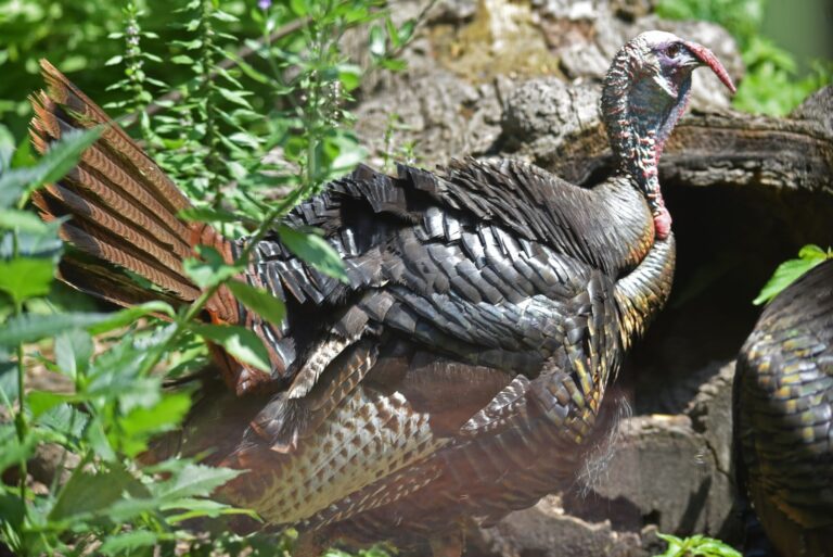
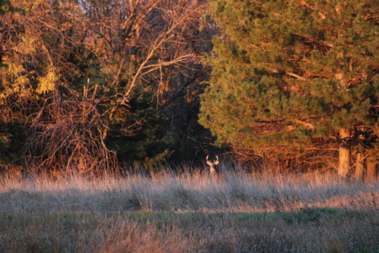
Game on the list: whitetails, gobblers and squirrels and rabbits.
White-tailed deer
The guide lists Nov. 20-22, Dec. 11-13 first (firearms).
Species from the area record; bag limits from the WRD bag limit table. Checked October 13, 2026.
Upatoi Ravines Natural Area plotted with nearby areas
Upatoi Ravines Natural Area sits at the orange pin, with 12 public neighbours inside 30 miles. Combined, about 56,564 acres are on record.
| Area | Type | Acres | Distance | Direction | Deer 2025-26 |
|---|---|---|---|---|---|
| Chattahoochee Fall Line WMA: VPA Tracts | VPA property | 9,048 | 7 mi | southwest | 35 |
| Chattahoochee Fall Line WMA: Almo Tract | WMA | 6,700 | 9 mi | southeast | 31 |
| Chattahoochee Fall Line WMA: Fort Perry Tract | WMA | 2,100 | 11 mi | southeast | 6 |
| Sandhills WMA: West | WMA | 2,500 | 15 mi | east | 19 |
| Chattahoochee Fall Line WMA: Hilliard Plantation Tract | WMA | 8,089 | 15 mi | south | 45 |
| Big Lazer Creek WMA | WMA | 7,200 | 17 mi | northeast | 51 |
| F.D. Roosevelt State Park | State park | 9,049 | 18 mi | north | — |
| Sprewell Bluff WMA: West | WMA | 6,571 | 20 mi | north | 59 |
| Sprewell Bluff WMA: East | WMA | 1,330 | 20 mi | northeast | 12 |
| Sandhills WMA: East | WMA | 870 | 21 mi | east | — |
| Standing Boy Creek State Park | State park | 1,580 | 23 mi | west | 22 |
| Camp Thunder VPA | VPA property | 1,527 | 24 mi | north | 11 |
Points from WRD, USFS, USFWS, NPS, DoD and Recreation.gov layers (WRD WMA Boundary GIS (polygon centroid)). Distances are straight-line. Statewide public land map.
Upatoi Ravines Natural Area: nearest ranges
The WRD range closest to Upatoi Ravines Natural Area is Big Lazer Creek Shooting Range (17 miles). Private ranges within 30 miles are included.
Facilities: 100-yard Range
Lines for trap, skeet, sporting clays, 5-stand, steel and shotgun
Lines for rifle, handgun and smallbore
From the WRD range list and the GA DNR range layer, checked October 13, 2026.
Upatoi Ravines Natural Area: nearest towns and businesses
Town guides first, then businesses in the same and neighbouring counties.
| Town | County | Miles | Population | Public land nearby |
|---|---|---|---|---|
| Box Springs | Talbot | 5 mi | — | 27,131 |
| Talbotton | Talbot | 7 mi | 738 | 20,519 |
| Woodland | Talbot | 13 mi | 303 | 15,324 |
| Howard | Taylor | 15 mi | — | 11,319 |
County pages for this ground: Talbot County.
Services close to Upatoi Ravines Natural Area
Nearest offices to Upatoi Ravines Natural Area
Towns and populations from the Census 2024 estimates; public acres within 10 miles from WRD, USFS, USFWS and DoD layers; businesses from WRD lists, store locators and listings; offices from WRD, DNR Law Enforcement and USFS pages. Checked October 13, 2026. Call ahead.
Upatoi Ravines Natural Area: daily hunting hours
Hunting opens 30 minutes before sunup statewide. Most game runs to 30 minutes after sundown, while migratory birds close at sunset.
Worked out for Upatoi Ravines Natural Area in Eastern time from the rule in the Georgia DNR Wildlife Resources Division guide (hunting hours). Hogs, coyotes, raccoons and some furbearers may be hunted at night on private land; check the guide. Shooting hours for every county.
Upatoi Ravines Natural Area: what hunters ask
Is Game Check required for Upatoi Ravines Natural Area?
Report through Game Check within a day; bonus deer go to the area check station instead.
Can I hunt over bait on Upatoi Ravines Natural Area?
No. State and federal land prohibit bait.
Which agency is in charge of Upatoi Ravines Natural Area?
A WRD natural area with listed hunts; the manager is the Georgia DNR Wildlife Resources Division.
Is Upatoi Ravines Natural Area big enough for a full day?
Roughly 9,500 acres.
Which town makes a good base for Upatoi Ravines Natural Area?
Talbot County; Box Springs is the nearest town we cover, 5 miles away.
What do adults need to enter Upatoi Ravines Natural Area?
The old WMA license was dropped in 2017. Now a Georgia hunting or fishing license, or the Lands Pass, covers entry at 16+.
Do I have to sign in at Upatoi Ravines Natural Area?
Yes for bear, deer and turkey: sign in online on Go Outdoors Georgia, available from the day before.
When do deer hunts start on Upatoi Ravines Natural Area?
First deer line: Nov. 20-22, Dec. 11-13 (firearms). Every other line is in the season table above.
When does spring turkey open at Upatoi Ravines Natural Area?
Spring dates: May 2-8, 9-15. One gobbler per area per person on public land.
What does Upatoi Ravines Natural Area hold for hunters?
Whitetails, gobblers and squirrels and rabbits.
Do I need to be drawn for Upatoi Ravines Natural Area?
Yes: 2 listing lines are quota only, 80 hunters in all.
Is camping allowed at Upatoi Ravines Natural Area?
No camping on the area.
Upatoi Ravines Natural Area, the last word
Double-check Upatoi Ravines Natural Area with its manager: open areas, gates, sign-in and any drawn hunts.
Sources for this page: WRD: upatoi ravines na · Georgia regulations: wma regulations t z · WRD GIS · WRD GIS · WRD GIS; regulations from the 2026-27 Georgia hunting regulations. Checked October 13, 2026.
Other photos on this page: ShenandoahNPS (Public domain); USFWS/Southeast (Public domain).