Home › Idaho › Counties › Power County
Seat: American Falls
Power County Hunting Overview
What to check before driving into Power County: which units and elk zones it holds, what is drawn and what is sold over the counter, where public land is open and where it is closed.
Photo: Tony Webster (CC BY 2.0)
Power County and its IDFG region
For wildlife management Power County is shared by Southeast Region (84%) and Magic Valley Region (16%), so check which side of the line you hunt. County offices work out of American Falls, and the 2024 estimate came to 8,381 residents, 6.4% up from the 2020 base of 7,879. Its 1,404 square miles of land, about 898,449 acres, rank 21st of Idaho's 44 counties by area.
It shares its boundary with Bannock County, Bingham County, Blaine County, Cassia County and Oneida County. Clocks here run on Mountain Time under 49 CFR 71.9, so every time on this page carries the MT label. Measured from mid-county, the nearest IDFG office is Pocatello (24 miles).
Population from the Census Vintage 2024 estimates; area from the 2024 Census gazetteer; neighbours from Census county adjacency; regions from the IDFG regions and the IDFG administrative regions layer; offices from the IDFG office locations page; time zone from 49 CFR 71.9. Checked November 12, 2026.
Power County hunting units
Of county: how much of the county lies in the unit. Of unit: how much of the unit lies in the county.
Idaho sets big game seasons unit by unit, and Power County touches 6 of them; 33% of the county lies in Unit 73A. Units 73 and 68A only clip the edge, each under 5% of the county.
| Unit | Share here | Unit here | Zone (elk) | Wolf DAU | CWD | Shared with |
|---|---|---|---|---|---|---|
| Unit 73A | 33% | 82% | Bannock Zone | Southern Idaho | — | Oneida |
| Unit 68 | 32% | 24% | Big Desert Zone | Southern Idaho | — | Bingham, Blaine, Butte +1 |
| Unit 56 | 16% | 25% | South Hills Zone | Southern Idaho | — | Cassia, Oneida |
| Unit 70 | 11% | 42% | Bannock Zone | Southern Idaho | — | Bannock |
| Unit 73 | 4% | 5% | Bannock Zone | Southern Idaho | — | Oneida, Bannock, Franklin |
| Unit 68A | 4% | 15% | Big Desert Zone | Southern Idaho | — | Bingham, Bannock, Bonneville |
3 units straddle the line with Oneida County, more than with any other county. No general bear line in the 2026 and 2027 tables names Unit 56.
Unit shares from the IDFG Game Units layer overlaid on Census county polygons (GIS shares of land area, both ways); elk zone of each unit from the IDFG Elk Zones layer; wolf zones from the IDFG Wolf Zones layer; CWD units from the 2026 brochure; bear tables from the 2026 brochure. Checked November 12, 2026.
Power County elk zones and A/B tags
Dates are for the 2026 season.
Elk hunters in Power County choose among 3 zones, with the Bannock Zone taking 49% of the county.
| Elk zone | Share here | Zone here | Units |
|---|---|---|---|
| Bannock Zone | 49% | 18% | 73A/70/73 |
| Big Desert Zone | 35% | 9% | 68/68A |
| South Hills Zone | 16% | 3% | 56 |
Power County general elk lines by zone
| Elk zone | Tag | Method | Begins | Ends | Bag | Units | Tags |
|---|---|---|---|---|---|---|---|
| Bannock | A Tag | Archery | Aug 30, 2026 | Sep 30, 2026 | Antlerless or Antlered | 70/71/72 +3 | — |
| Bannock | A Tag | Any Weapon | Oct 25, 2026 | Nov 15, 2026 | Antlerless | 70/71/72 +3 | — |
| Bannock | A Tag | Muzzleloader | Dec 1, 2026 | Dec 31, 2026 | Antlerless | 70/71/72 +3 | — |
| Big Desert | A Tag | Archery | Aug 1, 2026 | Aug 30, 2026 | Antlerless or Antlered | Unit 68 | — |
| Big Desert | A Tag | Archery | Aug 1, 2026 | Dec 31, 2026 | Antlerless or Antlered | Unit 68A | — |
| Big Desert | A Tag | Short-Range Weapons | Aug 1, 2026 | Dec 31, 2026 | Antlerless or Antlered | Unit 53 | — |
| Big Desert | A Tag | Archery | Aug 30, 2026 | Sep 30, 2026 | Antlerless or Antlered | Units 52A and 68 | — |
| Big Desert | B Tag | Any Weapon | Nov 1, 2026 | Dec 31, 2026 | Antlerless | Units 52A and 68 | 350 |
| South Hills | A Tag | Archery | Aug 30, 2026 | Sep 30, 2026 | Antlerless or Antlered | 55/56/57 | — |
| South Hills | B Tag | Any Weapon | Oct 25, 2026 | Nov 15, 2026 | Antlerless | Unit 56 | 500 |
Big Desert Zone and South Hills Zone sell a set number of tags, starting July 8.
Zone shares from the IDFG Elk Zones layer overlaid on county polygons; A and B tag lines from the IDFG Hunt Planner general hunt pages and the brochure elk zone table; tag sale dates from the 2026 brochure. Checked November 12, 2026.
Chronic wasting disease and wolves in Power County
The 2026 CWD zone and testing units all lie outside Power County.
Power County wolf zones and wolf seasons
On the wolf zone layer Power County reads Southern Idaho; season dates depend on the unit and the land type. To trap a wolf, hold a trapping license and complete wolf trapper education; transmitting cameras became legal for wolf trap checks on July 1, 2026.
| Type | Land | Units | Open | Close |
|---|---|---|---|---|
| Hunting | Private land | 73A/68/56/70 +2 | Jul 1, 2026 | Jun 30, 2027 |
| Hunting | Public land | 73A/68/70/68A | Jul 1, 2026 | Jun 30, 2027 |
| Hunting | Public land | 73 | Jul 1, 2026 | Jun 30, 2027 |
| Trapping | Private land | 68/68A | Jul 1, 2026 | Nov 30, 2026 |
| Trapping | Private land | 56 | Nov 15, 2026 | Mar 31, 2027 |
| Trapping | Private land | 68/68A | Dec 1, 2026 | Feb 28, 2027 |
| Trapping | Public land | 68/68A | Jul 1, 2026 | Nov 30, 2026 |
| Trapping | Public land | 68/68A | Sep 10, 2026 | Nov 14, 2026 |
| Trapping | Public land | 73A/56/70/73 | Sep 10, 2026 | Nov 14, 2026 |
| Trapping | Public land | 68/68A | Nov 15, 2026 | Mar 31, 2027 |
| Trapping | Public land | 73A/56/70/73 | Nov 15, 2026 | Mar 31, 2027 |
| Trapping | Public land | 68/68A | Dec 1, 2026 | Feb 28, 2027 |
CWD zone, transport and testing rules from the Big Game 2026 Seasons and Rules p. 9; 2026 changes from IDFG, What hunters need to know about CWD requirements for 2026; county units from the IDFG CWD zone rules; wolf rules from the 2026 brochure; wolf zones from the IDFG Wolf Zones layer. Checked November 12, 2026.
Power County tags and season windows
Elk lines name an A or B tag because Idaho sells general elk tags zone by zone; one zone tag covers every unit in that zone.
| Animal | Hunt kind | What you buy | Covers | Begins | Ends | Open? |
|---|---|---|---|---|---|---|
| Deer | Controlled: Antlered | Controlled | 6 hunts | Aug 30, 2026 | Nov 30, 2026 | |
| Deer | Controlled: Archery | Controlled | 2 hunts | Aug 30, 2026 | Dec 19, 2026 | |
| Deer | Controlled: Extra Antlerless | Controlled | 2 hunts | Aug 30, 2026 | Dec 19, 2026 | |
| Deer | Controlled: Outfitter Allocated | Controlled | 3 hunts | Aug 30, 2026 | Oct 31, 2026 | |
| Deer | Archery | General tag | Units 73A, 68, 56 + | Aug 30, 2026 | Sep 30, 2026 | |
| Deer | Short-Range Weapon | General tag | Unit 53 | Aug 30, 2026 | Nov 6, 2026 | |
| Deer | Controlled: Muzzleloader | Controlled | 3 hunts | Oct 1, 2026 | Nov 30, 2026 | |
| Deer | Any Weapon | General tag | Units 68, 56 | Oct 10, 2026 | Oct 24, 2026 | |
| Deer | Archery | General tag | Unit 73A | Oct 10, 2026 | Oct 24, 2026 | |
| Deer | Muzzleloader | General tag | Unit 73A | Oct 10, 2026 | Oct 24, 2026 | |
| Elk | A Tag | A tag | Unit 53 | Aug 1, 2026 | Dec 31, 2026 | |
| Elk | A Tag | A tag | Unit 68 | Aug 1, 2026 | Aug 30, 2026 | |
| Elk | A Tag | A tag | Unit 68A | Aug 1, 2026 | Dec 31, 2026 | |
| Elk | A Tag | A tag | Unit 56 | Aug 30, 2026 | Sep 30, 2026 | |
| Elk | A Tag | A tag | Unit 68 | Aug 30, 2026 | Sep 30, 2026 | |
| Elk | A Tag | A tag | Units 73A, 70, 73 | Aug 30, 2026 | Sep 30, 2026 | |
| Elk | Controlled: Antlered | Controlled | 4 hunts | Oct 1, 2026 | Nov 30, 2026 | |
| Elk | Controlled: Antlerless | Controlled | 1 hunt | Oct 15, 2026 | Oct 31, 2026 | |
| Elk | A Tag | A tag | Units 73A, 70, 73 | Oct 25, 2026 | Nov 15, 2026 | |
| Elk | B Tag | B tag | Unit 56 | Oct 25, 2026 | Nov 15, 2026 | |
| Elk | B Tag | B tag | Unit 68 | Nov 1, 2026 | Dec 31, 2026 | |
| Elk | Controlled: Muzzleloader | Controlled | 2 hunts | Nov 16, 2026 | Dec 31, 2026 | |
| Elk | A Tag | A tag | Units 73A, 70, 73 | Dec 1, 2026 | Dec 31, 2026 | |
| Pronghorn | Controlled: Archery | Controlled | 4 hunts | Aug 15, 2026 | Sep 24, 2026 | |
| Pronghorn | Controlled: Landowner Permission Required Extra Doe or Fawn | Controlled | 1 hunt | Aug 15, 2026 | Oct 24, 2026 | |
| Pronghorn | Controlled: Either Sex | Controlled | 3 hunts | Sep 25, 2026 | Oct 24, 2026 | |
| Moose | Controlled: Antlered | Controlled | 6 hunts | Aug 30, 2026 | Nov 23, 2026 | |
| Black bear | Fall 2026 | General tag | Units 73A, 68, 70 + | Aug 30, 2026 | Oct 31, 2026 | |
| Black bear | Spring 2027 | General tag | Units 45, 52 + | Apr 15, 2027 | Jun 15, 2027 | |
| Black bear | Spring 2027 | General tag | Units 73A, 68, 70 + | Apr 15, 2027 | Jun 30, 2027 | |
| Mountain lion | July 2026 – June 2027 | General tag | Units 73A, 68, 56 + | Jul 1, 2026 | Jun 30, 2027 | |
| Wild turkey | Fall general | Units 70, 73, 68A | Aug 30, 2026 | Dec 31, 2026 | ||
| Wild turkey | Spring general – youth only | Units 70, 73, 68A | Apr 8, 2027 | Apr 14, 2027 | ||
| Wild turkey | Spring general | Units 70, 73, 68A | Apr 15, 2027 | May 25, 2027 | ||
| Forest grouse | Forest grouse (dusky, ruffed, spruce) | Area 2 | Aug 30, 2026 | Dec 31, 2026 | ||
| Sharp-tailed grouse | Sharp-tailed grouse | Permit | Area 1 | Oct 1, 2026 | Nov 8, 2026 | |
| Chukar | Chukar | Statewide | Sep 15, 2026 | Jan 31, 2027 | ||
| Gray partridge | Gray (Hungarian) partridge | Statewide | Sep 15, 2026 | Jan 31, 2027 | ||
| Quail | California and bobwhite quail | Statewide | Sep 15, 2026 | Jan 31, 2027 | ||
| Pheasant | Pheasant – youth (17 and under) | Statewide | Oct 8, 2026 | Oct 14, 2026 | ||
| Pheasant | Pheasant – resident | Statewide | Oct 15, 2026 | Dec 31, 2026 | ||
| Pheasant | Pheasant – nonresident | Statewide | Oct 20, 2026 | Dec 31, 2026 | ||
| Cottontail rabbit | Cottontail | Statewide | Aug 30, 2026 | Mar 31, 2027 | ||
| Snowshoe hare | Snowshoe hare | Statewide | Aug 30, 2026 | Mar 31, 2027 | ||
| Red squirrel | Red squirrel | Statewide | Aug 30, 2026 | Mar 31, 2027 | ||
| Ducks | Youth and veterans/active military waterfowl weekend | Statewide | Sep 26, 2026 | Sep 27, 2026 | ||
| Ducks | Ducks | Permit | Area 1 | Oct 19, 2026 | Jan 31, 2027 | |
| Scaup | Scaup | Area 1 | Nov 7, 2026 | Jan 31, 2027 | ||
| American coot | American coot | Area 1 | Oct 19, 2026 | Jan 31, 2027 | ||
| Wilson's snipe | Wilson's snipe | Area 1 | Oct 19, 2026 | Jan 31, 2027 | ||
| Canada goose | Canada goose | Area 3 | Nov 3, 2026 | Feb 15, 2027 | ||
| White-fronted goose | White-fronted goose (4 areas) | Areas 1-4 | Oct 3, 2026 | Feb 15, 2027 | ||
| Light goose | Snow, blue and Ross's geese (5 areas) | Areas 1-5 | Oct 3, 2026 | Mar 10, 2027 | ||
| Mourning dove | Mourning and white-winged dove | Permit | Statewide | Sep 1, 2026 | Oct 30, 2026 | |
| American crow | American crow | Statewide | Oct 27, 2026 | Feb 28, 2027 | ||
| Badger | Trapping and hunting | Trapping | Statewide | Jul 1, 2026 | Jun 30, 2027 | |
| Beaver | Trapping | Trapping | Statewide | Oct 15, 2026 | Apr 15, 2027 | |
| Bobcat | Trapping and hunting | Trapping | Statewide | Dec 14, 2026 | Feb 16, 2027 | |
| Marten | Trapping | Trapping | Statewide | Nov 1, 2026 | Jan 31, 2027 | |
| Mink | Trapping | Trapping | Statewide | Oct 15, 2026 | Apr 15, 2027 | |
| Muskrat | Trapping | Trapping | Statewide | Oct 15, 2026 | Apr 15, 2027 | |
| River otter | Trapping | Trapping | Statewide | Oct 15, 2026 | Mar 31, 2027 | |
| Red fox | Trapping and hunting – other regions (year-round) | By region | Jul 1, 2026 | Jun 30, 2027 |
From the Idaho Big Game 2026 Seasons and Rules, the Moose, Bighorn Sheep and Mountain Goat 2025 and 2026 brochure, the Upland Game, Turkey and Furbearer 2026 and 2027 brochure, the Migratory Game Bird 2026-2027 brochure and the IDFG Hunt Planner (Idaho Department of Fish and Game), data read November 11, 2026, checked November 12, 2026.
Power County controlled hunts for 2026
Hunts whose units reach the county; the hunt area itself can be smaller than the unit.
IDFG hunt numbers with a unit in Power County add up to 37, namely 16 deer, 7 elk, 8 pronghorn and 6 moose. Their 2026 tag counts add up to 1,651, a sum that includes tags for ground outside Power County.
Idaho draws controlled hunts at random: apply May 1 to June 5 for deer, elk, pronghorn and fall bear, April 1 to 30 for moose, sheep and goat. Moose, bighorn sheep and goat hunts below follow the 2025 and 2026 brochure (2026 season).
Deer draws reaching Power County (16)
| Hunt | Type | Units in county | Weapon | First day | Last day | Bag | Tags (2026) |
|---|---|---|---|---|---|---|---|
| 1056 | Antlered | 70 | Archery | Aug 30, 2026 | Sep 30, 2026 | Antlered | 145 |
| 1079 | Archery | — | Archery | Aug 30, 2026 | Dec 19, 2026 | Antlerless or Antlered | — |
| 1081 | Archery | 68A | Archery | Aug 30, 2026 | Dec 19, 2026 | Antlered | — |
| 1147 | Extra Antlerless | 68A | Archery | Aug 30, 2026 | Dec 19, 2026 | Antlerless | 50 |
| 1186 | Outfitter Allocated | 70 | Archery | Aug 30, 2026 | Sep 30, 2026 | Antlered | 1 |
| 1096 | Muzzleloader | 70 | Muzzleloader | Oct 1, 2026 | Oct 9, 2026 | Antlered | 50 |
| 1146 | Extra Antlerless | 73A/68/70 +1 | Any Weapon | Oct 1, 2026 | Nov 30, 2026 | Antlerless | 100 |
| 1055 | Antlered | 70 | Any Weapon | Oct 10, 2026 | Nov 30, 2026 | Antlered | 5 |
| 1056 | Antlered | 70 | Any Weapon | Oct 10, 2026 | Oct 31, 2026 | Antlered | 145 |
| 1057 | Antlered | 73 | Any Weapon | Oct 10, 2026 | Oct 24, 2026 | Antlered | — |
| 1058 | Antlered | 73 | Any Weapon | Oct 10, 2026 | Oct 31, 2026 | Antlered | 40 |
| 1059 | Antlered | 73 | Any Weapon | Oct 10, 2026 | Nov 30, 2026 | Antlered | 5 |
| 1186 | Outfitter Allocated | 70 | Any Weapon | Oct 10, 2026 | Oct 31, 2026 | Antlered | 1 |
| 1187 | Outfitter Allocated | 73 | Any Weapon | Oct 10, 2026 | Oct 24, 2026 | Antlered | 1 |
| 1095 | Muzzleloader | 68 | Muzzleloader | Nov 16, 2026 | Nov 30, 2026 | Antlered | 20 |
| 1097 | Muzzleloader | 73A | Muzzleloader | Nov 16, 2026 | Nov 30, 2026 | Antlered | 20 |
Power County: controlled elk (7)
| Hunt | Type | Units in county | Weapon | First day | Last day | Bag | Tags (2026) |
|---|---|---|---|---|---|---|---|
| 2034 | Antlered | 68 | Any Weapon | Oct 1, 2026 | Nov 30, 2026 | Antlered | 100 |
| 2036 | Antlered | 56 | Any Weapon | Oct 1, 2026 | Oct 31, 2026 | Antlered | 50 |
| 2043 | Antlered | 73A/70/73 | Any Weapon | Oct 1, 2026 | Oct 14, 2026 | Antlered | 25 |
| 2044 | Antlered | 73A/70/73 | Any Weapon | Oct 15, 2026 | Oct 24, 2026 | Antlered | 250 |
| 2106 | Antlerless | 68 | Any Weapon | Oct 15, 2026 | Oct 31, 2026 | Antlerless | 125 |
| 2145 | Muzzleloader | 73A/70/73 | Muzzleloader | Nov 16, 2026 | Nov 30, 2026 | Antlerless or Antlered | 125 |
| 2145 | Muzzleloader | 73A/70/73 | Muzzleloader | Dec 1, 2026 | Dec 31, 2026 | Antlerless | 125 |
Power County: controlled pronghorn (8)
| Hunt | Type | Units in county | Weapon | First day | Last day | Bag | Tags (2026) |
|---|---|---|---|---|---|---|---|
| 4037 | Archery | — | Archery | Aug 15, 2026 | Sep 15, 2026 | Antlerless or Antlered | — |
| 4039 | Archery | 56 | Archery | Aug 15, 2026 | Sep 15, 2026 | Antlerless or Antlered | 10 |
| 4041 | Archery | 68 | Archery | Aug 15, 2026 | Aug 30, 2026 | Bucks Only | 20 |
| 4603 | Landowner permission doe/fawn | 56 | Any Weapon | Aug 15, 2026 | Oct 24, 2026 | Doe or Fawn | 50 |
| 4042 | Archery | 68 | Archery | Sep 10, 2026 | Sep 24, 2026 | Bucks Only | 75 |
| 4017 | Either Sex | — | Any Weapon | Sep 25, 2026 | Oct 24, 2026 | Antlerless or Antlered | 50 |
| 4019 | Either Sex | 56 | Any Weapon | Sep 25, 2026 | Oct 24, 2026 | Antlerless or Antlered | 10 |
| 4023 | Either Sex | 68 | Any Weapon | Sep 25, 2026 | Oct 24, 2026 | Antlerless or Antlered | 25 |
Moose tags drawn around Power County (6)
| Hunt | Type | Units in county | Weapon | First day | Last day | Bag | Tags (2026) |
|---|---|---|---|---|---|---|---|
| 3058 | Antlered | 56 | Any Weapon | Aug 30, 2026 | Nov 23, 2026 | Antlered | 3 |
| 3080 | Antlered | 70 | Any Weapon | Aug 30, 2026 | Nov 23, 2026 | Antlered | 9 |
| 3083 | Antlered | 73 | Any Weapon | Aug 30, 2026 | Nov 23, 2026 | Antlered | 8 |
| 3084 | Antlered | 73A | Any Weapon | Aug 30, 2026 | Nov 23, 2026 | Antlered | 3 |
| 3092 | Antlered | 68A | Archery | Aug 30, 2026 | Nov 23, 2026 | Antlered | 4 |
| 3093 | Antlered | 68A | Archery | Aug 30, 2026 | Nov 23, 2026 | Antlered | 1 |
Hunt numbers, types, units, dates, bags and 2026 tags from the IDFG Hunt Planner hunt pages (each hunt number links its page) matched to the Idaho Big Game 2026 Seasons and Rules and the Moose, Bighorn Sheep and Mountain Goat 2025 and 2026 brochure; counties are whole units, so a hunt area can be smaller. Application periods from the 2026 brochure, the moose, sheep and goat brochure and the spring bear page. Checked November 12, 2026.
Power County units: 2025 harvest
Numbers come from IDFG hunter reports, by unit.
These are 2025 unit totals for the units that reach Power County; there is no IDFG county harvest, and each unit also covers ground beyond the line. Unit 68 tops the elk column at 122 animals for 2025. Deer harvest peaked in Unit 56 at 417 for 2025.
| Unit | Deer (success) | Elk (success) | Mountain lion | Turkey |
|---|---|---|---|---|
| Unit 73A | 34 (12%) | 46 (15%) | 3 | — |
| Unit 68 | 148 (19%) | 122 (27%) | — | — |
| Unit 56 | 417 (22%) | 118 (20%) | 6 | — |
| Unit 70 | 21 (10%) | 45 (10%) | 5 | 54 |
| Unit 73 | 70 (19%) | 88 (13%) | 4 | 75 |
| Unit 68A | 0 (0%) | 24 (26%) | — | 51 |
2025 harvest from the IDFG Hunt Planner statistics: general season deer 2025; general season elk 2025; mountain lion 2025; spring turkey 2025. Deer and elk cells are IDFG’s “All Weapons Combined” unit rows (harvest and success); bear, lion and wolf cells are unit harvest; turkey is the spring unit row. IDFG publishes harvest by hunting unit and controlled hunt only (Hunt Planner harvest statistics); no county harvest exists. `counties` on unit rows list every county named in the unit boundary description. Checked November 12, 2026.
Power County public land, owner by owner
Private land in Access Yes! and Large Tracts is open only on program terms.
The merged map of public hunting land in Power County reaches 261,869 acres, 29% of the county surface. No owner outweighs BLM land here: 193,937 acres. For forest roads, fire closures and camping rules, the Minidoka Ranger District covers about 28,162 acres of the county.
| Kind | Acres | County share | Access |
|---|---|---|---|
| NF land and NRAs | 33,992 | 4% | License holders |
| Curlew National Grassland | 156 | under 1% | License holders |
| BLM public land | 193,937 | 22% | License holders |
| Listed refuges | 343 | under 1% | CFR rules apply |
| Craters preserve (NPS) | 34,290 | 4% | License holders |
| Open land, overlaps once | 261,869 | 29% | Union |
| Access Yes! layer | 21,768 | 2% | Listed apart |
| IDL trust land | 24,713 | 3% | Use rule |
| USBR acres | 194 | under 1% | Listed apart |
| Tribal ground | 156,031 | 17% | Not public |
| Park land, state | 819 | under 1% | No hunting |
193,937 acres are BLM-managed, and 83,450 of those report to the Pocatello Field Office. Endowment land (24,713 GIS acres) sits outside the merged total; the IDFG brochure lists it among its access programs. The 156,031 acres of reservation and trust land are not public hunting ground; entering them to hunt without tribal permission is unlawful. National Park Service land (Craters of the Moon National Preserve) is closed to hunting.
Reservations inside Power County
- Fort Hall Reservation156,031 GIS acres · closed
Power County public places by owner
Minidoka National Wildlife Refuge
Units 53/56/68
Big Onion (Access Yes!)
Unit 73
Rockland (Access Yes!)
Units 56/73A
Access Yes! property 5938
Units 56/73A
Access Yes! property 5838
Unit 56
Hillhouse Canyon (Access Yes!)
Unit 73A
Lazy "R" Ranch (Access Yes!)
Unit 56
Cliff Canyon (Access Yes!)
Unit 56
- Caribou-Targhee National ForestNational forest
- Sawtooth National ForestNational forest
- Minidoka Ranger DistrictRanger district
- Westside Ranger DistrictRanger district
- Twin Falls DistrictBLM district
- Idaho Falls DistrictBLM district
- Upper Snake Field OfficeBLM field office
- Shoshone Field OfficeBLM field office
- Burley Field OfficeBLM field office
- Pocatello Field OfficeBLM field office
- Craters of The Moon National Monument (BLM part)BLM part of the monument
- Craters of the Moon National PreserveNational preserve
Open land a short drive from Power County
- Access Yes! property 608914 miles, Access Yes! property
- Sterling Wildlife Management Area20 miles, IDFG WMA
- Daniels Valley (Access Yes!)28 miles, Access Yes! property
- Pocatello – 2 and 1/2 Mile Road (Access Yes!)30 miles, Access Yes! property
- Portneuf Wildlife Management Area34 miles, IDFG WMA
- Inkom – East Bench (Access Yes!)34 miles, Access Yes! property
Power County ground off the hunting map
- Massacre Rocks State ParkState park, closed
Acres are GIS measures of polygons with water over 2 square km removed, not official acreage: IDFG WMA layer, PAD-US 4.1 (forest, grassland, BLM, refuge, park, endowment, Reclamation, military, DOE and tribal land), IDFG Access Yes! 2026 layer, IDFG Large Tracts layer; refuges counted only when listed in 50 CFR 32.31; tribal rule from 18 U.S.C. 1165; closures from the 2026 brochure; Craters of the Moon from the NPS laws and policies page. Checked November 12, 2026.
Power County offices and outfitters
IDFG staff for Power County sit in the IDFG Southeast Region (84%) and IDFG Magic Valley Region (16%); present bear, lion or wolf skull and hide within 10 days of the kill.
Power County towns and their units
- American Falls4,863 people · Unit 68 · 7 places within 10 mi
American Falls has a town page with nearby land within 10 and 25 miles. 0 sporting goods shops, 0 taxidermists and 0 meat processors list an address in the county. The IDFG layer of OGLB outfitter licences shows 4 hunting outfitters whose operating areas take in the county; check the licence lookup before booking.
- Bearpaw OutfittersOGLB licensed
- Idaho Guide Service IncOGLB licensed
- Lodge At Palisades Creek (The)OGLB licensed
- War Eagle Outfitters And Guides LlcOGLB licensed
Offices from the IDFG office locations page; skull and hide rule from the 2026 brochure; towns from the 2024 Census gazetteer; shops from Yellow Pages listings and chain store locators; outfitters from the IDFG outfitter layer of OGLB licences. Listings not individually verified; call ahead. Checked November 12, 2026.
Power County sunrise and shooting times
The dates in this Power County table come from the season lines that reach its own units, plus the shortest day of the year.
| When | Event | First sun | Last sun | Legal light |
|---|---|---|---|---|
| Aug 30, 2026 | Archery deer opener | 6:53 a.m. MT | 8:12 p.m. MT | 6:23 a.m. MT to 8:42 p.m. MT |
| Sep 15, 2026 | Chukar opener | 7:10 a.m. MT | 7:44 p.m. MT | 6:40 a.m. MT to 8:14 p.m. MT |
| Oct 10, 2026 | General deer opener | 7:37 a.m. MT | 6:59 p.m. MT | 7:07 a.m. MT to 7:29 p.m. MT |
| Oct 19, 2026 | Duck opener | 7:48 a.m. MT | 6:45 p.m. MT | 7:18 a.m. MT to 7:15 p.m. MT |
| Oct 25, 2026 | General elk opener | 7:55 a.m. MT | 6:36 p.m. MT | 7:25 a.m. MT to 7:06 p.m. MT |
| Dec 21, 2026 | Shortest day | 7:58 a.m. MT | 5:00 p.m. MT | 7:28 a.m. MT to 5:30 p.m. MT |
| Apr 15, 2027 | Spring turkey | 6:52 a.m. MT | 8:12 p.m. MT | 6:22 a.m. MT to 8:42 p.m. MT |
Hours rule from the Idaho Big Game 2026 Seasons and Rules (wolf and upland game animals: same rule, wolf, upland); time zone from 49 CFR 71.9; sunrise and sunset worked out for this location with the NOAA solar formula (Mountain Time); migratory bird hours: IDFG migratory bird table; checked November 12, 2026. Legal hours for every county.
Power County gear picks
Picked for timber, sagebrush, canyon rim and marsh; nothing loads until you tap.
Amazon links are affiliate links. We may earn a commission at no cost to you.
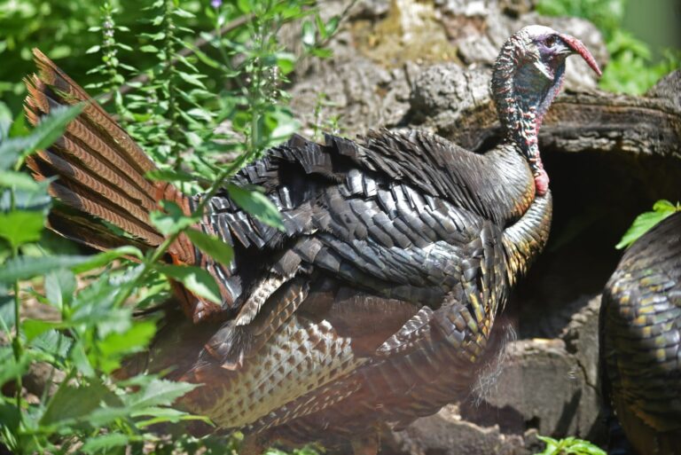
Wild turkey gobbler strutting with tail fannedPhoto: U.S. Fish and Wildlife Service – Midwest Region (Public domain)
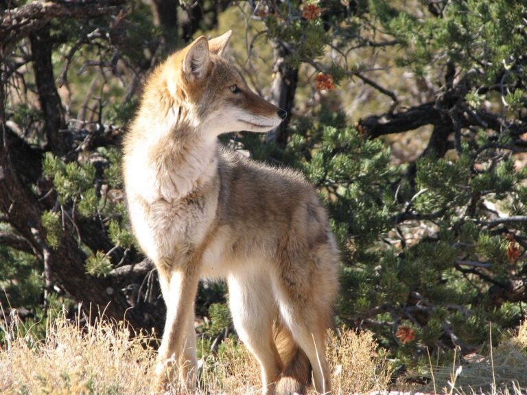
Coyote walkingPhoto: ZionNPS (CC BY 2.0)
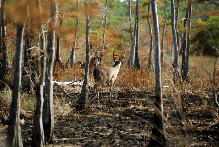
White-tailed deer buck in the treesPhoto: USFWS/Southeast (CC BY 2.0)
Power County: common questions
Where does a Power County bear skull get checked?
Bear, lion and wolf skull and hide go to a regional office, a check point or a conservation officer within 10 days; the regional office is in Pocatello.
Which clock do Power County shooting times follow?
Mountain Time; every time printed on this page carries its zone label.
Which tribal lands touch Power County?
Fort Hall Reservation, about 156,031 GIS acres.
Does IDFG print a harvest number for Power County itself?
No. IDFG reports by unit and hunt; Unit 68 led the units here with 122 (general season elk).
How soon do I report a Power County elk?
Within 10 days after you take it; bear, lion and wolf need the skull and hide presented within 10 days too.
Must big game hunters in Power County wear orange?
Not by law for big game. IDFG recommends at least 36 square inches above the waist and requires it only for permit pheasant areas and sponsored hunts.
Which general elk zones reach Power County?
Bannock Zone, Big Desert Zone and South Hills Zone. The zone band lists every A and B line with dates.
Which unit pages matter for a trip to Power County?
Start with Unit 73A, Unit 68, Unit 56, then Unit 70, Unit 73, Unit 68A; each page carries its own hunts and harvest.
How many GIS acres of public hunting land does Power County hold?
About 261,869 GIS acres, 29% of the county.
How many 2026 controlled tags go with Power County hunts?
1,651 tags across 37 hunts, counted for the whole hunt rather than for the county.
Is CWD sampling required around Power County?
No testing or transport rule applies here in 2026.
From the Idaho Big Game 2026 Seasons and Rules, IDFG hunter orange policy, harvest reporting, CWD rules, 49 CFR 71.9, 18 U.S.C. 1165 and the county data above. Checked November 12, 2026.
Other photos on this page: U.S. Fish and Wildlife Service – Midwest Region (Public domain); ZionNPS (CC BY 2.0); USFWS/Southeast (CC BY 2.0).